Embed Size (px)
Citation preview

iv
MAP SKILLSScales, distance, symbols and direction 6–7Map projections 8–9The Earth in the Solar System 10–11
MAP SKILLS: ORDNANCE MAP INTERPRETATION Songea and Arusha, Tanzania 12–13Eldoret, Kenya 14Nsika, Kabale, Uganda 15, 17Ruhuha, Rwanda 16Addis Ababa, Ethiopia 18Photograph interpretation: 19–24Earth’s atmosphere and structure 25
PHYSICAL WORLD Tectonic plates 26–27Weathering and depositional features 28–29The hydrological cycle and river systems 30–31Air masses 32Ocean currents 33Weather systems 34–35
KENYA Administration 36Relief and landforms 37Irrigation and land reclamation 38Agriculture 39Forestry, livestock and fi shing 40–41Energy, mining and industry 42–43Population 44Urbanisation 45Tourism and wildlife 46–47
CONTENTSETHIOPIAAdministration 86–87Relief and landforms 88–89Agriculture, livestock and fi shing 90–91Population 92–93Energy and mining 94–95Water resources 96–97Industry, trade, tourism and wildlife 98–99Forestry and environment 100–01
SOUTH SUDANAdministration 102Relief and landforms 103Population 104Agriculture, industry and tourism 105
EASTERN AFRICACountries and relief 106Rift Valley 107Climate and land use 108Environmental issues in Eastern Africa 109Vegetation, soils and geology 110–11Transport and communications 112Industry and trade 113Population 114–15
CENTRAL AFRICACountries and relief 116Climate and land use 117Mining and energy 118Transport and communication 119
TANZANIA Administration 48Relief and landforms 49Agriculture, forestry and fi shing 50–51Water resources and energy 52–53Mining, industry and trade 54–55Population 56–57Wildlife, tourism and environment 58–59
UGANDAAdministration 60Relief and landforms 61Agriculture, livestock and fi shing 62–63Mining and energy 64–65Industry and trade 66Transport and communication 67Population 68–69Tourism, wildlife and environment 70–71
RWANDAAdministration, relief and landforms 72–73Population 74Agriculture, livestock, forestry and fi shing 75Mining and energy 76–77Industry, trade, transport and communications 78–79Tourism and wildlife 80Environment 81
BURUNDIAdministration, relief and landforms 82–83Population and tourism 84Agriculture and industry 85
ii_v_2nd.indd 4 19/11/2012 16:50

v
NORTH AFRICACountries and relief 120Climate, water issues and vegetation 121Nile Basin 122Mining and energy 123Tourism 124Industry, trade, transport and communication 125
WEST AFRICACountries and relief 126Climate and vegetation 127Agriculture 128Mining and energy 129
SOUTHERN AFRICACountries and relief 130Climate and vegetation 131Mining and energy 132Tourism and wildlife 133Trade, industry and transport 134Agriculture 135
AFRICACountries and relief 136–37Climate, vegetation, agriculture,livestock and fi shing 138–39Mining and energy 140Population 141Transport and trade 142Environment 143
NORTH AMERICACountries and relief 144Climate and vegetation 145Agriculture, livestock, forestry and fi shing 146–47Mining 148Transport and communications 149Industry and trade 150Population 151
SOUTH AMERICACountries and relief 152Climate and vegetation 153Agriculture, livestock and fi shing 154Mining and energy 155
EUROPECountries 156Relief 157Climate and vegetation 158Transport, communication and tourism 159Population 160Mining, industry and trade 161Agriculture, livestock and fi shing 162–63
ASIACountries 164Relief 165Climate and land use 166Agriculture, livestock and fi shing 167Mining and energy 168Industry and trade 169Transport, communication and trade 170Population 171Tourism 172–73
AUSTRALASIA AND OCEANIACountries and relief 174Climate and vegetation 175Agriculture, livestock and fi shing 176Mining and energy 177Industry, trade and transport 178Population 179
POLAR REGIONSArctic 180Antarctica 181
THE WORLDCountries 182–83Relief 184–85Climate 186–87Environment 188–89Time zones 190–91Population 192–93Mining, energy, information and communication technology 194–95
GLOBAL ISSUESEconomy 196–97Industrialisation and pollution 198–99Climate change and the environment 200Biodiversity 201Sustainable development 202–03Access to water 204–05HIV and AIDS 206–07
STATISTICS 208–15
INDEX 216–224
ii_v_2nd.indd 5 19/11/2012 16:50

106
x
x
x
x x
Re
d S
ea
Gulf
of Aden
I
ND
IA
N
OC
EA
N
Lake Victoria
Lake Turkana
LotagipiSwamp
S u d d
Lake Tana
Lake Albert
Lake Edward
Lake Kivu
Lake Tanganyika
Lake Nyasa
Nile
Blue Nile
Atbara
Tana
Rufiji
Rovuma
Juba
Shebeli
Whi
te N
ile
EquatorEquator
Tropic of Cancer
20°N
20°E 30°E 40°E 50°E 60°E
20°E 30°E 40°E 50°E 60°E
10°N
10°S
Eq
Tr
20°N
10°N
10°S
Eq
Tr
Jabal al ’Uwaynát 1907m
Amba Farit4270m
Ras Dashen4550m
Shimbiris 2407m
Mount Kenya (Kirinyaga) 5200m
Kilimanjaro 5895m
-156m
Nubian Desert
Ethiopian
Highlands
Da
r f u r
O g a d e n
Danakil Desert
Gre
at Rif
t Val
ley
Gre
at
R
ift V
alle
y
Great R
if t Val ley
Atbara
Gedaref
Nyala Gonder
Wau
Malakal
Bahir Dar Dese
NazretHarer
Burco
Meru Nyeri
Eldoret Mbale
Kigoma Tabora
Singida
Iringa
Moshi Arusha
Mbeya
Shinyanga
Lira
Gulu
Jinja Mbarara
Kabale
Arua
Nakuru
Berbera
Khartoum North Kassala
Wad Medani
El Obeid
Dire Dawa Hargeysa
Kisumu
Mombasa
Mwanza
Zanzibar Tanga
Marka
Kismaayo
Omdurman
Dar es Salaam
KHARTOUM
NAIROBI
ASMARA
DJIBOUTI
KIGALI
JUBA
BUJUMBURA
DODOMA
KAMPALA
ADDIS ABABA
MOGADISHU
E G Y P T
CHAD
CENTRALAFRICANREPUBLIC
ZAMBIA
MOZAMBIQUE
DEM. REP.CONGO
L I B Y A
Y E M E N
MA
LA
WI
S A U D IA R A B I A
S U D A N
K E N Y A
S O U T HS U D A N
TANZANIA
UGANDA
ETHIOPIA
DJIBOUTI
RWANDA
BURUNDI
E R I T R E A
S O
MA
LI A
0 km
(projection: Lambert Azimuthal Equal Area)
1 000500250 750
Scale 1:23 360 000
50 000 – 100 000
500 000 – 1 million
over 1 million
100 000 – 500 000
4 000 m2 000 m1 000 m
500 m250 m100 m
Belowsea level
0250 m
2 000 m4 000 m
international border
mountain
depression
maritime border
disputed border
sandy desert
marsh/wetland
Elevation
Boundaries
Settlements
MAP KEY
IGAD MEMBERSHIP
Intergovernmental Authorityon Development (IGAD)
AFRICA
COUNTRIES AND RELIEF
EASTERN AFRICA
Geographically, Eastern Africa is famous for its contrasting areas of highland and rift valley. It
is home to Africa’s two highest mountains; Mount Kilimanjaro and Mount Kenya, and Africa’s largest lake; Lake Victoria. Eastern Africa is composed of 11 countries; most are members of the Intergovernmental Authority on Development (IGAD). The seven countries that make up the Nile Basin are also members of the Nile Basin Initiative.
DECENTRALISATION
There are four forms of decentralisation:Devolution: The complete transfer of authority from the central government to the local government and community.Delegation: An assignment of certain functions by the local government to its agencies or statutory authority and the localgovernment.Deconcentration: Dispersal of central authority to its representative office at regional and local government levels.Privatisation: Divesture of certain specific functions from government to private sector.
106_107.indd 106 19/11/2012 16:04

107
Blue Nile
Lomam
i
Zambe
Luan
gwa Lúrio
Luwegu
Ruvuma
Rufiji
Lufira
Lualaba
Zambezi
Tana
Moyow
osi
Wami
Uele
Shebeli
Lake Tana
RoseiresReservoir
Lake Abaya
LacUpemba
Lake Kariba
LakeRukwa
LakeEyasi
Lake Natron
Ch’ew Bahir
Lake Kivu
Lake Edward
LakeTanganyika
LakeAlbert
Lake BisinaLake Kyoga
LakeTurkana
Lake Nyasa
LakeVictoria
IN
DI
AN
O
CE
AN
5°S
5°N
10°N
15°N
10°N
15°N
10°S
35°E 40°E30°E
35°E 40°E30°E
Eq
5°S
5°N
10°S
Eq
Mount Kenya(Kirinyaga)
5200m
Mount Elgon 4321m
Ras Dashen4550m
Margherita5110m
Kilimanjaro5895m
Mount Meru4565m
Mont Teza2666m
Kinyeti3187m
E t h i o p i a nH i g h l a n d s
Chera
ngan
y
Ahmar Mountains
Hills
Mit
um
ba R
ange
We
s t e r n G
r e a t Ri f t Va l l e y
Ea s
t er n
Gr e
at
Ri f
t V
al l
e y
We s
t er n
Gr e
a t R
i ft
Va l le y
Kipengere Range
Chyulu Range
MasaiSteppe
ChalbiDesert
MendeboMountains
AfarTriangle
RubehoMountains
SerengetiPlain
LivingstoneMountains
UsanguFlats
Ruw
enzo
ri
LaikipiaEscarpment
LotagipiSwamp
E T H I O P I A
BURUNDI
RWANDA
UGANDA
SOUTHSUDAN
SOM
ALI
A
T A N Z A N I A
K E N Y A
MA
LAW
I
Z A M B I A
SUDAN
DEM.REP.CONGO
0 km 200 400 600
Scale 1:13 700 000(projection: Lambert Azimuthal Equal Area)
Boundariesinternational bordermaritime border
4 000 m2 000 m1 000 m
500 m250 m100 m
Belowsea level
0250 m
2 000 m4 000 m
MAP KEYElevation
mountain
marsh/wetland
Structuremajor faults
EASTERN AFRICA EASTERN AFRICA
RIFT VALLEY
The East African Rift Valley forms the lower part of the African Rift System that extends from Jordan and Syria in the north to
Malawi in the south. In Eastern Africa there are two rift valleys –the eastern and western rifts. The western rift contains Lakes Albert and Tanganyika while the eastern rift contains Lakes Turkana, Baringo, Nakuru, Naivasha, Natron and Manyara.
FORMATION OF THE EAST AFRICAN RIFT VALLEY
The East African Rift Valley is characterised by step faults and escarpments with steep walls ranging from 900 m to 2700 m. The average width is 50 km, but is wider in some places. It is believed that the East African Rift Valley was formed as a result of tensional and compressional forces brought about by the movement of continental plates.
Volcanic eruptions along the rift valley have further complicated the landscape features associated with it. The East African Rift Valley still remains unstable, with some active cones like Lengai in Tanzania.
central area slides down between
faults
magma rises through fractures in crust
plates pull apart
fault
106_107.indd 107 19/11/2012 16:04

x
x
x
x
x
x
xxxx
x
xx
xxxx
20°N
30°E 40°E 50°E
30°E 40°E 50°E
10°N
10°S
0°
20°N
10°N
10°S
0°
0 km
(projection: Lambert Azimuthal Equal Area)
1 000 1 500500
Scale 1:39 500 000
desert & desert steppetropical wooded steppetropical dry savanna
Vegetation
MAP KEY
tropical savanna woodlandforest savanna mosaictropical rain forestundifferentiated montanemontane and warmtemperate grasslandafro-alpine and alpinethicketsmangrove swampnaturally irrigated areasswamp
map key continued...
110
VEGETATION, SOILS AND GEOLOGY
EASTERN AFRICA
Tropical savanna in the Serengeti, Tanzania High-altitude rainforest in Rwanda
The baobab tree is able to store water in its vast trunk for up to nine months, which enables it to survive in areas of dry scrubland such as this.
The vegetation of Eastern Africa is closely related to the climate. It is a product of a combination of
factors such as relief and altitude. Major vegetation types in Eastern Africa include: evergreen forests (confined to a few areas in the Southern Sudan and Lake Victoria basin) the Savanna grassland (found in most low-altitude
areas of the region) and mountain vegetation. There is also the semi-desert and desert vegetation in Ethiopia, Somalia, South Sudan and Eastern parts of Kenya. Natural vegetation is dwindling as a result of destruction caused by human activities.
110_111.indd 110 20/11/2012 16:27

x
x
x
x
x
x
xxxx
x
xx
xxxx
Tropic of Cancer
20°N
Tr
30°E 40°E 50°E
30°E 40°E 50°E
10°N
10°S
Eq
20°N
Tr
10°N
10°S
Eq
0 km
(projection: Lambert Azimuthal Equal Area)
1 000 1 500500
Scale 1:39 500 000
QuarternaryTertiaryMesozoicPre-cambrianextrusive igneous rocks
major fault line
Geology
MAP KEY
x
x
x
x
x
x
xxxx
x
xx
xxxx
20°N
30°E 40°E 50°E 60°E
30°E 40°E 50°E 60°E
10°N
10°S
Eq
20°N
10°N
10°S
Eq
0 km
(projection: Lambert Azimuthal Equal Area)
1 000 1 500500
Scale 1:39 500 000
leached and highlyleached red soilsiron rich red soils ofsavanna areasrich brown soils oftropical areastropical black earthsbrown soils of aridand semi-arid areaspoorly developedsub-desert soilssand and rock debrisof desert areasshallow highlycalcareous soilsrecent alluvium
Soils
MAP KEY
skeletal soilssoils formed onvolcanic ashsaline soils
111EASTERN AFRICA EASTERN AFRICA
SOILS
Eastern Africa has many types of soils, each with its specific characteristics that are related to climate, vegetation, the nature of the slopes and the underlying rocks and time. The specific soils are referred to as zonal soils. Examples include the lateritic soils found in many parts, and desert soils mainly found in Ethiopia, Sudan, north east Kenya and Somalia. Other soils include peat soils which are found in poorly drained areas, alluvial soils, found along river valleys and terra rossa soils found in limestone areas of Eastern Africa.
GEOLOGY
Eastern Africa has rocks that are more than 3000 million years old. These rocks were formed mainly during Pre-Cambrian, Mesozoic and Quaternary periods. Tectonic and volcanic movements that followed led to the formation of the igneous and volcanic rocks that characterise most of the Eastern Africa region. Sedimentary rocks have covered most of the original rocks as a result of soil erosion.
Lion-shaped mountain rocks in Yeha
Lateritic soils usually have a distinctive red colour.
110_111.indd 111 19/11/2012 21:21

114
(administeredby Sudan)
(administeredby Egypt) R
ed
Se
a
Gulf
of Aden
I ND
IA
N
OC
EA
NLake
Victoria
LakeTurkana
LakeTana
LakeAlbert
LakeEdward
Lake Kivu
LakeTanganyika
LakeNyasa
Nile
Blue Nile
Tana
Rufiji
Rovuma
Juba
Shebeli
Whi
te N
ile
Tropic of Cancer Tropic of Cancer
20°E 30°E 40°E 50°E
20°E 30°E 40°E 50°E
10°N
10°S
Eq
10°N
10°S
Eq
Gonder
Bahir DarDese
NazretHarer
Meru
Nyeri
EldoretMbale
KigomaTabora
Singida
Iringa
MoshiArusha
Mbeya
Shinyanga
Lira
Gulu
Jinja
Mbarara
Kabale
Arua
Nakuru
Dire Dawa
Kisumu
Mombasa
Mwanza
Zanzibar
Tanga
Wau
Malakal
Dar es Salaam
NAIROBIKIGALI
JUBA
BUJUMBURA
DODOMA
KAMPALA
ADDIS ABABA
CHAD
CENTRALAFRICANREPUBLIC
ZAMBIA
DEM. REP.CONGO
Y E M E N
MA
LA
WI
S U D A N
DJIBOUTI
MOZAMBIQUE
E R I T R EA
S OM
AL
I AK E N Y A
S O U T HS U D A N
TANZANIA
UGANDA
E T H I O P I A
RWANDA
BURUNDI
0 km
(projection: Lambert Azimuthal Equal Area)
1 000500250 750
Scale 1:18 690 00050 000 – 100 000
500 000 – 1 million
over 1 million
100 000 – 500 000
international border
maritime border
disputed border
Boundaries
Settlements
MAP KEY
above 200100 to 20050 to 10010 to 501 to 10below 1
Population density(people per square km)
A red square indicates anational capital.
POPULATION OF EAST AFRICAN COUNTRIES
20
10
0
40
50
30
60
70
80
90
100
South Sudan KenyaBurundi Ethiopia TanzaniaRwanda Uganda
Population (millions)
EASTERN AFRICA
POPULATION
The population of Eastern Africa is dense in Ethiopia, Tanzania, Kenya, Uganda and Somalia. There are
increasing numbers of refugees and internally displaced people. Civil wars in Rwanda, Burundi and Somalia have resulted in refugees in the neighbouring countries. Refugees are concentrated in a number of camps in the region. The popular refugee camp is Dadaab in northern Kenya, which accommodates thousands of Somali refugees. Political and ethnic violence has also led to internally displaced persons. For example, thousands of people were internally displaced in Kenya following the 2007 post-election violence.
114_115.indd 114 19/11/2012 21:22

115
(administeredby Sudan)
(administeredby Egypt) R
ed
Se
a
Gulf
of Aden
I ND
IA
N
OC
EA
N
LakeVictoria
LakeTurkana
LakeTana
LakeAlbert
LakeEdward
Lake Kivu
LakeTanganyika
LakeNyasa
Nile
Blue Nile
Tana
Rufiji
Rovuma
Juba
Shebeli
Whi
te N
ile
Tropic of Cancer Tropic of Cancer
20°E 30°E 40°E 50°E
20°E 30°E 40°E 50°E
10°N
10°S
Eq
10°N
10°S
Eq
Gonder
Bahir DarDese
NazretHarer
Meru
Nyeri
EldoretMbale
KigomaTabora
Singida
Iringa
MoshiArusha
Mbeya
Shinyanga
Lira
Gulu
Jinja
Mbarara
Kabale
Arua
Nakuru
Dire Dawa
Kisumu
Mombasa
Mwanza
Zanzibar
Tanga
Wau
Malakal
Dar es Salaam
NAIROBIKIGALI
JUBA
BUJUMBURA
DODOMA
KAMPALA
ADDIS ABABA
CHAD
CENTRALAFRICANREPUBLIC
ZAMBIA
DEM. REP.CONGO
Y E M E N
MA
LA
WI
S U D A N
DJIBOUTI
MOZAMBIQUE
E R I T R EA
S O
MA
LI A
K E N Y A
S O U T HS U D A N
TANZANIA
UGANDA
E T H I O P I A
RWANDA
BURUNDI
0 km
(projection: Lambert Azimuthal Equal Area)
1 000500250 750
Scale 1:18 690 00050 000 – 100 000
500 000 – 1 million
over 1 million
100 000 – 500 000
international border
maritime border
disputed border
Boundaries
Settlements
MAP KEY
above 200100 to 20050 to 10010 to 501 to 10below 1
Population density(people per square km)
A red square indicates anational capital.
POPULATION AND LAND AREA
Country Area (in thousands Km2)
Population (in millions)
Burundi 27.8 9.9
South Sudan 619.7 8.2
Ethiopia 1104.3 82.1
Kenya 582.6 38.6
Rwanda 26.3 11.6
Tanzania 945.2 46.3
Uganda 236.0 28.2
EASTERN AFRICA EASTERN AFRICA
Newly arrived refugees in Kenya’s Dadaab Refugee Camp
UN Conference Centre, Addis Ababa
Kenya’s Dadaab Refugee Camp
114_115.indd 115 19/11/2012 21:22
www.pearsonafrica.com
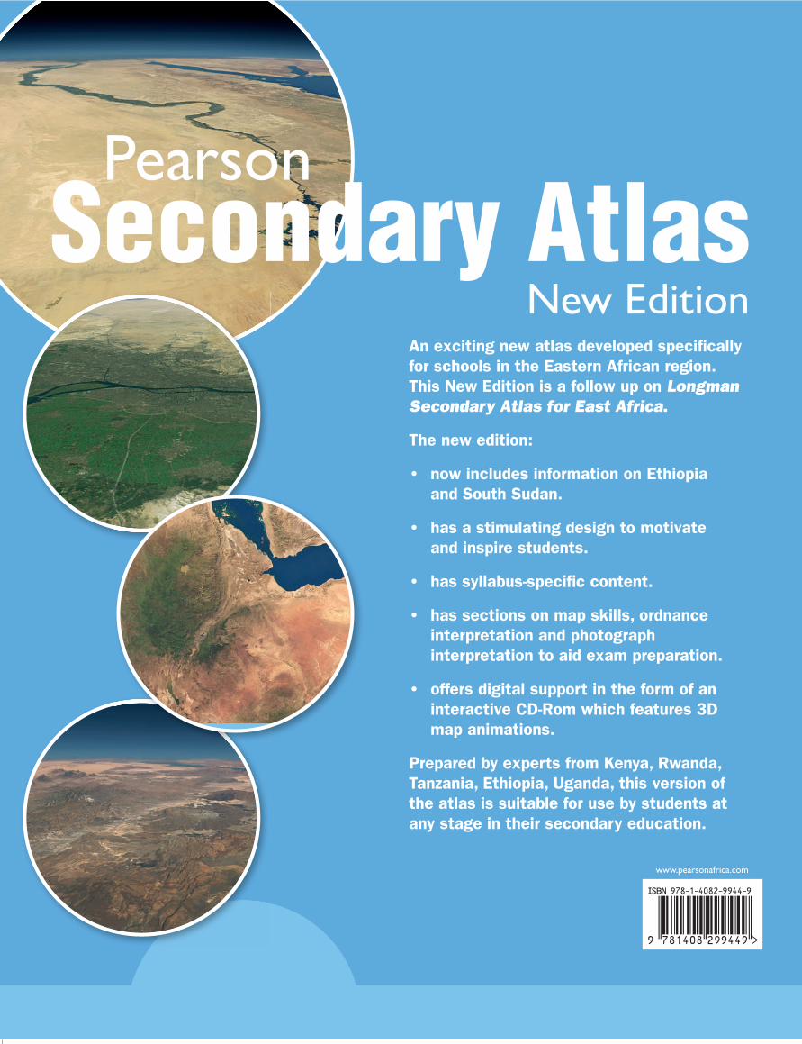
An exciting new atlas developed specifi cally for schools in the Eastern African region.This New Edition is a follow up on Longman Secondary Atlas for East Africa.
The new edition:
• now includes information on Ethiopia and South Sudan.
• has a stimulating design to motivate and inspire students.
• has syllabus-specifi c content.
• has sections on map skills, ordnance interpretation and photograph interpretation to aid exam preparation.
• offers digital support in the form of an interactive CD-Rom which features 3D map animations.
Prepared by experts from Kenya, Rwanda, Tanzania, Ethiopia, Uganda, this version of the atlas is suitable for use by students at any stage in their secondary education.
Secondary AtlasNew Edition
Pearson
Pearson Se
condary A
tlas New
Edition
Your CD-Rom INSIDE
Pearson Secondary Atlas
New Edition
Longman Secondary Atlas cover.indd 1 21/11/2012 10:53