Embed Size (px)
Citation preview
base line 38 (5): 1
ISSN 1943-6548
base line3 From the Chair5 On the Cataloging/Cataloguing Front8 Call for Nominations – MAGIRT HONORS Award 20189 National Geospatial Advisory Committee (NGAC)
meeting minutes10 New Maps and Cartographic Materials19 Great Moments in Map Librarianship
a newsletter of theMap and Geospatial Information Round Table
TABLE OF CONTENTS
http://www.ala.org/magirt/
Volume 38, Number 5October 2017
http://www.ala.org/magirt/© American Library Association 2017
312.944.6780
Published by the Map and Geospatial Information Round Table
base line is an official publication of the American Library Association’s Map and Geospatial Information Round Table (MAGIRT). The purpose of base line is to provide current information on cartographic materials, other publications of interest to map and geography librarians, meetings, related governmental activities, and map librarianship. It is a medium of communication for members of MAGIRT and information of interest is welcome. The opinions expressed by contributors are their own and do not necessarily represent those of the American Library Association and MAGIRT. Contributions should be sent to the appropriate editor listed below.Editor: John A. OlsonGovernment and Geo-Information LibrarianSyracuse UniversityTel: 315-443-4818 E-mail: [email protected] Manager: Sandy SchieferGovernment Documents and Political Science Librarian Uni-versity of Missouri, ColumbiaTel: 573-884-8123, E-mail: [email protected] Editor: Tammy T. WongCartographic Materials CatalogerGeography and Map Division, Library of CongressTel: 202/707-6735 E-mail: [email protected] Mapping Editor: Carol McAuliffeMap LibrarianMap & Imagery Library, University of FloridaTel: 352/273-2828 E-mail: [email protected] Maps and Books Editor: David J. BertucaMap Librarian, Science & Engineering Information CenterUniversity at BuffaloTel: 716/645-1332 E-mail: [email protected] and Marketing Committee Chairperson:Andrew BattistaLibrarian for Geospatial Information SystemsNew York UniversityTel: 212/992-7312 E-mail: ab6137@nyu@edu
Advertising Rates: For one issue: full page $100; half page $50; quarter page $25. Opposite “Great Moments in Map Librarianship”: full page $150; half page $80; quarter page $40.
Send graphics as an: .AI, .PDF, .JPG, or .GIF file and 300 dpi or better. Send text documents in: Times New Roman 12 point. Send files as an email attachment to the editor. Submissions may be edited and re-formatted to the extent necessary to fit the size and space allotted for each issue. Final full-page size is 8 x 10 inches. Advertisers will be invoiced. Please make payments to the MAGIRT Treasurer, payable in U.S. dollars to ALA-MAGIRT.
base line is published electronically six times a year: in February, April, June, August, October, and December. All older issues of base line are now freely available on the MAGIRT website.
Members of MAGIRT can access base line as a benefit of their membership.
American Library Association personal and institutional mem-bers may choose MAGIRT membership for $20.00 (personal) or $60.00 (institutional) by so advising the American Library Association, 50 W. Huron St., Chicago, IL 60611.
MAGIRT OFFICERS:Chairperson:Leslie WagnerMetadata ArchivistUniv of Texas-ArlingtonTel: 817/272-6209 E-mail: [email protected]
Vice-Chairperson (Chair-Elect):Tammy T. WongCartographic Materials CatalogerGeography and Map Division, Library of CongressTel: 202/707-6735 E-mail: [email protected]
Secretary:Catherine HodgeMonograph & Cartographic Resources Cataloging LibrarianThe University of IowaTel: 319/335-6295 E-mail: [email protected]
Treasurer:Maggie M. Long Special Collections Cataloger Wesleyan UniversityTel: E-mail: [email protected]
Assistant Treasurer:Bruce GodfreyGIS LibrarianUniveristy of IdahoE-mail: [email protected]
Past Chairperson:Louise M. RatliffSocal Sciences and Map Catalog LibrarianUCLAPhone: 310/206-5853 E-mail: [email protected]
From The ChairLeslie Wagner
University of Texas - Arlington
As we creep toward another Halloween (and for me, another birthday, another year older), I want time to stand still for just a minute so that I can catch my breath, assess our needs, make a few determinations, and move forward proactively. That’s pretty hard to do without a little help.
I put a recent call out to our executive board for updates on their respective charges, committees, and discus-sion groups, but have yet to receive any feedback, so I cannot provide you with a current update. As a friendly reminder, I am asking for monthly status reports from each chair and officer on a monthly basis, with a dead-line of the 7th for updates on what has occurred in the previous month.
ALA Connect is now back online and running, and we’re trying to get our website up to date. We should also be considering nominations for a number of round table offices that will be opening up for 2018 and Louise is providing more detail here in baseline. Nominees will need to complete their bios online by February. Newly elected officers will move into their positions at the end of ALA Annual 2018.
Our ALA Midwinter Conference field trip and Dutch-dinner social are being planned for Friday, February 9th. Vice Chair Tammy Wong has made some contacts and once those plans are solidified, we will reveal yet another fun Friday for those attending ALA Winter 2018. I’m sending out the schedule for Midwinter’s proposed meetings via email soon, so you should get those soon in order to make your travel plans – hopefully, before you read this!
As for our members, new and old, if you have an interest in joining a committee or discussion group that meets your particular area of interest, please feel free to contact the chair of that entity or any of the MAGIRT board to let us know. Our board meetings are also open to our membership, and we will be meeting via Zoom online on Wednesday, October 25, from 1:30 – 2:30 pm (Central).
base line 38 (5): 4
base line 38 (5): 5
On The Cataloging/Cataloguing FrontTammy Wong
Library of Congress
Library of Congress Subject Headings: Online TrainingThis online training on Library of Congress Subject Headings (LCSH) is being developed primarily to meet internal training needs of the Library of Congress, but it is being made freely available online as a service to the library community.
The instructors are Janis L. Young, MA, MSLS, a senior cataloging policy specialist in the Policy and Standards Division of the Library of Congress, and Daniel N. Joudrey, MLIS, Ph. D., an associate professor at the School of Library and Information Science at Simmons College in Boston, Massachusetts.
Training units are divided into two or more modules, each of which consists of a lecture and one or more exercises or quizzes.
Access to LCSH and the Subject Headings Manual (SHM) is essential to complete the exercises. LCSH is available through Classification Web or through the free PDFs available at http://www.loc.gov/aba/publications/FreeLCSH/freelcsh.html, and the SHM can be found in Cataloger’s Desktop or through the free PDFs at http://www.loc.gov/aba/publications/FreeSHM/freeshm.html.
Information about subscribing to Classification Web and Cataloger’s Desktop can be found on the LC Cataloging Distribution Service website.
Technology requirements for this training include an Internet connection and the ability to play audio and video files. The playing times listed for each module are approximate and refer to the lecture. Additional time should be allowed to complete the exercises.
The training is still under development, and additional modules will be added to the site at https://www.loc.gov/catworkshop/lcsh/ as they are completed.
Questions or comments about the training may be directed to Janis L. Young at [email protected].
Introduction to the Course [3 minutes] (PDF, 523 KB)
Unit 1. FoundationsModule 1.1 Why Do We Organize Information? [13 minutes] (PDF, 826 KB)Module 1.2 Why Do We Use Controlled Vocabulary? [19 minutes] (PDF, 1.0 MB)Module 1.3 What is Subject Analysis? [8 minutes] (PDF, 996 KB)Module 1.4 How Do We Determine Aboutness? [26 minutes] (PDF, 1.26 KB)Module 1.5 Introduction to LCSH [8 minutes] (PDF, 715 KB)
base line 38 (5): 6
Unit 2. Structure of LCSHModule 2.1 Structural Overview of LCSH [18 minutes] (PDF, 2.37 KB)Module 2.2 Headings [16 minutes] (PDF, 1.86 KB)Module 2.3 Qualifiers [11 minutes] (PDF, 1.56 KB)Module 2.4 Scope Notes [7 minutes] (PDF, 1.2 MB)Module 2.5 Broader Term and Narrower Term References [13 minutes] (PDF, 2.9 MB)Module 2.6 Related Term References [8 minutes] (PDF, 1.25 MB) Module 2.7 “Used For” References [14 minutes] (PDF, 2.87 MB)Module 2.8 General See and General See Also References [10 minutes] (PDF, 1.48 MB)
Unit 3. Subject Headings ManualModule 3.1 Introduction to the Subject Headings Manual [14 minutes] (PDF, 1.14 MB)Module 3.2 The Anatomy of an Instruction Sheet [16 minutes] (PDF, 1.21 MB)Module 3.3 Reading and Interpreting Instruction Sheets [24 minutes] (PDF, 1.92 MB)
Unit 4. Main Headings: The DetailsModule 4.1 Categories of Headings [23 minutes] (PDF, 2.5 MB)Module 4.2 Chronological Headings [15 minutes] (PDF, 1.6 MB)Module 4.3 Form Headings [21 minutes] (PDF, 2.29 MB)
Descriptive Access Points as SubjectsModule 4.4 Introduction to Descriptive Access Points as Subjects [13 min.] (PDF, 1.34 MB)Module 4.5 Personal Names as Subjects [14 minutes] (PDF, 1.38 MB)Module 4.6 Non-Human Entities as Subjects [8 minutes] (PDF, 958 KB)Module 4.7 Corporate Names as Subjects [16 minutes] (PDF, 1.82 KB)Module 4.8 Title and Name/Title Access Points as Subjects [22 minutes] (PDF, 2.16 MB)
Geographic HeadingsModule 4.9 Introduction to Geographic Headings [18 minutes] (PDF, 2.54 MB) Module 4.10 Linear Name Changes and Mergers of Jurisdictions [18 min.] (PDF, 1.55 MB)Module 4.11 Jurisdictional Splits [12 minutes] (PDF, 1.42 MB)Module 4.12 Geographic Regions [16 minutes] (PDF, 2.41 MB)
Unit 5. Assigning Headings: The PrinciplesModule 5.1 Principles of Heading Assignment, Part 1 [15 minutes] (PDF, 2.29 MB)Module 5.2 Principles of Heading Assignment, Part 2 [12 minutes] (PDF, 2.22 MB)Module 5.3 Order of Subject Headings [8 minutes] (PDF, 842 KB)Module 5.4 Extended Examples [22 minutes] (PDF, 2.42 MB)
base line 38 (5): 7
Unit 6. SubdivisionsModule 6.1 Overview of Subdivisions [16 minutes] (PDF, 2.18 MB)Module 6.2 Free-Floating Subdivisions: Introduction [11 minutes] (PDF, 1.68 MB)Module 6.3 Free-Floating Subdivisions: Using the SHM [20 minutes] (PDF, 3.15 MB)Module 6.4 Pattern Subdivisions [13 minutes] (PDF, 1.44 MB)Module 6.5 Free-Floating Subdivisions: H 1095 [8 minutes] (PDF, 1.0 MB)Module 6.6 Finding Topical and Form Subdivisions [27 minutes] (PDF, 3.98 MB)Module 6.7 Assigning Two or More Free-Floating and Pattern Subdivisions [22 minutes]
(PDF, 3.15 MB)
Geographic Subdivisions Module 6.8 Which Headings May Be Subdivided Geographically? [10 min.] (PDF, 1.33 MB) Module 6.9 Geographic Subdivision or Geographic Heading? [13 minutes] (PDF, 2.01 MB)Module 6.10 Which Subdivisions May Be Subdivided Geographically? [13 minutes] (PDF,
1.48 MB)Module 6.11 General Rules for Formulating Geographic Subdivisions [12 minutes] (PDF,
1.27 MB)Module 6.12 Formulating Geographic Subdivisions for the Exceptional Countries [12
minutes] (PDF, 1.02 MB)Module 6.13 Geographic Subdivision Information in MARC 21 Authority Records;
Geographic Entities in Cities [7 minutes] (PDF, 1.08 MB)
Chronological Subdivisions Module 6.14 Format of Chronological Subdivisions [18 minutes] (PDF, 1.51 MB)Module 6.15 Assigning the Subdivision – History [18 minutes] (PDF, 2.09 MB)Module 6.16 Assignment of Chronological Subdivisions [29 minutes] (PDF, 2.88 MB)Module 6.17 Form Subdivisions [15 minutes] (PDF, 2.25 MB)Module 6.18 Multiple Subdivisions [21 minutes] (PDF, 2.44 MB)
base line 38 (5): 8
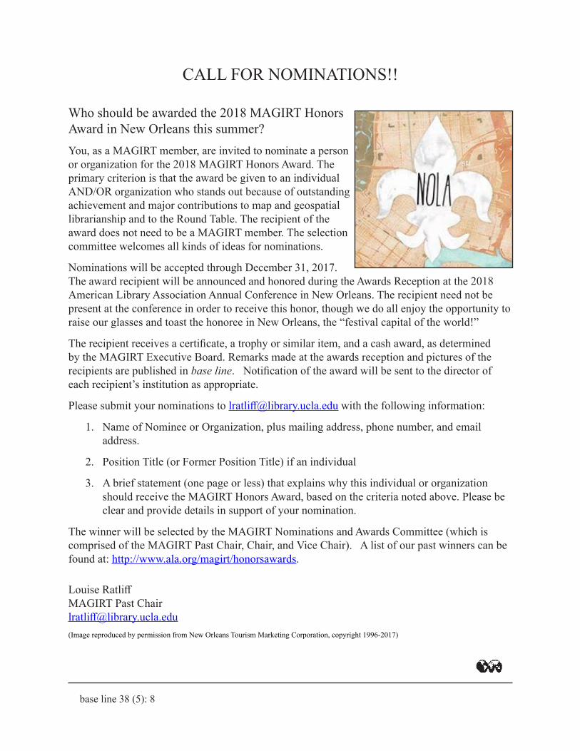
CALL FOR NOMINATIONS!! Who should be awarded the 2018 MAGIRT Honors Award in New Orleans this summer?You, as a MAGIRT member, are invited to nominate a person or organization for the 2018 MAGIRT Honors Award. The primary criterion is that the award be given to an individual AND/OR organization who stands out because of outstanding achievement and major contributions to map and geospatial librarianship and to the Round Table. The recipient of the award does not need to be a MAGIRT member. The selection committee welcomes all kinds of ideas for nominations.
Nominations will be accepted through December 31, 2017. The award recipient will be announced and honored during the Awards Reception at the 2018 American Library Association Annual Conference in New Orleans. The recipient need not be present at the conference in order to receive this honor, though we do all enjoy the opportunity to raise our glasses and toast the honoree in New Orleans, the “festival capital of the world!”
The recipient receives a certificate, a trophy or similar item, and a cash award, as determined by the MAGIRT Executive Board. Remarks made at the awards reception and pictures of the recipients are published in base line. Notification of the award will be sent to the director of each recipient’s institution as appropriate.
Please submit your nominations to [email protected] with the following information:
1. Name of Nominee or Organization, plus mailing address, phone number, and email address.
2. Position Title (or Former Position Title) if an individual
3. A brief statement (one page or less) that explains why this individual or organization should receive the MAGIRT Honors Award, based on the criteria noted above. Please be clear and provide details in support of your nomination.
The winner will be selected by the MAGIRT Nominations and Awards Committee (which is comprised of the MAGIRT Past Chair, Chair, and Vice Chair). A list of our past winners can be found at: http://www.ala.org/magirt/honorsawards.
Louise RatliffMAGIRT Past [email protected](Image reproduced by permission from New Orleans Tourism Marketing Corporation, copyright 1996-2017)

base line 38 (5): 9
National Geospatial Advisory Group quarterly meeting — September 2017
NGAC blog
The National Geospatial Advisory Committee (NGAC) held their fall meeting September 6-7, 2017 at the National Conservation Training Center in Shepherdstown, West Viriginia. The NGAC is a Federal Advisory Committee (FACA) to the Federal Geographic Data Committee (FGDC). The role of the NGAC is to provide advice and recommendations related to the national geospatial program and the development of the National Spatial Data Infrastructure. Full minutes of the meeting, PowerPoints, and lightning talks are available on the NGAC website.
https://library.stanford.edu/blogs/stanford-libraries-blog/2017/09/national-geospatial-advisory-group-holds-quarterly-meeting
Julie [email protected] Director of Geospatial and Cartographic ServicesHead, Branner Earth Sciences Map Library & Map CollectionsStanford University
Your Round TableNeeds YOU!
Have we got a deal for you!We are seeking individuals to run for
Vice Chair/Chair Elect, Secretary, and Assistant Treasurer.
Please nominate someone, or nominate yourself!
Contact Louise Ratliff, MAGIRT Past Chair, [email protected]
Want to help shape the direction of our
organization?
Want to serve your fellow members as
an officer?
base line 38 (5): 10
New Maps and Cartographic MaterialsDavid Bertuca
University of Buffalo
You only understand information relative to what you already understand. You only understand the size of a building if there is a car or a person in front of it. You only understand facts and figures when they can be related to tangible, comprehensible elements – Richard Saul Wurman, Information Anxiety, 1989.
In this issue, I included a number of relatively new books, including one that is very new. I believe these offer a representative group of some of the atlases being produced now. A few of these are major works that are impressive in their own right. Several web resources are included that might be useful, especially the Government Publishing Office links; government printing has declined but online, maps abound.
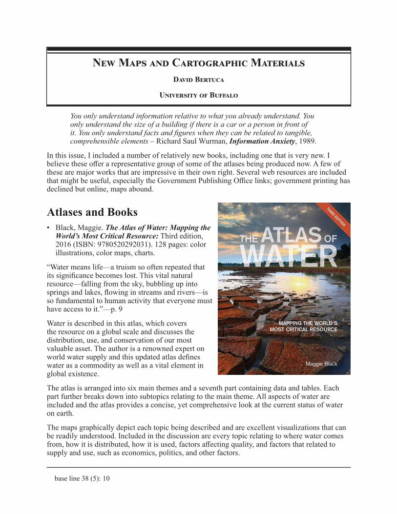
Atlases and Books• Black, Maggie. The Atlas of Water: Mapping the
World’s Most Critical Resource: Third edition, 2016 (ISBN: 9780520292031). 128 pages: color illustrations, color maps, charts.
“Water means life—a truism so often repeated that its significance becomes lost. This vital natural resource—falling from the sky, bubbling up into springs and lakes, flowing in streams and rivers—is so fundamental to human activity that everyone must have access to it.”—p. 9
Water is described in this atlas, which covers the resource on a global scale and discusses the distribution, use, and conservation of our most valuable asset. The author is a renowned expert on world water supply and this updated atlas defines water as a commodity as well as a vital element in global existence.
The atlas is arranged into six main themes and a seventh part containing data and tables. Each part further breaks down into subtopics relating to the main theme. All aspects of water are included and the atlas provides a concise, yet comprehensive look at the current status of water on earth.
The maps graphically depict each topic being described and are excellent visualizations that can be readily understood. Included in the discussion are every topic relating to where water comes from, how it is distributed, how it is used, factors affecting quality, and factors that related to supply and use, such as economics, politics, and other factors.
base line 38 (5): 11
Topics cover the issues and offer thoughts on the future, with suggestions for ensuring the preservation and continued use of water.
The data section has country listings for two main topics: Needs and Resources, and Water Uses. For each country, there are population figures for 2015 and 2030 projected levels. Figures show water resources by type (e.g., Total Renewable Water Resources). The Water Uses table shows total use for each country, with a breakdown by types of use.
Also included are a glossary, bibliographical references, and an index that has country and topical listings.
This atlas will be useful to students from high school through adult learner. The text and maps are clear and provide good definitions of the issues, problems, and state of water on earth. It would be an excellent choice for any collection.
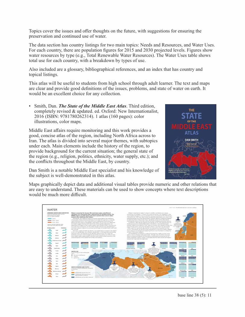
• Smith, Dan. The State of the Middle East Atlas. Third edition, completely revised & updated. ed. Oxford: New Internationalist, 2016 (ISBN: 9781780262314). 1 atlas (160 pages): color illustrations, color maps.
Middle East affairs require monitoring and this work provides a good, concise atlas of the region, including North Africa across to Iran. The atlas is divided into several major themes, with subtopics under each. Main elements include the history of the region, to provide background for the current situation; the general state of the region (e.g., religion, politics, ethnicity, water supply, etc.); and the conflicts throughout the Middle East, by country.
Dan Smith is a notable Middle East specialist and his knowledge of the subject is well-demonstrated in this atlas.
Maps graphically depict data and additional visual tables provide numeric and other relations that are easy to understand. These materials can be used to show concepts where text descriptions would be much more difficult.
base line 38 (5): 12
The text throughout provides discussion of topics, plus includes chronologies to show time elements of historic events and periods. Bibliographical notes and an index help the reader to locate data and to find more materials beyond the atlas.
This atlas, as the Water Atlas, is a good resource for students from high school through adult learner. The descriptions are short and clear, with maps and tables that visually represent topics. This atlas is a good resource for collections on general studies, history, political science, and any study relating to international relations.
The atlas was also published by Penguin Books under title: The Penguin state of the Middle East Atlas.
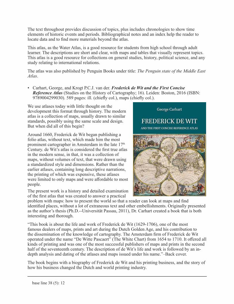
• Carhart, George, and Krogt P.C.J. van der. Frederick de Wit and the First Concise Reference Atlas (Studies on the History of Cartography; 16). Leiden: Boston, 2016 (ISBN: 9789004299030). 589 pages: ill. (chiefly col.), maps (chiefly col.).
We use atlases today with little thought on the development this format through history. The modern atlas is a collection of maps, usually drawn to similar standards, possibly using the same scale and design. But when did all of this begin?
Around 1660, Frederick de Wit began publishing a folio atlas, without text, which made him the most prominent cartographer in Amsterdam in the late 17th Century. de Wit’s atlas is considered the first true atlas in the modern sense, in that, it was a collection of maps, without volumes of text, that were drawn using a standardized style and dimensions. Rather than the earlier atlases, containing long descriptive narrations, the printing of which was expensive, these atlases were limited to only maps and were affordable to most people.The present work is a history and detailed examination of the first atlas that was created to answer a practical problem with maps: how to present the world so that a reader can look at maps and find identified places, without a lot of extraneous text and other embellishments. Originally presented as the author’s thesis (Ph.D.--Universität Passau, 2011), Dr. Carhart created a book that is both interesting and thorough.
“This book is about the life and work of Frederick de Wit (1629-1706), one of the most famous dealers of maps, prints and art during the Dutch Golden Age, and his contribution to the dissemination of the knowledge of cartography. The Amsterdam firm of Frederick de Wit operated under the name “De Witte Pascaert” (The White Chart) from 1654 to 1710. It offered all kinds of printing and was one of the most successful publishers of maps and prints in the second half of the seventeenth century. The description of de Wit’s life and work is followed by an in-depth analysis and dating of the atlases and maps issued under his name.”–Back cover.
The book begins with a biography of Frederick de Wit and his printing business, and the story of how his business changed the Dutch and world printing industry.
base line 38 (5): 13
The second chapter defines the modern concept of an atlas, providing a description of what differentiates an atlas from a collection of maps. This is done to emphasize de Wit’s contributions to modern cartography. “Putting a binding around a bundle of unsorted and disorganized maps does not make it an atlas; all atlases worthy of the name are structured according to some geographical scheme or purpose. That is to say, an atlas is distinguished from a mere collection of maps by an editor’s guiding hand; an atlas is a map of maps, and its editor a metacartographer.” (Akerman, James R. “On the Shoulders of a Titan: Viewing the World of the Past in Atlas Structure.” Dissertation: Ph. D.; Pennsylvania State University; 1991.)
Additional defining features of atlases are described that further prove the author’s premise that this atlas was a turning point in cartographic publishing history.
The third chapter describes de Wit’s reference atlas and its history. The atlas was produced to provide an inexpensive and smaller collection of maps that could be used for reference purposes.
Chapter four covers the most important part of the thesis: the dating and authenticating of the original atlases to explain editions and changes to printing. The author’s main thesis was to show how the maps are dated and the history of the cartography behind the maps.
The next several chapters discuss de Wit’s other maps and atlases, many of which were innovative. Additional dating methods are shown to chronologically sort the works. A chapter covers de Wit’s and the map’s legacy to the world. The last chapter describes the cartographic origins of de Wit’s maps. A conclusion finishes the text.
A final section (p. 133-534) shows individual maps, cartouches, and other details of the many maps in the atlas. The color reproduction of the maps is very good and all maps are cited with details.
There is a bibliography and index, as well as an alphabetical list of the titles of all maps in the book.
This work is a detailed study of a major cartographic publisher that provides a wealth of description of the atlas and of de Wit’s work. The author spent years locating and examining the maps and the history of the atlas.
The illustrations are excellent and enjoyable to examine. Text is interesting and provides a wealth of data on the atlas, the cartographer, his printing house, and on Amsterdam as a map producer.
This work would be suitable for college and advanced degree work, as well as studies in cartography, cartographic history, and fine arts.
• Desimini, Jill, and Waldheim Charles. Cartographic Grounds: Projecting the Landscape Imaginary. New York: Princeton Architectural Press, 2016 (ISBN: 9781616893293). 271 pages: illustrations (chiefly color), color maps.
During most classes that I instruct, when speaking of maps, I point out that maps are usually two-dimensional representations of a three-dimensional universe. Also included is the statement that maps are abstract renditions of this landscape and that cartographers employ many techniques and conventions to provide the user with a good representation of reality.
The purpose of this book is to discuss traditional conventions for mapping, as well as to inspire readers wanting to find methods for representing the terrain as well as possible. A publisher’s description explains best:
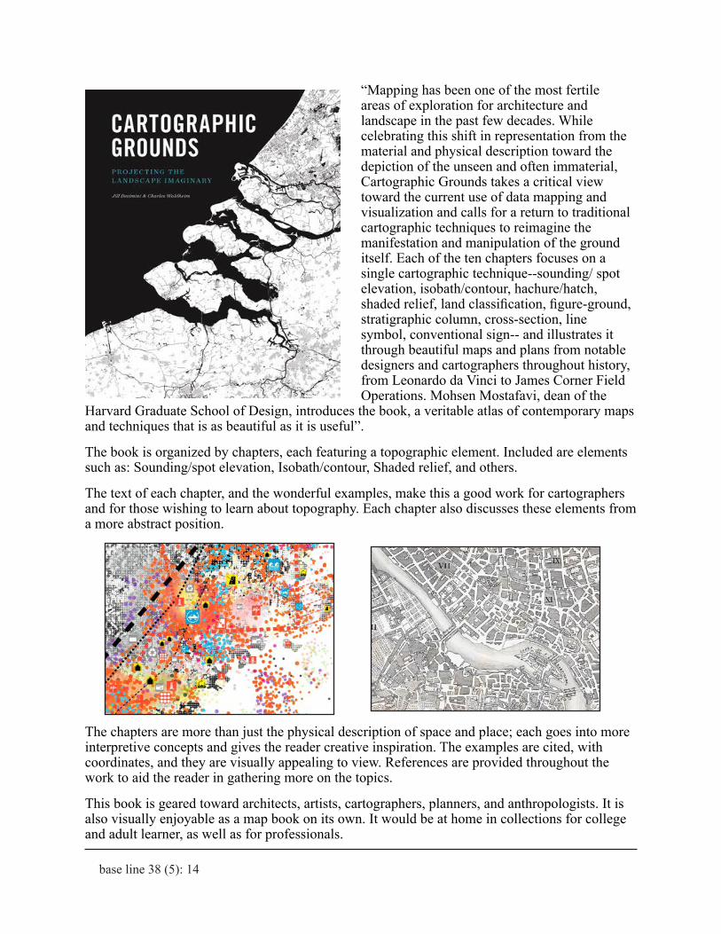
base line 38 (5): 14
“Mapping has been one of the most fertile areas of exploration for architecture and landscape in the past few decades. While celebrating this shift in representation from the material and physical description toward the depiction of the unseen and often immaterial, Cartographic Grounds takes a critical view toward the current use of data mapping and visualization and calls for a return to traditional cartographic techniques to reimagine the manifestation and manipulation of the ground itself. Each of the ten chapters focuses on a single cartographic technique--sounding/ spot elevation, isobath/contour, hachure/hatch, shaded relief, land classification, figure-ground, stratigraphic column, cross-section, line symbol, conventional sign-- and illustrates it through beautiful maps and plans from notable designers and cartographers throughout history, from Leonardo da Vinci to James Corner Field Operations. Mohsen Mostafavi, dean of the
Harvard Graduate School of Design, introduces the book, a veritable atlas of contemporary maps and techniques that is as beautiful as it is useful”.
The book is organized by chapters, each featuring a topographic element. Included are elements such as: Sounding/spot elevation, Isobath/contour, Shaded relief, and others.
The text of each chapter, and the wonderful examples, make this a good work for cartographers and for those wishing to learn about topography. Each chapter also discusses these elements from a more abstract position.
The chapters are more than just the physical description of space and place; each goes into more interpretive concepts and gives the reader creative inspiration. The examples are cited, with coordinates, and they are visually appealing to view. References are provided throughout the work to aid the reader in gathering more on the topics.
This book is geared toward architects, artists, cartographers, planners, and anthropologists. It is also visually enjoyable as a map book on its own. It would be at home in collections for college and adult learner, as well as for professionals.
base line 38 (5): 15
• Trans-Siberian Railroad Atlas: Scale 1:3,200,000: Saint Petersburg, Moscow, Heritage Cities Region, Sergiev Posad, Suzdal. Richmond, B.C.: ITMB Publishing, Ltd., 2016 (ISBN: 9781771297912). Scales differ. 1 atlas (iii, 53 pages): color maps; Scales differ.
The Trans-Siberian Railway is a rail network that spans almost 6,000 miles across Russia, from Moscow to Vladivostok on the Pacific. Extensions connect it with China and Mongolia. It passes through many exotic and varied landscapes and is the longest railway in the world.
This compact atlas of the entire railway, plus branches is designed for travelers, but offers a good tool for anyone studying the route and its regions.
A map key shows all maps in the volume, in relation to their location in Asia. Additional maps cover larger scale renditions of Moscow, St. Petersburg, and a number of “Heritage Cities.”
The maps are typical ITMB design and are easy to read with a map key to assist with symbols and conventions. The main sequence of maps are drawn at scale 3,200,000, while the city maps are larger scales. Moscow has an additional metro rail map.
An index assists in locating the right map for the entry.
This is a good travel atlas, but it is also handy for Russian studies, history, business, internation-al trade, and other research. The maps are readable and this atlas will be good for high school through adult user.
• Carandini, Andrea, Paolo Carafa, Andrew Campbell Halavais, et al. The Atlas of Ancient Rome: Biography and Portraits of the City. Princeton, NJ: Princeton University Press, 2017 (ISBN: 9780691163475). 2 volumes (xiii, 640, 463 pages): illustrations (chiefly color), color maps.
Ancient Rome has been studied in great detail throughout history. Many atlases and maps cover all aspects of the city, but this new work contains an even deeper look at Rome, combining maps, diagrams, photographs of structures and artifacts, and archaeological descriptions to make a wonderful addition to the literature.
The publisher’s description opens with “The Atlas of Ancient Rome provides a comprehensive archaeological survey of the city of Rome from prehistory to the early medieval period. Lavishly illustrated throughout with full-color maps, drawings, photos, and 3D reconstructions, this magnificent two-volume slipcased edition features the latest discoveries and scholarship, with new descriptions of more than 500 monuments…”
base line 38 (5): 16
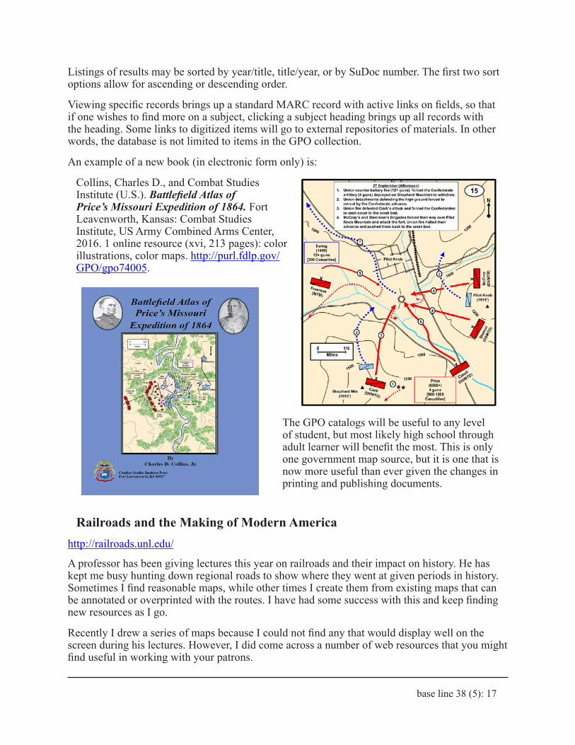
Volume 1: “Text and Images” contains the main body of the work. The atlas contains maps and drawings based on the most recent archeological findings and is rich with new discoveries. The text and imagery go into great detail and provide enough detail to make the ancient buildings and statues come to life.
The newly drawn views of buildings and sections of Rome are very detailed and show the city at various moments in time. The use of color and number of illustrations makes this a good visual work, on top of being full of extensive text. The bibliography is sizeable: (p. 589-639).
Volume 2: “Tables and Indexes” provides indexes that will assist both student and expert in finding what they need within the work. The tables contain an incredible density of detailed maps of individual structures and sections of the city, with building elevations, architectural diagrams of elements, maps showing every detail and much more. This section is quite impressive and not easily described. The intensity of the detail and annotation will give the archaeologist and even amateur historian a wonderful reading experience.
Additional tables, entitled “Rome in the Fourth Century AD With Overlap of the Successive Monuments” is a detailed composite atlas of Rome showing buildings and structures as they lay on the city through time. The saturation of detail is overwhelming but intriguing.
These two volumes provide an amazing reference for the archeologist and historian, while also being fascinating to anyone interested in Roman art, architecture, and urban planning.
This work will mainly interest college and professional level researchers but the maps, tables, and illustrations should be of interest to any student from high school through adult. The atlas would be at home in most reference collections and is definitely worth perusing.
Web Resources
Catalog of U.S. Government Publications (CGP)https://catalog.gpo.gov/F
Now that most maps and geographical publications are not being printed, the GPO is making materials available online in larger quantities. The Catalog provides the main method for accessing government documents and is a valuable finding aid for map products, especially using the Advanced Search. You can enter terms, with preference to specific fields (e.g., keyword, title), then can “Limit” your search by: years, format (e.g., maps), language, and catalog (e.g., National Bibliography of U.S. Government Publications).
You can also select a specific catalog and conduct a search in just that catalog. Catalogs include the Congressional Serial Set, Electronic Titles, Gov eBooks, and others. If a document is digital/digitized, the link is displayed.
base line 38 (5): 17
Listings of results may be sorted by year/title, title/year, or by SuDoc number. The first two sort options allow for ascending or descending order.
Viewing specific records brings up a standard MARC record with active links on fields, so that if one wishes to find more on a subject, clicking a subject heading brings up all records with the heading. Some links to digitized items will go to external repositories of materials. In other words, the database is not limited to items in the GPO collection.
An example of a new book (in electronic form only) is:
Collins, Charles D., and Combat Studies Institute (U.S.). Battlefield Atlas of Price’s Missouri Expedition of 1864. Fort Leavenworth, Kansas: Combat Studies Institute, US Army Combined Arms Center, 2016. 1 online resource (xvi, 213 pages): color illustrations, color maps. http://purl.fdlp.gov/GPO/gpo74005.
The GPO catalogs will be useful to any level of student, but most likely high school through adult learner will benefit the most. This is only one government map source, but it is one that is now more useful than ever given the changes in printing and publishing documents.
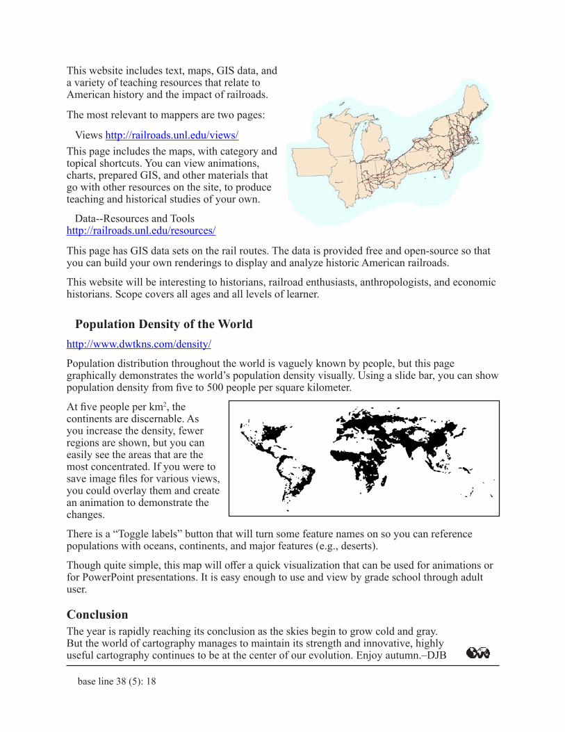
Railroads and the Making of Modern Americahttp://railroads.unl.edu/
A professor has been giving lectures this year on railroads and their impact on history. He has kept me busy hunting down regional roads to show where they went at given periods in history. Sometimes I find reasonable maps, while other times I create them from existing maps that can be annotated or overprinted with the routes. I have had some success with this and keep finding new resources as I go.
Recently I drew a series of maps because I could not find any that would display well on the screen during his lectures. However, I did come across a number of web resources that you might find useful in working with your patrons.
base line 38 (5): 18
This website includes text, maps, GIS data, and a variety of teaching resources that relate to American history and the impact of railroads.
The most relevant to mappers are two pages:
Views http://railroads.unl.edu/views/This page includes the maps, with category and topical shortcuts. You can view animations, charts, prepared GIS, and other materials that go with other resources on the site, to produce teaching and historical studies of your own.
Data--Resources and Tools http://railroads.unl.edu/resources/
This page has GIS data sets on the rail routes. The data is provided free and open-source so that you can build your own renderings to display and analyze historic American railroads.
This website will be interesting to historians, railroad enthusiasts, anthropologists, and economic historians. Scope covers all ages and all levels of learner.
Population Density of the Worldhttp://www.dwtkns.com/density/
Population distribution throughout the world is vaguely known by people, but this page graphically demonstrates the world’s population density visually. Using a slide bar, you can show population density from five to 500 people per square kilometer.
At five people per km2, the continents are discernable. As you increase the density, fewer regions are shown, but you can easily see the areas that are the most concentrated. If you were to save image files for various views, you could overlay them and create an animation to demonstrate the changes.
There is a “Toggle labels” button that will turn some feature names on so you can reference populations with oceans, continents, and major features (e.g., deserts).
Though quite simple, this map will offer a quick visualization that can be used for animations or for PowerPoint presentations. It is easy enough to use and view by grade school through adult user.
ConclusionThe year is rapidly reaching its conclusion as the skies begin to grow cold and gray. But the world of cartography manages to maintain its strength and innovative, highly useful cartography continues to be at the center of our evolution. Enjoy autumn.–DJB
base line 38 (5): 19
!
c
JIM
COOM
BS 1
0/17
NO, I’LL REQUEST IT ON MAPS-L. IT’S LIKE GOOGLE FOR MAP LIBRARIANS WE JUST SEND IN OUR QUESTION AND BUDDAH- BING BUDDAH-BOOM, WE GET ANSWERS FROM OUR FELLOW MAP AND GIS LIBRARIANS.
THE
IS IN
MAPS & GISLIBRARIAN
BOSS, OUR COPY OF THE HISTORIC HUMANSVILLEQUADRANGLE IS MISSING. CAN I GOOGLE IT ON MY PHONE AND SEE WHERE OR IF WE CAN GET A REPLACEMENT FOR IT?
GREAT MOMENTS IN MAP LIBRARIANSHIP by Jim Coombs
THE
IS IN
MAPS & GISLIBRARIAN