Embed Size (px)
Citation preview
ISOTOPE HYDROLOGY IN THE EXPLORATION OF THE KATWE, BURANGA AND KIBIRO GEOTHERMAL SYSTEMS, UGANDA
Godfrey BahatiGodfrey BahatiDepartment of Geological Survey and Mines, Department of Geological Survey and Mines,
P.O Box 9, Entebbe, UgandaP.O Box 9, Entebbe, Uganda
Second African Rift Geothermal ConferenceSecond African Rift Geothermal ConferenceImperial Resort Beach Hotel Entebbe, Uganda,Imperial Resort Beach Hotel Entebbe, Uganda,
November 24November 24--28, 200828, 2008
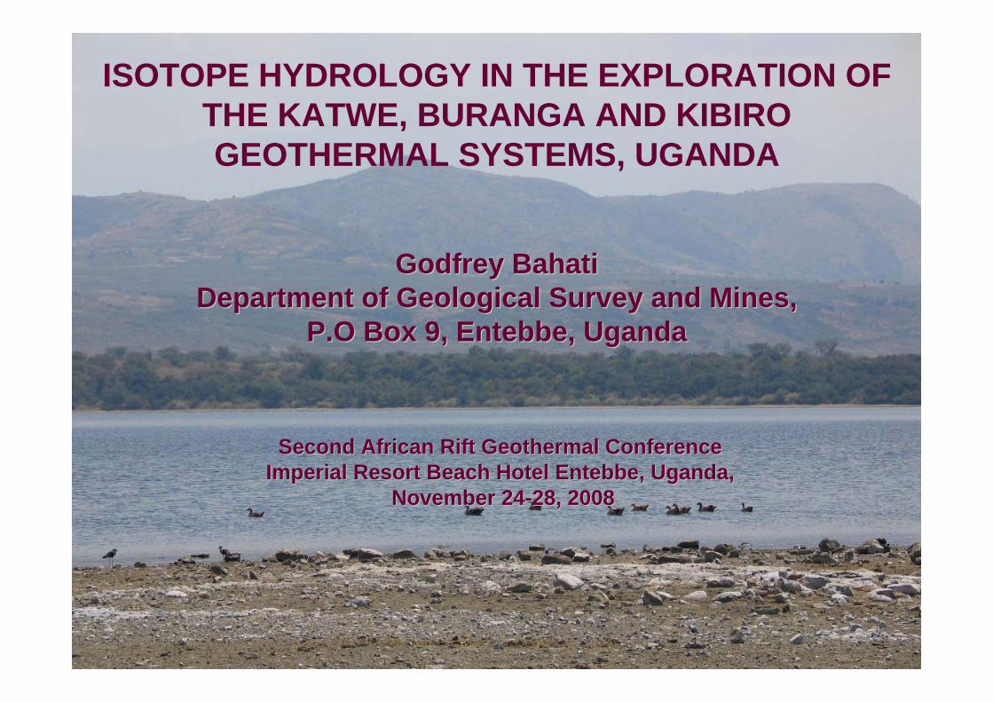
Outline Outline
• Objectives of the study• Study areas• Methodology• Geology of the western Rift Valley• Sampling points• Stable isotopes• Tritium and mixing processes• Sources of solutes • Water–rock interaction • Conclusions
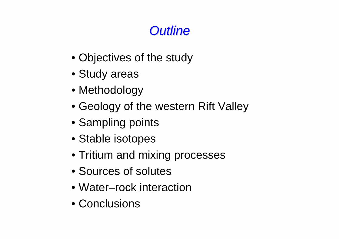
Objectives of the study
• To elucidate the origin of the geothermal fluids,
• identify the recharge mechanisms,• estimate subsurface temperature using
isotope geothermometry,• trace the source of solutes,• improve the conceptual geothermal
models of the study areas.
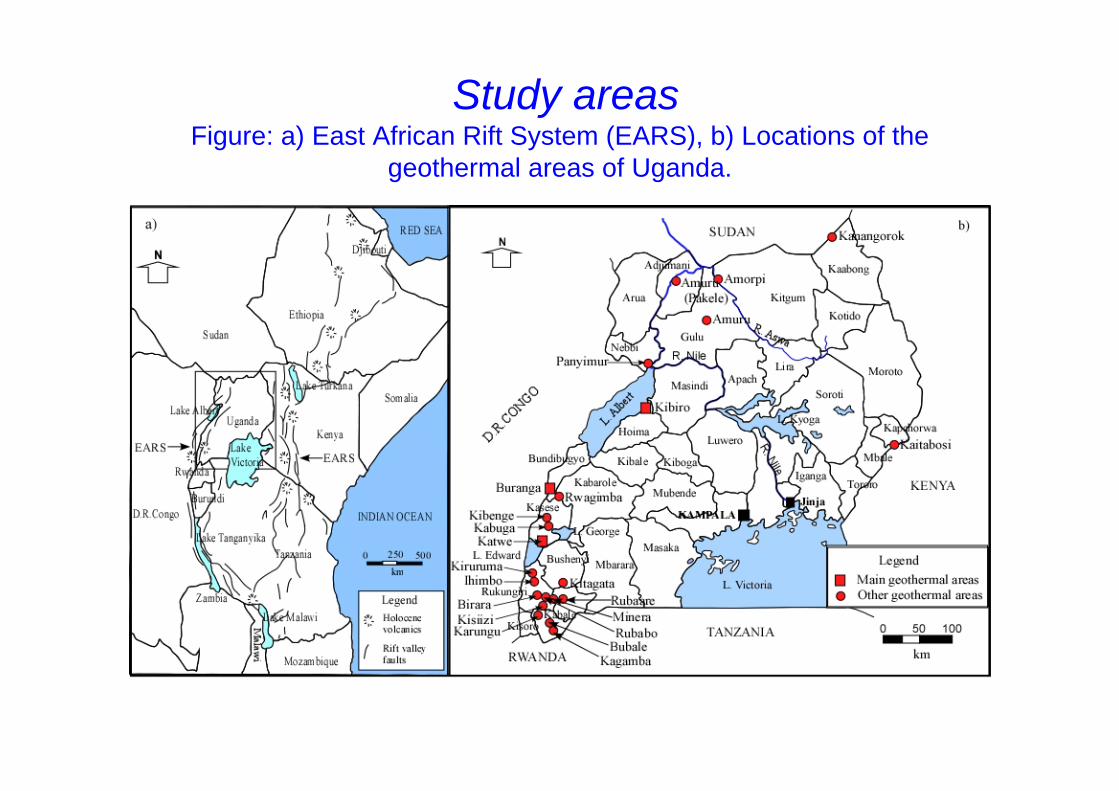
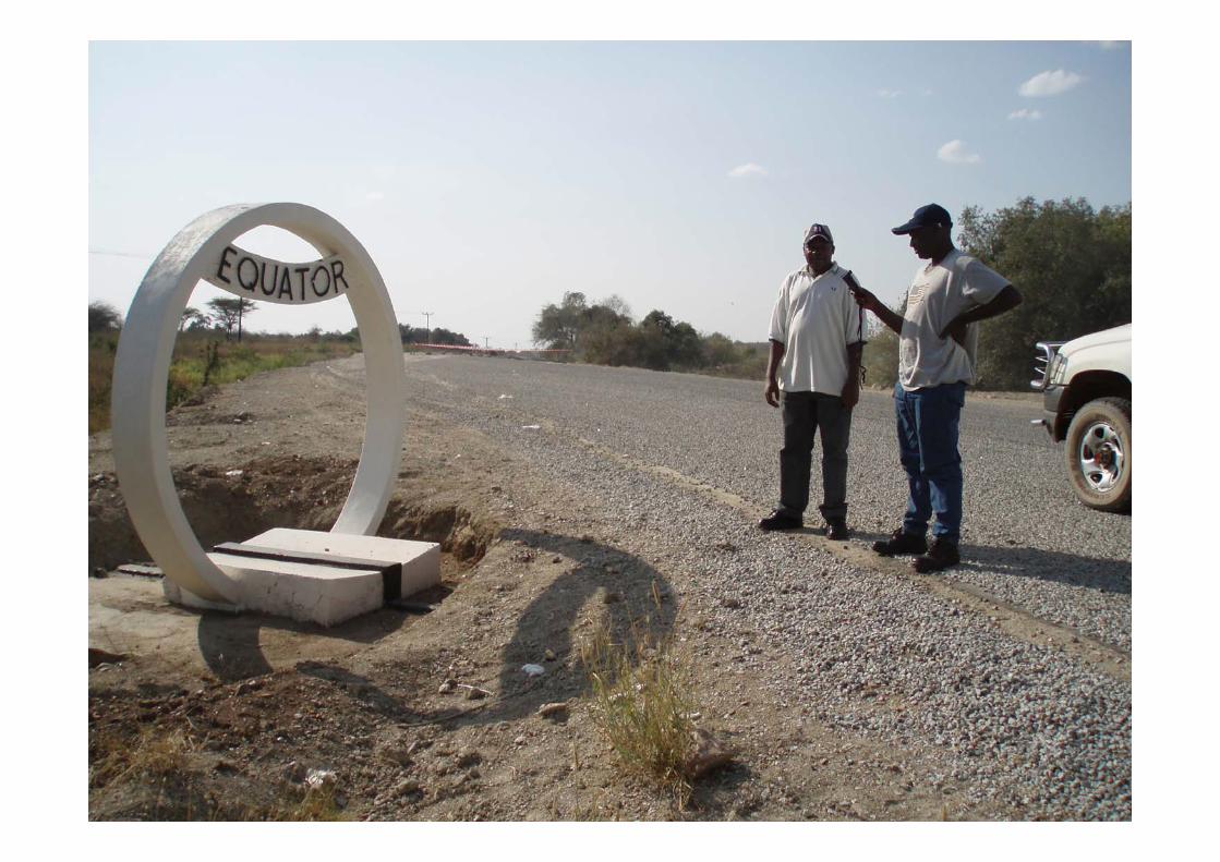
Study areasFigure: a) East African Rift System (EARS), b) Locations of the
geothermal areas of Uganda.
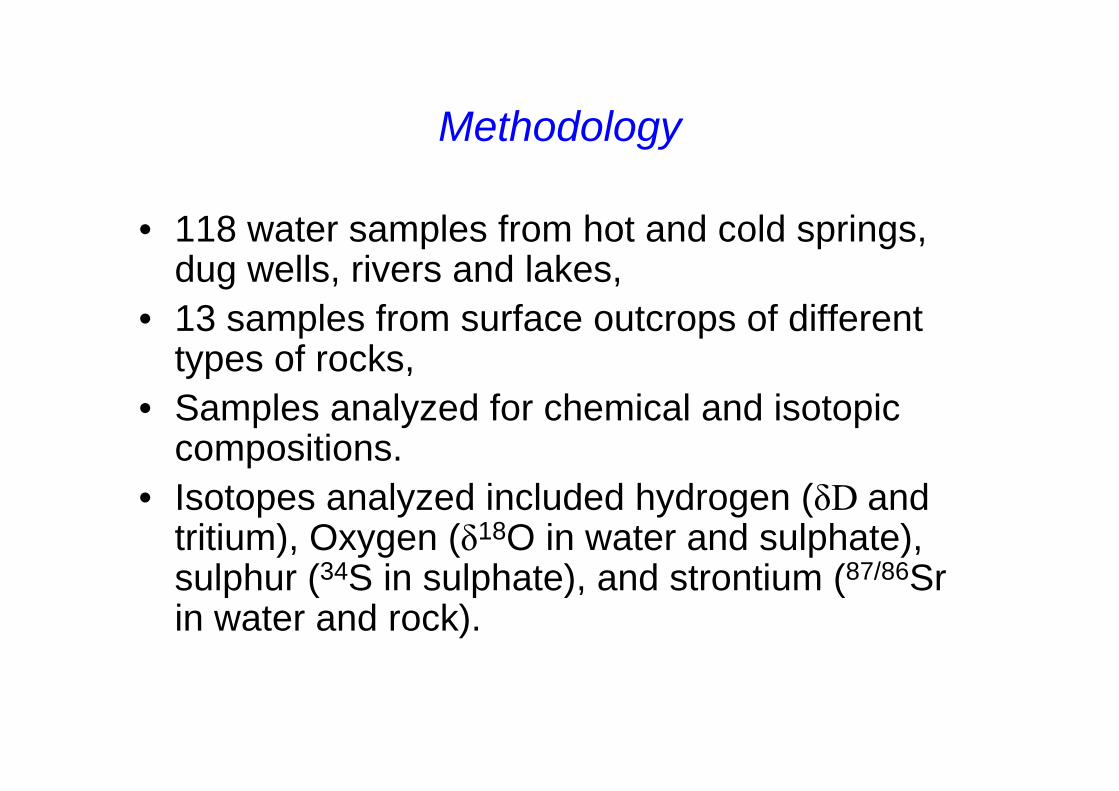
Methodology
• 118 water samples from hot and cold springs, dug wells, rivers and lakes,
• 13 samples from surface outcrops of different types of rocks,
• Samples analyzed for chemical and isotopic compositions.
• Isotopes analyzed included hydrogen (δD and tritium), Oxygen (δ18O in water and sulphate), sulphur (34S in sulphate), and strontium (87/86Sr in water and rock).
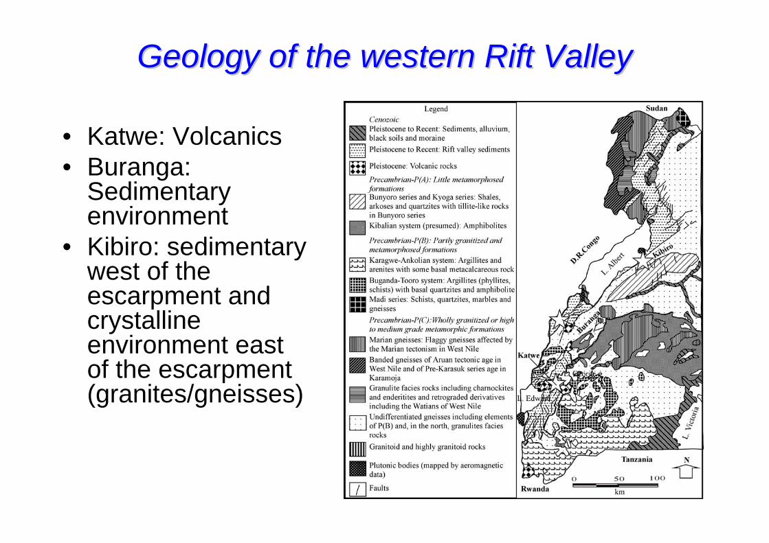
Geology of the western Rift ValleyGeology of the western Rift Valley
• Katwe: Volcanics• Buranga:
Sedimentary environment
• Kibiro: sedimentary west of the escarpment and crystalline environment east of the escarpment (granites/gneisses)
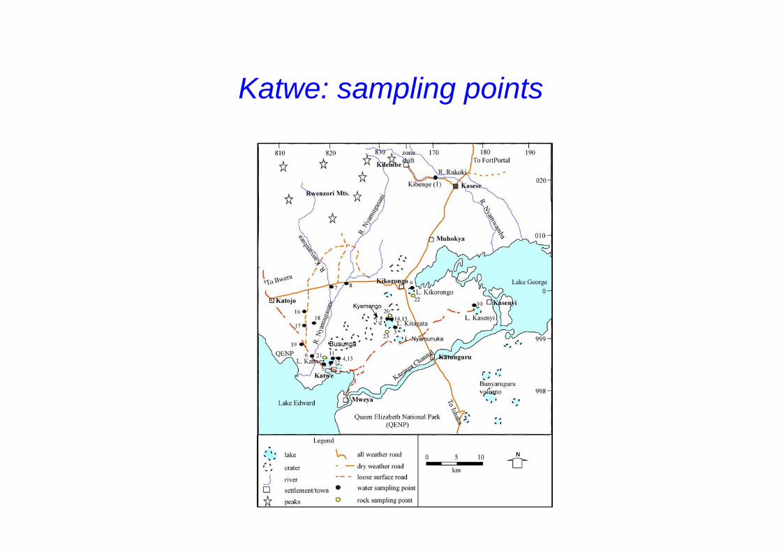
Katwe: sampling points
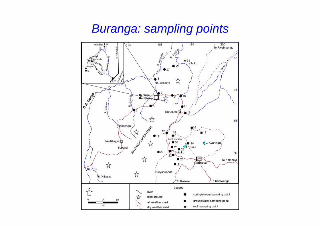
Buranga: sampling points
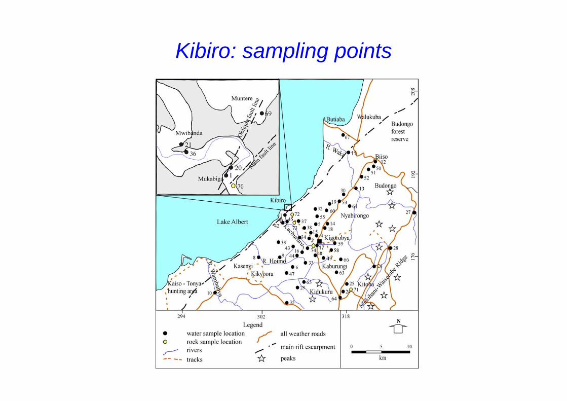
Kibiro: sampling points
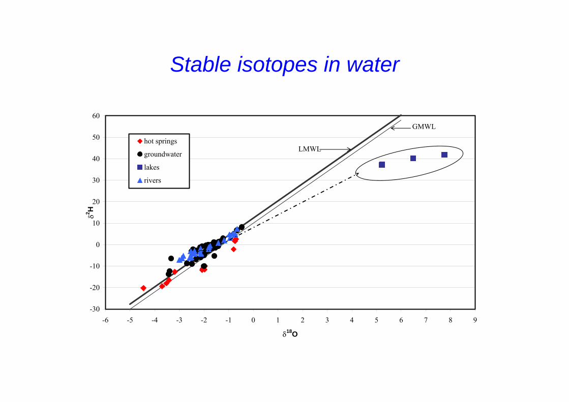
Stable isotopes in water
-30
-20
-10
0
10
20
30
40
50
60
-6 -5 -4 -3 -2 -1 0 1 2 3 4 5 6 7 8 9
δ18O
δ2 H
hot springs
groundwater
lakes
rivers
LMWL
GMWL
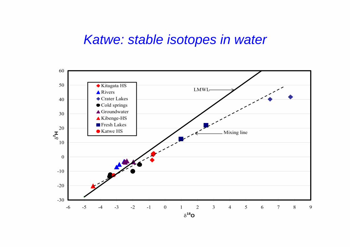
Katwe: stable isotopes in water
-30
-20
-10
0
10
20
30
40
50
60
-6 -5 -4 -3 -2 -1 0 1 2 3 4 5 6 7 8 9
δ18O
δ2 H
Kitagata HSRiversCrater LakesCold springsGroundwaterKibenge-HSFresh LakesKatwe HS Mixing line
LMWL
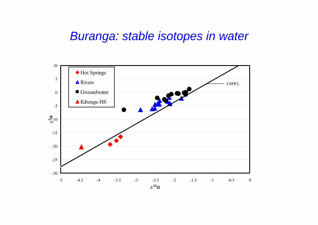
Buranga: stable isotopes in water
-30
-25
-20
-15
-10
-5
0
5
10
-5 -4.5 -4 -3.5 -3 -2.5 -2 -1.5 -1 -0.5 0
δ18O
δ2 H
Hot Springs
Rivers
Groundwater
Kibenge-HS
LMWL
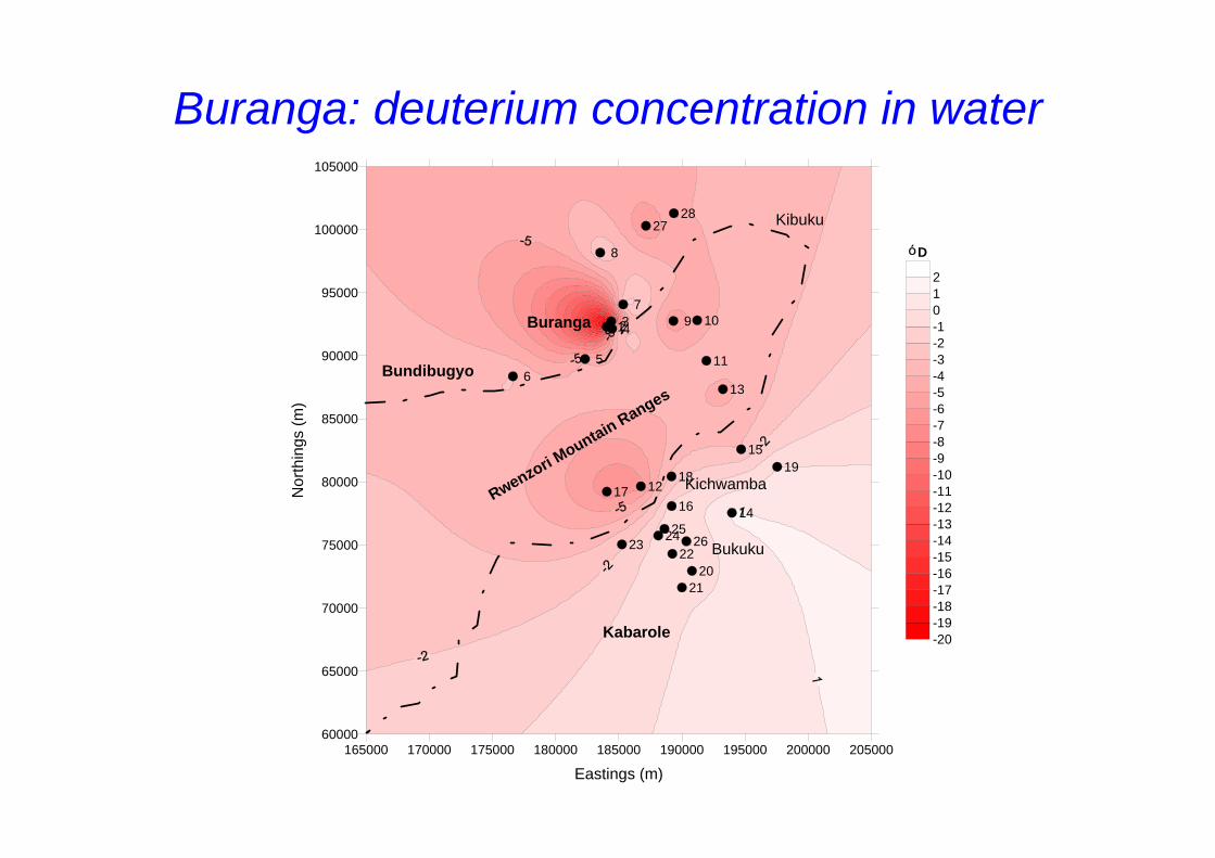
Buranga: deuterium concentration in water
165000 170000 175000 180000 185000 190000 195000 200000 205000
Eastings (m)
60000
65000
70000
75000
80000
85000
90000
95000
100000
105000
Nor
thin
gs (m
)
1234
56
7
8
9 10
11
12
13
14
15
1617
1819
2021
2223
242526
2728
-20-19-18-17-16-15-14-13-12-11-10-9-8-7-6-5-4-3-2-1012
Buranga
Bundibugyo
Rwenzori Mountain Ranges
Kibuku
Kichwamba
Bukuku
Kabarole
D
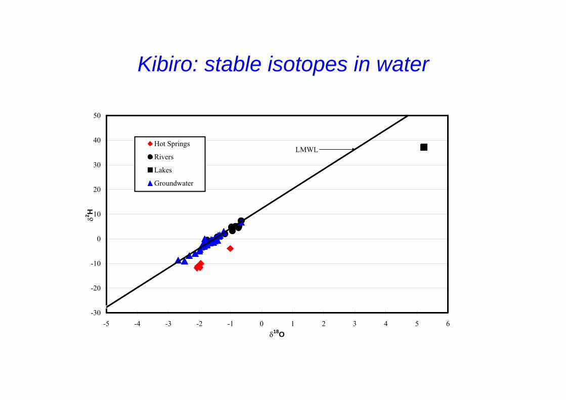
Kibiro: stable isotopes in water
-30
-20
-10
0
10
20
30
40
50
-5 -4 -3 -2 -1 0 1 2 3 4 5 6δ18O
δ2 H
Hot Springs
Rivers
Lakes
Groundwater
LMWL
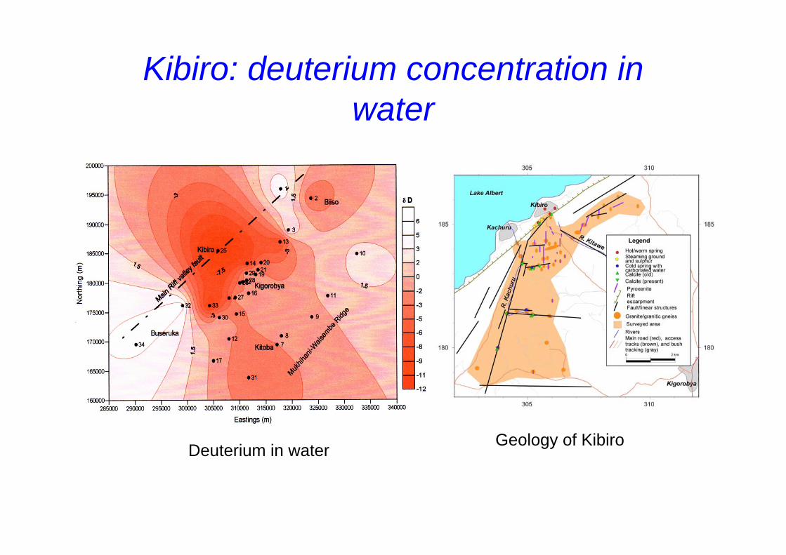
Kibiro: deuterium concentration in water
Deuterium in water Geology of Kibiro
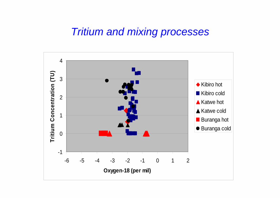
Tritium and mixing processes
-1
0
1
2
3
4
-6 -5 -4 -3 -2 -1 0 1 2
Oxygen-18 (per mil)
Triti
um C
once
ntra
tion
(TU
)
Kibiro hotKibiro coldKatwe hotKatwe coldBuranga hotBuranga cold
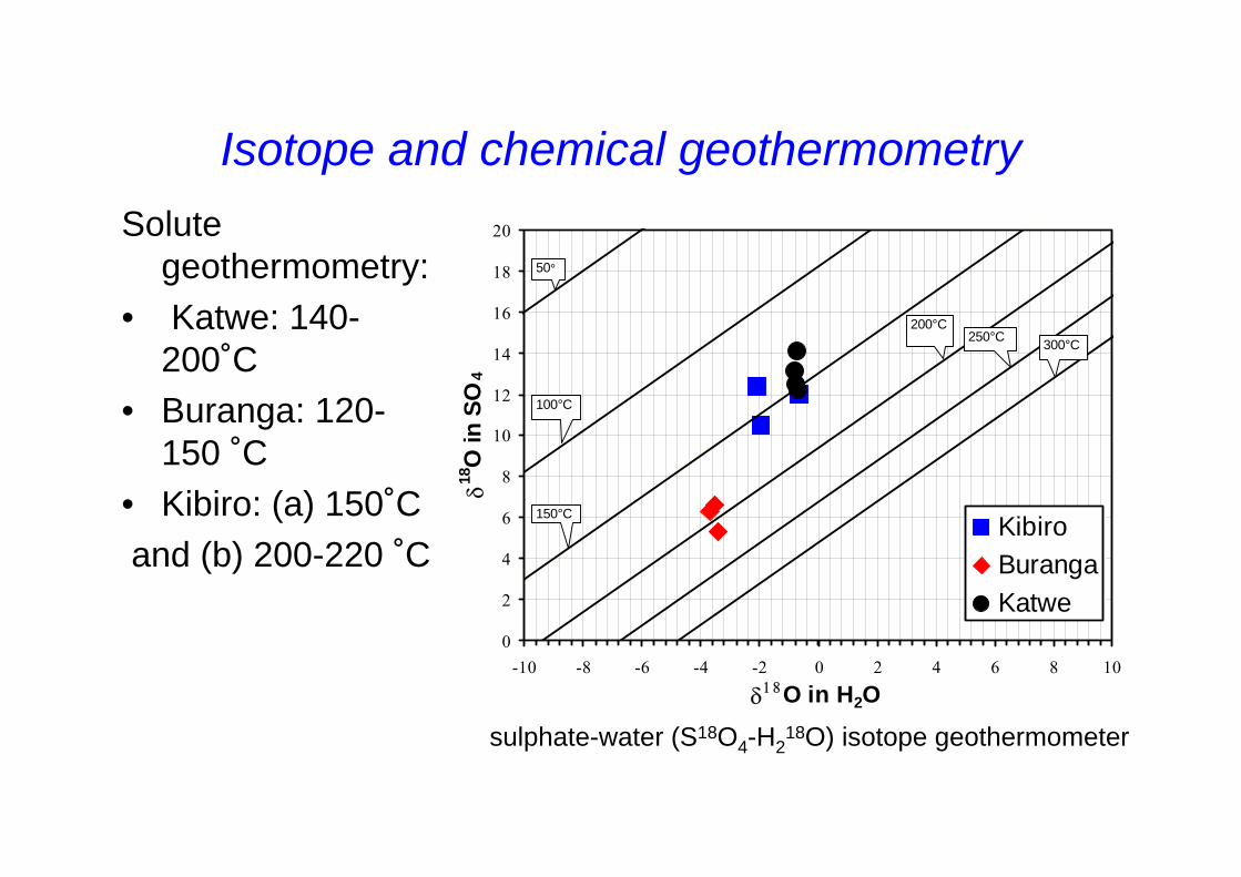
Isotope and chemical geothermometry
0
2
4
6
8
10
12
14
16
18
20
-10 -8 -6 -4 -2 0 2 4 6 8 10
δ18O in H2O
δ18O
in S
O4
KibiroBurangaKatwe
150°C
50°
200°C250°C 300°C
100°C
Solute geothermometry:
• Katwe: 140-200˚C
• Buranga: 120-150 ˚C
• Kibiro: (a) 150˚Cand (b) 200-220 ˚C
sulphate-water (S18O4-H218O) isotope geothermometer
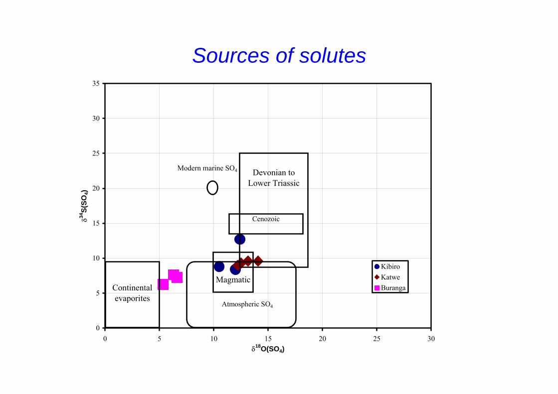
Sources of solutes
0
5
10
15
20
25
30
35
0 5 10 15 20 25 30δ18O(SO4)
δ34S(
SO4)
KibiroKatweBuranga
Devonian to Lower Triassic
Magmatic Continental evaporites
Cenozoic
Modern marine SO4
Atmospheric SO4
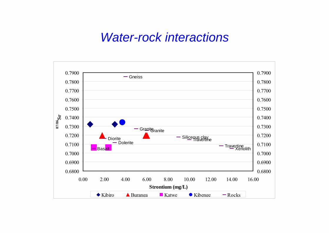
Water-rock interactions
Basalt
DioriteDolerite
Gneiss
GraniteGraniteSiliceous clayTravertine
TravertineXenolith
0.6800
0.6900
0.7000
0.7100
0.7200
0.7300
0.7400
0.7500
0.7600
0.7700
0.7800
0.7900
0.00 2.00 4.00 6.00 8.00 10.00 12.00 14.00 16.00Strontium (mg/L)
87/8
6 Sr
0.6800
0.6900
0.7000
0.7100
0.7200
0.7300
0.7400
0.7500
0.7600
0.7700
0.7800
0.7900
Kibiro Buranga Katwe Kibenge Rocks
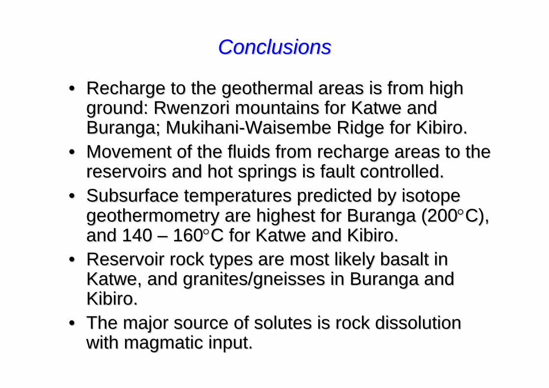
ConclusionsConclusions
•• Recharge to the geothermal areas is from high Recharge to the geothermal areas is from high ground: ground: RwenzoriRwenzori mountains for mountains for KatweKatwe and and BurangaBuranga; ; MukihaniMukihani--WaisembeWaisembe Ridge for Ridge for KibiroKibiro..
•• Movement of the fluids from recharge areas to the Movement of the fluids from recharge areas to the reservoirs and hot springs is fault controlled.reservoirs and hot springs is fault controlled.
•• Subsurface temperatures predicted by isotope Subsurface temperatures predicted by isotope geothermometry are highest for geothermometry are highest for BurangaBuranga (200(200°°C), C), and 140 and 140 –– 160160°°C for C for KatweKatwe and and KibiroKibiro. .
•• Reservoir rock types are most likely basalt in Reservoir rock types are most likely basalt in KatweKatwe, and granites/gneisses in , and granites/gneisses in BurangaBuranga and and KibiroKibiro..
•• The major source of solutes is rock dissolution The major source of solutes is rock dissolution with with magmaticmagmatic input.input.