Embed Size (px)
Citation preview
Island County SMPShoreline Residential Development Workshop
December 5, 2011
Workshop Goals
Are County’s shoreline rules the right rules to accomplish the purposes of the SMA and the community’s vision?
What changes to the shoreline rules regarding residential development and redevelopment are needed?
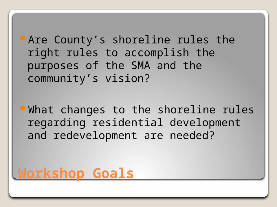
Agenda
1. Introduction – 4.302. Presentation – 4.353. Breakout Vote – 5.104. Break – 5.305. Group Discussion - 5.456. Q & A – 6.157. Close – 6.30
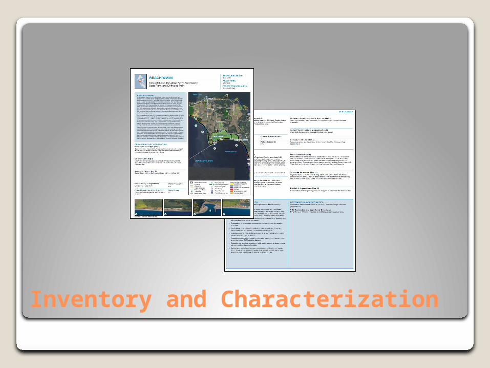
Inventory and Characterization
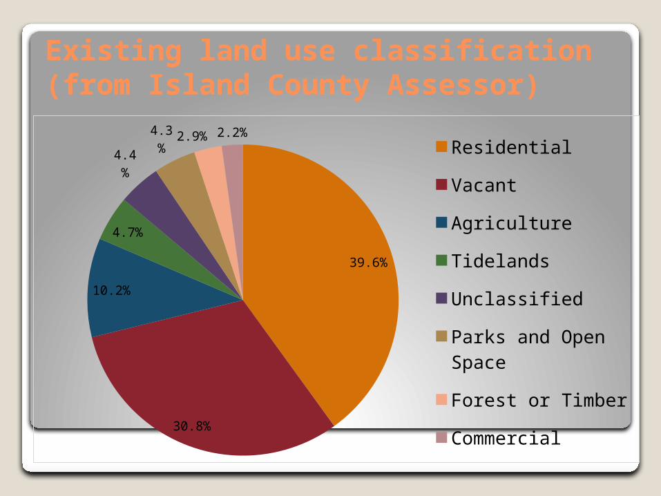
39.6%
30.8%
10.2%
4.7%
4.4%
4.3%2.9% 2.2%
Residential
Vacant
Agriculture
Tidelands
Unclassified
Parks and Open Space
Forest or Timber
Commercial
Existing land use classification (from Island County Assessor)
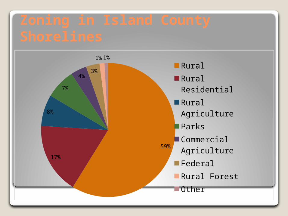
59%
17%
8%
7%
4%3%
1%1%
Rural
Rural Residential
Rural Agriculture
Parks
Commercial Agriculture
Federal
Rural Forest
Other
Zoning in Island County Shorelines
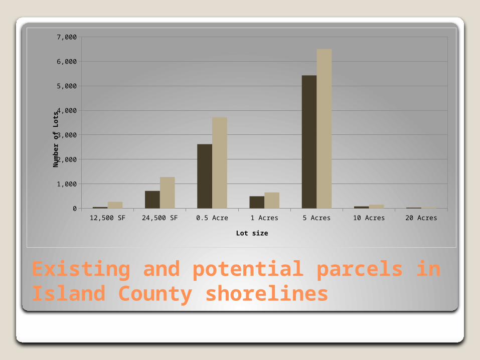
Existing and potential parcels in Island County shorelines
12,500 SF 24,500 SF 0.5 Acre 1 Acres 5 Acres 10 Acres 20 Acres
Existing Lots
55 712 2622 496 5427 80 30
Potential Lots
267.246168057439
1280.59461604924
3718.49409814945
652.30972323889
6500.50074597783
150.486870713721
33.4610130063131
500
1,500
2,500
3,500
4,500
5,500
6,500
Lot size
Nu
mb
er o
f L
ots
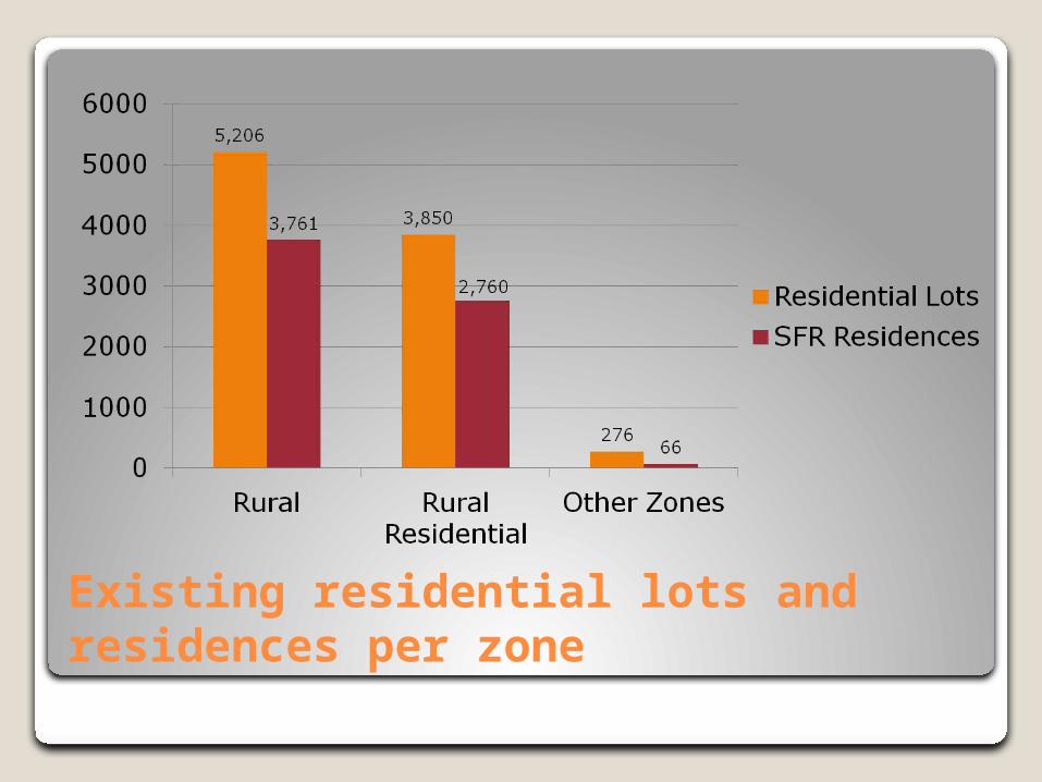
Existing residential lots and residences per zone
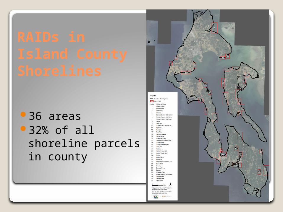
RAIDs in Island County Shorelines
36 areas32% of all shoreline
parcels in county
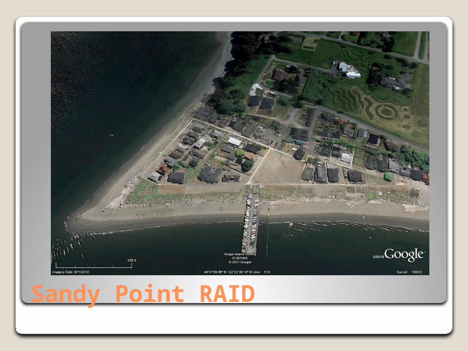
Sandy Point RAID
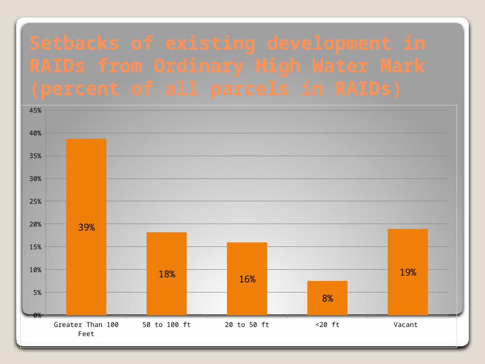
Setbacks of existing development in RAIDs from Ordinary High Water Mark(percent of all parcels in RAIDs)
Greater Than 100 Feet 50 to 100 ft 20 to 50 ft <20 ft Vacant 0%
5%
10%
15%
20%
25%
30%
35%
40%
45%
39%
18% 16%
8%
19%
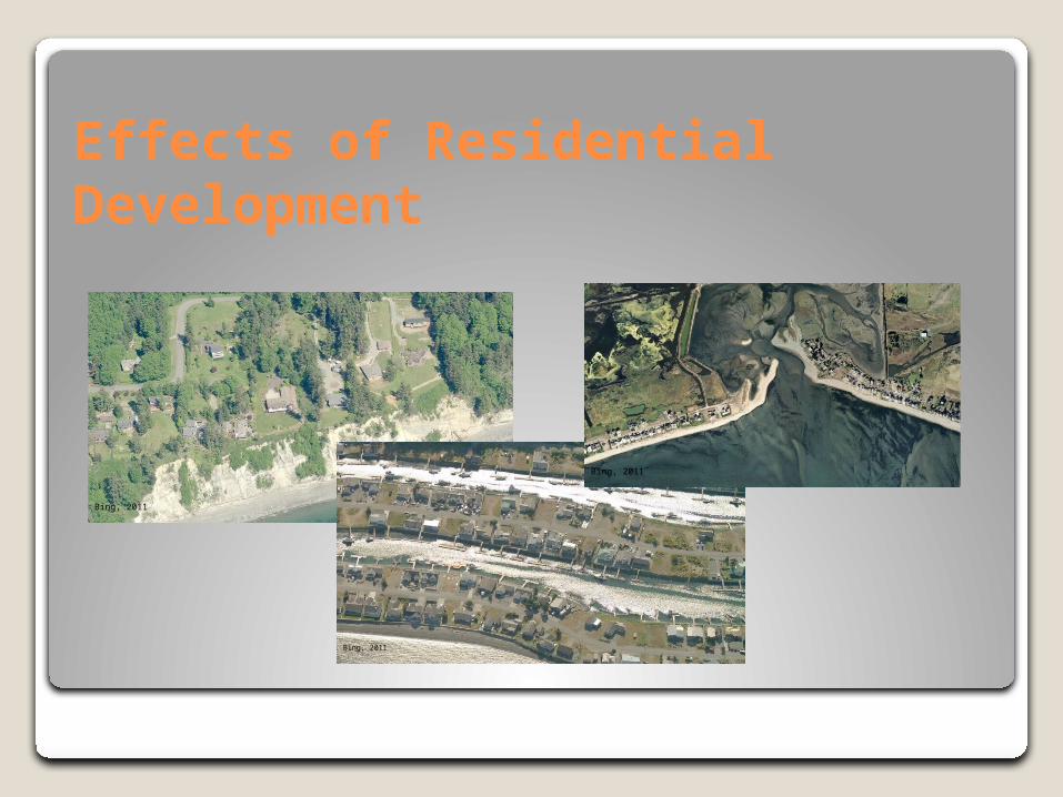
Effects of Residential Development
Bing, 2011
Bing, 2011
Bing, 2011
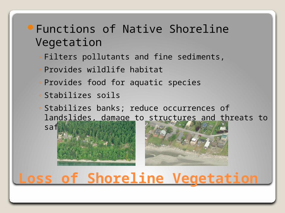
Loss of Shoreline Vegetation
Functions of Native Shoreline Vegetation ◦ Filters pollutants and fine sediments,
◦ Provides wildlife habitat
◦ Provides food for aquatic species
◦ Stabilizes soils
◦ Stabilizes banks; reduce occurrences of landslides, damage to structures and threats to safety.
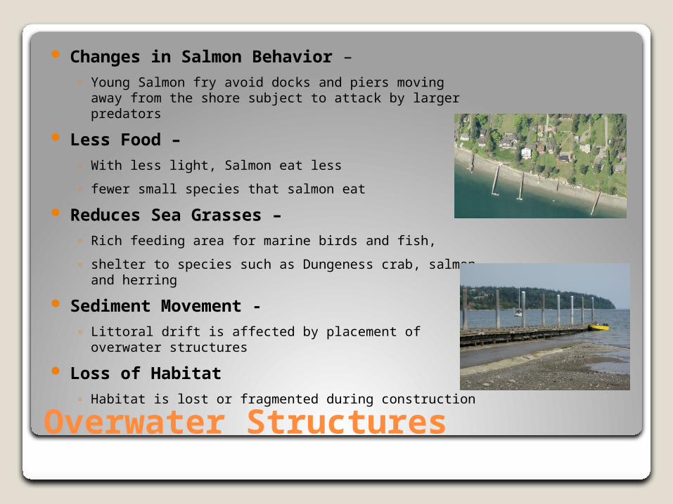
Overwater Structures
Changes in Salmon Behavior – ◦ Young Salmon fry avoid docks and piers moving away from
the shore subject to attack by larger predators
Less Food – ◦ With less light, Salmon eat less
◦ fewer small species that salmon eat
Reduces Sea Grasses –◦ Rich feeding area for marine birds and fish,
◦ shelter to species such as Dungeness crab, salmon and herring
Sediment Movement -◦ Littoral drift is affected by placement of overwater
structures
Loss of Habitat◦ Habitat is lost or fragmented during construction
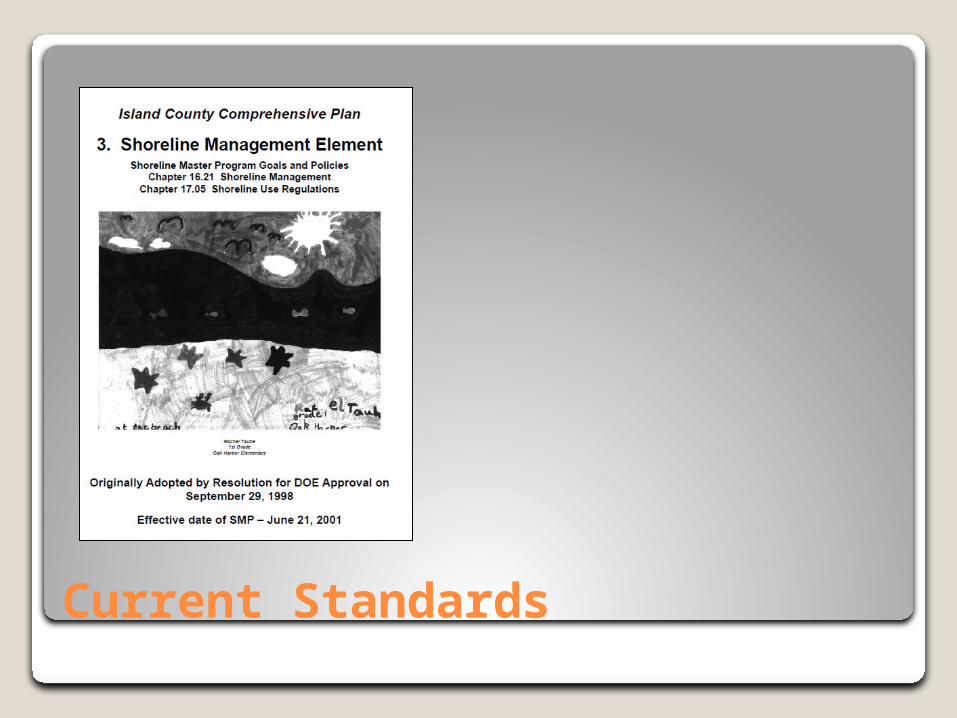
Current Standards
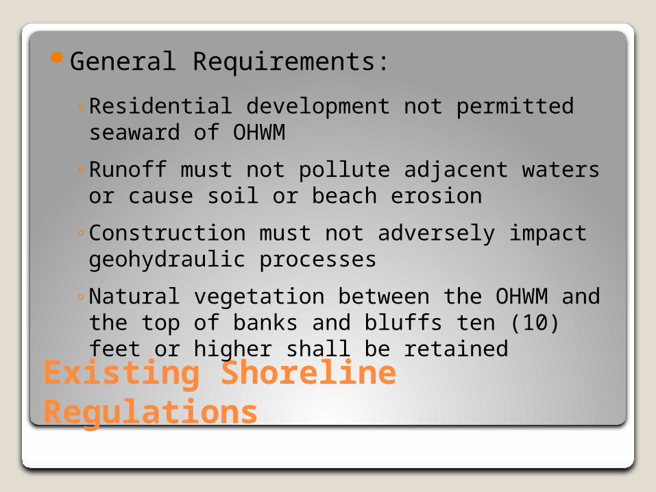
Existing Shoreline Regulations
General Requirements:
◦Residential development not permitted seaward of OHWM
◦Runoff must not pollute adjacent waters or cause soil or beach erosion
◦Construction must not adversely impact geohydraulic processes
◦Natural vegetation between the OHWM and the top of banks and bluffs ten (10) feet or higher shall be retained
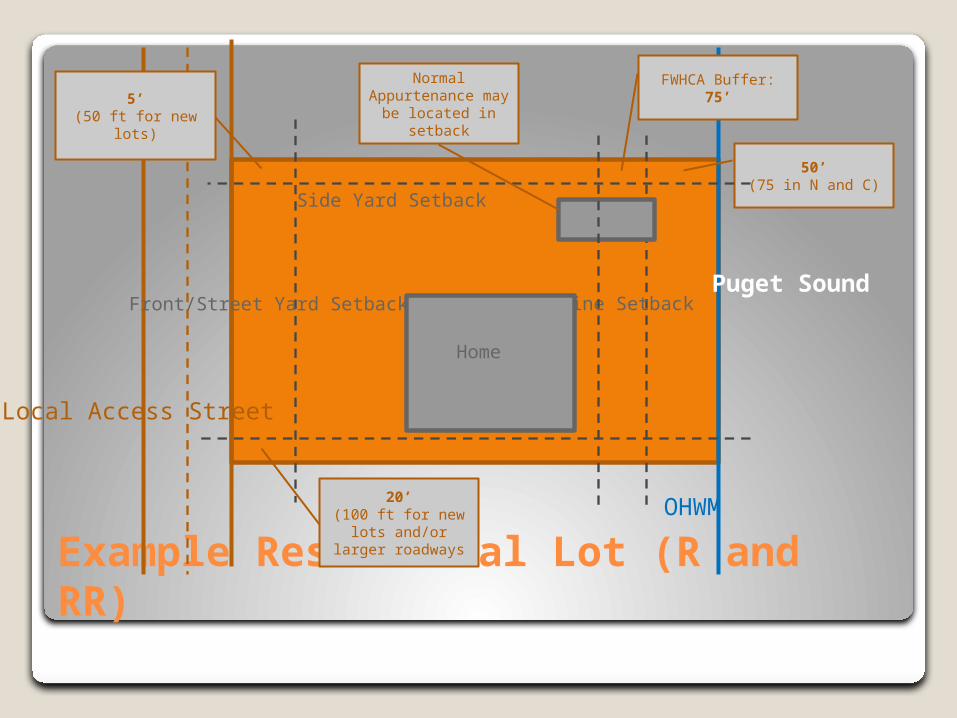
Example Residential Lot (R and RR)
Pu
get
So
un
d
OH
WM
Loca
l Acc
ess
Str
eet
Fro
nt/S
tre
et Y
ard
Set
back
20’(100 ft for new lots
and/or larger roadways
50’(75 in N and C)
Sho
relin
e S
etba
ck
Side Yard Setback
5’(50 ft for new lots)
Normal Appurtenance may
be located in setback
Home
FWHCA Buffer:75’
Existing Shoreline Regulations
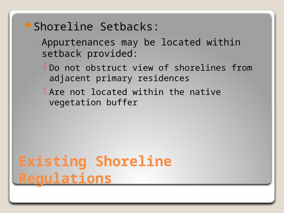
Shoreline Setbacks:◦Appurtenances may be located within setback
provided: Do not obstruct view of shorelines from adjacent
primary residences Are not located within the native vegetation buffer
Existing Shoreline Regulations
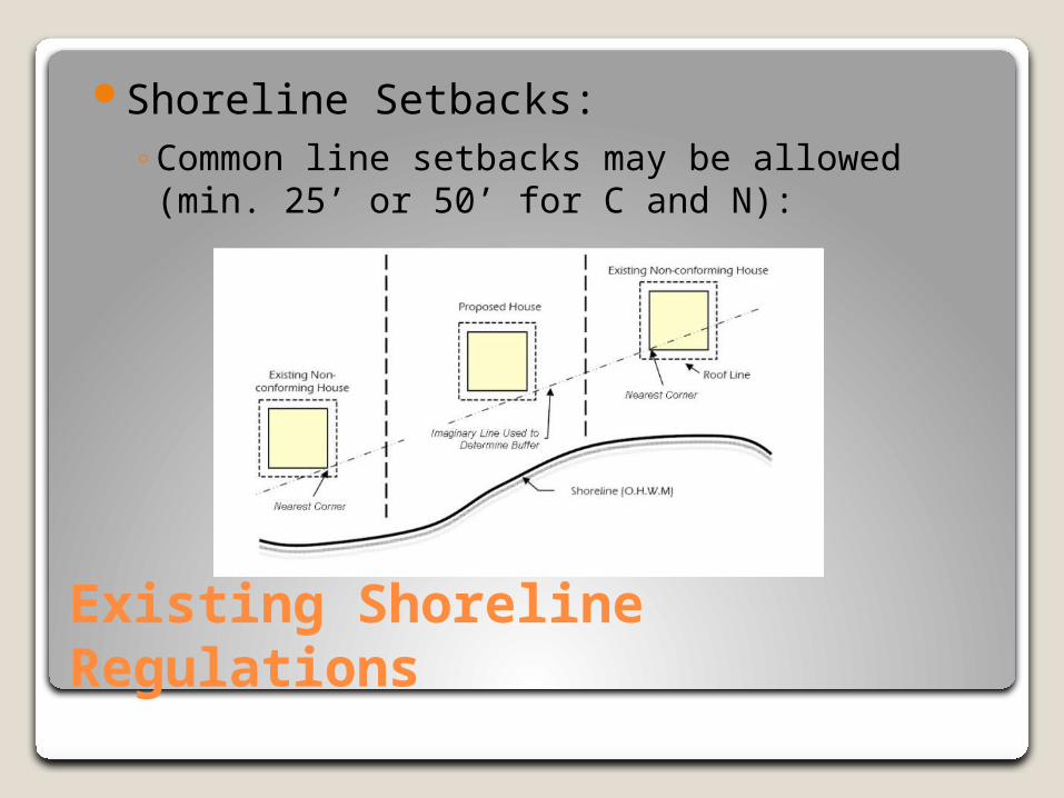
Shoreline Setbacks:◦Common line setbacks may be allowed
(min. 25’ or 50’ for C and N):
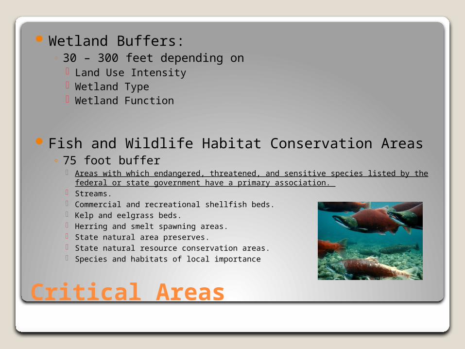
Critical Areas
Wetland Buffers:◦ 30 – 300 feet depending on
Land Use Intensity Wetland Type Wetland Function
Fish and Wildlife Habitat Conservation Areas◦ 75 foot buffer
Areas with which endangered, threatened, and sensitive species listed by the federal or state government have a primary association.
Streams. Commercial and recreational shellfish beds. Kelp and eelgrass beds. Herring and smelt spawning areas. State natural area preserves. State natural resource conservation areas. Species and habitats of local importance
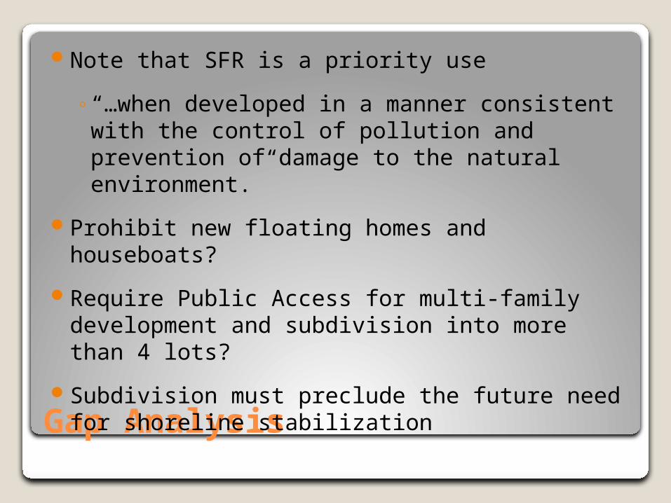
Gap Analysis
Note that SFR is a priority use
◦“…when developed in a manner consistent with the control of pollution and prevention of damage to the natural environment.”
Prohibit new floating homes and houseboats?
Require Public Access for multi-family development and subdivision into more than 4 lots?
Subdivision must preclude the future need for shoreline stabilization
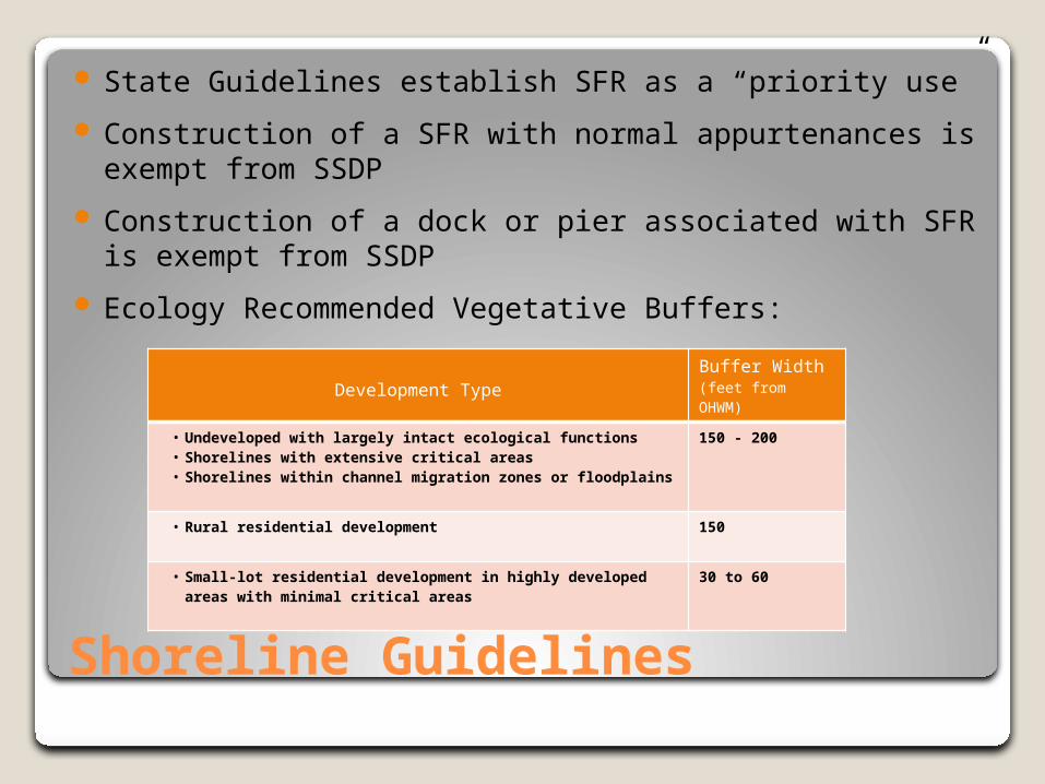
Shoreline Guidelines
State Guidelines establish SFR as a “priority use”
Construction of a SFR with normal appurtenances is exempt from SSDP
Construction of a dock or pier associated with SFR is exempt from SSDP
Ecology Recommended Vegetative Buffers:
Development TypeBuffer Width (feet from OHWM)
• Undeveloped with largely intact ecological functions • Shorelines with extensive critical areas• Shorelines within channel migration zones or floodplains
150 - 200
• Rural residential development 150
• Small-lot residential development in highly developed areas with minimal critical areas
30 to 60