Embed Size (px)
DESCRIPTION
A facilities program for collection and distribution of seismological data for research and education related to: • Earthquakes • Earth Structure • Earth Dynamics David Simpson, IRIS CIDER Marconi Conference Center May 19, 2009. IRIS Mission. - PowerPoint PPT Presentation
Citation preview

A facilities program for collection and distribution of seismological data for research and education related to:
• Earthquakes• Earth Structure• Earth Dynamics
David Simpson, IRIS
CIDER Marconi Conference Center
May 19, 2009
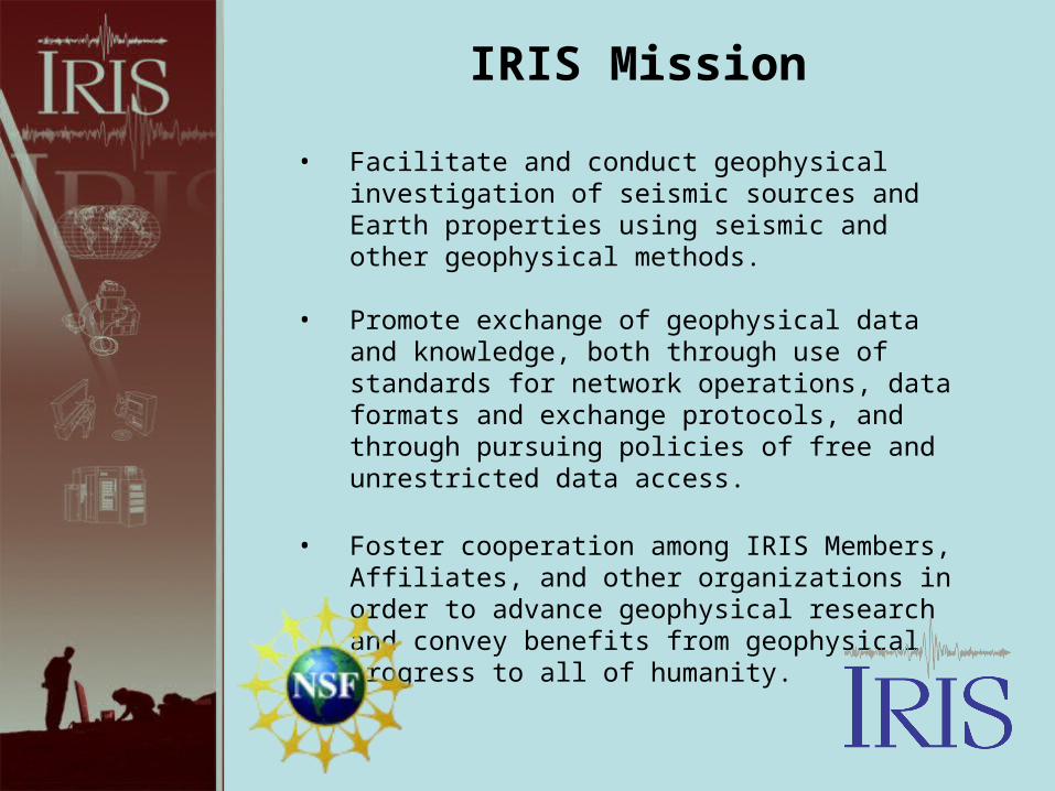
• Facilitate and conduct geophysical investigation of seismic sources and Earth properties using seismic and other geophysical methods.
• Promote exchange of geophysical data and knowledge, both through use of standards for network operations, data formats and exchange protocols, and through pursuing policies of free and unrestricted data access.
• Foster cooperation among IRIS Members, Affiliates, and other organizations in order to advance geophysical research and convey benefits from geophysical progress to all of humanity.
IRIS Mission
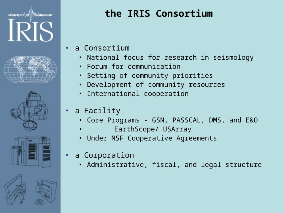
the IRIS Consortium
• a Consortium• National focus for research in seismology• Forum for communication• Setting of community priorities• Development of community resources• International cooperation
• a Facility• Core Programs - GSN, PASSCAL, DMS, and E&O• EarthScope/ USArray• Under NSF Cooperative Agreements
• a Corporation• Administrative, fiscal, and legal structure
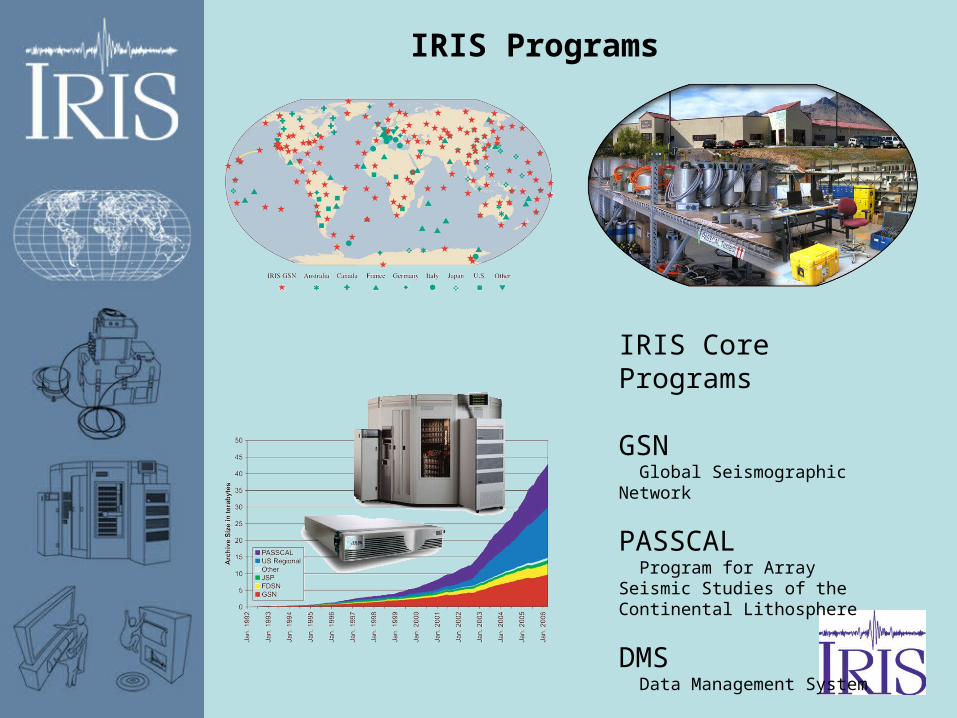
IRIS Programs
IRIS Core Programs
GSN Global Seismographic Network
PASSCAL Program for Array Seismic Studies of the Continental Lithosphere
DMS Data Management System
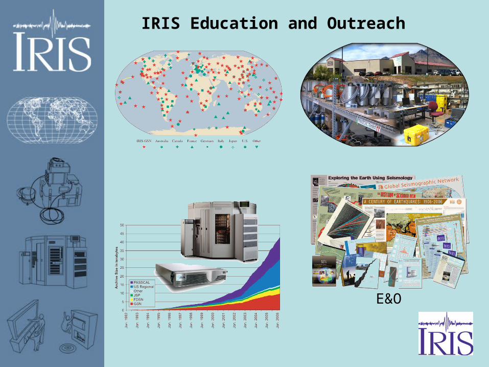
IRIS Education and Outreach
E&O
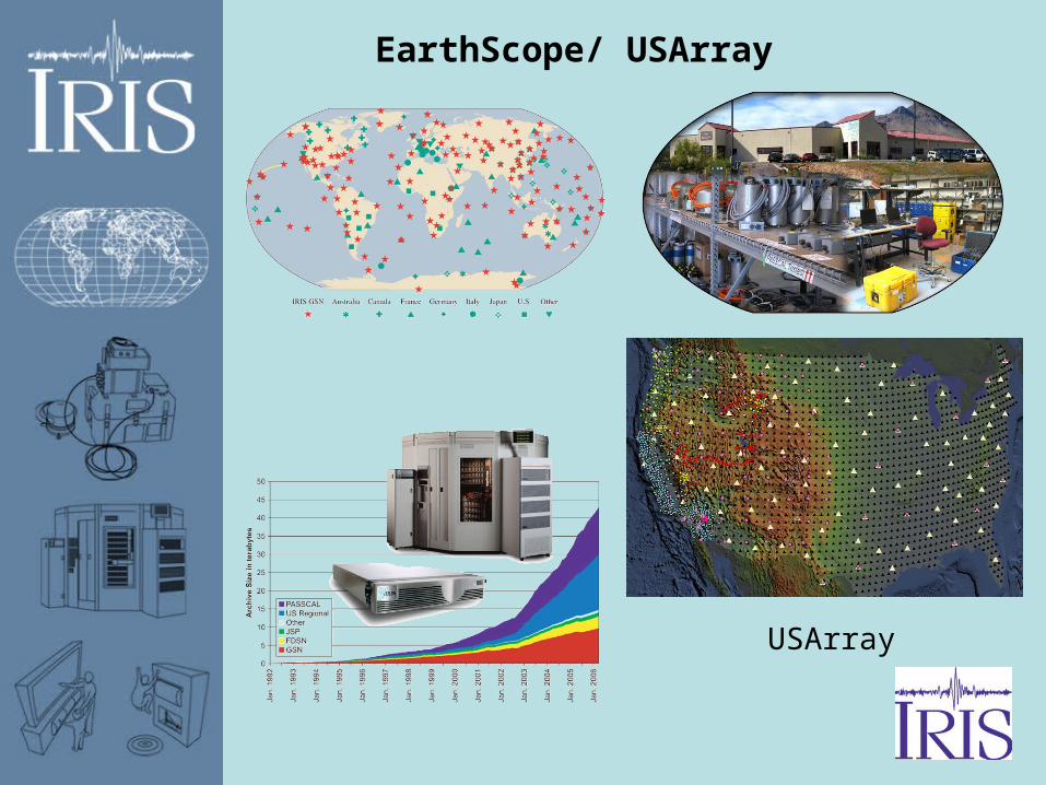
EarthScope/ USArray
USArray
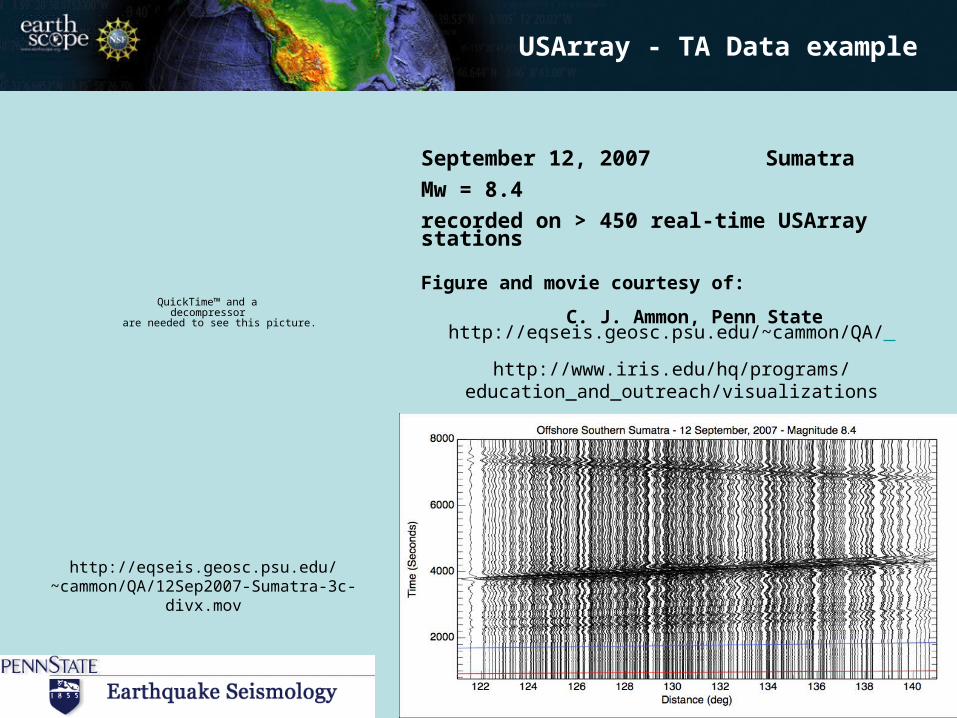
September 12, 2007 Sumatra
Mw = 8.4
recorded on > 450 real-time USArray stations
Figure and movie courtesy of:
C. J. Ammon, Penn State
TA Data example
QuickTime™ and a decompressor
are needed to see this picture.
USArray - TA Data example
http://eqseis.geosc.psu.edu/~cammon/QA/
http://www.iris.edu/hq/programs/education_and_outreach/visualizations
http://eqseis.geosc.psu.edu/~cammon/QA/12Sep2007-Sumatra-3c-divx.mov
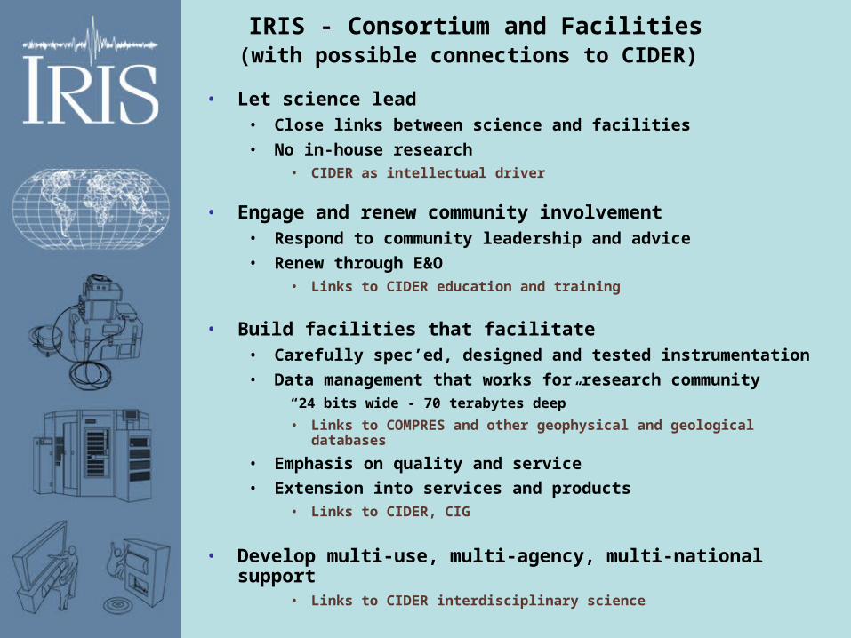
IRIS - Consortium and Facilities(with possible connections to CIDER)
• Let science lead• Close links between science and facilities
• No in-house research• CIDER as intellectual driver
• Engage and renew community involvement • Respond to community leadership and advice
• Renew through E&O• Links to CIDER education and training
• Build facilities that facilitate• Carefully spec’ed, designed and tested instrumentation
• Data management that works for research community“24 bits wide - 70 terabytes deep”
• Links to COMPRES and other geophysical and geological databases
• Emphasis on quality and service
• Extension into services and products• Links to CIDER, CIG
• Develop multi-use, multi-agency, multi-national support• Links to CIDER interdisciplinary science
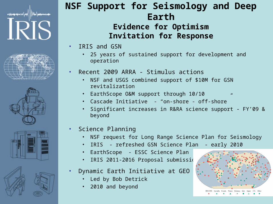
NSF Support for Seismology and Deep EarthEvidence for OptimismInvitation for Response
• IRIS and GSN• 25 years of sustained support for development and operation
• Recent 2009 ARRA - Stimulus actions• NSF and USGS combined support of $10M for GSN revitalization• EarthScope O&M support through 10/10• Cascade Initiative - “on-shore - off-shore” • Significant increases in R&RA science support - FY’09 & beyond
• Science Planning• NSF request for Long Range Science Plan for Seismology• IRIS - refreshed GSN Science Plan - early 2010• EarthScope - ESSC Science Plan - January 2010• IRIS 2011-2016 Proposal submission - fall 2010
• Dynamic Earth Initiative at GEO level • Led by Bob Detrick• 2010 and beyond
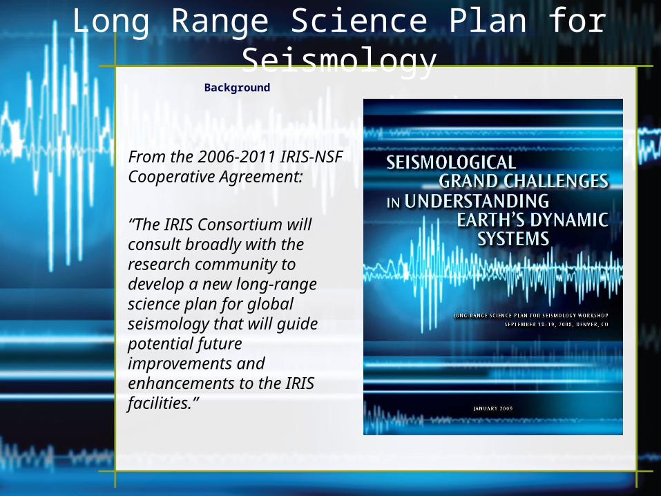
Long Range Science Plan for SeismologyBackground
From the 2006-2011 IRIS-NSF Cooperative Agreement:
“The IRIS Consortium will consult broadly with the research community to develop a new long-range science plan for global seismology that will guide potential future improvements and enhancements to the IRIS facilities.”
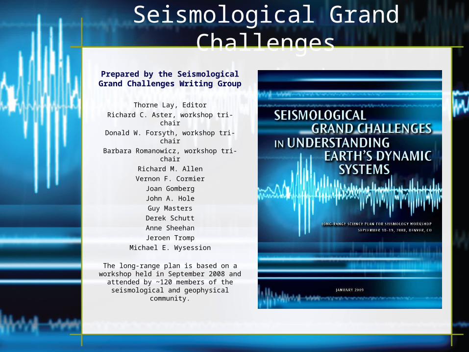
Seismological Grand Challenges
Prepared by the Seismological Grand Challenges Writing Group
Thorne Lay, Editor
Richard C. Aster, workshop tri-chair
Donald W. Forsyth, workshop tri-chair
Barbara Romanowicz, workshop tri-chair
Richard M. Allen
Vernon F. Cormier
Joan Gomberg
John A. Hole
Guy Masters
Derek Schutt
Anne Sheehan
Jeroen Tromp
Michael E. Wysession
The long-range plan is based on a workshop held in September 2008 and
attended by ~120 members of the seismological and geophysical
community.
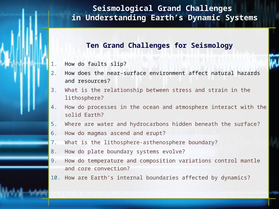
Seismological Grand Challenges in Understanding Earth’s Dynamic Systems
Ten Grand Challenges for Seismology
1. How do faults slip?
2. How does the near-surface environment affect natural hazards and resources?
3. What is the relationship between stress and strain in the lithosphere?
4. How do processes in the ocean and atmosphere interact with the solid Earth?
5. Where are water and hydrocarbons hidden beneath the surface?
6. How do magmas ascend and erupt?
7. What is the lithosphere-asthenosphere boundary?
8. How do plate boundary systems evolve?
9. How do temperature and composition variations control mantle and core
convection?
10. How are Earth’s internal boundaries affected by dynamics?
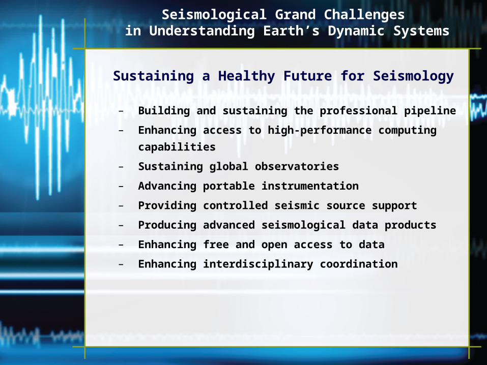
Seismological Grand Challenges in Understanding Earth’s Dynamic Systems
Sustaining a Healthy Future for Seismology
– Building and sustaining the professional pipeline
– Enhancing access to high-performance computing capabilities
– Sustaining global observatories
– Advancing portable instrumentation
– Providing controlled seismic source support
– Producing advanced seismological data products
– Enhancing free and open access to data
– Enhancing interdisciplinary coordination


![1992-8645 IMAGE FUSION TECHNIQUES FOR IRIS AND · PDF fileand iris boundary. In iris segmentation the iris ... lower eyelid using the linear Hough transform [13]. In this paper Iris](https://img.pdfslide.us/doc/110x75/5aac91c37f8b9aa06a8d31f9/1992-8645-image-fusion-techniques-for-iris-and-iris-boundary-in-iris-segmentation.jpg)