Embed Size (px)
Citation preview

Plate Tectonics
Mr. Skirbst
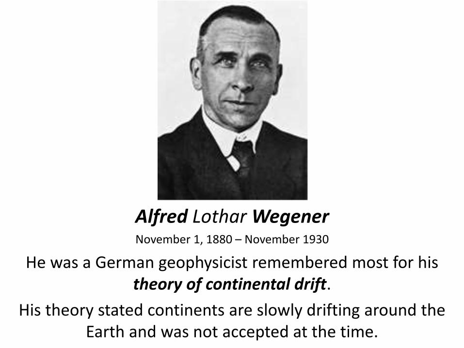
Alfred Lothar Wegener November 1, 1880 – November 1930
He was a German geophysicist remembered most for his theory of continental drift.
His theory stated continents are slowly drifting around the Earth and was not accepted at the time.
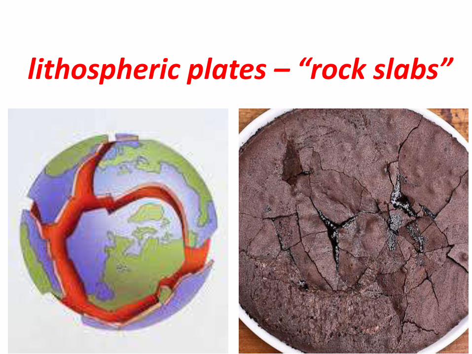
lithospheric plates – “rock slabs”

lithospheric plates – “rock slabs”
tectonics – “movement”
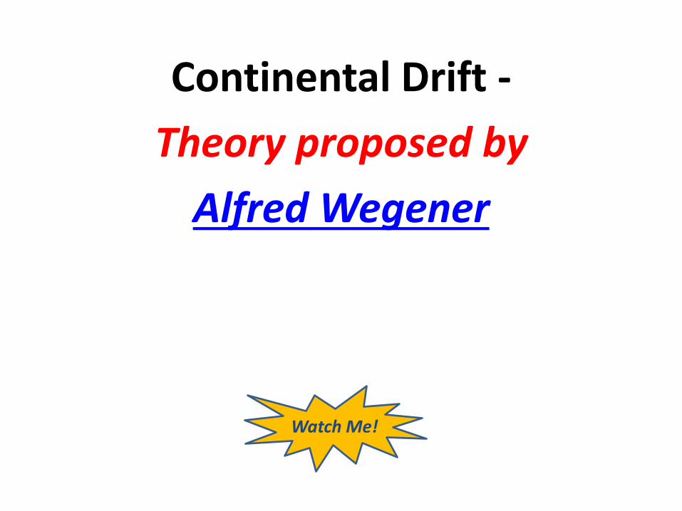
Continental Drift -
Theory proposed by
Alfred Wegener
Watch Me!

Continental Drift:
Earth’s continents are “floating” from one place to another
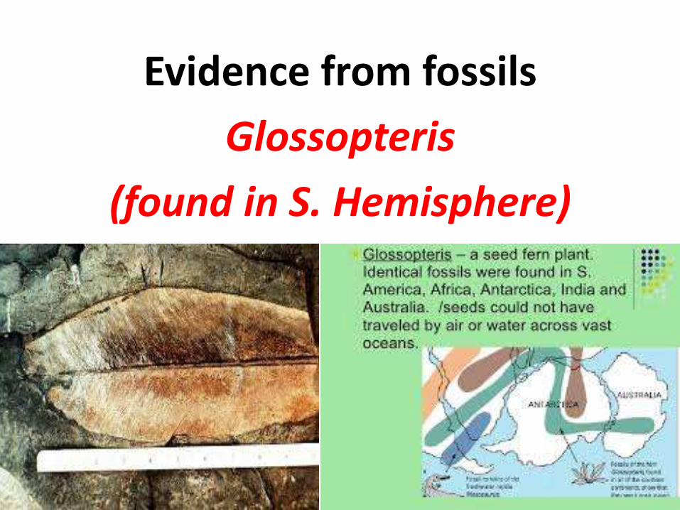
Evidence from fossils
Glossopteris
(found in S. Hemisphere)

Evidence from rocks
mountains, shapes, deposits

Evidence from sea-floor
sea-floor spreading
mid-ocean ridge

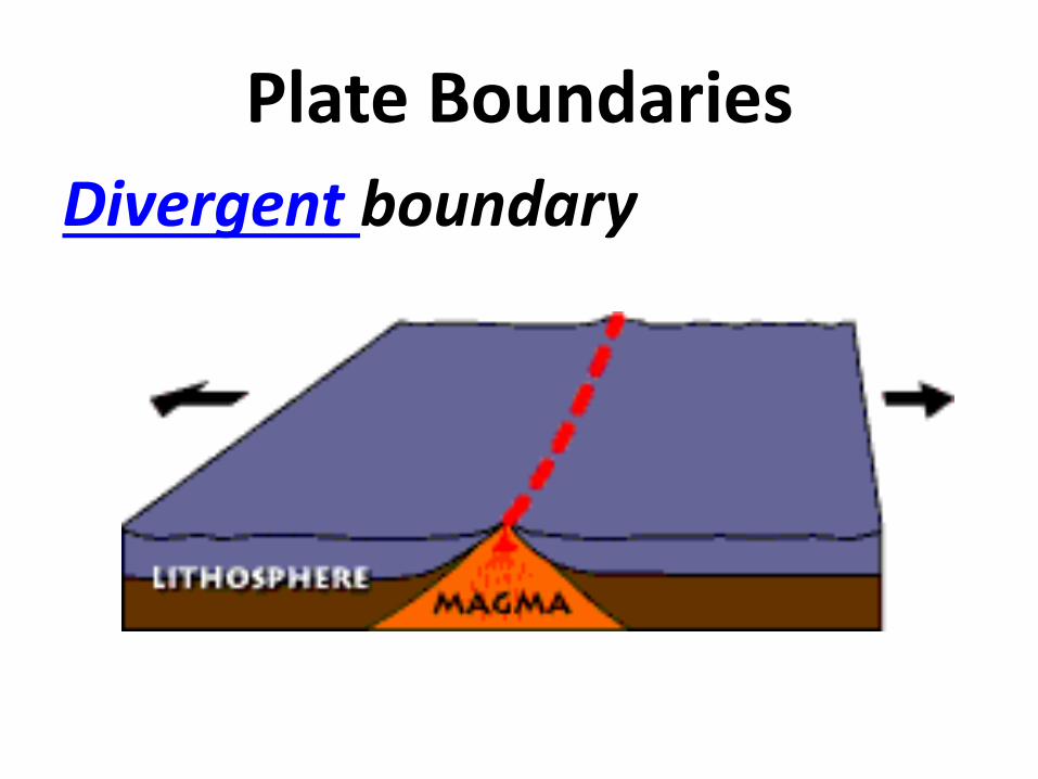
Plate Boundaries

Plate Boundaries
Places where plate edges meet on Earth’s surface

Plate Boundaries
Divergent boundary

Plate Boundaries
Divergent boundary
* plates move apart

Plate Boundaries
Divergent boundary
* plates move apart
* found along mid-ocean ridges

Plate Boundaries
Divergent boundary
* plates move apart
* found along mid-ocean ridges
* called constructive boundary

Plate Boundaries
Convergent boundary
* plates come together
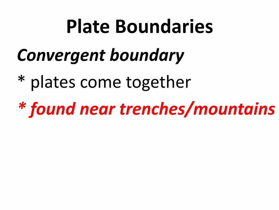
Plate Boundaries
Convergent boundary
* plates come together
* found near trenches/mountains

Plate Boundaries
Convergent boundary
* plates come together
* found near trenches
* called destructive boundaries

Plate Boundaries
Strike-slip boundary
* grind horizontally

Plate Boundaries
Strike-slip boundary
* grind horizontally
* forms lateral faults

Plate Boundaries
Strike-slip boundary
* grind horizontally
* forms lateral faults
* called a conservative boundary

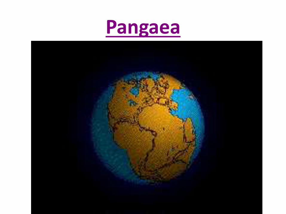
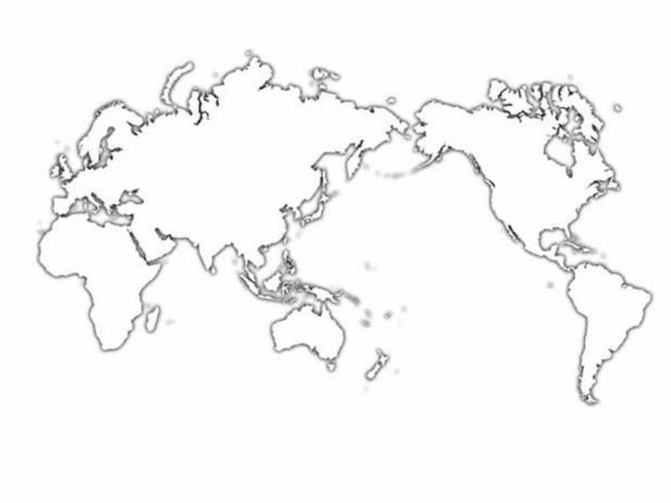
Pangaea
(All together Earth)

Pangaea
Large, single landmass that existed in the past - before breaking apart and moving into the current position

Pangaea Activity
1. Label the landmasses (use choices).
2. Trace landmasses as they appear.
3. Color-code evidence (use colors provided).
4. Cut out landmasses.
5. Place landmasses on table as they appear today (use map).
6. Move them into a single landmass (use the color-coded evidence).
7. Tape them together as PANGAEA.

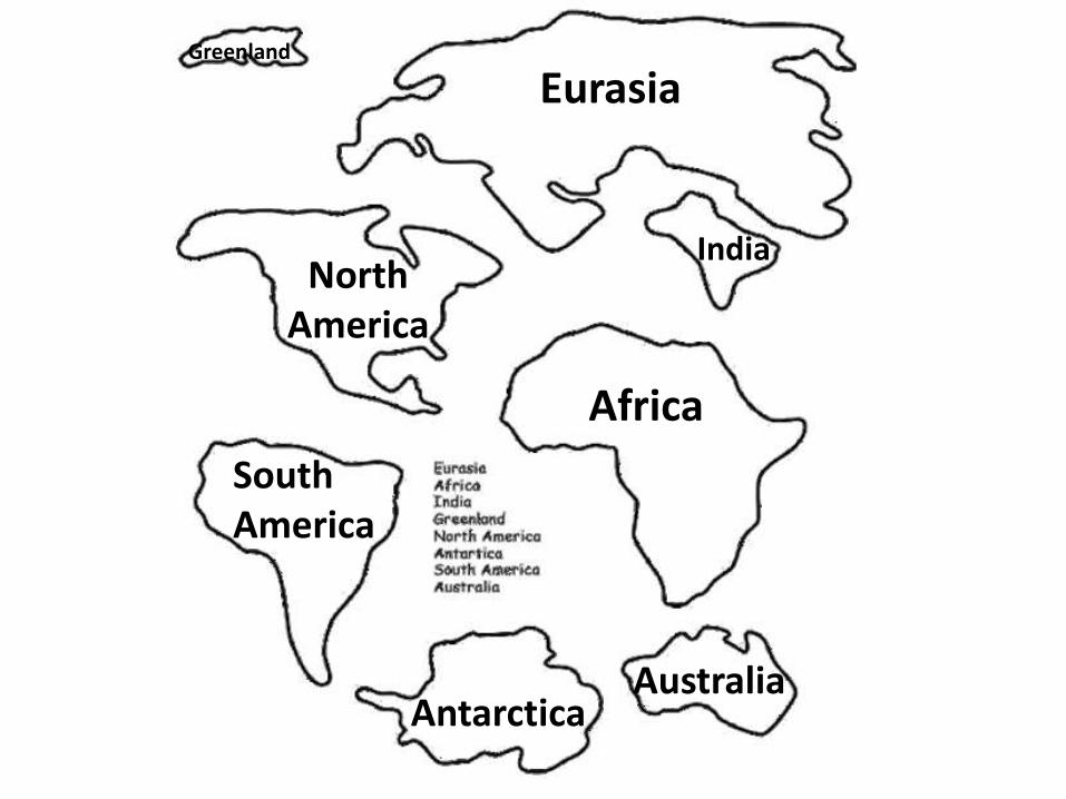
Eurasia
Africa
North America
South America
Antarctica Australia
India
Greenland
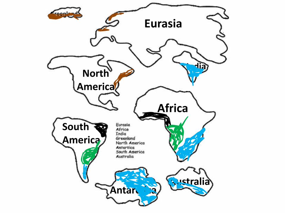
Eurasia
Africa
North America
South America
Antarctica Australia
India
Greenland
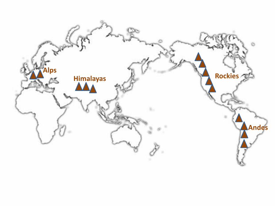
Alps Himalayas Rockies
Andes

Ring of Fire

Earthquakes
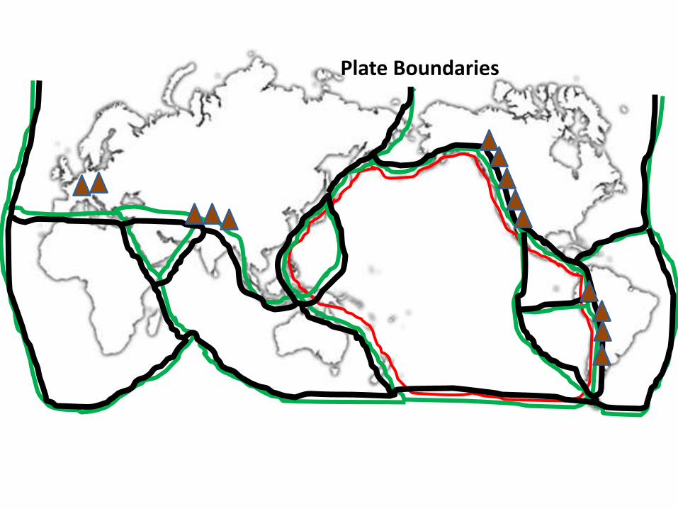
Plate Boundaries
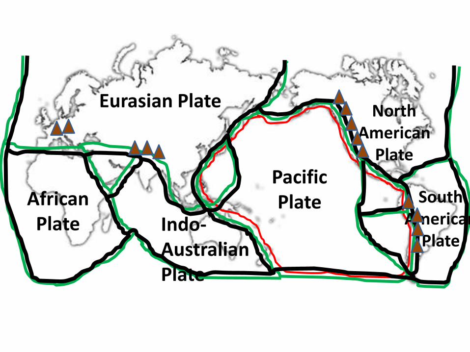
Eurasian Plate
Pacific Plate African
Plate
North American
Plate
South American
Plate Indo- Australian Plate