Embed Size (px)
Citation preview
Introduction to Map, Compass and GPS BasicsPart 3 of 3 GPS Basics
Passaic County Sheriff’s Department
CERT Team Training
Bob Smith
Revision 1.05 Copyright 1/3/2010 Robert J. Smith
Purpose of this Presentation
To introduce the basics of GPS.
What you will learn
A basic introduction to:* The Background on GPS* GPS navigation*Using a GPS unit with a map for navigation
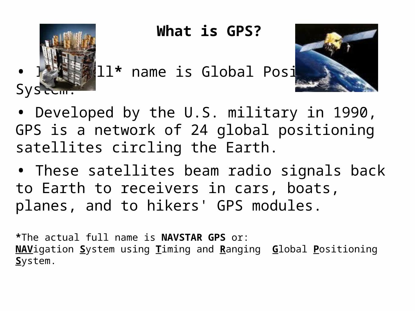
What is GPS?
• It’s full* name is Global Positioning System.
• Developed by the U.S. military in 1990, GPS is a network of 24 global positioning satellites circling the Earth.
• These satellites beam radio signals back to Earth to receivers in cars, boats, planes, and to hikers' GPS modules.
*The actual full name is NAVSTAR GPS or:NAVigation System using Timing and Ranging Global Positioning System.
What A GPS can do:
• Provide an exact position that can be plotted on a map.
• Give straight-line distance and direction to your destination.
• Record the day's travel as a "track," creating a “bread crumb” trail to follow home, or transfer to computer.
• Altitude within 30 feet*.
• Provide detailed trip information, such as mileage, speed, and elevation gain.
• Warn of topographical roadblocks like rivers and deep canyons, as long as you've loaded the latest topo maps onto the unit.*Altitude should NOT be trusted if this information is critical! - It depends on where the satellites are relative to you.
What a GPS can’t do:
• Provide enough map detail to plan long-distance routes or navigate through tricky terrain.
• Warn of detours due to recently rerouted trails, fallen bridges, or natural disasters.
• Can not replace basic navigation skills.
• Know how to use a map & compass
The 10th Mountain Division STRONGLY advises their units against relying solely on the GPS for use in accessing battle front forward areas and field operations because they may not provide the desired accuracy due to weak satellite signals caused by forest cover, inclement weather, topography, less-than-ideal satellite positions, and other factors.
A GPS unit can be a good backup tool for backcountry navigation when used in conjunction with a map, compass, altimeter and appropriate skills.
If your GPS fails, you will be very thankful that you wisely brought your map, compass, and altimeter - and that you have mastered how to use them.
When using a map and GPS together for navigation, your GPS must be set to the same datum as the map you are using. Failure to do so could result in errors of 200 meters or more in your displayed position.
If you are using your GPS without a map (shame on you for not having a map!), using WGS84 is generally the best datum to use as it is considered the most accurate datum to use with a GPS ALONE.
Note that most GPS units come from the factory with WGS84 as the default map datum.
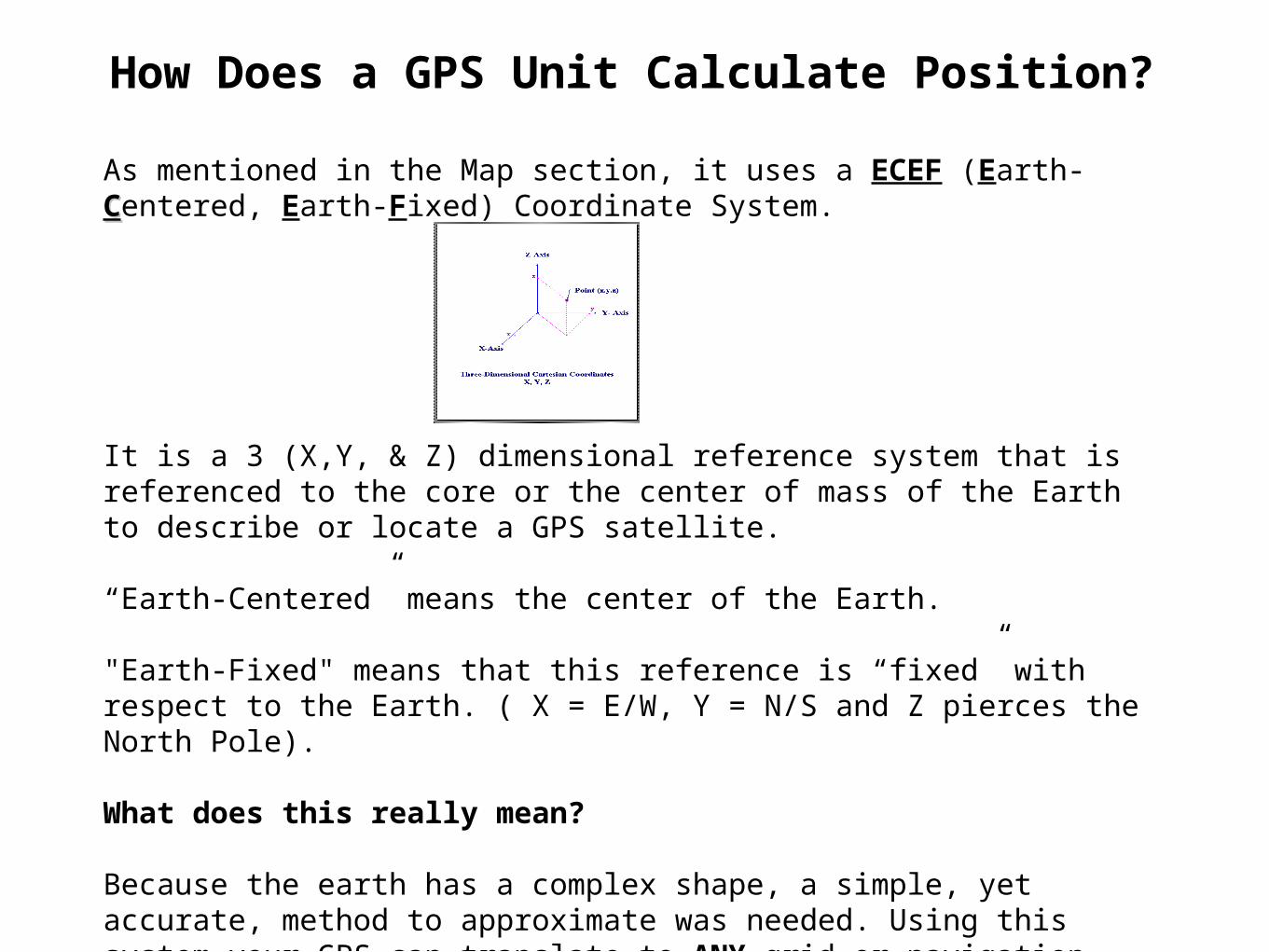
How Does a GPS Unit Calculate Position?
As mentioned in the Map section, it uses a ECEF (Earth-CCentered, Earth-Fixed) Coordinate System.
It is a 3 (X,Y, & Z) dimensional reference system that is referenced to the core or the center of mass of the Earth to describe or locate a GPS satellite.
“Earth-Centered” means the center of the Earth.
"Earth-Fixed" means that this reference is “fixed” with respect to the Earth. ( X = E/W, Y = N/S and Z pierces the North Pole).
What does this really mean?
Because the earth has a complex shape, a simple, yet accurate, method to approximate was needed. Using this system your GPS can translate to ANY grid or navigation system (UTM, Longitude, Latitude, etc). Its just MATH now!
GPS Elevation & Direction Inaccuracies
Good positional fix requires four satellites located well above the horizon.
For altitude, the satellites should be more overhead.
Generally speaking, the GPS system does not give accurate enough readings for altitude to be useful.
The error could be 75 to 100 meters.
Most stationary GPSs will NOT tell you North or any other direction. The GPS will only give direction when it (and you) are moving.
The “compass” on the GPS display is not a “true” magnetic compass. It is based on satellite calculations and provides directional based on these calculations.
GPS Receivers use SA & WAAS
What is SA & WAAS?
GPS satellites transmitted a number of different signals.
Two of these signals are:
Selective Availability (SA)
Wide Area Augmentation System (WAAS)
Selective Availability (SA)
The Selective Availability (or SA) signal was available only to the US military and some other selected users, i.e NOT civilians.
This signal provides enhanced accuracy to the user.
SA added in a navigation error unless you had a special military receiver.
On May 2, 2000 "Selective Availability" was discontinued as a result of a 1996 Presidential executive order.
Wide Area Augmentation System (WAAS)
*Developed by FAA for Aircraft air traffic using IFR (Instrument Flying Rules).
*WAAS uses approximately 25 ground reference stations positioned across the United States that monitor GPS satellite data to provide enhanced accuracy.
*Two master stations, collect GPS data from the reference stations and correct for any signal errors.
*The corrected signal is then broadcast through one of two geostationary satellites, or satellites with a fixed position over the equator. These satellites are NOT GPS satellites.
*This enhanced accuracy information (including elevation) is compatible with the basic GPS signal structure, which means any WAAS-enabled GPS receiver can read the signal.
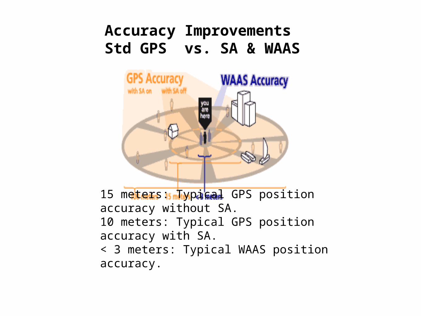
Accuracy ImprovementsStd GPS vs. SA & WAAS
15 meters: Typical GPS position accuracy without SA.10 meters: Typical GPS position accuracy with SA.< 3 meters: Typical WAAS position accuracy.
As mentioned in “Maps” - Distortion on Maps is a Problem
Trying to represent a point on a sphere onto a flat surface will result in distortion.
It is impossible to represent a spherical feature on a flat surface without distorting some of the shapes, distances, or areas.
Many ways were tried minimize this distortion.
A quick overview will follow and how it was minimized.
Map Distortion
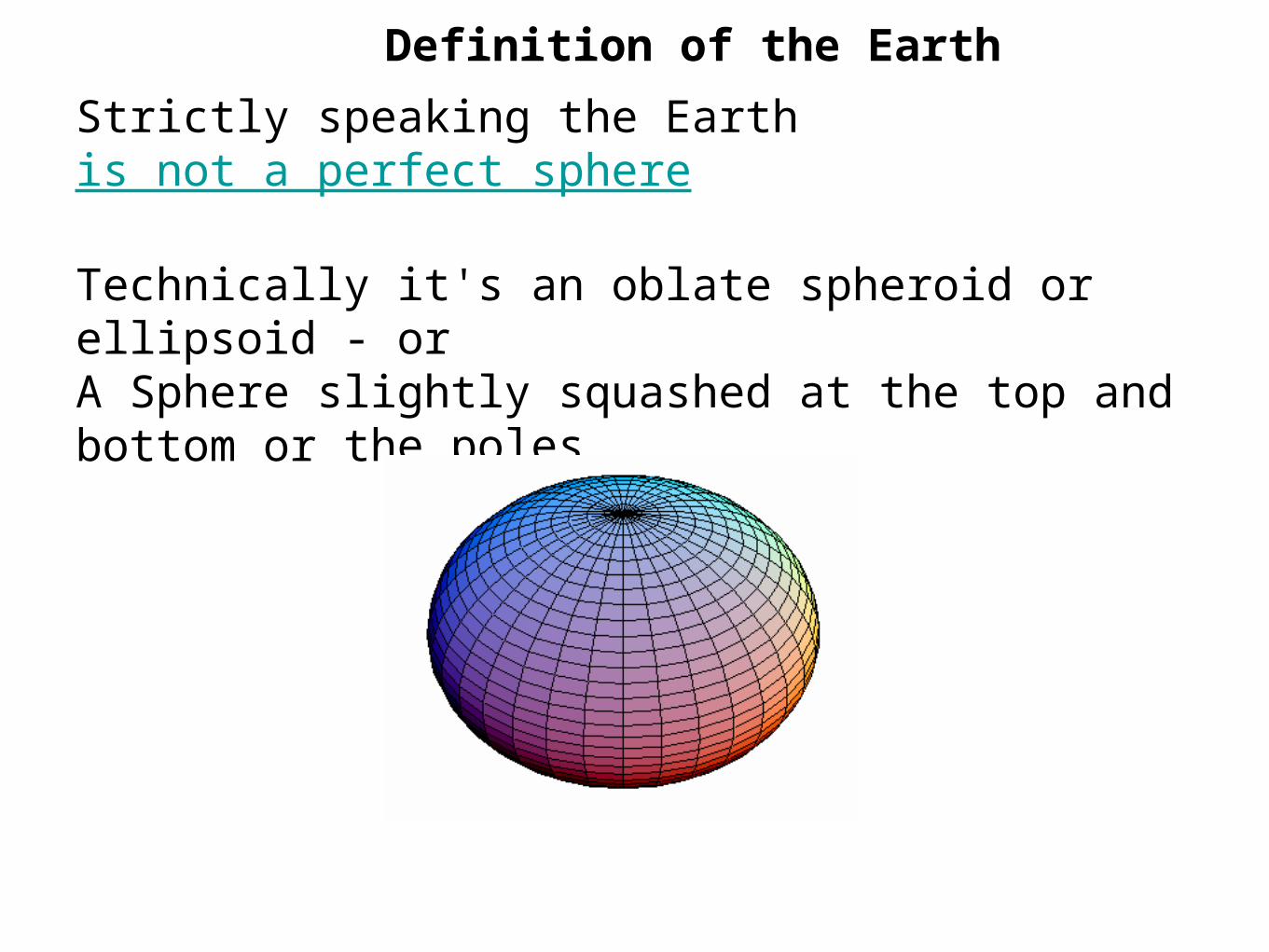
Definition of the Earth
Strictly speaking the Earth is not a perfect sphere
Technically it's an oblate spheroid or ellipsoid - or A Sphere slightly squashed at the top and bottom or the poles.
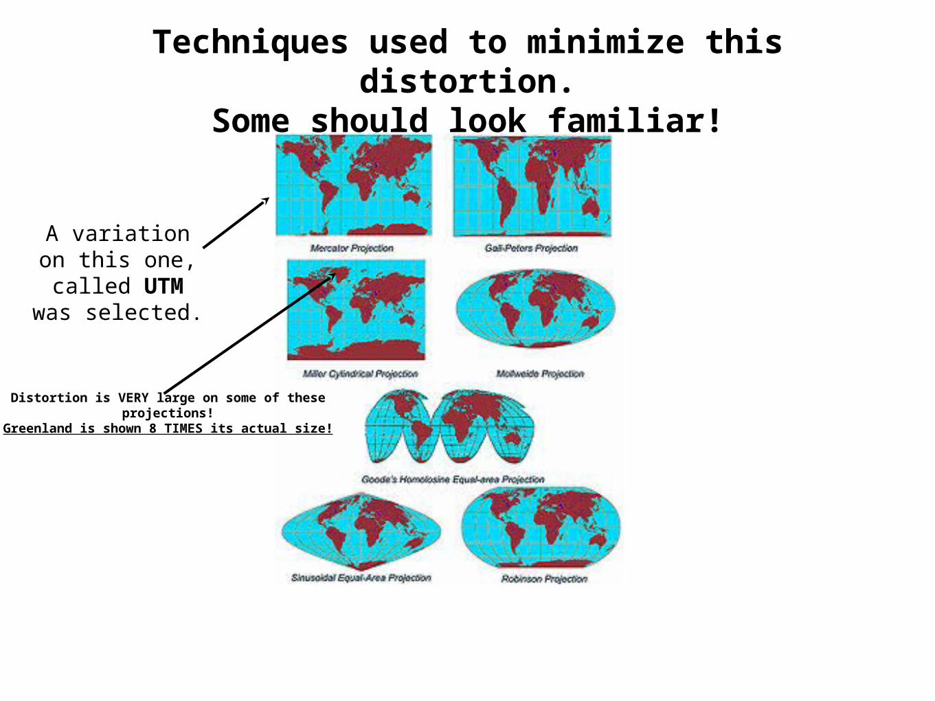
Techniques used to minimize this distortion.Some should look familiar!
A variation on this one, called UTM
was selected.
Distortion is VERY large on some of these projections!Greenland is shown 8 TIMES its actual size!
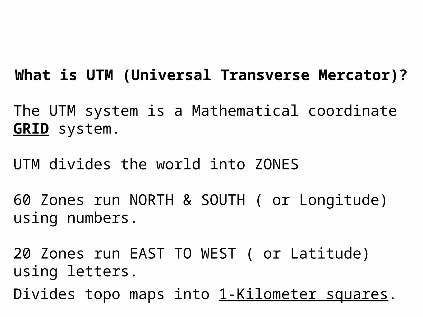
What is UTM (Universal Transverse Mercator)?
The UTM system is a Mathematical coordinate GRID system.
UTM divides the world into ZONES
60 Zones run NORTH & SOUTH ( or Longitude) using numbers.
20 Zones run EAST TO WEST ( or Latitude) using letters.
Divides topo maps into 1-Kilometer squares.
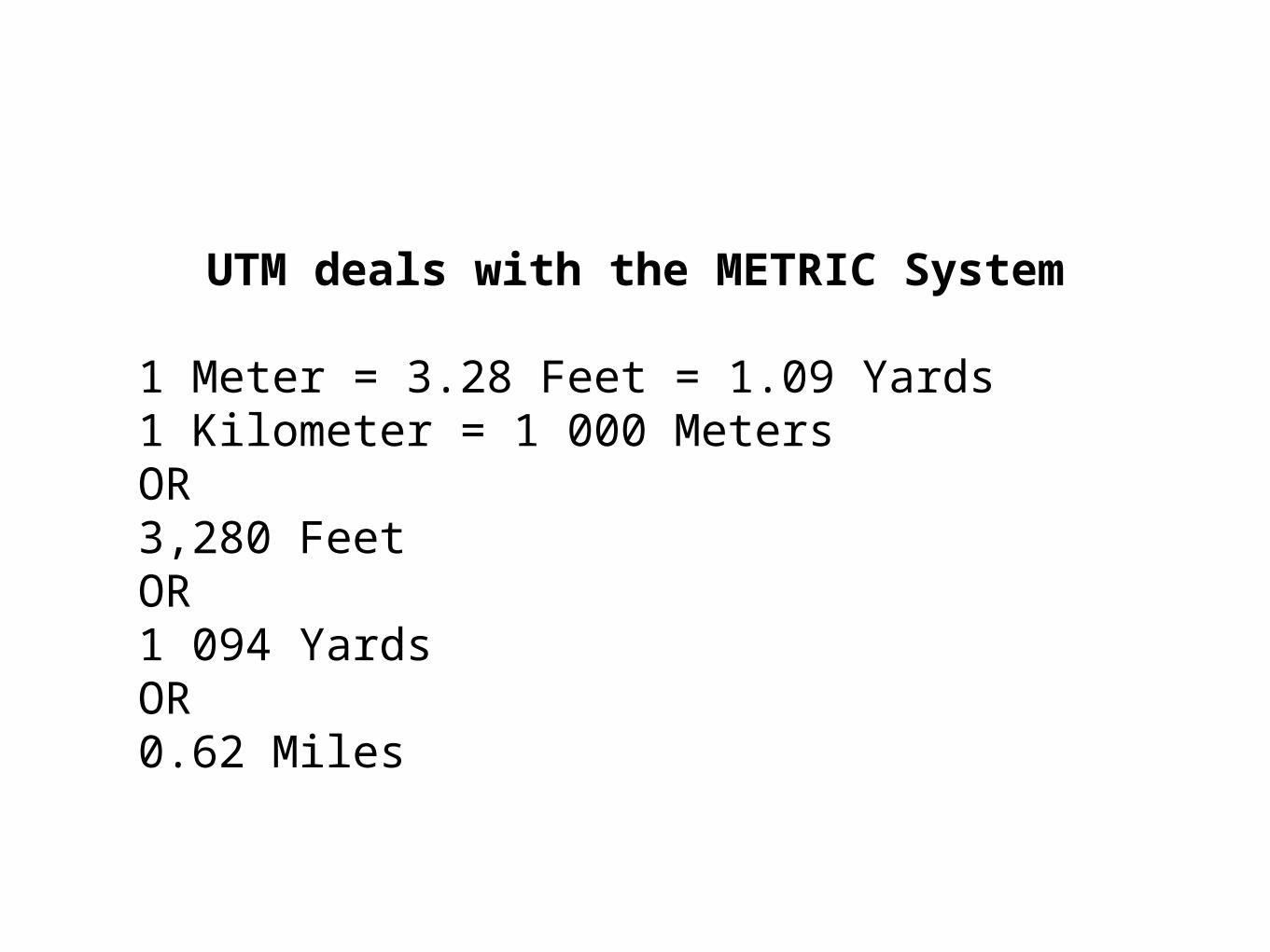
UTM deals with the METRIC System
1 Meter = 3.28 Feet = 1.09 Yards1 Kilometer = 1 000 MetersOR3,280 FeetOR1 094 YardsOR0.62 Miles
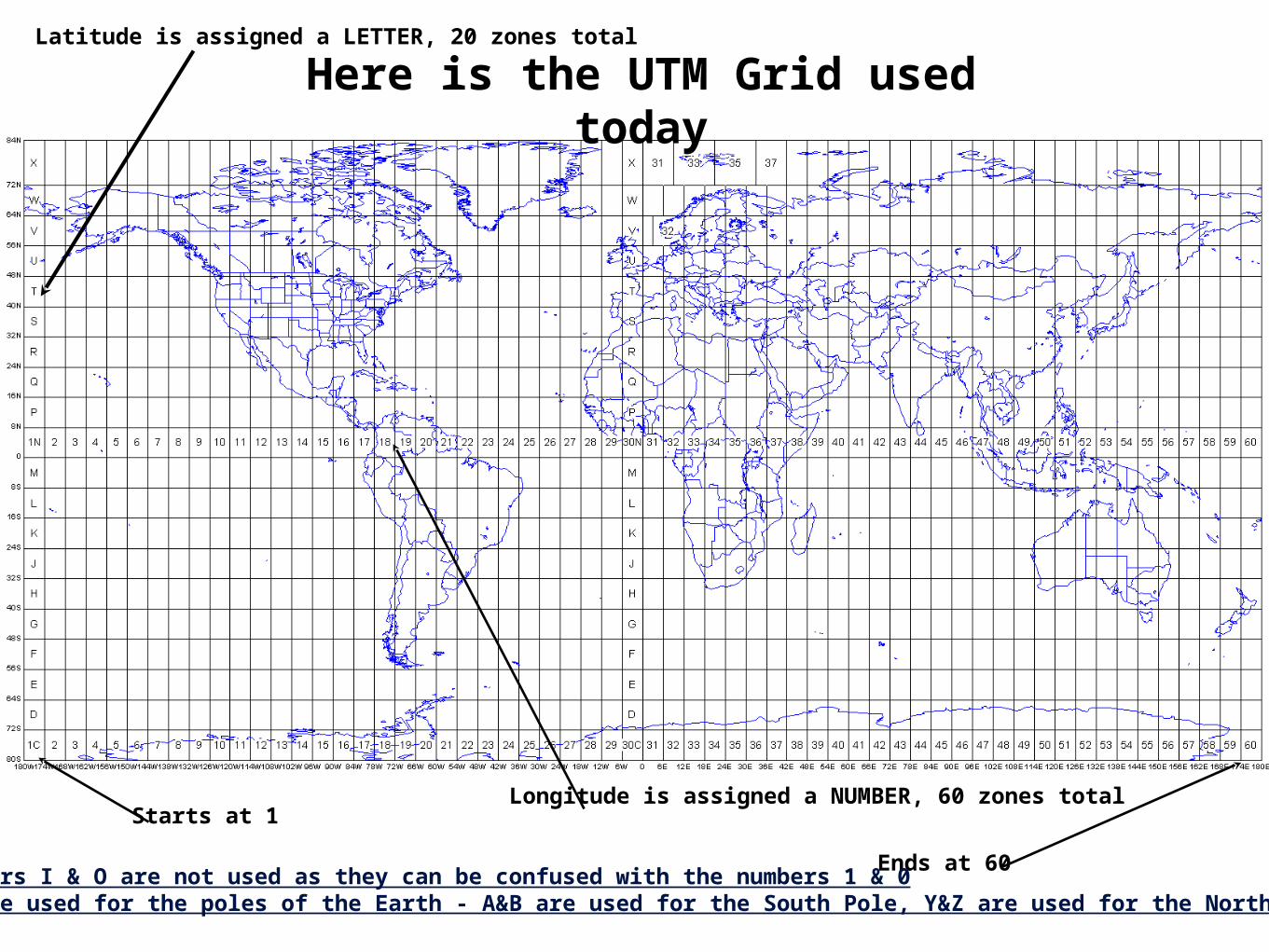
Here is the UTM Grid used today
Latitude is assigned a LETTER, 20 zones total
Longitude is assigned a NUMBER, 60 zones totalStarts at 1
Ends at 60Note: the letters I & O are not used as they can be confused with the numbers 1 & 0Special maps are used for the poles of the Earth - A&B are used for the South Pole, Y&Z are used for the North Pole
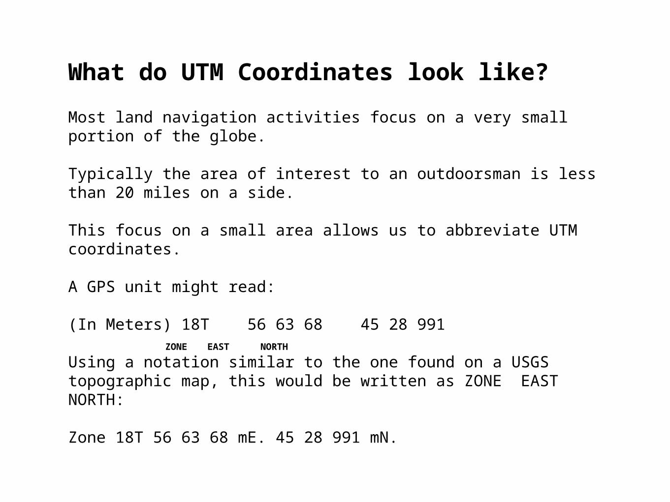
What do UTM Coordinates look like?
Most land navigation activities focus on a very small portion of the globe.
Typically the area of interest to an outdoorsman is less than 20 miles on a side.
This focus on a small area allows us to abbreviate UTM coordinates.
A GPS unit might read:
(In Meters) 18T 56 63 68 45 28 991
Using a notation similar to the one found on a USGS topographic map, this would be written as ZONE EAST NORTH:
Zone 18T 56 63 68 mE. 45 28 991 mN.
ZONE EAST NORTH
Additional Facts on the UTM Coordinate System
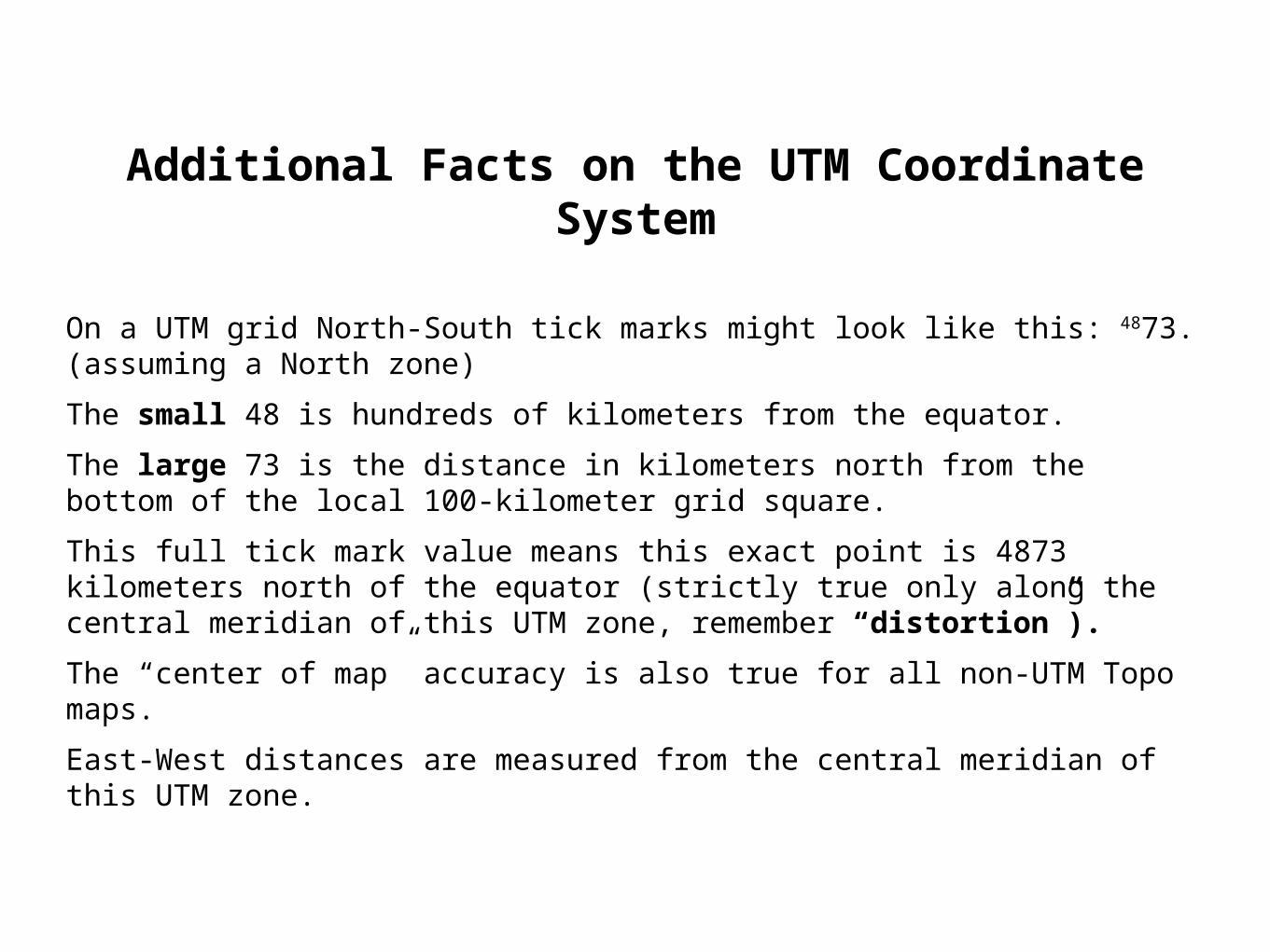
On a UTM grid North-South tick marks might look like this: 4873. (assuming a North zone)
The small 48 is hundreds of kilometers from the equator.
The large 73 is the distance in kilometers north from the bottom of the local 100-kilometer grid square.
This full tick mark value means this exact point is 4873 kilometers north of the equator (strictly true only along the central meridian of this UTM zone, remember “distortion”).
The “center of map” accuracy is also true for all non-UTM Topo maps.
East-West distances are measured from the central meridian of this UTM zone.
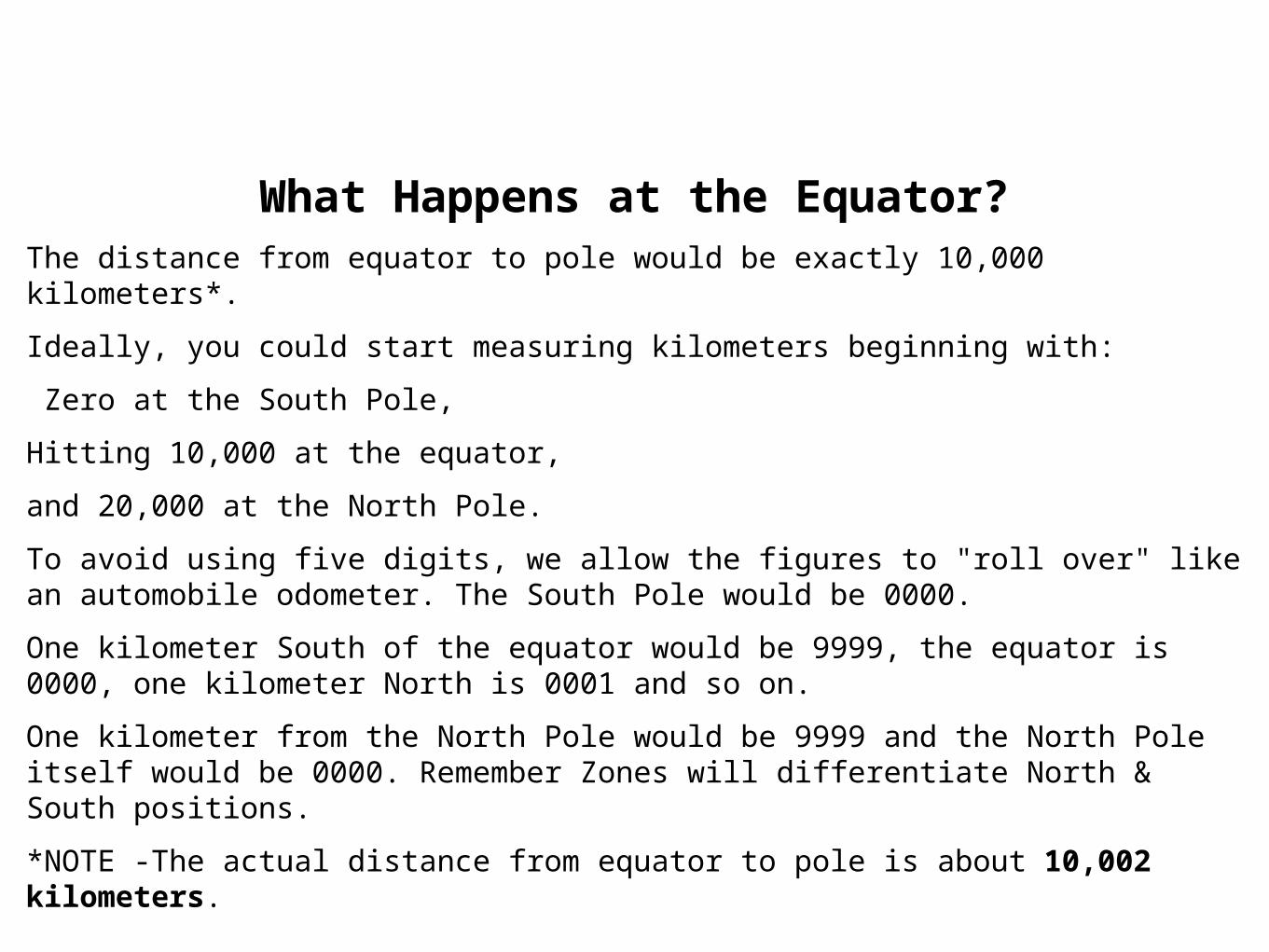
What Happens at the Equator?The distance from equator to pole would be exactly 10,000 kilometers*.
Ideally, you could start measuring kilometers beginning with:
Zero at the South Pole,
Hitting 10,000 at the equator,
and 20,000 at the North Pole.
To avoid using five digits, we allow the figures to "roll over" like an automobile odometer. The South Pole would be 0000.
One kilometer South of the equator would be 9999, the equator is 0000, one kilometer North is 0001 and so on.
One kilometer from the North Pole would be 9999 and the North Pole itself would be 0000. Remember Zones will differentiate North & South positions.
*NOTE -The actual distance from equator to pole is about 10,002 kilometers.
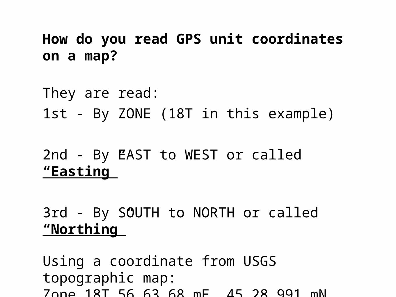
How do you read GPS unit coordinates on a map?
They are read:
1st - By ZONE (18T in this example)
2nd - By EAST to WEST or called “Easting”
3rd - By SOUTH to NORTH or called “Northing”
Using a coordinate from USGS topographic map: Zone 18T 56 63 68 mE. 45 28 991 mN.
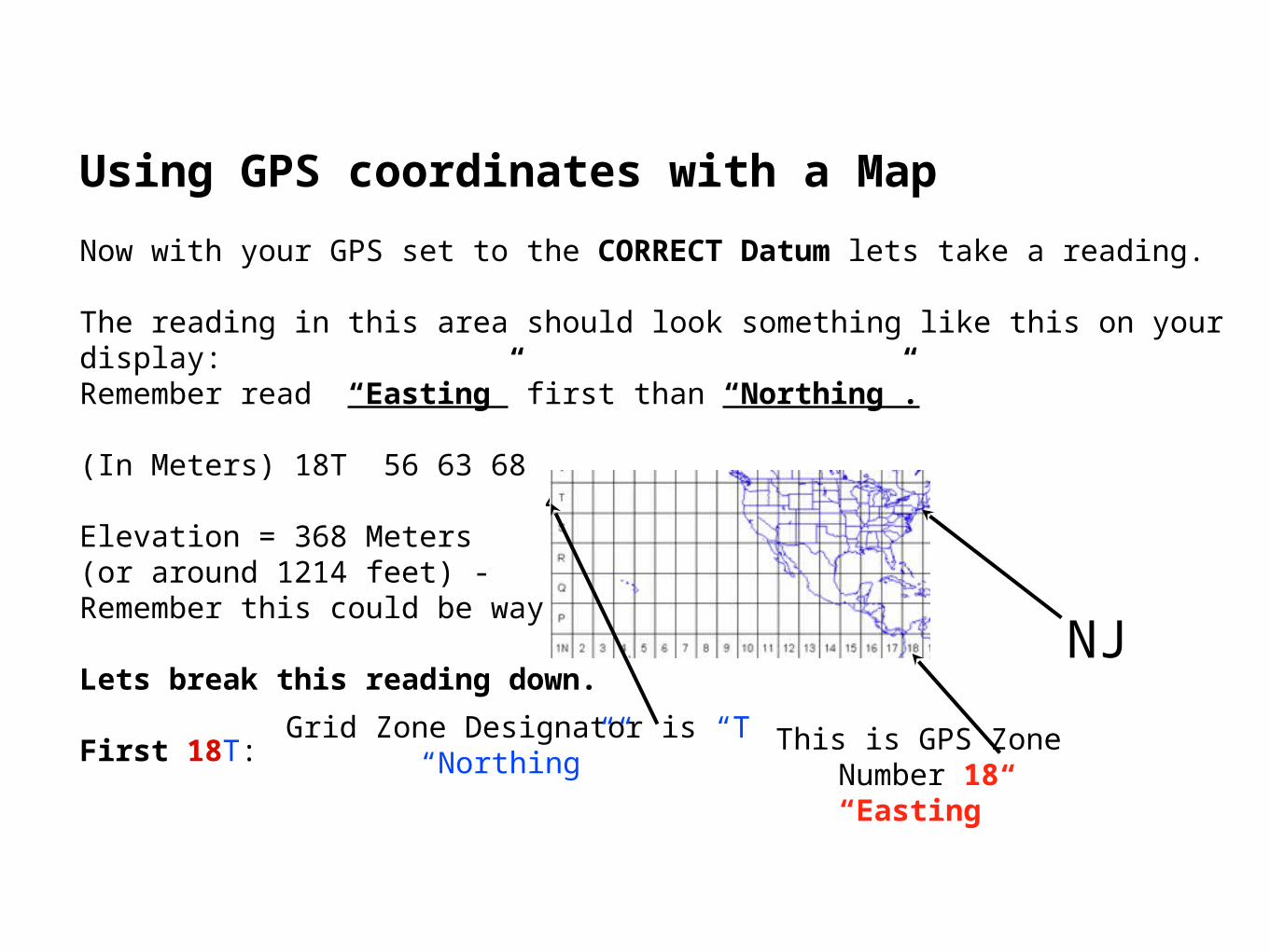
Using GPS coordinates with a Map
Now with your GPS set to the CORRECT Datum lets take a reading.
The reading in this area should look something like this on your display:Remember read “Easting” first than “Northing”.
(In Meters) 18T 56 63 68 45 28 991 Elevation = 368 Meters (or around 1214 feet) - Remember this could be way off!
Lets break this reading down.
First 18T:This is GPS Zone Number 18
“Easting”
Grid Zone Designator is “T“Northing””
NJ
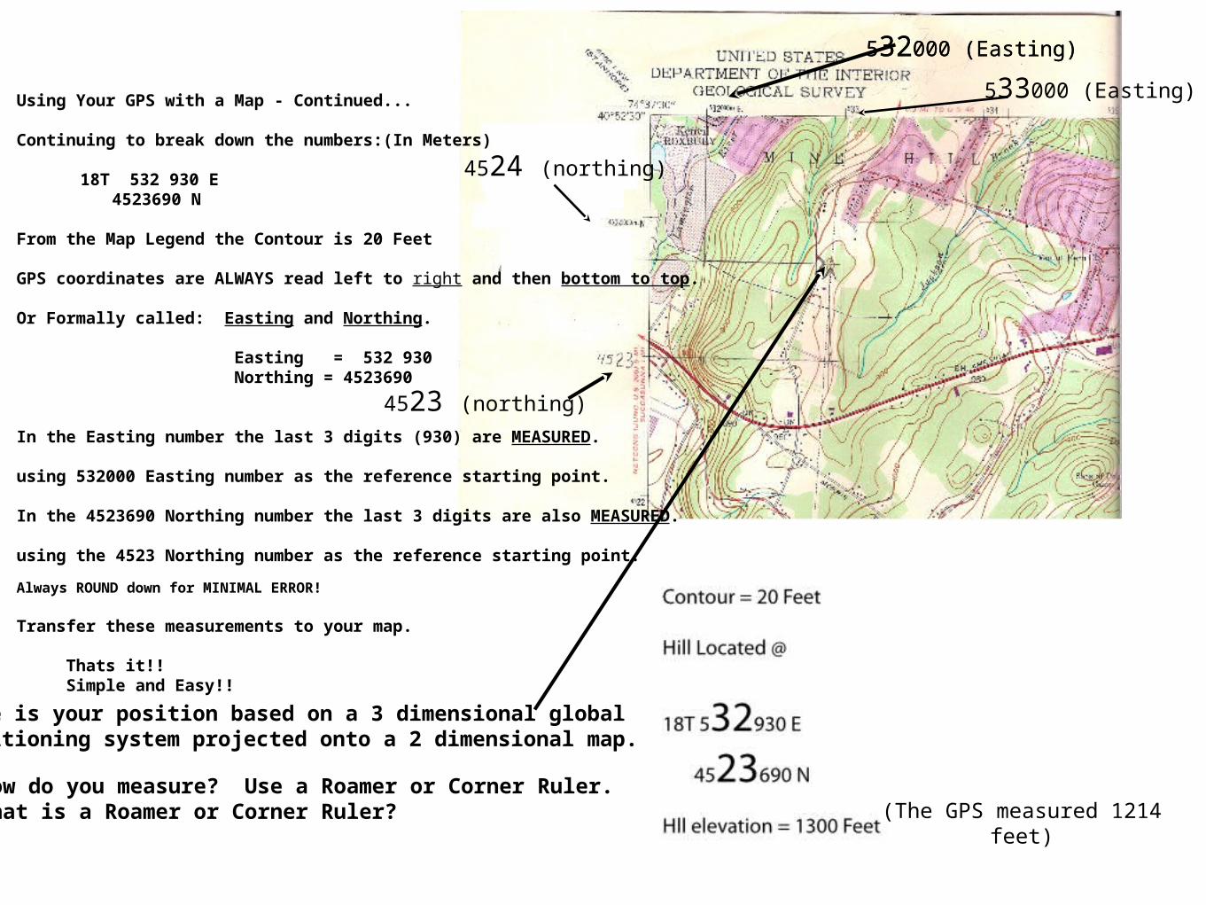
Using Your GPS with a Map - Continued...
Continuing to break down the numbers:(In Meters)
18T 532 930 E4523690 N
From the Map Legend the Contour is 20 Feet
GPS coordinates are ALWAYS read left to right and then bottom to top.
Or Formally called: Easting and Northing.
Easting = 532 930 Northing = 4523690
In the Easting number the last 3 digits (930) are MEASURED.
using 532000 Easting number as the reference starting point.
In the 4523690 Northing number the last 3 digits are also MEASURED.
using the 4523 Northing number as the reference starting point.
Always ROUND down for MINIMAL ERROR!
Transfer these measurements to your map.
Thats it!! Simple and Easy!!
532000 (Easting)
4523 (northing)
Here is your position based on a 3 dimensional global positioning system projected onto a 2 dimensional map.
(The GPS measured 1214 feet)
533000 (Easting) t
532000 (Easting)
4524 (northing)
How do you measure? Use a Roamer or Corner Ruler.What is a Roamer or Corner Ruler?
Tools for GPS Map Work
To obtain better measurement resolution with GPS coordinates you can buy map rulers, corner rulers or “Roamers” and other UTM tools to assist in the triangulation of your position.
Make SURE the map scaling MATCHES the tool scaling!
With these tools and a 7.5 Minute map (1:24 000 scale) you can get down to around 15 meters (or 49.2 feet) or better of accuracy.
Excellent for a $100 GPS system!
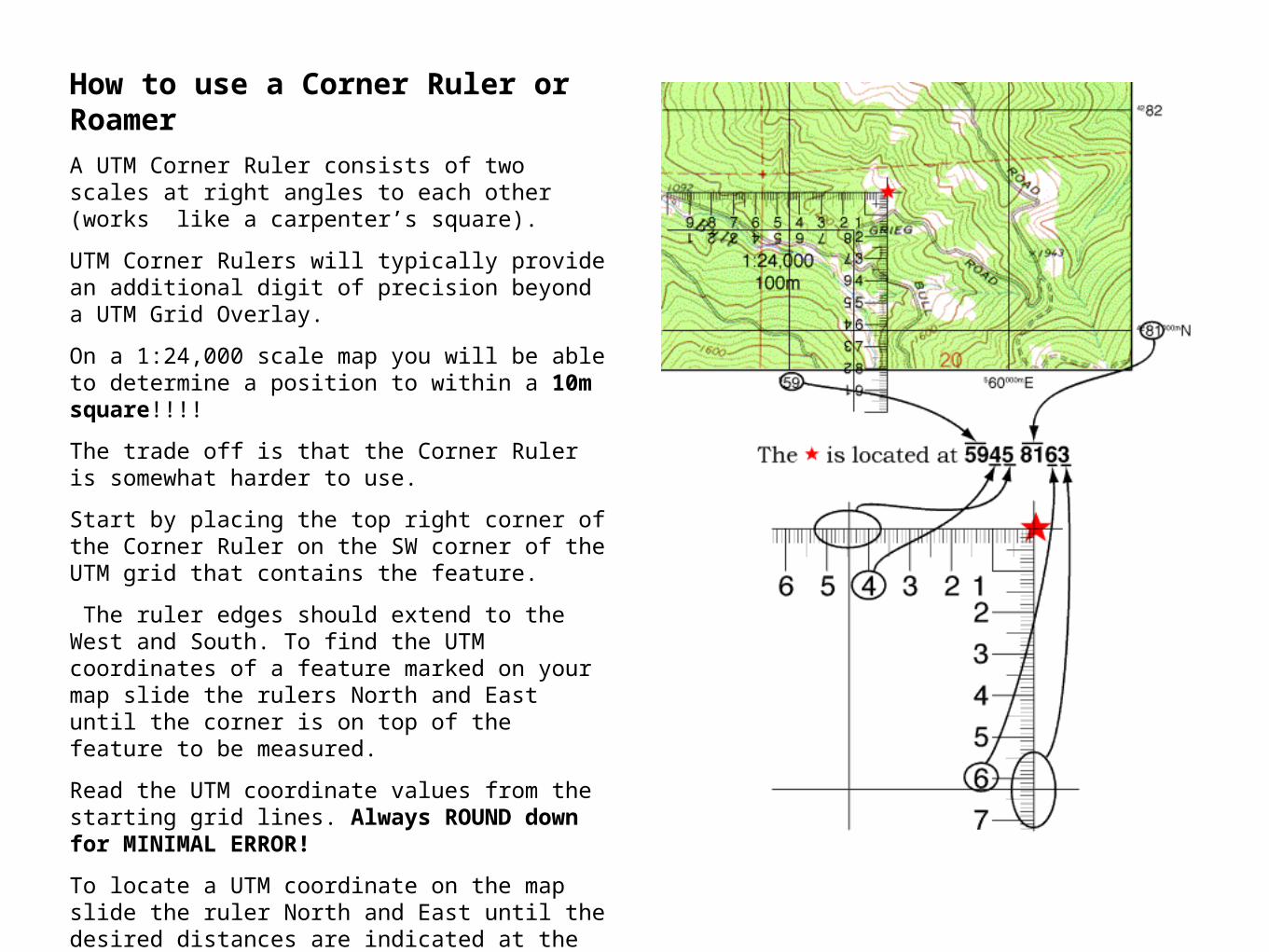
How to use a Corner Ruler or Roamer
A UTM Corner Ruler consists of two scales at right angles to each other (works like a carpenter’s square).
UTM Corner Rulers will typically provide an additional digit of precision beyond a UTM Grid Overlay.
On a 1:24,000 scale map you will be able to determine a position to within a 10m square!!!!
The trade off is that the Corner Ruler is somewhat harder to use.
Start by placing the top right corner of the Corner Ruler on the SW corner of the UTM grid that contains the feature.
The ruler edges should extend to the West and South. To find the UTM coordinates of a feature marked on your map slide the rulers North and East until the corner is on top of the feature to be measured.
Read the UTM coordinate values from the starting grid lines. Always ROUND down for MINIMAL ERROR!
To locate a UTM coordinate on the map slide the ruler North and East until the desired distances are indicated at the grid lines.
Make Sure the Ruler SCALING MATCHES the map!

Another Example on reading UTM Coordinates
The map below plots the UTM coordinate: 0559671E 1232685N. Follow the steps below.
The zone -which is NOT shown (12S) is printed on the corner of the map near the map datum.
Step #1 Read EAST FIRST
Step #2 0559
Step #3 Find 6 and estimate 71
Step #4 Read NORTH NEXT
Step #5 1232
Step #6 Find 6 and estimate 85
Using your GPS -Sources of Operator Error
If you have a GPS (regardless of which make or model) you will probably HAVE to change the Datum setting on it.
Their default datum setting is WGS 84 Datum.
Remember the section on the compass that said if you use a compass by itself you will NOT have an problems. The same with GPS units.
If you use your GPS with a map you need to set them up so they can be used together.
Open the map you are going to use and look for the Datum type the map was drawn with because this is the Datum you NEED to enter into your GPS.
Most “Topo” maps are NAD 27 (BUT CHECK IT!)
So if your map is NAD 27 select NAD 27 CONUS (Continental United States) on your GPS
FAILURE to do so can result in large errors!
How much of an error are we talking about?
Changing the datum on your GPS and not moving will cause the latitude andlongitude to change (remember this is all math conversions).
A place marker put on the 4-H Building at the Oklahoma State University campus has coordinates that read:UTM 14 673457E, 3999688N for NAD83/WGS84.
If switched to NAD27, the coordinates now read: UTM 14 673489E, 3999482N.
This is a shift of: 32 meters (or 34 yards or 102 feet) East and 206 meters (or 225 yards or 675 feet) North which is quite substantial.
So if you were walking in bad weather you would have missed your destination.
The difference between magnetic and true north is called declination.
This declination difference also affects GPS receivers.
Your GPS wants to know which North to use.
Remember the 3 Norths?
Use magnetic north if you use it together with a non compensated compass.
Use true north with a: Compensated compass or a lat /long map
Use grid north if you use a UTM map/ chart
Using your GPS - More Sources of Operator Error
Other GPS Errors out of your Control
Ephemeris ErrorsIonosphere ConditionsTroposphere ConditionsTiming ErrorsMulti-path ErrorsPoor Satellite CoverageMilitary Intervention
Ephemeris Errors Occurs when a satellite does not correctly transmit its exact position.
Ionosphere Conditions
The Ionosphere starts at at about 43 to 50 miles above the Earth and continues on for 100s of miles.
Signals are SLOWED down as they travel through the Ionosphere. These are causes by temperature, pressure, and humidity. GPSs also try to attempt to correct for unexpected plasma (solar flares) events and can cause errors.

Troposphere Conditions
The Troposphere is the lowest region of the Earth’s atmosphere and goes from the ground up to around 11 miles. Variations in temperature, pressure, and humidity cause variations in radio waves. These also SLOW down radio waves.
Timing Errors
It is not practical to place an atomic clock in every GPS receiver ($$$), so timing errors from YOUR GPS receiver’s less-precise clock causes slight positional inaccuracies.
Multi-path Errors
When a satellite signal bounces off a hard surface (like buildings, mountains, canyon walls, hard frozen snow) before it reaches YOUR GPS a DELAY in time travel occurs, which causes INACCURATE distance calculations.
Poor Satellite Coverage
When a significant part of the sky is blocked YOUR GPS receiver can have difficulty receiving satellite data. You can be blocked by trees, cloud cover, dust in the air, mountains, tall buildings, etc.
If satellite coverage is blocked you need to move to where is stronger. This may NOT be possible because of physical objects blocking or preventing you moving.
Military Intervention
During times of war, as in Iraq & Afghanistan the Military jams GPS signals to prevent the Taliban from using consumer GPS receivers in operations against American Forces. Military GPS receivers can receive “special” or encrypted GPS signals.
When satellite data is “modified” by the military and you are in this region you can go from 10 meters of accuracy to 100 of meters of accuracy.
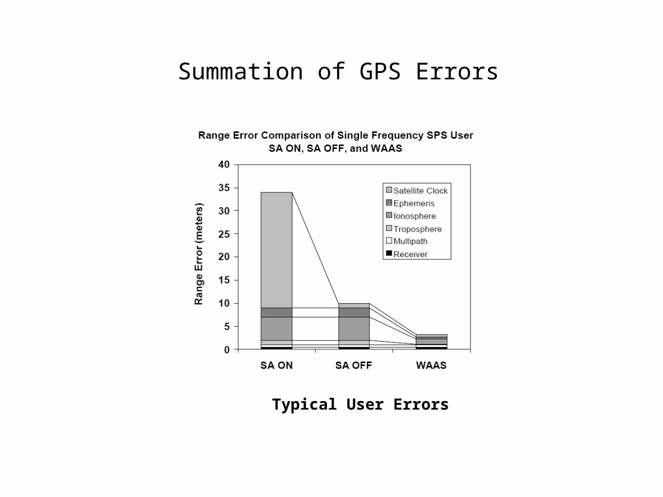
Summation of GPS Errors
Typical User Errors
End of GPS Basics
Questions?
We have completed the Introduction and Basic Overview of the following 3 topics:
* Map Basics.* Compass Basics.* GPS Basics.
Any Questions?