Embed Size (px)
Citation preview
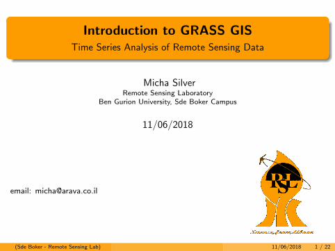
Introduction to GRASS GISTime Series Analysis of Remote Sensing Data
Micha SilverRemote Sensing Laboratory
Ben Gurion University, Sde Boker Campus
11/06/2018
email: [email protected]
(Sde Boker - Remote Sensing Lab) 11/06/2018 1 / 22
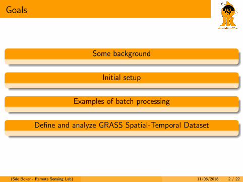
Goals
Some background
Initial setup
Examples of batch processing
Define and analyze GRASS Spatial-Temporal Dataset
(Sde Boker - Remote Sensing Lab) 11/06/2018 2 / 22
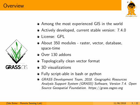
Overview
Among the most experienced GIS in the world
Actively developed, current stable version: 7.4.0
License: GPL
About 350 modules - raster, vector, database,space-time
Over 130 addons
Topologically clean vector format
3D visualizations
Fully script-able in bash or python
GRASS Development Team, 2018. Geographic ResourcesAnalysis Support System (GRASS) Software, Version 7.4. OpenSource Geospatial Foundation. https://grass.osgeo.org
(Sde Boker - Remote Sensing Lab) 11/06/2018 3 / 22
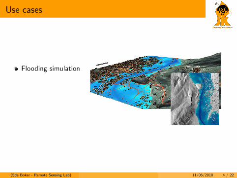
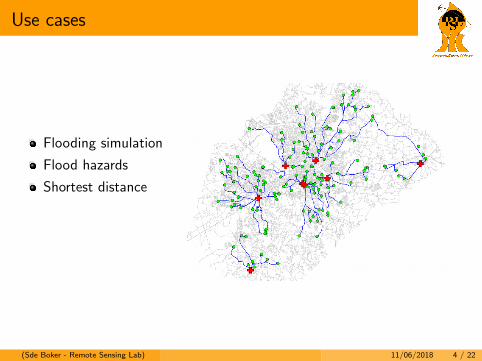
Use cases
Flooding simulation
Flood hazards
Shortest distance
Landscape changes
LIDAR point clouds
(Sde Boker - Remote Sensing Lab) 11/06/2018 4 / 22
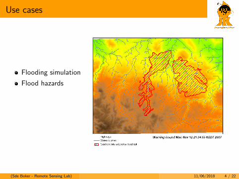
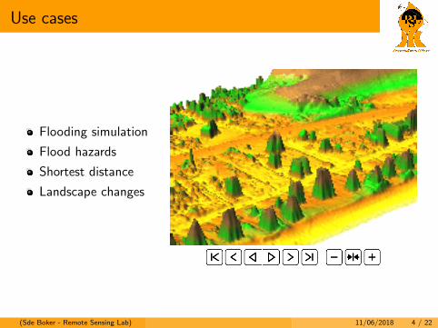
Use cases
Flooding simulation
Flood hazards
Shortest distance
Landscape changes
LIDAR point clouds
(Sde Boker - Remote Sensing Lab) 11/06/2018 4 / 22
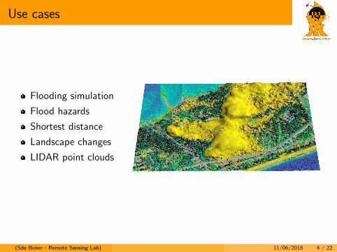
Use cases
Flooding simulation
Flood hazards
Shortest distance
Landscape changes
LIDAR point clouds
(Sde Boker - Remote Sensing Lab) 11/06/2018 4 / 22
Use cases
Flooding simulation
Flood hazards
Shortest distance
Landscape changes
LIDAR point clouds
(Sde Boker - Remote Sensing Lab) 11/06/2018 4 / 22
Use cases
Flooding simulation
Flood hazards
Shortest distance
Landscape changes
LIDAR point clouds
(Sde Boker - Remote Sensing Lab) 11/06/2018 4 / 22
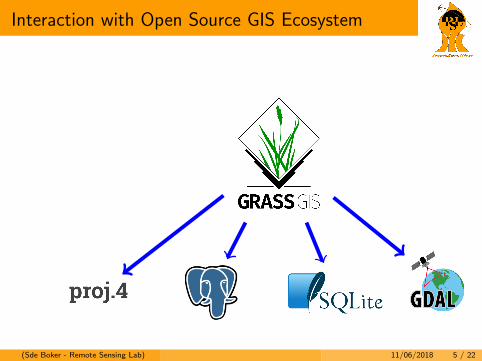
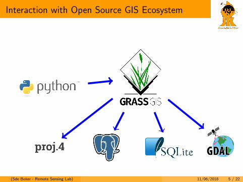
Interaction with Open Source GIS Ecosystem
(Sde Boker - Remote Sensing Lab) 11/06/2018 5 / 22
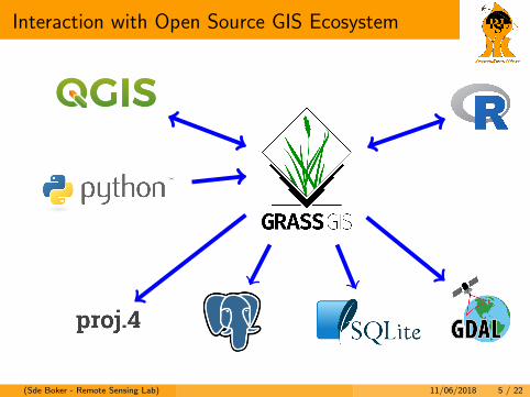
Interaction with Open Source GIS Ecosystem
(Sde Boker - Remote Sensing Lab) 11/06/2018 5 / 22
Interaction with Open Source GIS Ecosystem
(Sde Boker - Remote Sensing Lab) 11/06/2018 5 / 22
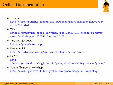
Online Documentation
Tutorial:http://www.training.gismentors.eu/grass-gis-workshop-jena-2018/
units/01.html
Wiki:https://grasswiki.osgeo.org/wiki/From_GRASS_GIS_novice_to_power_
user_(workshop_at_FOSS4G_Boston_2017)
The GRASS book:https://grassbook.org/
User’s maillist:http://lists.osgeo.org/mailman/listinfo/grass-user
NCSU Lab:http:
//ncsu-geoforall-lab.github.io/geospatial-modeling-course/grass/
Spatial-Temporal workshop:http://ncsu-geoforall-lab.github.io/grass-temporal-workshop/
(Sde Boker - Remote Sensing Lab) 11/06/2018 6 / 22
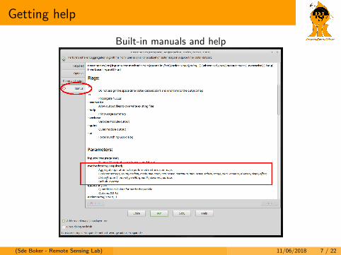
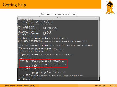
Getting help
Built-in manuals and help
(Sde Boker - Remote Sensing Lab) 11/06/2018 7 / 22
Getting help
Built-in manuals and help
(Sde Boker - Remote Sensing Lab) 11/06/2018 7 / 22
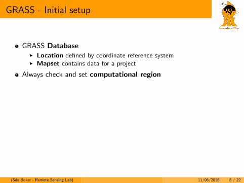
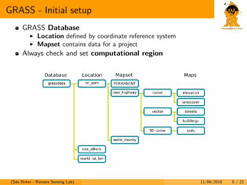
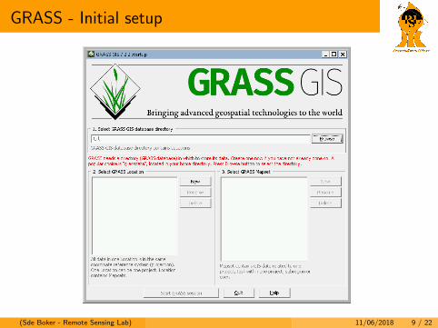
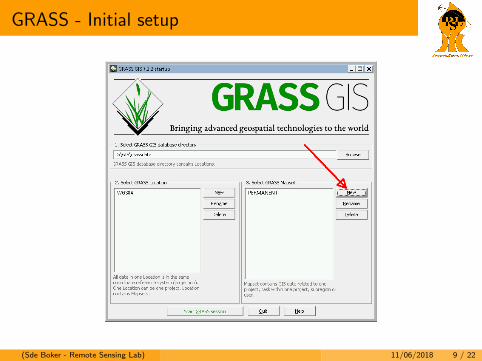
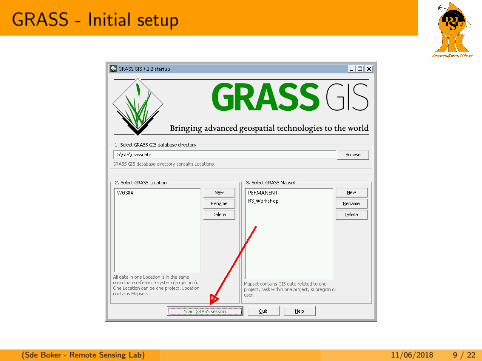
GRASS - Initial setup
GRASS DatabaseI Location defined by coordinate reference systemI Mapset contains data for a project
Always check and set computational region
Two take-home messages:
1 Location = Coordinate System
2 Set GRASS region
(Sde Boker - Remote Sensing Lab) 11/06/2018 8 / 22
GRASS - Initial setup
GRASS DatabaseI Location defined by coordinate reference systemI Mapset contains data for a project
Always check and set computational region
Two take-home messages:1 Location = Coordinate System2 Set GRASS region
(Sde Boker - Remote Sensing Lab) 11/06/2018 8 / 22
GRASS - Initial setup
GRASS DatabaseI Location defined by coordinate reference systemI Mapset contains data for a project
Always check and set computational region
Two take-home messages:
1 Location = Coordinate System
2 Set GRASS region
(Sde Boker - Remote Sensing Lab) 11/06/2018 8 / 22
GRASS - Initial setup
(Sde Boker - Remote Sensing Lab) 11/06/2018 9 / 22
GRASS - Initial setup
(Sde Boker - Remote Sensing Lab) 11/06/2018 9 / 22
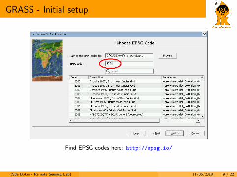
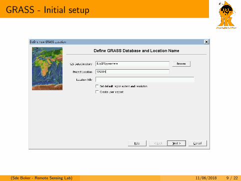
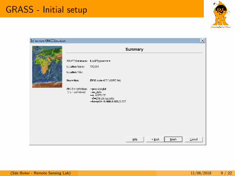
GRASS - Initial setup
Find EPSG codes here: http://epsg.io/
(Sde Boker - Remote Sensing Lab) 11/06/2018 9 / 22
GRASS - Initial setup
(Sde Boker - Remote Sensing Lab) 11/06/2018 9 / 22
GRASS - Initial setup
(Sde Boker - Remote Sensing Lab) 11/06/2018 9 / 22
GRASS - Initial setup
(Sde Boker - Remote Sensing Lab) 11/06/2018 9 / 22
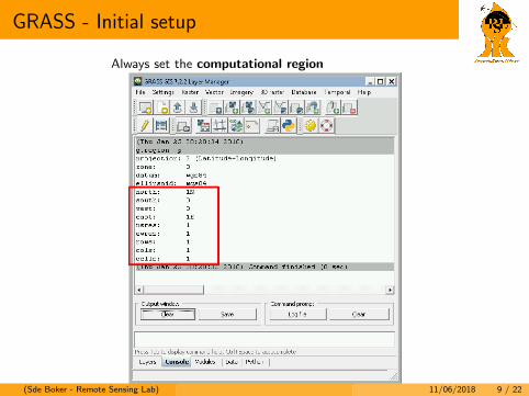
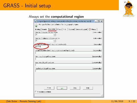
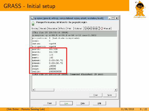
GRASS - Initial setup
Always set the computational region
(Sde Boker - Remote Sensing Lab) 11/06/2018 9 / 22
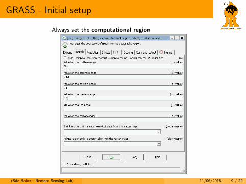
GRASS - Initial setup
Always set the computational region
(Sde Boker - Remote Sensing Lab) 11/06/2018 9 / 22
GRASS - Initial setup
Always set the computational region
(Sde Boker - Remote Sensing Lab) 11/06/2018 9 / 22
GRASS - Initial setup
(Sde Boker - Remote Sensing Lab) 11/06/2018 9 / 22
Batch Processing in GRASS
(Sde Boker - Remote Sensing Lab) 11/06/2018 10 / 22
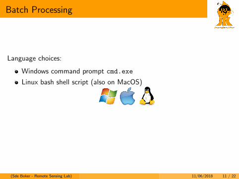
Batch Processing
Time series analysis requires processing large batches of input
Language choices:
Windows command prompt cmd.exe
Linux bash shell script (also on MacOS)
python (any OS)
(Sde Boker - Remote Sensing Lab) 11/06/2018 11 / 22
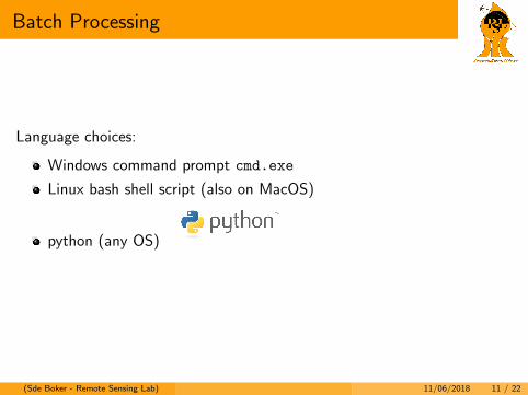
Batch Processing
Language choices:
Windows command prompt cmd.exe
Linux bash shell script (also on MacOS)
python (any OS)
(Sde Boker - Remote Sensing Lab) 11/06/2018 11 / 22
Batch Processing
Language choices:
Windows command prompt cmd.exe
Linux bash shell script (also on MacOS)
python (any OS)
(Sde Boker - Remote Sensing Lab) 11/06/2018 11 / 22
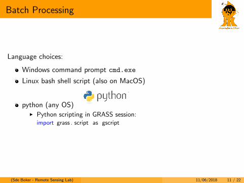
Batch Processing
Language choices:
Windows command prompt cmd.exe
Linux bash shell script (also on MacOS)
python (any OS)I Python scripting in GRASS session:
import grass . script as gscript
(Sde Boker - Remote Sensing Lab) 11/06/2018 11 / 22
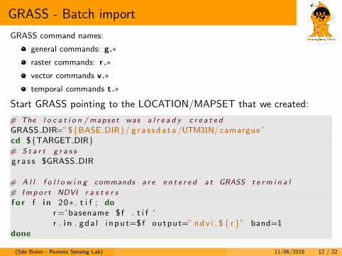
GRASS - Batch import
GRASS command names:
general commands: g.∗raster commands: r .∗vector commands v.∗temporal commands t .∗
Start GRASS pointing to the LOCATION/MAPSET that we created:
# The l o c a t i o n / mapse t was a l r e a d y c r e a t e d
GRASS DIR=”${BASE DIR}/ g r a s s d a t a /UTM31N/camargue”cd ${TARGET DIR}# S t a r t g r a s s
g r a s s $GRASS DIR
# A l l f o l l o w i n g commands a r e e n t e r e d a t GRASS t e r m i n a l
# Imp o r t NDVI r a s t e r s
f o r f i n 20∗ . t i f ; dor=‘basename $ f . t i f ‘r . i n . gda l i n pu t=$ f output=” ndv i $ { r }” band=1
done
(Sde Boker - Remote Sensing Lab) 11/06/2018 12 / 22
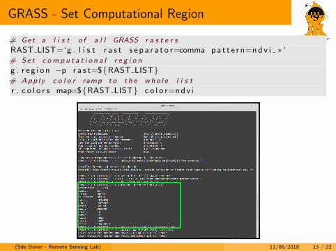
GRASS - Set Computational Region
# Get a l i s t o f a l l GRASS r a s t e r s
RAST LIST=‘g . l i s t r a s t s e p a r a t o r=comma pa t t e r n=nd v i ∗ ‘# Se t c om p u t a t i o n a l r e g i o n
g . r e g i o n −p r a s t=${RAST LIST}# App l y c o l o r ramp t o t h e who l e l i s t
r . c o l o r s map=${RAST LIST} c o l o r=ndv i
(Sde Boker - Remote Sensing Lab) 11/06/2018 13 / 22
STRDS in GRASS
Spatial-Temporal Raster Datasets
(Sde Boker - Remote Sensing Lab) 11/06/2018 14 / 22
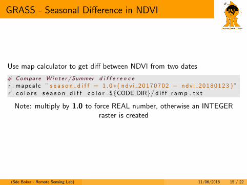
GRASS - Seasonal Difference in NDVI
Use map calculator to get diff between NDVI from two dates
# Compare W i n t e r /Summer d i f f e r e n c e
r . mapcalc ” s e a s o n d i f f = 1 . 0∗ ( ndv i 20170702 − ndv i 20180123 ) ”r . c o l o r s s e a s o n d i f f c o l o r=${CODE DIR}/ d i f f r amp . t x t
Note: multiply by 1.0 to force REAL number, otherwise an INTEGERraster is created
(Sde Boker - Remote Sensing Lab) 11/06/2018 15 / 22
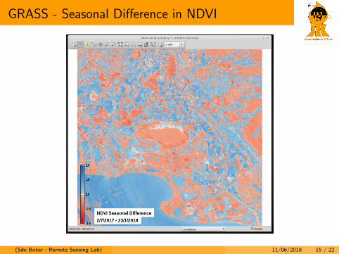
GRASS - Seasonal Difference in NDVI
(Sde Boker - Remote Sensing Lab) 11/06/2018 15 / 22
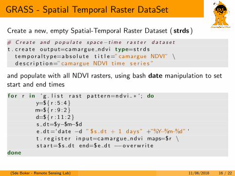
GRASS - Spatial Temporal Raster DataSet
Create a new, empty Spatial-Temporal Raster Dataset ( strds )
# C r e a t e and p o p u l a t e s p a c e−t im e r a s t e r d a t a s e t
t . c r e a t e output=camargue ndv i type=s t r d st empo ra l t ype=ab s o l u t e t i t l e=”camargue NDVI” \d e s c r i p t i o n=”camargue NDVI t ime s e r i e s ”
and populate with all NDVI rasters, using bash date manipulation to setstart and end times
f o r r i n ‘ g . l i s t r a s t p a t t e r n=nd v i ∗ ‘ ; doy=${ r : 5 : 4 }m=${ r : 9 : 2 }d=${ r : 1 1 : 2}s d t=$y−$m−$de d t=‘ date −d ” $ s d t + 1 days ” +”%Y−%m−%d” ‘t . r e g i s t e r i n pu t=camargue ndv i maps=$r \s t a r t=$ s d t end=$e d t −−o v e rw r i t e
done
(Sde Boker - Remote Sensing Lab) 11/06/2018 16 / 22
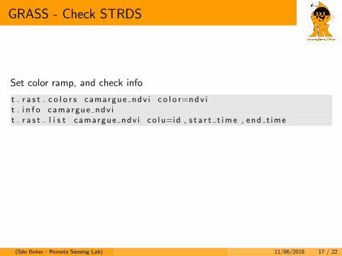
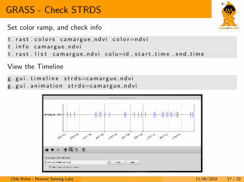
GRASS - Check STRDS
Set color ramp, and check info
t . r a s t . c o l o r s camargue ndv i c o l o r=ndv it . i n f o camargue ndv it . r a s t . l i s t camargue ndv i c o l u=id , s t a r t t im e , end t ime
View the Timeline
g . gu i . t i m e l i n e s t r d s=camargue ndv ig . gu i . an imat i on s t r d s=camargue ndv i
(Sde Boker - Remote Sensing Lab) 11/06/2018 17 / 22
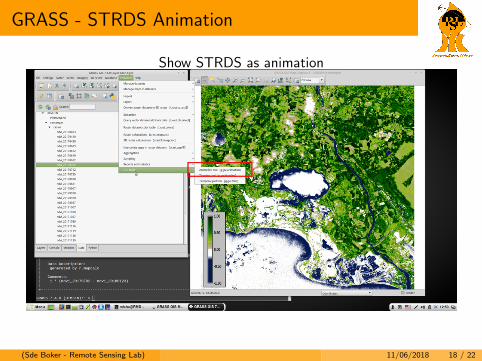
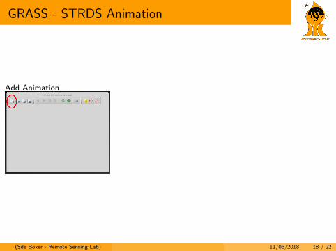
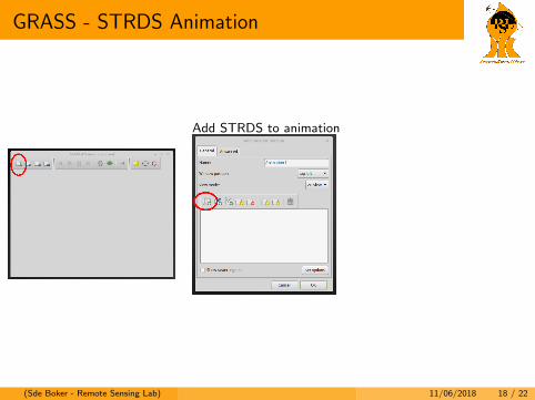
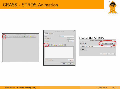
GRASS - STRDS Animation
Show STRDS as animation
Add Animation Add STRDS to animation Choose the STRDS
(Sde Boker - Remote Sensing Lab) 11/06/2018 18 / 22
GRASS - STRDS Animation
Show STRDS as animation
Add Animation
Add STRDS to animation Choose the STRDS
(Sde Boker - Remote Sensing Lab) 11/06/2018 18 / 22
GRASS - STRDS Animation
Show STRDS as animation
Add Animation
Add STRDS to animation
Choose the STRDS
(Sde Boker - Remote Sensing Lab) 11/06/2018 18 / 22
GRASS - STRDS Animation
Show STRDS as animation
Add AnimationAdd STRDS to animation
Choose the STRDS
(Sde Boker - Remote Sensing Lab) 11/06/2018 18 / 22
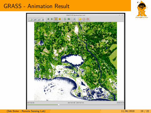
GRASS - Animation Result
(Sde Boker - Remote Sensing Lab) 11/06/2018 19 / 22

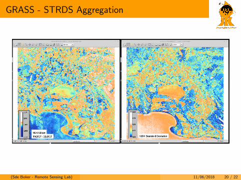
GRASS - STRDS Aggregation
Module: t.rast.series
# t . r a s t . s e r i e s e x amp l e
t . r a s t . s e r i e s i n pu t=camargue ndvi@camargue method=s l o p e \where=” s t a r t t im e >’2017−09−01 00 :00 ’ and \s t a r t t im e <’2017−12−31” output=c am a r g u e n d v i s l o p e f a l l
(Sde Boker - Remote Sensing Lab) 11/06/2018 20 / 22
GRASS - STRDS Aggregation
(Sde Boker - Remote Sensing Lab) 11/06/2018 20 / 22
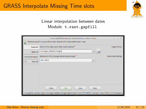
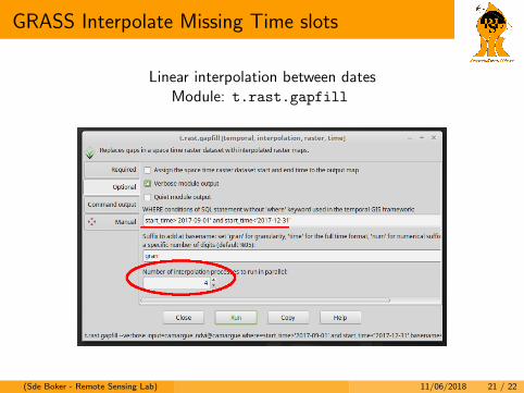
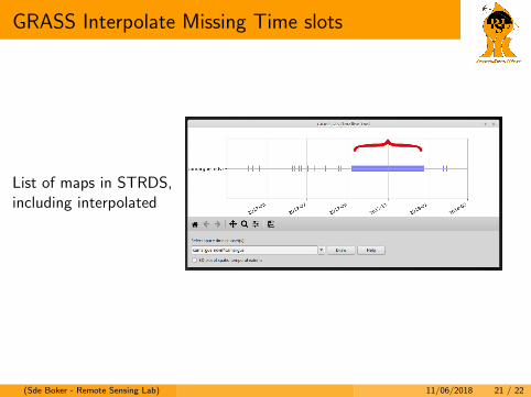
GRASS Interpolate Missing Time slots
Linear interpolation between datesModule: t.rast.gapfill
(Sde Boker - Remote Sensing Lab) 11/06/2018 21 / 22
GRASS Interpolate Missing Time slots
Linear interpolation between datesModule: t.rast.gapfill
(Sde Boker - Remote Sensing Lab) 11/06/2018 21 / 22
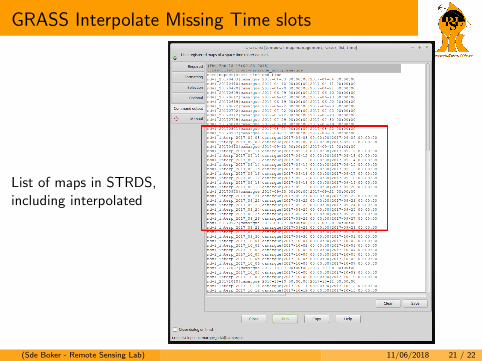
GRASS Interpolate Missing Time slots
List of maps in STRDS,including interpolated
(Sde Boker - Remote Sensing Lab) 11/06/2018 21 / 22
GRASS Interpolate Missing Time slots
List of maps in STRDS,including interpolated
(Sde Boker - Remote Sensing Lab) 11/06/2018 21 / 22
Thanks
Thanks for your attention
(Sde Boker - Remote Sensing Lab) 11/06/2018 22 / 22