Embed Size (px)
Citation preview
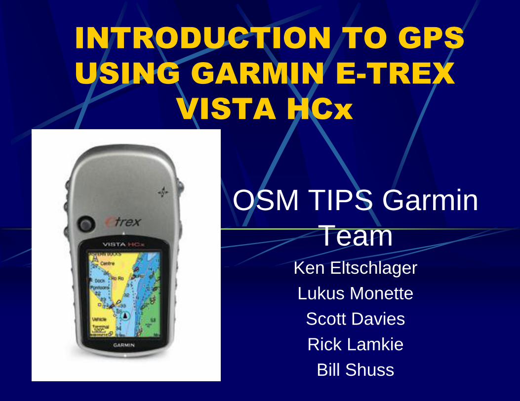
INTRODUCTION TO GPS
USING GARMIN E-TREX
VISTA HCx
OSM TIPS Garmin
Team Ken Eltschlager
Lukus Monette
Scott Davies
Rick Lamkie
Bill Shuss
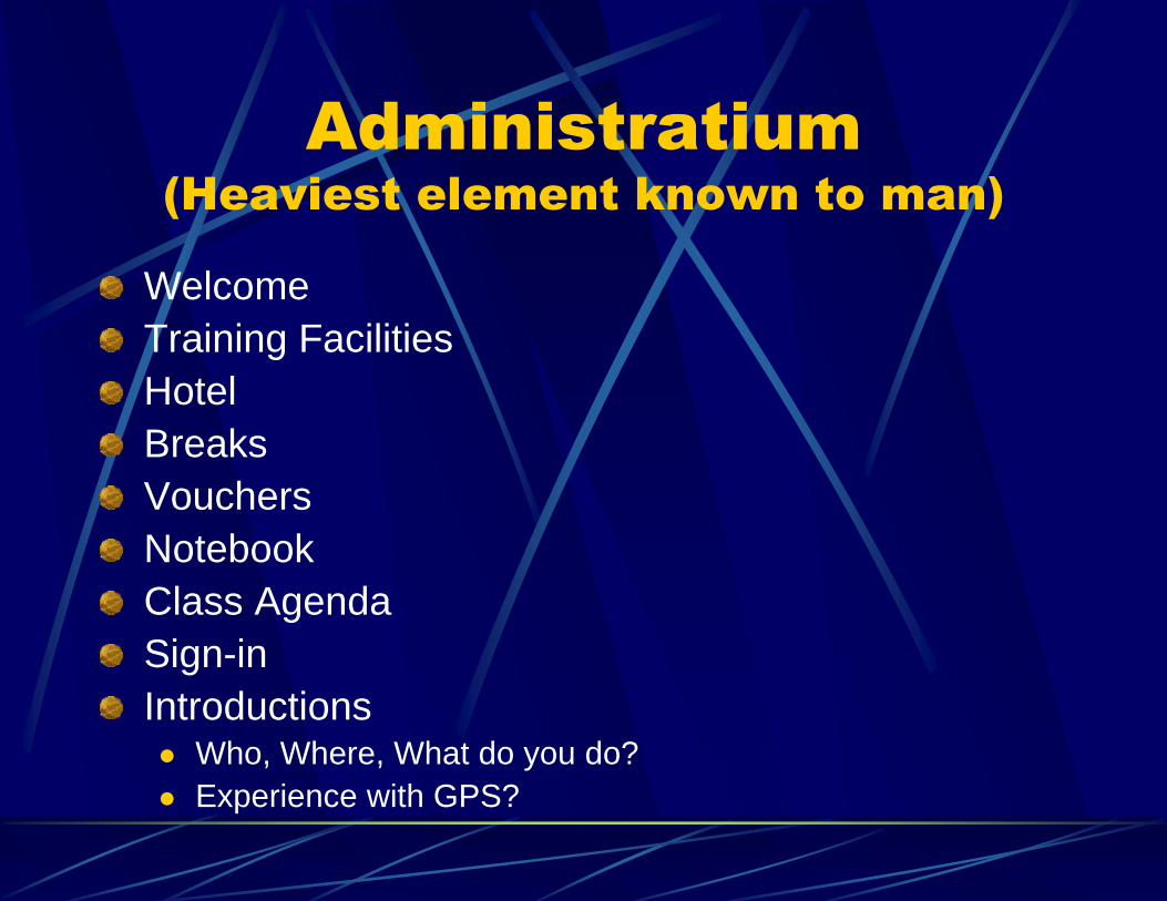
Administratium
(Heaviest element known to man)
Welcome
Training Facilities
Hotel
Breaks
Vouchers
Notebook
Class Agenda
Sign-in
Introductions Who, Where, What do you do?
Experience with GPS?

First a word from our
sponsors …… TIPS
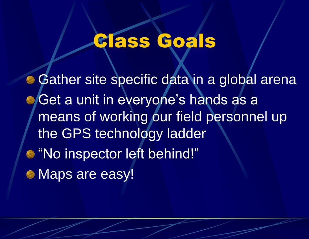
Class Goals
Gather site specific data in a global arena
Get a unit in everyone’s hands as a
means of working our field personnel up
the GPS technology ladder
“No inspector left behind!”
Maps are easy!
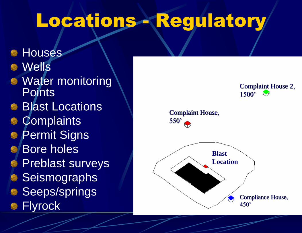
Locations - Regulatory
Houses
Wells
Water monitoring Points
Blast Locations
Complaints
Permit Signs
Bore holes
Preblast surveys
Seismographs
Seeps/springs
Flyrock Compliance House,
450’
Complaint House,
550’
Complaint House 2,
1500’
Blast
Location
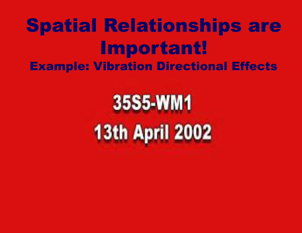
Spatial Relationships are
Important!
Example: Vibration Directional Effects
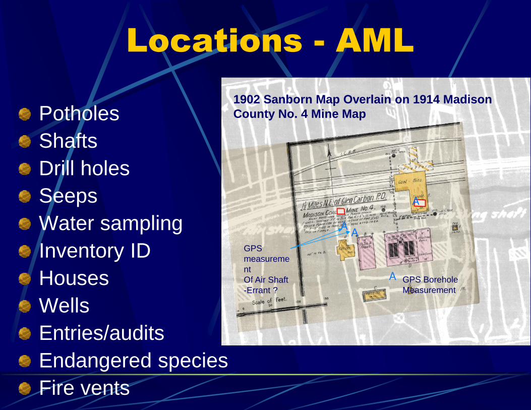
Locations - AML
Potholes
Shafts
Drill holes
Seeps
Water sampling
Inventory ID
Houses
Wells
Entries/audits
Endangered species
Fire vents
AA
A
A
A
A
A
A
AA
A
AA A
AA
A
A
A
AA
A
1902 Sanborn Map Overlain on 1914 Madison
County No. 4 Mine Map
GPS Borehole
Measurement
GPS
measureme
nt
Of Air Shaft
-Errant ?
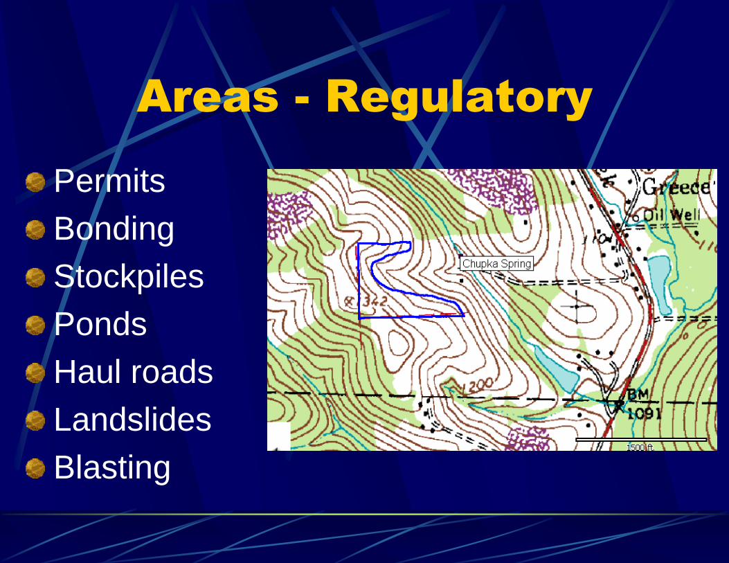
Areas - Regulatory
Permits
Bonding
Stockpiles
Ponds
Haul roads
Landslides
Blasting
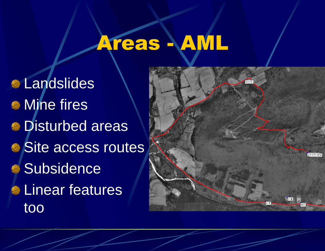
Areas - AML
Landslides
Mine fires
Disturbed areas
Site access routes
Subsidence
Linear features
too
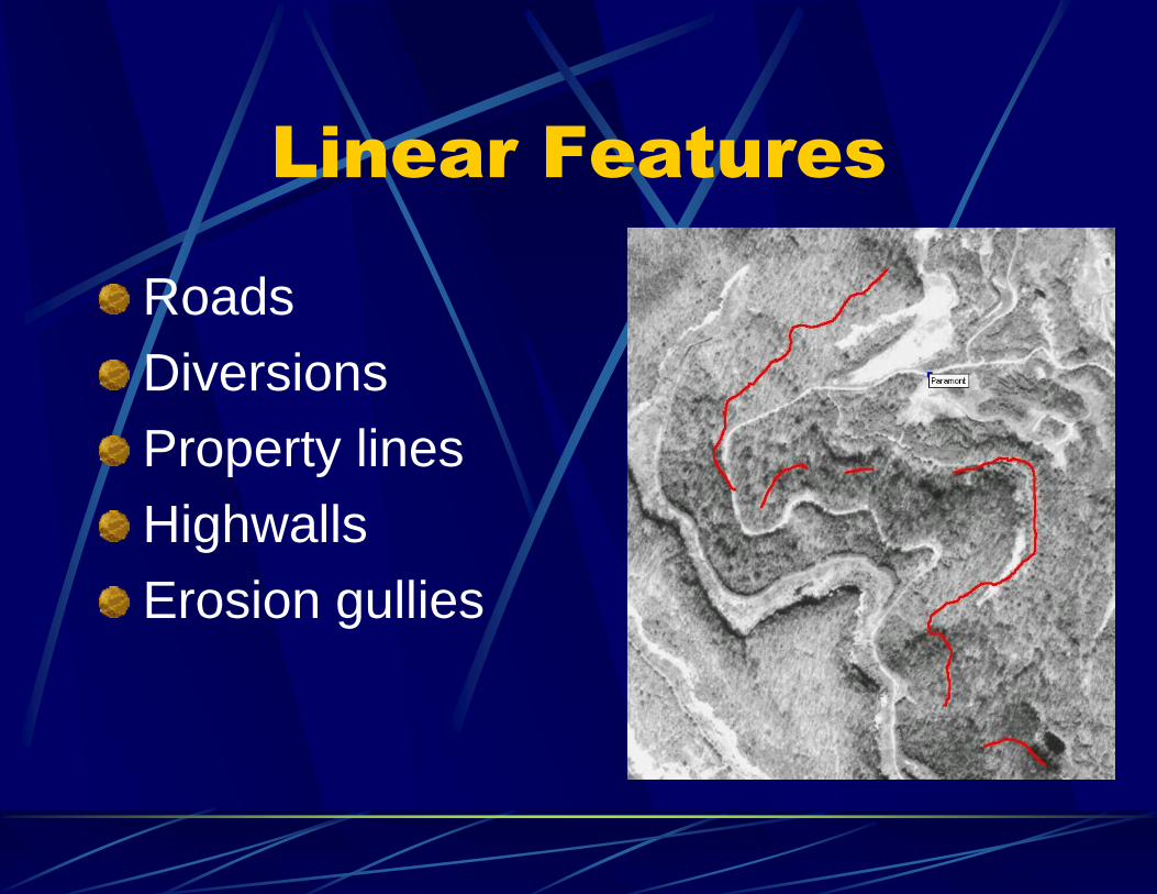
Linear Features
Roads
Diversions
Property lines
Highwalls
Erosion gullies
Other Uses
Navigation to mines
Navigation to homes
Cross sections
Estimating travel times
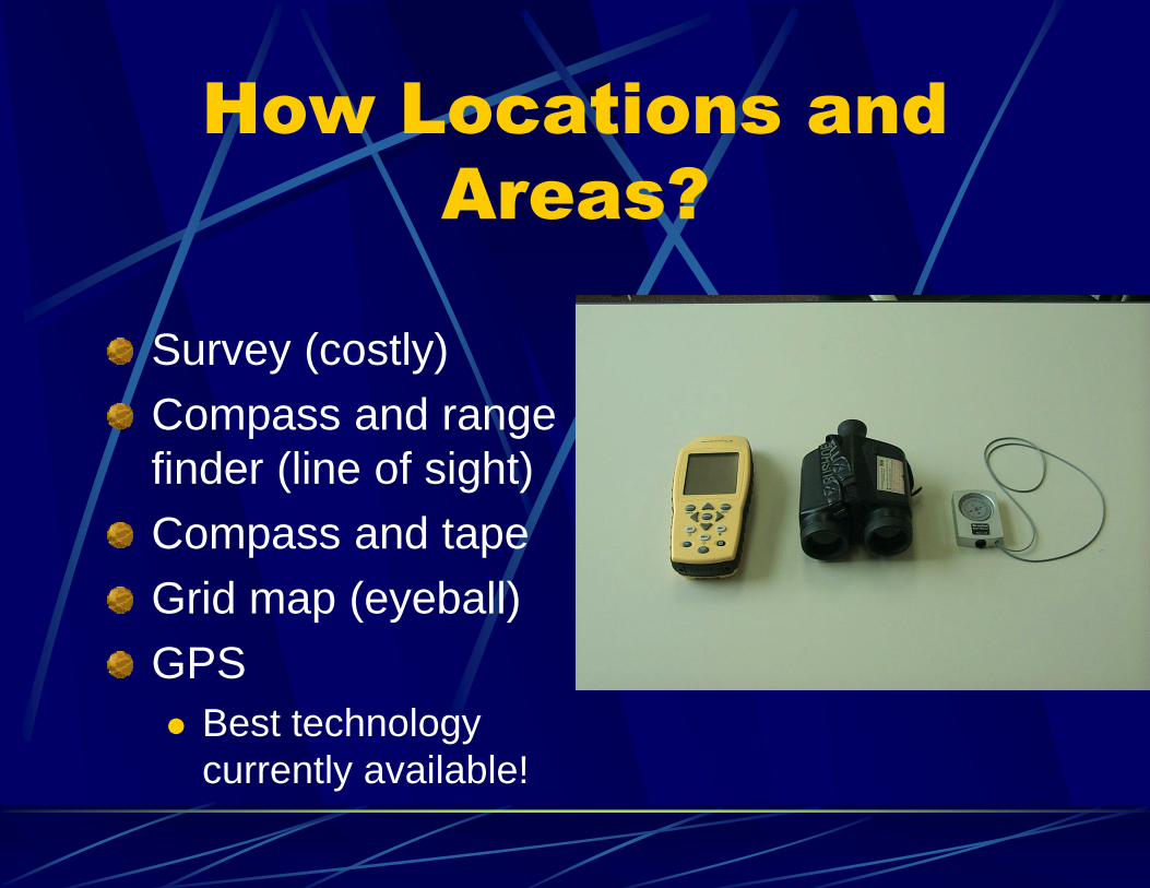
How Locations and
Areas?
Survey (costly)
Compass and range
finder (line of sight)
Compass and tape
Grid map (eyeball)
GPS
Best technology
currently available!
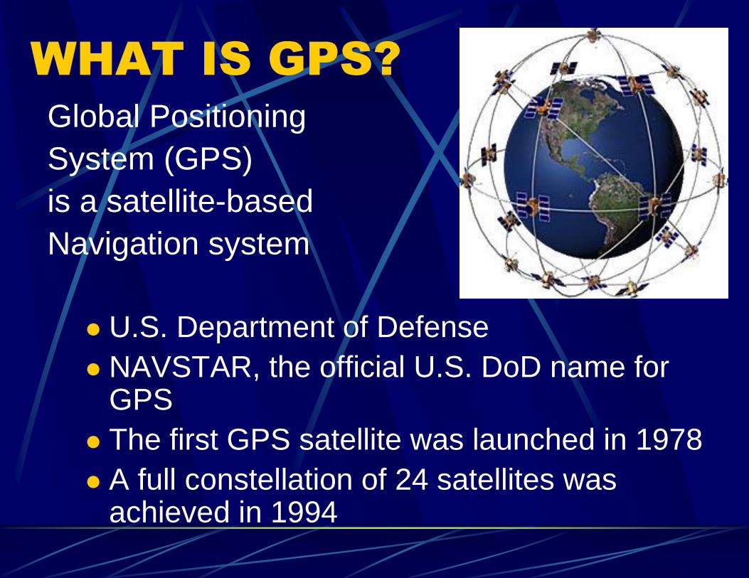
WHAT IS GPS?
Global Positioning
System (GPS)
is a satellite-based
Navigation system
U.S. Department of Defense
NAVSTAR, the official U.S. DoD name for GPS
The first GPS satellite was launched in 1978
A full constellation of 24 satellites was achieved in 1994
GPS satellites:
Orbit the earth at about 12,000 miles
Constantly moving, two complete orbits in less
than 24 hours
Travel at roughly 7,000 miles an hour
Satellites are powered by solar energy
1980’s - System available for civilian use
but with Selective Availability (scrambled
signal), accuracy 300 feet
HOW GPS WORKS
Selective Availability off in May 2001, now
useable as a hand held unit
Triangulation to calculate location
When locked on to at least three satellites,
can calculate a 2D position (latitude and
longitude)
Four or more satellites, can determine a 3D
position (latitude, longitude and altitude)
HOW GPS WORKS
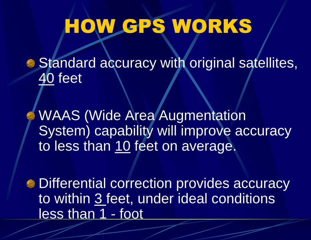
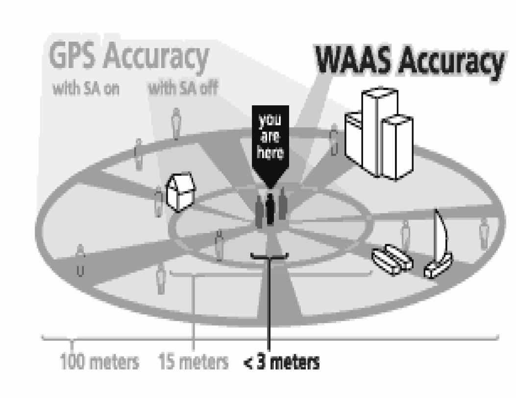
Standard accuracy with original satellites, 40 feet
WAAS (Wide Area Augmentation System) capability will improve accuracy to less than 10 feet on average.
Differential correction provides accuracy to within 3 feet, under ideal conditions less than 1 - foot
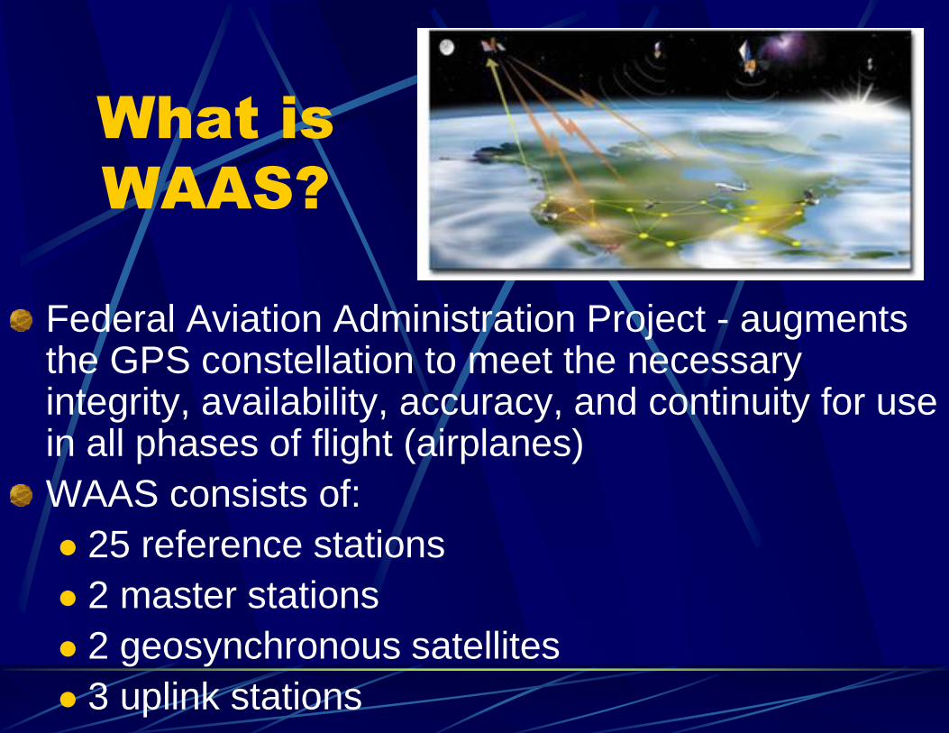
What is
WAAS?
Federal Aviation Administration Project - augments the GPS constellation to meet the necessary integrity, availability, accuracy, and continuity for use in all phases of flight (airplanes)
WAAS consists of:
25 reference stations
2 master stations
2 geosynchronous satellites
3 uplink stations
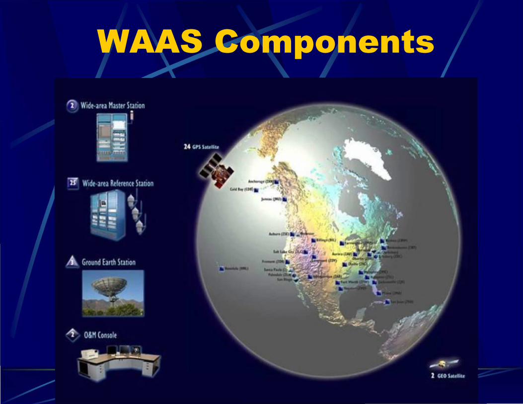
WAAS Components
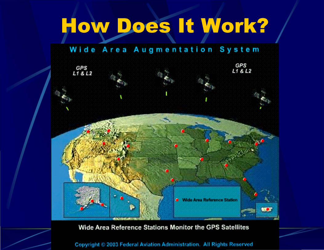
How Does It Work?
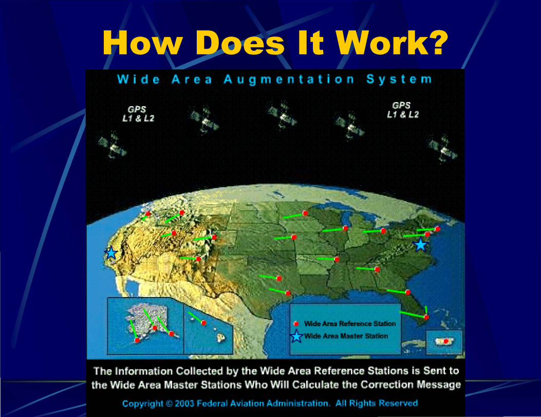
How Does It Work?
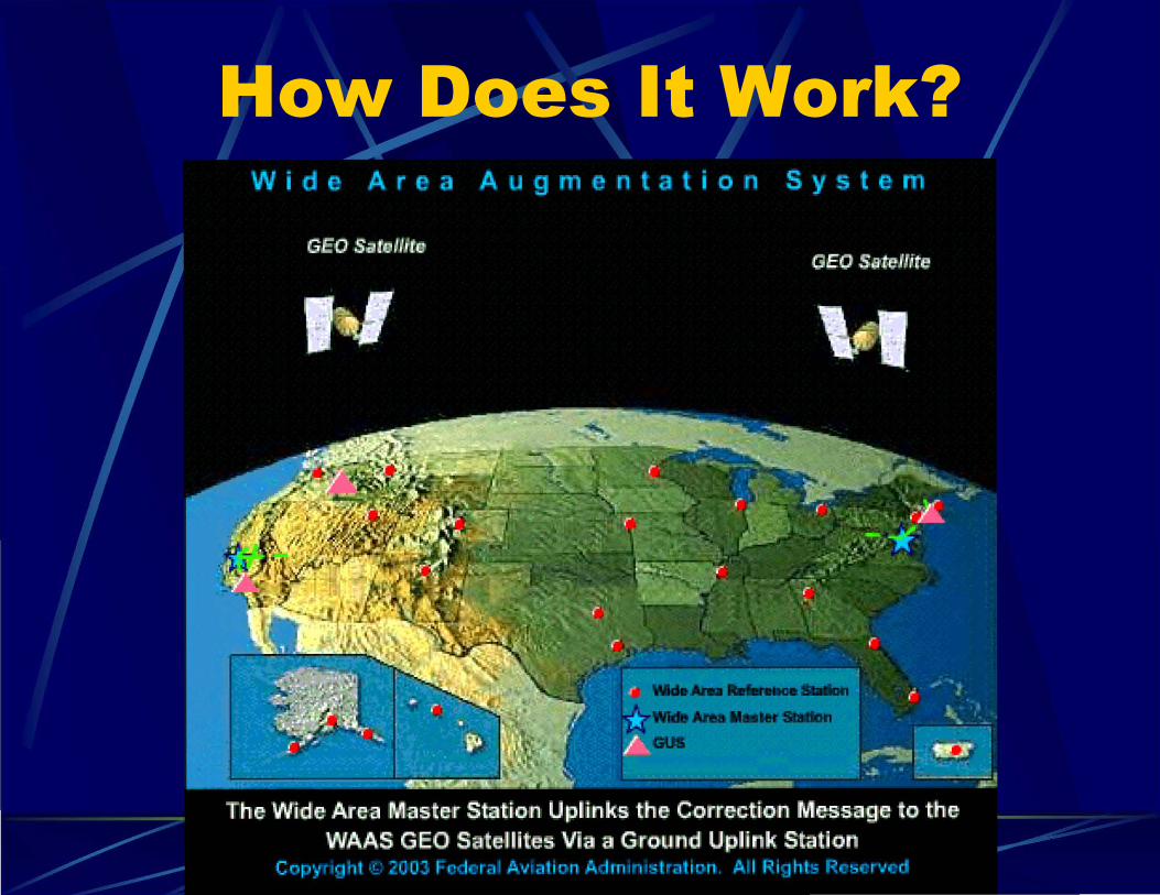
How Does It Work?
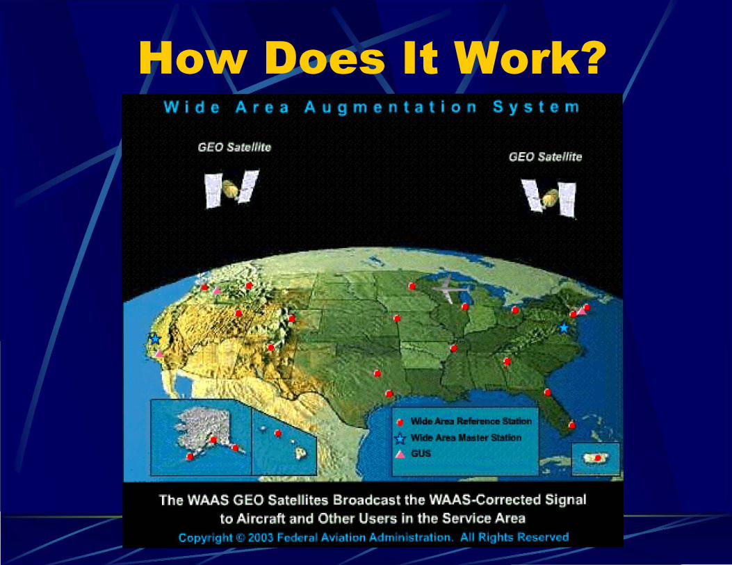
How Does It Work?
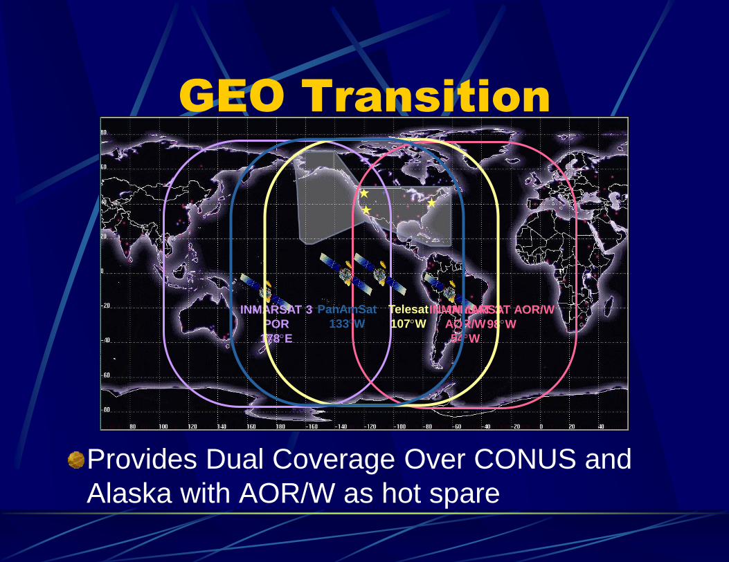
GEO Transition
Provides Dual Coverage Over CONUS and
Alaska with AOR/W as hot spare
INMARSAT 3
AOR/W
54W
INMARSAT 3
POR
178E
INMARSAT AOR/W
98W
Telesat
107W
PanAmSat
133W
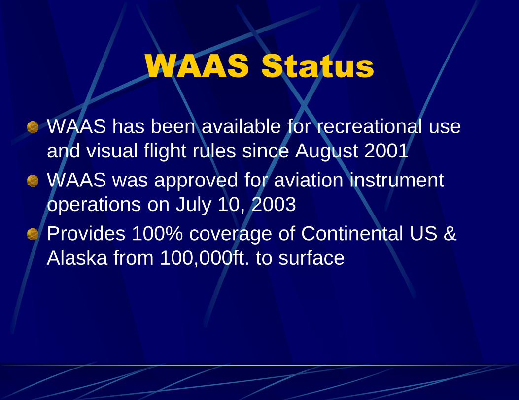
WAAS Status
WAAS has been available for recreational use
and visual flight rules since August 2001
WAAS was approved for aviation instrument
operations on July 10, 2003
Provides 100% coverage of Continental US &
Alaska from 100,000ft. to surface
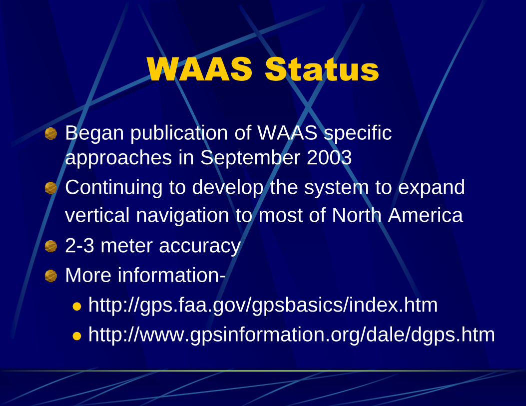
WAAS Status
Began publication of WAAS specific
approaches in September 2003
Continuing to develop the system to expand
vertical navigation to most of North America
2-3 meter accuracy
More information-
http://gps.faa.gov/gpsbasics/index.htm
http://www.gpsinformation.org/dale/dgps.htm
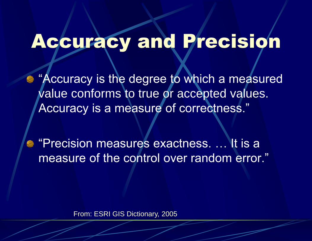
Accuracy and Precision
“Accuracy is the degree to which a measured
value conforms to true or accepted values.
Accuracy is a measure of correctness.”
“Precision measures exactness. … It is a
measure of the control over random error.”
From: ESRI GIS Dictionary, 2005
USGS Accuracy and
Precision Standards
90% of “well-defined points” must be plotted to within 1/50th an inch accuracy on a 1:24,000 scale map which is the equivalent of 40 feet on ground surface.
“Well-defined points are easily visible or recoverable on the ground, such as the following: monuments or markers, property boundary monuments; intersection of roads and railroads; corners of large buildings or structures (or center points of small buildings).”
From: USGS Map Accuracy Standards Fact Sheet FS-171-99 (November 1999)
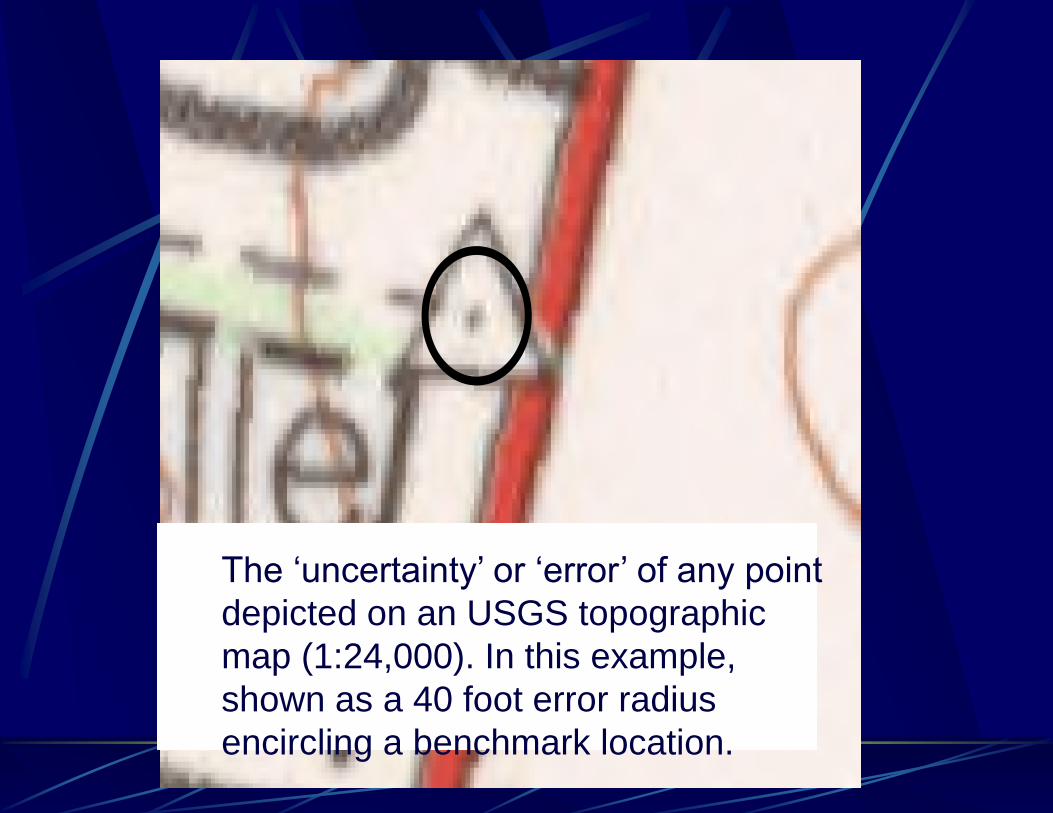
The ‘uncertainty’ or ‘error’ of any point
depicted on an USGS topographic
map (1:24,000). In this example,
shown as a 40 foot error radius
encircling a benchmark location.
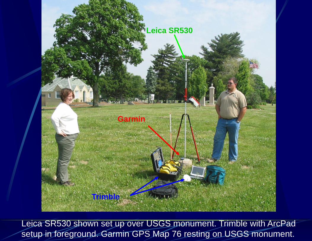
Leica SR530 shown set up over USGS monument. Trimble with ArcPad
setup in foreground. Garmin GPS Map 76 resting on USGS monument.
Garmin
Trimble
Leica SR530
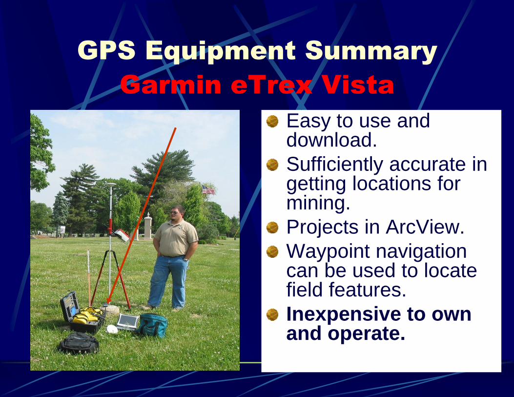
GPS Equipment Summary
Garmin eTrex Vista
Easy to use and download.
Sufficiently accurate in getting locations for mining.
Projects in ArcView.
Waypoint navigation can be used to locate field features.
Inexpensive to own and operate.
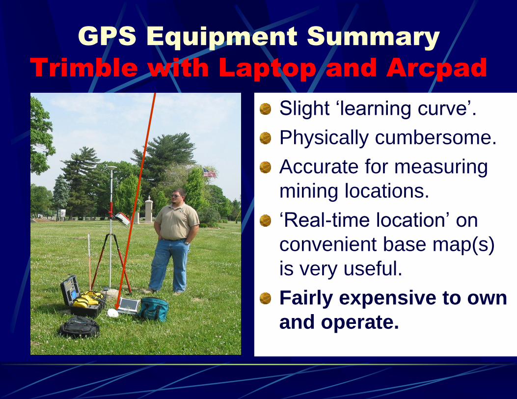
GPS Equipment Summary
Trimble with Laptop and Arcpad
Slight ‘learning curve’.
Physically cumbersome.
Accurate for measuring
mining locations.
‘Real-time location’ on
convenient base map(s)
is very useful.
Fairly expensive to own
and operate.
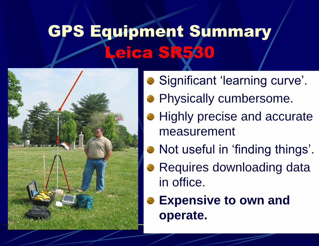
GPS Equipment Summary
Leica SR530
Significant ‘learning curve’.
Physically cumbersome.
Highly precise and accurate
measurement.
Not useful in ‘finding things’.
Requires downloading data
in office.
Expensive to own and
operate.
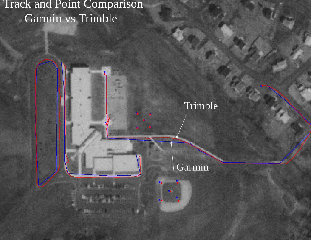
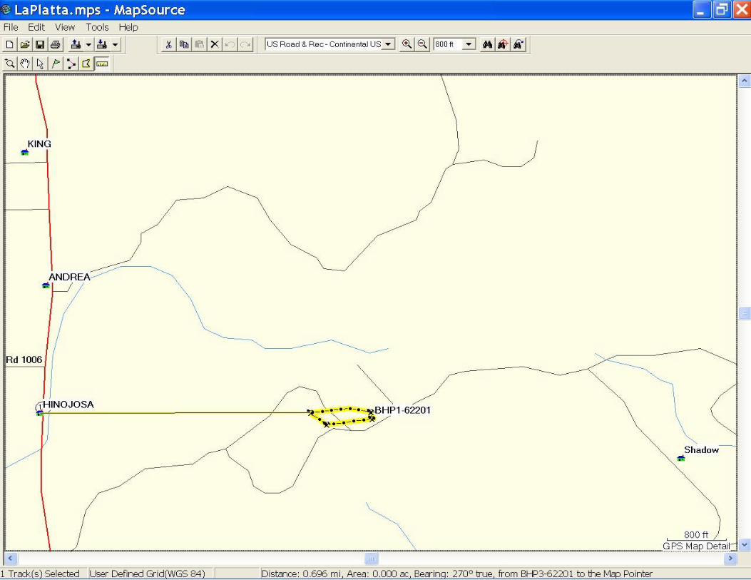
Track and Point Comparison
Garmin vs Trimble
Garmin
Trimble
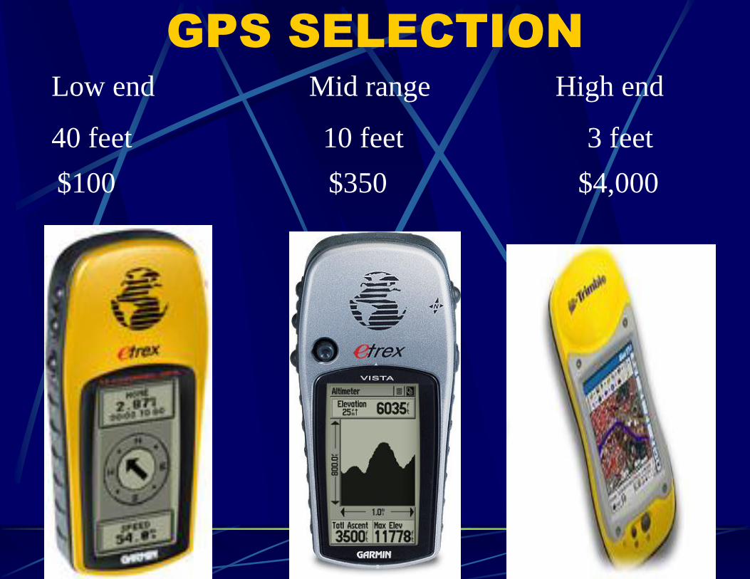
GPS SELECTION
40 feet 10 feet 3 feet
Low end Mid range High end
$100 $350 $4,000
Garmin Etrex (Vista)
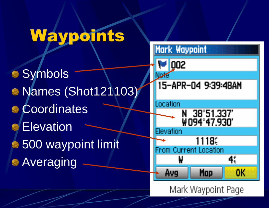
Waypoints
Symbols
Names (Shot121103)
Coordinates
Elevation
500 waypoint limit
Averaging
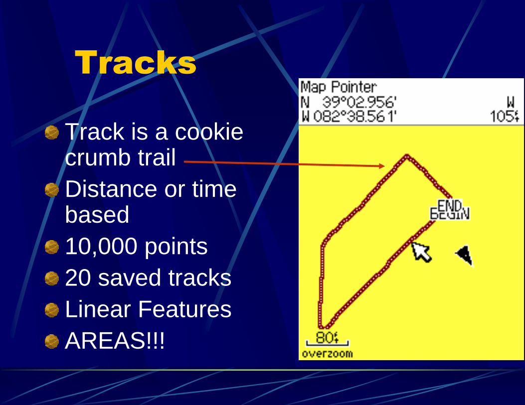
Tracks
Track is a cookie crumb trail
Distance or time based
10,000 points
20 saved tracks
Linear Features
AREAS!!!
Software
Download GPS data to desktop
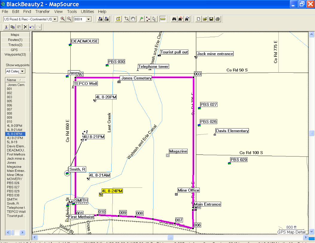
Map Source – Manage the data
Edit data
Save data monthly or by site
AutoCadd conversion .dxf
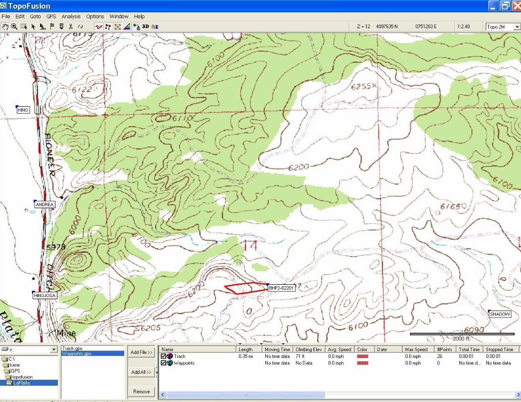
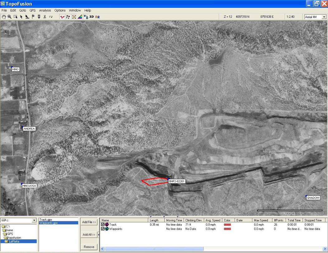
TopoFusion – Display the data
Topographic Maps
Aerial photographs
Conversion – shape files
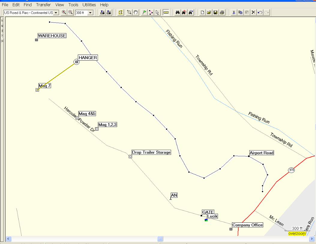
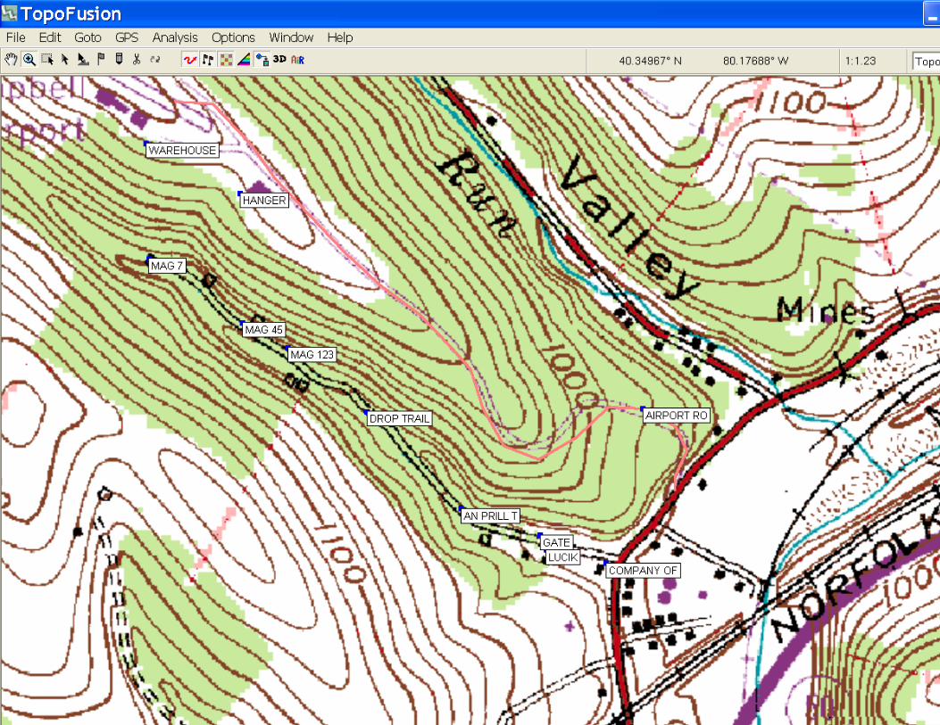

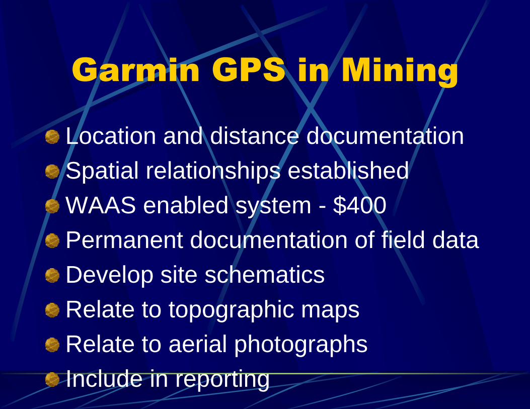
Garmin GPS in Mining
Location and distance documentation
Spatial relationships established
WAAS enabled system - $400
Permanent documentation of field data
Develop site schematics
Relate to topographic maps
Relate to aerial photographs
Include in reporting
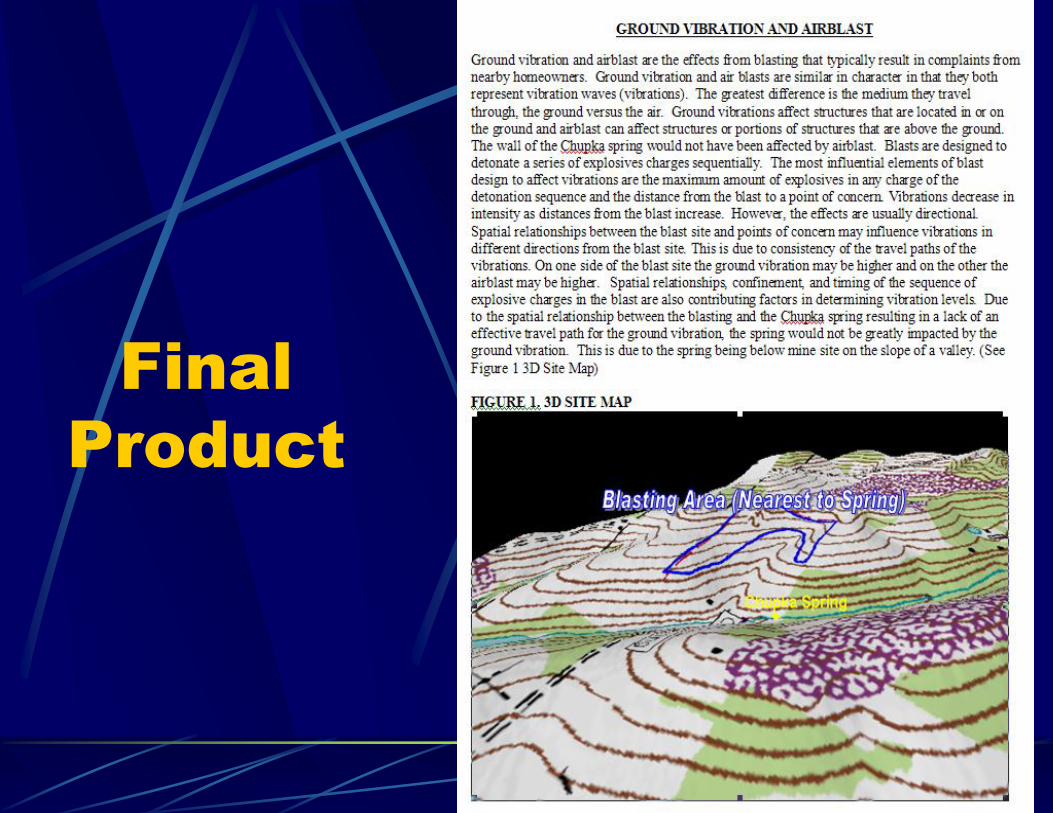
Final
Product
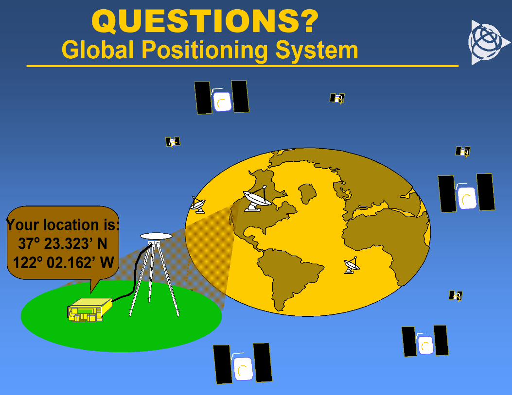
QUESTIONS?
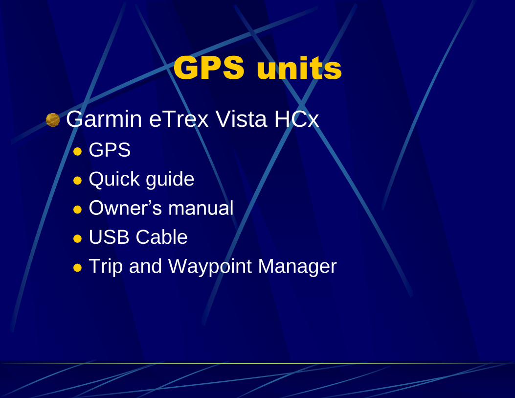
GPS units
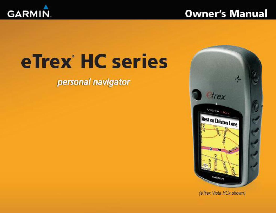
Garmin eTrex Vista HCx
GPS
Quick guide
Owner’s manual
USB Cable
Trip and Waypoint Manager
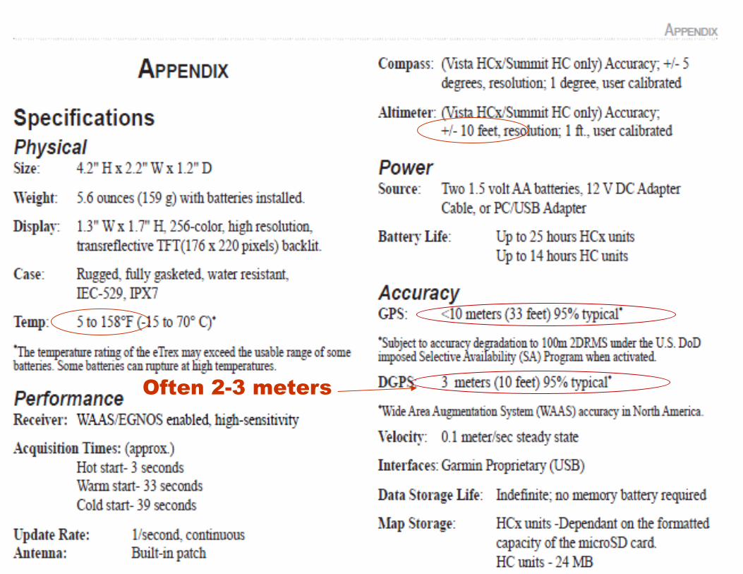
Often 2-3 meters
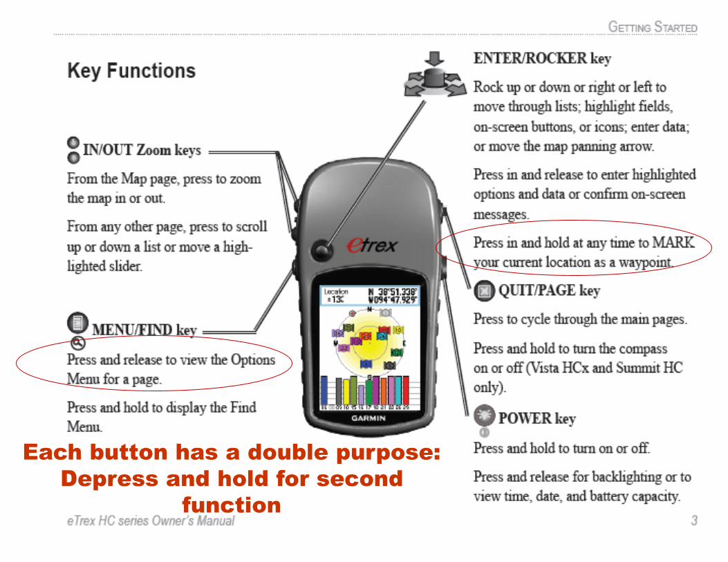
Each button has a double purpose:
Depress and hold for second
function
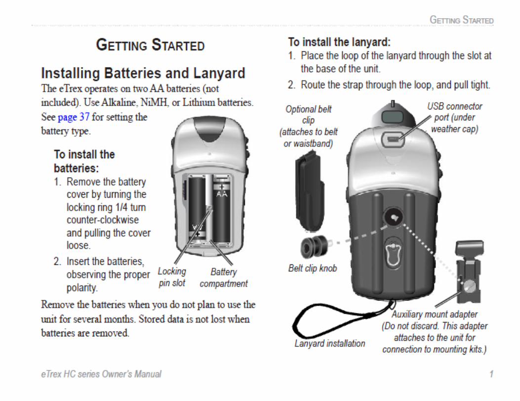
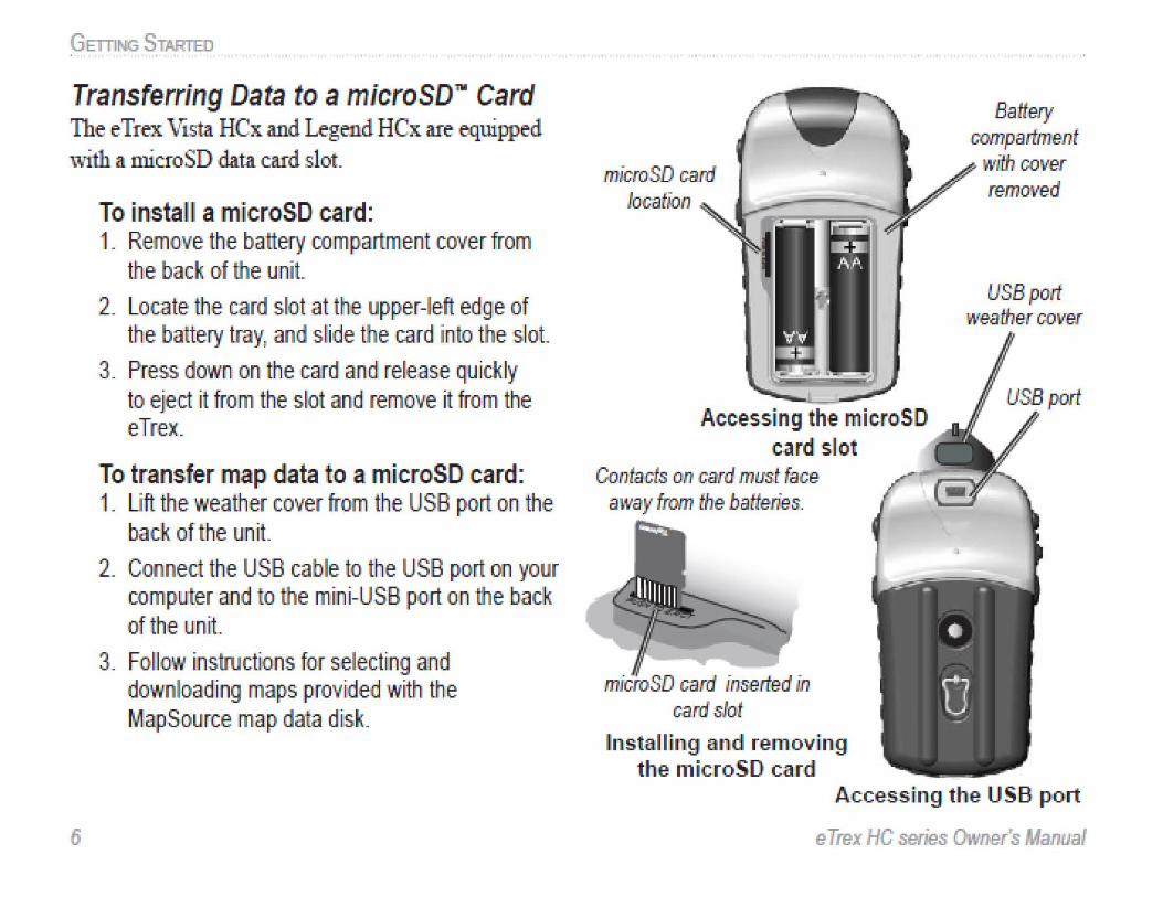
GETTll\lG STARTED
Transferring D~ata to a~ microSDJII Card The eTrex Vts.ta HCx and Legend HCx an- equipped. \\~that m.icroSD data card .slot
6
To insta ~ ~ a m icroSD~ card: 1. R!emove the batlery compartment cover fnlm
the back of the unit
2. Locate the card slot at the upper-left edge of the battery tray; and slide the ca rd into the slot
3_ Pness down on the card and release quickly to eject it from the slot and remove it from the eTrex_
To transfer map data to a microSD card: 1. Uft the weather cover from the USB port on the
badk of the urn it
2. Conneot the USB cable to the USB port on your computer and to the mini-USB port orn the baok of the unit.
3. Follow instructiorns for selectirng and downloadirng maps p rovide~ with the MapS ou rce map data disk_
microSD card location
Accessing the m i c roSD card :s~ot
Contacfs on card must face mvay from the batteries.
microSD card inserted in card slot
In st aJII ~n g and removing the 1nioroSD ca rd
Battery oomparlment
with oo~er tem0\1\ed
USB pod weather oo~er
A,ccess'ng the USB port
e T rex HC series Owner's Manual
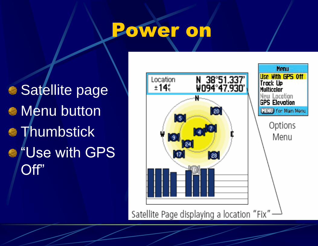
Power on
Satellite page
Menu button
Thumbstick
“Use with GPS
Off”
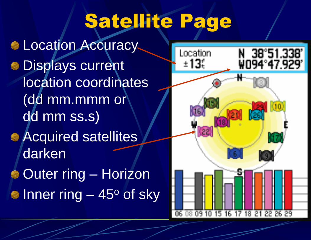
Satellite Page
Location Accuracy
Displays current
location coordinates
(dd mm.mmm or
dd mm ss.s)
Acquired satellites
darken
Outer ring – Horizon
Inner ring – 45o of sky
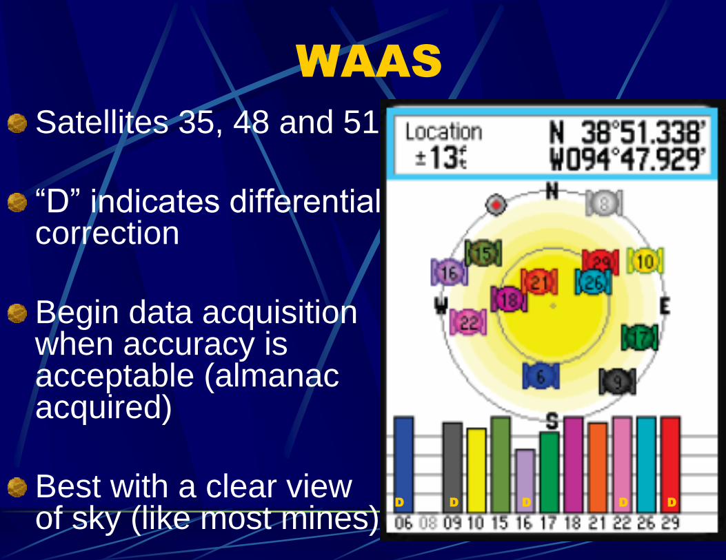
WAAS
Satellites 35, 48 and 51
“D” indicates differential correction
Begin data acquisition when accuracy is acceptable (almanac acquired)
Best with a clear view of sky (like most mines)
D D D D D
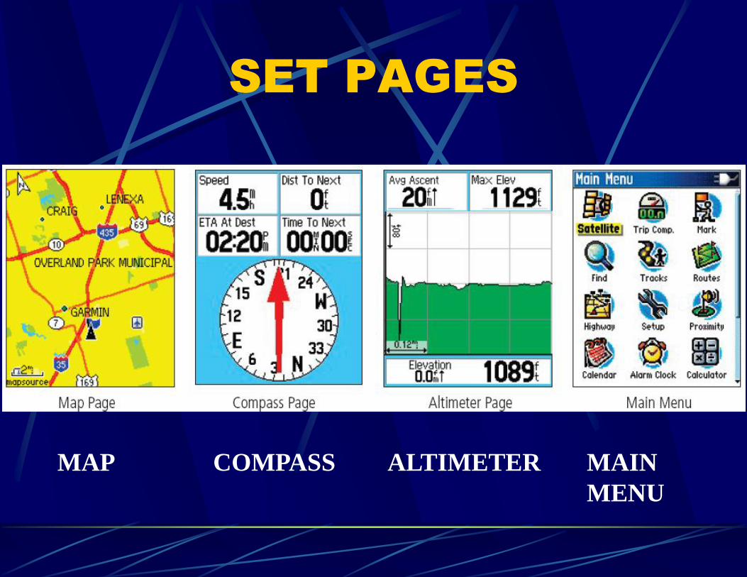
SET PAGES
MAP ALTIMETER MAIN
MENU
COMPASS
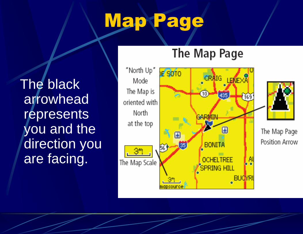
Map Page
The black arrowhead represents you and the direction you are facing.
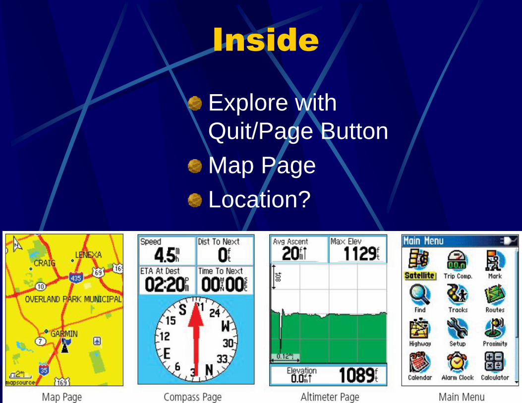
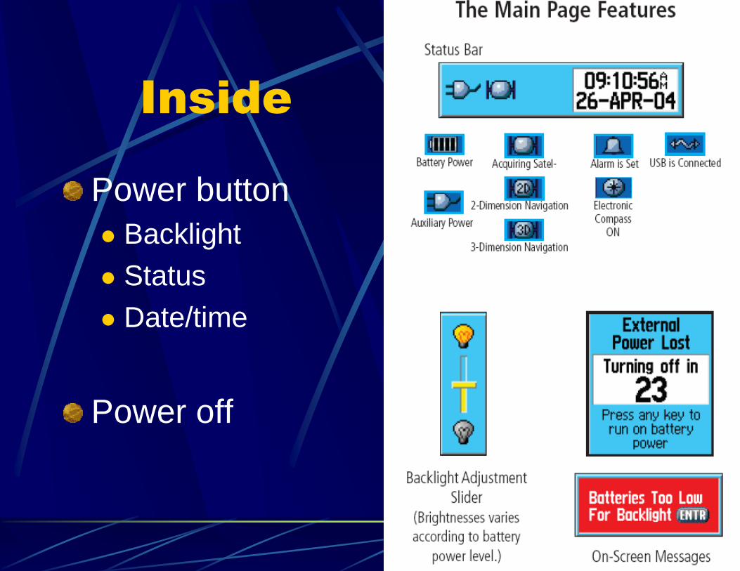
Inside
Explore with
Quit/Page Button
Map Page
Location?
Inside
Power button
Backlight
Status
Date/time
Power off
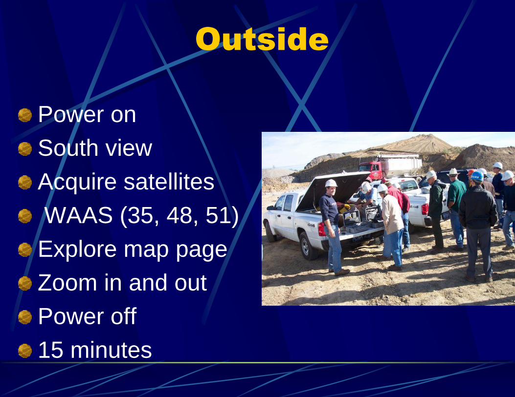
Outside
Power on
South view
Acquire satellites
WAAS (35, 48, 51)
Explore map page
Zoom in and out
Power off
15 minutes
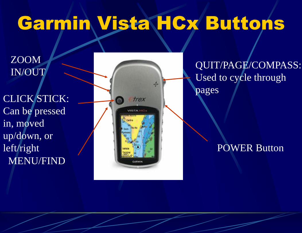
Garmin Vista HCx Buttons
POWER Button
QUIT/PAGE/COMPASS:
Used to cycle through
pages
ZOOM
IN/OUT
CLICK STICK:
Can be pressed
in, moved
up/down, or
left/right
MENU/FIND