Embed Size (px)
Citation preview
1
2nd FIG Reginal Conference2nd FIG Reginal Conference
�� El El HassaneHassane SEMLALISEMLALIInstitut Agronomique et VInstitut Agronomique et Vééttéérinaire Hassan IIrinaire Hassan II
FiliFilièère de Formation en Topographiere de Formation en Topographie
Email: Email: e.semlalie.semlali@@iaviavii.ac.ma.ac.ma
SSèèddééhouhou J. AZONJ. AZON
IGT IGT surveyingsurveying
ElarbiElarbi ELARCHIELARCHI, , civil civil engineerengineer
Division des Travaux de Contournement de Division des Travaux de Contournement de
CasablancaCasablanca
2nd FIG Reginal Conference2nd FIG Reginal Conference
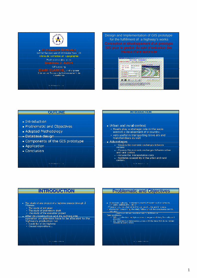
Design and Implementation of GIS prototype Design and Implementation of GIS prototype for the fulfillment of a highwayfor the fulfillment of a highway’’s workss works
Conception et dConception et dééveloppementveloppement dd’’un prototype un prototype SIG pour la gestion du suivi dSIG pour la gestion du suivi d’’exexéécution des cution des
travaux dtravaux d’’une autorouteune autoroute
2nd FIG Reginal Conference2nd FIG Reginal Conference
�� IntroductionIntroduction
�� Problematic and ObjectivesProblematic and Objectives
�� Adopted Methodology Adopted Methodology
�� Database designDatabase design
�� Components of the GIS prototypeComponents of the GIS prototype
�� Application Application
�� ConclusionConclusion
OUTLINEOUTLINE
2nd FIG Reginal Conference2nd FIG Reginal Conference
�� Urban and rural contextUrban and rural context•• Roads play a strategic role in the socio Roads play a strategic role in the socio
economic development of a country, economic development of a country,
•• very useful in transporting travelers and very useful in transporting travelers and merchandises as well merchandises as well
�� AdvantagesAdvantages�� -- Ensures the economic exchanges between Ensures the economic exchanges between
regionsregions
�� -- Ensures the economic exchanges between urban Ensures the economic exchanges between urban and rural centersand rural centers
�� -- reduces the transportation costs reduces the transportation costs
�� -- facilitates accessibility in the urban and rural facilitates accessibility in the urban and rural centers.centers.
INTRODUCTIONINTRODUCTION
2nd FIG Reginal Conference2nd FIG Reginal Conference
�� The study of any project of a highway passes throughThe study of any project of a highway passes through 3 3 Phases: Phases: •• The study of definitionThe study of definition
•• The study of preliminary draftThe study of preliminary draft
•• The study of the execution projectThe study of the execution project
�� After its construction and its putting into After its construction and its putting into operation an attention have to be allocated to the operation an attention have to be allocated to the highwayhighway’’s production runs production run•• feasibility of the highway feasibility of the highway
•• Caused expenditure... Caused expenditure...
INTRODUCTIONINTRODUCTION
2nd FIG Reginal Conference2nd FIG Reginal Conference
�� Moroccan highway inheritance counts thousands of structures Moroccan highway inheritance counts thousands of structures (bridges, aqueducts,(bridges, aqueducts,……etc.).etc.).
-- These structures change in the course of time and in space.These structures change in the course of time and in space.
-- information concerning the daily followinformation concerning the daily follow--up of the structures carried up of the structures carried out are :out are :
-- graphic and alphanumeric documents for its followgraphic and alphanumeric documents for its follow--upsups
Data problems: Data problems: •• Difficult collection: multiple sources: divergence of data, TopiDifficult collection: multiple sources: divergence of data, Topicality and cality and
precisionprecision•• are managed in a heterogeneous way with the tools that do no loare managed in a heterogeneous way with the tools that do no longer nger
respond to userrespond to user’’s needss needs
Problematic and ObjectivesProblematic and Objectives
2
2nd FIG Reginal Conference2nd FIG Reginal Conference
ConsequentlyConsequently�� the decisionthe decision--making concerning an operation of positioning making concerning an operation of positioning
raises enormous difficulties of management and very long raises enormous difficulties of management and very long time of research.time of research.
�� adding problems of data collection after construction of a adding problems of data collection after construction of a highway.highway.
ThereforeTherefore, the development of a GIS then becomes a , the development of a GIS then becomes a necessity.necessity.
�� Within this framework, and with the assistance of the Within this framework, and with the assistance of the Division of the ByDivision of the By--pass Highway of Casablanca that we pass Highway of Casablanca that we propose to propose to
�� Design and implement a GIS prototype for the Design and implement a GIS prototype for the fulfillment of a highwayfulfillment of a highway’’s workss works
and and
�� prepare a management system of the highway's prepare a management system of the highway's inheritanceinheritance
Problematic and ObjectivesProblematic and Objectives
2nd FIG Reginal Conference2nd FIG Reginal Conference
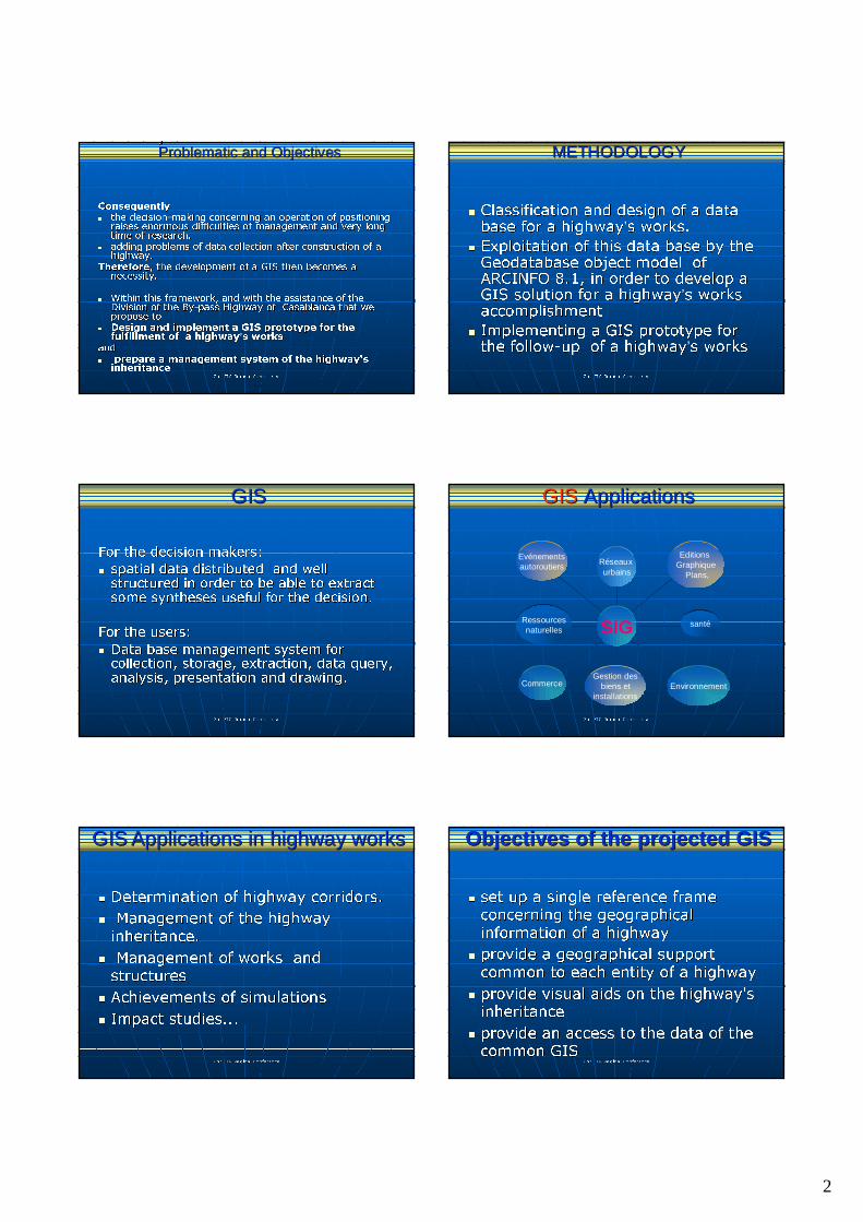
�� Classification and design of a data Classification and design of a data base for a highwaybase for a highway’’s works.s works.
�� Exploitation of this data base by the Exploitation of this data base by the GeodatabaseGeodatabase object model of object model of ARCINFO 8.1, in order to develop a ARCINFO 8.1, in order to develop a GIS solution for a highwayGIS solution for a highway’’s works s works accomplishmentaccomplishment
�� Implementing a GIS prototype for Implementing a GIS prototype for the followthe follow--up of a highwayup of a highway’’s works s works
METHODOLOGYMETHODOLOGY
2nd FIG Reginal Conference2nd FIG Reginal Conference
For the decision makers:For the decision makers:
�� spatial data distributed and well spatial data distributed and well structured in order to be able to extract structured in order to be able to extract some syntheses useful for the decision. some syntheses useful for the decision.
For the users:For the users:
�� Data base management system for Data base management system for collection, storage, extraction, data query, collection, storage, extraction, data query, analysis, presentation and drawing.analysis, presentation and drawing.
GISGIS
2nd FIG Reginal Conference2nd FIG Reginal Conference
Evénementsautoroutiers
Ressourcesnaturelles
CommerceGestion des
biens et installations
Environnement
santé
Editions Graphique
Plans,
Réseaux urbains
SIG
GISGIS ApplicationsApplications
2nd FIG Reginal Conference2nd FIG Reginal Conference
�� Determination of highway corridors.Determination of highway corridors.
�� Management of the highway Management of the highway
inheritance. inheritance.
�� Management of works and Management of works and structuresstructures
�� Achievements of simulationsAchievements of simulations
�� Impact studies...Impact studies...
GISGIS Applications in highway worksApplications in highway works
2nd FIG Reginal Conference2nd FIG Reginal Conference
�� set up a single reference frame set up a single reference frame concerning the geographical concerning the geographical
information of a highwayinformation of a highway
�� provide a geographical support provide a geographical support
common to each entity of a highway common to each entity of a highway
�� provide visual aids on the highway's provide visual aids on the highway's inheritance inheritance
�� provide an access to the data of the provide an access to the data of the common GIS common GIS
Objectives of the projected GISObjectives of the projected GIS
3
2nd FIG Reginal Conference2nd FIG Reginal Conference
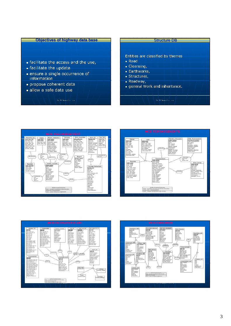
�� facilitate the access and the use,facilitate the access and the use,
�� facilitate the updatefacilitate the update
�� ensure a single occurrence of ensure a single occurrence of information information
�� propose coherent datapropose coherent data
�� allow a safe data useallow a safe data use
Objectives of highway data baseObjectives of highway data base
2nd FIG Reginal Conference2nd FIG Reginal Conference
Entities are classified by themesEntities are classified by themes
�� RoadRoad
�� Cleansing, Cleansing,
�� Earthworks,Earthworks,
�� Structures,Structures,
�� Roadway, Roadway,
�� general Work and inheritance.general Work and inheritance.
Structure DBStructure DB
2nd FIG Reginal Conference2nd FIG Reginal Conference
MCD ASSAINISSEMENT
2nd FIG Reginal Conference2nd FIG Reginal Conference
MCD TERRASSEMENTS
2nd FIG Reginal Conference2nd FIG Reginal Conference
MCD OUVRAGES D’ART
2nd FIG Reginal Conference2nd FIG Reginal Conference
MCD CHAUSSEE
4
2nd FIG Reginal Conference2nd FIG Reginal Conference
MCD TRAVAUX GENERAUX ET PATRIMOINE
2nd FIG Reginal Conference2nd FIG Reginal Conference
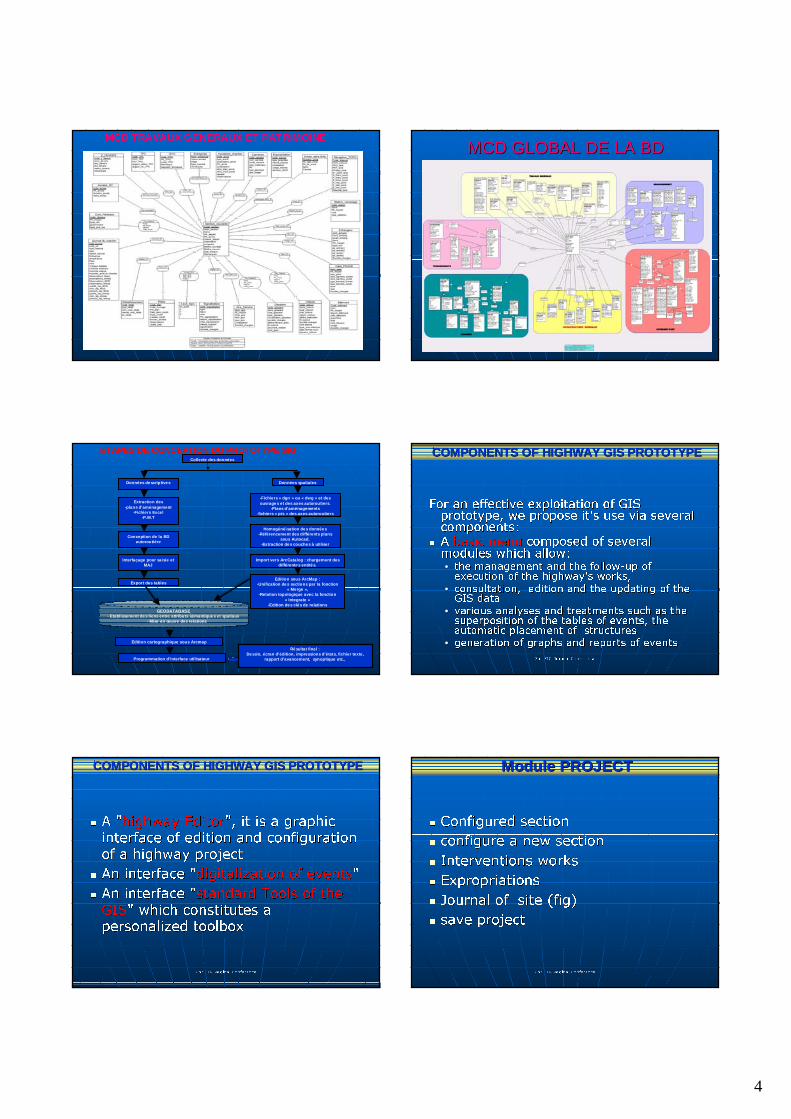
MCD GLOBAL DE LA BDMCD GLOBAL DE LA BD
2nd FIG Reginal Conference2nd FIG Reginal Conference
Collecte des données
GEODATABASE- Etablissement des liens entre attributs sémantiques et spatiaux
- Mise en œuvre des relations
Extraction des-plans d’aménagement
-Fichiers Excel-P.M.T
Conception de la BD autoroutière
Interfaçage pour saisie et MAJ
-Fichiers « dgn » ou « dwg » et des ouvrages et des axes autoroutiers.
-Plans d’aménagements-fichiers « pis » des axes autoroutiers
Homogénéisation des données-Référencement des différents plans
sous Autocad.-Extraction des couches à utiliser
Import vers ArcCatalog : chargement des différentes entités.
Export des tablesEdition sous ArcMap :
-Unification des sections par la fonction « Merge »,
-Relation topologique avec la fonction« Integrate »
-Edition des clés de relations
Edition cartographique sous Arcmap
Programmation d’interface utilisateur
Données spatialesDonnées descriptives
Résultat final :Dessin, écran d’édition, impressions d’états, fichier texte,
rapport d’avancement, synoptique etc.,
ETAPES DE CONCEPTION DU PROTOTYPE SIG
2nd FIG Reginal Conference2nd FIG Reginal Conference
For an effective exploitation of GIS For an effective exploitation of GIS prototype, we propose it's use via several prototype, we propose it's use via several components:components:
�� A A basic menubasic menu composed of several composed of several modules which allow: modules which allow: •• the management and the followthe management and the follow--up of up of
execution of the highway's works,execution of the highway's works,
•• consultation, edition and the updating of the consultation, edition and the updating of the GIS dataGIS data
•• various analyses and treatments such as the various analyses and treatments such as the superposition of the tables of events, the superposition of the tables of events, the automatic placement of structuresautomatic placement of structures
•• generation of graphs and reports of eventsgeneration of graphs and reports of events
COMPONENTS OF HIGHWAY GIS PROTOTYPECOMPONENTS OF HIGHWAY GIS PROTOTYPE
2nd FIG Reginal Conference2nd FIG Reginal Conference
�� A "A "highway Editorhighway Editor", it is a graphic ", it is a graphic interface of edition and configuration interface of edition and configuration
of a highway projectof a highway project
�� An interface "An interface "digitalization of eventsdigitalization of events""
�� An interface "An interface "standard Tools of the standard Tools of the
GISGIS" which constitutes a " which constitutes a personalized toolboxpersonalized toolbox
COMPONENTS OF HIGHWAY GIS PROTOTYPECOMPONENTS OF HIGHWAY GIS PROTOTYPE
2nd FIG Reginal Conference2nd FIG Reginal Conference
�� Configured sectionConfigured section
�� configure a new section configure a new section
�� Interventions worksInterventions works
�� ExpropriationsExpropriations
�� Journal of site (fig)Journal of site (fig)
�� save projectsave project
Module PROJECTModule PROJECT
5
2nd FIG Reginal Conference2nd FIG Reginal Conference
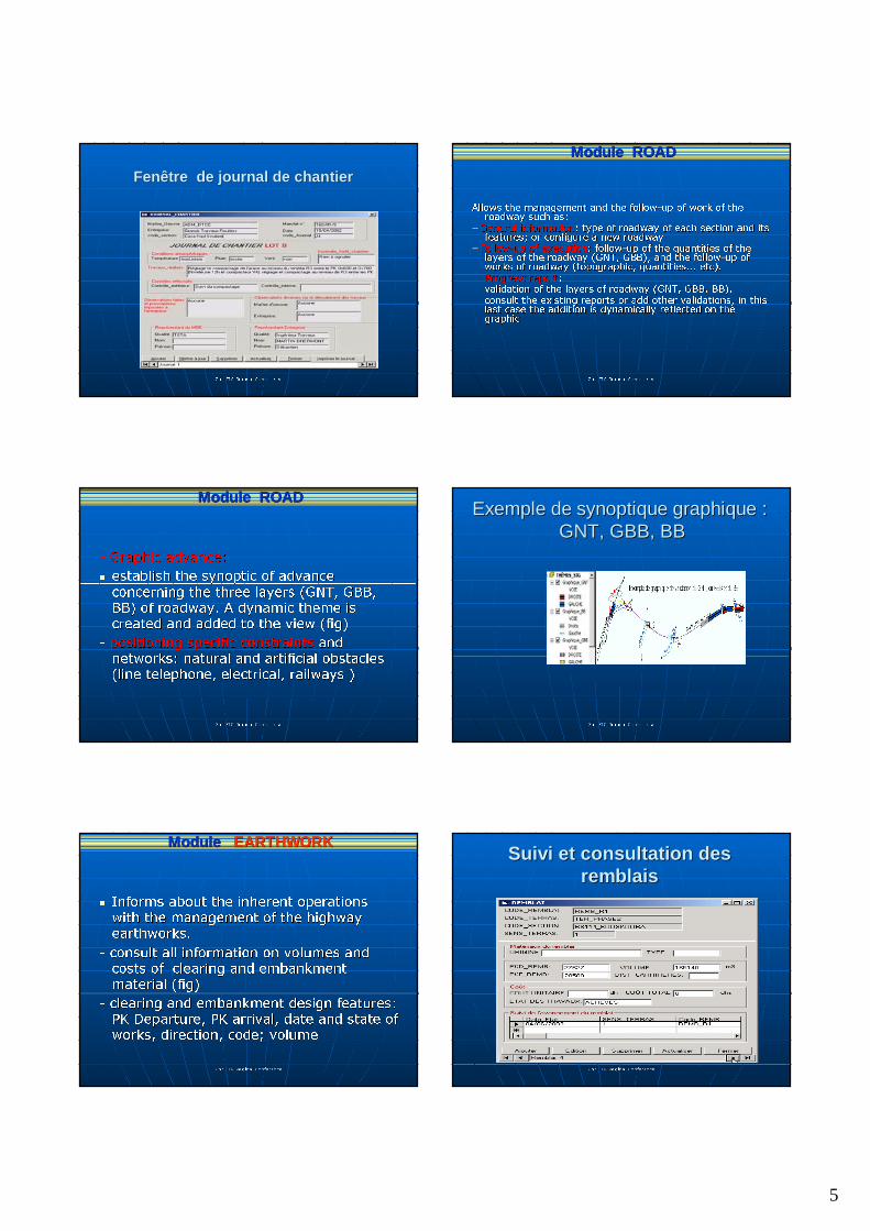
FenFenêêtre de journal de chantiertre de journal de chantier
2nd FIG Reginal Conference2nd FIG Reginal Conference
Allows the management and the followAllows the management and the follow--up of work of the up of work of the roadway such as:roadway such as:
-- General informationGeneral information: type of roadway of each section and its : type of roadway of each section and its features; or configure a new roadwayfeatures; or configure a new roadway
-- FollowFollow--up of executionup of execution: follow: follow--up of the quantities of the up of the quantities of the layers of the roadway (GNT, GBB), and the followlayers of the roadway (GNT, GBB), and the follow--up of up of works of roadway (topographic, quantities... etc).works of roadway (topographic, quantities... etc).
-- Progress reportProgress report::-- validation of the layers of roadway (GNT, GBB, BB). validation of the layers of roadway (GNT, GBB, BB). -- consult the existing reports or add other validations, in this consult the existing reports or add other validations, in this
last case the addition is dynamically reflected on the last case the addition is dynamically reflected on the graphicgraphic
Module ROADModule ROAD
2nd FIG Reginal Conference2nd FIG Reginal Conference
-- Graphic advance:Graphic advance:
�� establish the synoptic of advance establish the synoptic of advance
concerning the three layers (GNT, GBB, concerning the three layers (GNT, GBB, BB) of roadway. A dynamic theme is BB) of roadway. A dynamic theme is created and added to the view (fig)created and added to the view (fig)
-- positioning specific constraintspositioning specific constraints and and networks: natural and artificial obstacles networks: natural and artificial obstacles (line telephone, electrical, railways )(line telephone, electrical, railways )
Module ROADModule ROAD
2nd FIG Reginal Conference2nd FIG Reginal Conference
Exemple de synoptique graphiqueExemple de synoptique graphique : : GNT, GBB, BBGNT, GBB, BB
2nd FIG Reginal Conference2nd FIG Reginal Conference
�� Informs about the inherent operations Informs about the inherent operations with the management of the highway with the management of the highway earthworks. earthworks.
-- consult all information on volumes and consult all information on volumes and costs of clearing and embankment costs of clearing and embankment material (fig)material (fig)
-- clearing and embankment design features: clearing and embankment design features: PK Departure, PK arrival, date and state of PK Departure, PK arrival, date and state of works, direction, code; volumeworks, direction, code; volume
Module Module EARTHWORKEARTHWORK
2nd FIG Reginal Conference2nd FIG Reginal Conference
Suivi et consultation des Suivi et consultation des remblaisremblais
6
2nd FIG Reginal Conference2nd FIG Reginal Conference
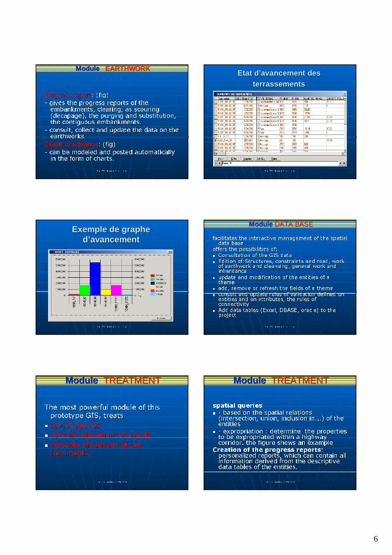
Progress reportProgress report: (fig): (fig)
-- gives the progress reports of the gives the progress reports of the embankments, clearing, as scouring embankments, clearing, as scouring ((decapagedecapage), the purging and substitution, ), the purging and substitution, the contiguous embankments.the contiguous embankments.
-- consult, collect and update the data on the consult, collect and update the data on the earthworks.earthworks.
Graph of advanceGraph of advance: (fig): (fig)
-- can be modeled and posted automatically can be modeled and posted automatically in the form of charts.in the form of charts.
Module Module EARTHWORKEARTHWORK
2nd FIG Reginal Conference2nd FIG Reginal Conference
Etat dEtat d’’avancement des avancement des terrassementsterrassements
2nd FIG Reginal Conference2nd FIG Reginal Conference
Exemple de graphe Exemple de graphe dd’’avancementavancement
2nd FIG Reginal Conference2nd FIG Reginal Conference
facilitates the interactive management of the spatial facilitates the interactive management of the spatial data basedata base
offers the possibilities of:offers the possibilities of:
�� Consultation of the GIS data Consultation of the GIS data �� Edition Edition of:Structuresof:Structures, constraints and road, work , constraints and road, work
of earthwork and cleansing, general work and of earthwork and cleansing, general work and inheritanceinheritance
�� update and modification of the entities of a update and modification of the entities of a themetheme
�� add, remove or refresh the fields of a theme add, remove or refresh the fields of a theme
�� consult and update rules of validation defined on consult and update rules of validation defined on entities and on attributes, the rules of entities and on attributes, the rules of connectivityconnectivity
�� Add data tables (Excel, DBASE, oracle) to the Add data tables (Excel, DBASE, oracle) to the projectproject
Module Module DATA BASEDATA BASE
2nd FIG Reginal Conference2nd FIG Reginal Conference
The most powerful module of this The most powerful module of this prototype GIS, treatsprototype GIS, treats
�� spatial queriesspatial queries
�� dynamic placement of eventsdynamic placement of events
�� presents the results of the presents the results of the
treatments.treatments.
Module Module TREATMENTTREATMENT
2nd FIG Reginal Conference2nd FIG Reginal Conference
spatial queriesspatial queries�� -- based on the spatial relations based on the spatial relations
(intersection, union, inclusion in...) of the (intersection, union, inclusion in...) of the entitiesentities
�� -- expropriation : determine the properties expropriation : determine the properties to be expropriated within a highway to be expropriated within a highway corridor. the figure shows an example corridor. the figure shows an example
Creation of the progress reportsCreation of the progress reports: : personalized reports, which can contain all personalized reports, which can contain all information derived from the descriptive information derived from the descriptive data tables of the entities.data tables of the entities.
Module Module TREATMENTTREATMENT
7
2nd FIG Reginal Conference2nd FIG Reginal Conference
Highway corridorHighway corridor
2nd FIG Reginal Conference2nd FIG Reginal Conference
Dynamic placement of punctual or linear objects per PKDynamic placement of punctual or linear objects per PK..
Creation of dynamic graphic themes from text filesCreation of dynamic graphic themes from text files�� creates a graphic theme for any information referred by Cartesiacreates a graphic theme for any information referred by Cartesian n
coordinates (x, y), stored in the data base (table or text file)coordinates (x, y), stored in the data base (table or text file) the the theme will be added automatically to the view theme will be added automatically to the view
Adding CAD plans in 2 waysAdding CAD plans in 2 ways-- As a drawing: viewed such as conceived in the CAD software, As a drawing: viewed such as conceived in the CAD software,
preserving its characteristics: no analysis possiblepreserving its characteristics: no analysis possible-- As a layer: plan converted with GIS format, used as a theme and As a layer: plan converted with GIS format, used as a theme and
possibility of analysispossibility of analysis
Posting graphic symbols of the PK and PC Posting graphic symbols of the PK and PC
Analysis of eventsAnalysis of events�� punctualpunctual--linear analysis, linear analysis, �� linearlinear--linear analysis. linear analysis.
Module Module TREATMENTTREATMENT
2nd FIG Reginal Conference2nd FIG Reginal Conference
Exemple de reprExemple de repréésentation sentation graphique d'graphique d'éévvéénements nements
ponctuels reprponctuels repréésentant les sentant les accidents accidents
2nd FIG Reginal Conference2nd FIG Reginal Conference
Exemple de reprExemple de repréésentation sentation graphique d'graphique d'éévvéénements linnements linééaires aires
QualitQualitéé de la chaussde la chausséée sur diffe sur difféérentes sectionsrentes sections
2nd FIG Reginal Conference2nd FIG Reginal Conference
�� Placement of the PK in lengthPlacement of the PK in length: automatically on a portion of the : automatically on a portion of the selected road, starting from the PK D of the road. (the selected road, starting from the PK D of the road. (the PkPk No No origin , the scale factor )origin , the scale factor )
�� Initialization of the Initialization of the PkPk NoNo: allows the user to specify, for a new : allows the user to specify, for a new configured road, starting configured road, starting PkPk No, the No, the PkPk No arrival, the other No arrival, the other PkPkwill be automatically interpolated will be automatically interpolated
�� Interpolations of the zones without Interpolations of the zones without PkPk NoNo: starting from the : starting from the sections where PK are defined, sections where PK are defined, PKsPKs can be calculated for all the can be calculated for all the zones without PK No zones without PK No
�� remove all the PK of the activated roadremove all the PK of the activated road. . �� reverse the order of the PKreverse the order of the PK: allows to change the order of the : allows to change the order of the PKsPKs
and to traverse the road in the increasing direction of the PK oand to traverse the road in the increasing direction of the PK or in r in the contrary direction. the contrary direction.
�� change the origin of the PKchange the origin of the PK
FFunctions of theunctions of the "highway Editor""highway Editor"
2nd FIG Reginal Conference2nd FIG Reginal Conference
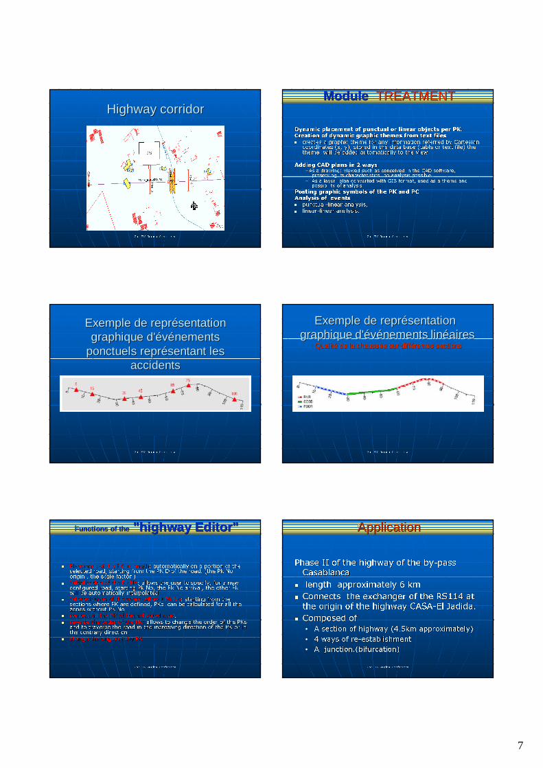
Phase II of the highway of the byPhase II of the highway of the by--pass pass Casablanca Casablanca
�� length approximately 6 kmlength approximately 6 km
�� Connects the exchanger of the RS114 at Connects the exchanger of the RS114 at the origin of the highway CASAthe origin of the highway CASA--El El JadidaJadida..
�� Composed ofComposed of
•• A section of highway (4.5km approximately)A section of highway (4.5km approximately)
•• 4 ways of re4 ways of re--establishmentestablishment
•• A A junction.(bifurcationjunction.(bifurcation))
ApplicationApplication
8
2nd FIG Reginal Conference2nd FIG Reginal Conference
Application to phase II of the Application to phase II of the highway of Casablanca highway of Casablanca
2nd FIG Reginal Conference2nd FIG Reginal Conference
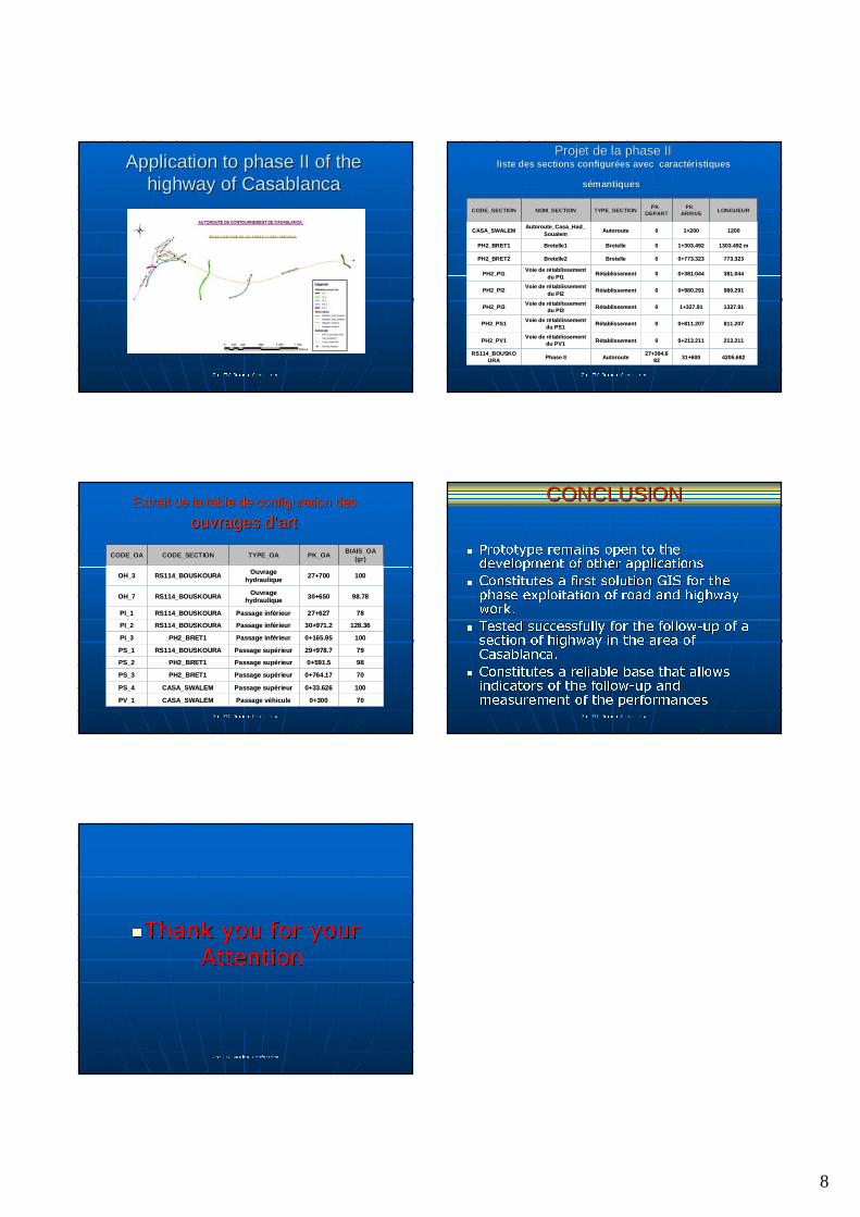
Projet de la phase II Projet de la phase II liste des sections configurliste des sections configuréées avec caractes avec caractééristiques ristiques
sséémantiquesmantiques
4205.6824205.68231+60031+60027+394.627+394.6
8282AutorouteAutoroutePhase IIPhase IIRS114_BOUSKORS114_BOUSKO
URAURA
213.211213.2110+213.2110+213.21100RRéétablissementtablissementVoie de rVoie de réétablissement tablissement
du PV1du PV1PH2_PV1PH2_PV1
811.207811.2070+811.2070+811.20700RRéétablissementtablissementVoie de rVoie de réétablissement tablissement
du PS1du PS1PH2_PS1PH2_PS1
1327.911327.911+327.911+327.9100RRéétablissementtablissementVoie de rVoie de réétablissement tablissement
du PI3du PI3PH2_PI3PH2_PI3
980.291980.2910+980.2910+980.29100RRéétablissementtablissementVoie de rVoie de réétablissement tablissement
du PI2du PI2PH2_PI2PH2_PI2
381.044381.0440+381.0440+381.04400RRéétablissementtablissementVoie de rVoie de réétablissement tablissement
du PI1du PI1PH2_PI1PH2_PI1
773.323773.3230+773.3230+773.32300BretelleBretelleBretelle2Bretelle2PH2_BRET2PH2_BRET2
1303.492 m1303.492 m1+303.4921+303.49200BretelleBretelleBretelle1Bretelle1PH2_BRET1PH2_BRET1
120012001+2001+20000AutorouteAutorouteAutoroute_Casa_Had_Autoroute_Casa_Had_
SoualemSoualemCASA_SWALEMCASA_SWALEM
LONGUEURLONGUEURPK_PK_
ARRIVEARRIVEPK_PK_
DEPARTDEPARTTYPE_SECTIONTYPE_SECTIONNOM_SECTIONNOM_SECTIONCODE_SECTIONCODE_SECTION
2nd FIG Reginal Conference2nd FIG Reginal Conference
Extrait de la table de configuration des Extrait de la table de configuration des
ouvrages douvrages d’’artart
70700+3000+300Passage vPassage vééhiculehiculeCASA_SWALEMCASA_SWALEMPV_1PV_1
1001000+33.6260+33.626Passage supPassage supéérieurrieurCASA_SWALEMCASA_SWALEMPS_4PS_4
70700+764.170+764.17Passage supPassage supéérieurrieurPH2_BRET1PH2_BRET1PS_3PS_3
98980+591.50+591.5Passage supPassage supéérieurrieurPH2_BRET1PH2_BRET1PS_2PS_2
797929+978.729+978.7Passage supPassage supéérieurrieurRS114_BOUSKOURARS114_BOUSKOURAPS_1PS_1
1001000+165.950+165.95Passage infPassage inféérieurrieurPH2_BRET1PH2_BRET1PI_3PI_3
128.36128.3630+971.230+971.2Passage infPassage inféérieurrieurRS114_BOUSKOURARS114_BOUSKOURAPI_2PI_2
787827+62727+627Passage infPassage inféérieurrieurRS114_BOUSKOURARS114_BOUSKOURAPI_1PI_1
98.7898.7830+65030+650Ouvrage Ouvrage hydrauliquehydrauliqueRS114_BOUSKOURARS114_BOUSKOURAOH_7OH_7
10010027+70027+700Ouvrage Ouvrage hydrauliquehydraulique
RS114_BOUSKOURARS114_BOUSKOURAOH_3OH_3
BIAIS_OA BIAIS_OA (gr)(gr)PK_OAPK_OATYPE_OATYPE_OACODE_SECTIONCODE_SECTIONCODE_OACODE_OA
2nd FIG Reginal Conference2nd FIG Reginal Conference
�� Prototype remains open to the Prototype remains open to the development of other applicationsdevelopment of other applications
�� Constitutes a first solution GIS for the Constitutes a first solution GIS for the phase exploitation of road and highway phase exploitation of road and highway work. work.
�� Tested successfully for the followTested successfully for the follow--up of a up of a section of highway in the area of section of highway in the area of Casablanca. Casablanca.
�� Constitutes a reliable base that allows Constitutes a reliable base that allows indicators of the followindicators of the follow--up and up and measurement of the performances measurement of the performances
CONCLUSIONCONCLUSION
2nd FIG Reginal Conference2nd FIG Reginal Conference
��Thank you for your Thank you for your
AttentionAttention