Embed Size (px)
Citation preview
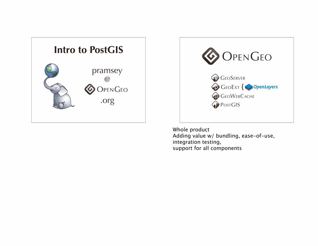
Intro to PostGIS
pramsey@
.org
GEOSERVER
GEOWEBCACHE
GEOEXT {
POSTGIS
Whole productAdding value w/ bundling, ease-of-use, integration testing, support for all components
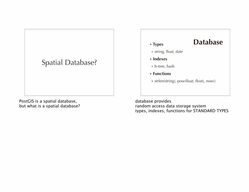
Spatial Database?
PostGIS is a spatial database, but what is a spatial database?
‣ Types
‣ string, float, date
‣ Indexes
‣ b-tree, hash
‣ Functions
‣ strlen(string), pow(float, float), now()
Database
database provides random access data storage systemtypes, indexes, functions for STANDARD TYPES
‣ Spatial Types
‣ geometry, geography
‣ Spatial Indexes
‣ r-tree, quad-tree, kd-tree
‣ Spatial Functions
‣ ST_Length(geometry), ST_X(geometry)
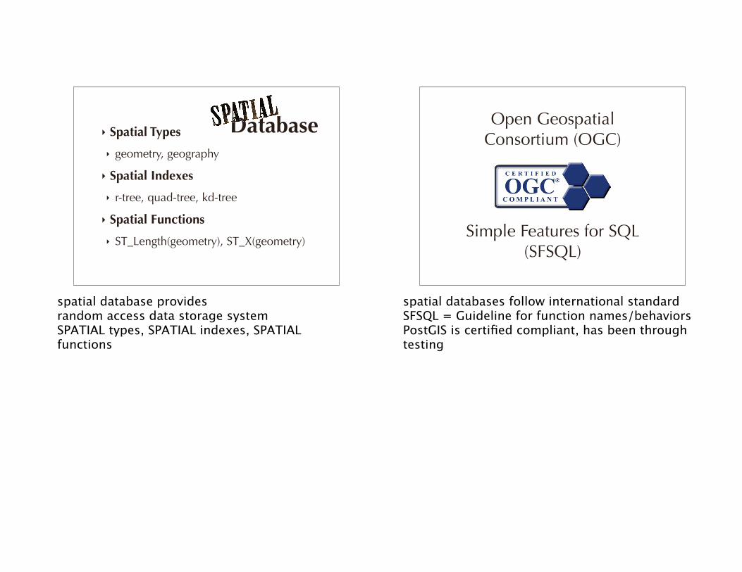
Database
spatial database provides random access data storage systemSPATIAL types, SPATIAL indexes, SPATIAL functions
Open Geospatial Consortium (OGC)
Simple Features for SQL (SFSQL)
spatial databases follow international standardSFSQL = Guideline for function names/behaviorsPostGIS is certified compliant, has been through testing
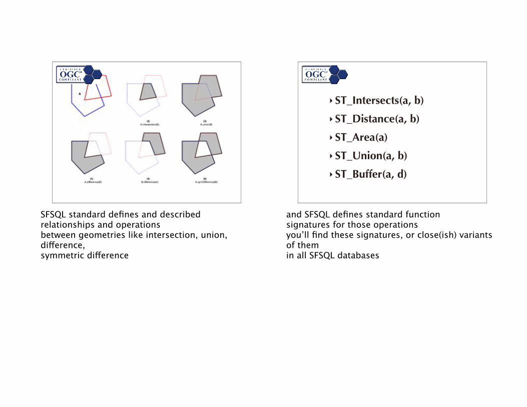
SFSQL standard defines and described relationships and operations between geometries like intersection, union, difference, symmetric difference
‣ ST_Intersects(a, b)
‣ ST_Distance(a, b)
‣ ST_Area(a)
‣ ST_Union(a, b)
‣ ST_Buffer(a, d)
and SFSQL defines standard functionsignatures for those operationsyou’ll find these signatures, or close(ish) variants of themin all SFSQL databases
SpatiaLite
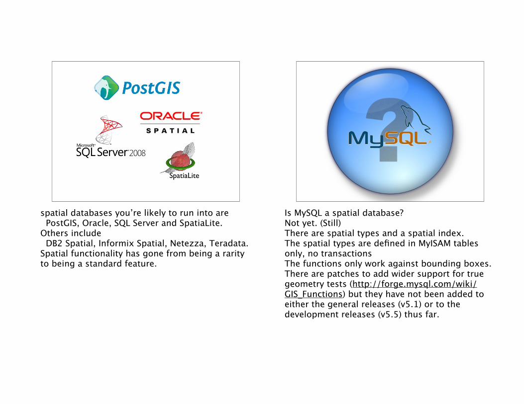
spatial databases you’re likely to run into are PostGIS, Oracle, SQL Server and SpatiaLite. Others include DB2 Spatial, Informix Spatial, Netezza, Teradata. Spatial functionality has gone from being a rarity to being a standard feature.
Is MySQL a spatial database? Not yet. (Still)There are spatial types and a spatial index.The spatial types are defined in MyISAM tables only, no transactionsThe functions only work against bounding boxes. There are patches to add wider support for true geometry tests (http://forge.mysql.com/wiki/GIS_Functions) but they have not been added to either the general releases (v5.1) or to the development releases (v5.5) thus far.
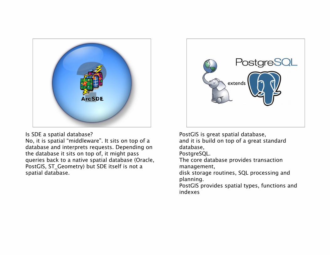
Is SDE a spatial database?No, it is spatial “middleware”. It sits on top of a database and interprets requests. Depending on the database it sits on top of, it might pass queries back to a native spatial database (Oracle, PostGIS, ST_Geometry) but SDE itself is not a spatial database.
extends
PostGIS is great spatial database, and it is build on top of a great standard database,PostgreSQL.The core database provides transaction management,disk storage routines, SQL processing and planning.PostGIS provides spatial types, functions and indexes
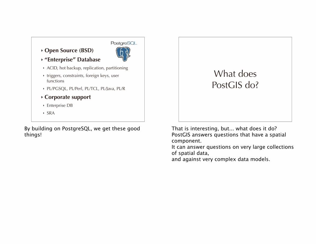
‣ Open Source (BSD)
‣ “Enterprise” Database‣ ACID, hot backup, replication, partitioning
‣ triggers, constraints, foreign keys, user functions
‣ PL/PGSQL, PL/Perl, PL/TCL, PL/Java, PL/R
‣ Corporate support‣ Enterprise DB
‣ SRA
By building on PostgreSQL, we get these good things!
What does PostGIS do?
That is interesting, but... what does it do?PostGIS answers questions that have a spatial component. It can answer questions on very large collections of spatial data, and against very complex data models.
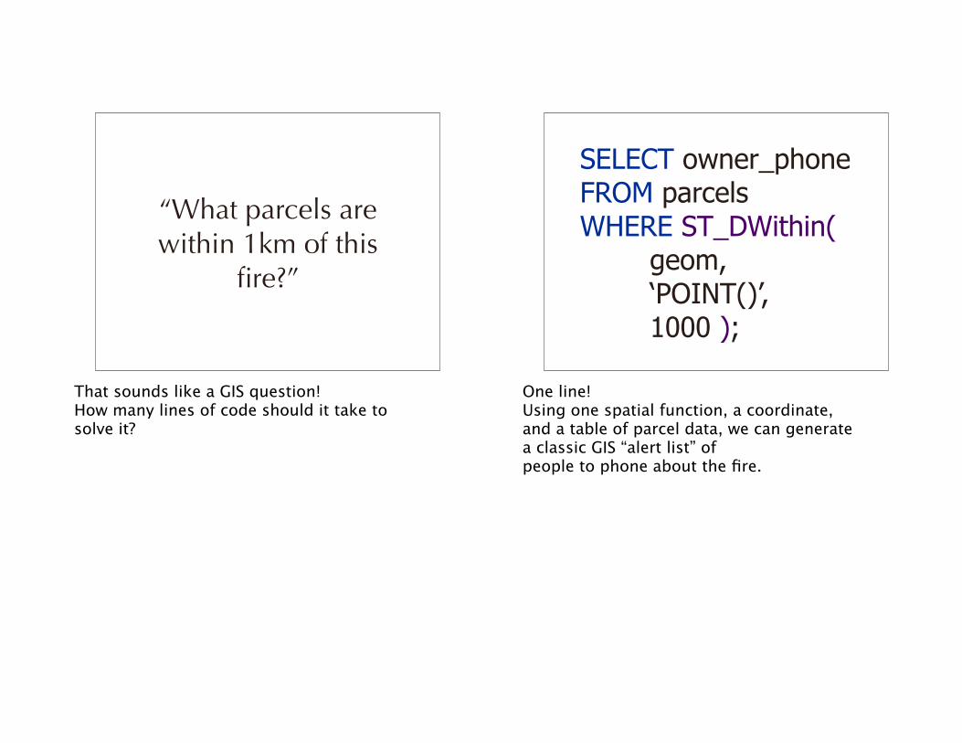
“What parcels are within 1km of this
fire?”
That sounds like a GIS question! How many lines of code should it take to solve it?
SELECT owner_phoneFROM parcelsWHERE ST_DWithin( geom, ‘POINT()’, 1000 );
One line!Using one spatial function, a coordinate, and a table of parcel data, we can generate a classic GIS “alert list” of people to phone about the fire.
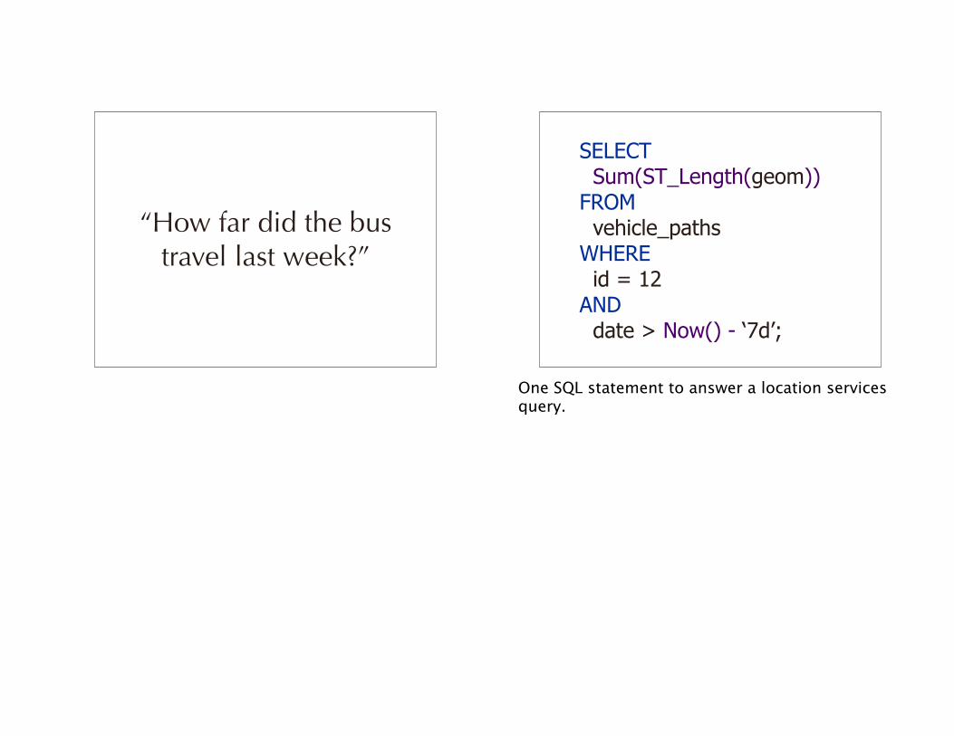
“How far did the bus travel last week?”
SELECT Sum(ST_Length(geom))FROM vehicle_pathsWHERE id = 12AND date > Now() - ‘7d’;
One SQL statement to answer a location services query.
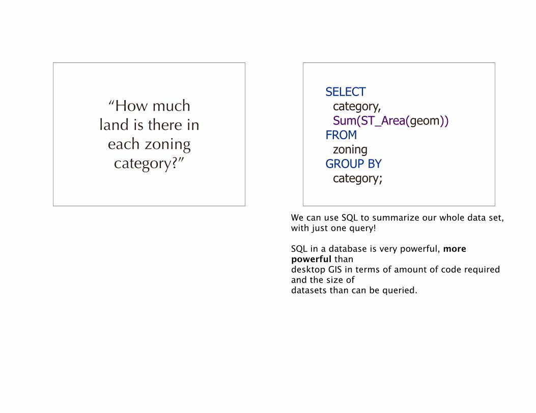
“How much land is there in
each zoning category?”
SELECT category, Sum(ST_Area(geom))FROM zoningGROUP BY category;
We can use SQL to summarize our whole data set, with just one query!
SQL in a database is very powerful, more powerful thandesktop GIS in terms of amount of code required and the size of datasets than can be queried.
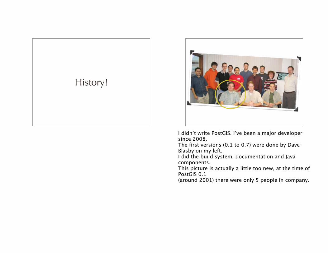
History!
I didn’t write PostGIS. I’ve been a major developer since 2008.The first versions (0.1 to 0.7) were done by Dave Blasby on my left.I did the build system, documentation and Java components.This picture is actually a little too new, at the time of PostGIS 0.1 (around 2001) there were only 5 people in company.

“Managing changing data in shape files is a
pain in the _____!”
PostGIS was the answer to the question “how are we going to manage this changing data?!”
Table Date Geometry
Haida 19991213 POLYGON()
Haida 20000213 POLYGON()
Haida 20000219 POLYGON()
Carrier 20010412 POLYGON()
Carrier 20010421 POLYGON()
Klahoose 20011023 POLYGON()
Klahoose 20011203 POLYGON()
We had a collection of “areas of interest” for treaty negotiations that were passed through modeling software. The negotiators would provide ever changing versions they wanted analyses on, so knowing what the history was, was important.<X>Database model could provide history, easy publication distribution, and automation of analysis runs. (That was the theory, in fact we never got around to using the database for this purpose.)
Database Advantages• Query all areas at once
• Publish in one step
• Manage in one placeHistory!!!
That was the beginning, but there is more.
Type and index
2001 2006
0.1
GEOS LWGEOMexperiment
ANALYZE
0.5 0.6 0.7 0.8 0.9 1.0
Distance
OGC standards
PgSQL 7.2
Point-in-polygon
Index selectivity
OGC SFSQLReprojectionWKT
WKB
JTS LWGEOM
4D Polygonize
2002 2003 2004 2005
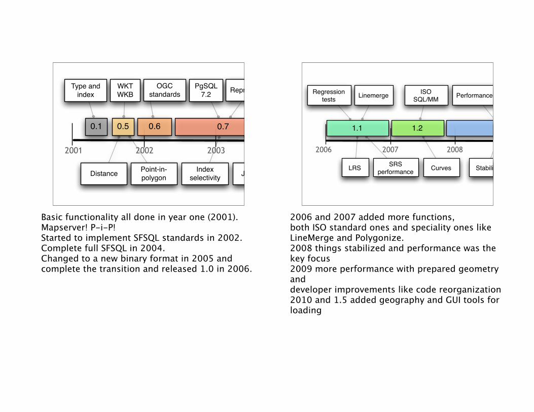
Basic functionality all done in year one (2001). Mapserver! P-i-P!Started to implement SFSQL standards in 2002.Complete full SFSQL in 2004.Changed to a new binary format in 2005 and complete the transition and released 1.0 in 2006.
2006 2011
Regressiontests
ISO SQL/MM
Curves
Linemerge
Stability
Performance
LRS
1.1 1.2 1.3 1.4 1.5
SRSperformance
Cascaded union
Preparedgeometry
Developerimprovements
Newdocs GEOGRAPHY
2007 2008 2009 2010
GUIloader
2006 and 2007 added more functions, both ISO standard ones and speciality ones like LineMerge and Polygonize.2008 things stabilized and performance was the key focus2009 more performance with prepared geometry and developer improvements like code reorganization2010 and 1.5 added geography and GUI tools for loading
2011 2016
3D/4D Indexing
Typemod forGEOMETRY
Achievessentience
PolyhedralSurface
2.0 XP Vista
Slave mines
Hunter-killerrobots
Radioactive wastelands
2012 2013 2014 2015
Topology
Raster
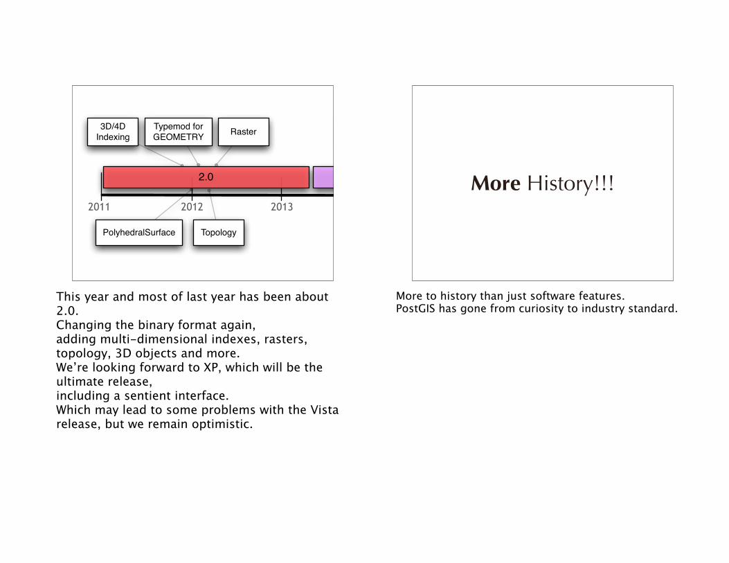
This year and most of last year has been about 2.0.Changing the binary format again,adding multi-dimensional indexes, rasters, topology, 3D objects and more.We’re looking forward to XP, which will be the ultimate release, including a sentient interface.Which may lead to some problems with the Vista release, but we remain optimistic.
More History!!!
More to history than just software features.PostGIS has gone from curiosity to industry standard.
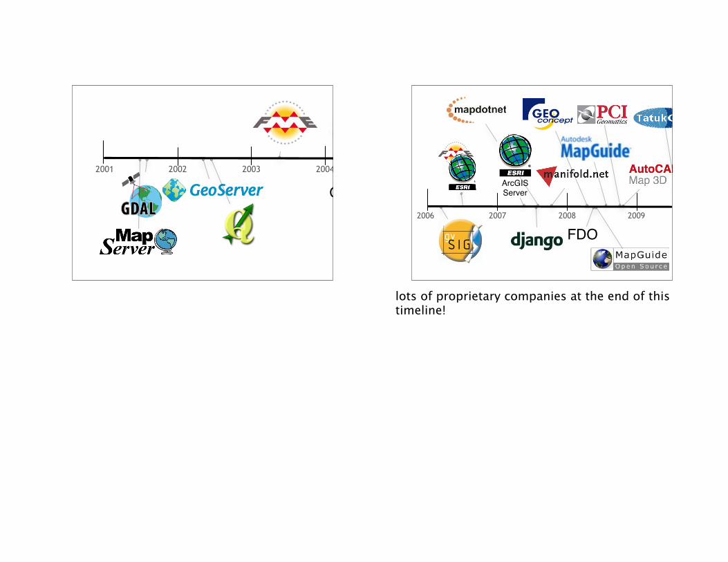
2001 20062002 2003 2004 2005
OSSIM2006 20112007 2008 2009 2010
FDO
ArcGIS Server
lots of proprietary companies at the end of this timeline!
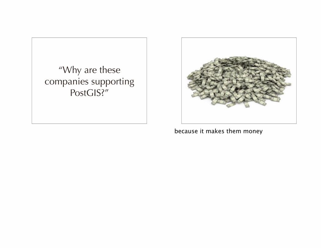
“Why are these companies supporting
PostGIS?”
because it makes them money
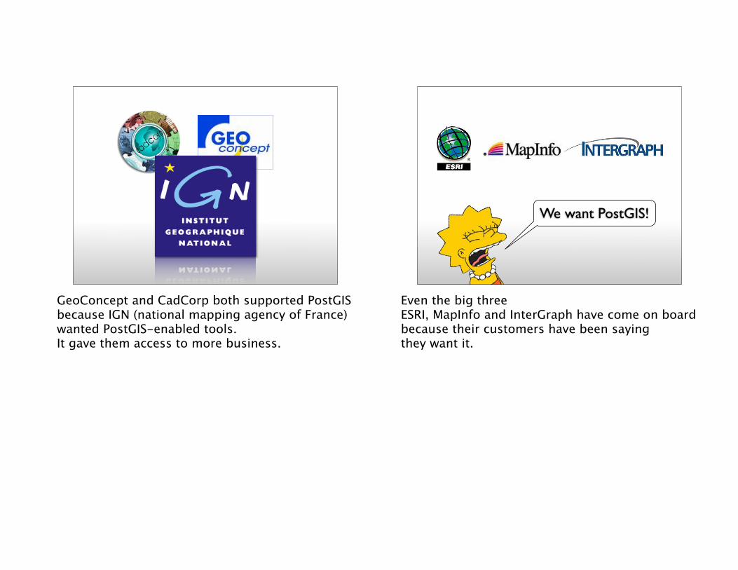
GeoConcept and CadCorp both supported PostGIS because IGN (national mapping agency of France)wanted PostGIS-enabled tools.It gave them access to more business.
We want PostGIS!
Even the big threeESRI, MapInfo and InterGraph have come on boardbecause their customers have been sayingthey want it.
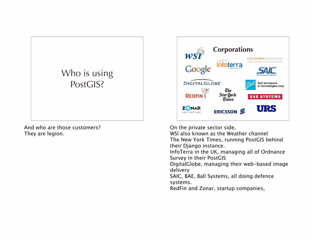
Who is using PostGIS?
And who are those customers?They are legion.
Corporations
On the private sector side,WSI also known as the Weather channelThe New York Times, running PostGIS behind their Django instance.InfoTerra in the UK, managing all of Ordnance Survey in their PostGISDigitalGlobe, managing their web-based image deliverySAIC, BAE, Ball Systems, all doing defence systems.RedFin and Zonar, startup companies,
Governments
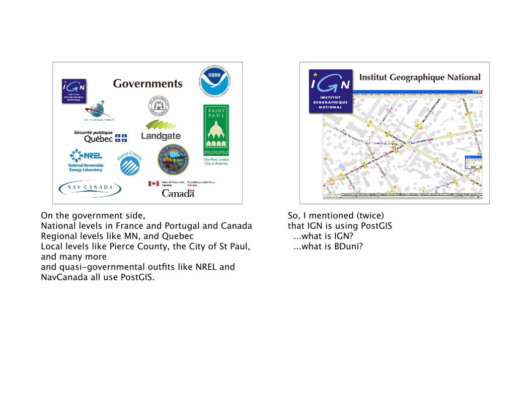
On the government side,National levels in France and Portugal and CanadaRegional levels like MN, and QuebecLocal levels like Pierce County, the City of St Paul, and many moreand quasi-governmental outfits like NREL and NavCanada all use PostGIS.
Institut Geographique National
So, I mentioned (twice)that IGN is using PostGIS ...what is IGN? ...what is BDuni?
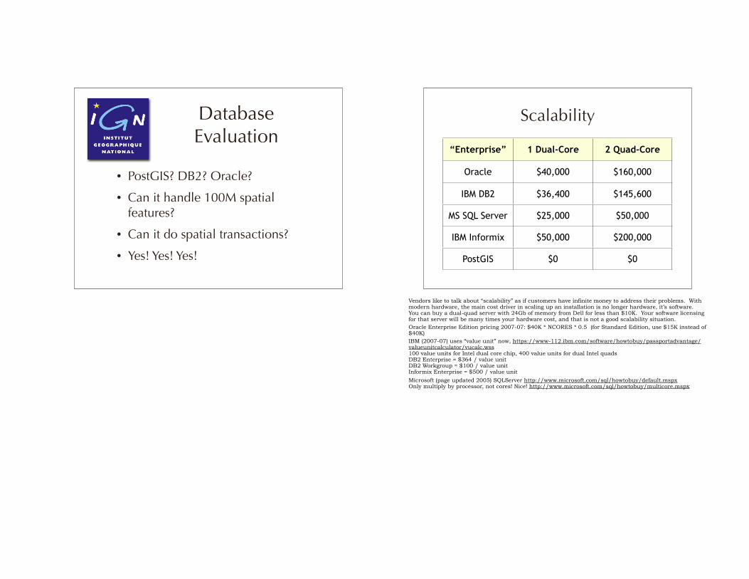
• PostGIS? DB2? Oracle?
• Can it handle 100M spatial features?
• Can it do spatial transactions?
• Yes! Yes! Yes!
Database Evaluation
“Enterprise” 1 Dual-Core 2 Quad-Core
Oracle $40,000 $160,000
IBM DB2 $36,400 $145,600
MS SQL Server $25,000 $50,000
IBM Informix $50,000 $200,000
PostGIS $0 $0
Scalability
Vendors like to talk about “scalability” as if customers have infinite money to address their problems. With modern hardware, the main cost driver in scaling up an installation is no longer hardware, it’s software. You can buy a dual-quad server with 24Gb of memory from Dell for less than $10K. Your software licensing for that server will be many times your hardware cost, and that is not a good scalability situation.Oracle Enterprise Edition pricing 2007-07: $40K * NCORES * 0.5 (for Standard Edition, use $15K instead of $40K)IBM (2007-07) uses “value unit” now, https://www-112.ibm.com/software/howtobuy/passportadvantage/valueunitcalculator/vucalc.wss100 value units for Intel dual core chip, 400 value units for dual Intel quadsDB2 Enterprise = $364 / value unit DB2 Workgroup = $100 / value unitInformix Enterprise = $500 / value unit
Microsoft (page updated 2005) SQLServer http://www.microsoft.com/sql/howtobuy/default.mspxOnly multiply by processor, not cores! Nice! http://www.microsoft.com/sql/howtobuy/multicore.mspx
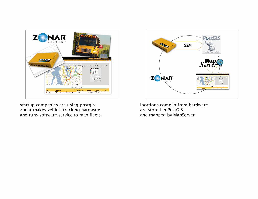
startup companies are using postgiszonar makes vehicle tracking hardwareand runs software service to map fleets
GSM
locations come in from hardwareare stored in PostGISand mapped by MapServer
GSM
GSM
GSM
GSM
GSM
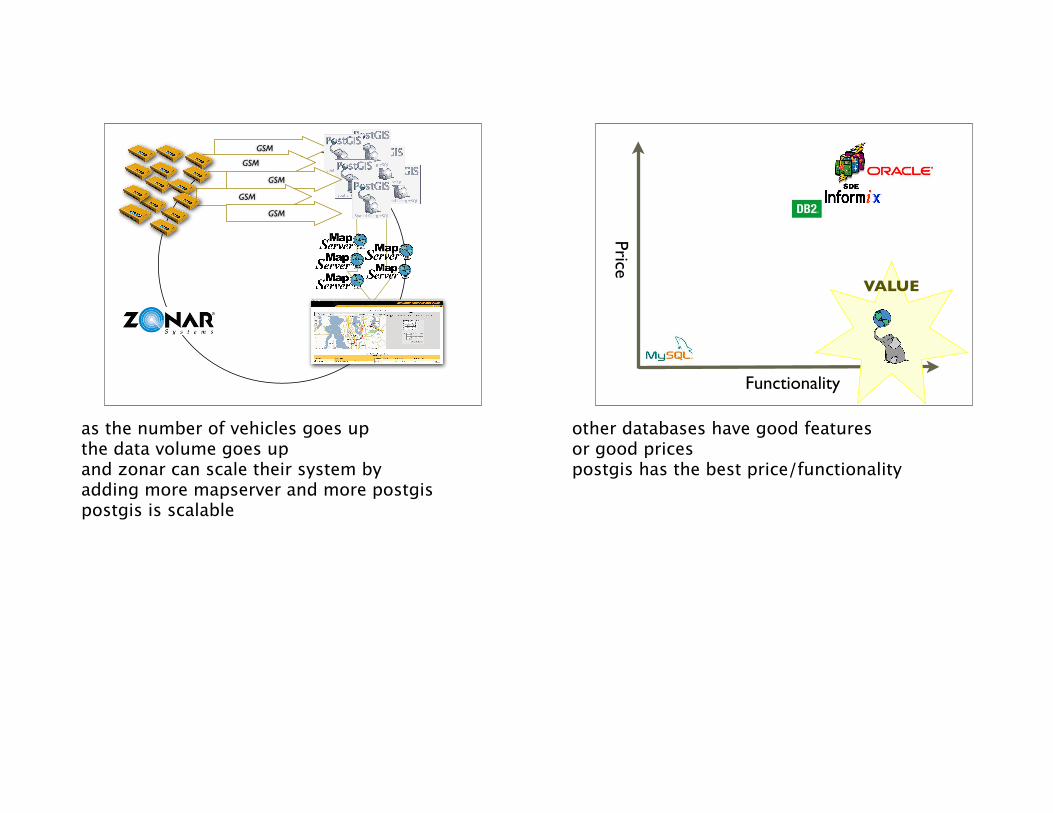
as the number of vehicles goes upthe data volume goes upand zonar can scale their system byadding more mapserver and more postgispostgis is scalable
Functionality
Price
VALUE
other databases have good featuresor good pricespostgis has the best price/functionality
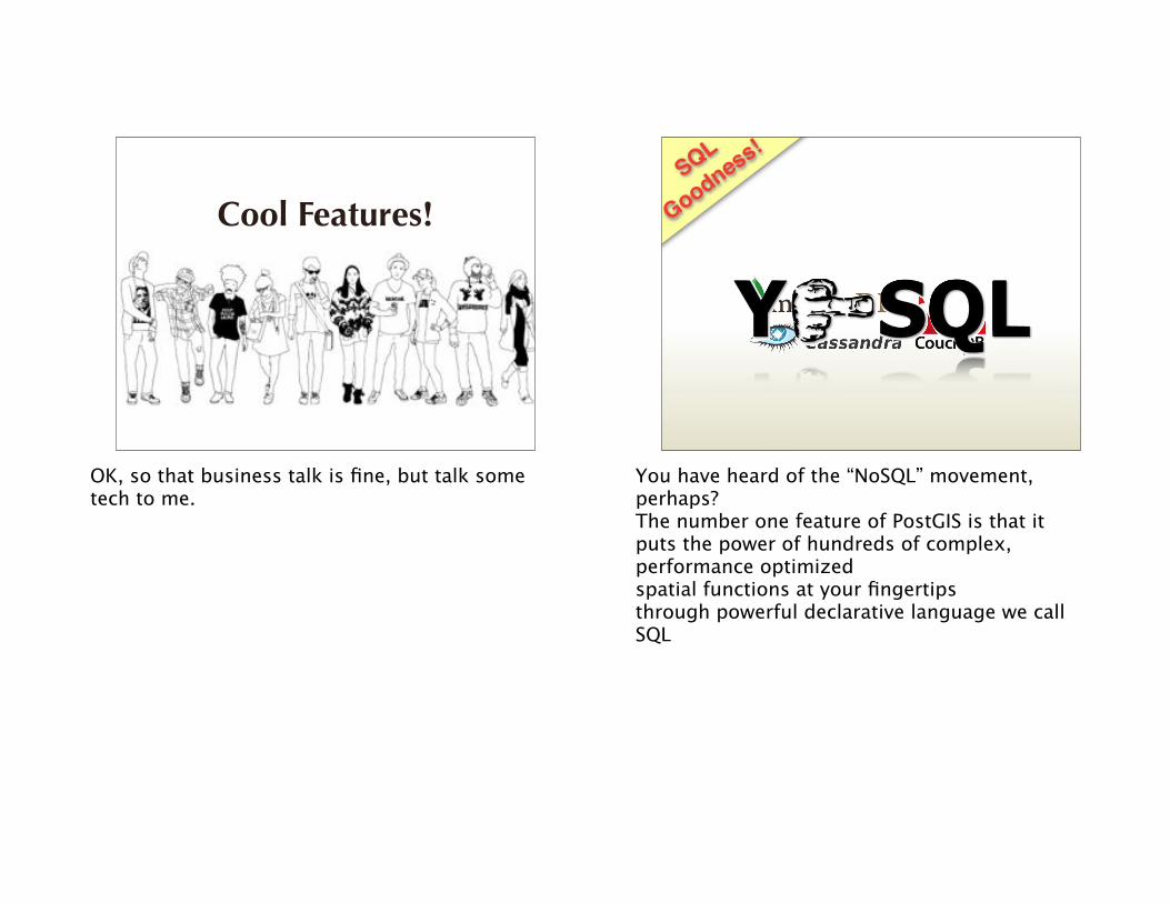
Cool Features!
OK, so that business talk is fine, but talk some tech to me.
SQL
Goodness!
You have heard of the “NoSQL” movement, perhaps?The number one feature of PostGIS is that itputs the power of hundreds of complex, performance optimizedspatial functions at your fingertipsthrough powerful declarative language we callSQL
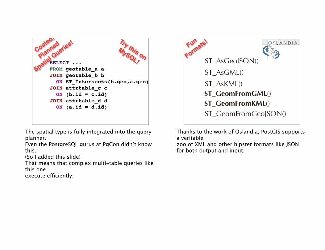
SELECT ...FROM geotable_a aJOIN geotable_b b ON ST_Intersects(b.geo,a.geo)JOIN attrtable_c c ON (b.id = c.id)JOIN attrtable_d d ON (a.id = d.id)
Try this onMySQL!
Costed,
Planned
Spatial Querie
s!
The spatial type is fully integrated into the query planner.Even the PostgreSQL gurus at PgCon didn’t know this.(So I added this slide)That means that complex multi-table queries like this oneexecute efficiently.
ST_AsGeoJSON()
ST_AsKML()ST_GeomFromGML()ST_GeomFromKML()
ST_AsGML()
Fun
Formats!
ST_GeomFromGeoJSON()
Thanks to the work of Oslandia, PostGIS supports a veritablezoo of XML and other hipster formats like JSONfor both output and input.
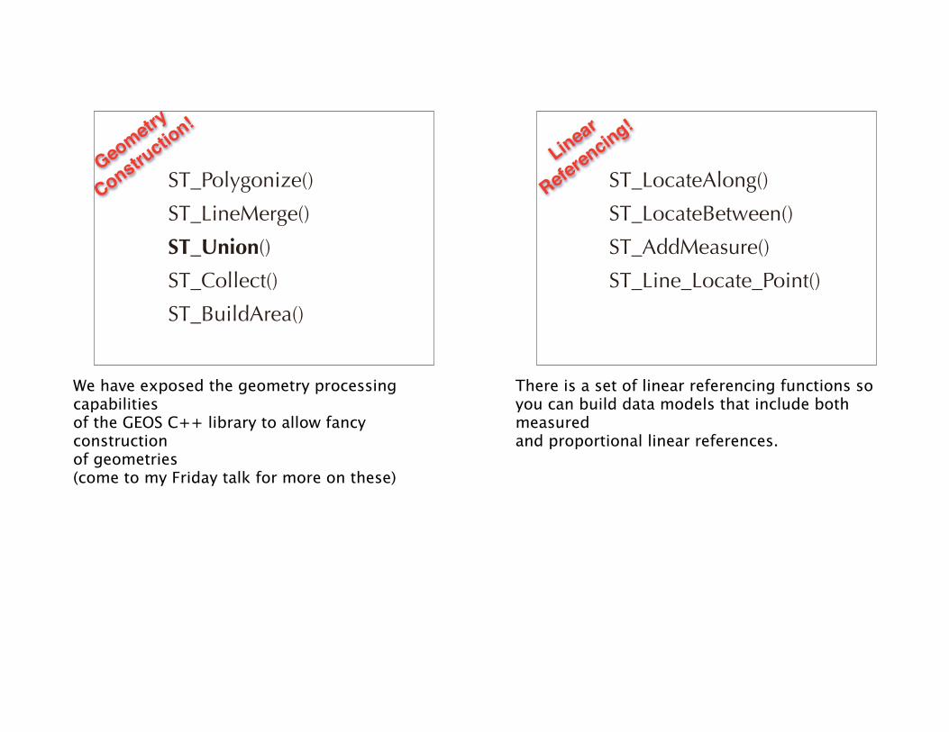
ST_Polygonize()
ST_Union()
ST_Collect()
ST_BuildArea()
ST_LineMerge()
Geometry
Constructio
n!
We have exposed the geometry processing capabilitiesof the GEOS C++ library to allow fancy constructionof geometries(come to my Friday talk for more on these)
ST_LocateAlong()
ST_AddMeasure()
ST_Line_Locate_Point()
ST_LocateBetween()
Linear
Referencing!
There is a set of linear referencing functions soyou can build data models that include both measuredand proportional linear references.
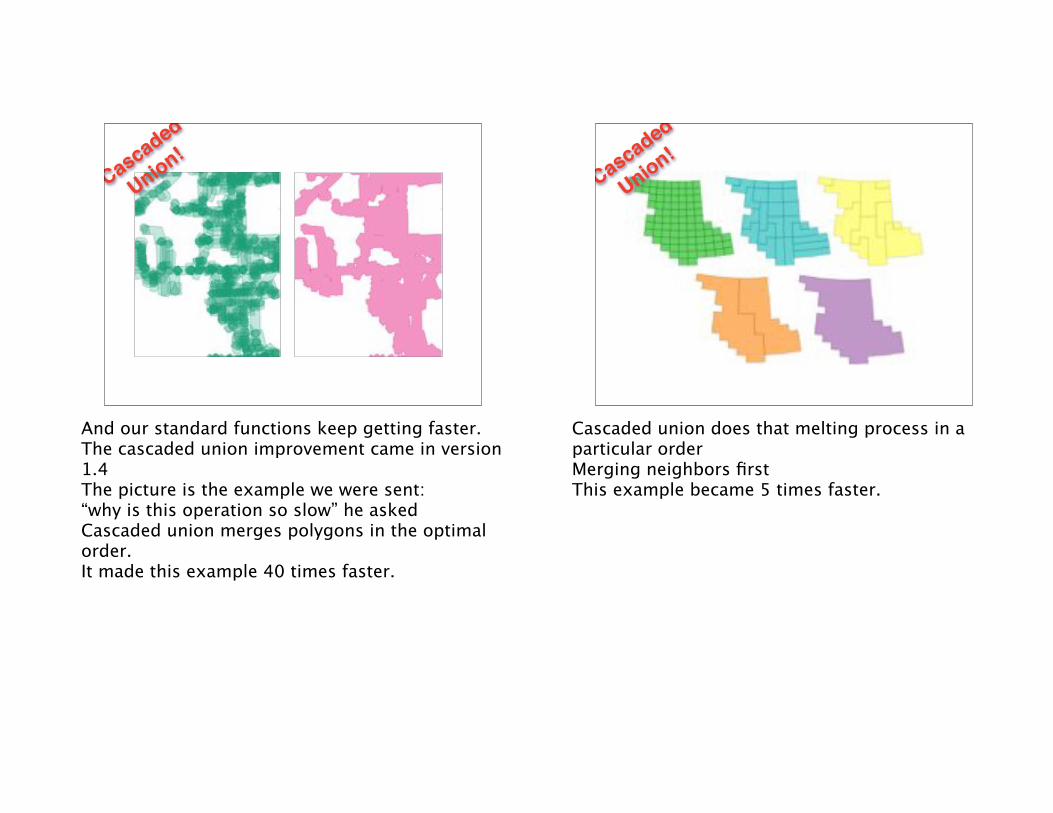
Cascaded
Union!
And our standard functions keep getting faster.The cascaded union improvement came in version 1.4The picture is the example we were sent:“why is this operation so slow” he askedCascaded union merges polygons in the optimal order.It made this example 40 times faster.
Cascaded
Union!
Cascaded union does that melting process in a particular orderMerging neighbors firstThis example became 5 times faster.
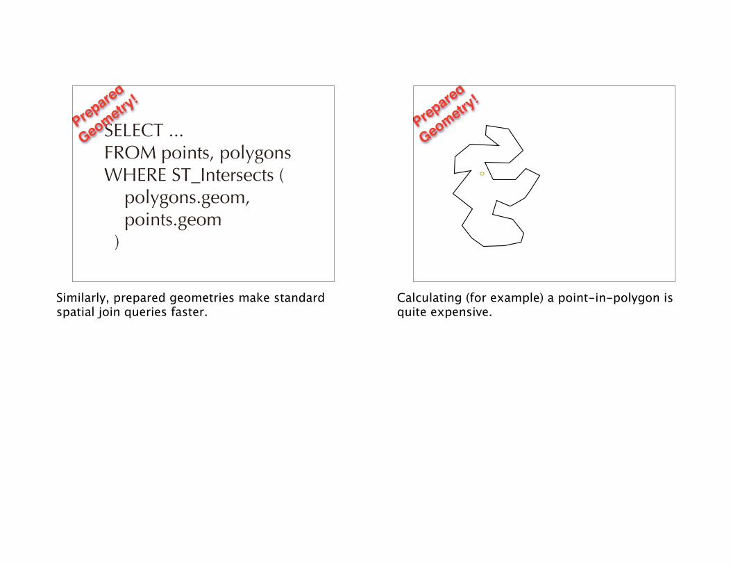
SELECT ... FROM points, polygons WHERE ST_Intersects ( polygons.geom, points.geom )
Prepared
Geometry!
Similarly, prepared geometries make standard spatial join queries faster.
Prepared
Geometry!
Calculating (for example) a point-in-polygon is quite expensive.
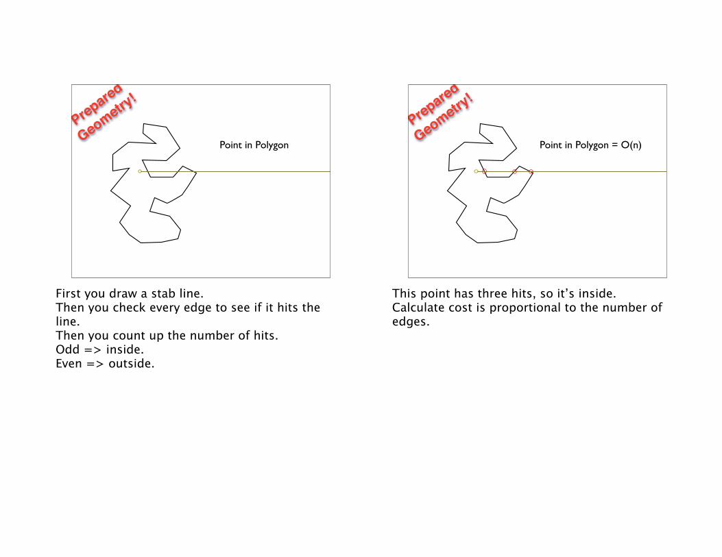
Point in Polygon
Prepared
Geometry!
First you draw a stab line.Then you check every edge to see if it hits the line.Then you count up the number of hits.Odd => inside. Even => outside.
Point in Polygon = O(n)
Prepared
Geometry!
This point has three hits, so it’s inside.Calculate cost is proportional to the number of edges.
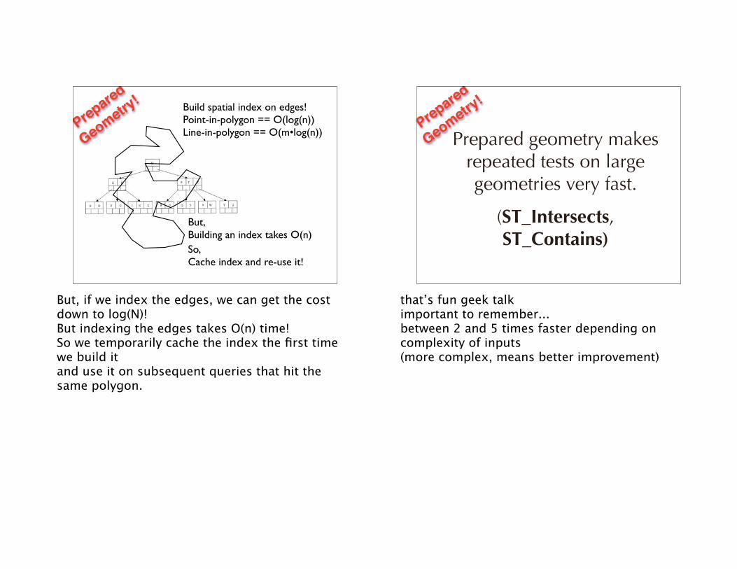
Build spatial index on edges!Point-in-polygon == O(log(n))Line-in-polygon == O(m•log(n))
But, Building an index takes O(n)So,Cache index and re-use it!
Prepared
Geometry!
But, if we index the edges, we can get the cost down to log(N)!But indexing the edges takes O(n) time!So we temporarily cache the index the first time we build itand use it on subsequent queries that hit the same polygon.
Prepared geometry makes repeated tests on large geometries very fast.
(ST_Intersects, ST_Contains)
Prepared
Geometry!
that’s fun geek talkimportant to remember... between 2 and 5 times faster depending on complexity of inputs (more complex, means better improvement)
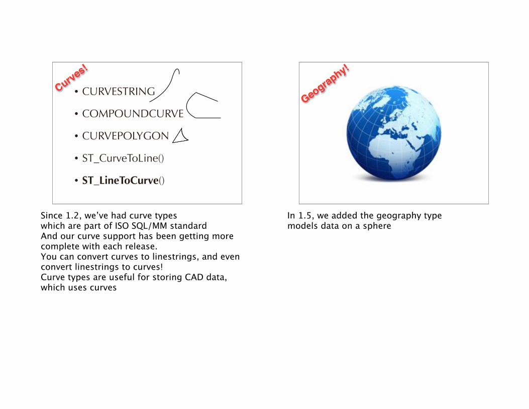
• CURVESTRING
• COMPOUNDCURVE
• CURVEPOLYGON
• ST_CurveToLine()
• ST_LineToCurve()
Curves!
Since 1.2, we’ve had curve types which are part of ISO SQL/MM standardAnd our curve support has been getting more complete with each release.You can convert curves to linestrings, and even convert linestrings to curves!Curve types are useful for storing CAD data, which uses curves
Geography!
In 1.5, we added the geography type models data on a sphere
Geography!
“geometry” type models data on a planebut that Simple Plate-Carre view, has lots of problem cases.
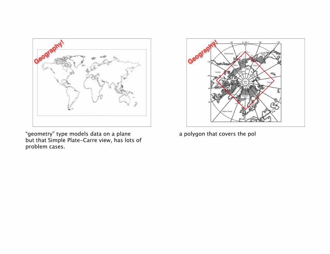
Geography!
a polygon that covers the pol
Geography!
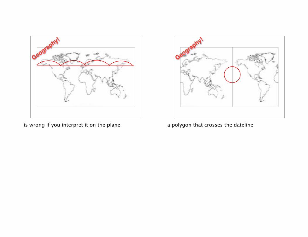
is wrong if you interpret it on the plane
Geography!
a polygon that crosses the dateline
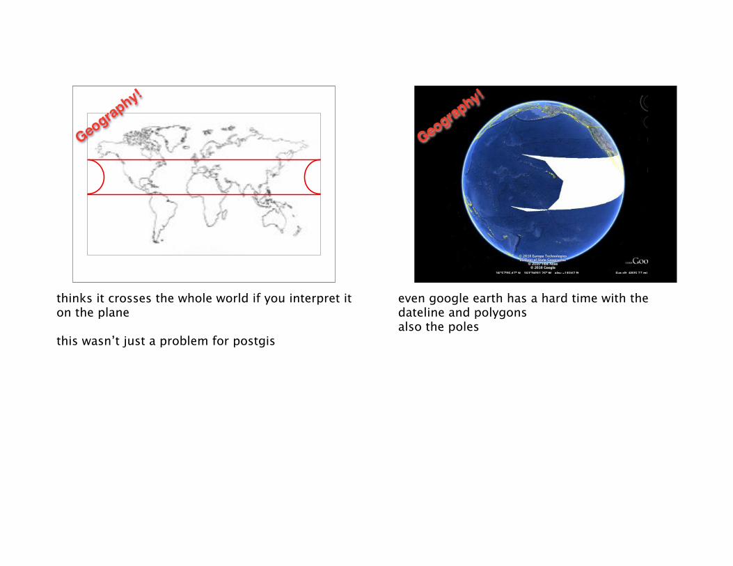
Geography!
thinks it crosses the whole world if you interpret it on the plane
this wasn’t just a problem for postgis
Geography!
even google earth has a hard time with the dateline and polygonsalso the poles
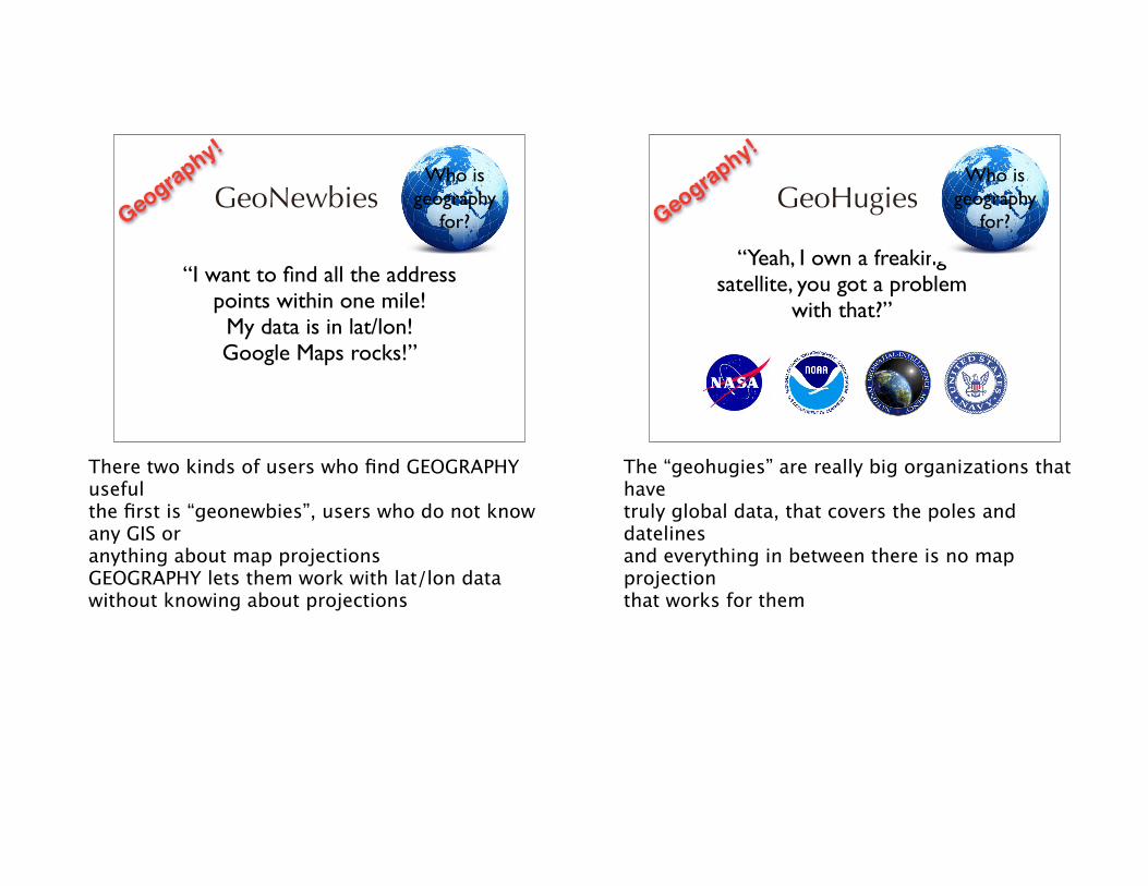
GeoNewbiesWho is
geography for?
“I want to find all the address points within one mile!
My data is in lat/lon! Google Maps rocks!”
Geography!
There two kinds of users who find GEOGRAPHY usefulthe first is “geonewbies”, users who do not know any GIS oranything about map projectionsGEOGRAPHY lets them work with lat/lon data without knowing about projections
GeoHugies
“Yeah, I own a freaking satellite, you got a problem
with that?”
Who is geography
for?Geography!
The “geohugies” are really big organizations that have truly global data, that covers the poles and datelinesand everything in between there is no map projectionthat works for them
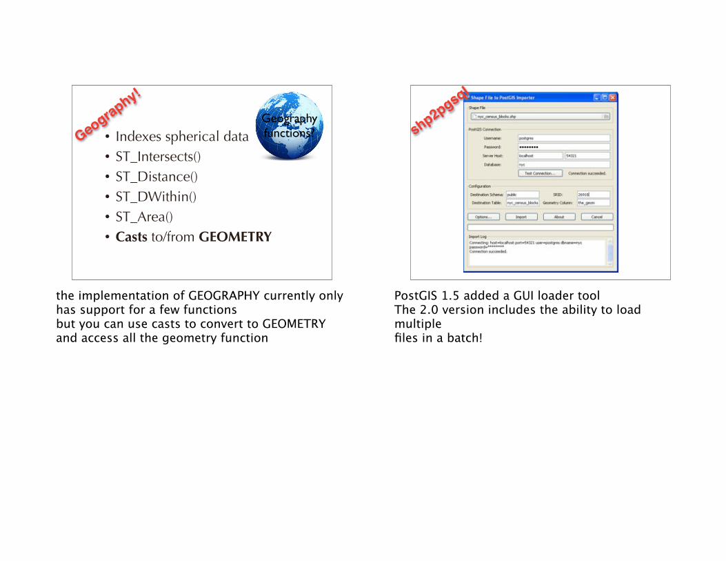
• Indexes spherical data• ST_Intersects()• ST_Distance()• ST_DWithin()• ST_Area()• Casts to/from GEOMETRY
Geographyfunctions?Geography!
the implementation of GEOGRAPHY currently only has support for a few functionsbut you can use casts to convert to GEOMETRY and access all the geometry function
shp2pgsql
PostGIS 1.5 added a GUI loader toolThe 2.0 version includes the ability to load multiple files in a batch!
2.0!?!
When is 2.0 coming?!!?!We have to stabilize the features we have, and close ticketsRealistically, not before early 2012.Yes, we want it to be done too!
Intro to PostGIS
pramsey@
.org
Thanks!