Embed Size (px)
Citation preview
Intro. To GIS
Pre-lab 2
February 11th , 2012
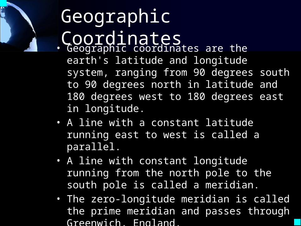
Geographic Coordinates• Geographic coordinates are the earth's
latitude and longitude system, ranging from 90 degrees south to 90 degrees north in latitude and 180 degrees west to 180 degrees east in longitude.
• A line with a constant latitude running east to west is called a parallel.
• A line with constant longitude running from the north pole to the south pole is called a meridian.
• The zero-longitude meridian is called the prime meridian and passes through Greenwich, England.
• A grid of parallels and meridians shown as lines on a map is called a graticule.
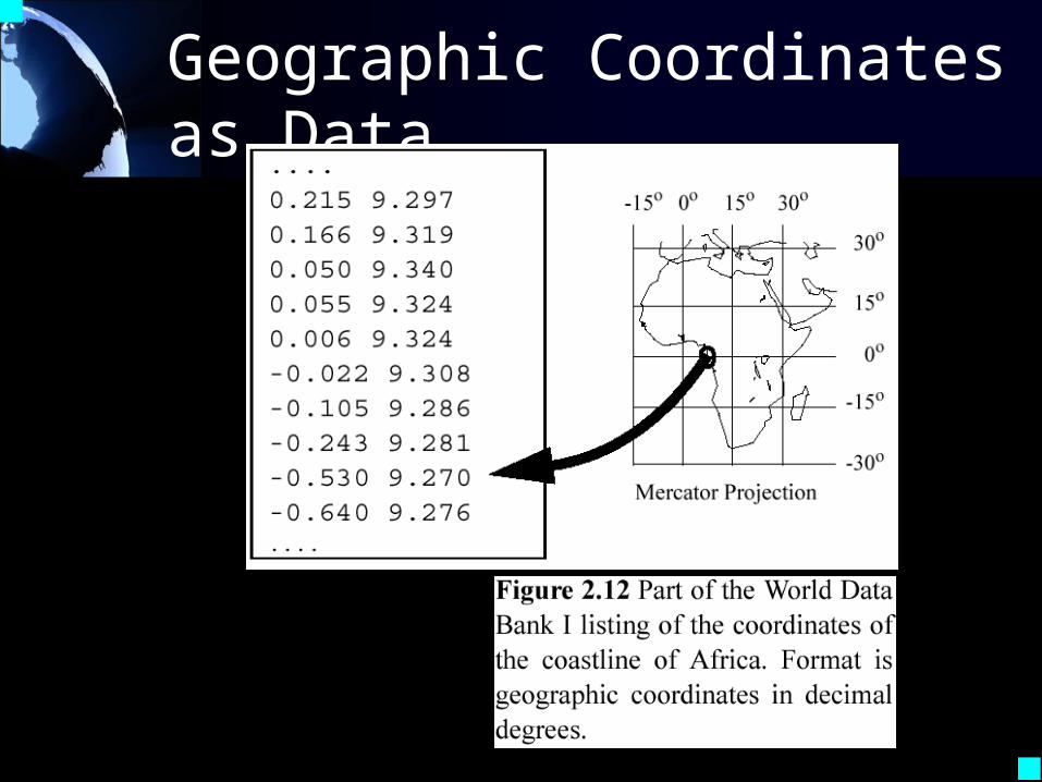
Geographic Coordinates as Data
Map Projections
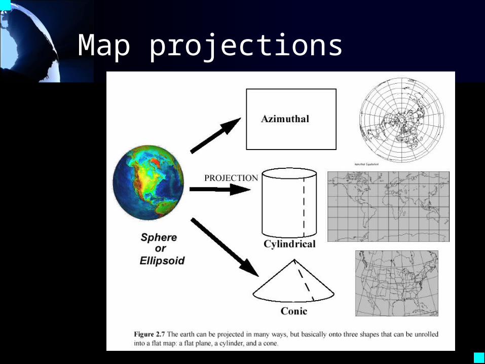
• A transformation of the spherical or ellipsoidal earth onto a flat map is called a map projection.
• The map projection can be onto a flat surface or a surface that can be made flat by cutting, such as a cylinder or a cone.
• If the globe, after scaling, cuts the surface, the projection is called secant. Lines where the cuts take place or where the surface touches the globe have no projection distortion.
Map projections
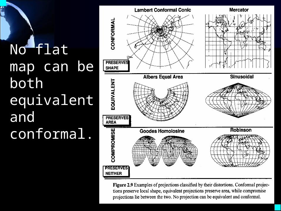
No flat map can be both equivalent and conformal.
Map Projections (ctd)• Projections can be based on axes parallel to
the earth's rotation axis (equatorial), at 90 degrees to it (transverse), or at any other angle (oblique).
• A projection that preserves the shape of features across the map is called conformal.
• A projection that preserves the area of a feature across the map is called equal area or equivalent.
• No flat map can be both equivalent and conformal. Most fall between the two as compromises.
• To compare or edge-match maps in a GIS, both maps MUST be in the same projection.
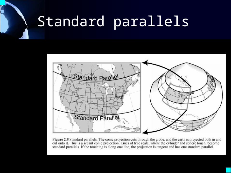
Standard parallels
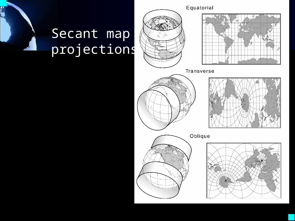
Secant map projections
Figure 2.9 Variations on the Mercator (pseudocylindrical) projection shown as secant
Coordinate Systems
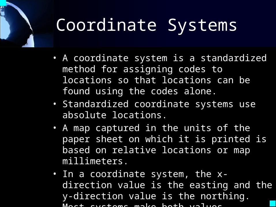
• A coordinate system is a standardized method for assigning codes to locations so that locations can be found using the codes alone.
• Standardized coordinate systems use absolute locations.
• A map captured in the units of the paper sheet on which it is printed is based on relative locations or map millimeters.
• In a coordinate system, the x-direction value is the easting and the y-direction value is the northing. Most systems make both values positive.
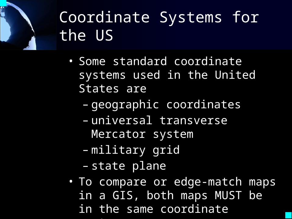
Coordinate Systems for the US
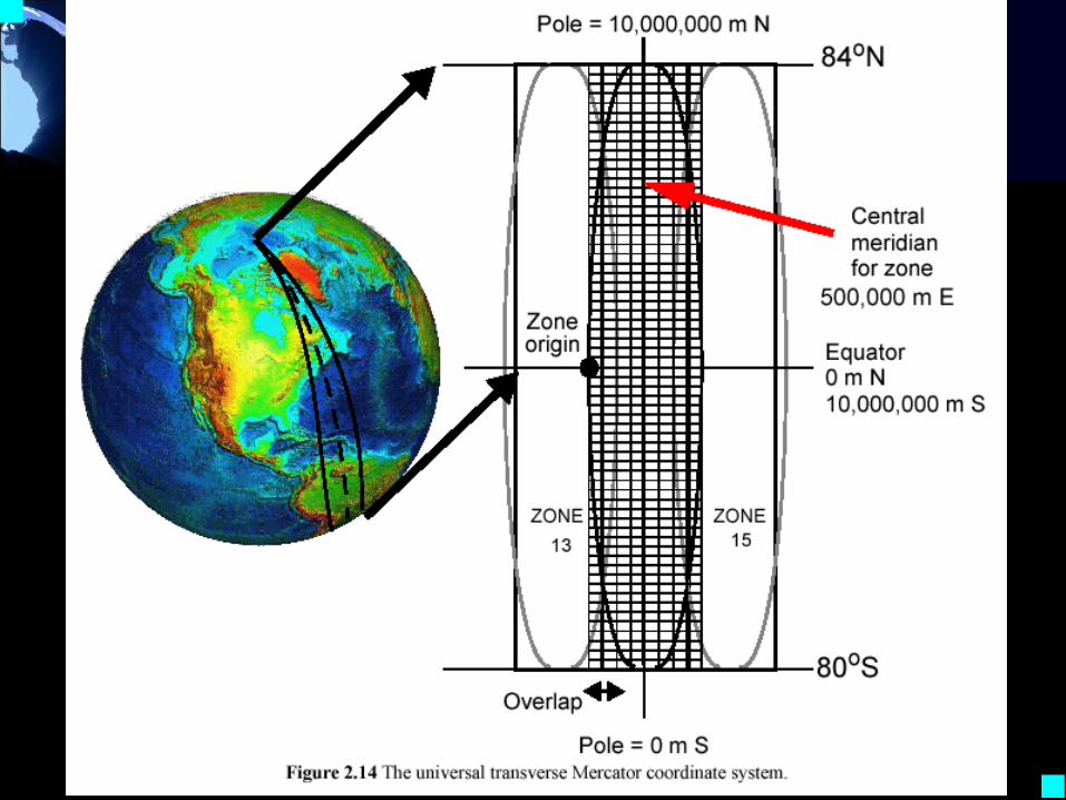
• Some standard coordinate systems used in the United States are – geographic coordinates– universal transverse Mercator
system– military grid– state plane
• To compare or edge-match maps in a GIS, both maps MUST be in the same coordinate system.
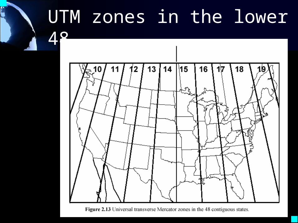
UTM zones in the lower 48
Figure 6.5 14