Embed Size (px)
Citation preview
INTERNATIONAL INSTITUTE FOR GEO-INFORMATION SCIENCE AND EARTH OBSERVATION
Global Positioning Systems (GPS)
Jeroen Verplanke
Department of Urban and Regional Planning and Geo-Information Management
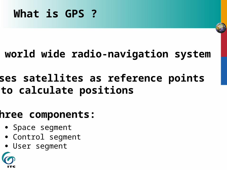
What is GPS ?
A world wide radio-navigation system
Uses satellites as reference points to calculate positions
Three components: Space segment Control segment User segment
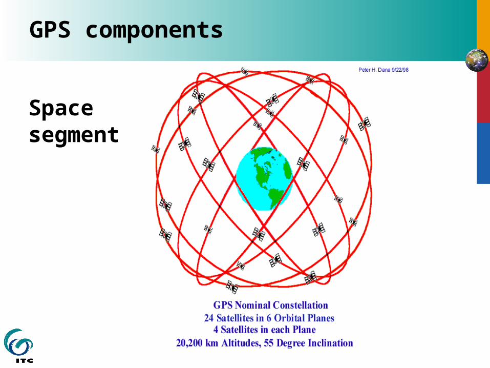
GPS components
Space segment
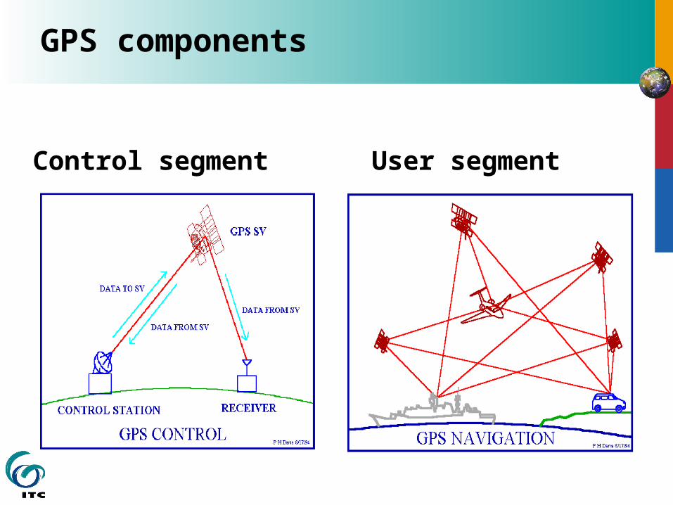
GPS components
Control segment User segment
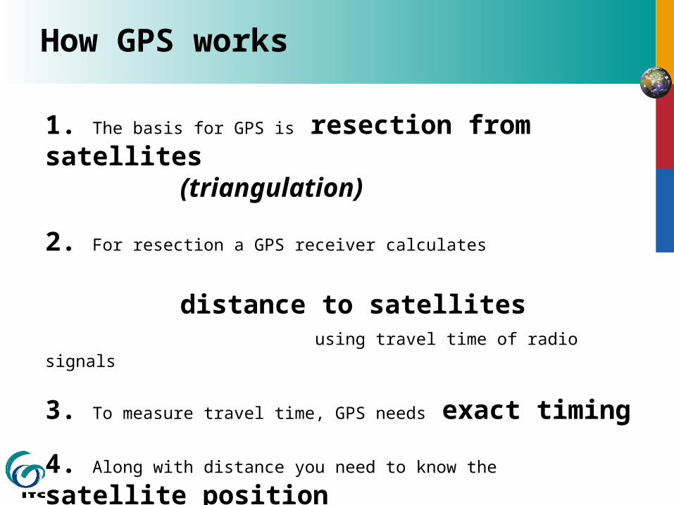
How GPS works
1. The basis for GPS is resection from satellites(triangulation)
2. For resection a GPS receiver calculates distance to satellites
using travel time of radio signals
3. To measure travel time, GPS needs exact timing
4. Along with distance you need to know the satellite position
5. For accurate positioning you must correct for errors
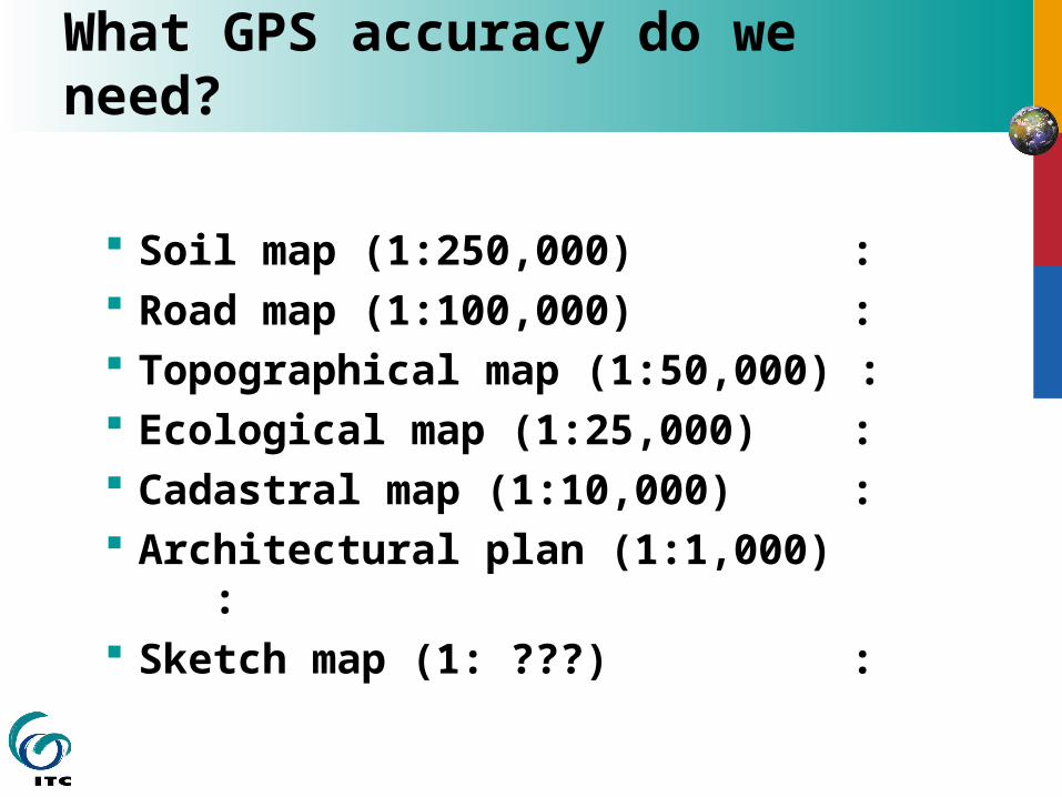
What GPS accuracy do we need?
Soil map (1:250,000) : Road map (1:100,000) : Topographical map (1:50,000) : Ecological map (1:25,000) : Cadastral map (1:10,000) : Architectural plan (1:1,000) : Sketch map (1: ???) :
Superficie de la Tierra
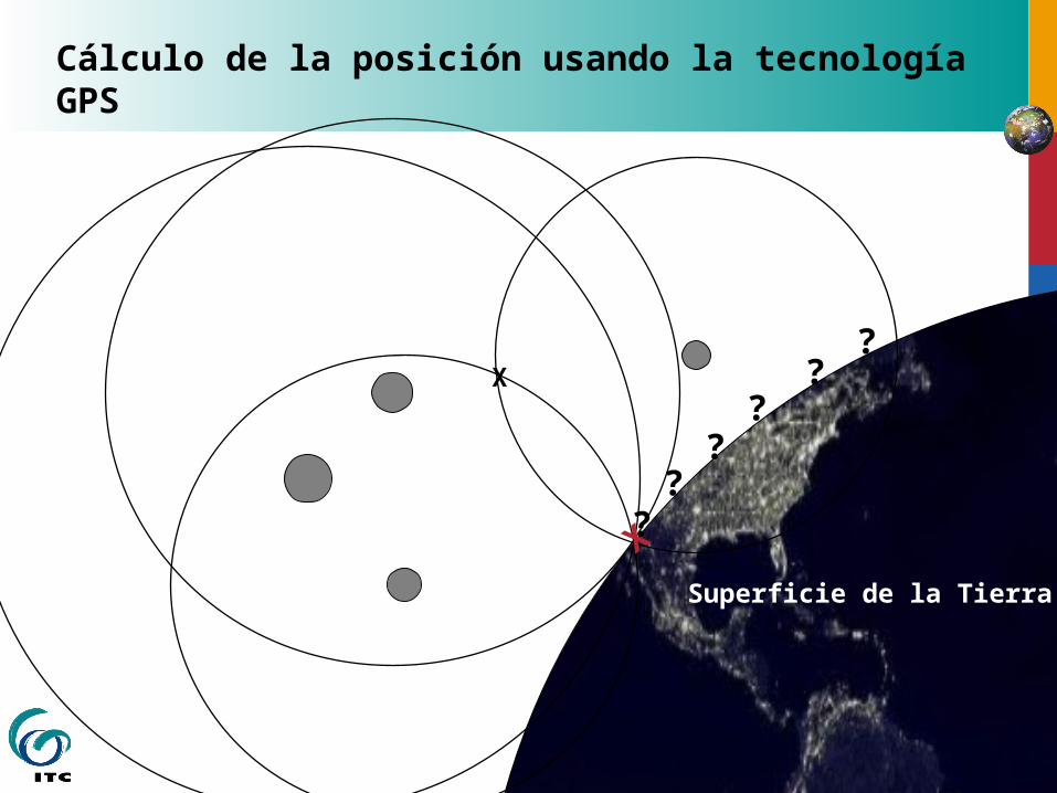
Cálculo de la posición usando la tecnología GPS
X
X
??
??
??
ADa
X
Da
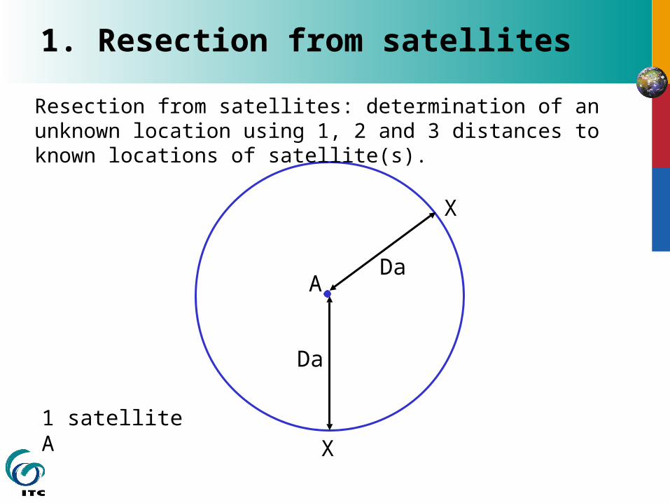
X1 satelliteA
Resection from satellites: determination of an unknown location using 1, 2 and 3 distances to known locations of satellite(s).
1. Resection from satellites
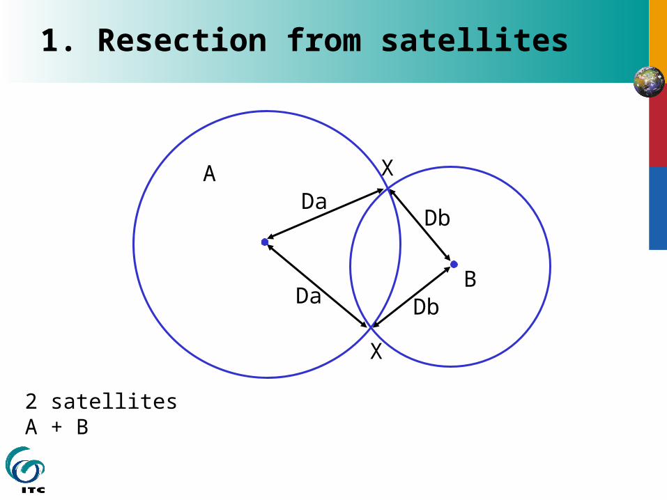
ADa
X
Da
2 satellitesA + B
X
B
Db
Db
1. Resection from satellites
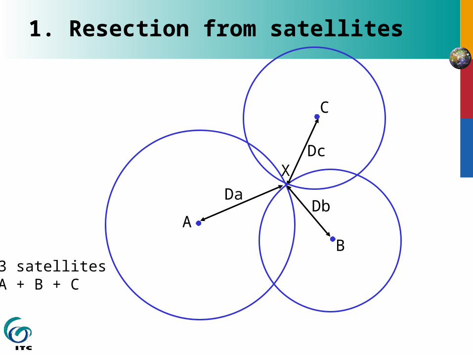
A
Da
XDc
3 satellitesA + B + C
B
Db
C
1. Resection from satellites
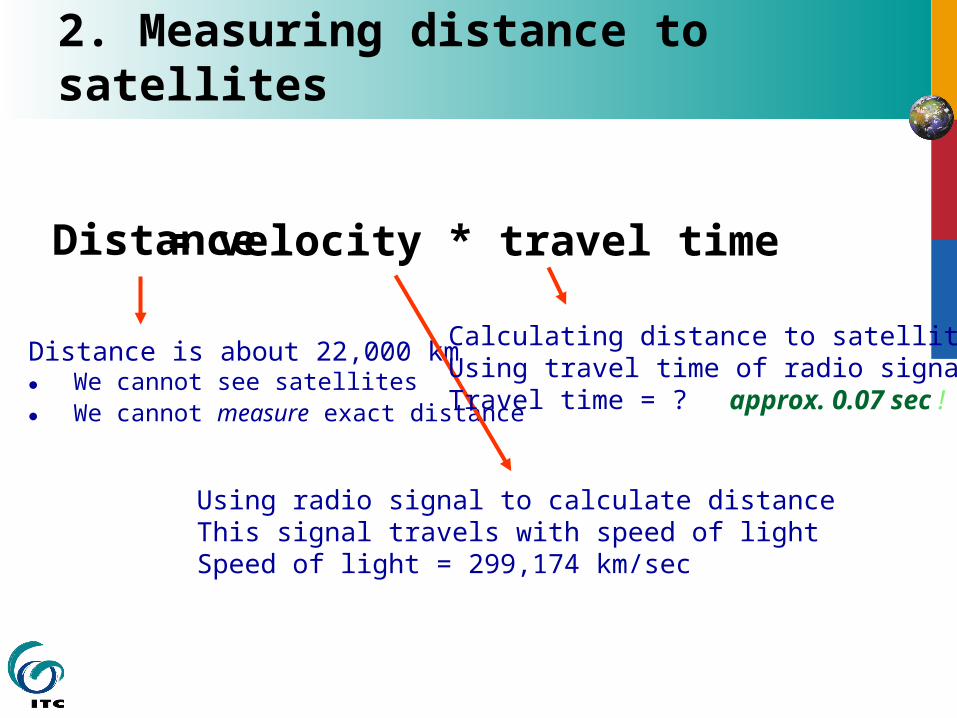
2. Measuring distance to satellites
Distance is about 22,000 km We cannot see satellites We cannot measure exact distance
Distance = velocity * travel time
Using radio signal to calculate distanceThis signal travels with speed of lightSpeed of light = 299,174 km/sec
Calculating distance to satelliteUsing travel time of radio signalTravel time = ? approx. 0.07 sec !
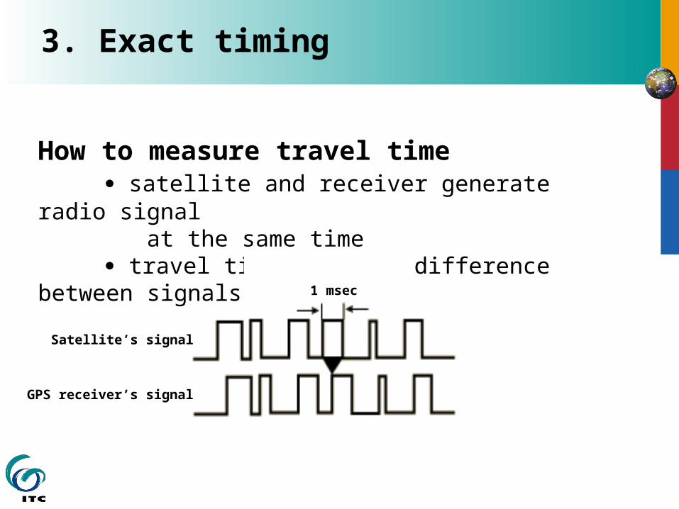
3. Exact timing
How to measure travel time satellite and receiver generate radio signal at the same time travel time = phase difference between signals
1 msec
Satellite’s signal
GPS receiver’s signal
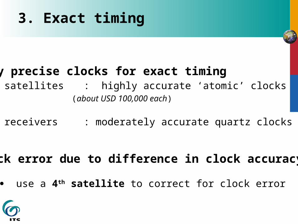
3. Exact timing
Very precise clocks for exact timing satellites : highly accurate ‘atomic’ clocks
(about USD 100,000 each)
receivers : moderately accurate quartz clocks
Clock error due to difference in clock accuracy
use a 4th satellite to correct for clock error
4. The satellite position in space
Using satellites as reference points for positioning also requires that you know the exact position in space of each satellite, at any place and at any time.
The GPS control segment monitors the satellite position in space.
All details of satellite orbits is available in an ‘almanac’
This satellite status information can be downloaded to the GPS receiver

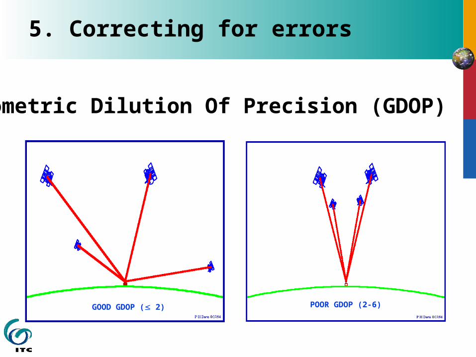
5. Correcting for errors
Main GPS error sources
Clock errors Signal errors (noise) Interference in ionosphere and troposphere Multipath error Satellite position (“ephemeris”) error Geometrical error (Geometric Dilution of Precision - GDOP) Intentional errors (Selective Availability - SA) Human errors Receiver errors (hardware, software, antenna)
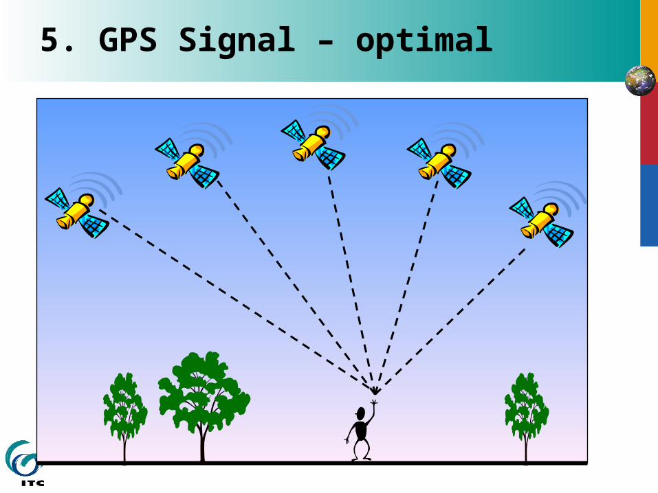
5. GPS Signal – optimal
5. Correcting for errors
Geometric Dilution Of Precision (GDOP)
GOOD GDOP ( 2) POOR GDOP (2-6)
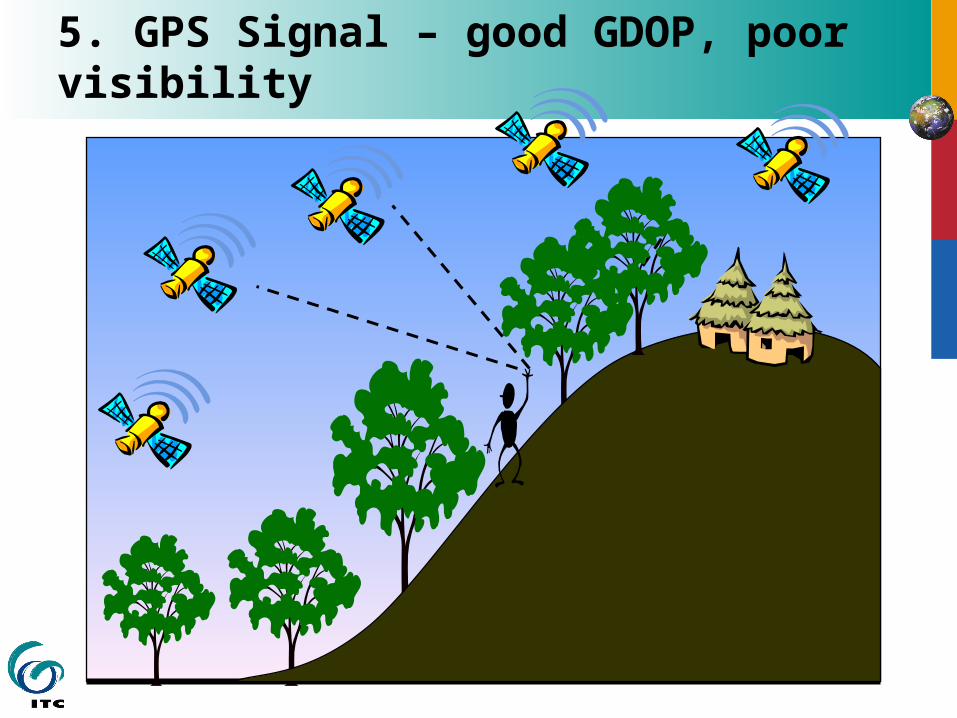
5. GPS Signal – good GDOP, poor visibility
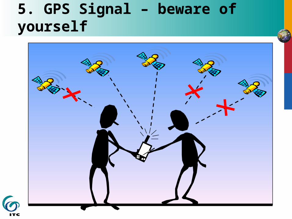
5. GPS Signal – beware of yourself
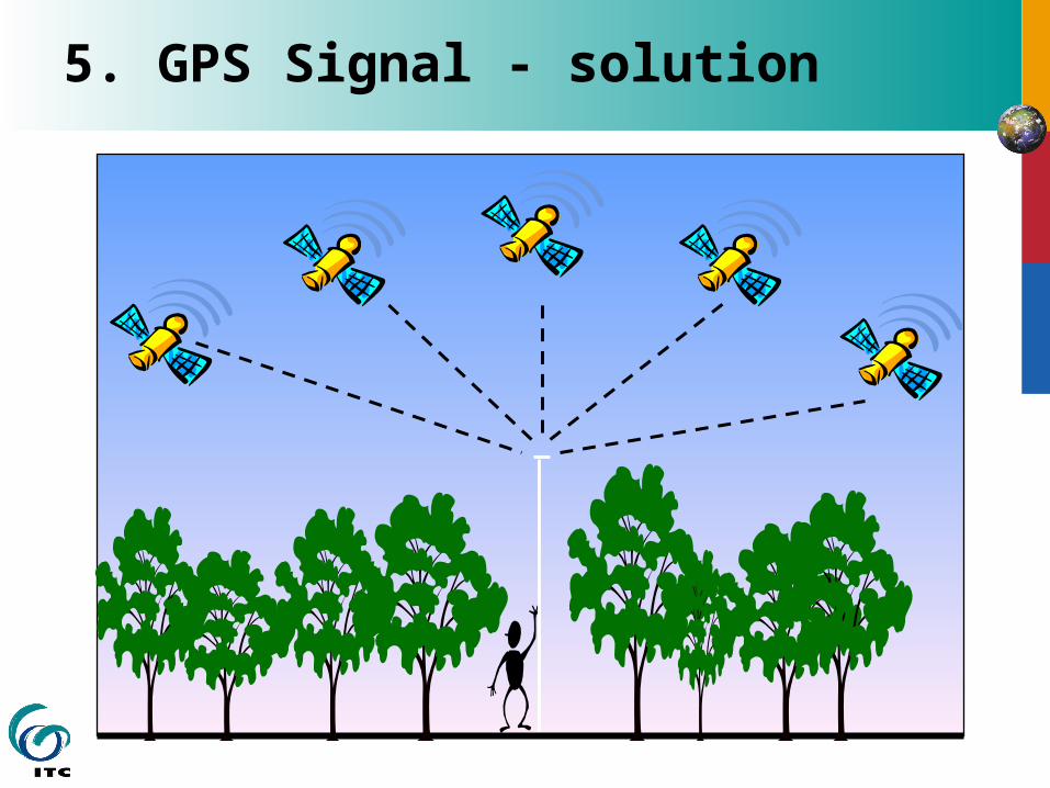
5. GPS Signal - solution
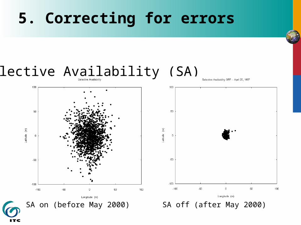
5. Correcting for errors
Selective Availability (SA)
SA on (before May 2000) SA off (after May 2000)
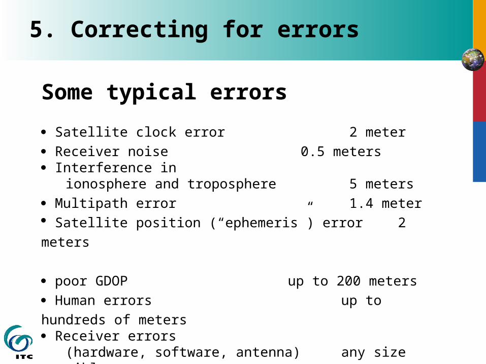
5. Correcting for errors
Some typical errors
Satellite clock error 2 meter
Receiver noise 0.5 meters Interference in ionosphere and troposphere 5 meters
Multipath error 1.4 meter Satellite position (“ephemeris”) error 2 meters
poor GDOP up to 200 meters
Human errors up to hundreds of meters Receiver errors (hardware, software, antenna) any size possible
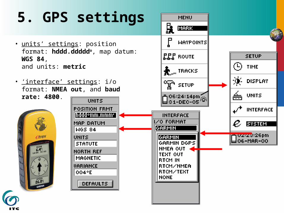
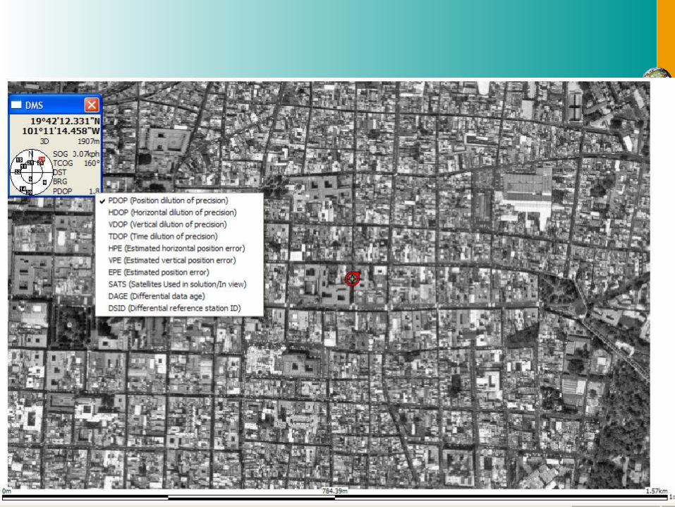
• units’ settings: position format: hddd.dddddo, map datum: WGS 84, and units: metric
• ‘interface’ settings: i/o format: NMEA out, and baud rate: 4800.
5. GPS settings
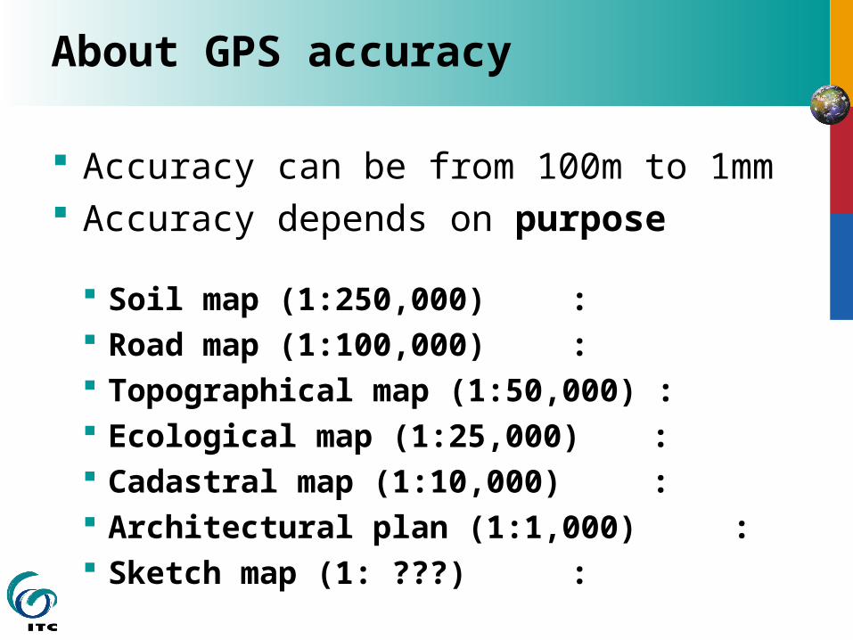
About GPS accuracy
Accuracy can be from 100m to 1mm Accuracy depends on purpose
Soil map (1:250,000) : Road map (1:100,000) : Topographical map (1:50,000) : Ecological map (1:25,000) : Cadastral map (1:10,000) : Architectural plan (1:1,000) : Sketch map (1: ???) :
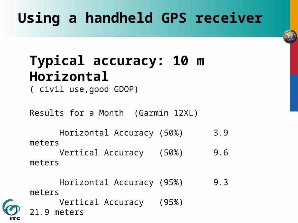
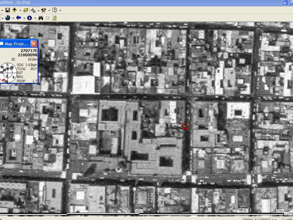
Using a handheld GPS receiver
Typical accuracy: 10 m Horizontal( civil use,good GDOP)
Results for a Month (Garmin 12XL)
Horizontal Accuracy (50%) 3.9 meters Vertical Accuracy (50%) 9.6 meters
Horizontal Accuracy (95%) 9.3 meters Vertical Accuracy (95%) 21.9 meters
Source: GPS ACCURACY MONITOR by Dennis Milbert (http://mywebpages.comcast.net/dmilbert/handacc/accur.htm)
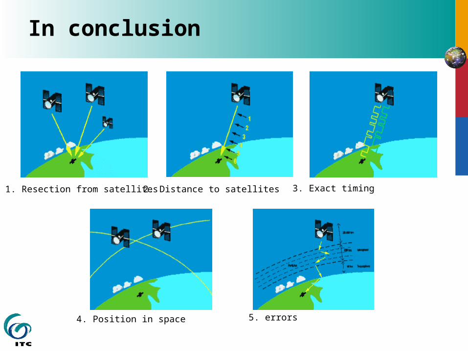
In conclusion
1. Resection from satellites 2. Distance to satellites 3. Exact timing
4. Position in space 5. errors