Embed Size (px)
Citation preview
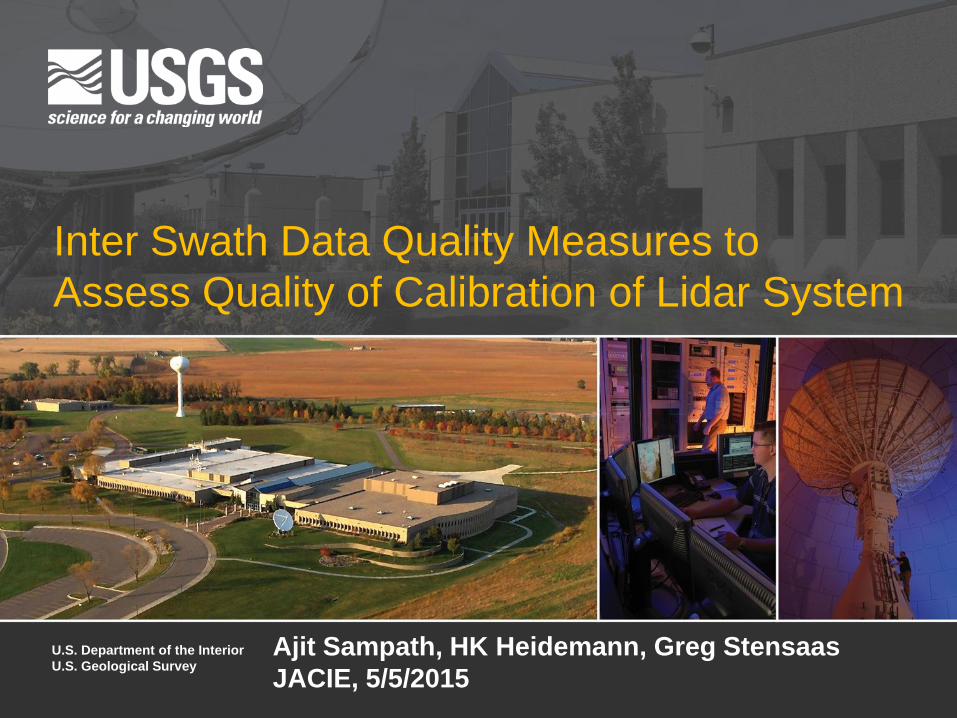
Inter Swath Data Quality Measures to
Assess Quality of Calibration of Lidar System
U.S. Department of the Interior
U.S. Geological Survey Ajit Sampath, HK Heidemann, Greg Stensaas
JACIE, 5/5/2015
Outline
• Introduction
• Inter Swath Analysis
• Internal Data Quality Measures
• Prototype Research Software for DQM
• DQM Test and Analysis
• Concluding Remarks and Discussion
Introduction
• Airborne Lidar data have become the primary means
of 3D mapping
• Quality standards transform Lidar point cloud from pretty
visualization to metric data
• Quality control and assurance processes are not
consistently applied and available
• Algorithms and Tools to analyze quality of point cloud are
necessary
• For national projects as 3DEP consistent geometric
quality assessment methods needed
3DEP
• 3DEP will collect 3D data over the entire US
• Lidar is the technology of choice
• Many data providers, sub contractors etc.
• Data should be of consistent and known quality
• Important to have tools to test quality of Lidar/3D data
• Lidar System involves integration of complex systems (sensor, IMU, GPS etc.)
• Errors in consistency are inevitable..
• Comprehensive data consistency measurement
specifications a must to minimize errors
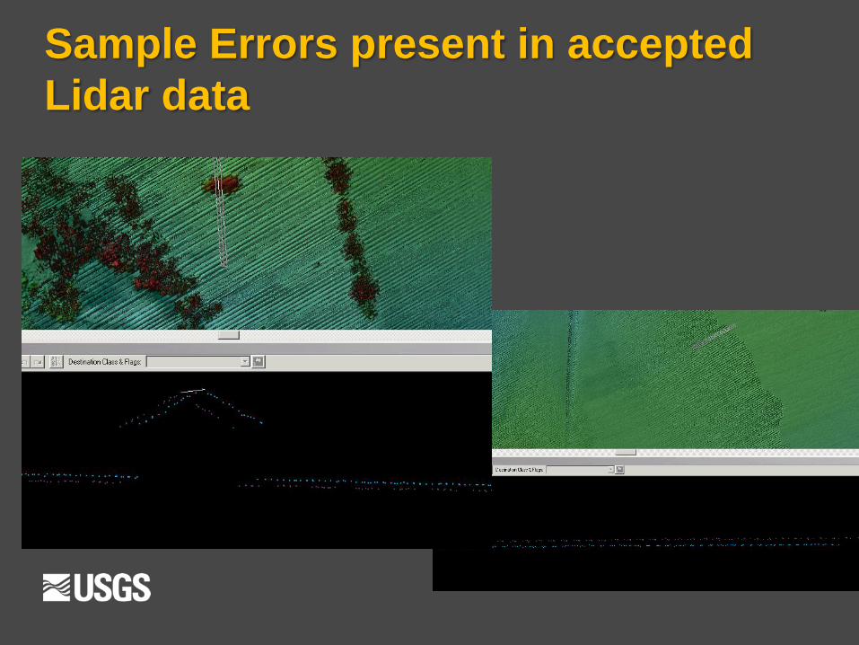
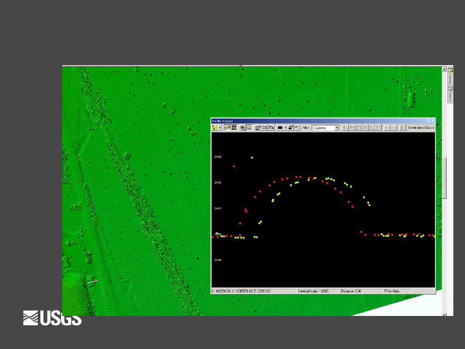
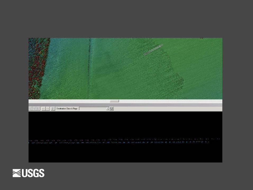
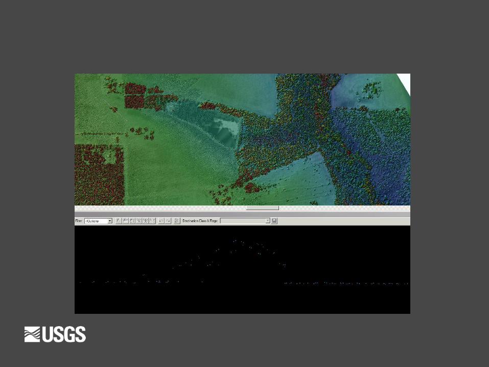
Sample Errors present in accepted
Lidar data
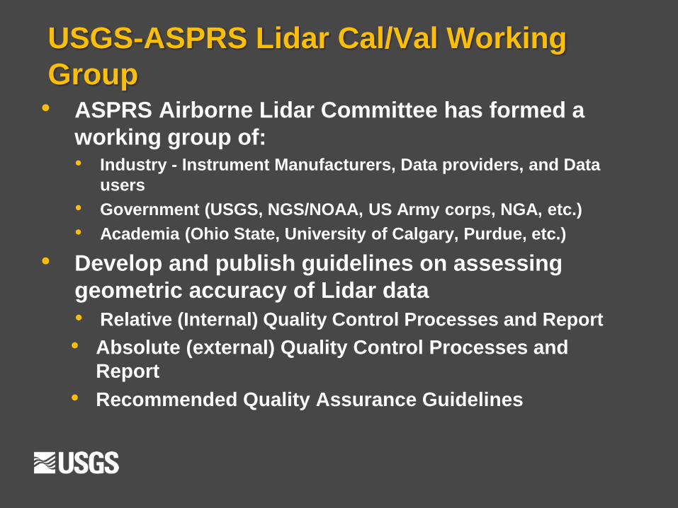
USGS-ASPRS Lidar Cal/Val Working
Group • ASPRS Airborne Lidar Committee has formed a
working group of: • Industry - Instrument Manufacturers, Data providers, and Data
users
• Government (USGS, NGS/NOAA, US Army corps, NGA, etc.)
• Academia (Ohio State, University of Calgary, Purdue, etc.)
• Develop and publish guidelines on assessing
geometric accuracy of Lidar data
• Relative (Internal) Quality Control Processes and Report
• Absolute (external) Quality Control Processes and
Report
• Recommended Quality Assurance Guidelines
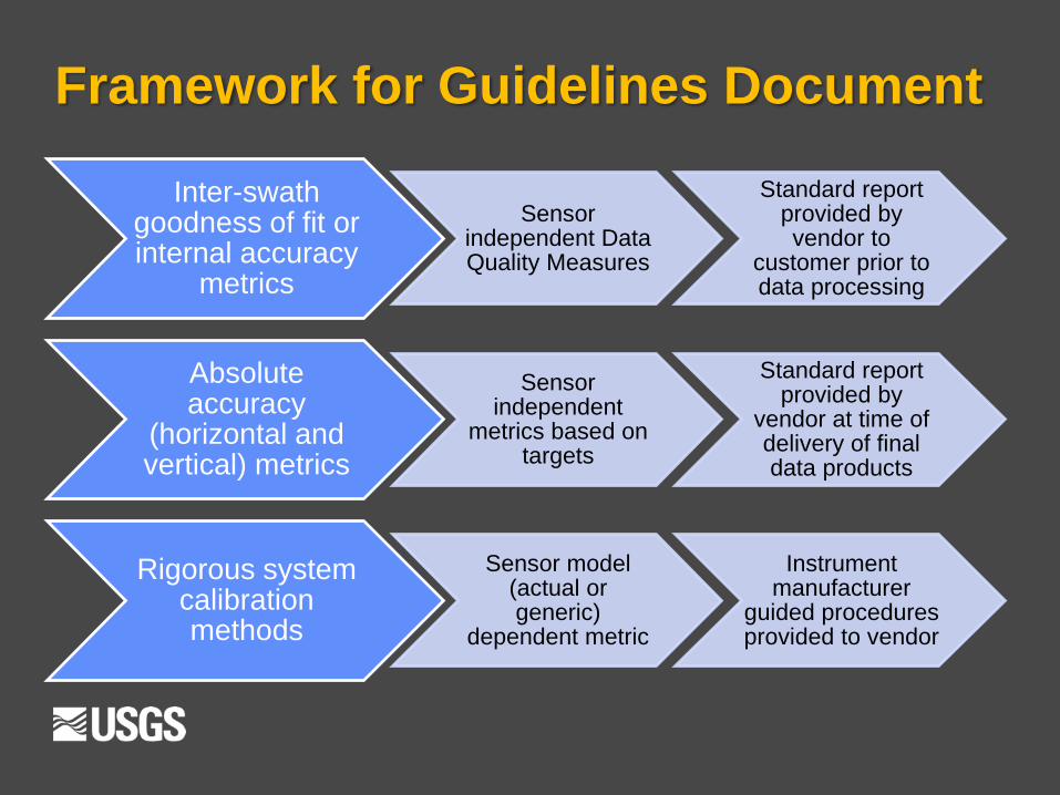
Framework for Guidelines Document
Inter-swath goodness of fit or internal accuracy
metrics
Sensor independent Data Quality Measures
Standard report provided by vendor to
customer prior to data processing
Absolute accuracy
(horizontal and vertical) metrics
Sensor independent
metrics based on targets
Standard report provided by
vendor at time of delivery of final data products
Rigorous system calibration methods
Sensor model (actual or generic)
dependent metric
Instrument manufacturer
guided procedures provided to vendor
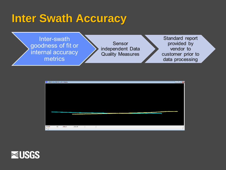
Inter Swath Accuracy
Inter Swath Accuracy
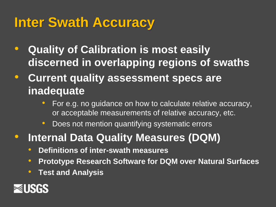
• Quality of Calibration is most easily
discerned in overlapping regions of swaths
• Current quality assessment specs are
inadequate • For e.g. no guidance on how to calculate relative accuracy,
or acceptable measurements of relative accuracy, etc.
• Does not mention quantifying systematic errors
• Internal Data Quality Measures (DQM) • Definitions of inter-swath measures
• Prototype Research Software for DQM over Natural Surfaces
• Test and Analysis
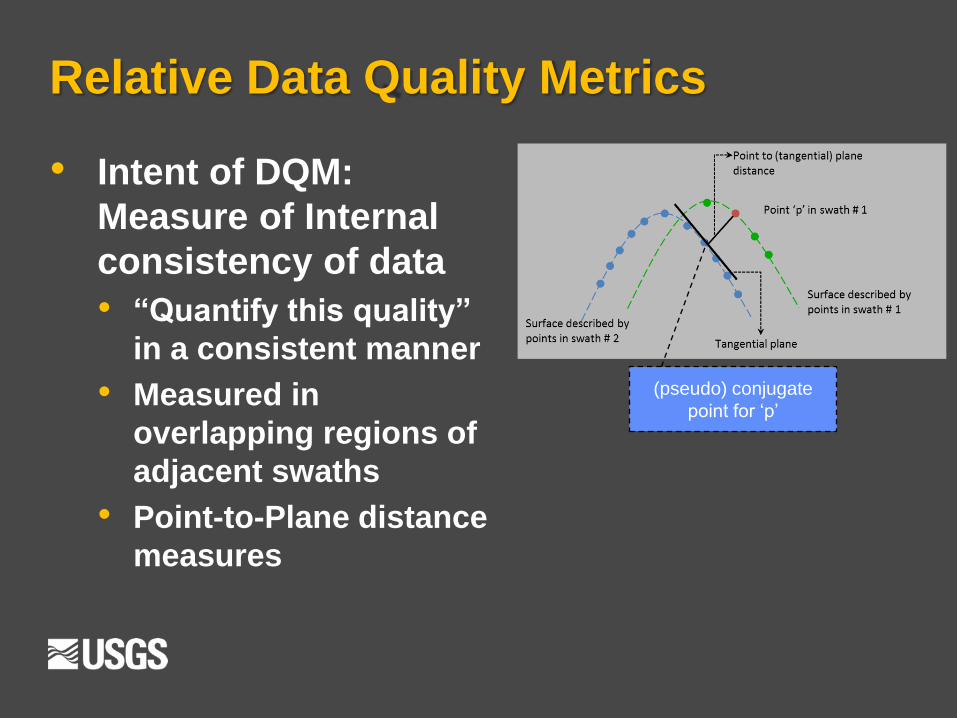
• Intent of DQM:
Measure of Internal
consistency of data
• “Quantify this quality”
in a consistent manner
• Measured in
overlapping regions of
adjacent swaths
• Point-to-Plane distance
measures
Relative Data Quality Metrics
(pseudo) conjugate
point for ‘p’
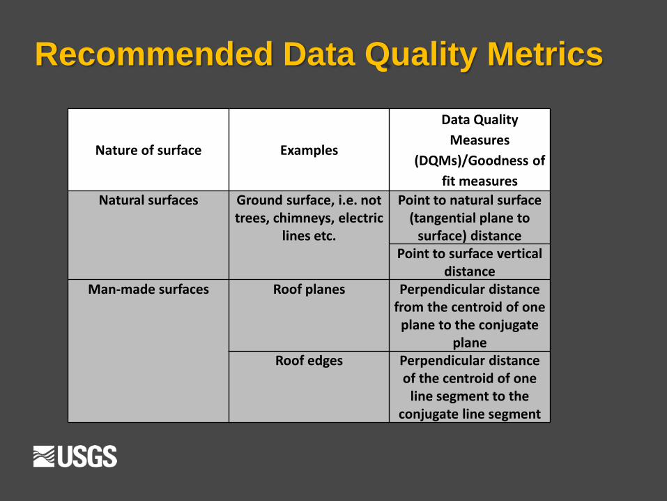
Recommended Data Quality Metrics
Nature of surface Examples
Data Quality
Measures
(DQMs)/Goodness of
fit measures
Natural surfaces Ground surface, i.e. not trees, chimneys, electric
lines etc.
Point to natural surface (tangential plane to
surface) distance Point to surface vertical
distance Man-made surfaces Roof planes Perpendicular distance
from the centroid of one plane to the conjugate
plane Roof edges Perpendicular distance
of the centroid of one line segment to the
conjugate line segment
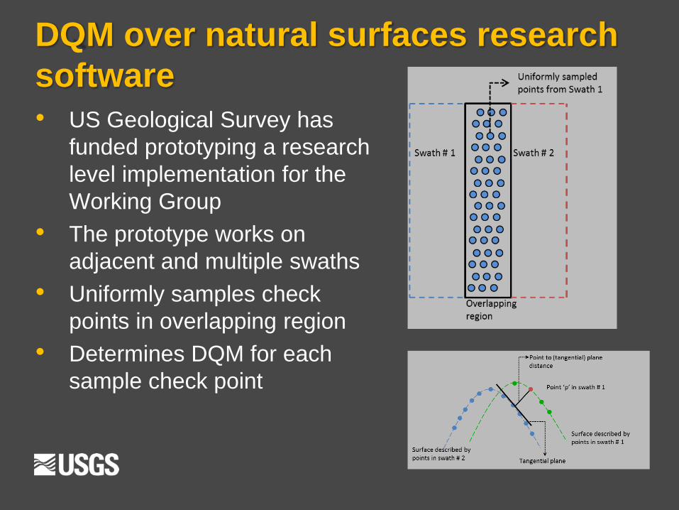
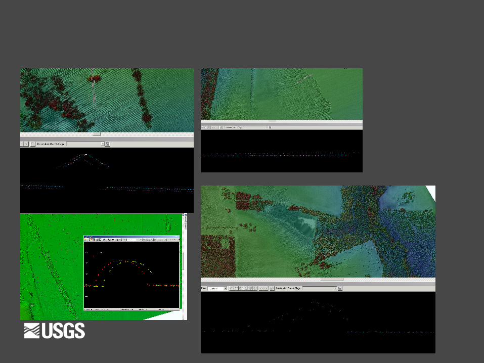
DQM over natural surfaces research
software
• US Geological Survey has
funded prototyping a research
level implementation for the
Working Group
• The prototype works on
adjacent and multiple swaths
• Uniformly samples check
points in overlapping region
• Determines DQM for each
sample check point
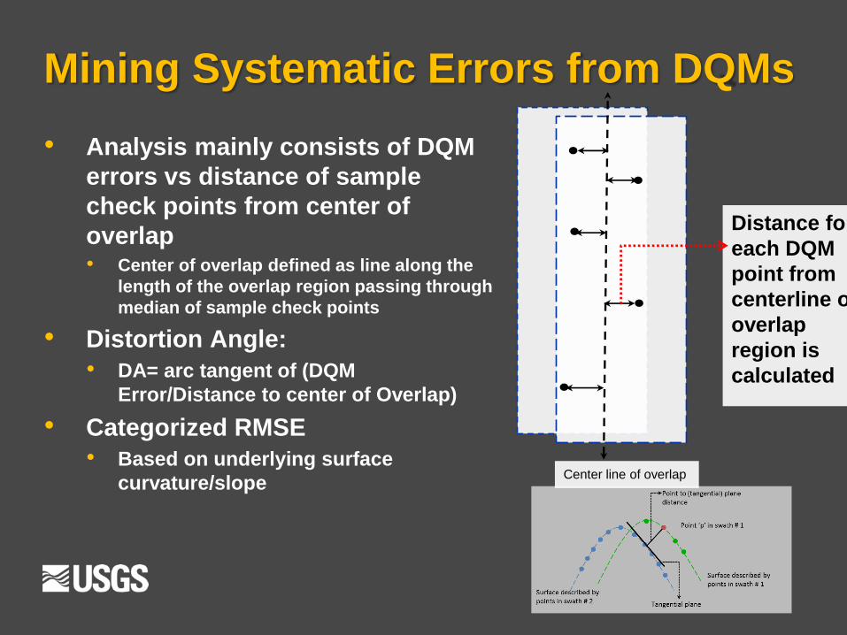
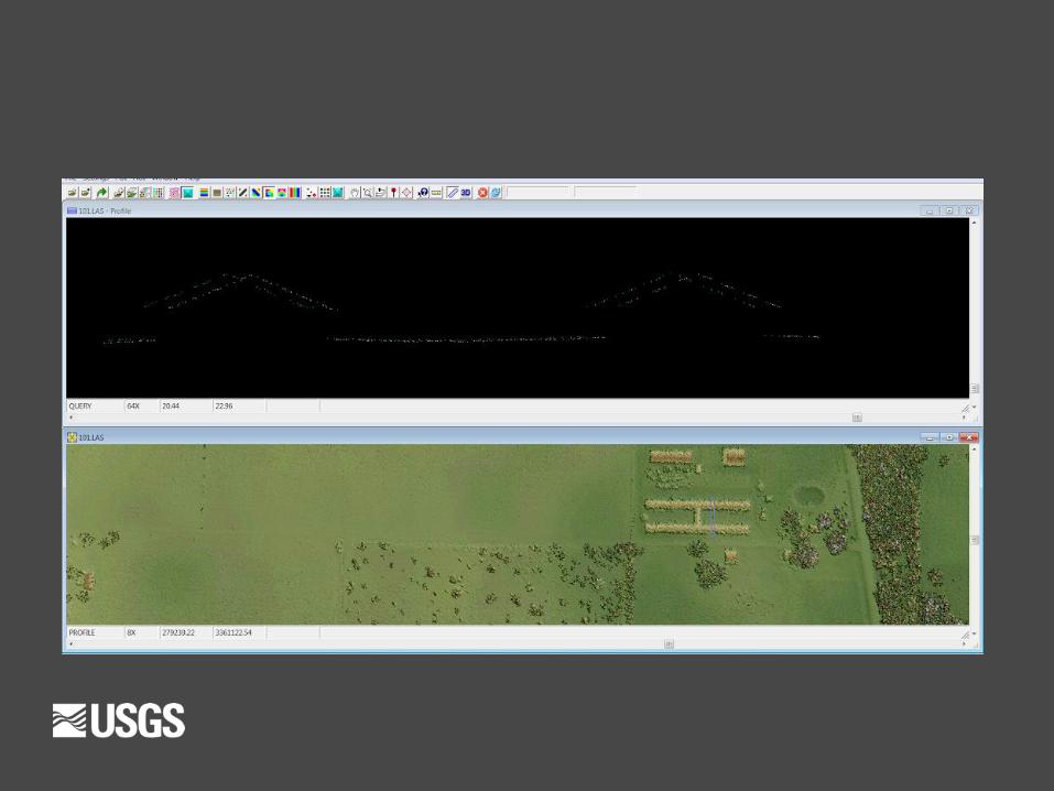
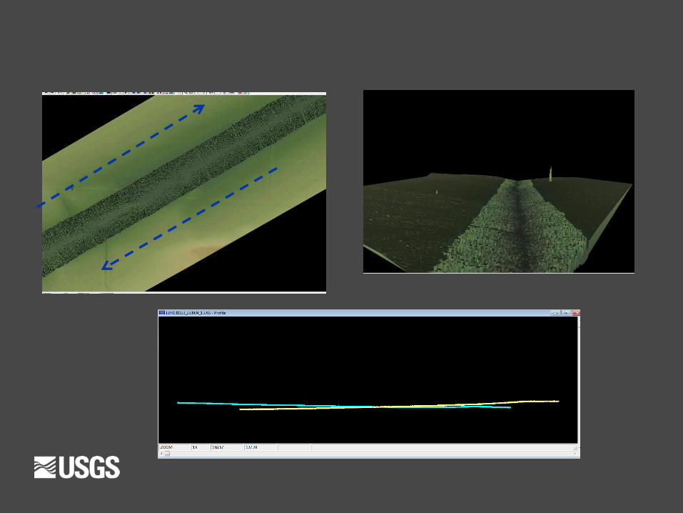
Mining Systematic Errors from DQMs
• Analysis mainly consists of DQM
errors vs distance of sample
check points from center of
overlap • Center of overlap defined as line along the
length of the overlap region passing through
median of sample check points
• Distortion Angle:
• DA= arc tangent of (DQM
Error/Distance to center of Overlap)
• Categorized RMSE
• Based on underlying surface
curvature/slope
Distance for
each DQM
point from
centerline of
overlap
region is
calculated
Center line of overlap
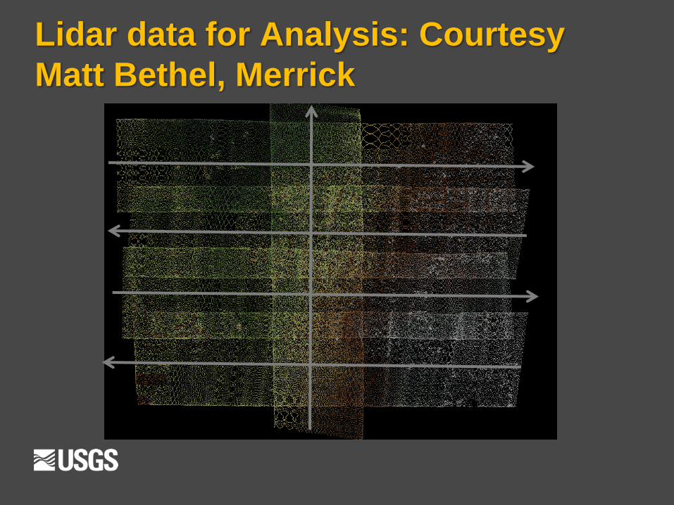
Lidar data for Analysis: Courtesy
Matt Bethel, Merrick
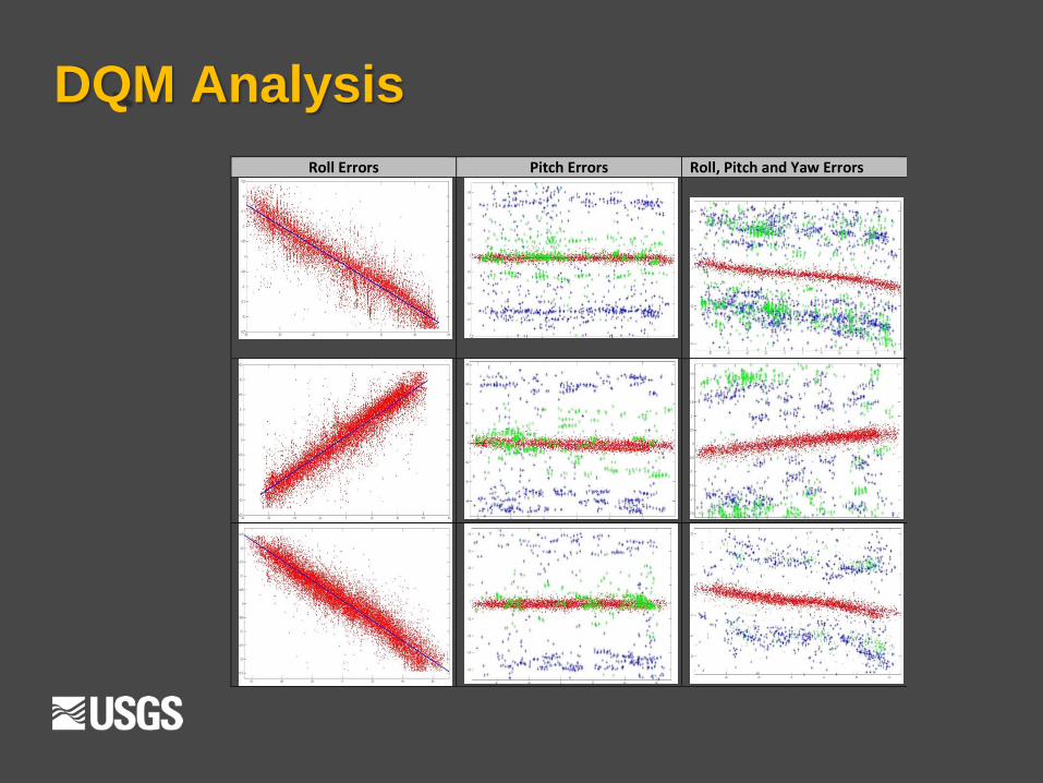
DQM Analysis
Roll Errors Pitch Errors Roll, Pitch and Yaw Errors
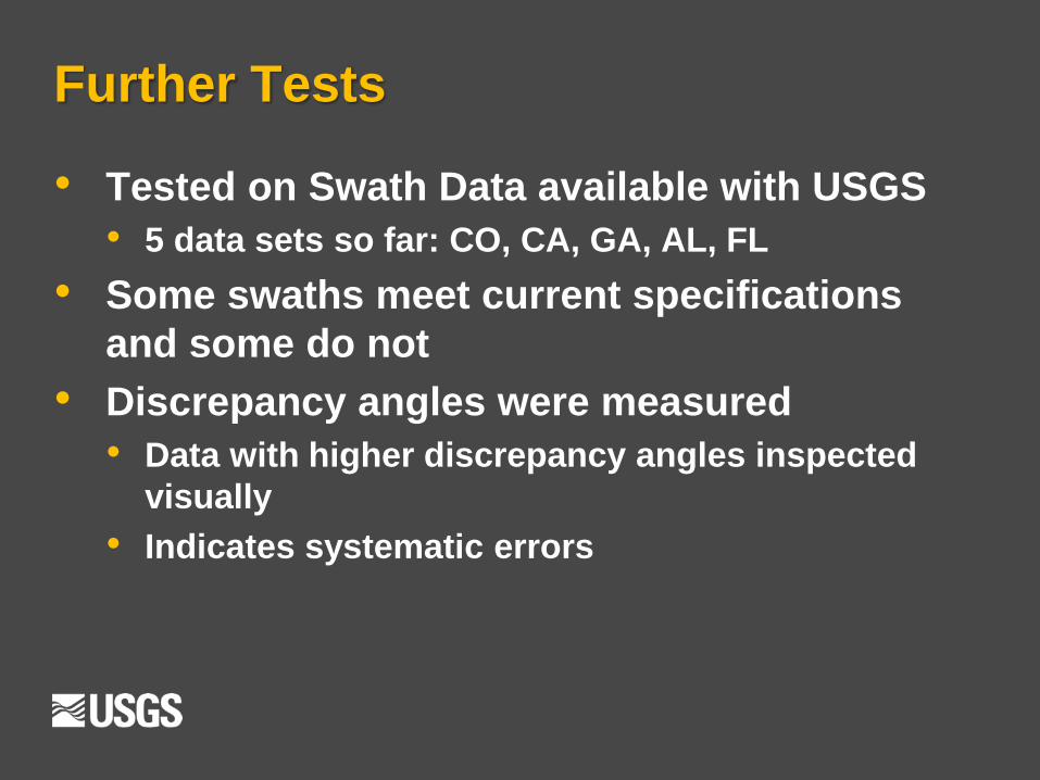
Further Tests
• Tested on Swath Data available with USGS
• 5 data sets so far: CO, CA, GA, AL, FL
• Some swaths meet current specifications
and some do not
• Discrepancy angles were measured
• Data with higher discrepancy angles inspected
visually
• Indicates systematic errors
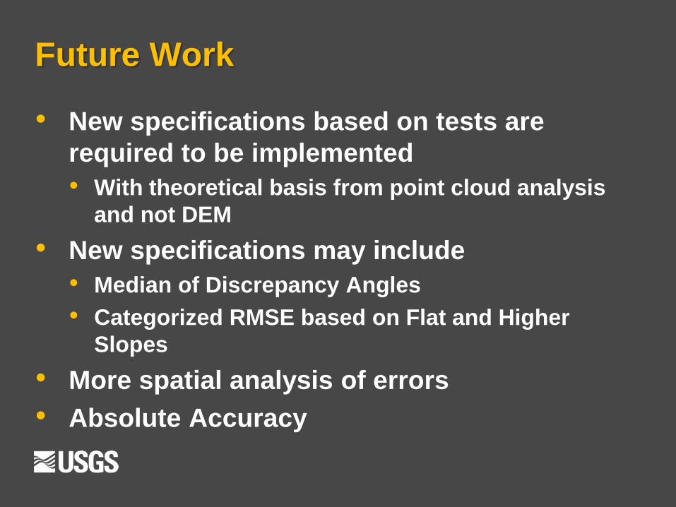
Future Work
• New specifications based on tests are
required to be implemented
• With theoretical basis from point cloud analysis
and not DEM
• New specifications may include
• Median of Discrepancy Angles
• Categorized RMSE based on Flat and Higher
Slopes
• More spatial analysis of errors
• Absolute Accuracy
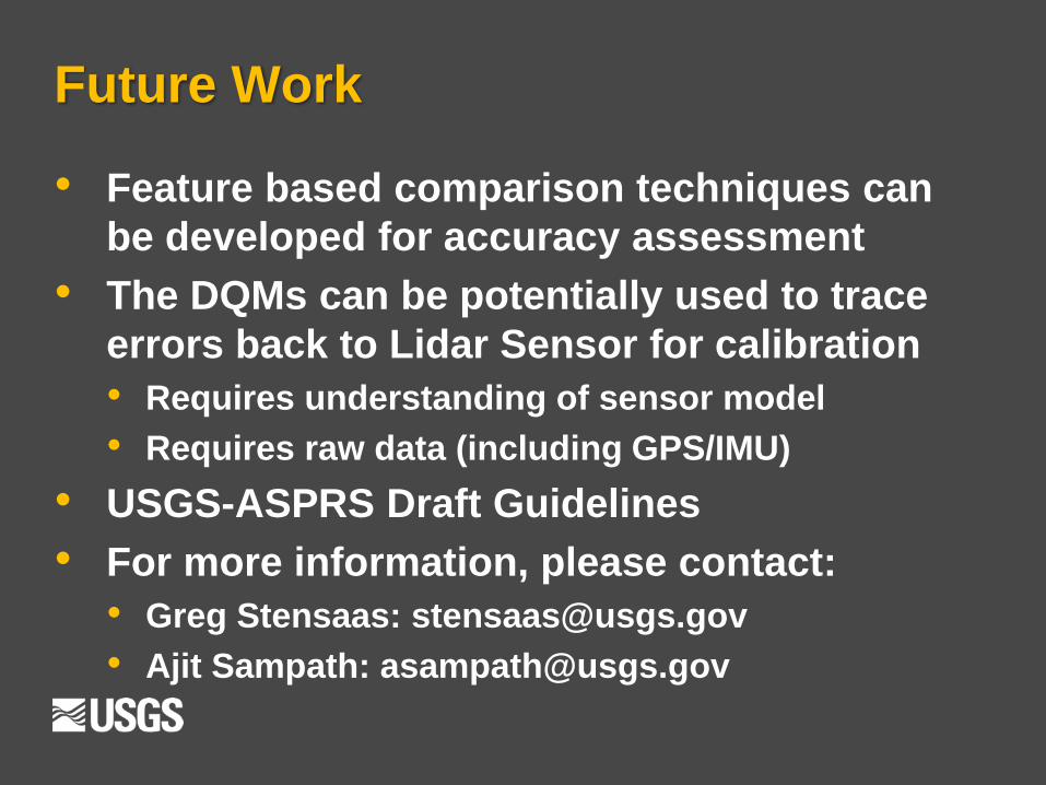
Future Work
• Feature based comparison techniques can
be developed for accuracy assessment
• The DQMs can be potentially used to trace
errors back to Lidar Sensor for calibration
• Requires understanding of sensor model
• Requires raw data (including GPS/IMU)
• USGS-ASPRS Draft Guidelines
• For more information, please contact:
• Greg Stensaas: [email protected]
• Ajit Sampath: [email protected]