Embed Size (px)
Citation preview

Site Allocations Plan for Stratford-on-Avon District
to accompany the Core Strategy
Intention to Prepare a Local Plan
Regulation 18 Consultation
Revised Scoping & Initial Options
January 2018

Site Allocations Plan Revised Scoping and Initial Options – January 2018
2 of 34
Contents Page No.
About this Consultation 3
Introduction 5
Part 1 Approach to identifying Reserve Housing Sites 8
Part 2 Definition of Settlement (Built-Up Area) Boundaries 13
Part 3 Proposed approach towards Specific Sites 21
(a) Proposal SUA.2: South of Alcester Road, Stratford-upon-Avon 21
(b) Proposal SUA.4: Atherstone Airfield 23
(c) Land east of Shipston Road, Stratford-upon-Avon 25
(d) Napton Brickworks 26
(e) University of Warwick Campus, Wellesbourne 29
(f) Priory Square, Studley 29
(g) Studley Enterprise Centre 30
(h) Rother Street/Grove Road, Stratford-upon-Avon 30
Part 4 Self-Build and Custom Housebuilding 32
Appendix A Built-Up Area Boundary Maps: Main Rural Centres
Appendix B Built-Up Area Boundary Maps: Category 1 Local Service Villages
Appendix C Built-Up Area Boundary Maps: Category 2 Local Service Villages
Appendix D Built-Up Area Boundary Maps: Category 3 Local Service Villages
Appendix E Built-Up Area Boundary Maps: Category 4 Local Service Villages
Appendix F Location Plans of sites identified in Part 3
Appendix G Location Plans of sites identified in Part 4
If you have any queries regarding this document please contact the Policy Team. If
you find the text in this document difficult to read, we may be able to supply it in a
format better suited to your needs.
Telephone: 01789 260473
Email: [email protected]
Write to: Planning Policy Team, Stratford-on-Avon District Council, Elizabeth House,
Church Street, Stratford-upon-Avon, CV37 6HX
Site Allocations Plan Revised Scoping and Initial Options – January 2018
3 of 34
About this Consultation Stratford-on-Avon District Council is holding a six-week public consultation on the revised scope of
its Site Allocations Plan. The Site Allocations Plan is one of a number of planning policy documents
that, when finished (adopted), will be used by the Council to help make decisions on planning
applications across Stratford-on-Avon District. It will also enable communities to know where new
development may happen in the future.
Structure of the Document Following a short introductory section, the document is divided into various parts which you can
comment on, in particular by responding to specific questions relating to the topics covered. To
assist with reading the document, the following icons are used:
Denotes a specific consultation question
Provides specific information and links to where further information can be found
Provides the technical material that has informed the Council’s intended approach
at this stage
Summarises the feedback from the previous scoping consultation where relevant
How to Comment The period for submitting comments is from Thursday 25 January 2018 to 5pm on Friday 9 March
2018.
Comments on any aspect of the document are invited. You are strongly recommended to use the
prescribed form as this will assist us in understanding which parts of the document you are making
comments on.
Comments received after the deadline may not be considered.
You can respond in the following ways:
Do it online - use our INTERACTIVE DOCUMENT which allows you to click on
specific sections, questions, etc. and comment online
or
Use the online comment form at www.stratford.gov.uk/siteallocations
Do it by email - download and fill in a comment form and email it to
• Comment Form - pdf to download
Site Allocations Plan Revised Scoping and Initial Options – January 2018
4 of 34
• Comment Form - Word version (Save this RTF document as Word.doc to reduce
memory size)
Do it by post – send your completed comment form to: Freepost Plus RTYG–BGXS–
ESLZ, Stratford on Avon District Council, Elizabeth House, Church Street, Stratford-
upon-Avon, CV37 6HX
or
Print off and complete a comment form and hand it in at the District Council offices
at Elizabeth House, Church Street, Stratford-upon-Avon, CV37 6HX
Availability of Documents Copies of the consultation documents are available to view on the District Council’s website at
www.stratford.gov.uk/siteallocations, at the District Council Offices at Elizabeth House, Stratford-
upon-Avon between 8.45am and 5.15pm Mondays to Wednesdays and between 8.45am and
5.00pm on Thursdays and Fridays, and at public libraries across the District during normal opening
hours - http://www.warwickshire.gov.uk/findalibrary.
Copies of the consultation documents can be purchased from the Planning Policy Team.
Paper copies of the form can be provided on request. A Word.doc version of the form can be
emailed to you on request.

Site Allocations Plan Revised Scoping and Initial Options – January 2018
5 of 34
Stratford-on-Avon Core Strategy
Policy CS.15 identifies Stratford-upon-Avon as the main town; Alcester, Bidford-on-Avon,
Henley-in-Arden, Kineton, Shipston-on-Stour, Southam, Studley and Wellesbourne as Main
Rural Centres; four categories of smaller settlements called Local Service Villages; and two
new settlements at Gaydon Lighthorne Heath and Long Marston Airfield.
Policy CS.16 establishes the need to provide at least 14,600 additional homes in the District
during the period 2011 to 2031. As at 31 March 2017, provision had already been made for
16,200 homes, including completions, permissions and strategic allocations.
Policy CS.16 also specifies that reserve sites accommodating 20% of the total housing
requirement should be identified in the Site Allocations Plan.
Find out more at www.stratford.gov.uk/corestrategy
Introduction What is the Site Allocations Plan?
The Site Allocations Plan sits alongside the Core Strategy and emerging Gypsy and Traveller Plan,
and once adopted, will form part of the Development Plan for Stratford-on-Avon District. These
documents, along with Neighbourhood Plans prepared by parish councils, set out the principles and
policies against which planning applications are judged. The context for the Site Allocations Plan is
set by the Core Strategy which was adopted in July 2016.
What is the purpose of this document?
A consultation exercise was undertaken in autumn 2014 regarding the intended scope of the Site
Allocations Plan (SAP). At that time it was envisaged that its main purpose would be to identify
non-strategic housing sites to supplement the allocations identified in the Core Strategy in order to
achieve the District’s housing requirement. Since then, the scale of housing provision now made
through completions, commitments and allocations has more than met the 14,600 dwellings
specified in the adopted Core Strategy. Consequently, the primary focus of the SAP will now be on
the identification of reserve housing sites in accordance with the provisions of Policy CS.16(D).
Given the significant change of circumstance regarding housing provision, together with other
issues that have now arisen, it is appropriate to consult on a revised scoping of the SAP. By doing
so, interested parties are made aware of the situation and it provides an opportunity for them to
express their views on its intended contents. This initial consultation stage will assist the District
Council to produce the Plan itself which will be submitted to the Secretary of State for examination
and eventual adoption.
Site Allocations Plan Revised Scoping and Initial Options – January 2018
6 of 34
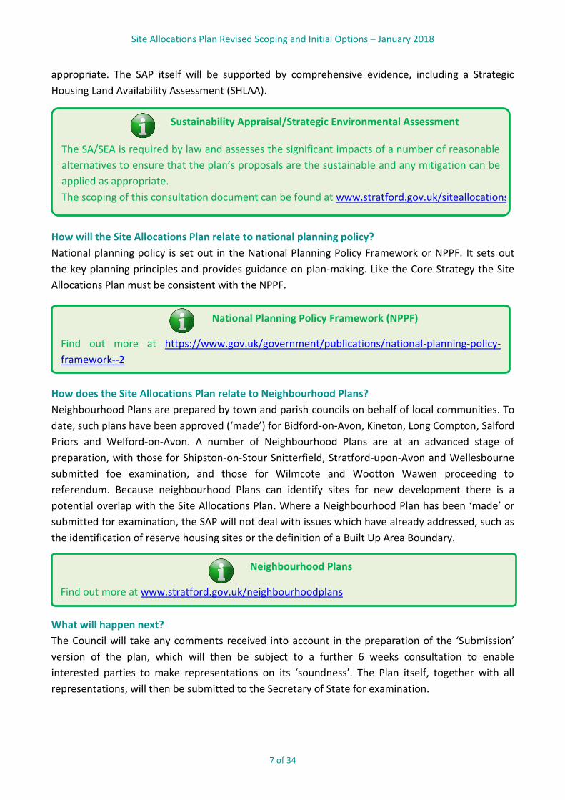
Preparing the Plan
The anticipated stages of preparation are as follows:
Revised Scoping & Initial Options Consultation
January 2018
Draft Plan Consultation Summer 2018
Submission to Secretary of State for examination Autumn 2018
Examination hearings Late 2018/early 2019
Receipt of Inspector’s Report Late spring 2019
Adoption Summer 2019
There are four parts to this consultation document that follow this introduction:
1. Approach to identifying Reserve Housing Sites
2. Definition of Settlement (Built Up Area) Boundaries
3. Proposed approach in relation to specific sites
4. Provision for Self-Build and Custom Housebuilding
Please note: this consultation is not an opportunity to comment on the development strategy or
the categorisation of settlements as these are matters already established in the adopted Core
Strategy.
How will the Site Allocations Plan be prepared?
Preparing the SAP is not a one-off event and there are a number of stages to its preparation. The
current anticipated timetable for preparing the Plan is set out below. Following this consultation,
the full Plan will be prepared, which will identify the Council’s proposed reserve housing sites. This
will be published for representations on the ‘soundness’ of the Plan to be made, including its
conformity to national planning policy and whether its proposals are appropriate and effective. It
will then be submitted to the Government and examined by an independent planning inspector
who will hold a public examination to check that it has been prepared properly and its contents are
acceptable. If ‘sound’ the Plan will be adopted by the District Council and it will then form part of
the Development Plan.
How does the Council decide on its proposals?
As well as being subject to community and stakeholder engagement the eventual content of the
SAP will be informed by an analysis of the available technical evidence and subject to a
Sustainability Appraisal/Strategic Environmental Assessment (SA/SEA). The contents of this
document have been subject to an SA/SEA scoping and this assessment has been published as part
of the consultation process.
Specific aspects of this consultation document have been informed by technical material and
evidence. Links to this can be found in individual sections throughout the rest of the document as
Site Allocations Plan Revised Scoping and Initial Options – January 2018
7 of 34
Neighbourhood Plans
Find out more at www.stratford.gov.uk/neighbourhoodplans
Sustainability Appraisal/Strategic Environmental Assessment
The SA/SEA is required by law and assesses the significant impacts of a number of reasonable
alternatives to ensure that the plan’s proposals are the sustainable and any mitigation can be
applied as appropriate.
The scoping of this consultation document can be found at www.stratford.gov.uk/siteallocations
National Planning Policy Framework (NPPF)
Find out more at https://www.gov.uk/government/publications/national-planning-policy-
framework--2
appropriate. The SAP itself will be supported by comprehensive evidence, including a Strategic
Housing Land Availability Assessment (SHLAA).
How will the Site Allocations Plan relate to national planning policy?
National planning policy is set out in the National Planning Policy Framework or NPPF. It sets out
the key planning principles and provides guidance on plan-making. Like the Core Strategy the Site
Allocations Plan must be consistent with the NPPF.
How does the Site Allocations Plan relate to Neighbourhood Plans?
Neighbourhood Plans are prepared by town and parish councils on behalf of local communities. To
date, such plans have been approved (‘made’) for Bidford-on-Avon, Kineton, Long Compton, Salford
Priors and Welford-on-Avon. A number of Neighbourhood Plans are at an advanced stage of
preparation, with those for Shipston-on-Stour Snitterfield, Stratford-upon-Avon and Wellesbourne
submitted foe examination, and those for Wilmcote and Wootton Wawen proceeding to
referendum. Because neighbourhood Plans can identify sites for new development there is a
potential overlap with the Site Allocations Plan. Where a Neighbourhood Plan has been ‘made’ or
submitted for examination, the SAP will not deal with issues which have already addressed, such as
the identification of reserve housing sites or the definition of a Built Up Area Boundary.
What will happen next?
The Council will take any comments received into account in the preparation of the ‘Submission’
version of the plan, which will then be subject to a further 6 weeks consultation to enable
interested parties to make representations on its ‘soundness’. The Plan itself, together with all
representations, will then be submitted to the Secretary of State for examination.

Site Allocations Plan Revised Scoping and Initial Options – January 2018
8 of 34
Part 1 Approach to identifying Reserve Housing
Sites
Why identify reserve sites?
1.1 Along with those homes already built and those with planning permission, the strategic site
allocations identified in the Core Strategy contribute to meeting the District housing requirement
of 14,600 homes for the 20 year period 2011 to 2031. The Council considers that the sites it has
identified and those with permission will deliver the homes as expected.
1.2 However, there are always risks that some sites with planning permission will not get built
or that additional housing needs arise that need to be met within the District. Indeed, the NPPF
requires plans to include flexibility to adapt to changing circumstances. If such eventualities were
to occur, it could lead to an undersupply of housing and accusations that the Core Strategy is out of
date and no longer valid. To prevent this from happening, a sensible and pragmatic approach is to
identify ‘reserve sites’. Reserve sites would only be brought forward for development within the
plan period if monitoring were to show a shortfall in housing supply that could not be met
elsewhere, or other specific circumstances arose that required the provision of more housing. It
enables the Council, as the Local Planning Authority, to retain control of and continue to manage
development in the District.
1.3 Reserve sites also provide certainty to communities as to where alternative or additional
development will take place rather than having to react to speculative applications or appeals.
What you told us previously
1.4 The previous consultation on the scoping of the SAP did not focus on the identification of
reserve sites. Consequently, the responses received did not comment on this specific issue.
1.5 Core Strategy Policy CS.16 requires the Site Allocations Plan to identify reserve housing sites
capable of meeting 20% of the housing requirement to 2031 i.e. around 2,920 homes. The policy
also identifies specific circumstances where a reserve site may need to be released for
development.

Site Allocations Plan Revised Scoping and Initial Options – January 2018
9 of 34
Core Strategy Policy CS.16.D
The Site Allocations Plan will identify Reserve Housing Sites providing flexibility to ensure that
the District can meet in full its agreed housing requirement (the share of the housing needs
arising in the Coventry and Warwickshire Housing Market Area to 2031) and/or to respond to
the need to meet housing need arising outside the Coventry and Warwickshire Housing
Market Area (HMA). The location of any reserve sites will take account of the settlement
pattern and the overall balance of distribution of development set out in Policy CS.15.
Reserve sites will have the capacity to deliver up to 20% of the total housing requirement to
2031.
Reserve sites will be released in the following circumstances:
• To rectify any identified shortfall in housing delivery in order to maintain a 5 year
supply of housing land in Stratford-on-Avon District;
• To contribute to meeting any identified additional need for housing in relation to a net
growth in jobs at Jaguar Land Rover arising from development of the employment
allocation at Gaydon Lighthorne Heath;
• To contribute to meeting within the District any identified shortfall in housing across
the Coventry and Warwickshire HMA as demonstrated through the agreed outcomes of
ongoing joint working between the Coventry and Warwickshire local planning
authorities;
• To contribute to meeting any housing needs arising outside the Coventry and
Warwickshire HMA that it is accepted through co-operation between the relevant
councils as needing to be met within the HMA and most appropriately being met within
the District.
Find out more at www.stratford.gov.uk/corestrategy
Find out more about Core Strategy Policy CS.16 at www.stratford.gov.uk/corestrategy.
How will the reserve housing sites be identified?
1.6 This consultation document does not identify any potential reserve sites. Work is currently
being undertaken to produce a new Strategic Housing Land Availability Assessment (SHLAA) which
will consider the availability, suitability and achievability of sites.
1.7 The focus of this process is on locations which are consistent with the distribution of
housing development established in Policy CS.15 in the Core Strategy. This approach was supported
by the Inspector who examined the Core Strategy (see pages 276ff). The Inspector recommended
that when identifying reserve sites, the following principles that should be taken into account:
Site Allocations Plan Revised Scoping and Initial Options – January 2018
10 of 34
Core Strategy Examination Inspector’s Final Report
Find out more at www.stratford.gov.uk/corestrategy
Question 1.1
Do you agree that the Site Allocations Plan should not release Green Belt land for reserve
housing sites?
Question 1.2
Do you agree with the broad strategy outlined above for seeking to locate reserve housing
sites?
• By their nature, reserve sites would comprise those that are not allocated in the Core
Strategy.
• It is appropriate to discount the possibility of identifying housing currently scheduled beyond
the Plan period in such locations as a reserve.
• Against the backdrop of concerns about the level of dispersal to LSVs, this aspect of the
strategy might need to be revisited when selecting reserve sites in the SAP.
• Given raised thresholds, dispersal of reserves sites to LSVs might not maximise the delivery of
affordable housing.
• Identifying a broad range of sites that are consistent with the strategy would allow them to
be released according to the different needs that might arise.
• It would be perverse to direct more housing to a site that was not delivering.
• The Core Strategy has identified a variety of sustainable locations and it is improbable that it
would be necessary to fundamentally revisit the significant amount of work that has already
been undertaken.
• Given the imperative to identify reserve sites, it would seem unlikely that the SAP must be
informed by a Green Belt review.
1.8 On the basis of the last bullet point above, it is not intended that the SAP will identify
reserve sites within the Green Belt.
1.9 It is intended that the location and capacity of reserve sites should broadly follow the
distribution of housing development established in Policy CS.16 in the Core Strategy.
1.10 Policy CS.15 in the Core Strategy sets a number of principles for determining the suitability
of sites for development.

Site Allocations Plan Revised Scoping and Initial Options – January 2018
11 of 34
Core Strategy Policy CS.15 Requirements
All development at existing settlements is expected to protect and enhance the character of
the settlement involved and its setting. To achieve this, each individual proposal will be
assessed against the following principles:
1. In relation to residential development, the number of homes proposed is consistent
with the overall scale of development identified for the settlement in Policy CS.16
Housing Development;
2. The scale of the development is appropriate to its immediate surroundings and to the
overall size and character of the settlement;
3. The design of the development is well-related to, and can be readily integrated with,
the existing form of the settlement;
4. The location and extent of the development does not have an unreasonably harmful
impact on the surrounding landscape and setting of the settlement;
5. The location and extent of the development would not result in the identity and/or
integrity of the settlement being undermined as a result of the reduction in the gap
with an adjacent settlement; and
6. The scheme incorporates or provides for appropriate improvements to the
infrastructure and services of the community.
Find out more at www.stratford.gov.uk/corestrategy
Find out more about Core Strategy Policy CS.15 at www.stratford.gov.uk/corestrategy.
1.11 The first of these principles is not applicable to the identification of reserve sites but the
remainder will be applied in assessing the suitability of such sites.
1.12 Decisions about which sites to identify will be based on the findings of the Strategic Housing
Land Availability Assessment (SHLAA) and other technical material, and also be informed by the
recommendations of the SA/SEA. This will be particularly applicable to deciding whether a further
new settlement should be identified as a reserve site.
1.13 Work on the SHLAA is currently ongoing with publication expected in early 2018. A standard
methodology agreed by the Coventry and Warwickshire local authorities is being applied to provide
a consistent basis for assessing and identifying potential reserve sites is available to view on the
Council’s website.
Site Allocations Plan Revised Scoping and Initial Options – January 2018
12 of 34
Question 1.3
Do you have any comments about the appropriateness of these principles being applied to the
identification of reserve sites?
Question 1.4
Option 1: Should reserve sites be identified that have the capacity to provide in the region of
2,920 dwellings?
Option 2: Should reserve sites be identified that have the capacity to provide in the region of
1,320 dwellings?
Option 3: Should reserve sites be identified that have the capacity to provide some other
number of dwellings?
Strategic Housing Land Availability Assessments (SHLAA)
Government guidance on the purpose of SHLAAs can be found at:
https://www.gov.uk/guidance/housing-and-economic-land-availability-assessment
The SHLAA methodology being used by the District Council can be found at:
https://www.stratford.gov.uk/siteallocations
What scale of reserve sites should be identified?
1.14 Policy CS.16 specifies that reserve sites should have the capacity to deliver 20% of the
District’s total housing requirement to 2031. Given that the housing requirement is 14,600
dwellings, this equates to sites for 2,920 dwellings being identified.
1.15 At 31 March 2017, the housing supply over the plan period 2011-2031 was 16,200 dwellings.
On that basis, it might be argued that because provision has already been made for 1,600 dwellings
over and above the housing requirement, this should be discounted, leaving about 1,320 dwellings
to be identified on reserve sites.
1.16 A number of options are set out below regarding the dwelling capacity of reserve sites to be
identified.
Site Allocations Plan Revised Scoping and Initial Options – January 2018
13 of 34
Green Belt
Just over one-fifth of the District is designated as Green Belt (the area north of Stratford-
upon-Avon). The fundamental aim of Green Belt is to prevent urban sprawl by keeping land
permanently open. Green Belt includes both undeveloped ‘greenfield’ and previously
developed ‘brownfield’ land. The quality of the landscape is not a Green Belt consideration.
Policy CS.10 in the Core Strategy deals with the control of development in the Green Belt and
identifies what types of development are appropriate.
Find out more at www.stratford.gov.uk/corestrategy
Part 2 Definition of Settlement (Built-Up Area)
Boundaries Why draw settlement boundaries?
2.1 The purpose of a settlement boundary is to distinguish between land inside the settlement
where new development is acceptable ‘in principle’, from land outside the settlement, where,
subject to certain exemptions, development is generally not acceptable. Settlement boundaries
therefore help prevent encroachment into the countryside. This is particularly important in the
Green Belt.
Haven’t settlement boundaries already been identified?
2.2 Stratford-upon-Avon and the eight Main Rural Centres have existing Built-Up Area
Boundaries (BUABs) but these may need to be amended to reflect any recent developments and
other circumstances. The Local Service Villages do not currently have BUABs, although some
villages have had such boundaries in the past.
How will the settlement boundaries affect the Green Belt?
2.3 Of the 45 Local Service Villages identified, 11 are in the Green Belt. The drawing of
settlement boundaries for those settlements does not change Green Belt policy which will still
apply and they will continue to be ‘washed over’ by the Green Belt designation.
2.4 Alcester, Henley-in-Arden and Studley are ‘inset’ (i.e. removed) from the Green Belt, whilst
Stratford-upon-Avon abuts the Green Belt.

Site Allocations Plan Revised Scoping and Initial Options – January 2018
14 of 34
Settlement Boundaries
At the Scoping Stage consultation in August/September 2014 a wide range of views were
expressed, including the following:
• Settlement boundaries provide clarity on what is a settlement and what is open
countryside and help prevent encroachment
• Use of boundaries should not conflict with the NPPF’s presumption in favour of
sustainable development and its aim to boost significantly housing supply
• Boundaries should not be drawn too tightly but enable a degree of flexibility rather
than restrict or limit development
• Boundaries should not be drawn too loosely as this could imply that every site within
the boundary was suitable for development
• Boundaries should include any sites allocated and with planning permission for
development
• Definition of boundaries should take account of environmental designations such as
AONB and Conservation Areas
• Boundaries are an important means of protecting the rural nature of the District and
the villages within it
What you told us previously
2.5 A brief summary of the comments received from the community and stakeholders in
response to the Scoping consultation is set out below. As can be seen, opinions were varied on this
matter, with a wide range of views expressed.
2.6 The Council believes that it is appropriate to draw settlement boundaries as an effective
means of managing development. It is also the Council’s view that settlement boundaries are not
incompatible with the NPPF where they are included in an up-to-date plan since the plan defines
sustainable development in Stratford-on-Avon District. Policy CS.16 in the adopted Core Strategy
has established the principle of using Built-Up Area Boundaries as a mechanism for managing the
location of development.
2.7 The wording of the policy, which was supported by the Inspector who examined the Core
Strategy, confirms that the BUABs for Stratford-upon-Avon and the Main Rural Centres as defined
on the Policies Map are the appropriate basis for assessing whether any revisions are justified. In
his Main Modifications (MM88) to the submitted Core Strategy, he agreed that BUABs should
include allocations identified in the Plan but not that any unallocated land on the edges of these
settlements should be included. This is reflected in paragraph 8.1.4 in the Core Strategy.

Site Allocations Plan Revised Scoping and Initial Options – January 2018
15 of 34
Policies Map
Question 2.1
Do you agree with the criteria that have been applied to define Built-Up Area Boundaries?
Find out more at www.stratford.gov.uk/corestrategy
2.8 Furthermore, it is appropriate to define BUABs for Local Service Villages to coincide with the
physical confines of these settlements as the two are clearly meant to be inter-changeable in
accordance with Part D in Policy CS.16.
How have Built-Up Area Boundaries been defined?
2.9 Boundaries have been drawn around the existing extent of the built-up area of each
settlement but also include any land allocated for development. Owing to the rural nature of the
District, many settlements have a dispersed settlement pattern. Where a settlement is comprised
of distinct parts, separate boundaries around each part have been drawn, which together form the
settlement as a whole. This approach will help protect important gaps within settlements.
2.10 Whilst much of the distinction between the built-up area and the open countryside is clear
cut, subjective judgement has been necessary in certain cases. To assist, the Council has applied,
subject to specific local circumstances, the following principles:
Land to be included within settlement boundaries:
• Churchyards;
• Community buildings and their immediate curtilage (i.e. playing fields are excluded);
• Areas of residential curtilage unless these areas are clearly paddocks or orchards or land more appropriately defined as ‘non-urban’;
• Employment sites on the edge of a village
Land to be excluded from settlement boundaries:
• Playing fields – including public, private and school playing fields;
• Modern agricultural buildings;
• Miscellaneous uses which may be located on the fringe of a settlement (e.g. sewage treatment plants, electricity sub-stations, railway land etc.);
• Allotments
• ‘Manor Houses’ and their associated land

Site Allocations Plan Revised Scoping and Initial Options – January 2018
16 of 34
Question 2.2
Do you agree with the Built-Up Area Boundaries defined for the following Main Rural
Centres?
(a) Alcester
(b) Henley-in-Arden
(c) Southam
(d) Studley
2.11 The definition of BUABs will not incorporate reserve sites that are identified. This is because
their release will be dependent on specific circumstances arising which will only become evident in
the future. Should a reserve site be released, the BUAB for that settlement will be amended to
include that development through a revision of the Development Plan.
Stratford-upon-Avon
2.12 Stratford-upon-Avon town’s BUAB has been defined in successive Local Plans and the
current boundary is shown on the District Council’s Policies Map. A Neighbourhood Plan for
Stratford-upon-Avon has been submitted for examination. The BUAB identified on its Proposals
Map corresponds with that shown on the District Council’s Policies Map.
2.13 Given this situation, it is appropriate for the boundary for the town to be examined and
established through the Neighbourhood Plan process and not duplicate the matter in the SAP.
Main Rural Centres
2.14 The BUABs for the eight Main Rural Centres have also been defined in previous Local Plans
and their boundaries are shown on the District Council’s Policies Map.
2.15 However, since the Policies Map was published in July 2016 to correspond with the
adoption of the Core Strategy, Neighbourhood Plans for Bidford-on-Avon and Kineton have been
‘made’ and those for Shipston-on-Stour and Wellesbourne have been submitted for examination.
All four Plans identify a settlement boundary and, on that basis, it is not intended to cover these
boundaries in the SAP.
2.16 The maps at Appendix A show the BUABs for the other four MRCs as defined on the Policies
Map.

Site Allocations Plan Revised Scoping and Initial Options – January 2018
17 of 34
Local Service Villages
2.17 In accordance with Policy CS.15.D in the Core Strategy, it is intended to identify a BUAB for
each of the LSVs. For some of these settlements such a boundary has been or is being identified
through a Neighbourhood Plan.
2.18 The definition of BUABs includes those LSVs situated within the Green Belt. However, the
BUABs have no bearing on the Green Belt and this designation will continue to wash over
settlements in the Green Belt irrespective of whether they have a BUAB or not. It should also be
noted that, whilst the BUAB will establish where in principle infill development is appropriate, such
development must still maintain the openness of the Green Belt and otherwise comply with Green
Belt policy.
2.19 All of the LSVs have been assessed, except for the following villages on the basis that their
BUAB is identified through a Neighbourhood Plan which has been ‘made’ or is in an advanced stage
of preparation, i.e. submitted for examination:
• Alveston (through the Stratford-upon-Avon NDP)
• Harbury
• Long Compton
• Salford Priors
• Snitterfield
• Tiddington (through the Stratford-upon-Avon NDP)
• Welford-on-Avon
• Wilmcote
• Wootton Wawen
Site Allocations Plan Revised Scoping and Initial Options – January 2018
18 of 34
Question 2.3
Do you agree with the proposed Built-Up Area Boundaries defined for the following
Category 1 Local Service Villages?
(a) Bishop’s Itchington
(b) Long Itchington
(c) Quinton
(d)
Question 2.4
Do you agree with the proposed Built-Up Area Boundaries defined for the following
Category 2 Local Service Villages?
(a) Brailes
(b) Fenny Compton
(c) Lighthorne Heath
(d) Napton-on-the-Hill
(e) Salford Priors
(f) Stockton
(g) Tysoe
(h) Tysoe
Category 1 Local Service Villages
2.20 Two of the five Category 1 LSVS, namely Harbury and Tiddington, are covered by a
Neighbourhood Plan that is ‘made’ or well-advanced. The submitted Stratford-upon-Avon NDP
identifies a BUAB for the separate settlement of Tiddington so it is not necessary for the SAP to do
so. The maps at Appendix B show the proposed boundaries for the remaining settlements.
Category 2 Local Service Villages
2.21 Four of the 10 Category 2 LSVS, namely Salford Priors, Welford-on-Avon, Wilmcote and
Wootton Wawen, are covered by a Neighbourhood Plan that is ‘made’ or well-advanced. Each of
them, apart from Salford Priors, identifies a BUAB for the settlement so it is not necessary for the
SAP to do so. The maps at Appendix C show the proposed boundaries for the remaining
settlements. It had been anticipated that the Brailes NDP would be submitted by now but this has
been delayed. On that basis, a BUAB for Brailes is included in this consultation document.
2.22 Two of the Category 2 LSVs, i.e. Wilmcote and Wootton Wawen, are located within the
Green Belt and Green Belt policy will continue to apply within their respective BUABs.
Site Allocations Plan Revised Scoping and Initial Options – January 2018
19 of 34
Question 2.5
Do you agree with the proposed Built-Up Area Boundaries defined for the following Category
3 Local Service Villages?
(a) Claverdon
(b) Earlswood
(c) Ettington
(d) Great Alne
(e) Ilmington
(f) Newbold-on-Stour
(g) Temple Herdewycke
(h) Tredington
Category 3 Local Service Villages
2.23 Two of the 10 Category 3 LSVS, namely Long Compton and Snitterfield, are covered by a
Neighbourhood Plan that is ‘made’. They both identify a BUAB for these settlements so it is not
necessary for the SAP to do so. The maps at Appendix D show the proposed boundaries for the
remaining settlements.
2.24 Four of the Category 2 LSVs, i.e. Claverdon, Earlswood, Great Alne and Snitterfield, are
located within the Green Belt and Green Belt policy will continue to apply within their respective
BUABs.
Category 4 Local Service Villages
2.25 One of the 20 Category 3 LSVS, namely Alveston, is covered by a Neighbourhood Plan that is
at an advanced stage of preparation. It identifies a BUAB for this settlements so it is not necessary
for the SAP to do so. The maps at Appendix E show the proposed boundaries for the remaining
settlements.
2.26 Five of the Category 2 LSVs, i.e. Aston Cantlow, Bearley, Mappleborough Green (east of
A435 only), Tanworth-in-Arden and Wood End, are located within the Green Belt and Green Belt
policy will continue to apply within their respective BUABs.
Site Allocations Plan Revised Scoping and Initial Options – January 2018
20 of 34
Question 2.6
Do you agree with the proposed Built-Up Area Boundaries defined for the following
Category 4 Local Service Villages?
(a) Alderminster
(b) Aston Cantlow
(c) Bearley
(d) Clifford Chambers
(e) Gaydon
(f) Halford
(g) Hampton Lucy
(h) Ladbroke
(i) Lighthorne
(j) Long Marston
(k) Loxley
(l) Mappleborough Green
(m) Moreton Morrell
(n) Northend
(o) Oxhill
(p) Pillerton Priors
(q) Priors Marston
(r) Tanworth-in-Arden
(s) Wood End

Site Allocations Plan Revised Scoping and Initial Options – January 2018
21 of 34
Part 3 Proposed approach towards Specific Sites
(a) Proposal SUA.2: South of Alcester Road, Stratford-upon-Avon
3.1 The Core Strategy allocates this site for employment development, comprising Class B1 uses
and the relocation of business from the Canal Quarter in Stratford-upon-Avon (see Proposal SUA.1),
together with an area for housing development.
3.2 Since the Core Strategy was adopted, circumstances have changed in various respects and
the Site Allocations Plan provides an opportunity to update and amend the provisions of Proposal
SUA.2.
3.3 The following matters are relevant in this respect:
(a) The housing component has now been granted planning permission and is being
implemented. Consequently, it can be deleted from any revised allocation. Accordingly, a
revised boundary to Proposal SUA.2 is shown in Appendix G.
(b) Liaison with the County Highway Authority has shown that an access off Wildmoor
Roundabout or the proposed Western Relief Road is unlikely to be acceptable. As a result
an alternative access off the A46 is now being pursued with Highways England. It would be
appropriate to reflect all these options in a revised allocation to provide flexibility.
(c) Latest evidence has shown there is limited demand in the Stratford-upon-Avon area for
Class B1(a) office. On that basis, it would seem appropriate to provide greater flexibility
regarding the nature of employment uses that would be acceptable on this site to include
manufacturing (Class B2) and logistics (Class B8). However, it remains important to seek to
attract office-based companies to the town and this site remains a key opportunity for
doing so due to its location and image.
(d) There is known to be strong interest from a number of car dealerships to locate on the site.
Facilitating this may also prompt certain car dealerships on the Canal Quarter to relocate
to this site which would help to deliver the Regeneration Zone.
(e) Discussions with businesses on the Canal Quarter have revealed that there is limited
interest in relocating to this site, and far less than the 13 hectares envisaged for this
purpose in the existing Core Strategy allocation.
(f) The District Council wishes to provide an opportunity for a comparison/bulky goods (eg.
DIY) retail store to relocate within the town.
3.4 The up-front infrastructure needed to open up this site for development is known to be
significant. This includes the new access, diversion of a high pressure water main which crosses the
site, and substantial earthworks to achieve a more level site. On that basis, greater flexibility on the
range of business uses that can occupy the site and the timescales for implementation may be
appropriate to help deliver wider objectives relating to growth in the local economy and the
creation of new jobs.

Site Allocations Plan Revised Scoping and Initial Options – January 2018
22 of 34
3.5 An assessment of other land parcels on the edge of Stratford-upon-Avon has been carried
out to show that Proposal SUA.2 is the most appropriate location for car dealerships and a retail
store in terms of its availability and suitability. However, justification for the latter use on this site
would need to be supported by a sequential assessment and retail impact assessment in
accordance with national planning policy and Policy CS.23 in the Core Strategy.
3.6 The following revised version of Proposal SUA.2 is proposed:
[NB. underlined text is new; crossed out text is deleted]
Proposal SUA.2: South of Alcester Road, Stratford-upon-Avon
Where it is to be delivered South of Alcester Road
Approx. 23 25 hectares (gross)
What is to be delivered Employment uses comprising:
1. Employment uses within Classes B1 (Business), B2 (General
Industrial and B8 (Storage and Distribution)
Class B1(a) office and Class B1(b) research and development uses,
although scope for B1(c) light industry will be considered
2. Relocation of businesses from the Canal Quarter Regeneration
Zone
3. Car Dealerships on a maximum of 7 hectares
4. Bulky goods retail store on a maximum of 2 hectares, subject
to a sequential assessment and retail impact assessment
During the plan period up to 10 hectares will be released, plus
additional land to correspond with the area taken up by
businesses relocating from the Regeneration Zone.
Housing – approx. 65 dwellings on land to the east of the Western
Relief Road
When it is to be delivered Phases 2 - 4 (2016/17 - 2030/31)
How it is to be delivered Private sector
Specific requirements
• vehicle access to the employment development directly off
the A46, or Wildmoor Roundabout or proposed Western
Relief Road
• improvements to Wildmoor Roundabout as required by
Highways England
• provision for improvements to A46 adjacent to the site as

Site Allocations Plan Revised Scoping and Initial Options – January 2018
23 of 34
Question 3.1
Do you agree with the proposed changes to Proposal SUA.2 South of Alcester Road, Stratford-
upon-Avon?
required by Highways England
• extensive landscaping on the southern and western
boundaries of the employment development
• appropriate treatment and management of mature
hedgerows along road frontages
• protect and enhance ecological features
• frequent bus service into the development
A thorough marketing exercise to seek to attract Class B1(a) office
uses to the site.
An effective mechanism to ensure that sufficient opportunity is
provided for businesses to relocate from the Canal Quarter to the
site.
If a plot that has been developed on that part of the site allocated
for the relocation of businesses from the Canal Quarter
Regeneration Zone becomes available it should be marketed for a
period of three months in order that another business in the
Regeneration Zone has the opportunity to take it up. This
provision will be applied for a period of two years from when that
plot was originally implemented.
(b) Proposal SUA.4: Atherstone Airfield
3.7 The Core Strategy allocates this site for employment development specifically for the
relocation of businesses from the Canal Quarter in Stratford-upon-Avon, together with scope for
businesses to relocate from elsewhere in the District to help facilitate implementation of the site.
3.8 Since the Core Strategy was adopted it has become apparent that there is very little interest
from businesses in the Canal Quarter to relocate to this site. Nevertheless, this location provides an
opportunity for employment development to assist the local economy by providing greater scope
for businesses in the District as a whole to relocate for operational reasons or in order to expand. It
is also apparent that most industrial estates in the District are very well occupied with few vacant
units. Some flexibility might reasonably be provided for businesses from outside the District to
move to this site in order to facilitate implementation for its principal purposes.
Site Allocations Plan Revised Scoping and Initial Options – January 2018
24 of 34
3.9 The Inspector who examined the Core Strategy found the site to be well-located in relation
to Stratford-upon-Avon. It has direct access onto the A road network, and a frequent bus service
runs along Shipston Road. It is an established business location with readily available infrastructure.
3.10 An assessment of other land parcels on the edge of Stratford-upon-Avon has been carried
out to show that Proposal SUA.4 is the most appropriate location for a wider range of uses as
proposed in terms of its availability and suitability.
3.11 The following revised version of Proposal SUA.4 is proposed:
[NB. underlined text is new; crossed out text is deleted]
Proposal SUA.4: Atherstone Airfield
Where it is to be delivered Atherstone Airfield, east of Shipston Road, PrestonAtherstone-on-
Stour
Approx. 10 hectares gross (5 hectares net), plus a ‘reserve‘ of
approx. 9 hectares gross (5 hectares net) should it be required, all
to assist in the delivery of the Canal Quarter Regeneration Zone
(see Proposal SUA.1) and the needs of businesses elsewhere in the
District.
What is to be delivered Employment uses comprising:
1. The relocation of businesses from the Canal Quarter
Regeneration Zone falling within Use Classes B1c, B2 or B8;
2. The relocation of businesses from elsewhere in the District
falling within Use Classes B1c, B2 or B8, including those
already operating on other parts of Atherstone Airfield
(Alscot Estate);
3. The relocation of businesses from outside the District but
only insofar as this would help to facilitate (1) and (2) above,
and not in respect of the ‘reserve’ unless an exceptional
justification is advanced as part of a planning application.
When it is to be delivered Phases 2 - 4 (2016/17 - 2030/31), subject to the reserve only being
released at a point where it is demonstrated that there is
insufficient land, either quantitatively or qualitatively, at either
SUA.2 or the first phase of this allocation to meet the needs of
businesses relocating from the Canal Quarter Regeneration Zone or
businesses based elsewhere in the District, or an exceptional
justification is proven as part of a planning application.

Site Allocations Plan Revised Scoping and Initial Options – January 2018
25 of 34
Question 3.2
Do you agree with the proposed changes to Proposal SUA.4 Atherstone Airfield?
How it is to be delivered Private sector
Specific requirements
• improvements to the access off Shipston Road if required in
order to achieve a satisfactory access
• mitigation to the local road network where identified in a
detailed transport assessment which should accompany a
planning application
• structural landscaping around the boundaries of the site to
consolidate and complement that which already exists
(c) Land east of Shipston Road, Stratford-upon-Avon
3.12 A specific site has been proposed by the promoters of a scheme to redevelop land at Wharf
Road, which lies within the Canal Quarter Regeneration Zone, on which to relocate the current
occupiers of that area. The extent of the site is shown on the plan in Appendix F.
3.13 One of the main companies affected by the redevelopment scheme has advised the District
Council that it would not consider, for operational reasons, moving to either of the two allocations
in the Core Strategy identified for the relocation of businesses from the Canal Quarter. It will only
be prepared to move to a site on Shipston Road close to the Waitrose foodstore.
3.14 This site is not allocated in the Core Strategy and is in open countryside. On that basis, the
development of the site for a business use of this nature would be contrary to the District Council’s
current planning policies.
3.15 The Site Allocations Plan provides the opportunity to consider whether this site should be
identified for the specific purpose proposed in order to assist the implementation of the Canal
Quarter Regeneration Zone.
3.16 The site is reasonably well-related to the physical form of the town given its proximity to the
Waitrose store and two schemes for elderly persons’ accommodation.
3.17 Access can be provided directly off the A3400 and from there to the wider road network in
the area. It will be necessary to ensure that no undue harm would be caused by the intended use of
the site to the amenity of existing dwellings immediately to the south of the site and to residents of
the prospective adjacent development to the north. Extensive landscaping will need to be provided
Site Allocations Plan Revised Scoping and Initial Options – January 2018
26 of 34
Question 3.3
Should land east of Shipston Road, Stratford-upon-Avon be identified in the Site Allocations
Plan for the purpose specified?
around the site, particularly along its eastern boundary in order to minimise the impact of
development on the wider landscape and from views across it.
3.18 An assessment of other land parcels on the edge of Stratford-upon-Avon has been carried
out to show that this site is the most appropriate location for the proposed use in terms of its
availability and suitability.
3.19 The following allocation is proposed to be included in the Site Allocations Plan:
Proposal SUA.5: East of Shipston Road, Stratford-upon-Avon
Where it is to be delivered East of Shipston Road; south of Waitrose foodstore
Approx. 3 hectares
What is to be delivered The relocation of specific businesses from Wharf Road within the
Canal Quarter Regeneration Zone.
When it is to be delivered Phase 2 (2016/17 – 2021/22)
How it is to be delivered Private sector
Specific requirements
• provision of a satisfactory access off Shipston Road
• extensive structural landscaping around the boundaries of
the site
• disposition of buildings and activities on the site to avoid
unacceptable impact on neighbouring existing and proposed
residential uses
(d) Napton Brickworks
3.20 This site is located off Daventry Road about 1km to the west of the village of Napton-on-the-
Hill and about 4km to the east of Southam (see location plan in Appendix F). The Brickworks and
associated quarry closed in the 1970s and the buildings and structures on the site have since been
cleared. However, there remain extensive areas of concrete hardstanding and remnants of
buildings. On that basis, it is previously developed (brownfield) site.

Site Allocations Plan Revised Scoping and Initial Options – January 2018
27 of 34
Definition of previously developed land
The National Planning Policy Framework (NPPF) Glossary provides the following definition:
Land which is or was occupied by a permanent structure, including the curtilage of the
developed land (although it should not be assumed that the whole of the curtilage should be
developed) and any associated fixed surface infrastructure. This excludes: land that is or has
been occupied by agricultural or forestry buildings; land that has been developed for minerals
extraction or waste disposal by landfill purposes where provision for restoration has been
made through development control procedures; land in built-up areas such as private
residential gardens, parks, recreation grounds and allotments; and land that was previously-
developed but where the remains of the permanent structure or fixed surface structure have
blended into the landscape in the process of time.
3.21 The total site area is about 10.5 hectares, although the footprint of the former brickworks
itself is about 6 hectares. The quarry part of the site, to the east of the former Brickworks, is
designated as a Local Wildlife Site.
3.22 The site has a complex planning history. Planning permission was granted in 1995 to
redevelop it as a business park but only the access off Daventry Road was implemented.
Subsequently, the site was allocated in the previous District Local Plan Review for a mix of Class B1
employment, residential units tied specifically to businesses on the site, holiday accommodation
and canal-based recreation. A scheme comprising 56 live/work units and Class B1 business buildings
was granted outline planning permission in January 2015.
3.23 The owners of the site have advised the District Council that this permission will not be
implemented because it is unviable given the costs involved in site clearance, stabilisation and
remediation. Consequently, they are now promoting a scheme comprising approximately 80
dwellings, including a proportion of self-build and custom-build plots and holiday homes. They also
propose to incorporate a nature reserve and visitor facilities associated with the canal.
3.24 Development of this brownfield site would bring a range of benefits including: removal of an
eyesore in the landscape, treatment of contamination, cessation of anti-social activities,
management and enhancement of existing habitats, and improvements to the canal environment.
3.25 There is a range of factors that would require consideration, including the relationship of the
site to Napton-on-the-Hill, its accessibility by various means of travel, and the landscape and visual
impact of development.
3.26 It should be borne in mind that Policy AS.11 in the Core Strategy provides the basis for
considering development schemes for large rural brownfield sites, as follows:

Site Allocations Plan Revised Scoping and Initial Options – January 2018
28 of 34
Question 3.4
Should land at Napton Brickworks be identified in the Site Allocations Plan for residential
development?
Core Strategy Policy AS.11 Extract
Proposals for the re-use and redevelopment of extensive previously developed sites in the
countryside, outside the Green Belt, will be assessed against the following factors in order to
minimise any adverse impacts:
(a) The extent to which the nature of the proposed development would be in the
national or local interest.
(b) Whether the form and scale of the proposed development could reasonably be
provided elsewhere in the District in a manner that is consistent with the overall
development strategy set out in this Plan.
(c) The extent to which the nature of the proposed development would be beneficial
compared with the current use and condition of the site.
(d) The scale and nature of impacts, including visual, noise and light, on the character of
the local area and local communities.
(e) The extent to which features that are statutorily protected or of local importance are
affected and any impact on them can be mitigated.
(f) The scope to minimise the need to travel and promote the use of transport other
than the private car.
(g) The absence of development on any area of the site liable to flood risk.
Find out more about Core Strategy Policy AS.11 at www.stratford.gov.uk/corestrategy.
3.27 This consultation provides the opportunity to gauge the views of interested parties about
the suitability of this site for housing development and whether it should be identified in the Site
Allocations Plan for this or some other form of use(s).

Site Allocations Plan Revised Scoping and Initial Options – January 2018
29 of 34
Question 3.5
Should land at University of Warwick’s campus near Wellesbourne be identified in the Site
Allocations Plan for research and educational development?
Core Strategy Policy AS.9 Extract
Wellesbourne
The Council will apply the following principles in considering development proposals and other
initiatives relating to the Wellesbourne area. It will assess the extent to which each of these
principles is applicable to an individual development proposal. Developers will be expected to
contribute to the achievement of these principles where it is appropriate and reasonable for
them to do so, taking into account the provisions of the Infrastructure Delivery Plan.
C. Economic
6. Support the use of the Horticultural Research International (Warwick University) site for
research and development and educational purposes.
Find out more about Core Strategy Policy AS.9 at www.stratford.gov.uk/corestrategy.
(e) University of Warwick Campus, Wellesbourne
3.28 This site is situated to the north of Wellesbourne, in Charlecote Parish, as shown on the plan
in Appendix F. The site is identified in the Core Strategy (Policy AS.9) as providing a significant
opportunity for research and development and educational purposes.
3.29 The University wishes to develop the site into a new Innovation Campus covering agriculture, medicine, energy and technology, in order to build on its international renown for knowledge and research. 3.30 Such a campus would respond directly to the West Midlands region’s drive towards improved economic regeneration and resilience. The location and image of the site is ideal for the incubation of ideas into practice, the exchange of intellectual investment with industry-leading companies, and the nurturing of skills and jobs to support the local and regional economy. 3.31 Whilst located in rural surroundings, the site benefits from excellent connectivity, lying within a 5-mile range of Stratford-upon-Avon, M40 Junction 15, and Warwick Parkway and Leamington railway stations.
(f) Priory Square, Studley
3.32 This is a vacant site adjacent to the Co-operative Store as shown on the plan in Appendix F.
It is an important site in the heart of the village and has been derelict for over 10 years despite a
number of residential proposals. As part of the wider regeneration of Studley village centre, the

Site Allocations Plan Revised Scoping and Initial Options – January 2018
30 of 34
Question 3.6
Should land at Priory Square, Studley be identified in the Site Allocations Plan for mixed
residential and business development?
Question 3.7
Should land at High Street, Studley be identified in the Site Allocations Plan for a business
start-up centre?
Council proposes to support the redevelopment of this vacant site to attract businesses and jobs,
provide affordable homes and improve the environment of the village centre.
(g) Studley Enterprise Centre
3.33 Studley supports a wide range of small businesses located around the village, with a number
in the Birmingham Road / Studley Point area. However, it does not have ‘easy-in, easy-out’ facilities
for new start-up businesses and entrepreneurs as found in Stratford and Alcester. As a result,
business start-ups tend to have to move into Redditch to access affordable and well-supported
business incubation workspace.
3.34 The ‘Studley Centre’ on High Street, as shown on the plan in Appendix F, has been
unoccupied for some time and is in the ownership of Warwickshire County Council. Formerly
housing the youth club and other facilities, the building is on the County Council’s Asset of
Community Value List and it has been the intention to dispose of this asset if other potential uses
are not identified by the community.
3.35 The Council wishes to investigate the business case and local demand for an Enterprise
Centre located within the Studley Centre building, providing specialist workspace for local
entrepreneurs working or starting in the digital and creative sector. It is intended that the Hub
would be managed by the District Council and operate in partnership with the County Council and
other business support organisations.
(h) Rother Street/Grove Road, Stratford-upon-Avon
3.36 The area to the west of Rother Street, previously known as the Rother Quarter, is on the
edge of the town centre and could provide scope for a wide range of uses to be provided that
would be suitable for this key location. It is stressed that there is no expectation that any existing
uses in the area should be redeveloped. However, it is thought appropriate to explore the
opportunity to accommodate other uses. An example of this is the new hotel that is nearing
completion.

Site Allocations Plan Revised Scoping and Initial Options – January 2018
31 of 34
Question 3.8
Should land between Rother Street and Grove Road, Stratford-upon-Avon be identified in the
Site Allocations Plan as an opportunity for redevelopment for specific uses?
Question 3.9
Is the boundary of the site, as shown on the plan in Appendix F, appropriate?
3.37 Such an approach could be covered in a specific proposal in the Site Allocations Plan which
identifies the range of uses that would be appropriate in this area. The plan at Appendix F identifies
a potential boundary to which such a proposal would apply.

Site Allocations Plan Revised Scoping and Initial Options – January 2018
32 of 34
Self-Build and Custom Housebuilding
The national Regulations and the Register for Stratford-on-Avon District can be found at
www.stratford.gov.uk/selfbuild
You can apply to be on the Self-Build and Custom Housebuilding Register by using the form
provided on the District Council’s Self-Build webpage:
www.stratford.gov.uk/selfbuild
Part 4 Self-Build and Custom Housebuilding 4.1 The Government believes that self-build (where individuals or groups directly organise the
design and construction of new homes for themselves to occupy) and custom build (where
individuals or groups work with a specialist developer to deliver new homes that meet their specific
aspirations and needs) can play an important role in delivering high-quality housing that meets the
needs of all sections of the community.
4.2 The Self-Build and Custom Housebuilding (Register) Regulations 2016 oblige all district
councils in England to keep a register of individuals (and associations of individuals) who are
seeking to acquire serviced plots of land in their area for this purpose.
4.3 Local authorities are required to give planning permission to enough suitable serviced plots
to meet the demand for self-build and custom housebuilding in their area. To date, 93 people are
on the Self-Build Register for Stratford-on-Avon District.
4.4 There are various ways in which the District Council can offer opportunities for self-build
housing schemes. Plots are expected to be provided on both new settlements to be developed in
the District, at Gaydon/Lighthorne Heath and Long Marston Airfield. Planning permission may also
be granted for schemes that come forward through planning applications, subject to the site being
in an appropriate location and suitable for development.
4.5 Because the Core Strategy was at an advanced stage before this Government initiative took
effect, it does not contain a policy on self-build. The SAP provides an opportunity to establish such a
policy. This is set out below for consideration. The proposed approach is on the basis that such
schemes can be considered to be a form of housing to meet a local need, subject to mechanisms
being applied in relation to initial and subsequent occupancy.
4.6 However, it is appropriate to restrict this form of development to Stratford-upon-Avon,
Main Rural Centres and Local Service Villages. This is because self-build schemes will invariably not
be restricted to meeting the needs of the immediate community, as is the case with rural exception
schemes.
4.7 In accordance with national policy, self-build housing schemes will be exempt from the
Community Infrastructure Levy that has been adopted in Stratford-on-Avon District.

Site Allocations Plan Revised Scoping and Initial Options – January 2018
33 of 34
Question 4.1
Is the proposed wording of the policy on self-build and custom housebuilding appropriate?
4.8 It is confirmed that Core Strategy Policy CS.18 (see Development Management
Consideration 3), establishes that the provision of affordable housing does not apply to self-build
housing schemes.
4.9 It will be necessary for a condition to be placed on any planning permission for a self-build
and custom housebuilding scheme on a site that is not otherwise allocated for housing
development, to restrict it to that specific form of use.
Policy SAP.1: Self-Build and Custom Housebuilding
Within and adjacent to Stratford-upon-Avon, Main Rural Centres and Local Service Villages, self-
build and custom housebuilding schemes may be appropriate subject to the satisfaction of the
following criteria:
1. There is evidence to show there is a sufficient level of interest to build and occupy such
dwellings on the site involved.
2. The majority of plots should be taken up by individuals or households that have a local
connection through living and/or working in Stratford-on-Avon District or by having close
family living in the District.
3. A legal agreement is entered into in order to control the re-sale of dwellings initially to
individuals or households who satisfy 2. above.
All such schemes must make the following provisions:
(a) A Design Code to guide the form of dwellings that are appropriate to the site.
(b) A legal access to a public highway (or equivalent) to serve each individual plot.
(c) Connections to all services, i.e. electricity, water, drainage, at the boundary of each plot.
4.10 In addition, the preparation of the Site Allocations Plan provides an opportunity for
landowners who wish to promote self-build schemes to advise the District Council of sites that are
available. Consideration will then be given to whether a site is appropriate to be identified in the
Plan for this purpose. If you wish to submit a site to be considered as an allocation specifically for a
self-build development, please complete the form that can be opened using the link below.
4.11 A number of sites have already been put forward by landowners/developers for this specific
purpose, as listed below and shown on the plans at Appendix G.

Site Allocations Plan Revised Scoping and Initial Options – January 2018
34 of 34
Question 4.2
Should any of the following sites be identified in the Site Allocations Plan specifically for self-
build/custom housebuilding?
(a) Land east of Shipston Road, Alderminster (for approx. 10-15 plots)
(b) Land west of Bush Heath Lane, Harbury (for approx. 6 plots)
(c) Land west of Glebe Close, Stockton (for approx. 10-15 plots)
Self-Build and Custom Housebuilding Sites
You can submit sites to be considered for a Self-Build or Custom Housebuilding development
by using a specific form that can be downloaded from the District Council’s Self-Build webpage:
www.stratford.gov.uk/selfbuild
4.12 The three sites identified above comprise approximately 26-36 plots, which is significantly
less than the number of people currently on the District Council’s Self-Build Register. The Council
would welcome further suggestions for opportunities to contribute to meeting this need.