Embed Size (px)
Citation preview

Integrating & Displaying a Launch Range Schedule System with ArcGIS: RSS Feed to
ArcGIS Server
Alexander J BrownLJT & Associates, Inc.
NASA Wallops Flight Facility
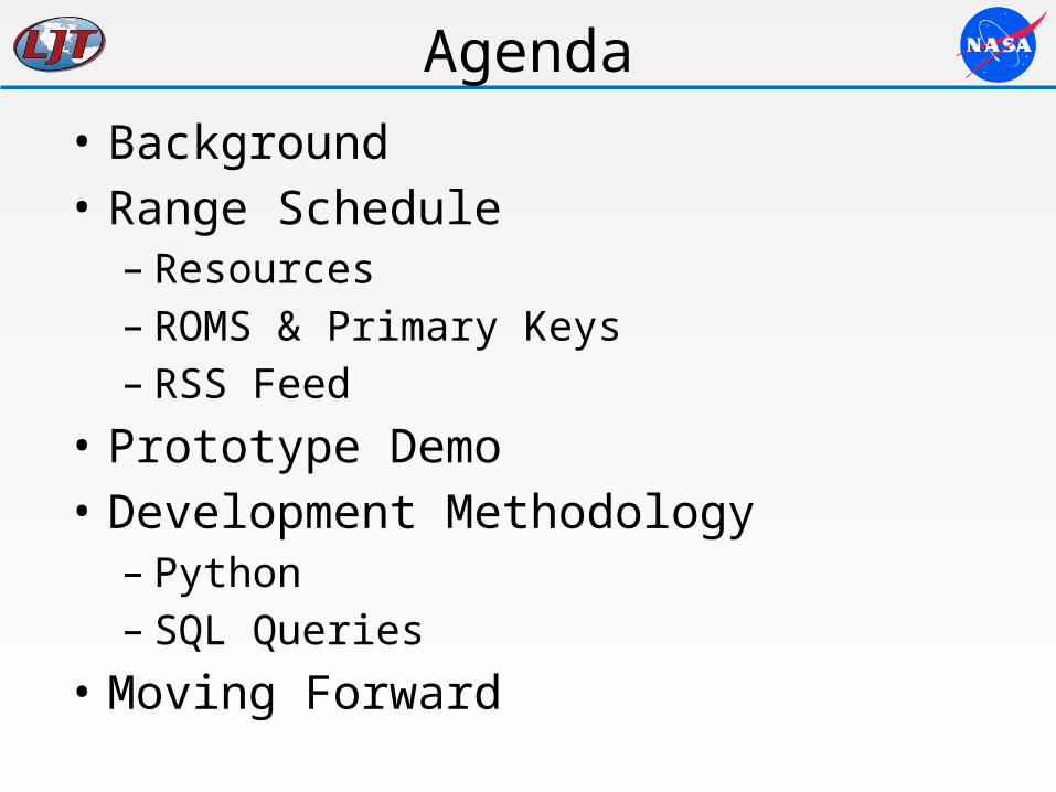
Agenda• Background• Range Schedule– Resources– ROMS & Primary Keys– RSS Feed
• Prototype Demo• Development Methodology– Python – SQL Queries
• Moving Forward
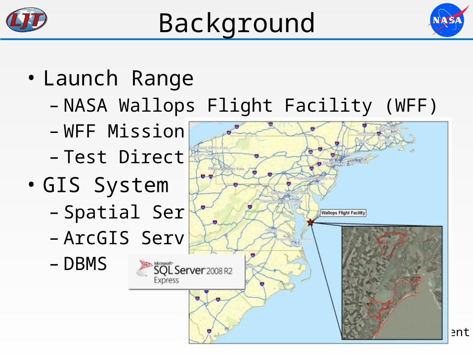
Background
• Launch Range– NASA Wallops Flight Facility (WFF)– WFF Missions– Test Directors
• GIS System– Spatial Services– ArcGIS Server– DBMS
Single Machine Deployment
Project Background
– Range Space Management “rSpace”• Joint NASA Project 2014 – Various Directorates– Phase 1: Integrate scheduled resource information
from Range Schedule and display in rSpace.• Capstone Project: Pennsylvania State University
– Project Goal: Integrate scheduled resource information from the Range Schedule and display in an intranet GIS application
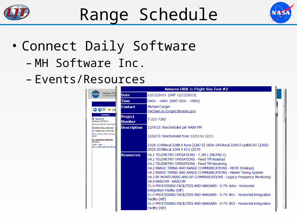
Range Schedule
• Connect Daily Software– MH Software Inc.– Events/Resources
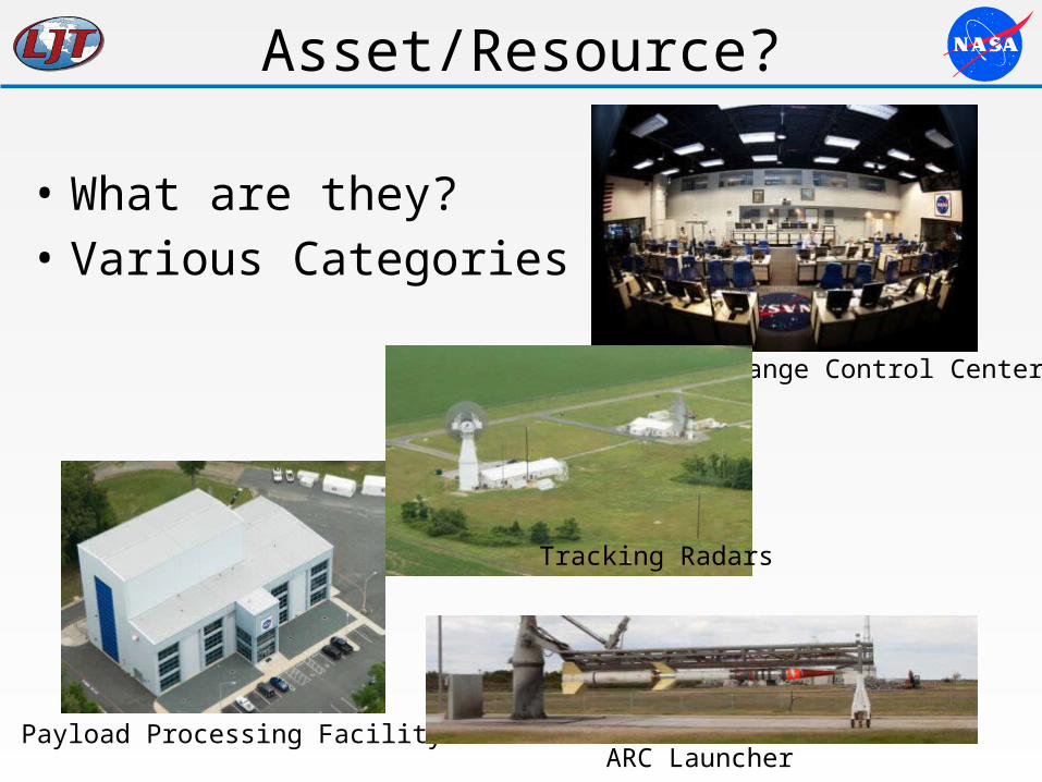
Asset/Resource?
• What are they?• Various Categories
Payload Processing FacilityARC Launcher
Range Control Center
Tracking Radars
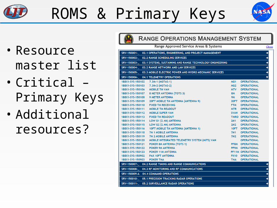
ROMS & Primary Keys
• Resource master list
• Critical – Primary Keys
• Additional resources?
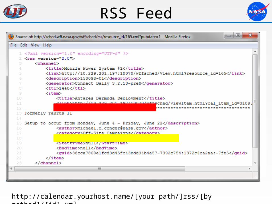
RSS Feed
• Export Options– iCal– RSS– Pubdate method• ?pubdate=0• ?pubdate=1
• Accessibility– URL Transformation
http://calendar.yourhost.name/[your path/]rss/[by method]/[id].xml
Demo
Literature Review
• Specific scenario?• Asset Management• Construction Schedule Planning• Space Scheduling• Python• ArcObjects
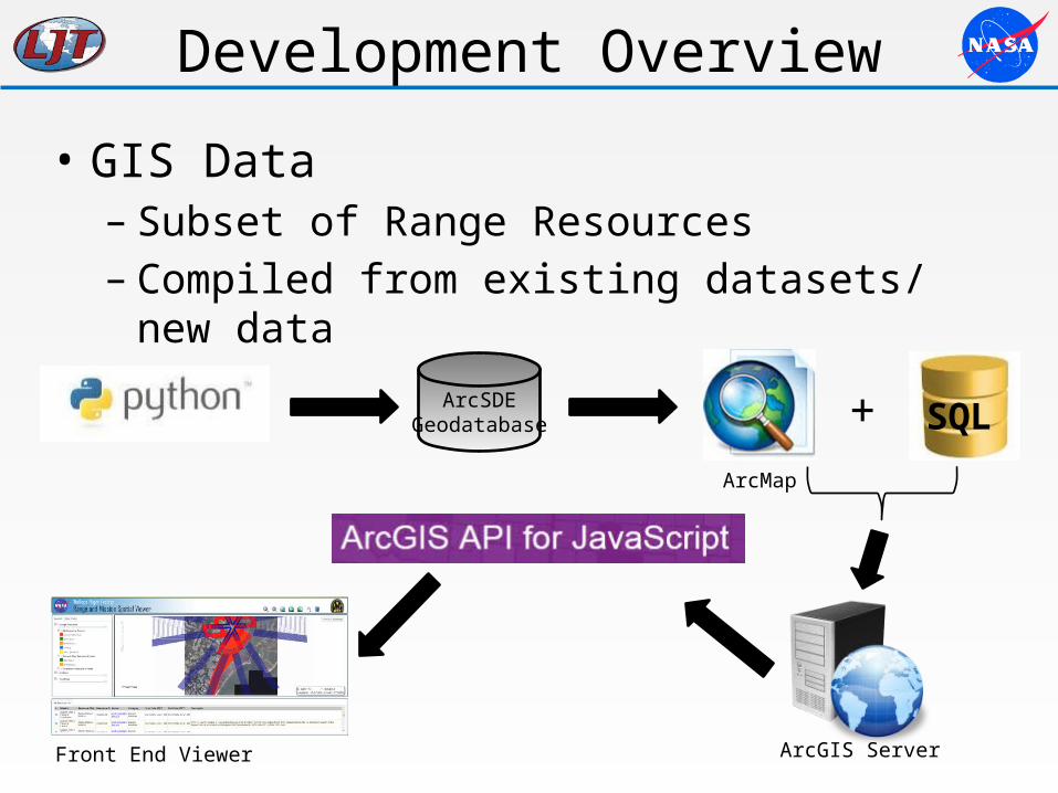
Development Overview
• GIS Data – Subset of Range Resources– Compiled from existing datasets/ new data
ArcSDEGeodatabase SQL
ArcGIS Server
ArcMap
+
Front End Viewer
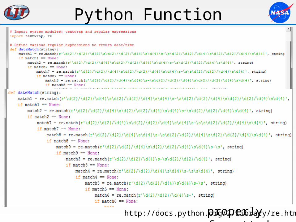
Python Function
• Determines proper date & time designations• Regular Expressions = matching formats– i.e. (r’\d{2}/\d{2}/\d{4}) = (00/00/0000)
– re.match()– \d = Decimal Digit• 0 to 9
– \s = Whitespace– Returns properly
formatted data
http://docs.python.org/2/library/re.html
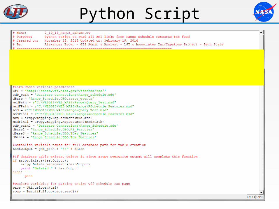
Python Script
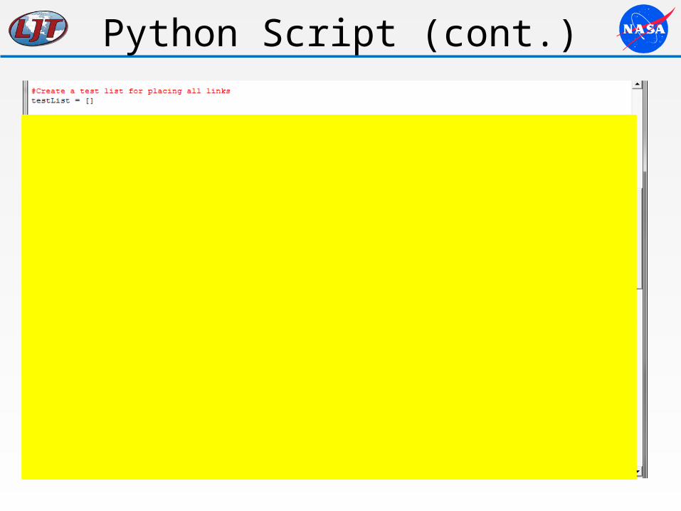
Python Script (cont.)
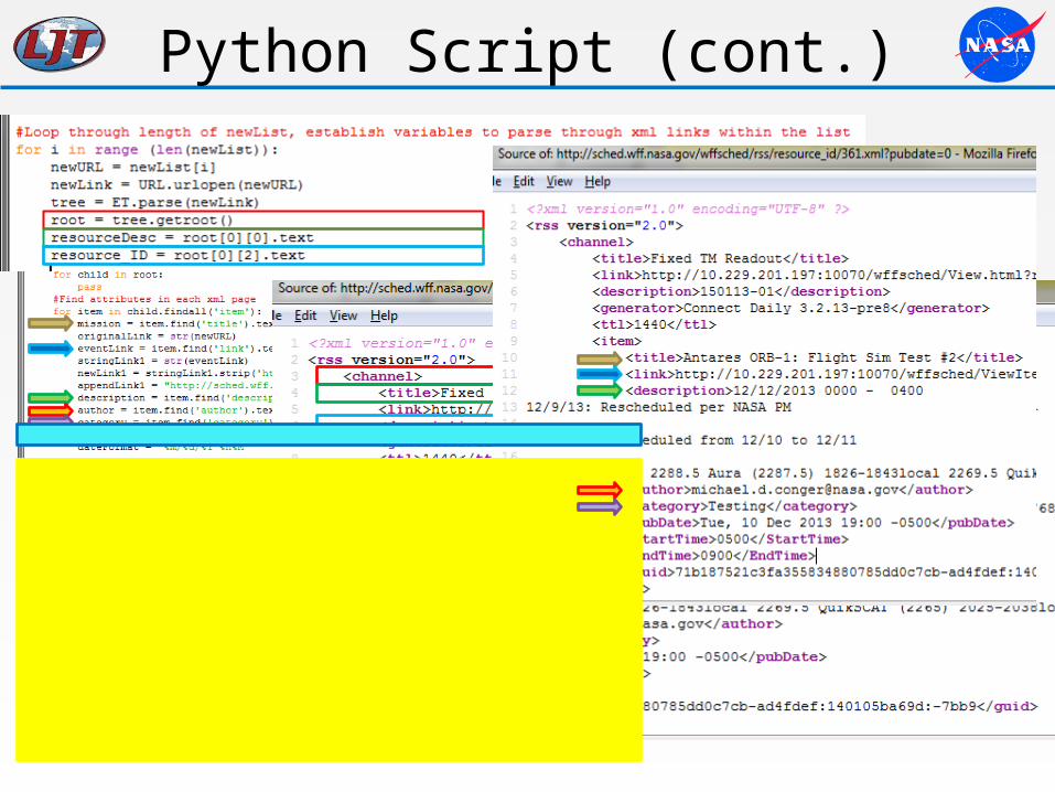
Python Script (cont.)
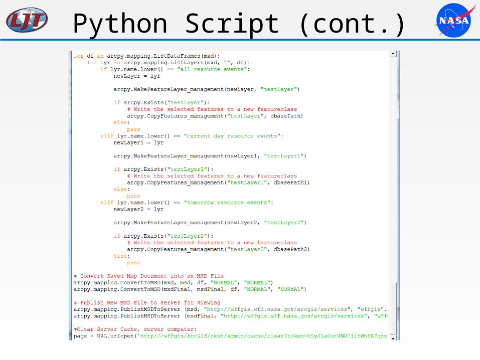
Python Script (cont.)
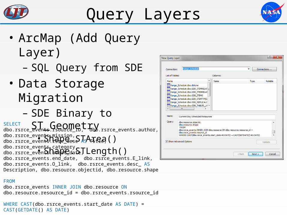
Query Layers• ArcMap (Add Query Layer)– SQL Query from SDE
• Data Storage Migration– SDE Binary to ST_Geometry
• Shape.STArea()• Shape.STLength()
SELECT dbo.rsrce_events.rsource_ID, dbo.rsrce_events.author, dbo.rsrce_events.mission, dbo.rsrce_events.rsrc_desc AS Title, dbo.rsrce_events.category, dbo.rsrce_events.start_date,dbo.rsrce_events.end_date, dbo.rsrce_events.E_link, dbo.rsrce_events.O_link, dbo.rsrce_events.desc_ AS Description, dbo.resource.objectid, dbo.resource.shape FROMdbo.rsrce_events INNER JOIN dbo.resource ON dbo.resource.resource_id = dbo.rsrce_events.rsource_id
WHERE CAST(dbo.rsrce_events.start_date AS DATE) = CAST(GETDATE() AS DATE)
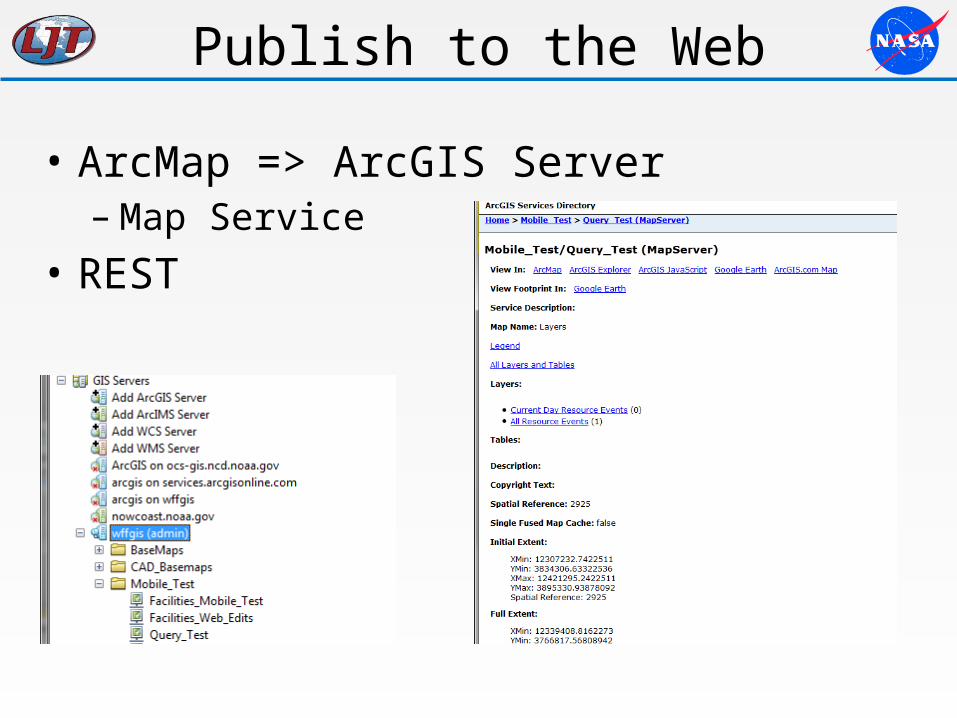
Publish to the Web
• ArcMap => ArcGIS Server– Map Service
• REST
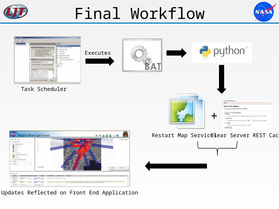
Final Workflow
Clear Server REST Cache
Updates Reflected on Front End Application
Executes
Task Scheduler
Restart Map Services
+
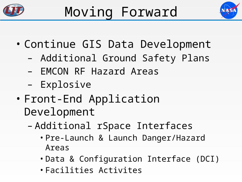
Moving Forward
• Continue GIS Data Development– Additional Ground Safety Plans– EMCON RF Hazard Areas– Explosive
• Front-End Application Development– Additional rSpace Interfaces• Pre-Launch & Launch Danger/Hazard Areas• Data & Configuration Interface (DCI)• Facilities Activites
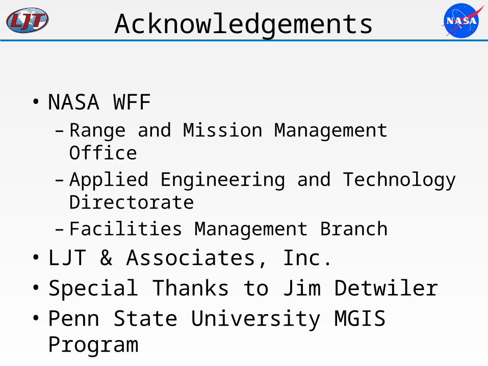
Acknowledgements
• NASA WFF – Range and Mission Management Office– Applied Engineering and Technology Directorate– Facilities Management Branch
• LJT & Associates, Inc.• Special Thanks to Jim Detwiler• Penn State University MGIS Program
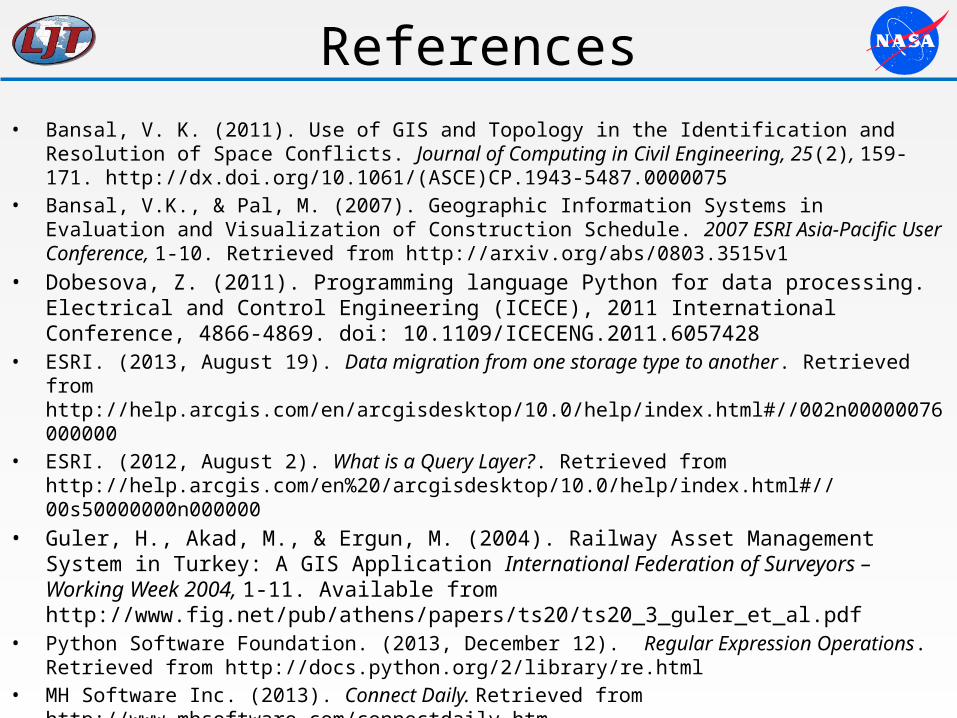
References• Bansal, V. K. (2011). Use of GIS and Topology in the Identification and Resolution of Space Conflicts. Journal of
Computing in Civil Engineering, 25(2), 159-171. http://dx.doi.org/10.1061/(ASCE)CP.1943-5487.0000075 • Bansal, V.K., & Pal, M. (2007). Geographic Information Systems in Evaluation and Visualization of Construction
Schedule. 2007 ESRI Asia-Pacific User Conference, 1-10. Retrieved from http://arxiv.org/abs/0803.3515v1• Dobesova, Z. (2011). Programming language Python for data processing. Electrical and Control
Engineering (ICECE), 2011 International Conference, 4866-4869. doi: 10.1109/ICECENG.2011.6057428 • ESRI. (2013, August 19). Data migration from one storage type to another. Retrieved from
http://help.arcgis.com/en/arcgisdesktop/10.0/help/index.html#//002n00000076000000• ESRI. (2012, August 2). What is a Query Layer?. Retrieved from
http://help.arcgis.com/en%20/arcgisdesktop/10.0/help/index.html#//00s50000000n000000• Guler, H., Akad, M., & Ergun, M. (2004). Railway Asset Management System in Turkey: A GIS Application
International Federation of Surveyors – Working Week 2004, 1-11. Available from http://www.fig.net/pub/athens/papers/ts20/ts20_3_guler_et_al.pdf
• Python Software Foundation. (2013, December 12). Regular Expression Operations. Retrieved from http://docs.python.org/2/library/re.html
• MH Software Inc. (2013). Connect Daily. Retrieved from http://www.mhsoftware.com/connectdaily.htm• Newman, G., & Reck, N. (2009). GIS Application Support of Operations-Based Programs at NJ Transit
[PowerPoint slides]. Retrieved from http://www.transitgis.org/download/conference/2009- presentations/BAquila.pdf
• RSS Advisory Board (2009, March 30). RSS 2.0 Specification. Retrieved from http://www.rssboard.org/rss-specification