Embed Size (px)
Citation preview
Integrated Coastal Zone
Management in Greece Prof. Konstantinos Lalenis
University of Thessaly, Greece
Prof. Georgios Sylaios
Democritus University of Thrace, Greece
Ioannis Papatheocharis
Urban & Regional Planner
MARE NOSTRUM
Kick off Meeting 4th March 2013 Haifa, Israel
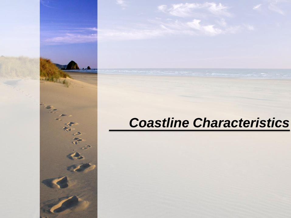
Coastline Characteristics
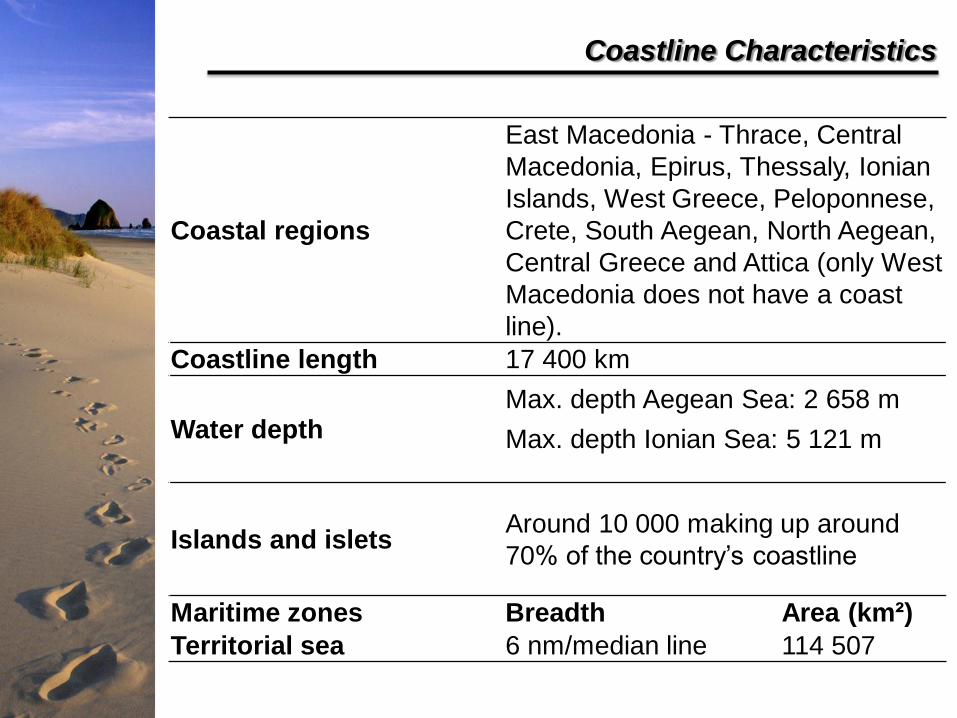
Coastal regions
East Macedonia - Thrace, Central
Macedonia, Epirus, Thessaly, Ionian
Islands, West Greece, Peloponnese,
Crete, South Aegean, North Aegean,
Central Greece and Attica (only West
Macedonia does not have a coast
line).
Coastline length 17 400 km
Water depth Max. depth Aegean Sea: 2 658 m
Max. depth Ionian Sea: 5 121 m
Islands and islets Around 10 000 making up around
70% of the country’s coastline
Maritime zones Breadth Area (km²)
Territorial sea 6 nm/median line 114 507
Coastline Characteristics
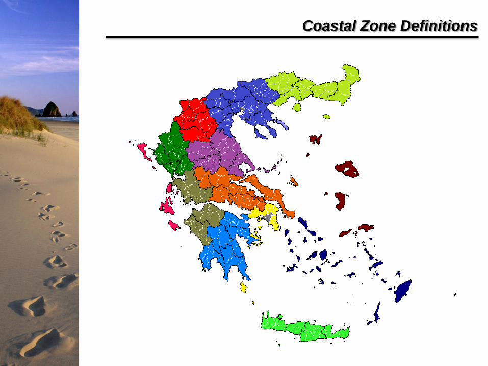
Coastal Zone Definitions
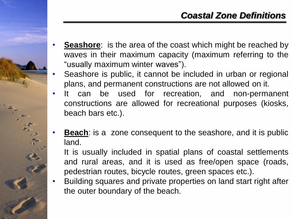
Coastal Zone Definitions
• Seashore: is the area of the coast which might be reached by
waves in their maximum capacity (maximum referring to the
“usually maximum winter waves”).
• Seashore is public, it cannot be included in urban or regional
plans, and permanent constructions are not allowed on it.
• It can be used for recreation, and non-permanent
constructions are allowed for recreational purposes (kiosks,
beach bars etc.).
• Beach: is a zone consequent to the seashore, and it is public
land.
It is usually included in spatial plans of coastal settlements
and rural areas, and it is used as free/open space (roads,
pedestrian routes, bicycle routes, green spaces etc.).
• Building squares and private properties on land start right after
the outer boundary of the beach.
Coastal Zone Definitions
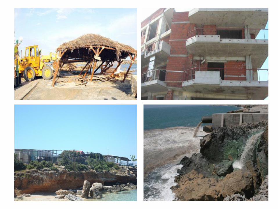
• Legal arsenal but also legal “by passes” and problems in
implementation.
• Laws aspiring to tackle illegal construction: LD 1923, 410/68,
720/76, 1337/83, 4014/2011. Inventiveness, legalization and
“regularization” (!)
• Illegal construction on coastal zones: from the pre ‘80s slums to
after ‘80s vacation homes.
• Legal status, infrastructure.
• Usual process: informal “planning” by developers, pressures for
legalization.
• Champions in illegal constructions: Heraklion (Creta), Pyrgos
(Helia).
• Other threats: pollution from illegal night soils, toxic waste etc.
Cross-border / International relations
Greece – Turkey
Issues concern the mutual delimitation of several zones of control:
The width of the territorial waters.
The sovereignty over some islets (theretofore unheard-of grey
zones theory).
The delimitation of the continental shelf zone in the international
parts of the Aegean, which would give the states exclusive rights to
economic exploitation.
Legal Aspects & Key Players
Romans first defined seashore: the area of the coast which
might be reached by waves in any capacity (In Usu Publico).
The above definition was also adopted by the Byzantines.
When the new Greek State was established, in L. 21-6-1837
the Roman definition of seashore was adopted (the zone
which can be reached by the winter waves). According to the
same law, seashore is public property and its use is public.
Historical References
Article 24 of Greek Constitution (from 1975 until today)
• Coastal areas and seashores are characterized as “public good”.
• They are elements of the natural environment which constitute a vulnerable ecosystem and which should be under special protection.
• Attention is also drawn in their development. It should be “mild” and managed with caution.
Constitutional Reference
Law 2344/1940 On defining the seashore and the beach
Was the only legislative tool for the development and protection of
seashores for almost 61 years in Greece.
Seashores and beaches can be used in order to serve transport,
tourism and industry. They can be leased to individuals.
Criterion for the latter was the economic benefits of both the State
and private actors, and the duration of the lease could not exceed 25
years.
Coastal Management Legal Framework
Law 2344/1940 On defining the seashore and the beach
Declares the seashore as the terrestrial-marine wetted zone and the
beach as zone expanded by 20 m landwards from the mean seashore level.
There were no references to obligations of the State to protect the coastal areas.
There was no reference to limitations on construction in coastlines, to land use controls, to protection from urban sprawl, or, to planning regulations for these areas.
Failed to specify the procedures and the technical means to draw boundaries to the seashores and beaches with acceptable accuracy.
The development of coastal zones and the accruing economic benefits for the Greek State were given higher emphasis than the citizens’ right to enjoy it as a public good.
Tourist business were given the right to use and exploit coastal areas, with incentives and privileges. Usually overstepped their legal rights.
Coastal Management Legal Framework
Coastal Management Legal Framework
Law 2971/2001 On Coasts and Beaches
Aimed to accommodate European and International regulations and
Guidelines concerning coastal areas.
Targets
• Defining seashores and beaches with priority to coastal areas with
intense urban development and to areas of high productivity.
• Achieving effective protection and management of coastal areas.
A new administrative body (part of the Ministry of Finance) was
established to manage the coastal areas. It was considered as an asset
of the new legislative framework.
Law 2971/2001 On Coasts and Beaches
The protection of ecosystems of coastal zones is a responsibility of
the State.
Demarcation of seashore boundaries is made by modern technologies, and in shorter deadlines.
Any stable and/or private construction within a seashore zone is prohibited. The legal constructions are expropriated and fully compensated, and the illegal ones demolished.
Properties on seashore are also expropriated.
Exceptions are made for old settlements pre-existing of 1923, where seashore cannot overstep the already existing zone of constructions.
Constructions on properties initially out of the coastal zone but due
to natural erosion gradually in it, exempted from demolition.
Illegal constructions used as hotels, industries, and fish-farming
structures are legalized.
Coastal Management Legal Framework
Law 2971/2001 On Coasts and Beaches
The leasing of seashores and beaches is allowed for works related
to trade, industry, land and sea transportation, or “other purposes
serving the public good”.
Beach zone 50 m wide.
Access roads to the beach of minimum width 10 m. Means:
expropriations of land properties.
Fences are prohibited in a zone of 500 m from the beach in areas
not covered by urban plan. Exceptions: when agricultural fields have
to be protected.
“Light”, non permanent constructions are allowed in the seashore
zone, meant to serve public recreation (tents, open bars etc.).
Coastal Management Legal Framework
Administrative Structure of Coastal Zones
• Coastal zones are public property, belonging to the State
which has the responsibilities for protecting and managing
them (L. 2971/2001). Management rights and responsibilities
have been passed to local organizations and agents such as
the Municipalities, the Municipal Port Departments and the
Port Organizations Ltd.
• Port Departments and Port Organizations are responsible for
managing the coastal zone in urban areas. In areas with
urban plan, the beach boundary cannot overlap with the
official building line. In turn, in expansions of city plans, the
building line cannot overlap with the beach boundary.
Traditional and historic buildings cannot be included in the
beach zone.
• Port Organizations Ltd. are managing the ten most important
ports in Greece. They prepare the Master Plan for the port
area (coastal zone of a harbour) which is approved by a
special committee with representatives of the municipality,
and related ministries and organizations.
• For implementing the Master Plan, Port Organizations can
sign contracts with other public bodies (local authorities,
ministries, chambers, cooperatives etc.) as well as with
private bodies in Public – Private Partnerships.
• Master Plans for Port Organizations are prepared
independently from General Development Plans of the
Municipalities, or the related City Plans. In cases where
there is no cooperation between local authorities and Port
Organizations, things can be led to a chaos.
• In 2009, Port Organizations of Piraeus have sold
management and exploitation rights of some port sectors to
a Chinese company. Despite the initial reactions, there are
recent plans for a different administration of ports, and sale
to more foreign companies.
Administrative Structure of Coastal Zones
Current draft of a new law concerning seashores
• Recent trends and efforts to turn coastal management towards more intensive profit making. Preparation of a new law, currently in the process of consultation with public, private bodies, the public etc.
• It has raised severe criticism, focusing to the following points:
The existence of beach zones as the continuation of seashore zones is not necessary.
The 50m width which was compulsory for the demarcation of the beach is now abolished.
Leasing of coastal zone has been greatly facilitated, and provisions for the protection of the environment have been reduced. No provision for consideration for the existing regulations for land uses in the surrounding area.
Restrictions related to the maximum area of coastal zone in which shops, hotels etc. can develop profit making activities are abolished.
Lack of provisions for cross-sectional cooperation for managing coastal zones.
Law 1337/1983 Urban development and relative provisions
The legal framework for Urban Restructuring Programme in Greece.
Introduced General Urban Plans (GUPs) and Town Plans (TPs),
Urban Studies and Implementation Plans (IPs) for the implementation
of Town Plans.
Includes land use and town-planning regulations relating to urban
areas and small towns, as well as provisions for the designation of
Urban Development Control Zones (with land use restrictions) in
towns and along the coast. There is no provision for new ones and
there are complications with the legal status of the existing.
Provisions addressed two issues:
• a) The exclusion of enclosures in a 500-metre setback zone from the
shoreline intended to ensure free access to the sea.
• b) The creation (through the expropriation of privately-owned property for
the public good) of public access routes to the sea and the shore.
These provisions satisfied the ‘sense of public justice’, but they have -
with very few exceptions- not been applied, due to the corruption and
clientelism of local politics.
Urban Planning Legal Framework
Law 2508/1997 (integration of Law 1337/1983)
Regulates the spatial planning on the municipality level (local plans
are now being instituted for the whole of the municipality area,
including the urban as well as the rural space), regarding the aspect
of Sustainable Urban Development
Established two levels of Urban Planning:
• The first level, which includes two kinds of strategic urban planning
tools:
– Regulatory (Master) Plans (Athens & Thessaloniki)
– General Urban Plans (GUPs) and Town Plans (TPs).
• The second level, which is the specification and implementation of
the first level, includes:
– All kinds of Urban Studies and Regeneration Studies or other special
urban planning studies.
– Implementation Plans (IPs) for the implementation of Town Plans.
Contains the guiding principles of urban policy in order to achieve
sustainable urban development.
Urban Planning Legal Framework
Law 2742/1999 Spatial Planning and Sustainable Development
National Level
• General Framework for Spatial Planning and Sustainable
Development (national territorial plan).
• Special Frameworks for Spatial Planning and Sustainable
Development (sectoral territorial plans):
• The Regional Framework for Tourism
• The Regional Framework for Industry
• The Regional Framework for Renewable Energy Sources
• The Regional Framework for Aquaculture
Regional Level
• 12 Regional Frameworks for Spatial Planning and Sustainable
Development (Regional Territorial Plans).
Sub-regional level
• Special Spatial Plans & Special Environmental Plans (Integrated
Development of Economic Activities Zones, Special Intervention Zones, Urban
Development Control Zones, Nature Protection Zones)
Spatial Planning Legal Framework
Judicial Remedies- Council of the State
• Basic principles of the Council of the State: the coastal areas
constitute a sensitive ecosystem. They are a “public good” which
facilitates the human contact with the sea and the enjoyment of all
other sea uses.
• According to these principles the Council of the State has nullified
numerous decrees, ministerial decisions, municipal acts etc. which
could endanger the very nature of coastal areas as a valuable
ecosystem and a “public good”.
Decisions of the Council of the State included:
• Characterization as illegal of any construction on coastal zone, as
degrading the natural environment.
• Setting strict rules for the distance between the building line and the
seashore line of specific areas.
• Enforcing the construction of access roads to the coasts and
prohibiting the fencing of coastal properties.
• Securing the distance of 500 m between the beach boundaries and
the construction sites in rural areas.
In all these cases, set the distances of constructions from the seashore
line in higher values than the ones provided by the legislation.
Other Planning or Legislative Tools
Environmental Planning Legal Framework
Law 1650/1986 On the protection of the environment
Basic law on the environmental protection.
It defines the basic principles on the environmental protection in
Greece, aiming to prevent pollution and its consequences, secure
human health, promote balanced and sustainable development,
maintain ecological integrity and implement environmental restoration
plans.
This Law presents the general framework of regulations governing
the coastal zone management, setting as its main target “to protect
the coasts, the sea and the river and lake banks as parts of the
natural and cultural elements of an ecosystem, recognizing their
ecological and aesthetic values”.
Environmental Planning Legal Framework
Law 3199/2003 Protection and Management of Water
This Law harmonizes the Greek environmental legislation to the
Water Framework Directive (200/60).
It defines ‘coastal waters’ as the surface waters within a distance of
1 n.m from the seashore.
The General Water Secretariat founded in the Ministry of
Environment, together with all regional water authorities, are
responsible for designing and implementing the Regional Water
Management Plans, integral parts of the National Water
Management Plan.
An intensive monitoring program of water and ecological quality
status is designed to classify all inland, transitional and marine
ecosystems.
The program follows the basic principles of the WFD
Mitigation measures should be taken to protect or upgrade the
status of each aquatic system.
State of the Coastal Zone
The Urban Environment
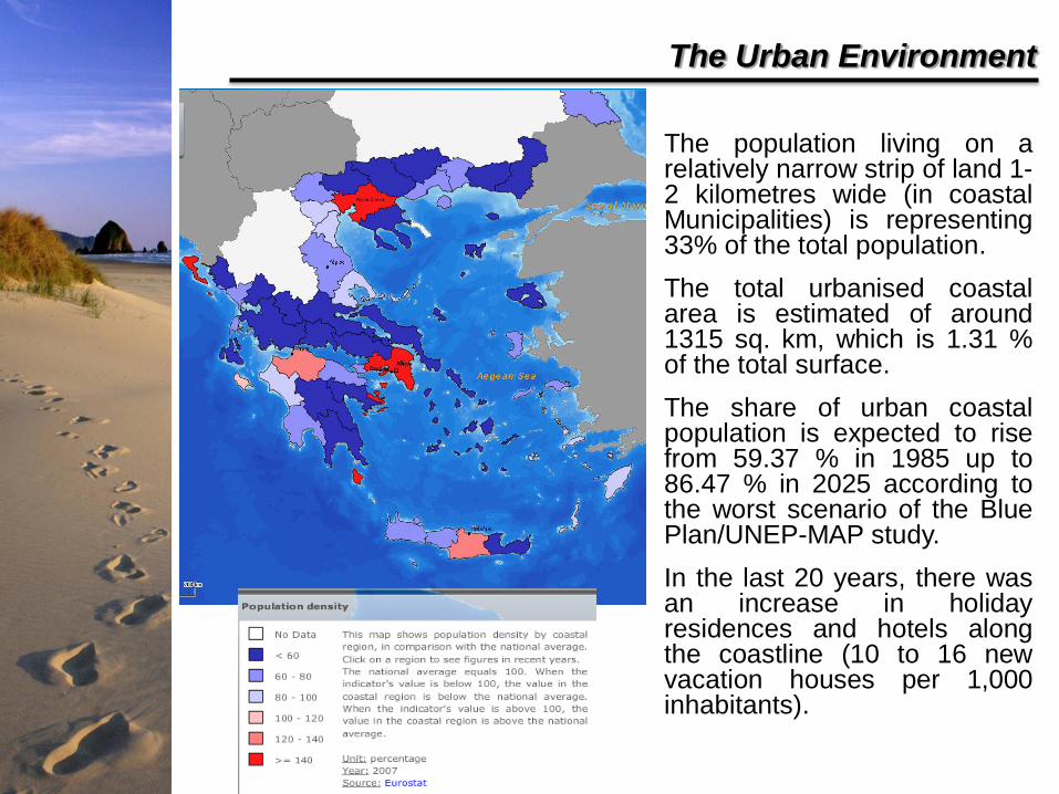
• The population living on a relatively narrow strip of land 1-2 kilometres wide (in coastal Municipalities) is representing 33% of the total population.
• The total urbanised coastal area is estimated of around 1315 sq. km, which is 1.31 % of the total surface.
• The share of urban coastal population is expected to rise from 59.37 % in 1985 up to 86.47 % in 2025 according to the worst scenario of the Blue Plan/UNEP-MAP study.
• In the last 20 years, there was an increase in holiday residences and hotels along the coastline (10 to 16 new vacation houses per 1,000 inhabitants).
The Urban Environment
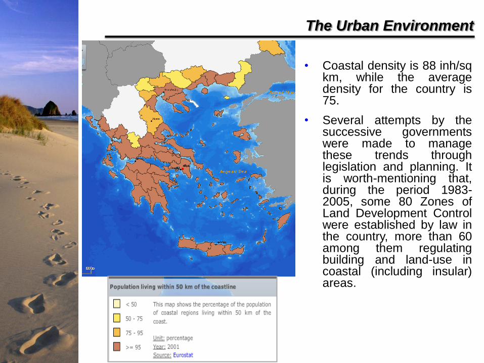
• Coastal density is 88 inh/sq km, while the average density for the country is 75.
• Several attempts by the successive governments were made to manage these trends through legislation and planning. It is worth-mentioning that, during the period 1983-2005, some 80 Zones of Land Development Control were established by law in the country, more than 60 among them regulating building and land-use in coastal (including insular) areas.
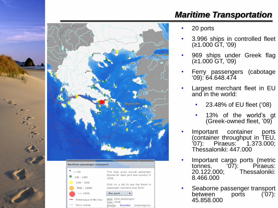
Maritime Transportation
• 20 ports
• 3.996 ships in controlled fleet (≥1.000 GT, ‘09)
• 969 ships under Greek flag (≥1.000 GT, ‘09)
• Ferry passengers (cabotage ‘09): 64.648.474
• Largest merchant fleet in EU and in the world:
• 23.48% of EU fleet (‘08)
• 13% of the world’s gt (Greek-owned fleet, ’09)
• Important container ports (container throughput in TEU, ‘07): Piraeus: 1.373.000; Thessaloniki: 447.000
• Important cargo ports (metric tonnes, ‘07): Piraeus: 20.122.000; Thessaloniki: 8.466.000
• Seaborne passenger transport between ports (’07): 45.858.000
Energy Sector
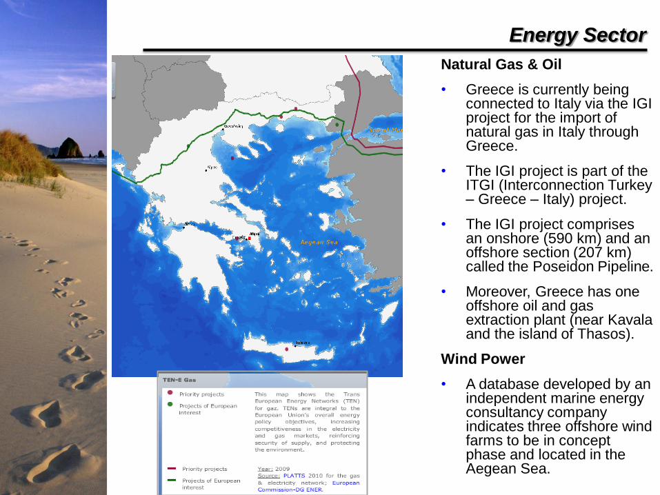
Natural Gas & Oil
• Greece is currently being connected to Italy via the IGI project for the import of natural gas in Italy through Greece.
• The IGI project is part of the ITGI (Interconnection Turkey – Greece – Italy) project.
• The IGI project comprises an onshore (590 km) and an offshore section (207 km) called the Poseidon Pipeline.
• Moreover, Greece has one offshore oil and gas extraction plant (near Kavala and the island of Thasos).
Wind Power
• A database developed by an independent marine energy consultancy company indicates three offshore wind farms to be in concept phase and located in the Aegean Sea.
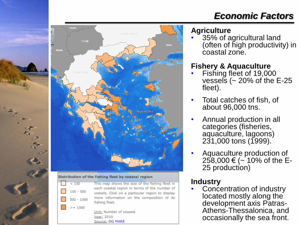
Economic Factors
Agriculture • 35% of agricultural land
(often of high productivity) in coastal zone.
Fishery & Aquaculture • Fishing fleet of 19,000
vessels (~ 20% of the E-25 fleet).
• Total catches of fish, of about 96,000 tns.
• Annual production in all categories (fisheries, aquaculture, lagoons) 231,000 tons (1999).
• Aquaculture production of 258,000 € (~ 10% of the E-25 production)
Industry • Concentration of industry
located mostly along the development axis Patras-Athens-Thessalonica, and occasionally the sea front.
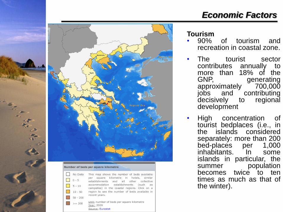
Economic Factors
Tourism • 90% of tourism and
recreation in coastal zone.
• The tourist sector contributes annually to more than 18% of the GNP, generating approximately 700,000 jobs and contributing decisively to regional development
• High concentration of tourist bedplaces (i.e., in the islands considered separately: more than 200 bed-places per 1,000 inhabitants. In some islands in particular, the summer population becomes twice to ten times as much as that of the winter).
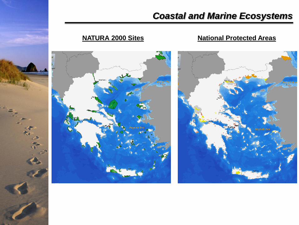
Coastal and Marine Ecosystems
NATURA 2000 Sites National Protected Areas
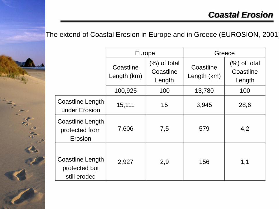
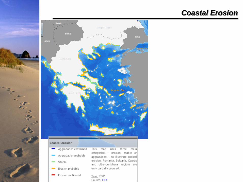
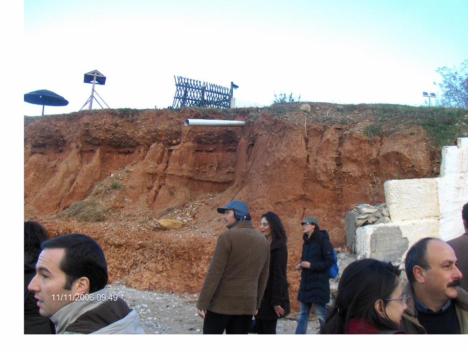
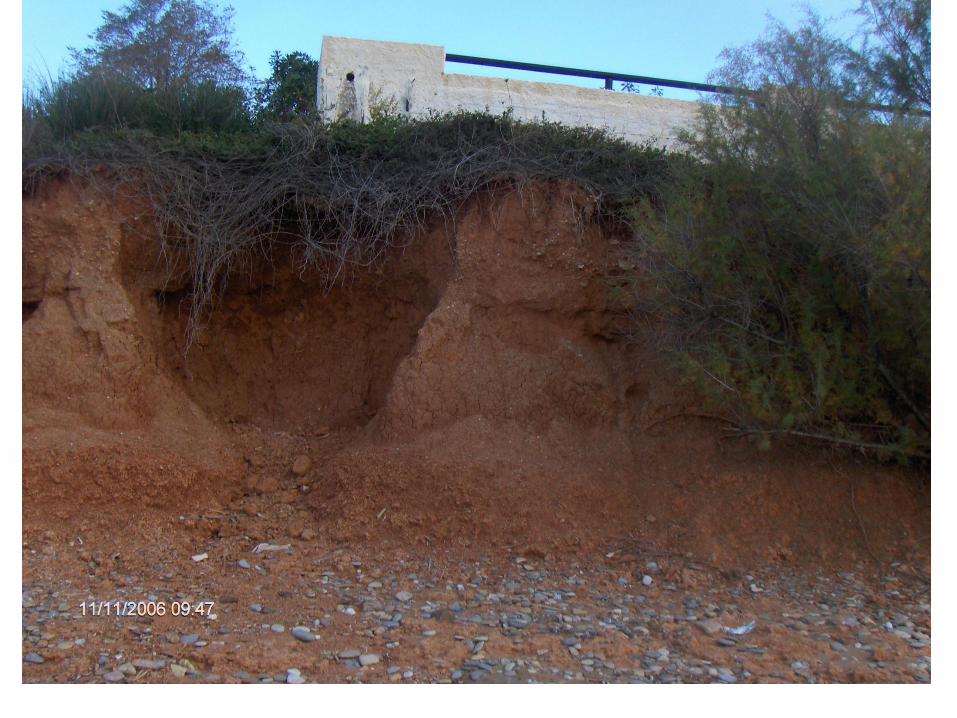
Coastal Erosion
Europe Greece
Coastline
Length (km)
(%) of total
Coastline
Length
Coastline
Length (km)
(%) of total
Coastline
Length
100,925 100 13,780 100
Coastline Length
under Erosion 15,111 15 3,945 28,6
Coastline Length
protected from
Erosion
7,606 7,5 579 4,2
Coastline Length
protected but
still eroded
2,927 2,9 156 1,1
The extend of Coastal Erosion in Europe and in Greece (EUROSION, 2001)
Coastal Erosion
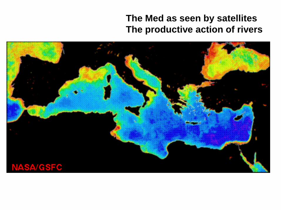
The Med as seen by satellites
The productive action of rivers
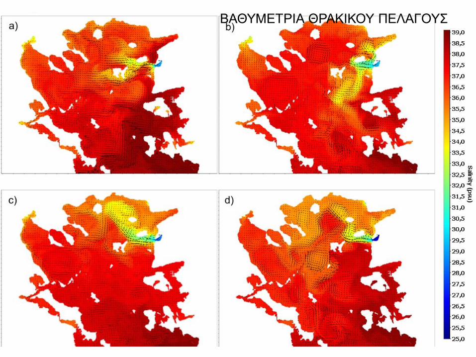
ΒΑΘΥΜΕΤΡΙΑ ΘΡΑΚΙΚΟΥ ΠΕΛΑΓΟΥΣ
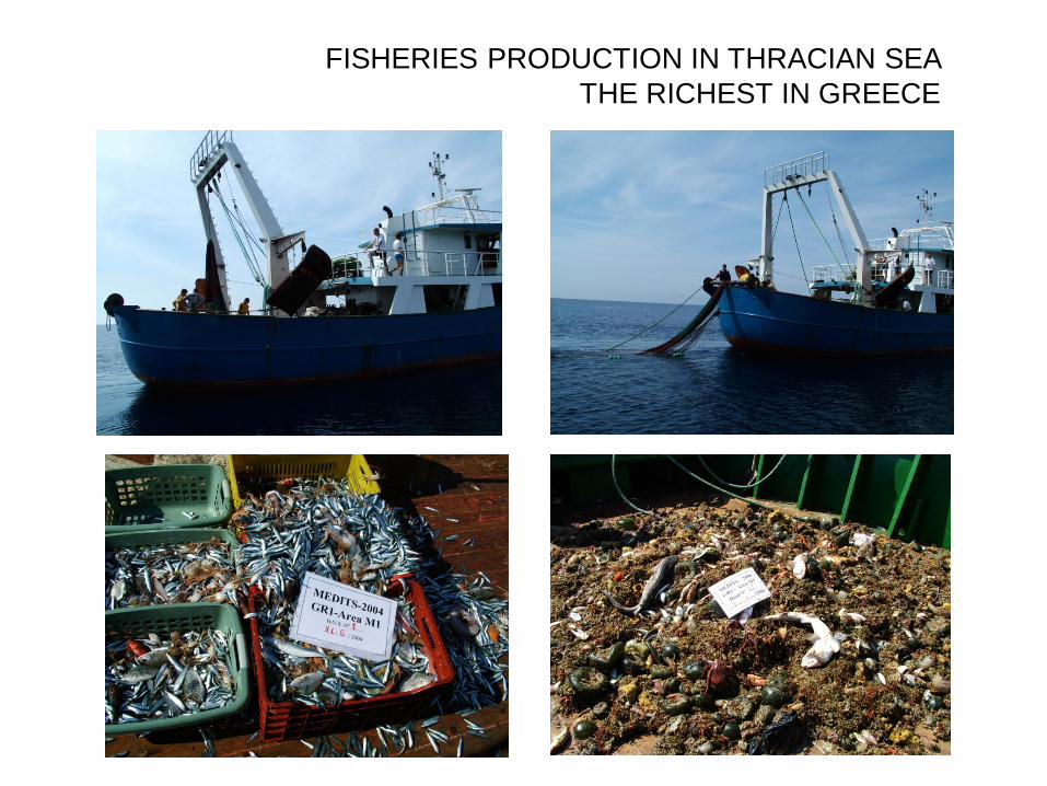
FISHERIES PRODUCTION IN THRACIAN SEA
THE RICHEST IN GREECE
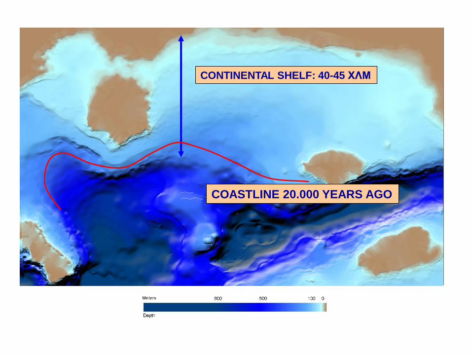
CONTINENTAL SHELF: 40-45 ΧΛΜ
COASTLINE 20.000 YEARS AGO
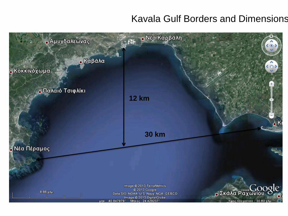
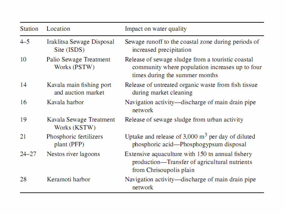
Kavala Gulf Borders and Dimensions
30 km
12 km
Kavala Gulf (40◦52’ 50’’N; 24◦25’00’’E) is the second in size
semi-enclosed coastal water body in the Thracian Sea, the
northern part on the continental shelf of the North Aegean
Sea. The system covers an area of 264 × 106 m2 and has a
coastline length of 62,800 m.
The Gulf’s mean depth is 32 m, obtaining a maximum
value of 60 m at Thassos Plateau.
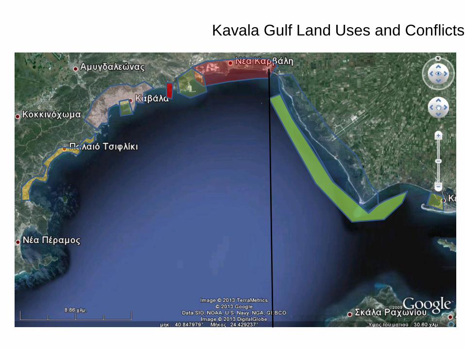
Kavala Gulf Land Uses and Conflicts
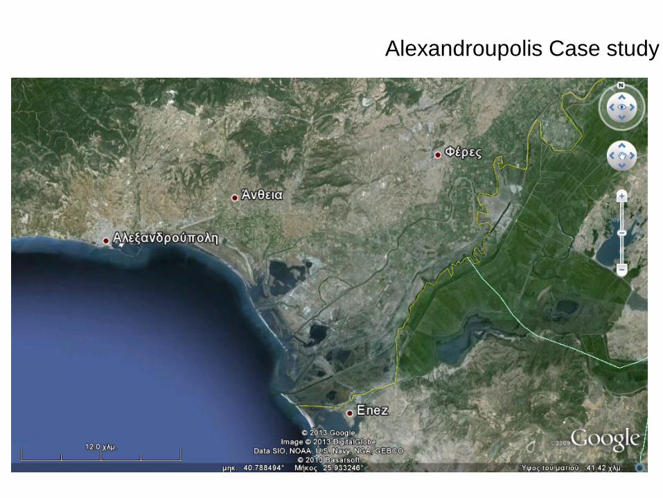
Alexandroupolis Case study
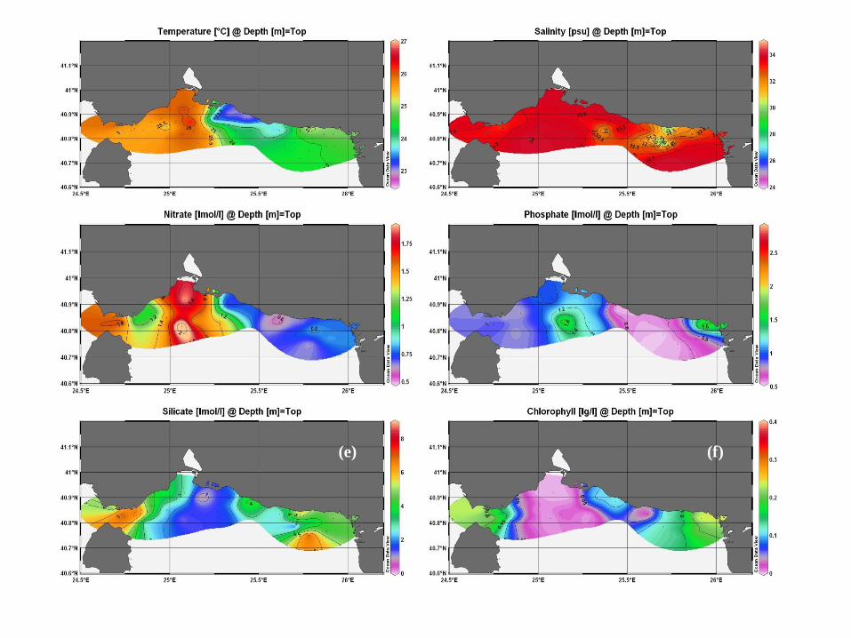
(e) (f)
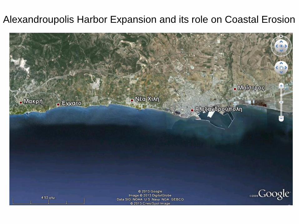
Alexandroupolis Harbor Expansion and its role on Coastal Erosion
Conclusion
• Coastal areas in Greece characterized by significant natural beauty,
the existence of sensitive ecosystems, and sites, monuments and
settlements, which are important elements of Greek cultural
heritage.
• In many of them, though, there is a downgrading of the quality of the
above characteristics. This has been intensified at the last decades,
and is provoked by illegal as well as legitimate interventions.
• These interventions were attracted by the significant potential of the
coastal areas for profit making activities such as tourism, holiday
housing, recreation, and economic development. They follow a trend
for increasing intensification due to the increased needs of the
population for the above activities, combined with a socially
accepted desire for making the maximum profit in the easiest and
fastest way.
• The most severe illegal activities which constitute a threat for the
coastal areas are related to illegal construction. On the other hand,
the legitimate interventions which also contribute to the degradation
of the coastal environment are the uncontrolled development and a
profit oriented coastal management.
Conclusions
• Successive laws had limited effectiveness in reversing the downgrading of coastal areas. For many, inadequacies of legislation were the main reason. Criticism was focused on:
• No attempt to coordinate legal provisions to urban, regional, and environmental planning.
• Vagueness concerning the terms of use of the coastal zone for profit making activities.
• Lack of adequately detailed, explicit , and clear directions for facing issues related to coastal management.
• Numerous exceptions to the legal provisions of the basic laws, introduced by decrees, ministerial decisions etc.
• Recently, an “entrepreneurial” spirit characterized the efforts to legislate for the coastal areas, which eased the strict environmental protection, facilitated exploitation and increased involvement of the private sector.
Conclusions
• Still, phenomena such as:
Samples of “privatization” of sea coasts by hotels, which
impose charges to the citizens who use the particular coast without being clients of the Hotels.
Frequency of leasing seashores and beaches by municipalities to enterprises which fill up the place with bars, restaurants, seats.
The inability of the municipalities to implement the legislation about coastal protection, due to lack of finances and resources.
The political pressure from interest groups, the political clientellism, and corruption, which also impede and distort implementation of legislation,
are not mainly due to inadequate legislation and still restrict the possibility for applying principles and policies aiming at an effective and integrated coastal management.
Conclusions
• Coastal protection and management, besides sound legislation, also
needed pragmatic policies and effectiveness in the operational level.
• Policies for coastal areas were not formulated and positive actions
were not encouraged.
• The protection and management of Greek coastal areas were
restricted to legal restrictions and prohibitions.
There is lack of coordination of private and public sector for the management of coastal areas.
Also, lack of participation of the interested parties in common actions, in the context of a democratic planning.
• The operational level should be strengthened to avoid distortions
when confronted by strong economic interests, political pressure,
and reactions of groups with specific interests.
Conclusions

THANK YOU
FOR YOUR ATTENTION


![Coastal zone [autosaved]](https://img.pdfslide.us/doc/110x75/58ab9f8c1a28abdf3c8b46b5/coastal-zone-autosaved.jpg)