Embed Size (px)
Citation preview

Insight on the contribution of photogrammetry and UAVsto the mapping and monitoring of unstable rock slopes
Reginald Hermanns
based on presentation and data
by Pierrick Nicolet and Ivanna Penna
Photogrammetry and UAV January 31st, 2017 1 /15

Helicopter versus UAV
Photogrammetry and UAV January 31st, 2017Norges Geologsike Undersøkelse
Introduction
2 /15
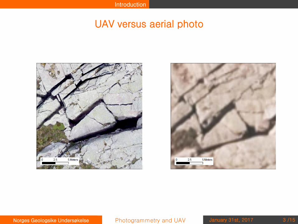
UAV versus aerial photo
Photogrammetry and UAV January 31st, 2017Norges Geologsike Undersøkelse
Introduction
3 /15

Photogrammetry and UAV January 31st, 2017Norges Geologsike Undersøkelse
Georeferencing
4 /15

Helicopter
Photogrammetry and UAV January 31st, 2017Norges Geologsike Undersøkelse
Georeferencing
Georeferencing
5 /15

Helicopter
Photogrammetry and UAV January 31st, 2017Norges Geologsike Undersøkelse
Georeferencing
Georeferencing
6 /15

Helicopter
Photogrammetry and UAV January 31st, 2017Norges Geologsike Undersøkelse
Georeferencing
7 /15

Helicopter
Photogrammetry and UAV January 31st, 2017Norges Geologsike Undersøkelse
Results
8 /15

Helicopter
Photogrammetry and UAV January 31st, 2017Norges Geologsike Undersøkelse
Results
9 /15

UAV
Photogrammetry and UAV January 31st, 2017Norges Geologsike Undersøkelse
Results
10 /15

UAV
Photogrammetry and UAV January 31st, 2017Norges Geologsike Undersøkelse
Results
11 /15

Helicopter versus UAV
Photogrammetry and UAV January 31st, 2017Norges Geologsike Undersøkelse
Results
12 /15

Helicopter versus UAV
Photogrammetry and UAV January 31st, 2017Norges Geologsike Undersøkelse
Results
- Combination of both allows to catch the unstable slope from more views. Specially for unstable slope with very steep fronts.
13 /15

Helicopter versus UAV
Photogrammetry and UAV January 31st, 2017Norges Geologsike Undersøkelse
Results
14 /15

High resolution photogrammetric model of Åkneset
Photogrammetry and UAV January 31st, 2017Norges Geologsike Undersøkelse
Proposal
• Documentation of changes on the surface over the year
• Activity of springs / change over the year – where to install gauges• Rock fall activity• Deformation of the surface
• Optimal 3D base data for 3D geological model to include all data in 3D software
15 /15