Embed Size (px)
Citation preview
Infrastructure – Theme 8
Mr Tim Moltmann (IMOS/UTAS), Dr Lyndon Llewellyn (AIMS) – co-convenorsProfessor Neville Exon (ANU), Professor Ian Turner (UNSW) - presenters

Infrastructure White papers
VesselsIODP
Observing Systems
Experimental Facilities
eResearch
Coastline Observatory
One main Infrastructure WP with four components
Two complementary WPs in targeted areas

Outline of presentation (30 mins)• Overview
• Tim, 3 mins
• Main Infrastructure White Paper• Tim, 15 mins
• International Ocean Discovery Program (IODP)• Neville, 5 mins
• National Coastline Observatory Facility (NCOF)• Ian, 5 mins
• Sum up• Tim, 2 mins
• Facilitated discussion (Lyndon, 15 mins)

Overview #1 - National Facilities

Overview #2 - Prioritised Investments
• Securing critical marine research infrastructure
• Utilising marine research infrastructure to optimal effect
• Accessing national research infrastructure needed for marine science

Vessels
• Bluewater
• Polar
• Shelf scale
– Tropical
– Temperate

VesselsBluewater• MNF our most mature marine national facility, proven model• World class capability in RV Investigator (+)
– oceanography, fisheries, biodiversity, geoscience, atmospheric
• Funded for 180 day operation (-)– Underutilisation, unmet science demand, lost international collaboration– Challenge in balancing science quality/track record with national benefit
Polar• Commitment to build a new icebreaker (+)• Funding for SO/Antarctic marine science highly constrained (-)
– Need to ensure adequate operational funding, not just capital

Vessels
• No coordination of shelf-scale capability
• Vessels managed at institutional and/or jurisdictional level– AIMS have a mandate in the tropical north
– Many challenges in the temperate south
• Scope for a national alliance?• coordination, collaboration, planning
• Eurofleets example?

Experimental Facilities
• Research Aquaria– AIMS National Sea Simulator (SeaSim)– SIMS, SARDI, AAD, Unis, State Depts…
• Analytical and Biosecurity Facilities– Australian Animal Health Laboratory (CSIRO)– AIMS, SARDI, AMC/UTAS…
• Research Stations– Island Research Stations– Antarctic Stations

Experimental Facilities
• Aquaria and Experimental Facilities institutionally managed and accessed
• Research stations used more collaboratively
• New precedent set by the National Sea Simulator (SeaSim) in making up to 50% of its capability available to work on collaborative research projects

Experimental Facilities
• Establish a national alliance of networked marine experimental facilities?– build on the precedent set by SeaSim
– investigate the potential for other facilities becoming more distributed and open
– ensure networks are integrated with relevant global initiatives• transfer of protocols and standards, harmonised QA/QC,
measurements of internationally recognised quality

Observing Systems
• IMOS now a mature national facility– Open ocean to coast, physics to biology
– Open access to all data, internationally recognised
• Infrastructure investment guided by community based science planning– Out in front of NMSP process, will need to calibrate
• Identified gaps – deep ocean, ice zone, coastal
• Annual funding cliff! (5+2+1+1+1 year funding)

Observing Systems
• Other in situ observing systems used for marine science– Bureau of Meteorology (including third party data)
– State and Territory Governments (little coordination)
– AMSA, RAN (opportunities for enhanced collaboration?)
• GA marine surveys– bathymetry (28% of EEZ), sediments
• How good is the data access from a national facility perspective?

Observing Systems
• Earth Observation from Space– mature globally: SST from ‘81, Altimetry from ‘93
• Australia has no independent satellite capability– Need very well coordinated investment in ground stations,
calibration and validation, processing storage and delivery• Opportunities presented by next generation satellites• Opportunities for Australia in sensors, micro satellites?
• NEOS-IP (Infrastructure Plan)– Is marine science high on the agenda?– Perhaps too much reliance on individuals in the past?
Observing Systems
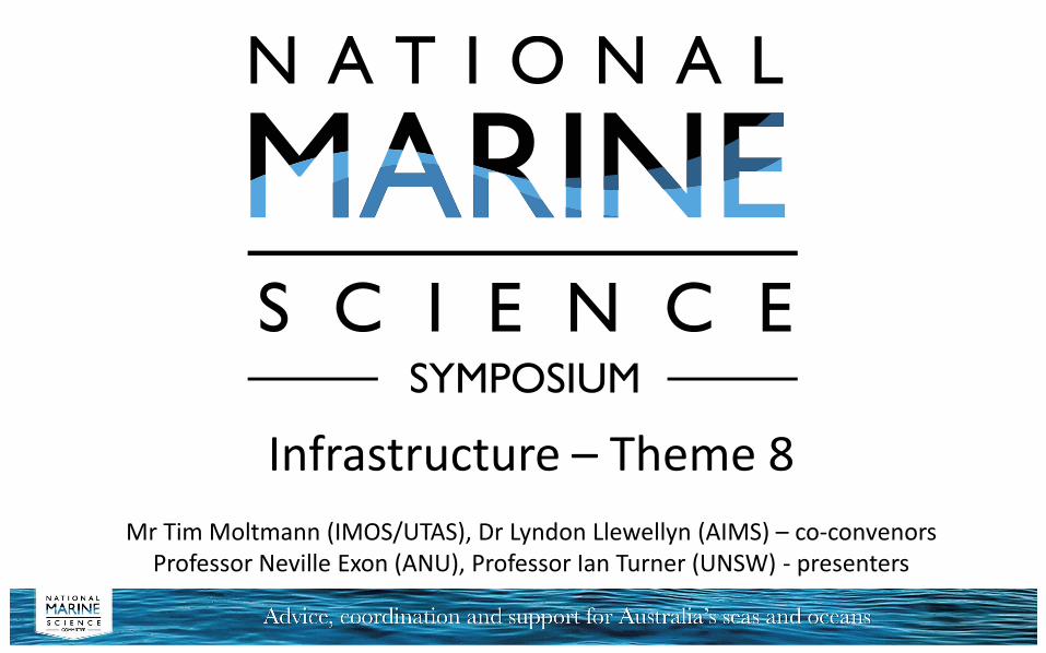
• Arguments for greater investment in autonomous systems capability– massive marine estate, most below diver depth, little
known and understood
• Very modest national capability at the moment– U Sydney ACRF/IMOS AUV Facility
– UTAS/AMC, new Antarctic Gateway under ice capability
– lagging internationally
• Opportunity to implement a national facility model?

eResearch• All IMOS data discoverable, accessible, usable and reusable
– standards based, open source, research data infrastructure– nationally and internationally benchmarked
• Same infrastructure used to underpin a broader Australian Ocean Data Network (AODN)– vision is for all marine research data to be discoverable…
• 13,500 metadata records in AODN, 77% non-IMOS (+)• Vast majority don’t have data attached (-)• Are we prepared to get behind AODN as a national facility?
– The case for collecting new data to close knowledge gaps is much stronger if we can account for everything we already have…
eResearch
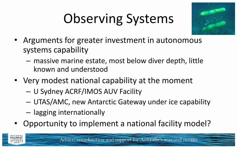
• Other foundational datasets/analyses are required:– bathymetry (underwater depth and topography)
– ocean reanalysis (historical 3-dimensional estimates of ocean properties)
• These need to be systematically managed as national resources by responsible agencies such as GA, BOM and CSIRO– ensuring the datasets/analyses are openly accessible to
the marine science community and other users

eResearch
• Access to high performance computing required– broadly based national/landmark scale research
infrastructure– petascale to exascale over the next decade
• Marine and climate science community using the National Computational Infrastructure (NCI)– Earth system modelling– Big datasets e.g. satellite remote sensing, EarthCube
• Data storage, mid-range compute, networking– issues for the science community (not marine specific)

The International Ocean Discovery Program: access to essential ocean drilling infrastructure for
marine geoscience
Submission by Neville Exon and others
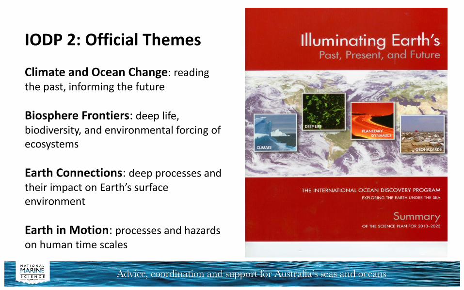
IODP 2: Official Themes
Climate and Ocean Change: reading the past, informing the future
Biosphere Frontiers: deep life, biodiversity, and environmental forcing of ecosystems
Earth Connections: deep processes and their impact on Earth’s surface environment
Earth in Motion: processes and hazards on human time scales

Australian bluewater marine geoscience depends partly on the brand new Investigator and makes up one third of its program: • Swath-mapping the seabed • Sub-bottom profiling to >50 mbsf• Seismic profiling to reveal the subsea
strata at great depth• Dredging rocky outcrops to understand
what forms the hard ocean floor• Coring shallow sediments to
understand processes, and climate and oceanographic history
This work is essential in building hypotheses that can only be tested by ocean drilling, and also in formulating globally competitive IODP proposals
IODP Depends on Basic Marine Geoscience Research

IODP: Main Points• Addresses global science problems by taking many thousand metres of
sediment and rock cores in our region and elsewhere each year
• Many valuable past, present and future ocean drilling activities
– IODP brings unique facilities to bear through a consortium of 27 countries
– Its operational budget is $US 180 million per year
– Ocean drilling has been a major international program for 45 years: now in new IODP ten year phase
– Australia could never afford such a program, but our research institutions and scientists are heavily involved through associate membership
– Our consortium (ANZIC) with New Zealand is highly successful scientifically
• Our present annual budget of $A3 million comes largely from ARC/LIEF, but runs out next year, so we need assured long-term funding

A great number of deep ocean drilling core holes in our region!

Value of ocean drilling to Australia and New Zealand
• Our scientists work in global teams– Produce cutting edge science and form lifelong partnerships
• We need to understand our huge offshore areas– For management and resources
• Definitively tests hypotheses built by other means– Formation of continental margins and oceanic plateaus– Processes and history of earthquakes, tsunamis, volcanism, mountain
building, erosion and deposition– Establish past climatic and oceanographic conditions, including sea level
rise, and look at the driving factors• Helps assess conventional petroleum potential and gas hydrate
potential

IODP Expeditions in our region in next few years
If we are not funded we miss out on many benefits
• Four scheduled in FY 2015• Two scheduled in FY 2016• Many possible in FY17 & FY
18• Operational cost $US8
million per expedition• Our financial input $US1.8
million per year

The establishment of an
Australian National Coastline Observatory Facility
Submission by Ian Turner and (many) others

‘The Coastline’
A recurring theme that cross-cuts the six MN2025 ‘grand challenges’ is the critical importance of our coastlines
• This unique land-ocean interface is where we live
• it is the focus of our international trade and built infrastructure
• natural coastline features such as beaches deliver enormous ecosystem services to our society’s economic and environmental wealth and security

Coastal ErosionThe economic value of existing built assets at risk to coastal erosion is substantial:- roads $46-$60 billion- commercial buildings $58-$81 billion- residential property $41-$63 billion
No less significantly, the cultural and economic value of natural coastal assets, including coastal ecosystems, marine parks and beaches, is immense. For example, the NSW government ranks beaches as one of its four most valuable natural resources
Nationally, the specific amenity and storm protection provided by beaches is estimated in the range of $3.8-$13 million for each and every kilometre of Australia’s shoreline

A Paucity of Coastline Observations
So it will come as a surprise to many that, at the present time, there is a paucity of sustained observation currently underway around Australia’s coastline
Australian Marine Science is lagging far behind in basic observations and infrastructure, compared to other developed nations throughout Europe and in North America

The Missing Gap……
The critical missing gap between the present IMOS and TERN observation programs is rigorous and sustained observations of the littoral zone specifically encompassing the land-ocean boundary, which also represents the region of the ocean with which the great majority of society directly interacts
Nominally spanning water depths of 20 – 0 m along open coastlines and extending landward to include frontal dunes, this critical region where the land meets the ocean currently falls outside any nationally-coordinated monitoring effort

Key Science Needs & Outcomes
Key advances in Australian Marine Science that will be facilitated by the establishment of a National Coastline Observatory Facility include:
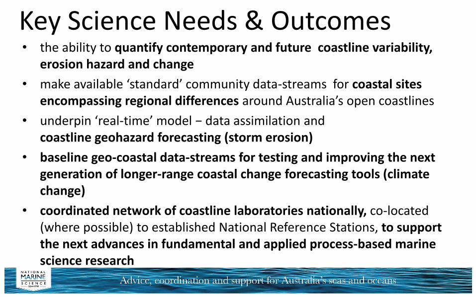
Key Science Needs & Outcomes• the ability to quantify contemporary and future coastline variability,
erosion hazard and change
• make available ‘standard’ community data-streams for coastal sites encompassing regional differences around Australia’s open coastlines
• underpin ‘real-time’ model − data assimilation and coastline geohazard forecasting (storm erosion)
• baseline geo-coastal data-streams for testing and improving the next generation of longer-range coastal change forecasting tools (climate change)
• coordinated network of coastline laboratories nationally, co-located (where possible) to established National Reference Stations, to support the next advances in fundamental and applied process-based marine science research

Summary of NCOF Core Baseline Data-Streams: continious imaging of the nearshore, surfzone,
shoreline and subaerial beach
periodic beach profile surveys
co-located to waves, water-level and wind measurements (existing or new)
shelf-to-shore bathymetry
beach and nearshore sediment characteristics
time-series of paleo-coastline evolution
water quality
baseline ecology
beach usage and hazards
The technology and expertise now exists within the Australian Marine Science community to deploy, maintain and immediately exploit the sustained data-streams that a nationally-coordinated coastline observatory facility can deliver

Sum Up – critical requirements (x12)
1. Securing critical marine research infrastructure
• Build and commission Australia’s next generation polar vessel, ensuring that at least 60 days per annum for Antarctic marine science
• Secure, sustain and develop the Integrated Marine Observing System (IMOS) – close gaps in deep ocean, ice zone, coastal
• Secure, sustain and develop the Australian Ocean Data Network (AODN)
• Consider options for securing a step change increase in autonomous systems capability – fresh approach to national facility development?
• Consider options for establishing a National Coastline Observatory Facility

Sum Up – critical requirements
2. Utilising marine research infrastructure to optimal effect
• Enable full utilisation of Investigator (i.e. up to 300 days per annum), and consider options for further expanding blue water research vessel capacity to match science demand
• Establish an alliance of shelf scale research vessel operators
• Establish a national alliance of networked marine experimental facilities

Sum Up – critical requirements3. Accessing national research infrastructure needed for marine science
• Implement the National Earth Observations from Space Infrastructure Plan (NEOS-IP)
• Sustain and develop Australia’s HPC capacity at the National Computational Infrastructure (NCI)
• Develop and sustain the virtual laboratory environments to bring observations, data and computing together
• Ensure ongoing access to IODP through the ANZIC consortium
N.B. Estimated cost of ~$3bn over the next decade, to 2025

Sum Up
• N.B. The Infrastructure theme will need to iterate with other theme requirements (x7)
• However there are obvious priorities and we’ve focused on those
– with due consideration
of dependencies

Thank youIssues we didn’t have time to cover in the presentation…• National capability in marine technology
– people and skills, not just ‘kit’…
• Continuity of funding for infrastructure on appropriate timescales• Adequacy of funding for operations and maintenance
– not just capital acquisition
• Coordination between funding of research and access to infrastructure – e.g. ARC and MNF
• Efficiency and effectiveness through greater use of commercial platforms, citizen science
• Enhanced national collaboration around satellite ocean colour• Access to other NCRIS capabilities e.g. Bioplatforms Australia