Embed Size (px)
Citation preview
INF
RA
ST
RU
CT
UR
E
INT
EG
RIT
Y
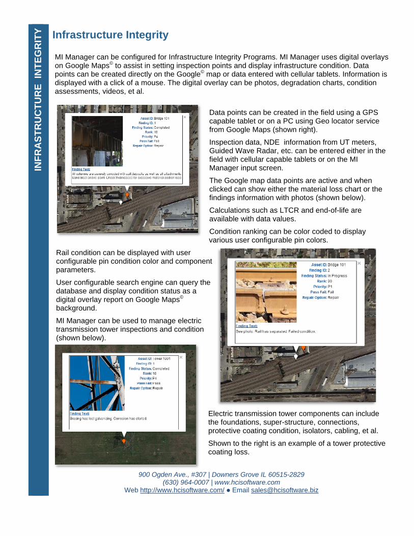
Infrastructure Integrity MI Manager can be configured for Infrastructure Integrity Programs. MI Manager uses digital overlays on Google Maps© to assist in setting inspection points and display infrastructure condition. Data points can be created directly on the Google© map or data entered with cellular tablets. Information is displayed with a click of a mouse. The digital overlay can be photos, degradation charts, condition assessments, videos, et al.
Data points can be created in the field using a GPS capable tablet or on a PC using Geo locator service from Google Maps (shown right).
Inspection data, NDE information from UT meters, Guided Wave Radar, etc. can be entered either in the field with cellular capable tablets or on the MI Manager input screen.
The Google map data points are active and when clicked can show either the material loss chart or the findings information with photos (shown below).
Calculations such as LTCR and end-of-life are available with data values.
Condition ranking can be color coded to display various user configurable pin colors.
Rail condition can be displayed with user configurable pin condition color and component parameters.
User configurable search engine can query the database and display condition status as a digital overlay report on Google Maps©
background.
MI Manager can be used to manage electric transmission tower inspections and condition (shown below).
Electric transmission tower components can include the foundations, super-structure, connections, protective coating condition, isolators, cabling, et al.
Shown to the right is an example of a tower protective coating loss.
900 Ogden Ave., #307 | Downers Grove IL 60515-2829 (630) 964-0007 | www.hcisoftware.com
Web http://www.hcisoftware.com/ Email [email protected]