Embed Size (px)
Citation preview
Currawong Resources P/L 4 Fitt Court, Bendigo
PO Box 456, Heathcote, VIC 3523 www.currawongres.com
INFORMATION SHEET – EXPLORATION TECHNIQUES
Currawong operates under an Exploration Licence granted by the State Government of Victoria who is responsible for the development of all mineral resources. Exploration Licences are usually granted for a period of 5 years.
Exploration techniques, including drilling, are strictly controlled, and regulated under the Mineral Resources (Sustainable Development) Act 1990. Drilling requires a DJPR section Earth Resources and Regulations approved Work Plan. A Work Plan requires a thorough and wide-ranging set of information including:
• heritage and environmental reviews and possible impacts, • details on proposed works & methodology, • landowner compensation agreements, • administrative plans, • proposed environmental impact mitigation.
These Work Plans are vetted, reviewed and possibly approved by a variety of government departments, which can take some months.
As such the company employs a variety of low-impact exploration techniques to search for minerals.
Currawong actively pursues a policy of low environmental impact at all sites and exploration projects. Low impact exploration restricts the removal of trees or the clearing of access tracks and other land. Land managers and landowners are always consulted in these matters and for Crown Land managers such as Parks Victoria or DELWP Forests consent is required from them prior to any drilling being conducted.
Mapping, geochemical (soil and rock sampling) and geophysical surveys are all regarded as low impact activities.
Exploration programs apply a systematic approach to collect samples to define areas of potential economic mineralisation. These can involve:
1. Office-based desk top studies to determine the nature of geology and mineralisation within the application area to guide targeted on-ground exploration efforts;
2. Mapping and rock chip sampling over areas of interest identified in office studies, including historic mine dumps and areas of geological outcrop. Mapping is usually done with the aid of handheld GPS navigation to survey the location of geological evidence for the purposes of making maps. Sampling is completed using a small hammer and simply taking small rock chips usually up to about 3kg in weight. These rock samples are sent to laboratories for analyses to determine the gold or other metal content.
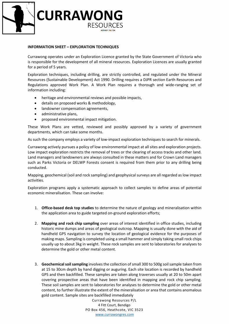
3. Geochemical soil sampling involves the collection of small 300 to 500g soil sample taken from at 15 to 30cm depth by hand digging or auguring. Each site location is recorded by handheld GPS and then backfilled. These samples are taken along traverses usually at 20 to 50m apart covering prospective areas that have been identified in mapping and rock chip sampling. These soil samples are sent to laboratories for analyses to determine the gold or other metal content, to further illustrate the extent of the mineralisation or area that contains anomalous gold content. Sample sites are backfilled immediately
Currawong Resources P/L 4 Fitt Court, Bendigo
PO Box 456, Heathcote, VIC 3523 www.currawongres.com
Auger Soil sampling technique and equipment
4. Geophysical surveys typically use electronic devices that measure the variation in the near surface rock formations of parameters such as gravity, magnetics or resistivity and electrical conductivity. These surveys, may be conducted on foot, mounted on a vehicle, or mounted on an aircraft. Geophysics may help build a detail image of the geology of the area. It is a non-invasive process.
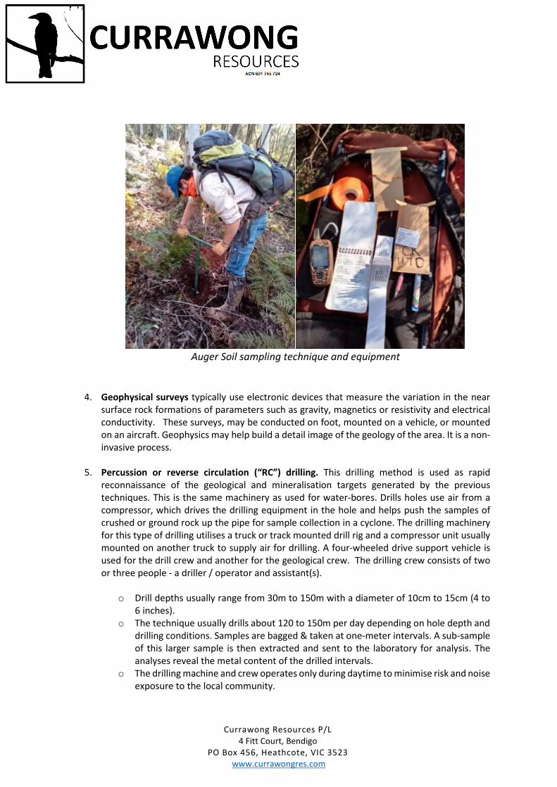
5. Percussion or reverse circulation (“RC”) drilling. This drilling method is used as rapid reconnaissance of the geological and mineralisation targets generated by the previous techniques. This is the same machinery as used for water-bores. Drills holes use air from a compressor, which drives the drilling equipment in the hole and helps push the samples of crushed or ground rock up the pipe for sample collection in a cyclone. The drilling machinery for this type of drilling utilises a truck or track mounted drill rig and a compressor unit usually mounted on another truck to supply air for drilling. A four-wheeled drive support vehicle is used for the drill crew and another for the geological crew. The drilling crew consists of two or three people - a driller / operator and assistant(s).
o Drill depths usually range from 30m to 150m with a diameter of 10cm to 15cm (4 to 6 inches).
o The technique usually drills about 120 to 150m per day depending on hole depth and drilling conditions. Samples are bagged & taken at one-meter intervals. A sub-sample of this larger sample is then extracted and sent to the laboratory for analysis. The analyses reveal the metal content of the drilled intervals.
o The drilling machine and crew operates only during daytime to minimise risk and noise exposure to the local community.
Currawong Resources P/L 4 Fitt Court, Bendigo
PO Box 456, Heathcote, VIC 3523 www.currawongres.com
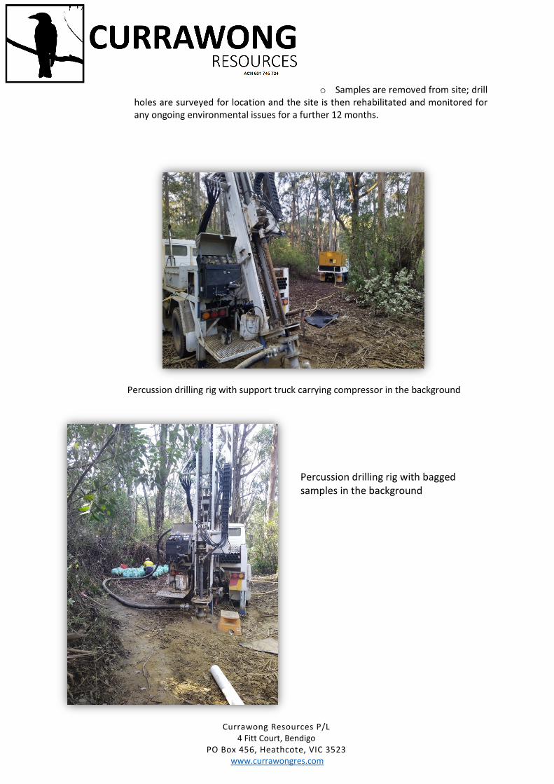
o Samples are removed from site; drill holes are surveyed for location and the site is then rehabilitated and monitored for any ongoing environmental issues for a further 12 months.
Percussion drilling rig with support truck carrying compressor in the background
Percussion drilling rig with bagged samples in the background
Currawong Resources P/L 4 Fitt Court, Bendigo
PO Box 456, Heathcote, VIC 3523 www.currawongres.com
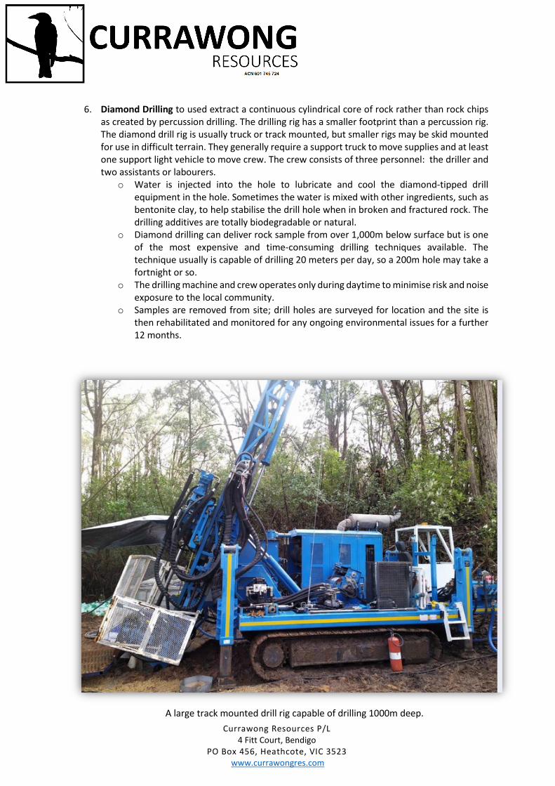
6. Diamond Drilling to used extract a continuous cylindrical core of rock rather than rock chips as created by percussion drilling. The drilling rig has a smaller footprint than a percussion rig. The diamond drill rig is usually truck or track mounted, but smaller rigs may be skid mounted for use in difficult terrain. They generally require a support truck to move supplies and at least one support light vehicle to move crew. The crew consists of three personnel: the driller and two assistants or labourers.
o Water is injected into the hole to lubricate and cool the diamond-tipped drill equipment in the hole. Sometimes the water is mixed with other ingredients, such as bentonite clay, to help stabilise the drill hole when in broken and fractured rock. The drilling additives are totally biodegradable or natural.
o Diamond drilling can deliver rock sample from over 1,000m below surface but is one of the most expensive and time-consuming drilling techniques available. The technique usually is capable of drilling 20 meters per day, so a 200m hole may take a fortnight or so.
o The drilling machine and crew operates only during daytime to minimise risk and noise exposure to the local community.
o Samples are removed from site; drill holes are surveyed for location and the site is then rehabilitated and monitored for any ongoing environmental issues for a further 12 months.
A large track mounted drill rig capable of drilling 1000m deep.
Currawong Resources P/L 4 Fitt Court, Bendigo
PO Box 456, Heathcote, VIC 3523 www.currawongres.com
7. Bulk Sampling or trenching. Bulk sampling is used to extract a quantity of material from a trench or small pit to be analysed for overall potential mineral content. Trenching is used to expose a geological feature. This activity is not recommended by Currawong Resources and is not proposed on any sites, because it has a more significant environmental impact and therefore requires a more rigorous rehabilitation program.
8. Rehabilitation and environmental monitoring are conducted on all sites where significant activities have taken place. In the case of drilling, each drill site is photographed before, during and after the rehabilitation so that it is clear what work has been done and that the impacts of that work are minimal, as well as the assurance and quality of the rehabilitation are complete. Further monitoring of these former drill sites is required to ensure that the area does not deteriorate after completing the rehabilitation.
It is important to note that an Exploration Licence does not allow an operator to conduct mining activities. Mining falls under a completely different licence and approval process and must be granted for any mining activities to occur.
More information: Code of Practice for Mineral Exploration, Appendix 2. www.earthresources.vic.gov.au