Embed Size (px)
Citation preview
Industry Solutions
Harness the Power of GIS for Government
GOVERNMENT

Harness the Power of GIS for Government | Esri Canada 1
Leverage the Power of Geography forUnprecedented Insight & Knowledge
Governments of all sizes are facing increasing demands while being forced to operate on tighter budgets. They face a growing expectation of accountability and are expected to maintain a high level of service often with fewer resources. Government organizations at all levels are also expected to reduce costs and their carbon footprint without compromising essential services.
To effectively deliver services, government employees must be able to access information from multiple departments quickly. They need a platform to organize, manage and integrate applications and data and then be able to make this information accessible. Unfortunately, many governmental bodies contend with:
• decreased budgets• limited resources• increased demand for transparency• increased demand for services• mounting costs• inefficient communication• redundant systems• data inaccessibility
Enter GISA geographic information system (GIS) integrates hardware, software, and data for capturing, managing, analyzing, and displaying all forms of geographically referenced information. Understanding the relationship between location and government activities assists tremendously in planning, decision-making and the delivery of services. With GIS, government employees can better collaborate and communicate to analyze complex situations, visualize problems, create plans and form solutions. At the forefront of GIS technology is Esri.
Esri offers a market leading GIS solution that allows civil servants to organize vast amounts of complex data into understandable visual representations in every branch of government.
Drawing from our comprehensive suite of software and an array of support services that include technical support, training, and the expertise of our professional services consultants and business partners, Esri provides flexible and scalable solutions that are tailored to your individual requirements. Our solutions are interoperable and designed to interface with existing databases, networks and enterprise resource planning systems.
The types of governmental bodies that have adopted Esri technology span the government spectrum. Some of these organizations include:
• federal departments & agencies• crown corporations• provincial ministries• counties, townships, municipalities• cities, towns, villages
“We left behind our manual, paper-based method of collecting census data to embrace an online system that has increased productivity by 50% and reduced our annual budget by almost 80%.” Corey Halford IT Data Services Team Leader City of Airdrie
Harness the Power of GIS for Government
Esri’s GIS solutions help planners, managers, policy makers and politicians to better understand geographic relationships that affect service delivery, accountability, fiscal management and other government concerns.
GIS plays a vital role in determining where people, assets or events are located. It also helps to reveal patterns, risks and opportunities that might not be easily detected in a spreadsheet or written document. This enables improved decision-making and clearer communication of these decisions through visual presentation.
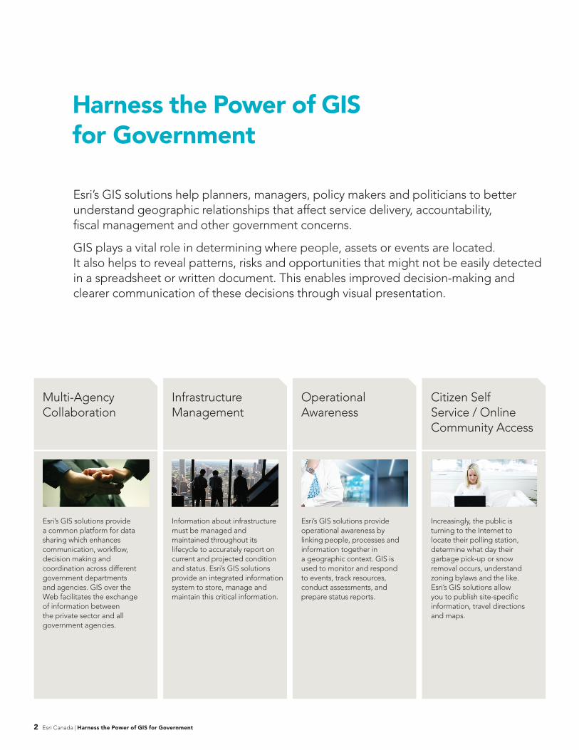
Multi-Agency Collaboration
Infrastructure Management
Operational Awareness
Citizen Self Service / Online Community Access
2 Esri Canada | Harness the Power of GIS for Government
Esri’s GIS solutions provide a common platform for data sharing which enhances communication, workflow, decision making and coordination across different government departments and agencies. GIS over the Web facilitates the exchange of information between the private sector and all government agencies.
Information about infrastructure must be managed and maintained throughout its lifecycle to accurately report on current and projected condition and status. Esri’s GIS solutions provide an integrated information system to store, manage and maintain this critical information.
Esri’s GIS solutions provide operational awareness by linking people, processes and information together in a geographic context. GIS is used to monitor and respond to events, track resources, conduct assessments, and prepare status reports.
Increasingly, the public is turning to the Internet to locate their polling station, determine what day their garbage pick-up or snow removal occurs, understand zoning bylaws and the like. Esri’s GIS solutions allow you to publish site-specific information, travel directions and maps.
“Developing a spatial data infrastructure has helped us to significantly reduce data duplication and inaccuracies to better meet the needs of our provincial departments and the public.” Bernie Connors SDI Manager, Land Information Secretariat Service New Brunswick
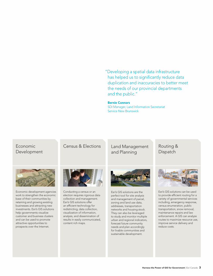
Economic Development
Census & Elections Land Management and Planning
Routing & Dispatch
Harness the Power of GIS for Government | Esri Canada 3
Economic development agencies work to strengthen the economic base of their communities by retaining and growing existing businesses and attracting new investments. Esri’s GIS solutions help governments visualize customer and business clusters and can be used to promote attractive opportunities to prospects over the Internet.
Conducting a census or an election requires rigorous data collection and management. Esri’s GIS solutions offer an efficient technology for redistricting, data collection, visualization of information, analysis, and dissemination of results in easily communicated, content rich maps.
Esri’s GIS solutions are the perfect tool for site analysis and management of parcel, zoning and land use data, addresses, transportation networks and housing stock. They can also be leveraged to study and monitor multiple urban and regional indicators, forecast future community needs and plan accordingly for livable communities and sustainable development.
Esri’s GIS solutions can be used to provide efficient routing for a variety of governmental services including, emergency response, census enumeration, public transportation, snow removal, maintenance repairs and law enforcement. A GIS can analyze routes to maximize resource use, improve service delivery and reduce costs.
Integrate Diverse Information: Informed decisions rely on integrated information from diverse sources. Using Esri technology, data can be compiled into a common operational picture for comparative analysis, visual presentation and reporting.
Perform Advanced Statistical Analysis: Advanced and computationally efficient algorithms perform complex statistical calculations to accurately deliver timely results for decision making, planning and forecasting.
Communicate More Effectively: Presenting clinical and administrative information graphically through mapped data opens the door to a wealth of information that can be quickly assimilated, communicated, understood and explained.
Improve Data Accuracy with Mobile Devices: By integrating mobile devices – such as handheld GPS units – data can be entered with exact geographic coordinates along with other descriptive information.
Provide Access to Data Across the Enterprise: Data is far more valuable when it can be integrated and used in the decision making process by a broad range of users. Esri technology provides a way to move data from the project level so that it can be used by the entire organization. Data can be easily accessed using an Intranet or the Internet.
Data Confidentiality: Esri’s GIS solutions allow you to mask sensitive information based on defined security and privacy needs.
Key Benefits & Features
In a government’s information intensive environment, Esri technology plays a critical role due to its ability to integrate a wide range of data sources, from legacy systems to imagery, and to make complex data quickly and easily understood through visual representation. The ability of Esri’s GIS solutions to intelligently manage, correlate, predict, model and share information makes it an essential analytical and decision making tool.
4 Esri Canada | Harness the Power of GIS for Government
Esri’s GIS Solutionsin Action
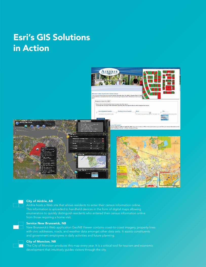
City of Airdrie, ABAirdrie hosts a Web site that allows residents to enter their census information online. This information is uploaded to handheld devices in the form of digital maps allowing enumerators to quickly distinguish residents who entered their census information online from those requiring a home visit.
Service New Brunswick, NBNew Brunswick’s Web application GeoNB Viewer contains coast-to-coast imagery, property lines with civic addresses, roads, and weather data amongst other data sets. It assists constituents and government employees in daily activities and future planning.
City of Moncton, NBThe City of Moncton produces this map every year. It is a critical tool for tourism and economic development that intuitively guides visitors through the city.
© 2016 Esri Canada Limited. All rights reserved. Trademarks provided under license from Environmental Systems ResearchInstitute, Inc. Other product and company names mentioned herein may be trademarks or registered trademarks of theirrespective owners. Errors and omissions excepted.EC2_0056_1201_4C
Esri Canada12 Concorde Place, Suite 900Toronto, ON M3C 3R8T: 416-441-6035F: 416-441-6838
Customer Care1-800-447-9778 [email protected]
Technical Support [email protected]
British ColumbiaVancouver: 604-682-4652 Victoria: 250-383-8330 Kelowna: 250-861-3774
AlbertaCalgary: 403-262-3774 Edmonton: 780-424-3774
SaskatchewanRegina: 306-352-3774
ManitobaWinnipeg: 204-943-3774
OntarioToronto: 416-441-6035Ottawa: 613-234-2103 London: 519-645-4919Sudbury: 705-670-0870
QuébecMontréal: 514-875-8568 Québec: 418-654-9597
Nova ScotiaHalifax: 902-423-5199
New BrunswickFredericton: 506-454-7773
Newfoundland & LabradorSt. John’s: 709-726-3774
Founded in 1984, Esri Canada provides enterprise geographic information system (GIS) solutions that empower businesses, governments and educational institutions to make timely, informed and mission-critical decisions by leveraging the power of geography. The company distributes the world’s leading GIS software from Esri, along with a comprehensive portfolio of complementary GIS products and services. Headquartered in Toronto, the company serves over 10,000 customers from 16 regional offi ces across Canada.