Embed Size (px)
Citation preview
NEWS
Issue 229 • January/February 2009
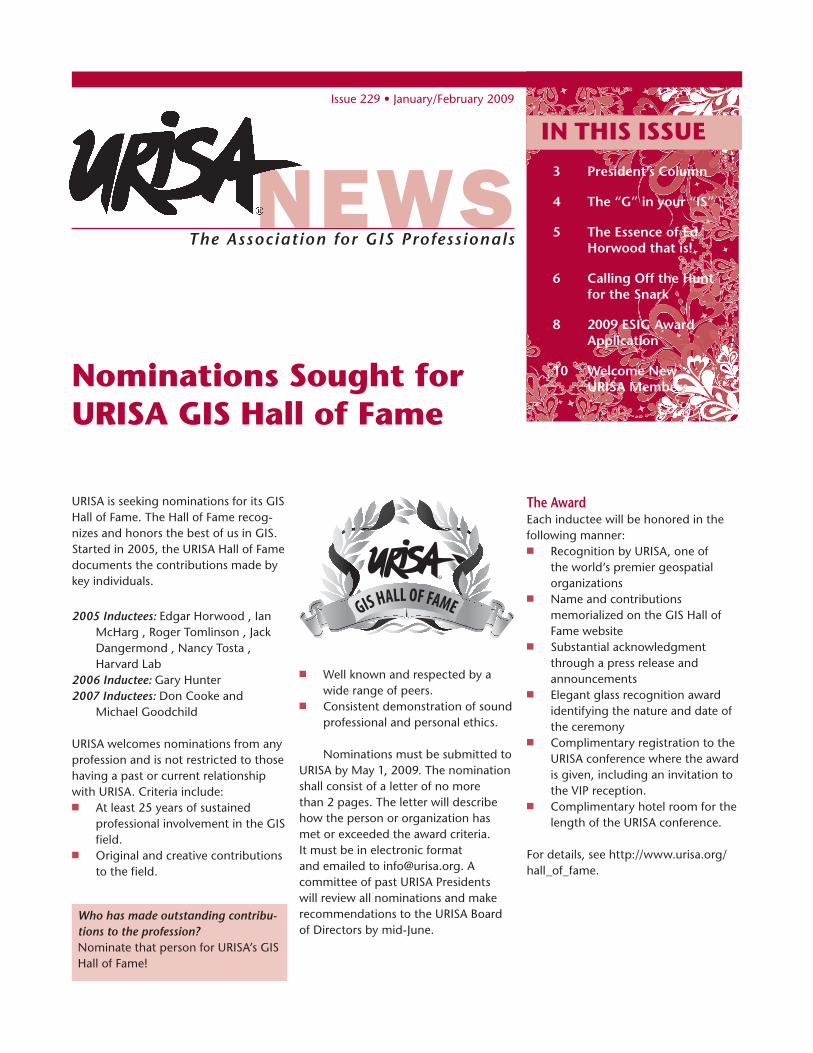
URISA is seeking nominations for its GIS Hall of Fame. The Hall of Fame recog-nizes and honors the best of us in GIS. Started in 2005, the URISA Hall of Fame documents the contributions made by key individuals.
2005 Inductees: Edgar Horwood , Ian McHarg , Roger Tomlinson , Jack Dangermond , Nancy Tosta , Harvard Lab
2006 Inductee: Gary Hunter 2007 Inductees: Don Cooke and
Michael Goodchild
URISA welcomes nominations from any profession and is not restricted to those having a past or current relationship with URISA. Criteria include:n At least 25 years of sustained
professional involvement in the GIS field.
n Original and creative contributions to the field.
Nominations Sought for URISA GIS Hall of Fame
n Well known and respected by a wide range of peers.
n Consistent demonstration of sound professional and personal ethics.
Nominations must be submitted to URISA by May 1, 2009. The nomination shall consist of a letter of no more than 2 pages. The letter will describe how the person or organization has met or exceeded the award criteria. It must be in electronic format and emailed to [email protected]. A committee of past URISA Presidents will review all nominations and make recommendations to the URISA Board of Directors by mid-June.
The Association for GIS Profess ionals
IN THIS ISSUE3 President’sColumn
4 The“G”inyour“IS”
5 TheEssenceofEdHorwoodthatis!
6 CallingOfftheHuntfortheSnark
8 2009ESIGAwardApplication
10 WelcomeNewurISAMembers
TheAwardEach inductee will be honored in the following manner: n Recognition by URISA, one of
the world’s premier geospatial organizations
n Name and contributions memorialized on the GIS Hall of Fame website
n Substantial acknowledgment through a press release and announcements
n Elegant glass recognition award identifying the nature and date of the ceremony
n Complimentary registration to the URISA conference where the award is given, including an invitation to the VIP reception.
n Complimentary hotel room for the length of the URISA conference.
For details, see http://www.urisa.org/hall_of_fame.
Who has made outstanding contribu-tions to the profession? Nominate that person for URISA’s GIS Hall of Fame!
ImportanturISADatestoremember
CoNFeReNCeS
February 27, 2009Abstracts due for 47th Annual URISA Conference
February 27, 2009Abstracts due for GIS in Transit Conference
June 5-8, 2009 URISA’s GIS in Public Health Conference Providence, RI
August 4-6, 2009 URISA/NENA Addressing Conference Providence, RI
September 29-october 2, 2009 47th Annual URISA Conference Anaheim, CA
November 10-12, 2009 GIS in Transit Conference St Petersburg, FL
AwARdS GIS Hall of Fame –May 1
Student Paper Competition – May 1
Exemplary Systems in Government Awards – May 11
The Urban and Regional Information
Systems Association (URISA) is the
premier professional association for
those involved in improving our urban
and regional environments through the
effective use of information technology.
Professionals in planning, economic
development, information systems,
emergency services, natural resources,
public works, transportation, and other
departments within state and local
government have depended on URISA
for professional development and
educational needs since 1963. Through
its international, national and local
chapter operations, URISA serves nearly
8,000 professionals.
AboutPRESIDENTHilary Perkins, GISP AICP-East-West Gateway Council of Governments, St. Louis, MO [email protected]
PRESIDENT-ELECTKathrine Cargo, GISP-Orleans Parish Communication [email protected]
IMMEDIATE PAST-PRESIDENTSusan Johnson-Charlotte Mecklenburg [email protected]
SECRETARYCynthia Braddock-Boulder County (CO) Assessor's [email protected]
TREASURERGreg Babinski, GISP-King County (WA) GIS [email protected]
Clare Brown, GISP-Montgomery Watson Harza, New Orleans, LA [email protected]
J. Allison Butler, GISP, AICP, MilePost Zero, Orlando, [email protected]
Michael W Lovett, GISP-CDM Camp Dresser & McKee, Maitland, FL [email protected]
Sandra K Majewski-Las Vegas Metro Police [email protected]
Juna Papajorgji, GISP - Alachua County (FL) Growth [email protected]
Karen RM Stewart, GISP-ESRI Canada, Vancouver, BC [email protected]
Geney Terry, GISP-El Dorado County (CA)[email protected]
urISAHeadquarters 1460 Renaissance Drive, Suite 305Park Ridge, IL 60068 Phone: 847-824-6300 Fax: [email protected]://www.urisa.org
Article submissions, calendar items and industry news should be sent to [email protected]
� January/February �009 • URISA News
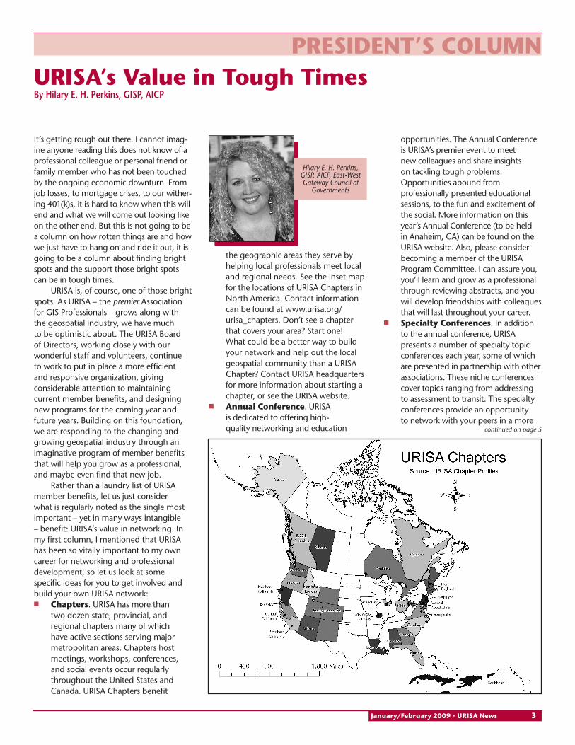
Hilary E. H. Perkins, GISP, AICP, East-West Gateway Council of
Governments
PReSIdeNt’S ColUmNURISA’s Value in tough timesByHilaryE.H.Perkins,GISP,AICP
It’s getting rough out there. I cannot imag-ine anyone reading this does not know of a professional colleague or personal friend or family member who has not been touched by the ongoing economic downturn. From job losses, to mortgage crises, to our wither-ing 401(k)s, it is hard to know when this will end and what we will come out looking like on the other end. But this is not going to be a column on how rotten things are and how we just have to hang on and ride it out, it is going to be a column about finding bright spots and the support those bright spots can be in tough times.
URISA is, of course, one of those bright spots. As URISA – the premier Association for GIS Professionals – grows along with the geospatial industry, we have much to be optimistic about. The URISA Board of Directors, working closely with our wonderful staff and volunteers, continue to work to put in place a more efficient and responsive organization, giving considerable attention to maintaining current member benefits, and designing new programs for the coming year and future years. Building on this foundation, we are responding to the changing and growing geospatial industry through an imaginative program of member benefits that will help you grow as a professional, and maybe even find that new job.
Rather than a laundry list of URISA member benefits, let us just consider what is regularly noted as the single most important – yet in many ways intangible – benefit: URISA’s value in networking. In my first column, I mentioned that URISA has been so vitally important to my own career for networking and professional development, so let us look at some specific ideas for you to get involved and build your own URISA network:n Chapters. URISA has more than
two dozen state, provincial, and regional chapters many of which have active sections serving major metropolitan areas. Chapters host meetings, workshops, conferences, and social events occur regularly throughout the United States and Canada. URISA Chapters benefit
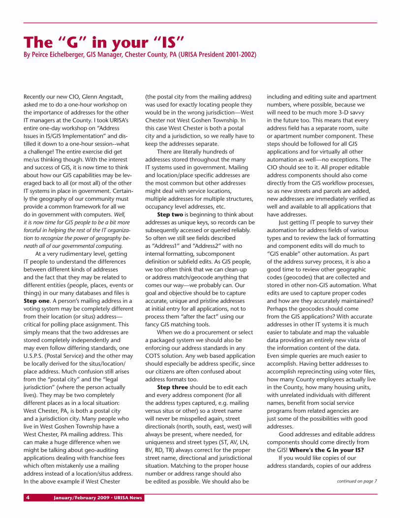
the geographic areas they serve by helping local professionals meet local and regional needs. See the inset map for the locations of URISA Chapters in North America. Contact information can be found at www.urisa.org/urisa_chapters. Don’t see a chapter that covers your area? Start one! What could be a better way to build your network and help out the local geospatial community than a URISA Chapter? Contact URISA headquarters for more information about starting a chapter, or see the URISA website.
n Annual Conference. URISA is dedicated to offering high-quality networking and education
opportunities. The Annual Conference is URISA’s premier event to meet new colleagues and share insights on tackling tough problems. Opportunities abound from professionally presented educational sessions, to the fun and excitement of the social. More information on this year’s Annual Conference (to be held in Anaheim, CA) can be found on the URISA website. Also, please consider becoming a member of the URISA Program Committee. I can assure you, you’ll learn and grow as a professional through reviewing abstracts, and you will develop friendships with colleagues that will last throughout your career.
n Specialty Conferences. In addition to the annual conference, URISA presents a number of specialty topic conferences each year, some of which are presented in partnership with other associations. These niche conferences cover topics ranging from addressing to assessment to transit. The specialty conferences provide an opportunity to network with your peers in a more
continued on page �
January/February �009 • URISA News �
Recently our new CIO, Glenn Angstadt, asked me to do a one-hour workshop on the importance of addresses for the other IT managers at the County. I took URISA’s entire one-day workshop on “Address Issues in IS/GIS Implementation” and dis-tilled it down to a one-hour session--what a challenge! The entire exercise did get me/us thinking though. With the interest and success of GIS, it is now time to think about how our GIS capabilities may be lev-eraged back to all (or most all) of the other IT systems in place in government. Certain-ly the geography of our community must provide a common framework for all we do in government with computers. Well, it is now time for GIS people to be a bit more forceful in helping the rest of the IT organiza-tion to recognize the power of geography be-neath all of our governmental computing.
At a very rudimentary level, getting IT people to understand the differences between different kinds of addresses and the fact that they may be related to different entities (people, places, events or things) in our many databases and files is Step one. A person’s mailing address in a voting system may be completely different from their location (or situs) address—critical for polling place assignment. This simply means that the two addresses are stored completely independently and may even follow differing standards, one U.S.P.S. (Postal Service) and the other may be locally derived for the situs/location/place address. Much confusion still arises from the “postal city” and the “legal jurisdiction” (where the person actually lives). They may be two completely different places as in a local situation: West Chester, PA, is both a postal city and a jurisdiction city. Many people who live in West Goshen Township have a West Chester, PA mailing address. This can make a huge difference when we might be talking about geo-auditing applications dealing with franchise fees which often mistakenly use a mailing address instead of a location/situs address. In the above example if West Chester
(the postal city from the mailing address) was used for exactly locating people they would be in the wrong jurisdiction—West Chester not West Goshen Township. In this case West Chester is both a postal city and a jurisdiction, so we really have to keep the addresses separate.
There are literally hundreds of addresses stored throughout the many IT systems used in government. Mailing and location/place specific addresses are the most common but other addresses might deal with service locations, multiple addresses for multiple structures, occupancy level addresses, etc.
Step two is beginning to think about addresses as unique keys, so records can be subsequently accessed or queried reliably. So often we still see fields described as “Address1” and “Address2” with no internal formatting, subcomponent definition or subfield edits. As GIS people, we too often think that we can clean-up or address match/geocode anything that comes our way—we probably can. Our goal and objective should be to capture accurate, unique and pristine addresses at initial entry for all applications, not to process them “after the fact” using our fancy GIS matching tools.
When we do a procurement or select a packaged system we should also be enforcing our address standards in any COTS solution. Any web based application should especially be address specific, since our citizens are often confused about address formats too.
Step three should be to edit each and every address component (for all the address types captured, e.g. mailing versus situs or other) so a street name will never be misspelled again, street directionals (north, south, east, west) will always be present, where needed, for uniqueness and street types (ST, AV, LN, BV, RD, TR) always correct for the proper street name, directional and jurisdictional situation. Matching to the proper house number or address range should also be edited as possible. We should also be
including and editing suite and apartment numbers, where possible, because we will need to be much more 3-D savvy in the future too. This means that every address field has a separate room, suite or apartment number component. These steps should be followed for all GIS applications and for virtually all other automation as well—no exceptions. The CIO should see to it. All proper editable address components should also come directly from the GIS workflow processes, so as new streets and parcels are added, new addresses are immediately verified as well and available to all applications that have addresses.
Just getting IT people to survey their automation for address fields of various types and to review the lack of formatting and component edits will do much to “GIS enable” other automation. As part of the address survey process, it is also a good time to review other geographic codes (geocodes) that are collected and stored in other non-GIS automation. What edits are used to capture proper codes and how are they accurately maintained? Perhaps the geocodes should come from the GIS applications? With accurate addresses in other IT systems it is much easier to tabulate and map the valuable data providing an entirely new vista of the information content of the data. Even simple queries are much easier to accomplish. Having better addresses to accomplish reprecincting using voter files, how many County employees actually live in the County, how many housing units, with unrelated individuals with different names, benefit from social service programs from related agencies are just some of the possibilities with good addresses.
Good addresses and editable address components should come directly from the GIS! where’s the G in your IS?
If you would like copies of our address standards, copies of our address
the “G” in your “IS”ByPeirceEichelberger,GISManager,ChesterCounty,PA(urISAPresident2001-2002)
continued on page �
� January/February �009 • URISA News
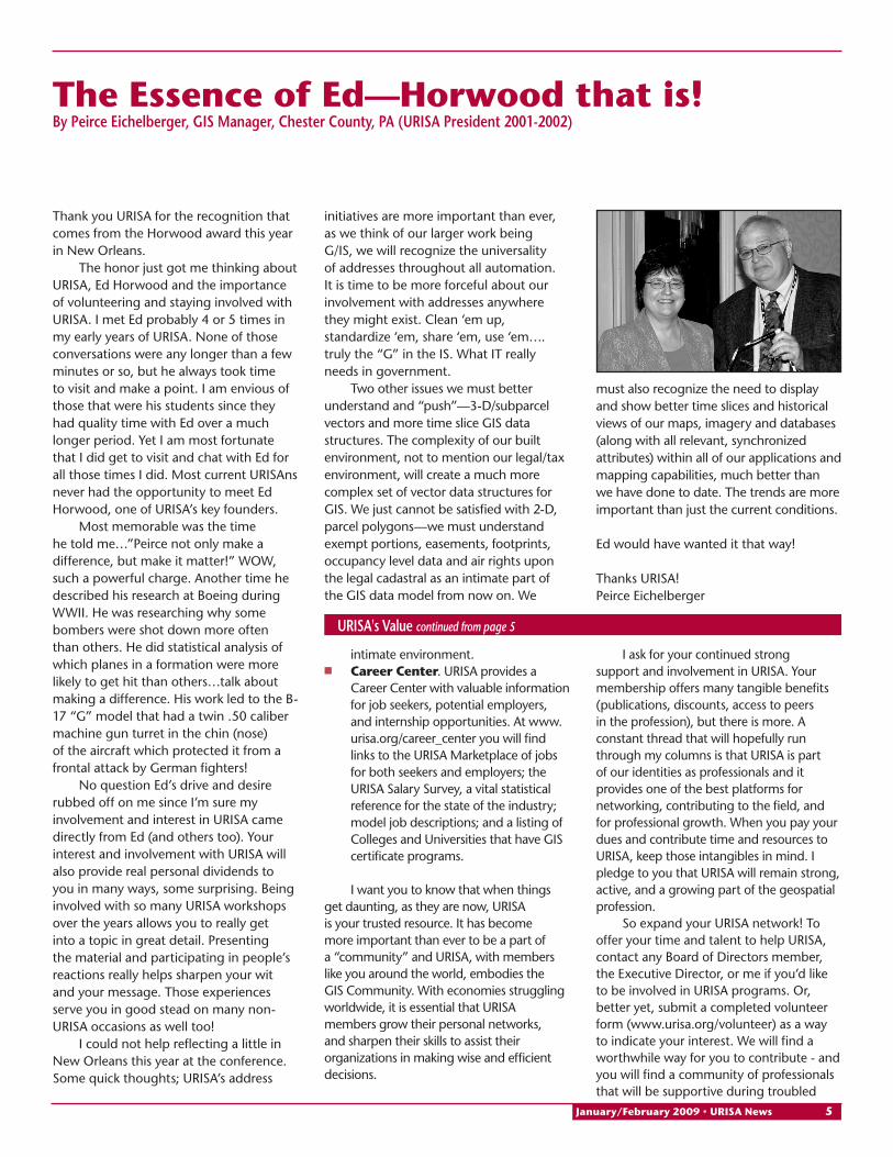
Thank you URISA for the recognition that comes from the Horwood award this year in New Orleans.
The honor just got me thinking about URISA, Ed Horwood and the importance of volunteering and staying involved with URISA. I met Ed probably 4 or 5 times in my early years of URISA. None of those conversations were any longer than a few minutes or so, but he always took time to visit and make a point. I am envious of those that were his students since they had quality time with Ed over a much longer period. Yet I am most fortunate that I did get to visit and chat with Ed for all those times I did. Most current URISAns never had the opportunity to meet Ed Horwood, one of URISA’s key founders.
Most memorable was the time he told me…”Peirce not only make a difference, but make it matter!” WOW, such a powerful charge. Another time he described his research at Boeing during WWII. He was researching why some bombers were shot down more often than others. He did statistical analysis of which planes in a formation were more likely to get hit than others…talk about making a difference. His work led to the B-17 “G” model that had a twin .50 caliber machine gun turret in the chin (nose) of the aircraft which protected it from a frontal attack by German fighters!
No question Ed’s drive and desire rubbed off on me since I’m sure my involvement and interest in URISA came directly from Ed (and others too). Your interest and involvement with URISA will also provide real personal dividends to you in many ways, some surprising. Being involved with so many URISA workshops over the years allows you to really get into a topic in great detail. Presenting the material and participating in people’s reactions really helps sharpen your wit and your message. Those experiences serve you in good stead on many non-URISA occasions as well too!
I could not help reflecting a little in New Orleans this year at the conference. Some quick thoughts; URISA’s address
the essence of ed—Horwood that is! ByPeirceEichelberger,GISManager,ChesterCounty,PA(urISAPresident2001-2002)
initiatives are more important than ever, as we think of our larger work being G/IS, we will recognize the universality of addresses throughout all automation. It is time to be more forceful about our involvement with addresses anywhere they might exist. Clean ‘em up, standardize ‘em, share ‘em, use ‘em….truly the “G” in the IS. What IT really needs in government.
Two other issues we must better understand and “push”—3-D/subparcel vectors and more time slice GIS data structures. The complexity of our built environment, not to mention our legal/tax environment, will create a much more complex set of vector data structures for GIS. We just cannot be satisfied with 2-D, parcel polygons—we must understand exempt portions, easements, footprints, occupancy level data and air rights upon the legal cadastral as an intimate part of the GIS data model from now on. We
must also recognize the need to display and show better time slices and historical views of our maps, imagery and databases (along with all relevant, synchronized attributes) within all of our applications and mapping capabilities, much better than we have done to date. The trends are more important than just the current conditions.
Ed would have wanted it that way!
Thanks URISA!Peirce Eichelberger
intimate environment.n Career Center. URISA provides a
Career Center with valuable information for job seekers, potential employers, and internship opportunities. At www.urisa.org/career_center you will find links to the URISA Marketplace of jobs for both seekers and employers; the URISA Salary Survey, a vital statistical reference for the state of the industry; model job descriptions; and a listing of Colleges and Universities that have GIS certificate programs.
I want you to know that when things get daunting, as they are now, URISA is your trusted resource. It has become more important than ever to be a part of a “community” and URISA, with members like you around the world, embodies the GIS Community. With economies struggling worldwide, it is essential that URISA members grow their personal networks, and sharpen their skills to assist their organizations in making wise and efficient decisions.
urISA'sValuecontinued from page 5
I ask for your continued strong support and involvement in URISA. Your membership offers many tangible benefits (publications, discounts, access to peers in the profession), but there is more. A constant thread that will hopefully run through my columns is that URISA is part of our identities as professionals and it provides one of the best platforms for networking, contributing to the field, and for professional growth. When you pay your dues and contribute time and resources to URISA, keep those intangibles in mind. I pledge to you that URISA will remain strong, active, and a growing part of the geospatial profession.
So expand your URISA network! To offer your time and talent to help URISA, contact any Board of Directors member, the Executive Director, or me if you’d like to be involved in URISA programs. Or, better yet, submit a completed volunteer form (www.urisa.org/volunteer) as a way to indicate your interest. We will find a worthwhile way for you to contribute - and you will find a community of professionals that will be supportive during troubled
January/February �009 • URISA News �
He had bought a large map representing the sea, Without the least vestige of land: And the crew were much pleased when they found it to be A map they could all understand. “What’s the good of Mercator’s North Poles and Equators, Tropics, Zones, and Meridian Lines?” So the Bellman would cry: and the crew would reply “They are merely conventional signs!”
“Other maps are such shapes, with their islands and capes! But we’ve got our brave Captain to thank: (So the crew would protest) “that he’s bought us the best -- A perfect and absolute blank!” (Carroll 1891)
Maps empower humans with a spatial context: “I am here. This is my home.” From the earliest stages of civilization, people have visualized their environment. In 1963, James Mellaart discovered what may be the world’s oldest map at Çatal Hüyük in central Turkey, reportedly from the 7th millennia BCE. (Mellaart 1964, 1967, 1976) Cartographers would strug-gle to create maps that brought a sense of reality to scenes that no person before the space age could hope to take in vast regions, mysterious continents and seem-ingly boundless oceans. Accurate geogra-phy often meant the difference between life and death. The 1707 grounding of four ships in Vice-Admiral Sir Cloudesley Shovell’s fleet off the Isles of Scilly, result-ing in the loss of 1400 lives (including the admiral), proved that dead reckoning often left you dead. “The longitude” be-came an international obsession.
The characters in Lewis Carroll’s farce took comfort in their geographic ignorance. America’s students cannot but seem to be doing so. One need only review the findings of the latest geographic literacy study, conducted by Roeper Public Affairs for National Geographic, to appreciate their level of spatial discombobulation. Only 37% of young Americans, ages 18-24, can find
Calling off the Hunt for the Snark StevenBranting,JeniferJuniorHighSchool,LewistonID
Iraq on a map, although American troops have been fighting there since 2003. Afghanistan is even more mysterious, with 88% of the respondents failing to locate it correctly. Fifty-four percent think Sudan is in Asia, even though the Darfur region of that nation has been the intense focus of media attention. Half cannot locate New York. Three-quarters still think that English is the most widely-spoken language. (National Geographic Society 2006) Quite frankly, Americans are more lost on their own planet than those characters on the popular television program. Oliver’s Law of Location appears to be the road map du jour: ‘No matter where you go, there you are.” The isle of the Snark might as well be a real destination, home to its Boojum, Bandersnatch, Jubjub and the Jabberwock.
Sadly, geography has been afforded short shrift in the “No Child Left Behind” rush to stress mathematics, reading and language usage. Senate Bill 727 (110th Session) “A bill to improve and expand geographic literacy among kindergarten through grade 12 students in the United States by improving professional development programs for kindergarten through grade 12 teachers offered through institutions of higher education” failed to survive the Committee on Health, Education, Labor, and Pensions. Its House counterpart (H.R. 1228) died in the House Committee on Education and Labor.
Given the foregoing, what can schools do to jumpstart, energize and excite a fundamental and long-lived interest in geography? Here is how one Idaho school in particular proved the truth in the Chinese proverb: “The person who says it cannot be done should not interrupt the person doing it. The administrators at Jenifer Junior High School (Lewiston ID) gave us the latitude to act; now we had to calculate the longitude and find our way. Clearly, no curriculum would survive depending on dead reckoning.
Step 1 involved accepting ownership, resolving to do what is best for kids regardless of popular or convenient trends. If you don’t take the lead in pulling the dog sled, your view of the path ahead will not change. Geographic information systems (GIS) are fundamental pillars to 21st century geography education, built on a foundation of increased teacher technology competencies. “The emerging critical new tool of Geographic Information Systems for the storage, analysis, and visualization of spatial data will have methodological impact on the geography, as well as, at least the spatial aspects of human society, allowing the completely different view points to analyze the world phenomena.” (Marble 1990)
We asked ourselves: What skills do teachers need to be geographically literate? What skills to students need? Understandably, those skills were not exclusive. The 18 national geography standards apply just as much to teachers as they do to students, and GIS supplies the tools to master a majority of the benchmarks and explore the Earth in spatial terms. So, we embraced its backbone principles and how those could be applied to the K-12 classroom. The learning curve has often been precipitous and remains so as new faculty and students are included. “There is no royal road, but there is a road.” (Brooks 1986)
Step 2 required the focused leadership of a teacher to “take the point,” to serve as mentor, which in our case was this author, who had learned GIS as a national Challenge Grant fellow. “For most social studies and geography teachers, GIS is as uncharted a territory as those areas of the planet once noted on old maps with the Latin phrase ‘hic sunt dracones,’ or ‘Here are dragons.’ To the uninitiated, geographic
Didyouknowthat28%ofurISAmembershavetheirGISPcertification?
� January/February �009 • URISA News
technology oft has its gleaming teeth and fiery breath.” (Branting 2008) Our premise was simple: Well-trained teachers produce well-trained students. Concerted instruction during the past two years has produced 6 resident faculty members substantially proficient with GIS.
Step 3 exploits the Internet as a delivery vehicle for instruction, data management, and to supply a comprehensive, focused curriculum for the faculty. Realizing that teacher education can be severely limited if face-to-face instruction is the sole avenue for disseminating information, our courses use the best practices of distance learning (i.e. screen captures, sequential protocols, punctuated reviews, et. al.). We have invested in college in-service opportunities, first with ArcGIS® and now with My World™, specifically designed for classroom settings by Northwestern University’s GEODE Project.
Access our courses at www.lewiston.k12.id.us/staff/sbranting/lc1/G&H.htm.
Step 4 of our management process has necessitated a systematic acquisition and integration of a broad spectrum of data libraries now numbering 20 that can meet the curriculum needs of the various disciplines utilizing the GIS to enhance learning.
Step 5 depends on regular classroom intervention. Delivery to small, select groups cannot compare with the effect produced when all students, regardless of educational potential, are exposed to the creative possibilities of GIS, when creative and thought-provoking
questions are posed for geographic solutions. The entire student body of Jenifer Junior High School, more than 620 in grades 7 to 9, now participates in the program with consistent enthusiasm in social studies, U.S. history and earth science courses.
The final component Step 6 revolves around our efforts to stabilize a self-sustaining curriculum of sequential activities that outlines a clear entry level, a manageable series of replicable lessons, and a clear vision of what proficiency and mastery look like as students move through the GIS lessons. the following is an example of an intermediate level spatial analysis activity for 7th graders:
Create a black outline layer of the counties of the United States, with the county outlines set to 70% transpar-ency. Create a red outline layer of the states. Projection: State Plane – Utah North. Zoom to the 48 conterminous States. For layer 3, in light blue, show those counties where the Black popula-tion outnumbers the White popula-tion, labeling it “Black > White.” For layer 4, in light green, show the coun-ties where the Hispanic population outnumbers the White population, labeling it “Hispanic > White.” For layer 5, in light red, show the counties where the Native American population outnumbers the White population, labeling it “Native American > White.” In your notes (complete sentences) on the final map, identify which four states contain counties meeting two of three conditions shown above. Answer these questions: Are there any counties that meet two criteria simultaneously? How many counties meet each of the three criteria? What tribe creates the conditions that meet the statement in layer 5 on the East Coast? What did you learn that you did not expect?
In 2006 a report from the National Research Council (NRC) stressed the importance of spatial thinking in everyone’s life and recommended embedding spatial thinking across the K–12 curriculum. According to the Council’s findings, geographic information systems (GIS) technology can confidently play
a powerful role in promoting spatial thinking. In part, the report said: “Jerome Bruner challenged fifth-grade students to think spatially for themselves, using a paper outline map and a pencil. (Bruner 1958) Today, students can be challenged to think spatially for themselves, using a database, a virtual map, and a mouse. In both cases, the responses from students are based on a spatial reasoning process that involves critical observation, exploration, posing questions, developing hypotheses, and generating answers. Both sets of tools offer the power to learn.” (NRC 2006)
If a sense of space is a requisite for personal and global awareness, then GIS will serve as the stable bedrock on which to fix a geography curriculum that students and teachers will joyously complete… and bid farewell to the Snark.
EndnotesBranting, Steven. (2008) “Hic sunt dracones,”
Journal of the Association for Computing and History. XI, 2 (August).
Brooks, F.P. (1986) “No Silver Bullet - Essence and Accident in Software Engineering.” Proceedings of the IFIP Tenth World Computing Conference, pp. 1069-1076.
Bruner, Jerome S. (1959) Learning and thinking. Harvard Educational Review. Cambridge MA: Harvard University, 29(3):184–192.
Carroll, Lewis. (1891) The Hunting of the Snark: an Agony in Eight Fits. New York: Macmillan, pp. 55-56.
Learning to Think Spatially: GIS as a Support System in the K-12 Curriculum. (2006) Washington, D.C.: National Academies Press.
Marble, Duane F. (1990) The Potential Methodological Impact of Geographic Infor-mation Systems on the Social Sciences. In Interpreting Space: GIS and Archaeology, edited by K. Allen, S. Green, and E. Zubrow. London: Taylor and Francis.
Mellaart, J. (1967) Çatal Hüyük: A Neolithic Town in Anatolia. London: Thames and Hudson.; 1976[1964]. A Neolithic city in Turkey. In Avenues to Antiquity: Readings from Scientific American, ed B. Faga, pp.141-150W. San Francisco: H. Freeman
National Geographic Literacy Study. (2006) Washington, D.C.: National Geographic Education Foundation.
survey or even the full one-hour mini-workshop on addresses for IT managers do not hesitate to contact me. I will be happy to email them to you.
Peirce can be reached for additional information via email at [email protected].
F. Peirce Eichelberger is a past URISA Presi-dent and has served on the Board of Direc-tors twice. He has been to every URISA international conference for the past 32 years. He is the GIS Manager for Chester County, Pennsylvania.
The"G"inyour"IS"continued from page �
January/February �009 • URISA News �
Apply for a 2009 URISA ESIG™ Award!Has your organization improved the delivery and quality of government services through the
application of geospatial information technology?
If so, that achievement should be recognized and shared with your peers. Nominate your organization for a prestigious URISA Exemplary Systems in Government (ESIG™) Award.
Or convince a colleague to participate!
You are encouraged to also submit an abstract on your system for consideration for the URISA 2009 Annual Conference. The deadline for abstracts is February 27, 2009.
Details are available at http://www.urisa.org/anaheim/abstracts .
All applications will be reviewed by the ESIG™ Committee and winners will be notified in August, 2009. Winners will be recognized during the Awards Ceremony at URISA 2009 in Anaheim, California and one person from each winning system will receive a discounted full registration for the conference. Following the conference, winners will receive additional recognition in URISA publications and an announcement of their accomplishment will be made to media representatives around the world.
In order for the ESIG™ Review Team to fairly evaluate each system, specific information (A-F below) must be included in your submission. When submitting this application, send it as an email attachment to [email protected] in PDF or Microsoft Word format. In the body of the email, specify the format, version number, and the length of the attached document. Include “ESIG™ Application” in the email subject field. URISA no longer accepts applications in paper form. Provide all requested information in your submission. Incomplete applications will not be considered.
The application deadline is: May 11, 2009
A. System
1. Name of system and ESIG™ category for which you are applying (Enterprise System or Single Process System).
ESIG™ Award Categories:
Enterprise Systems: Systems in this category are outstanding and working examples of using information systems technology in a multi-department environment as part of an integrated process. These systems exemplify effective use of technology yielding widespread improvements in the process(es) and/or service(s) involved and/or cost savings to the organization. Single Process Systems: Systems in this category are outstanding and working examples of applying information system technology to automate a specific SINGLE process or operation involving one department or sub-unit of an agency. The system application results in extended and/or improved government services that are more efficient and/or save money.
2. A letter from the executive administrator authorizing submission of the system application (letters must be signed and scanned).
3. One (1) page, or less, summary of what the system accomplishes and why it is exemplary. 4. Three “user testimonials”. These testimonials should include the title of the system, the person’s name, job title
(if relevant), a statement of what specific ways the system improves their work and/or the work of their organization, and how frequently they use the system (testimonials may be signed and scanned).
B. Jurisdiction 1. Name of jurisdiction 2. Population served by the organization/agency 3. Annual total budget for jurisdiction 4. Name, title, and address of chief elected and/or appointed official 5. Name, title, address, telephone, FAX, and email for contact person for system
You must answer each of the following questions. Please cross-reference your responses to each of the topics/questions listed below. Be sure that your responses are clearly written and sufficiently comprehensive for reviewers to develop a clear understanding of the system. Responses should be in complete sentences and as brief as possible while communicating the necessary information. If appropriate, include graphics.
C. System Design 1. What motivated the system development? 2. What specific service or services was the system intended to improve? 3. What, if any, unexpected benefits did you achieve? 4. What system design problems were encountered? 5. What differentiates this system from other similar systems?
D. Implementation 1. What phases did you go through in developing the system? 2. Were there any modifications to the original system design? Why? What?
E. Organizational Impact 1. What user community does the system serve and how? 2. What are the ultimate decisions/operations/services being affected? If appropriate, provide a few examples
including, but not limited to: screen input/output forms, paper products, or other descriptive graphics. 3. What were the quantitative and qualitative impacts of the system? 4. What effect has the system had on productivity? 5. What, if any, other impacts has the system had? 6. How did the system change the way business is conducted with and/or service delivered to clients? Give specific
examples comparing the old way with the new.
F. System Resources 1. What are the system’s primary hardware components? Give a brief list or description of the hardware
configuration supporting the system. 2. What are the system’s primary software components? Describe the primary software and, if a commercial
package, any customizations required for the system. 3. What data does the system work with? List and briefly describe the database(s). 4. What staff resources were required to implement the system? (i.e., report approximate staff and consultant
time as FTE’s)
Application Deadline: May 11, 2009 Join the exclusive list of ESIG™ Award winners (http://www.urisa.org/esig).
If you’ve successfully improved the way in which government operates, through the use of geospatial information technology, you should apply for a 2009 URISA ESIG™ Award.
If you have any questions, contact URISA Headquarters at (847) 824-6300 or [email protected]
welCome New URISA membeRS
FedeRAl AGeNCY membeRU.S. Census Bureau
CoRPoRAte membeRSESRI – Platinum Corporate Member
Autodesk – Gold Corporate MemberMichael Baker Corporation – Gold Corporate Member
Bowne Management Systems IncBritish Columbia AssessmentCDM - Camp Dresser & McKee Inc.Geographic Technologies GroupManatron IncMerrick & CompanyOGInfo.com, LLCOptimal Geomatics IncPictometry International CorpPinnacle Mapping Technologies IncPixxures, Inc.Sierra Systems Consultants IncTerraGo TechnologiesThe Schneider CorporationThe Sidwell CompanyYotta MVS
bUSINeSS membeRSData Transfer Solutions – Silver Business MembereGPS Solutions Inc – Silver Business MemberTeach Me GIS – Silver Business Member
Colorado CustomWare IncGeotek MappingGIS Innovations LtdGIS Planning IncKessler GISMGP IncMunsys IncNew Urban Research Inc.North River Geographic Systems Inc.Open Technology Group, IncOrion Technology IncSpatial Focus IncspatialestTetra TechTyler Technologies - Eagle DivisionVIXXI Solutions IncWellar Consulting Inc
AdesolaAdeyemo, Madison County Council of Governments, Anderson, IN
DavidAhlport, Mountain View, CA PascalAkl, GISP, Clayton, CA PeterAlward, City of West Linn, West Linn, OR AlyssaAnderson, University of Wisconsin-Superior,
Superior, WI MartinBalikov, ESRI, Olympia, WA AmberBeckler, Nevada County Geographic
Information Systems, Nevada City, CA MicheleBlackburnPearman, GISP, City of
Augusta, Information Technology, Augusta, GA KimBoyd, British Columbia Assessment, Victoria,
BC, CanadaJamesBudd, GISP, Hall County Government,
Lawrenceville, GA rustyBufford, CALIBRE, Alexandria, VA AmyBurnett, Software Techniques, inc., Winter
Park, FL ArthurChan, CDM, Ann Arbor, MI JonConnick, GISP, Nexen Inc, Calgary, AB,
CanadaPeggyCorey, GISP, Roanoke, IN JamesDavis, OGInfo.com, LLC, Corpus Christi, TX TonyaElliott, Washington State, Tacoma, WA BillEmison, Merrick & Company, Aurora, CO ChadFerrick, OGInfo.com, LLC, Corpus Christi, TX BruceFichtman, GISP, Klamath County IS,
Klamath Falls, OR ColinFraser, British Columbia Assessment, Victoria,
BC, CanadaDianaGijselaers, Alachua County, Gainesville, FL KrisGilbert, Ogle County, Oregon, IL DianaGrove, Purdue University, West Lafayette, IN Guyr.Groves, GRG Consulting, Evergreen, CO TravisGrumbles, OGInfo.com, LLC, Corpus Christi,
TX ScottHarris, Bel Air, MD AlisonHayes, Geographic Magic, Red Bank, NJ DylanHettinger, CFM, Denver, CO robertHirsch, Baltimore County DEPRM, Towson,
MD raymondHorner, OGInfo.com, LLC, Corpus
Christi, TX MichaelIto, Pearl City, HI LGJakeJenkins, Fugro Earthdata, Frederick, MD SaraJKidd, GISP, Hampton Roads Planning
District Commission, Chesapeake, VA Ji-YoungKim, ECC, Marlborough, MA ThomasLee, Discovery GIS, Philadelphia, PA KennyLegleiter, Merrick & Company, Aurora, CO
BruceLevy, Vista Irrigation District, Vista, CA TrishLong, City of Trenton, Trenton, NJ DennisN.Loven, GISP, City of Huntington Beach,
Huntington Beach, CA FengLu, Parsons Brinckerhoff Inc, New York, NY TripMcLaughlin, GISP, North Line GIS, LLC,
Breckenridge, CO HarryMercer, British Columbia Assessment,
Victoria, BC, CanadaBeckyMorton, Towill Inc, San Francisco, CA JeffreyMurphy, Lennon, Smith, Souleret
Engineering, Inc, Coraopolis, PA SindyNicholson, Prince Albert Grand Council,
Henribourg, SK, CanadaDavidNorris, Community Research Partners,
Columbus, OH ThomasNuwey, GISP, City of Huntington Beach,
Huntington Beach, CA KelleyO’Neill, RBF Consulting, Irvine, CA MichaelPateman, University of Cincinnati,
Oxford, OH TomPattison, ESRI, Redlands, CA DavidPeters, ESRI, Redlands, CA JeffreyPires, National Grid, Waltham, MA Luisrramos, GISP, Apo, AE Keithreasons, Town of Collierville, Collierville, TN Martharobinson, City of Mobile GIS Dept,
Mobile, AL DwayneScallion-Pond, British Columbia
Assessment, Victoria, BC, CanadaMicheleShimomura, City and County of Denver,
Denver, CO uWaTang, University of Macau, Macau, PR
China, ChinaPatrickThorstenson, Swain County, Bryson City,
NC richardFrankTuinstra, GISP, City of Fayetteville,
Fayetteville, NC JessicaViera-Atwell, City of Statesville NC,
Statesville, NC PatrickWalker, GISP, West Allis, WI MarcWatson, Goshen, IN ScottWeisman, GISP, Leon County MIS/GIS,
Tallahassee, FL AdamWilliams, Village of Northbrook,
Northbrook, IL JohnrWisdom, GISP, Wilbur Smith Associates,
Columbia, SC AlisonWoods, City of Greensboro, Greensboro,
NC
10 January/February �009 • URISA News
welCome New URISA bUSINeSS membeRS
In Memoriam C.DavidHawker,1961-2008
Dave Hawker of Tyler Technologies – Eagle Divi-sion, passed away on December 14, 2008. Dave was a key member of the GIS/CAMA Conference Planning Committee since 1999 and was the Con-ference Chair of the 2005 Savannah Conference. Dave was the recipient of URISA’s Service Award at the 2008 New Orleans annual conference.
Donations in Dave’s honor can be made to the Romanian Missionary that Dave supported: David Maynard – Mid Val-ley Baptist Church, 16472 Hwy 82, Carbondale, CO 81623 (checks made payable to David Maynard, Missionary).
Our community has lost a dear friend and colleague who will forever be in our thoughts.
The Open Technology Group (OTG) pro-vides training and consulting services fo-cused around Open Source technologies, including several GIS technologies. These technologies include: the PostGIS spa-tial extensions to PostgreSQL (a Spatial Database Engine); OpenLayers (Web 2.0 map “mash up” application); MapServer (WMS/WFS/WCS server, as well as raster generation from vector data); GeoDjango (Geospatial Web Development frame-work); and spatial analysis tools - such as GRASS and R. OTG’s solutions allow ur-ban planners to migrate away from costly commercial product offerings, providing recurring cost savings and often signifi-cant performance improvements.
With the current financial constraints placed on every sector of the economy, Open Source geospatial solutions provide a tangible cost benefit; are well supported in industry; and provide feature rich tools to manage, store, and analyze spatial data.
You can find out more about
OTG’s product offerings - and their custom training and mentoring solutions - via the web at http://www.opentechnologygroup.com - or by contacting them at 877-258-8987 or [email protected].
Inner Corridor Technologies, Inc. (ICT)/TeachMeGIS is a GIS training and con-sulting firm based in Houston, Texas that offers ESRI ® Authorized GIS courses. The TeachMeGIS training center is an ESRI Partner Education Center.
OUR TRAINERS:Our team of 8 ESRI Authorized Training Partners helps more than 1,000 profes-sionals a year become productive with the ESRI software suite. Our trainers have an average of 15 years of GIS consulting and training experience, and are consis-tently rated as “Above Average” or “Ex-cellent” by our students.
OUR SERVICES:We teach public courses at the Teach-
MeGIS training center in Houston as well as at partner learning centers and private client sites throughout the nation and internationally. We also offer on-site courses with our mobile lab and write custom curriculum for clients using local data and work flows. We have several senior consultants on staff who provide excellent on-site GIS support.
For more information, visit: www.teachmegis.com or contact Jennifer Harrison: [email protected].
ChapterNewsGeorgia URISA Election ResultsThe 2009 Georgia URISA Board will be comprised as follows: President: Tripp Corbin, GISP – Keck &
Wood Inc.Immediate Past President: Danielle
Ayan, GISP – Georgia Institute of Technology
Vice President: Rosemary Harman, GISP – Jordan Jones & Goulding
Treasurer: Jimmy McGavick, GISP – City of Marietta
Secretary: Jason Kandrick – City of Atlanta
Education & Certification Chair: Carl Anderson – Fulton County
Corporate Sponsors Chair: Ron Mulberry – BinaryBus Ltd.
North Georgia Sub-Chapter Chair: Randy Hale, GISP – North River Geographic Systems Inc.
South Georgia Sub-Chapter Chair: Ed Hawkins – Flint EMC
Membership Chair: Keith Hogsed, GISP – Data Smarts
Events Chair: David Holmes – Fulton County
Jeff Orton, GIS Coordinator of Kern County, started his term as president of the Central California Chapter of URISA following the term of Matt Cieri, GISP, City of Bakersfield.
January/February �009 • URISA News 11
Urban & Regional Information Systems Association
1460 Renaissance Drive, Suite 305
Park Ridge, IL 60068
NON–PROFIT ORG.U.S. POSTAGE
PAIDURISA
Business Directory
Your business card advertisement can be seen here for $�0 per issue.
Calendar!Mark Your
January/February �009
Easy RFP Distribution
Remember to email your technology-related RFPs
to [email protected] for FREE distribution to URISA’s
corporate and business members. Save lots of
time and effort. We have a list of contacts who are
pleased to receive your RFPs. Take advantage of this free service often!
Digital OrthophotographyDigital Planimetric and Topographic MappingAerial PhotographyLiDARGIS Services
Specializing in photogrammetric and GIS services since 1954
www.surdex.com
520 Spirit of St. Louis Blvd.Chesterfield, MO 63005tel 636-368-4400
URISA �009
1460 Renaissance Dr., Suite 305Park Ridge, IL 60068Phone: (847) 824-6300 Fax: (847) 824-6363 [email protected], www.urisa.org


![Fatos Xhafa Admir Barolli Petraq Papajorgji Editors …hpcochep/Publication/AINA-JOURNAL...Data [2] or Open PHACTS [3]. Along the Semantic Web – one of the most challenging data-centric](https://img.pdfslide.us/doc/110x75/5f466a38f9d41d38110c251d/fatos-xhafa-admir-barolli-petraq-papajorgji-editors-hpcocheppublicationaina-journal.jpg)