Embed Size (px)
Citation preview
In the Wake of Hurricane Sandy: Creating a More Resilient Regional Transportation System in New York, New Jersey, and Connecticut
TRB First International Conference on Surface Transportation Resilience September 18, 2015
• Josh DeFlorio, Cambridge Systematics
• Jeffrey Perlman, North Jersey Transportation Planning Authority
Image: NYSDOT
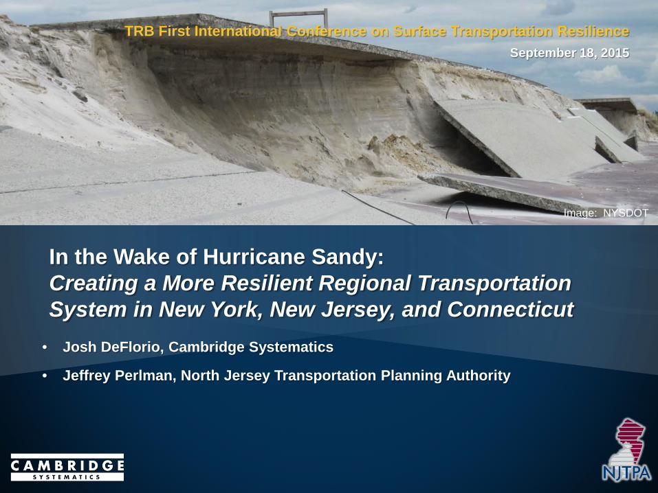
Climate Change Adaptation at FHWA
Goal: Regular/Systematic consideration of climate change & extreme weather vulnerability and risk in transportation decision making: • Systems level: Transportation
planning, Asset Management • Project Level: Environmental
process, Preliminary Engineering, Design, Operations, Maintenance
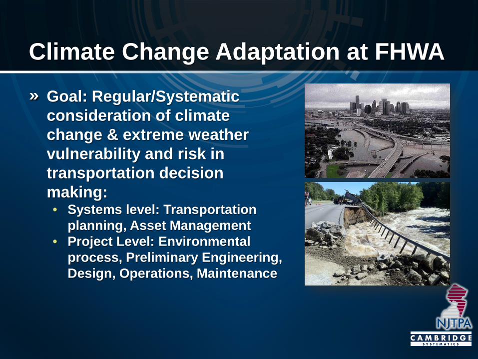
FHWA Climate Resilience Pilots & Other Project Locations
3
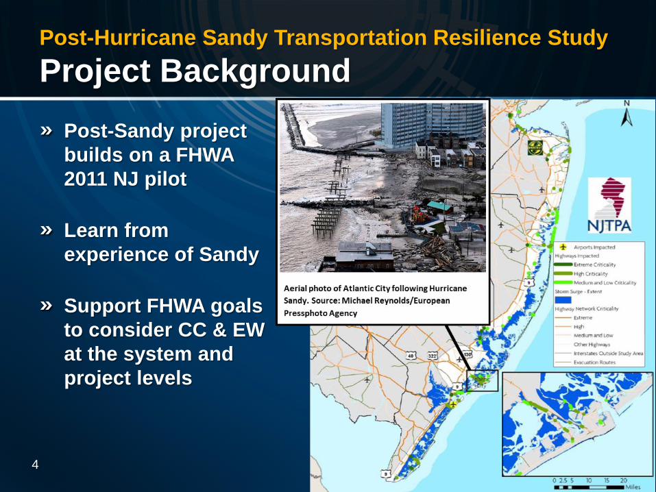
Post-Hurricane Sandy Transportation Resilience Study Project Background
Post-Sandy project builds on a FHWA 2011 NJ pilot
Learn from experience of Sandy
Support FHWA goals to consider CC & EW at the system and project levels
4 4
Post-Hurricane Sandy Transportation Resilience Study Project Objectives
Enhance the resilience of the region’s transportation system to climate change and extreme weather
Develop feasible, cost-effective strategies at the project level to reduce and manage extreme weather vulnerabilities amid the uncertainties of a changing climate
Inform the ongoing Hurricane Sandy recovery process
6
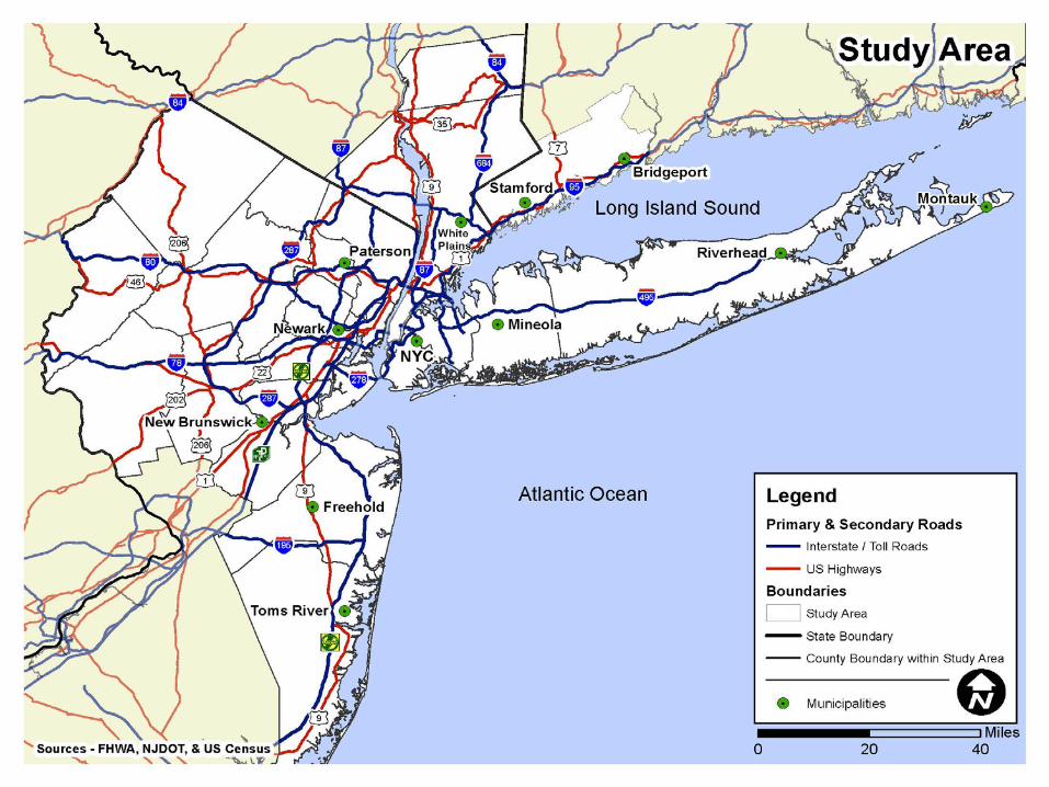
Post-Hurricane Sandy Transportation Resilience Study Regional Project Partners
State DOTs • Connecticut • New Jersey • New York
MPOs • Greater Bridgeport Regional
Council (CT) • Western Connecticut
Council of Gov’ts • North Jersey Transportation
Planning Authority • New York Metropolitan
Transportation Council
Authorities/Agencies • Metropolitan Transportation
Authority • NJ Transit • Port Authority of
New York & New Jersey
Consultant Team • Cambridge Systematics (Lead) • AECOM • Abt Associates • Fitzgerald & Halliday • Dr. Radley Horton • C2E*
7
Lead Agency: Federal Highway Administration
* Past team member
Post-Hurricane Sandy Transportation Resilience Study Major Tasks
Conduct Transportation Damage & Disruption Assessment
Collect and Analyze Climate Change Projections, Identify Gaps
Engineering-Based Assessments & Adaptation Analysis for Select Transportation Assets
Regional Climate Change Vulnerability Assessment and Adaptation Analysis
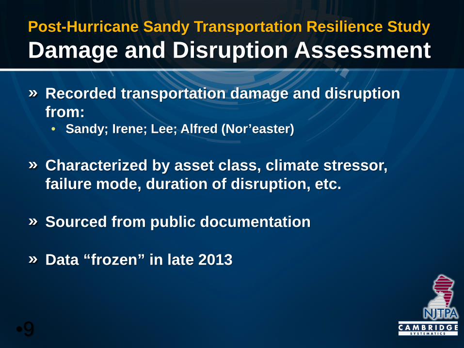
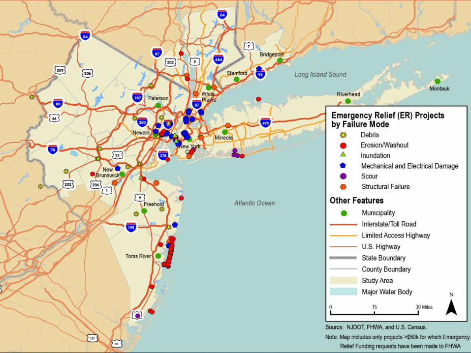
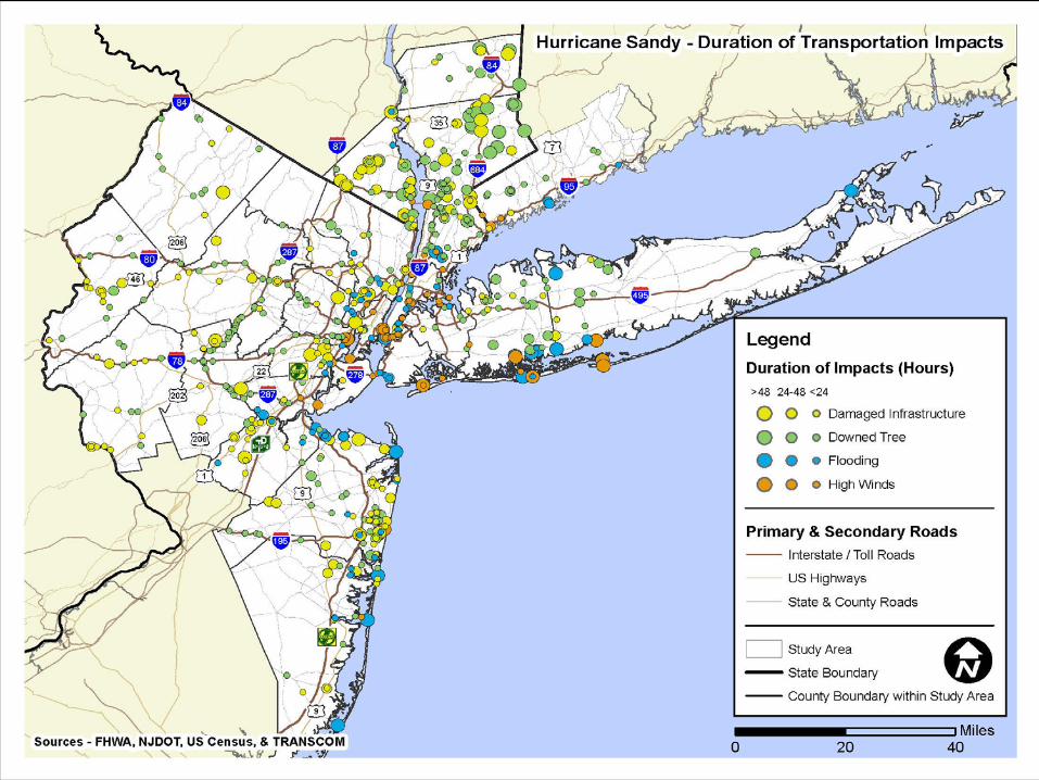
Post-Hurricane Sandy Transportation Resilience Study Damage and Disruption Assessment
Recorded transportation damage and disruption from: • Sandy; Irene; Lee; Alfred (Nor’easter)
Characterized by asset class, climate stressor, failure mode, duration of disruption, etc.
Sourced from public documentation
Data “frozen” in late 2013
•9
10
11
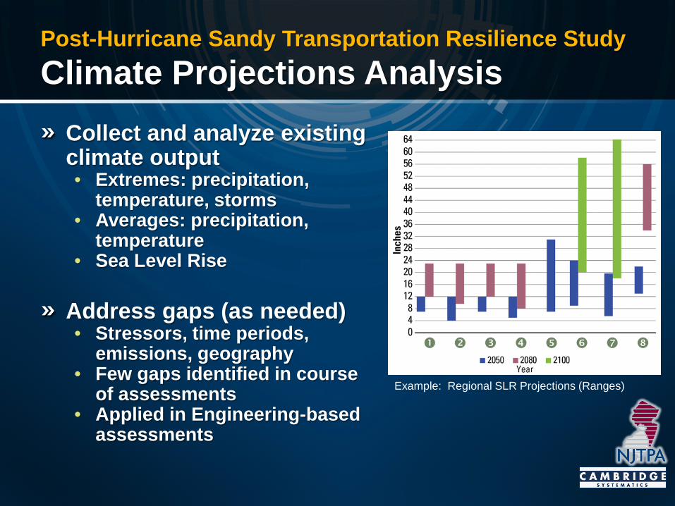
Post-Hurricane Sandy Transportation Resilience Study Climate Projections Analysis
Collect and analyze existing climate output • Extremes: precipitation,
temperature, storms • Averages: precipitation,
temperature • Sea Level Rise
Address gaps (as needed) • Stressors, time periods,
emissions, geography • Few gaps identified in course
of assessments • Applied in Engineering-based
assessments
Example: Regional SLR Projections (Ranges)
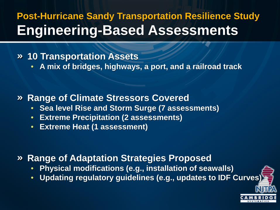
Post-Hurricane Sandy Transportation Resilience Study Engineering-Based Assessments
10 Transportation Assets • A mix of bridges, highways, a port, and a railroad track
Range of Climate Stressors Covered • Sea level Rise and Storm Surge (7 assessments) • Extreme Precipitation (2 assessments) • Extreme Heat (1 assessment)
Range of Adaptation Strategies Proposed • Physical modifications (e.g., installation of seawalls) • Updating regulatory guidelines (e.g., updates to IDF Curves)
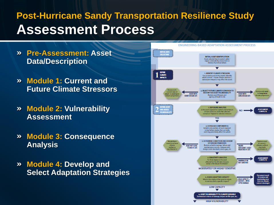
Post-Hurricane Sandy Transportation Resilience Study Assessment Process
Pre-Assessment: Asset Data/Description
Module 1: Current and Future Climate Stressors
Module 2: Vulnerability Assessment
Module 3: Consequence Analysis
Module 4: Develop and Select Adaptation Strategies
15
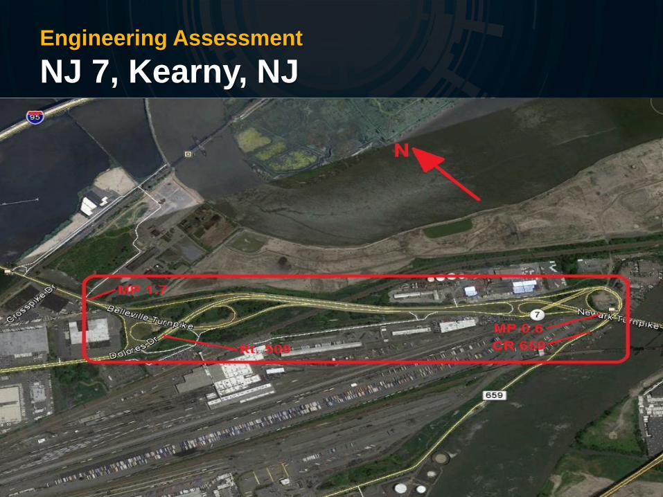
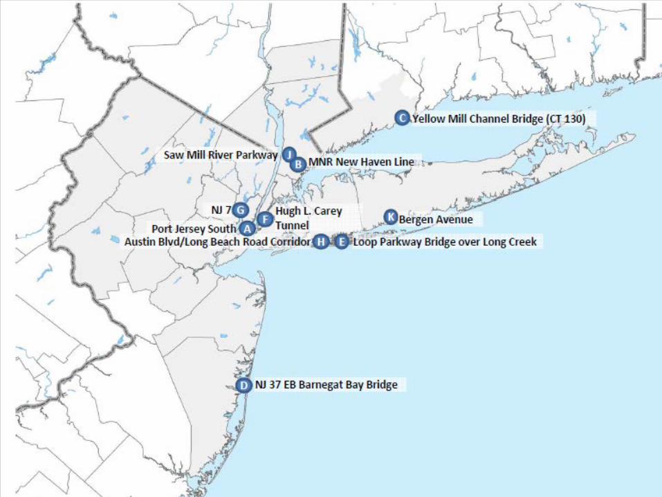
Engineering Assessment NJ 7, Kearny, NJ
Engineering Assessment NJ 7, Kearny, NJ
Climate Stressors Considered: • Sea Level Rise • Tidal Storms
Scenarios Chosen for Adaptation Planning • End-of-Century Sea Level Rise • 2-year Tidal Storm
Challenges and Considerations • Consistency with Adjacent Projects was Critical
Engineering Assessment NJ 7, Kearny, NJ
Adaptation Strategies Recommended: • Raise 3 out of 4 stretches of the NJ Route 7 segment • The 4th stretch cannot be raised due to minimum vertical
clearance requirements • Build a concrete seawall to protect this stretch • Install new drainage features (outfalls and pumps)

Engineering Assessment PANYNJ Port Jersey South
Climate Stressors Considered: • Sea Level Rise • Tidal Storms
Scenarios Chosen for Adaptation Planning: • Mid-century Sea Level Rise • 100-year Tidal Storm
Observations • Electrical infrastructure severely damaged during Hurricane
Sandy (switchgear, circuit breakers) • Peninsula likely to undergo major redevelopment • Proposed strategies to protect infrastructure supporting
future development.
Engineering Assessment PANYNJ Port Jersey South
Engineering Assessment PANYNJ Port Jersey South
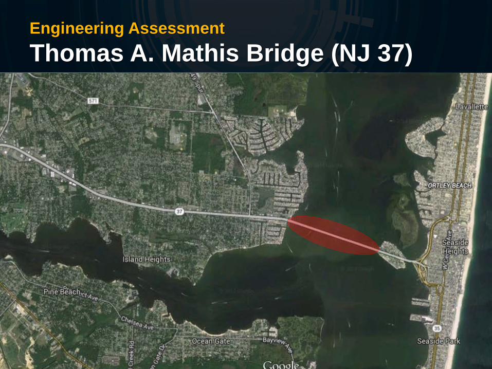
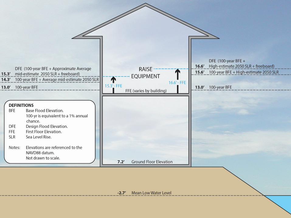
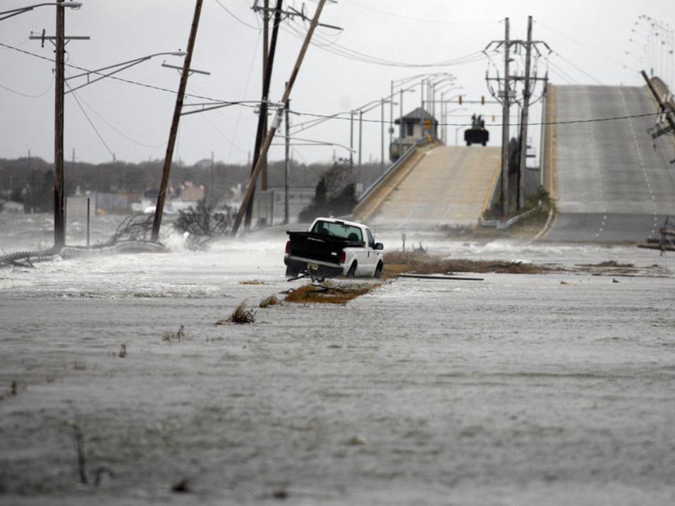
Engineering Assessment Thomas A. Mathis Bridge (NJ 37)
Project: Barnegat Bay Bridge, NJ
Engineering Assessment Thomas A. Mathis Bridge (NJ 37)
Climate Stressors Considered: • Sea Level Rise • Tidal Storms
Scenarios Chosen for Adaptation Planning: • Mid-century Sea Level Rise • 100-year Tidal Storm
Considerations: • Bridge to reach end of life by 2065 • Electrical equipment in bascule tower experienced minimal
flooding during Hurricane Sandy • Approach Roadways experienced significant flooding
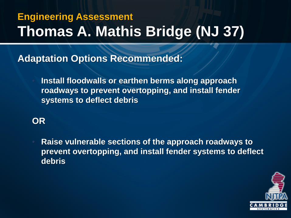
Engineering Assessment Thomas A. Mathis Bridge (NJ 37)
Adaptation Options Recommended:
• Install floodwalls or earthen berms along approach roadways to prevent overtopping, and install fender systems to deflect debris
OR
• Raise vulnerable sections of the approach roadways to prevent overtopping, and install fender systems to deflect debris
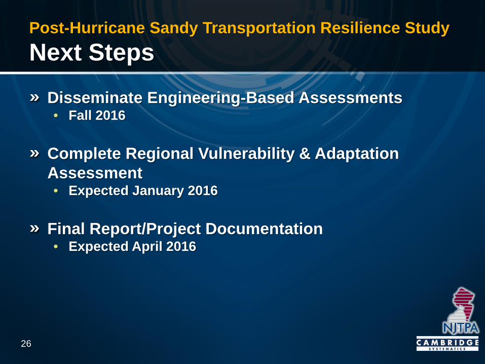
Post-Hurricane Sandy Transportation Resilience Study Next Steps
Disseminate Engineering-Based Assessments • Fall 2016
Complete Regional Vulnerability & Adaptation Assessment • Expected January 2016
Final Report/Project Documentation • Expected April 2016
26
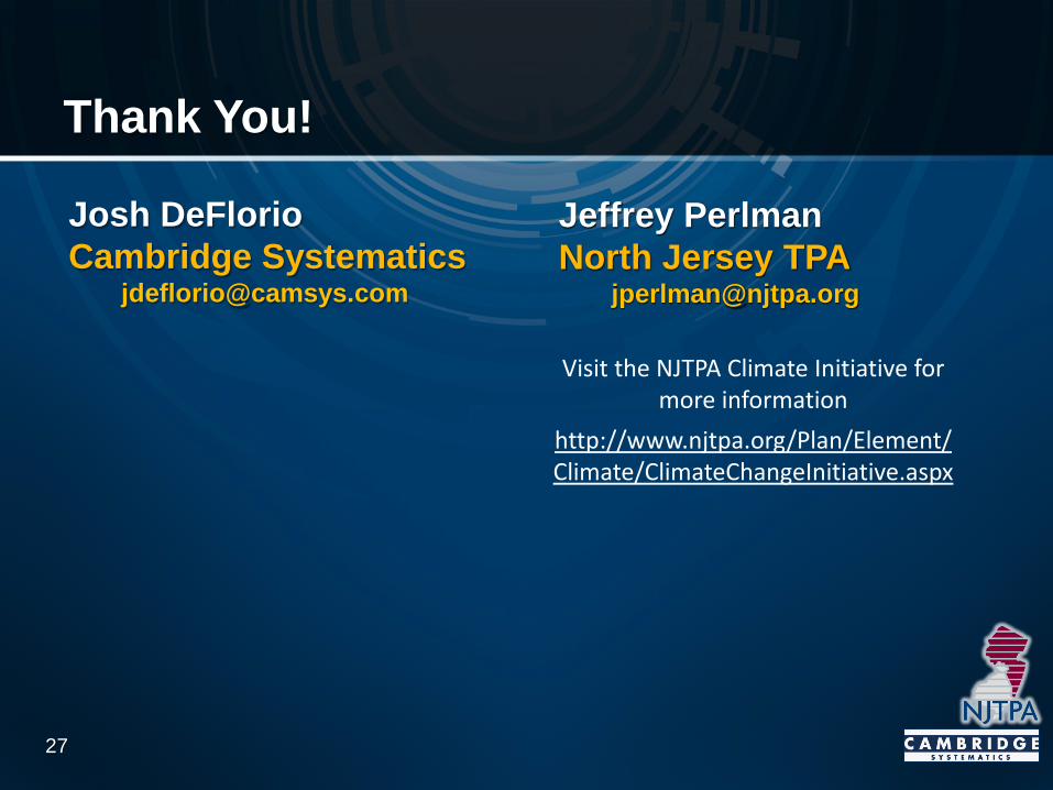
Thank You!
27
Josh DeFlorio Cambridge Systematics
Jeffrey Perlman North Jersey TPA
Visit the NJTPA Climate Initiative for
more information http://www.njtpa.org/Plan/Element/Climate/ClimateChangeInitiative.aspx