Embed Size (px)
Citation preview
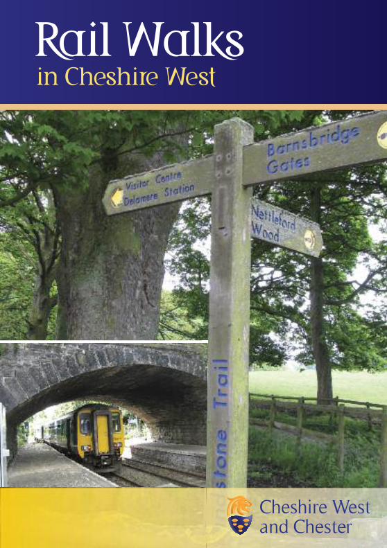
Rail Walksin Cheshire West
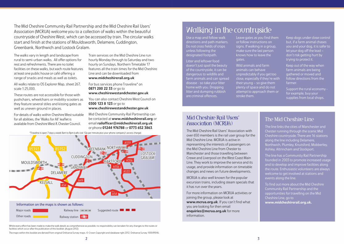
Major roads
Other roads
2
The walks vary in length and landscape fromrural to semi-urban walks. All offer options forrest and refreshments. There are no toiletfacilities on these walks, but each route featuresat least one public house or café offering arange of snacks and meals as well as toilets.
All walks relate to OS Explorer Map, sheet 267,scale 1:25,000.
These routes are not accessible for those withpushchairs, wheelchairs or mobility scooters asthey feature several stiles and kissing gates aswell as uneven ground in places.
For details of walks within Cheshire West suitablefor all abilities, the ‘Walks for All’ leaflet isavailable from Cheshire West & Chester Council.
Train services on the Mid Cheshire Line runhourly Monday through to Saturday and twohourly on Sundays. Northern Timetable 17features all the train times for the Mid CheshireLine and can be downloaded fromwww.midcheshirerail.org.uk
For bus services phone Traveline* on 0871 200 22 33 or go towww.cheshirewestandchester.gov.uk
You can also contact Cheshire West Council on0300 123 8 123 or go towww.cheshirewestandchester.gov.uk
Mid Cheshire Community Rail Partnership canbe contacted at www.midcheshirerail.org oremail [email protected] phone 01244 976788 or 0773 652 3863.
3
The Mid Cheshire Community Rail Partnership and the Mid Cheshire Rail Users’Association (MCRUA) welcome you to a collection of walks within the beautifulcountryside of Cheshire West, which can be accessed by train. The circular walksstart and finish at the stations of Mouldsworth, Delamere, Cuddington,Greenbank, Northwich and Lostock Gralam.
Use a map and follow walkdirections and path markers.Do not cross fields of cropsunless following thedesignated footpath.
Litter and leftover fooddoesn't just spoil the beautyof the countryside, it can bedangerous to wildlife andfarm animals and can spreaddisease - so take your litterhome with you. Droppinglitter and dumping rubbishare criminal offences.
Leave gates as you find themor follow instructions onsigns. If walking in a group,make sure the last personknows how to leave thegates.
Wild animals and farmanimals can behaveunpredictably if you get tooclose, especially if they’re withtheir young – so give themplenty of space and do notattempt to approach them orstroke them.
Keep dogs under close controlbut, if a farm animal chasesyou and your dog, it is safer tolet your dog off the lead –don’t risk getting hurt bytrying to protect it.
Keep out of the way whenfarm animals are beinggathered or moved andfollow directions from thefarmer.
Support the rural economy -for example, buy yoursupplies from local shops.
Walking in the countryside
Mid Cheshire Rail Users’Association (MCRUA)The Mid Cheshire Rail Users' Association withover 650 members is the rail user group for theMid Cheshire Line. MCRUA is active inrepresenting the interests of passengers onthe Mid Cheshire Line from Chester toManchester and those travelling betweenCrewe and Liverpool on the West Coast MainLine. They work to improve the service and itsusage, and provide information on timetablechanges and news on future developments.
MCRUA is also well known for the popularexcursion trains, including steam specials thatit has run over the years.
For more information on MCRUA activities orjoining the group, please look atwww.mcrua.org.uk. If you can’t find whatyou are looking for then [email protected] for moreinformation.
The Mid Cheshire LineThe line links the cities of Manchester andChester running through the scenic MidCheshire countryside. There are 16 stationsalong the line including Delamere,Northwich, Plumley, Knutsford, Mobberley,Ashley, Altrincham and Stockport.
The line has a Community Rail Partnershipfounded in 2003 to promote increased usageand to develop and improve facilities alongthe route. Enthusiastic volunteers are alwayswelcome to get involved at stations andevents along the line.
To find out more about the Mid CheshireCommunity Rail Partnership and theopportunities for travelling on the MidCheshire Line, go towww.midcheshirerail.org.uk.
Whilst every effort has been made to make the walk details as comprehensive as possible, no responsibility can be taken for any changes to the routes orfacilities which occur after the publication of this booklet. (August 2012)
The maps within this booklet are derived from original Ordnance Survey maps. © Crown Copyright and database right 2012. Ordnance Survey 100049046.
A559
A556
A556
B5152B5393
A54
A54
A49
A533DELAMEREDELAMERE
MOULDSWORTHMOULDSWORTHCUDDINGTONCUDDINGTON
KELSALLKELSALL
NORTHWICHNORTHWICH
LOSTOCKLOSTOCKGRALAMGRALAMLOSTOCKGRALAM
SANDIWAYSANDIWAYDELAMERE
MOULDSWORTHCUDDINGTON
KELSALL
NORTHWICH
HARTFORDHARTFORDHARTFORD
GREENBANKGREENBANKGREENBANK
SANDIWAY
Information on the maps is shown as follows:
Railway line
Railway station
Suggested route
*Traveline is open 7 days a week 8am to 8pm (calls cost 12p per minute plus your phone company's access charge)
MouldsworthHall
PoplargroveFarm
Stone HouseFarm
Lodge
Ashton Brook
School
BrookHouse
MOULDSWORTH
Grange Road
Delamere
Road
Norton’s Lane
Well Lane
Chur
ch R
oad
GongarLane
Smith
y Lane
Stat
ion
Road
Mouldsworth
TheRookery
LongWood
CricketGround
BankFarm
Rose BankFarm
GoshawkPH
MouldsworthMotorMuseum
St. John’sChurch
1
2
3
4
5 67
8
9
10
11
B593
4 5
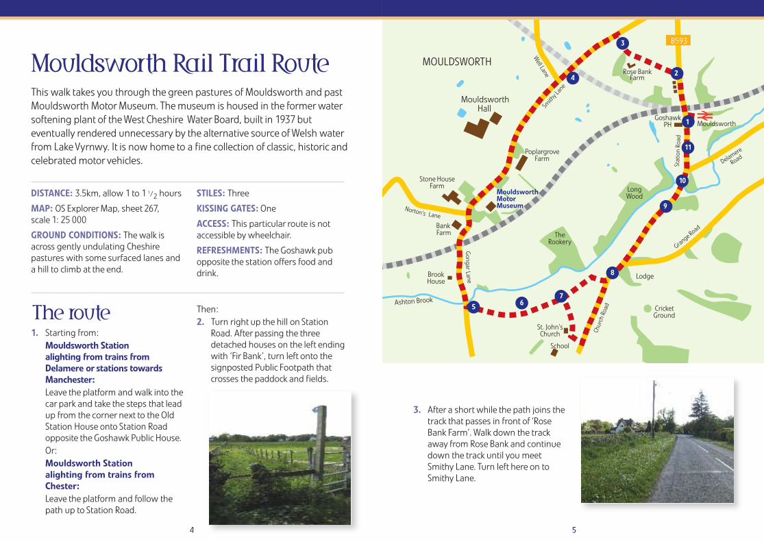
Mouldsworth Rail Trail Route
The route1. Starting from:
Mouldsworth Station alighting from trains fromDelamere or stations towardsManchester:Leave the platform and walk into thecar park and take the steps that leadup from the corner next to the OldStation House onto Station Roadopposite the Goshawk Public House.Or:Mouldsworth Stationalighting from trains fromChester:Leave the platform and follow thepath up to Station Road.
Then:2. Turn right up the hill on Station
Road. After passing the threedetached houses on the left endingwith ‘Fir Bank’, turn left onto thesignposted Public Footpath thatcrosses the paddock and fields.
3. After a short while the path joins thetrack that passes in front of ‘RoseBank Farm’. Walk down the trackaway from Rose Bank and continuedown the track until you meetSmithy Lane. Turn left here on toSmithy Lane.
DISTANCE: 3.5km, allow 1 to 1 1/2 hours
MAP: OS Explorer Map, sheet 267, scale 1: 25 000
GROUND CONDITIONS: The walk isacross gently undulating Cheshirepastures with some surfaced lanes anda hill to climb at the end.
STILES: Three
KISSING GATES: One
ACCESS: This particular route is notaccessible by wheelchair.
REFRESHMENTS: The Goshawk pubopposite the station offers food anddrink.
This walk takes you through the green pastures of Mouldsworth and pastMouldsworth Motor Museum. The museum is housed in the former watersoftening plant of the West Cheshire Water Board, built in 1937 buteventually rendered unnecessary by the alternative source of Welsh waterfrom Lake Vyrnwy. It is now home to a fine collection of classic, historic andcelebrated motor vehicles.
6 7
4. Eventually Smithy Lane crosses abridge over the route of the nowdisused Mouldsworth to Manleyand Helsby Junction line of theCheshire Lines Committee. The lanenow moves out into more opencountry and eventually slopes gentlydown past the entrance toMouldsworth Hall. Soon theentrance to Mouldsworth MotorMuseum will be passed on the left.
Having passed the museum, SmithyLane continues down the hill andcurving to the left at the junctionwith Norton’s Lane becomes GongarLane. Gongar Lane then turns topass back under the Mid CheshireLine which crosses by a tall stoneand brick arch bridge with black ironreinforcing plates.
5. Continue along Gongar Lane past‘Brook House’ until at the bottom ofthe hill, just after crossing a smallstream called “Ashton Brook”, turnleft over the stile onto the signpostedpublic footpath which forms part ofthe Baker Way, the 13 mile path thatruns between the railway stations ofChester and Delamere.
6. Cross another stile and keep thehedge on your left. Up and to theright can be seen the spire of thegrade II listed St. John the EvangelistChurch, Ashton Hayes.
7. Carry on through the kissing gate(another path* diverges to the rightbut this route carries straight onthrough the fields). The patheventually bears right to follow theline of the hedge and then across tothe stile which leads over ontoChurch Road. *An alternative way toget to Church Road is to take the righthand path at the kissing gate with afootpath sign which leads into thechurchyard of St John The EvangelistChurch. Follow the path to the roadand turn left into Church Road.
8. Turn left on to Church Road.Opposite the stile can be glimpsedthe newly planted wood that isbeing created on the side of theslope. Following Church Road andwhere Grange Road diverges to theright, there is a handy spot for a restat the bench placed here in memoryof the sadly missed Councillor JohnBurke.
9. As Church Road begins to climbgradually back towardsMouldsworth Station anotherdiverging footpath leads off to theright before the three pools of LloydsMeadow Coarse Fishery, which isapparently well stocked with Carp,Barbel, Bream, Roach, Rudd andTench.
10. Continue up the hill, on the left thesmall but distinctive shape of SaintCuthbert’s by the Forest CatholicChurch opened in 1957 can be seen.
11. Soon after in the distance can beseen the sign for Mouldsworthrailway station, the end of the walk,but for those with an appetite orthirst then The Goshawk provides anideal wayside halt.
Opposite the pub is the station carpark with the Station House nowbeing the home to Whistles Hair andBeauty salon.
The GoshawkTel: 01928 740900
VISITOR INFORMATION
Food is served every day from midday to 9:30pm (9pm on Sundays). Dogs welcome in the pub garden.
Whistles Hair andBeauty StationOld-Ticket Office,MouldsworthStationTel: 01928 740747
Open Tuesdayto Saturday
Delamere
A556
B512
B512
1
2
3
4
5
6
7
8
9
10
1112
DELAMERE
DelamerePark
LinmereLodgeVisitor Centre
Orchard
Orchard
LinmereMoss
PaleHeights
Roman Road
EddisburyLodge
Nettleford Wood
The Yeld
Yeld
Lan
e
Forest Gate Lane
Forest Farm RoadForest Farm Road
8 9
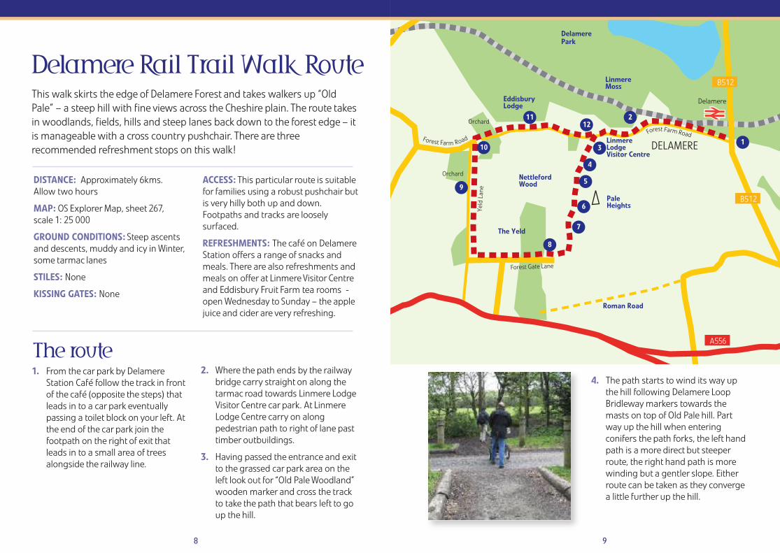
DISTANCE: Approximately 6kms. Allow two hours
MAP: OS Explorer Map, sheet 267, scale 1: 25 000
GROUND CONDITIONS: Steep ascentsand descents, muddy and icy in Winter,some tarmac lanes
STILES: None
KISSING GATES: None
ACCESS: This particular route is suitablefor families using a robust pushchair butis very hilly both up and down.Footpaths and tracks are looselysurfaced.
REFRESHMENTS: The café on DelamereStation offers a range of snacks andmeals. There are also refreshments andmeals on offer at Linmere Visitor Centreand Eddisbury Fruit Farm tea rooms -open Wednesday to Sunday – the applejuice and cider are very refreshing.
Delamere Rail Trail Walk Route
The route1. From the car park by Delamere
Station Café follow the track in frontof the café (opposite the steps) thatleads in to a car park eventuallypassing a toilet block on your left. Atthe end of the car park join thefootpath on the right of exit thatleads in to a small area of treesalongside the railway line.
2. Where the path ends by the railwaybridge carry straight on along thetarmac road towards Linmere LodgeVisitor Centre car park. At LinmereLodge Centre carry on alongpedestrian path to right of lane pasttimber outbuildings.
3. Having passed the entrance and exitto the grassed car park area on theleft look out for “Old Pale Woodland”wooden marker and cross the trackto take the path that bears left to goup the hill.
This walk skirts the edge of Delamere Forest and takes walkers up “OldPale” – a steep hill with fine views across the Cheshire plain. The route takesin woodlands, fields, hills and steep lanes back down to the forest edge – itis manageable with a cross country pushchair. There are threerecommended refreshment stops on this walk!
4. The path starts to wind its way upthe hill following Delamere LoopBridleway markers towards themasts on top of Old Pale hill. Partway up the hill when enteringconifers the path forks, the left handpath is a more direct but steeperroute, the right hand path is morewinding but a gentler slope. Eitherroute can be taken as they convergea little further up the hill.
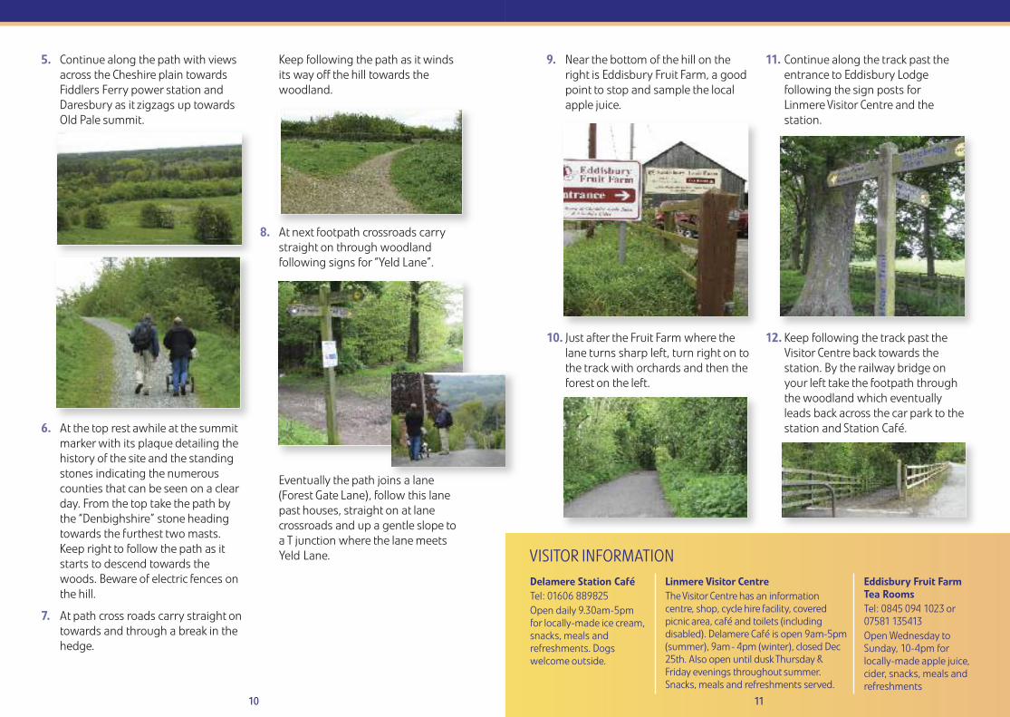
10 11
5. Continue along the path with viewsacross the Cheshire plain towardsFiddlers Ferry power station andDaresbury as it zigzags up towardsOld Pale summit.
6. At the top rest awhile at the summitmarker with its plaque detailing thehistory of the site and the standingstones indicating the numerouscounties that can be seen on a clearday. From the top take the path bythe “Denbighshire” stone headingtowards the furthest two masts.Keep right to follow the path as itstarts to descend towards thewoods. Beware of electric fences onthe hill.
7. At path cross roads carry straight ontowards and through a break in thehedge.
Keep following the path as it windsits way off the hill towards thewoodland.
8. At next footpath crossroads carrystraight on through woodlandfollowing signs for “Yeld Lane”.
Eventually the path joins a lane(Forest Gate Lane), follow this lanepast houses, straight on at lanecrossroads and up a gentle slope to a T junction where the lane meetsYeld Lane.
9. Near the bottom of the hill on theright is Eddisbury Fruit Farm, a goodpoint to stop and sample the localapple juice.
10. Just after the Fruit Farm where thelane turns sharp left, turn right on tothe track with orchards and then theforest on the left.
11. Continue along the track past theentrance to Eddisbury Lodgefollowing the sign posts forLinmere Visitor Centre and thestation.
12. Keep following the track past theVisitor Centre back towards thestation. By the railway bridge onyour left take the footpath throughthe woodland which eventuallyleads back across the car park to thestation and Station Café.
Delamere Station Café Tel: 01606 889825 Open daily 9.30am-5pmfor locally-made ice cream,snacks, meals andrefreshments. Dogswelcome outside.
Linmere Visitor Centre The Visitor Centre has an informationcentre, shop, cycle hire facility, coveredpicnic area, café and toilets (includingdisabled). Delamere Café is open 9am-5pm(summer), 9am- 4pm (winter), closed Dec25th. Also open until dusk Thursday &Friday evenings throughout summer.Snacks, meals and refreshments served.
Eddisbury Fruit Farm Tea RoomsTel: 0845 094 1023 or07581 135413Open Wednesday toSunday, 10-4pm forlocally-made apple juice,cider, snacks, meals andrefreshments
VISITOR INFORMATION
A49
A49
CUDDINGTON
BRYN
SANDIWAY
E
Bryn BankFarm
IMAPAutismCentre
F
Cuddington La ne
War
ringt
on R
oad
War
ringt
on R
oad
Fore
st R
oad
Wea
verh
amRo
ad
Nixon Road
Norley Road
Norley Road
Mill Lane
Mill Lane
Waste
Smithy Lane
MoorlandsAvenue
MayfieldGrove
GlebeRoad
ook
Pond
Lane
Cuddington1
2
3
4
5
6
7
8
9
10
1112
13
14
1516
12
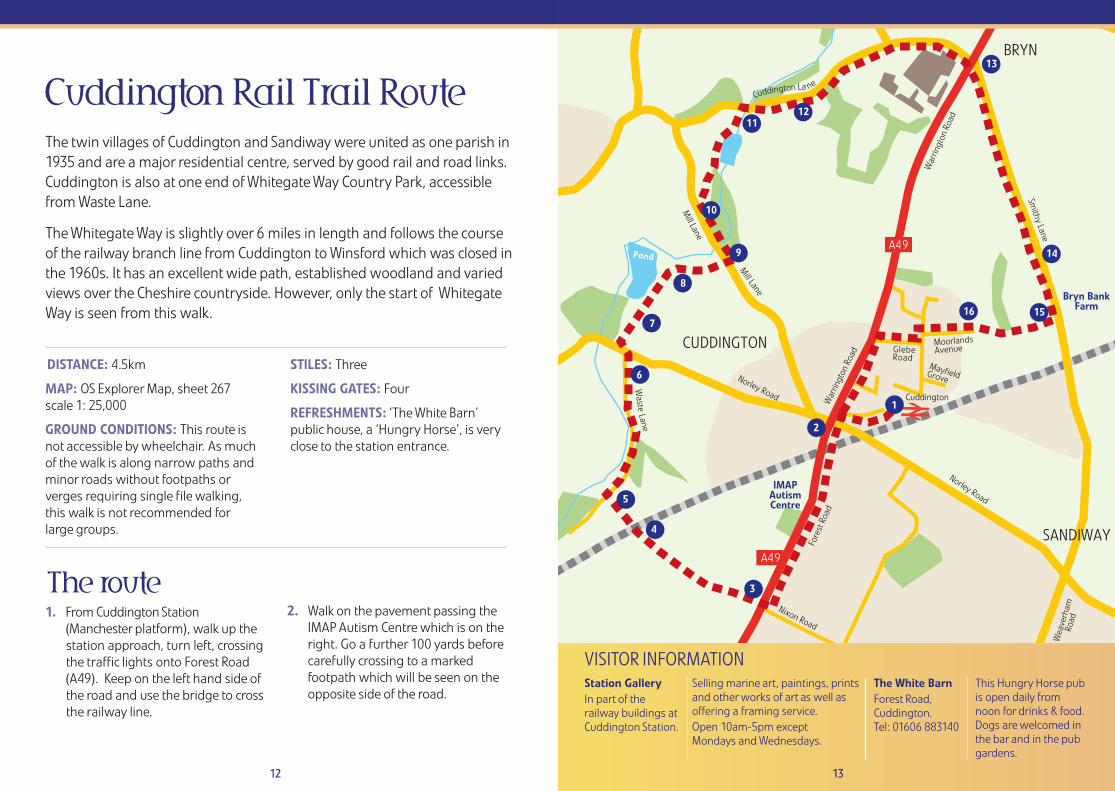
The route1. From Cuddington Station
(Manchester platform), walk up thestation approach, turn left, crossingthe traffic lights onto Forest Road (A49). Keep on the left hand side ofthe road and use the bridge to crossthe railway line.
2. Walk on the pavement passing theIMAP Autism Centre which is on theright. Go a further 100 yards beforecarefully crossing to a markedfootpath which will be seen on theopposite side of the road.
Cuddington Rail Trail RouteThe twin villages of Cuddington and Sandiway were united as one parish in1935 and are a major residential centre, served by good rail and road links.Cuddington is also at one end of Whitegate Way Country Park, accessiblefrom Waste Lane.
The Whitegate Way is slightly over 6 miles in length and follows the courseof the railway branch line from Cuddington to Winsford which was closed inthe 1960s. It has an excellent wide path, established woodland and variedviews over the Cheshire countryside. However, only the start of WhitegateWay is seen from this walk.
VISITOR INFORMATIONStation GalleryIn part of therailway buildings atCuddington Station.
DISTANCE: 4.5km
MAP: OS Explorer Map, sheet 267scale 1: 25,000
GROUND CONDITIONS: This route is not accessible by wheelchair. As muchof the walk is along narrow paths andminor roads without footpaths orverges requiring single file walking, this walk is not recommended for large groups.
STILES: Three
KISSING GATES: Four
REFRESHMENTS: ‘The White Barn’public house, a ‘Hungry Horse’, is veryclose to the station entrance.
13
The White BarnForest Road, Cuddington. Tel: 01606 883140
Selling marine art, paintings, printsand other works of art as well asoffering a framing service.Open 10am-5pm except Mondays and Wednesdays.
This Hungry Horse pubis open daily fromnoon for drinks & food.Dogs are welcomed inthe bar and in the pubgardens.
14 15
3. Go through a kissing gate onto anarrow fenced path which is likely tobe muddy. Then, after about half amile, go over a metal stile, up a shortsteep climb to the railway line.
4. Cross the railway line carefully andwalk down steps with a stout metalrail and across another metal stile.
5. Shortly you reach Waste Lane. Turnright. There is attractive woodlandon the right and a stream on the left.
6. At the end of Waste Lane, cross thebusy Norley Road. There is a veryshort path (unmarked) immediatelyopposite, just to the left of thetelegraph pole. Keep left afterpassing through this gap and soonturn right onto the establishedfootpath through a kissing gate.
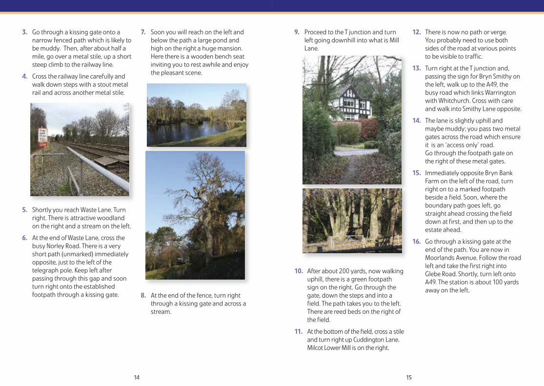
7. Soon you will reach on the left andbelow the path a large pond andhigh on the right a huge mansion.Here there is a wooden bench seatinviting you to rest awhile and enjoythe pleasant scene.
8. At the end of the fence, turn rightthrough a kissing gate and across astream.
9. Proceed to the T junction and turnleft going downhill into what is MillLane.
10. After about 200 yards, now walkinguphill, there is a green footpathsign on the right. Go through thegate, down the steps and into afield. The path takes you to the left.There are reed beds on the right ofthe field.
11. At the bottom of the field, cross a stileand turn right up Cuddington Lane.Milcot Lower Mill is on the right.
12. There is now no path or verge. You probably need to use bothsides of the road at various pointsto be visible to traffic.
13. Turn right at the T junction and,passing the sign for Bryn Smithy onthe left, walk up to the A49, thebusy road which links Warringtonwith Whitchurch. Cross with careand walk into Smithy Lane opposite.
14. The lane is slightly uphill andmaybe muddy; you pass two metalgates across the road which ensureit is an ‘access only’ road. Go through the footpath gate onthe right of these metal gates.
15. Immediately opposite Bryn BankFarm on the left of the road, turnright on to a marked footpathbeside a field. Soon, where theboundary path goes left, gostraight ahead crossing the fielddown at first, and then up to theestate ahead.
16. Go through a kissing gate at theend of the path. You are now inMoorlands Avenue. Follow the roadleft and take the first right intoGlebe Road. Shortly, turn left ontoA49. The station is about 100 yardsaway on the left.
Woodlands Road
Stones Manor LaneThe Green
HARTFORD
GREENBANK
School
School
CollegeSchools
HartfordManor
Greenbank
Beach R oad
CloughWood
GreenbankWood
Whitehall Drive
Greenbank Lane
Hatton Lane
Marshall Lane
Carriage Lane
Saxons Lane
Sydney
Street
Beach
Grove
Rive
r Wea
ver
Schools
Alfred Street
C l o u g h L
a n e
Vets
RelishCoffee Shop
King Street
Schools Lane
Riddings L
anePa
rk L
ane
Marshall’s ArmNature Reserve
Marina
Chester Road
Chester R
oad
A559
2 3
5
67
8
4
9
12
13
14
11
1
16 17
The route1. Starting from:
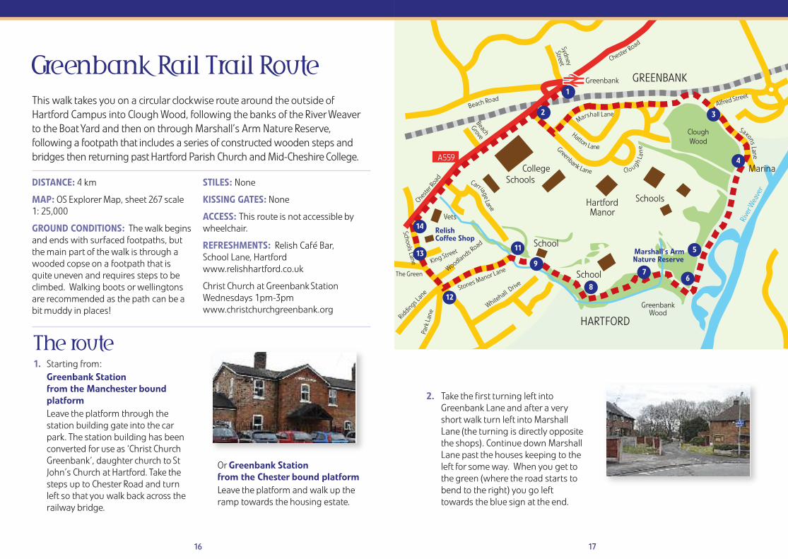
Greenbank Stationfrom the Manchester boundplatformLeave the platform through thestation building gate into the carpark. The station building has beenconverted for use as ‘Christ ChurchGreenbank’, daughter church to StJohn’s Church at Hartford. Take thesteps up to Chester Road and turnleft so that you walk back across therailway bridge.
OrGreenbank Stationfrom the Chester bound platformLeave the platform and walk up theramp towards the housing estate.
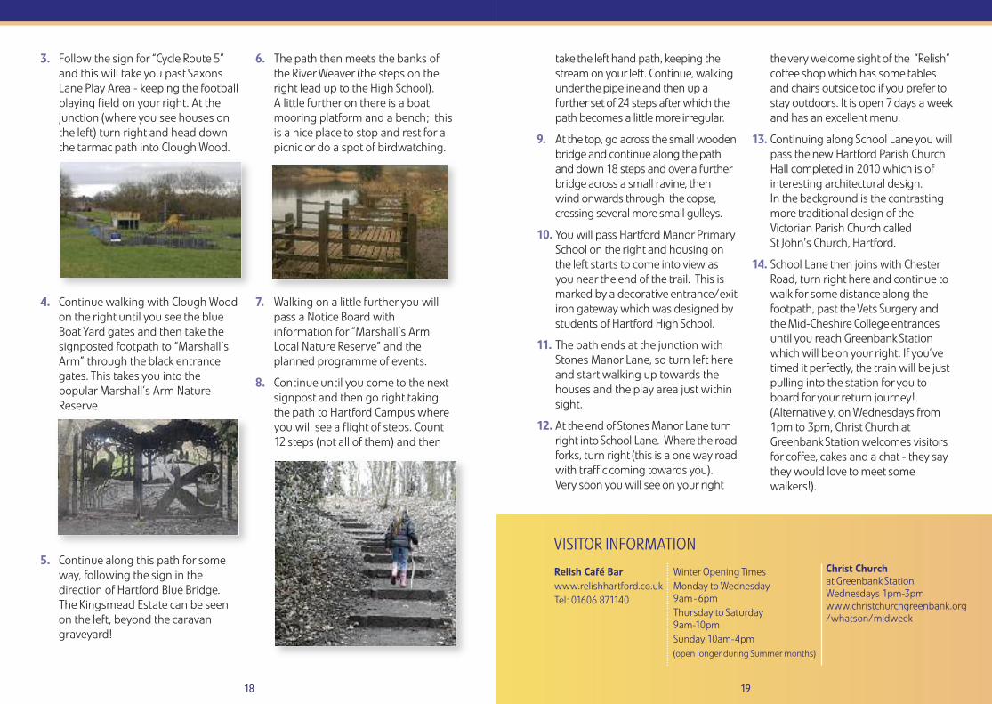
2. Take the first turning left intoGreenbank Lane and after a veryshort walk turn left into MarshallLane (the turning is directly oppositethe shops). Continue down MarshallLane past the houses keeping to theleft for some way. When you get tothe green (where the road starts tobend to the right) you go lefttowards the blue sign at the end.
Greenbank Rail Trail RouteThis walk takes you on a circular clockwise route around the outside ofHartford Campus into Clough Wood, following the banks of the River Weaverto the Boat Yard and then on through Marshall’s Arm Nature Reserve,following a footpath that includes a series of constructed wooden steps andbridges then returning past Hartford Parish Church and Mid-Cheshire College.
DISTANCE: 4 km
MAP: OS Explorer Map, sheet 267 scale1: 25,000
GROUND CONDITIONS: The walk beginsand ends with surfaced footpaths, butthe main part of the walk is through awooded copse on a footpath that isquite uneven and requires steps to beclimbed. Walking boots or wellingtonsare recommended as the path can be abit muddy in places!
STILES: None
KISSING GATES: None
ACCESS: This route is not accessible bywheelchair.
REFRESHMENTS: Relish Café Bar, School Lane, Hartfordwww.relishhartford.co.uk
Christ Church at Greenbank StationWednesdays 1pm-3pmwww.christchurchgreenbank.org
VISITOR INFORMATION
Relish Café Bar www.relishhartford.co.ukTel: 01606 871140
18 19
3. Follow the sign for “Cycle Route 5”and this will take you past SaxonsLane Play Area - keeping the footballplaying field on your right. At thejunction (where you see houses onthe left) turn right and head downthe tarmac path into Clough Wood.
4. Continue walking with Clough Woodon the right until you see the blueBoat Yard gates and then take thesignposted footpath to “Marshall’sArm” through the black entrancegates. This takes you into thepopular Marshall’s Arm NatureReserve.
5. Continue along this path for someway, following the sign in thedirection of Hartford Blue Bridge.The Kingsmead Estate can be seenon the left, beyond the caravangraveyard!
6. The path then meets the banks ofthe River Weaver (the steps on theright lead up to the High School). A little further on there is a boatmooring platform and a bench; thisis a nice place to stop and rest for apicnic or do a spot of birdwatching.
7. Walking on a little further you willpass a Notice Board withinformation for “Marshall’s ArmLocal Nature Reserve” and theplanned programme of events.
8. Continue until you come to the nextsignpost and then go right takingthe path to Hartford Campus whereyou will see a flight of steps. Count12 steps (not all of them) and then
take the left hand path, keeping thestream on your left. Continue, walkingunder the pipeline and then up afurther set of 24 steps after which thepath becomes a little more irregular.
9. At the top, go across the small woodenbridge and continue along the pathand down 18 steps and over a furtherbridge across a small ravine, thenwind onwards through the copse,crossing several more small gulleys.
10. You will pass Hartford Manor PrimarySchool on the right and housing onthe left starts to come into view asyou near the end of the trail. This ismarked by a decorative entrance/exitiron gateway which was designed bystudents of Hartford High School.
11. The path ends at the junction withStones Manor Lane, so turn left hereand start walking up towards thehouses and the play area just withinsight.
12. At the end of Stones Manor Lane turnright into School Lane. Where the roadforks, turn right (this is a one way roadwith traffic coming towards you).Very soon you will see on your right
the very welcome sight of the “Relish”coffee shop which has some tablesand chairs outside too if you prefer tostay outdoors. It is open 7 days a weekand has an excellent menu.
13. Continuing along School Lane you willpass the new Hartford Parish ChurchHall completed in 2010 which is ofinteresting architectural design. In the background is the contrastingmore traditional design of theVictorian Parish Church called St John's Church, Hartford.
14. School Lane then joins with ChesterRoad, turn right here and continue towalk for some distance along thefootpath, past the Vets Surgery andthe Mid-Cheshire College entrancesuntil you reach Greenbank Stationwhich will be on your right. If you’vetimed it perfectly, the train will be justpulling into the station for you toboard for your return journey!(Alternatively, on Wednesdays from1pm to 3pm, Christ Church atGreenbank Station welcomes visitorsfor coffee, cakes and a chat - they saythey would love to meet somewalkers!).
Christ Churchat Greenbank Station Wednesdays 1pm-3pmwww.christchurchgreenbank.org/whatson/midweek
Winter Opening TimesMonday to Wednesday9am-6pmThursday to Saturday9am-10pmSunday 10am-4pm(open longer during Summer months)
Rive
r Wea
ver Ri
ver D
ane
River Dane
NORTHWICH
A559
B5082
Cheste
r Way
Chester Way Kingsway Victoria
Road
Stat ion Road
Vicarage Road
Chur
ch R
oad
Manora Road
Vickers Way
Carlton Road
Vicarage Walk
Middlewich Road
WhalleyRoad
Watling Street
London Road
London Road
VickerswayPark
A533
B5337
Whalley Road
A559
Northwich 1
23
4
5
7
8
9
6
20 21
The route1. Leave Northwich Station from the
Manchester platform. Keep left of thepetrol station and leave the car parkthrough the black bollards. On yourleft is a set of traffic lights.
At these lights cross MiddlewichRoad and enter Victoria Road (theroad sign can only be seen after youenter the road). Walk along VictoriaRoad until the end (approx ¼ mile).
You will pass Victoria Road Primaryand Nursery School on the right,built in 1906.
2. At the end of the road, turn left andcross the railway bridge using thepavement on the right hand side.Turn into the first road on the right,Manora Road. The railway line is onyour right hand side.
3. At the junction with Carlton Road onthe left, walk straight ahead untilVickersway Park is seen also on theleft. Enter by the first gate and theroute keeps to the right, runningparallel to the railway.
There are various attractions in thepark including an aviary and thesemay be visited with a very smalldeviation.
It has a good range of facilitiesincluding a children’s play area,crazy golf, putting green, bowls,tennis courts, skatepark, a newaviary and an outdoor gym.
Various objects of historical interestare on display including part of a
Northwich Rail Trail RouteThis is a short urban walk through parts of Northwich, whose history isdominated by the salt and chemical industries. The town has manydistinctive black and white buildings. The Rivers Weaver and Daneconverge in the town, the Weaver having been a busy commercialwaterway. Within a short distance are the iconic Anderton Boat Lift andthe Northwich Woodlands: more than 20 miles of paths serve a widevariety of habitats, including ancient woodland as well as park land,making it a suitable venue for families.
Visit www.gonorthwich.co.uk for Your Complete Guide to Northwich.
DISTANCE: 3 km
MAP: OS Explorer Map, sheet 267 scale 1: 25,000
GROUND CONDITIONS: This walk is allon footpaths and there are no stiles orother obstructions. Also the terrain isbasically flat, with only a very minorclimb over the railway bridge.
STILES: None
KISSING GATES: None
ACCESS: This route is suitable for allmembers of the family and alsowheelchair use. The shorter version of thewalk is about 1 ¾ miles (3 km) and thelonger one adds about a further 1/3 mile(½ km). Allow ¾ hour for the basic walkwithout any stops at the points of interestand a further ¼ hour for the extension.
REFRESHMENTS: Available from The Bean café on Northwich Station, in the Costa Coffee café in Tesco next tothe station and between April andOctober in Vickersway Park (also knownas Roker Park).
Turn right and follow this until theroad ends. Continue in the samedirection with a school playgroundon your left. Continue along thepath, when it turns sharp left andshortly before the tunnel under therailway, turn left through the gateinto the cemetery of St Helens,Witton, also known as NorthwichParish Church (approx ½ mile).
This is the most historical building inthe town, founded in the 14thcentury. A Grade 1 listed building, itis included in Clifton-Taylor’s list ofbest English parish churches.Among its outstanding features area Tudor roof and splendid Victorianstained glass windows.
8. Follow the tarmac path and exit ontoChurch Road, where there is a largewar memorial on your left. On theopposite side of Church Road are twoVictorian buildings. The left one openedin 1869 and was the third building tohouse Witton Grammar School for boys.
The building to its right was the largemaster’s house built in 1878.
The original school was founded in1557 by Sir John Deane and the firstand second buildings to house theschool were in the churchyard nearthe gate you have just come through.Sir John Deane’s College is now on anearby site off London Road, havingrecently benefitted from a £28million redevelopment programme.
9. Cross over the road and into VictoriaRoad and follow this back toMiddlewich Road and NorthwichStation (approx 1/3 mile).
22 23
pillar from the local Vale Royal Abbey.The Abbey was founded in 1270 andclosed in 1538 by Henry VIII, as partof the dissolution of the monasteries.
4. At the end of the park leave by thegate and continue in the samedirection, with a skate park on yourleft and railway arches on your right,until you meet the River Dane. Thedistance from the start of ManoraRoad to this bridge is approximately2/3 mile. At this point you have theoption of taking a small extension tovisit the Weaver Hall Museum.
5. To do the extension cross thefootbridge in front for you and turnleft under the viaduct into LondonRoad and the museum is on yourright in an imposing Victorianworkhouse building.
Its displays reflect the history of MidCheshire and the salt industry. Themuseum is daily except Monday andoffers light refreshments. When youhave finished at the museum retracethe route until you have re-crossedthe River Dane.
6. To continue the walk follow the riverusing the footpath on your left soyou are between the river and therailway arches.
Follow this path until you pass threemetal figures behind a bench. These represent a salt worker, Paula Radcliffe and Gary Barlow(approx ½ mile).
7. Shortly after these figures, take theright fork that leads away from theriver until you meet Whalley Road.
VISITOR INFORMATIONThe Bean Café Northwich Station - sells refreshments,snacks and cakes.
Weaver Hall Museumand WorkhouseThe Museum has a well-stocked shop and a coffeeshop with a selection ofhot and cold drinks,biscuits and flapjacks.
Open 7am-5pm. Tel: 0758 3072024.Situated in the Zone atNorthwich Station.
There is a pub next doorfor those looking for hotfood. Open daily apartfrom Mondays. Summerand Winter opening timesare different.
www.weaverhallmuseum.org.uk
LostockGralam
Fitton Street
Herbert Street
Arthur Street
School L
aneStation Road
Lost
ock
Hollo
w
Lost
ock G
reen
Griff
iths R
oad
A530
Works
Manchester Road
Hall Lane
Depot
Mill Wood
LOSTOCKGRALAM
Slow and EasyPublic House
St. John’sChurch
School
Hall
HolfordBrinefields
Wade Brook
Tren
t and
Mer
sey
Cana
l
BoatYard
A559
A559
56
7
1
2
34
8
9
10
11
12
24 25
The route1. From the Chester-bound platform,
walk up the ramp; from theManchester-bound platform, walk upthe ramp and a short flight of steps.
Turn right onto a narrow lane,passing an entrance to the HolfordBrinefields. The lane soon becomes atree-lined dell; take care in autumn
and winter as leaves and mud canmake the pavement slippery.
This is a fairly easy route which skirts around and then through theNorthwich suburb of Lostock Gralam. Walkers may like to know that thereis a passenger shelter on both platforms.
The route includes fields, factories and a stroll along the Trent and MerseyCanal, with a dramatic industrial scene acting as backdrop to the tranquilCheshire countryside.
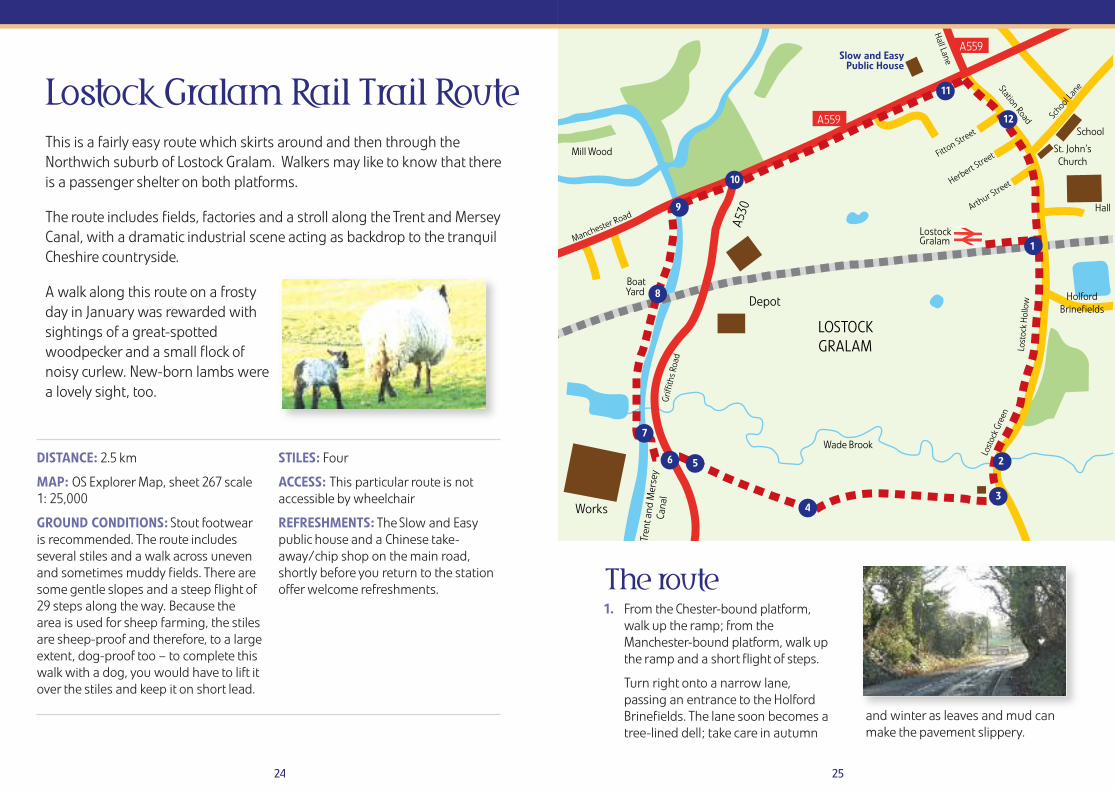
A walk along this route on a frostyday in January was rewarded withsightings of a great-spottedwoodpecker and a small flock ofnoisy curlew. New-born lambs werea lovely sight, too.
DISTANCE: 2.5 km
MAP: OS Explorer Map, sheet 267 scale1: 25,000
GROUND CONDITIONS: Stout footwearis recommended. The route includesseveral stiles and a walk across unevenand sometimes muddy fields. There aresome gentle slopes and a steep flight of29 steps along the way. Because thearea is used for sheep farming, the stilesare sheep-proof and therefore, to a largeextent, dog-proof too – to complete thiswalk with a dog, you would have to lift itover the stiles and keep it on short lead.
STILES: Four
ACCESS: This particular route is notaccessible by wheelchair
REFRESHMENTS: The Slow and Easypublic house and a Chinese take-away/chip shop on the main road,shortly before you return to the stationoffer welcome refreshments.
Lostock Gralam Rail Trail Route
26 27
2. As you emerge from the trees,ignore the footpath sign to yourright; continue over the sandstonebridge which crosses themeandering Wade Brook.
3. Pass a house on the right, then turnimmediately right over a stile.
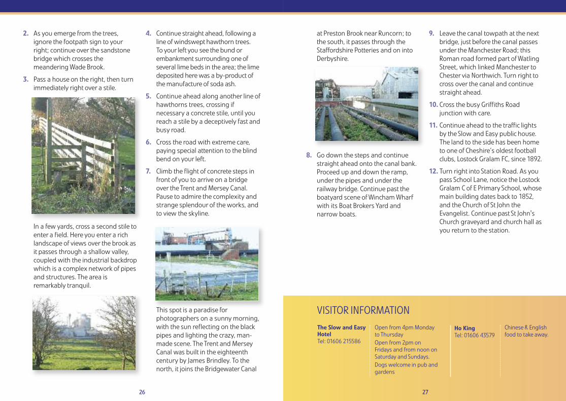
In a few yards, cross a second stile toenter a field. Here you enter a richlandscape of views over the brook asit passes through a shallow valley,coupled with the industrial backdropwhich is a complex network of pipesand structures. The area isremarkably tranquil.
4. Continue straight ahead, following aline of windswept hawthorn trees. To your left you see the bund orembankment surrounding one ofseveral lime beds in the area; the limedeposited here was a by-product ofthe manufacture of soda ash.
5. Continue ahead along another line ofhawthorns trees, crossing ifnecessary a concrete stile, until youreach a stile by a deceptively fast andbusy road.
6. Cross the road with extreme care,paying special attention to the blindbend on your left.
7. Climb the flight of concrete steps infront of you to arrive on a bridgeover the Trent and Mersey Canal.Pause to admire the complexity andstrange splendour of the works, andto view the skyline.
This spot is a paradise forphotographers on a sunny morning,with the sun reflecting on the blackpipes and lighting the crazy, man-made scene. The Trent and MerseyCanal was built in the eighteenthcentury by James Brindley. To thenorth, it joins the Bridgewater Canal
VISITOR INFORMATIONThe Slow and EasyHotelTel: 01606 215586
Open from 4pm Mondayto ThursdayOpen from 2pm onFridays and from noon onSaturday and Sundays.Dogs welcome in pub andgardens
Ho King Tel: 01606 43579 �
at Preston Brook near Runcorn; tothe south, it passes through theStaffordshire Potteries and on intoDerbyshire.
8. Go down the steps and continuestraight ahead onto the canal bank.Proceed up and down the ramp,under the pipes and under therailway bridge. Continue past theboatyard scene of Wincham Wharfwith its Boat Brokers Yard andnarrow boats.
9. Leave the canal towpath at the nextbridge, just before the canal passesunder the Manchester Road; thisRoman road formed part of WatlingStreet, which linked Manchester toChester via Northwich. Turn right tocross over the canal and continuestraight ahead.
10. Cross the busy Griffiths Roadjunction with care.
11. Continue ahead to the traffic lightsby the Slow and Easy public house.The land to the side has been hometo one of Cheshire’s oldest footballclubs, Lostock Gralam FC, since 1892.
12. Turn right into Station Road. As youpass School Lane, notice the LostockGralam C of E Primary School, whosemain building dates back to 1852,and the Church of St John theEvangelist. Continue past St John'sChurch graveyard and church hall asyou return to the station.
Chinese & Englishfood to take away.
Greenspace Cheshire West and Chester Council, Wyvern House, Winsford, Cheshire, CW7 1AH.
TEL: 0300 123 8 123
EMAIL:[email protected]
www.cheshirewestandchester.gov.uk
Further suggestions and informationon exploring Cheshire on cycle,horseback and on foot can be foundon the Discover Cheshire website atwww.discovercheshire.co.uk or from the Greenspace team.
If you have enjoyed any similar walksin Cheshire West and Chester pleasefeel free to contact the team who canadd them to the Discover Cheshirewebsite.
Further information on exploring Mid Cheshire bytrain and visiting local attractions or walking anddining can be found atwww.midcheshirerail.org.uk
Please contact us if you would like to receive this leaflet in an alternative format such as large print.