Embed Size (px)
Citation preview
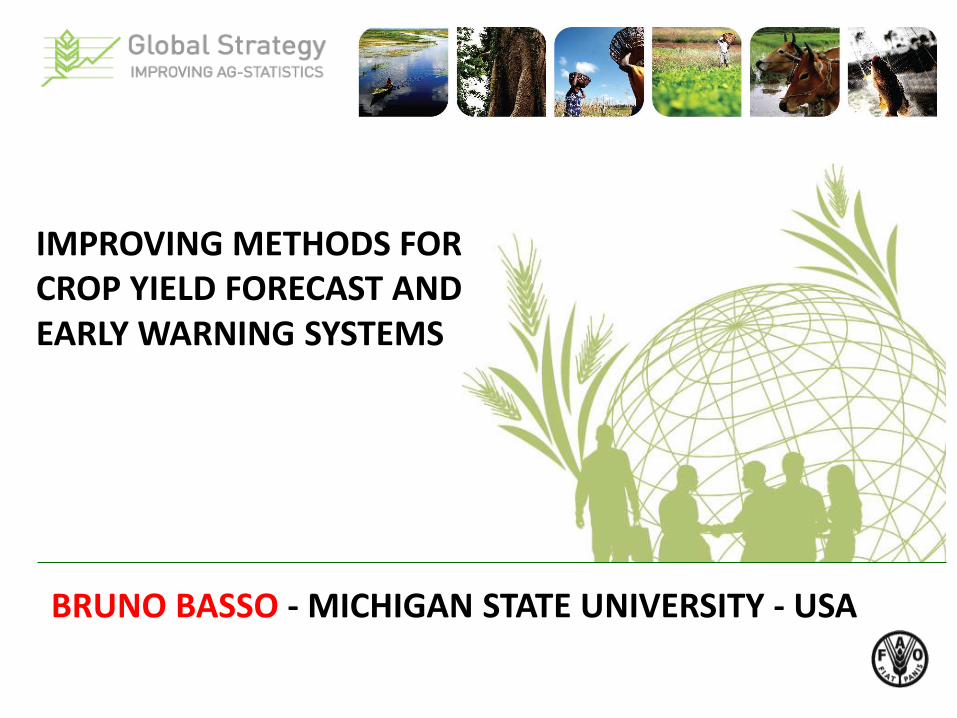
IMPROVING METHODS FOR CROP YIELD FORECAST AND EARLY WARNING SYSTEMS
BRUNO BASSO - MICHIGAN STATE UNIVERSITY - USA

• Crop simulation models (CSM) – types of models • Remote Sensing (RS): Principles and Vegetation
Indices • Yield Gap Analysis • Linking CSM with RS for yield forecast • Early Warning Systems (EWS) • Research needs for improving Ag Statistics in
developing countries
Outline - Research Topics

Yield Forecasting Methods

0 200 400 600 800
Growing-season rainfall (mm)
0
2
4
6
8
Gra
in y
ield
(t
ha
-1)
District averageyields
Rainfall alone cannot be used to predict yield
Evapotranspiration (mm)
0 100 200 300 400 500 600
Yie
ld (
t/h
a)
0
1
2
3
4
5
6
n = 691
China Loess Plateau
Mediterranean Basin
North American Great Plains
SE Australia
Lobell et al., 2013 Nature Climate Change
Sadras and Angus, 2006 Aust. J Ag. Res

• Types of models: Deterministic and Stochastic • Deterministic: Statistical, Mechanistic and Functional
Crop Simulation Models
Input Data
Weather
Soil
Management
Crop
Crop Yield
Soil Biochem, N , C, P dynamics
Soil Water Balance
Crop Growth Modules
Soil organic matter and Nutrient
Module
Soil Water Balance Module
Example of a functional model (SALUS)

SUB-TOPICS REQUIRING FURTHER RESEARCH
NASA POWER

Soil WISE Database

Spatial and Temporal Variability of Crop Yield
Spatial Variability Temporal Variability
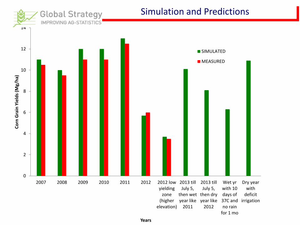
Simulation and Predictions
0
2
4
6
8
10
12
14
2007 2008 2009 2010 2011 2012 2012 lowyielding
zone(higher
elevation)
2013 tillJuly 5,
then wetyear like
2011
2013 tillJuly 5,
then dryyear like
2012
Wet yrwith 10days of37C andno rain
for 1 mo
Dry yearwith
deficitirrigation
Co
rn G
rain
Yie
lds
(Mg/
ha)
Years
SIMULATED
MEASURED

AgMIP project
Rosenzeweig et al., 2013, Ag. For. Meteo; Asseng et al., 2013 Nature Climate Change

Remote Sensing
NDVI
NDVI = (NIR-RED) / (NIR+RED)
RS can be used for yield estimation directly using VI or indirectly by incorporating data into simulation model for crop growth and development either as within season calibration checks of model output (LAI, biomass) or in a feedback loop used to adjust model starting conditions (Maas, 1988).
ND
VI
Leaf Area Index (m2/m2)
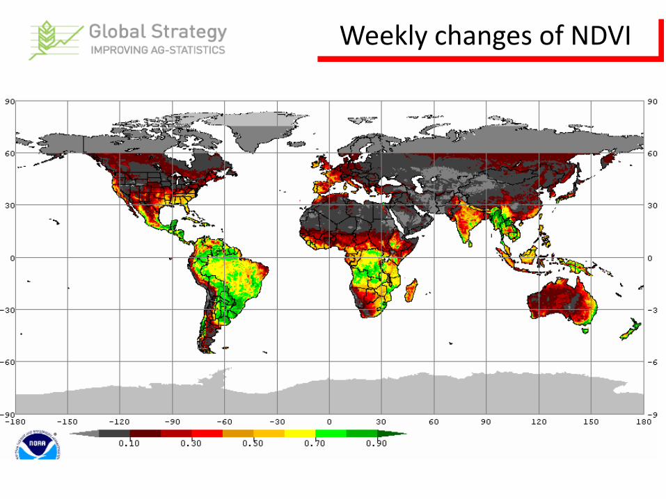
Weekly changes of NDVI

Early Warning Systems
• Early Warning System (EWS) is defined as an integrated system for monitoring, data collection, analysis, and communicating to people in order to make early decisions to protect peoples and the environment (Davies et al. 1991).
• FAO Global Information & Early Warning System (GIEWS) on Food and Agriculture (ISDR, 2009)
• Most of the EWS use RS for crop monitoring and early screening for signs of drought, flood, ENSO, climate change

Research for improving Ag Statistics
• RS - Create a database with availability and usefulness of satellite to exploit its spatial, temporal and spectral resolutions and its cost
• Test functional CSM using observed weather and soil properties along different scenarios of management to reproduce what RS has indicated
• Run pilot projects where CSM are integrated with RS to test the capability of the procedure under stratified agriculture to improve Ag Stats in developing world

Thank you
Bruno Basso
Michigan State University, USA
The first Scientific Advisory Committee
FAO Headquarters, 18 and 19 July 2013