Embed Size (px)
Citation preview

Improving Business Decisions for Existing Buildings with BIM and GIS
Ken Bragg European Services Manager, Safe Software @kenatsafe
GeoBIM Europe – Dec. 11th 2015

FME

FME Technology Capabilities
Translate spatial data from one format to another
300+ supported formats
Transform spatial data into the precise data model you need
300+ data transformers

Supporting Decisions

Supporting Decisions BIM to GIS
Seeing Structures in Context
Placing Structures in the “Real World”
Accessing Structures Relative to Infrastructure
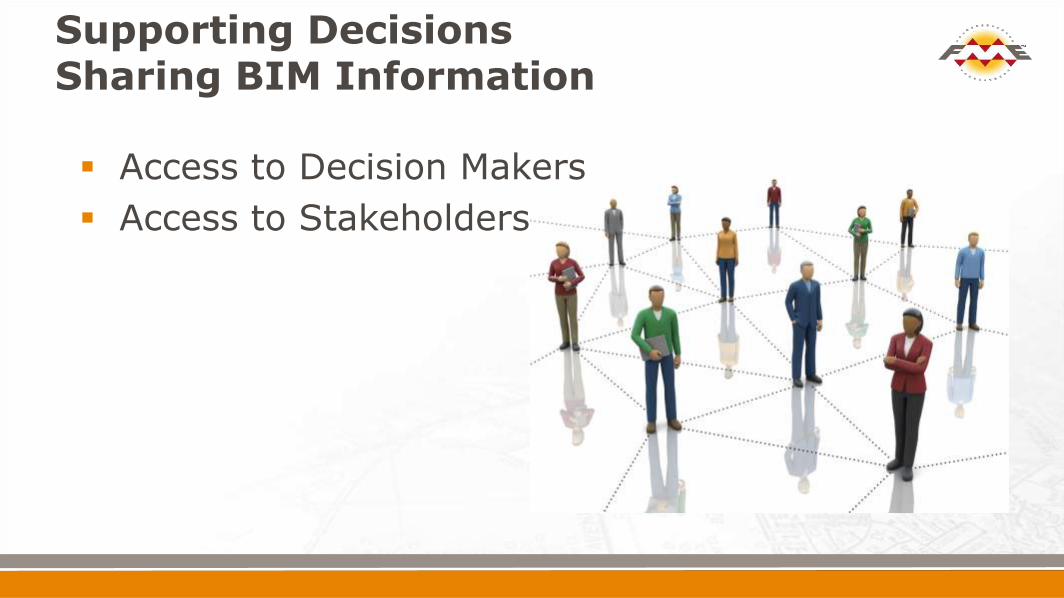
Access to Decision Makers
Access to Stakeholders
Supporting Decisions Sharing BIM Information

4 Success Stories
1. University of Massachusetts - Amherst
2. HOK
Global Design Architecture Engineering & Planning
3. George Washington’s - Mount Vernon
4. Vattenfall - Forsmark Nuclear Power Plant Sweden

Spatial Decision Support and Analytics on a
Campus Scale:
Bringing GIS, CAD, BIM and Tableau Together
Alexander Stepanov
GIS Architect
A&F Administrative Systems
Niels La Cour
Senior Planner
Campus Planning
University of Massachusetts, Amherst
Thank-you: Alexander Stepanov


University Campus: Problem Spatial DB of Space Inventory
Input: CAD Floor Plans CAFM GIS Layers with BLDG footprints Elevation profiles

Unique Campus Space ID & 3D representation of rooms
0318_04_0020A
Spatial database is a collection of rooms(spaces), which are registered in physical space and have unique “global” campus ID. Connection to the enterprise DB

Step 1: CAD to GIS - Inner Space Modeling

ETL: CAD to Arch Space

Step 2: Getting Shift, Scale and Rotation for Buildings

Step 3: GIS “Arch” to GIS “Real World”
Every SPACE has PRIMARY KEY BLGD_FLOOR_ROOM
Ability to JOIN External datasets
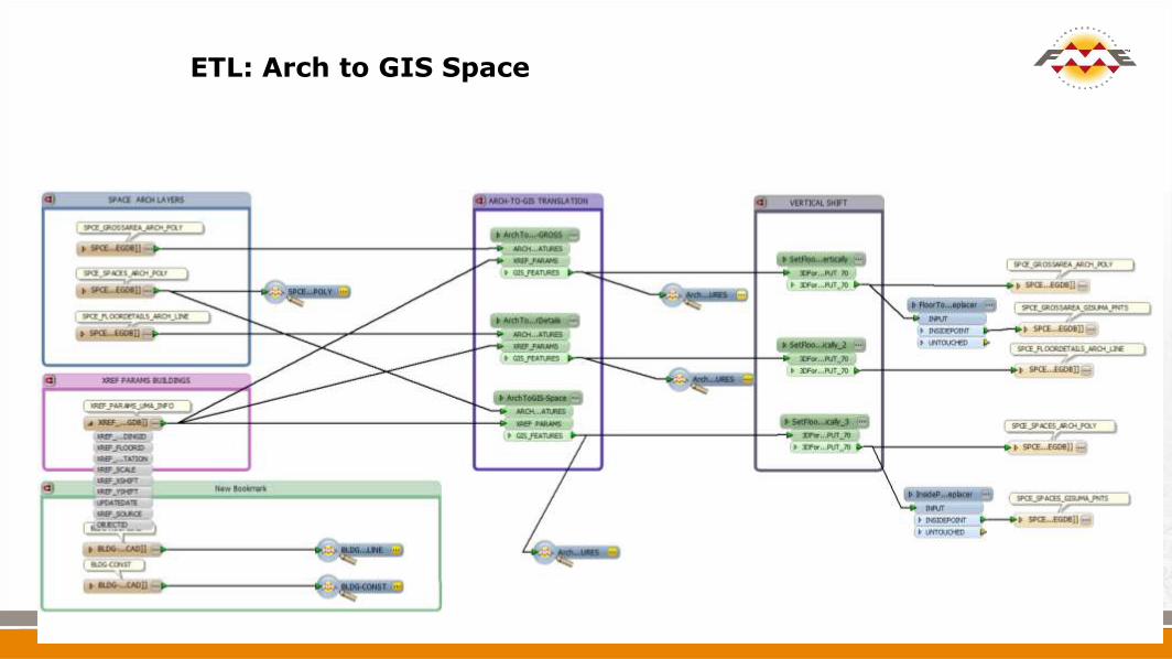
ETL: Arch to GIS Space

University Campus: Space Inventory

The University of Washington
Facilities Management Problem:
Each space is accurately represented in an Autodesk AutoCAD drawing
ESRI ArcGIS used for Space Occupancy Reporting
Solution Courtesy: Steve Grise, Solution Architect at Vertex 3 Inc

The University of Washington

All your BIM are belong to us – Revit and FME for Enterprise Data Management Greg Schleusner AIA, HOK Director of buildingSMART Innovation @gschleusner @zoog


HOK Challenge
HOK needed to update their workflows for large complex city modeling project
Data interoperability issues between the different applications and different teams
Looking for automation in BIM applications, and the AEC industry in general

HOK Challenge
For example:
Land-use planning was accomplished using Autodesk Revit
Massing of buildings was carried out using
Esri CityEngine.
Display of model effectively to stakeholders using was Autodesk Infraworks,

Revit Landuse Plan CityEngine Massing Infraworks Presentation Model

City Engine Smart CODE
• Road Creation • Block Subdivision • CGA Code (Generates Building Forms)

Transects Social Infrastructure
Road Center Lines (3,4,5)
Generated Buildings
GeoTIFFs Shape Files
Terrain IMX
IMX
Road Centerlines
(1,2)

Automation Goals Example: Revit to ... Self serve exporter

BIM to GIS at Mount Vernon
VIRGINIA, USA
Patrick Gahagan, Esri Quinn Evans Architects
Mount Vernon Ladies’ Association

Mount Vernon • George Washington’s home, constructed between 1758 and 1778
• Mount Vernon Ladies’ Association tasked with restoration, interpretation, and preservation of grounds and structures
• Mansion laser scanned to create architectural-quality HBIM in Revit by Quinn Evans Architects
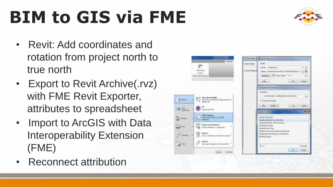
BIM to GIS via FME
• Revit: Add coordinates and
rotation from project north to
true north
• Export to Revit Archive(.rvz)
with FME Revit Exporter,
attributes to spreadsheet
• Import to ArcGIS with Data
Interoperability Extension
(FME)
• Reconnect attribution

A Blended World

Viewshed Analysis
• asdf

Stakeholder Access to Information
• Browser delivery provides
data to everyone, even fire
suppressant system
designer
• Historical data identifies
plaster from 1950 vs. 1787
• Framing details assist with
optimal routing

Nuclear BIM Forsmark Integrates CAD, GIS, BIM, and Non-Spatial
The Forsmark nuclear power plant provides approximately one-sixth of Sweden’s total electrical energy consumption!
Thank-you: Anton Sandström Mårten Martinsson
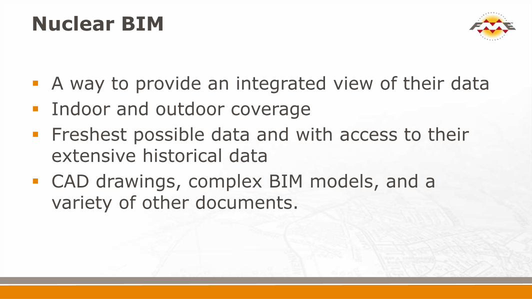
Nuclear BIM
A way to provide an integrated view of their data
Indoor and outdoor coverage
Freshest possible data and with access to their extensive historical data
CAD drawings, complex BIM models, and a variety of other documents.

Nuclear BIM

Nuclear BIM

Nuclear BIM

Who We Work With


![Welcome [geo-bim.org]](https://img.pdfslide.us/doc/110x75/62119d2849285512a9637e25/welcome-geo-bimorg.jpg)