Embed Size (px)
Citation preview
Implementing an Open Data Strategy
with ArcGIS HubPatrick Hammons, Esri
Agenda
• Open data overview
• Demonstration of ArcGIS Hub
• Building your open data catalog
• Sharing quality content
• What’s next
Open data overview
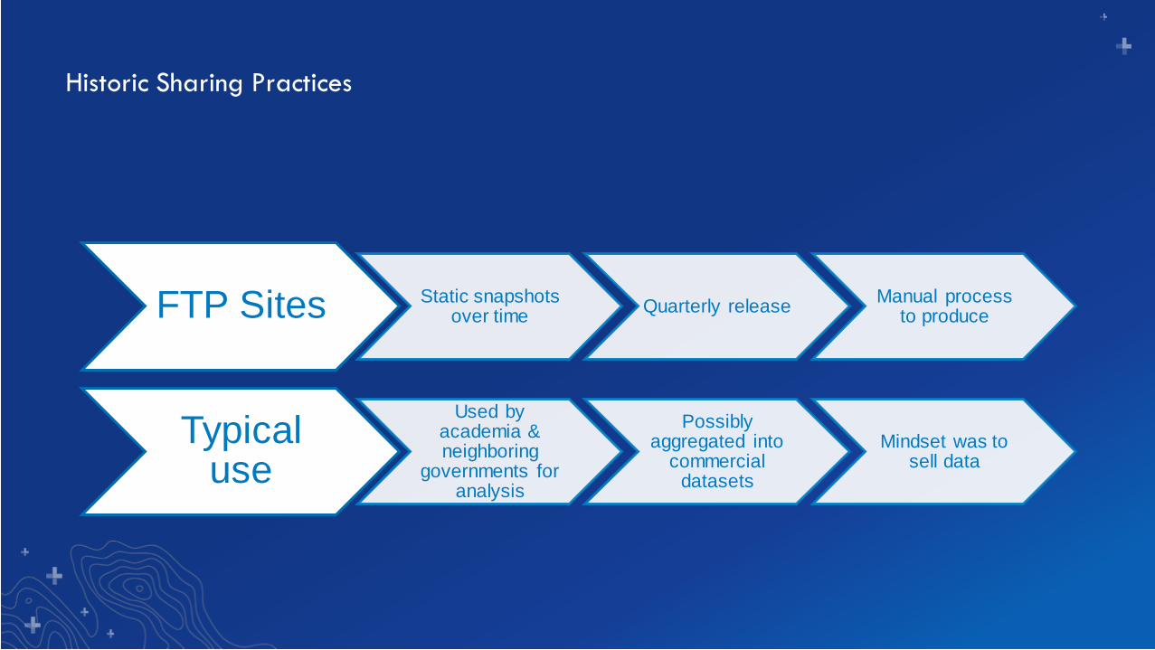
Historic Sharing Practices
FTP Sites Static snapshots over time
Quarterly releaseManual process
to produce
Typical use
Used by academia & neighboring
governments for analysis
Possibly aggregated into
commercial datasets
Mindset was to sell data
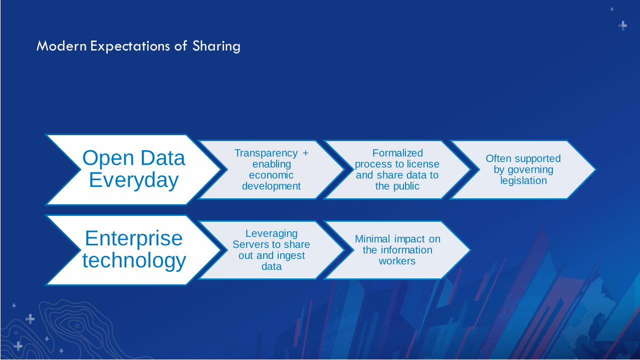
Modern Expectations of Sharing
Open Data Everyday
Transparency + enabling
economic development
Formalized process to license and share data to
the public
Often supported by governing
legislation
Enterprise technology
Leveraging Servers to share
out and ingest data
Minimal impact on the information
workers
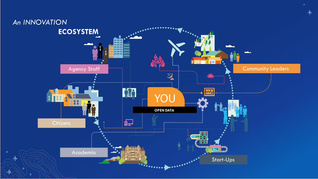
YOULOCATION STRATEGY
An INNOVATION
OPEN DATA
Community Leaders
Start-Ups
Academia
Citizens
Agency Staff
ECOSYSTEM
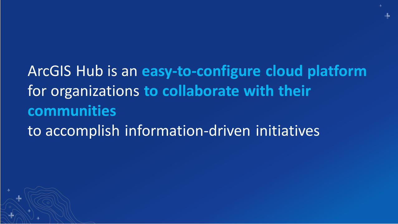
ArcGIS Hub is an easy-to-configure cloud platformfor organizations to collaborate with their communitiesto accomplish information-driven initiatives
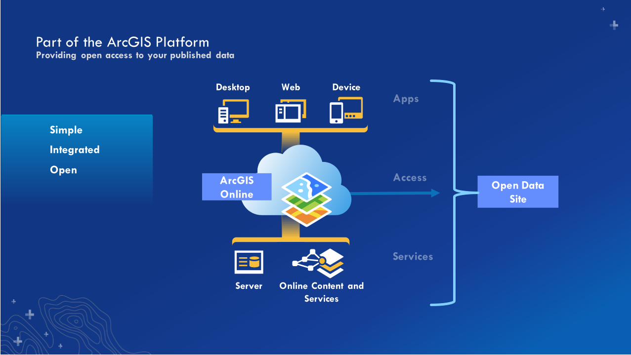
Part of the ArcGIS Platform
Open Data
Site
Providing open access to your published data
Simple
Integrated
Open
Desktop Web Device
Server Online Content and
Services
ArcGIS
Online
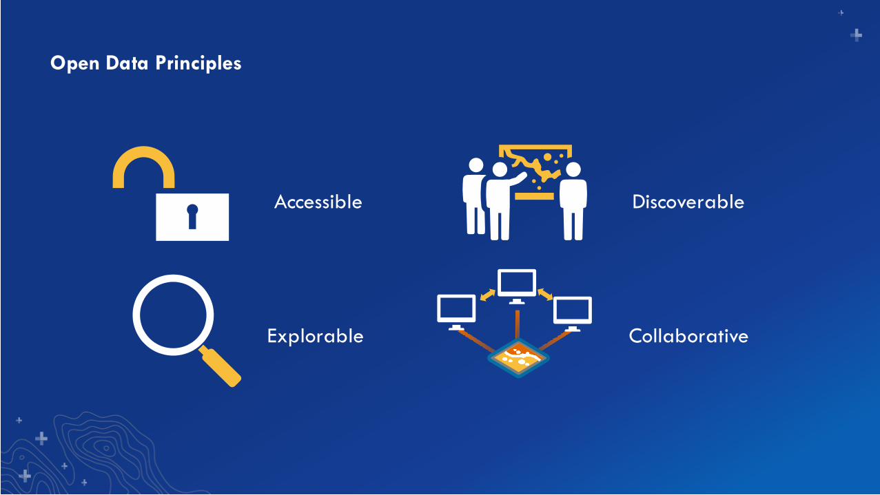
Open Data Principles
Accessible Discoverable
Explorable Collaborative
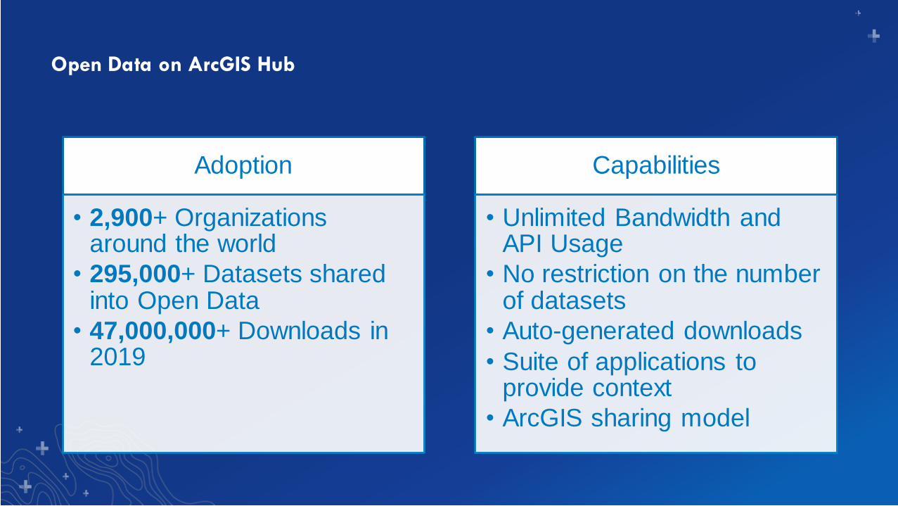
Open Data on ArcGIS Hub
Adoption
• 2,900+ Organizations around the world
• 295,000+ Datasets shared into Open Data
• 47,000,000+ Downloads in 2019
Capabilities
• Unlimited Bandwidth and API Usage
• No restriction on the number of datasets
• Auto-generated downloads
• Suite of applications to provide context
• ArcGIS sharing model
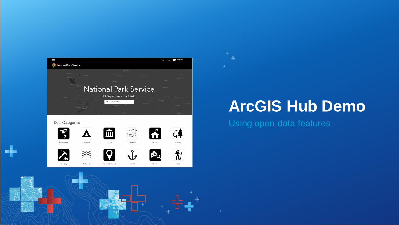
Using open data features
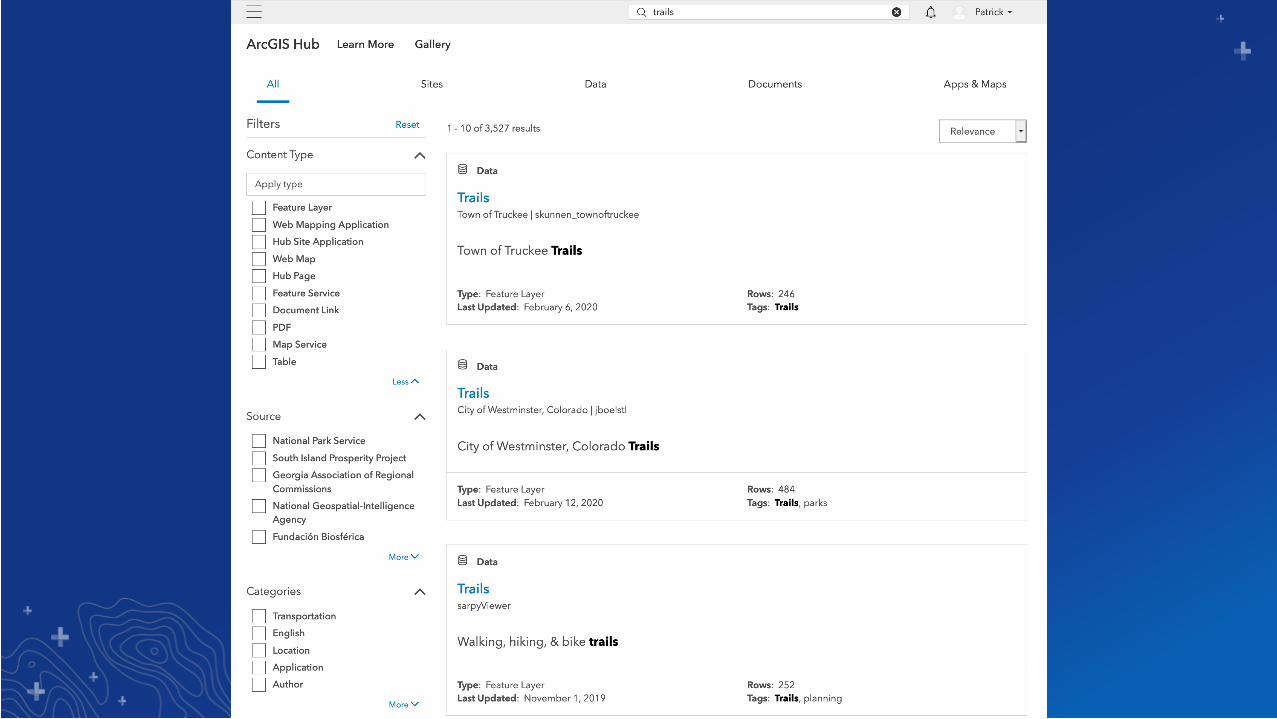
ArcGIS Hub Demo
Building your open data catalog
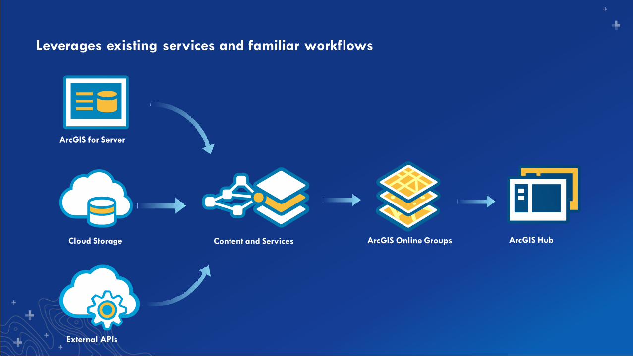
Leverages existing services and familiar workflows
ArcGIS for Server
Cloud Storage Content and Services ArcGIS HubArcGIS Online Groups
External APIs
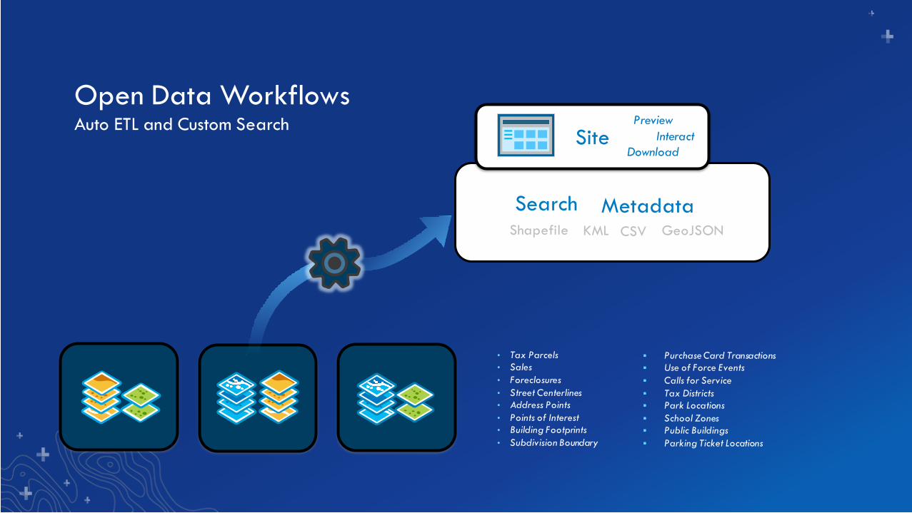
Open Data WorkflowsAuto ETL and Custom Search
MetadataSearchShapefile KML GeoJSONCSV
• Tax Parcels
• Sales
• Foreclosures
• Street Centerlines
• Address Points
• Points of Interest
• Building Footprints
• Subdivision Boundary
▪ Purchase Card Transactions
▪ Use of Force Events
▪ Calls for Service
▪ Tax Districts
▪ Park Locations
▪ School Zones
▪ Public Buildings
▪ Parking Ticket Locations
Site Interact
Download
Preview
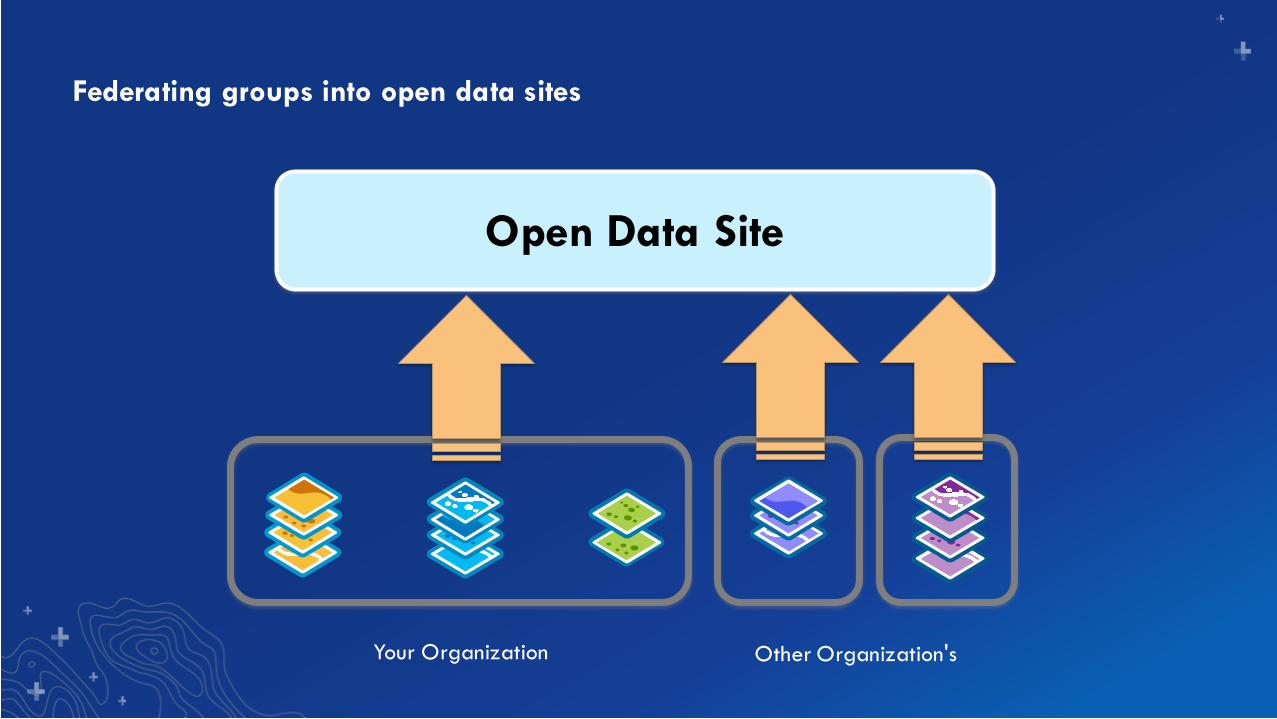
Federating groups into open data sites
Open Data Site
Your Organization Other Organization's
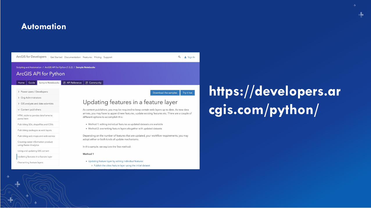
Automation
https://developers.ar
cgis.com/python/
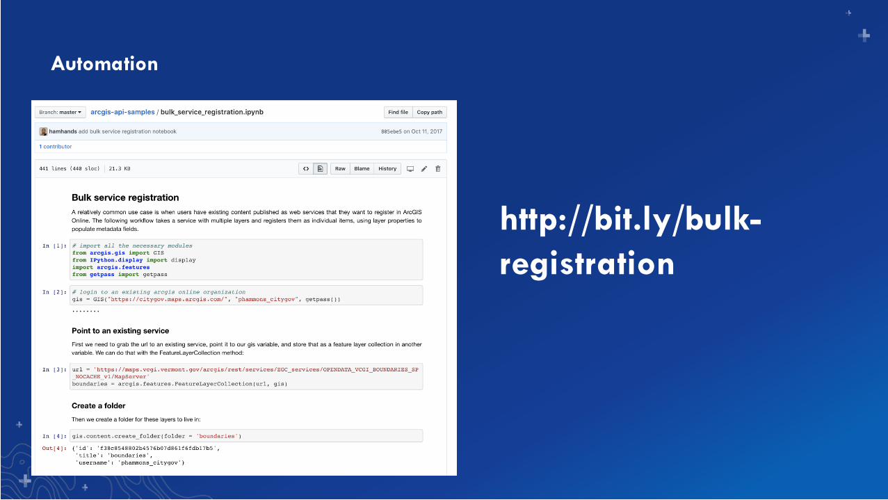
Automation
http://bit.ly/bulk-
registration
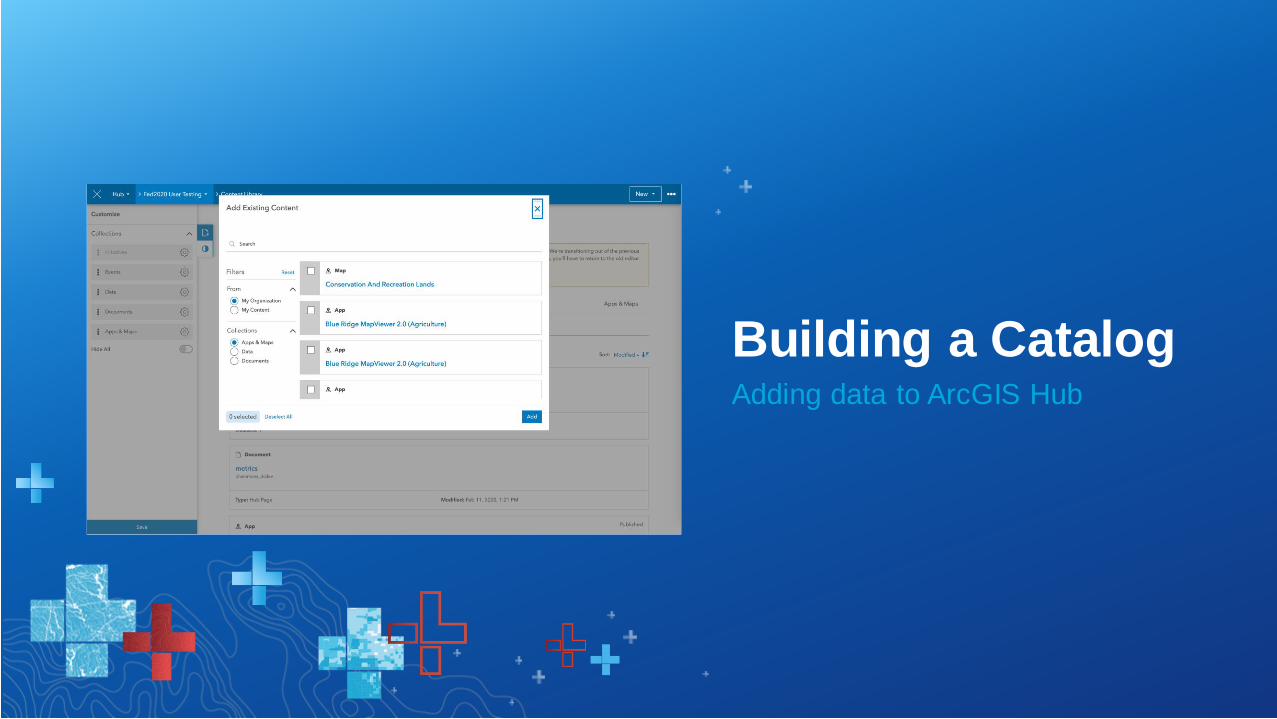
Adding data to ArcGIS Hub
Building a Catalog

Sharing quality content
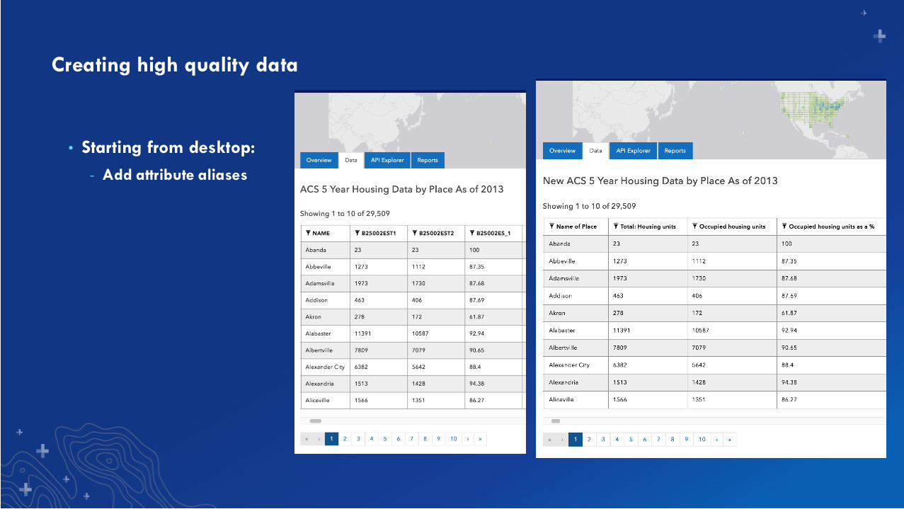
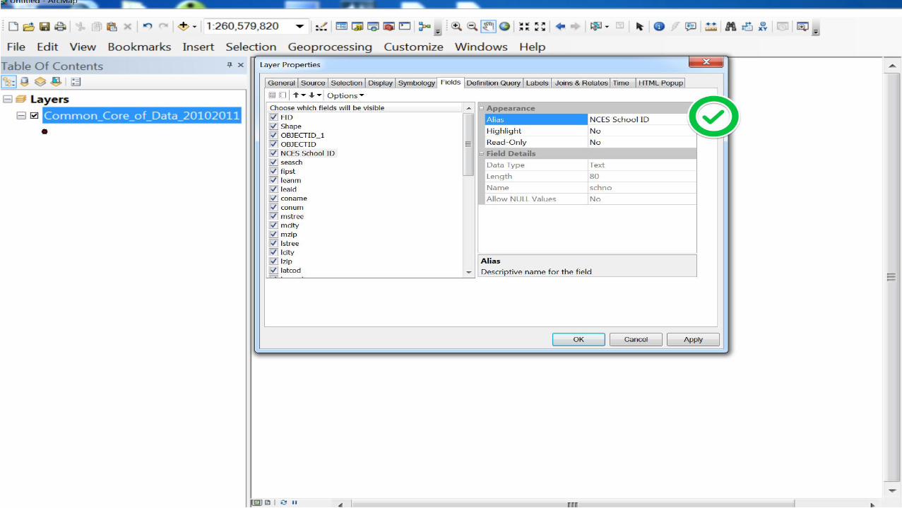
Creating high quality data
• Starting from desktop:
- Add attribute aliases
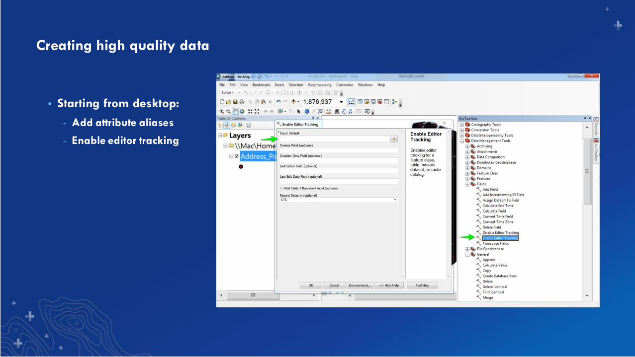
Creating high quality data
• Starting from desktop:
- Add attribute aliases
- Enable editor tracking

Making data more approachable in
Hub
Improving Data
Quality
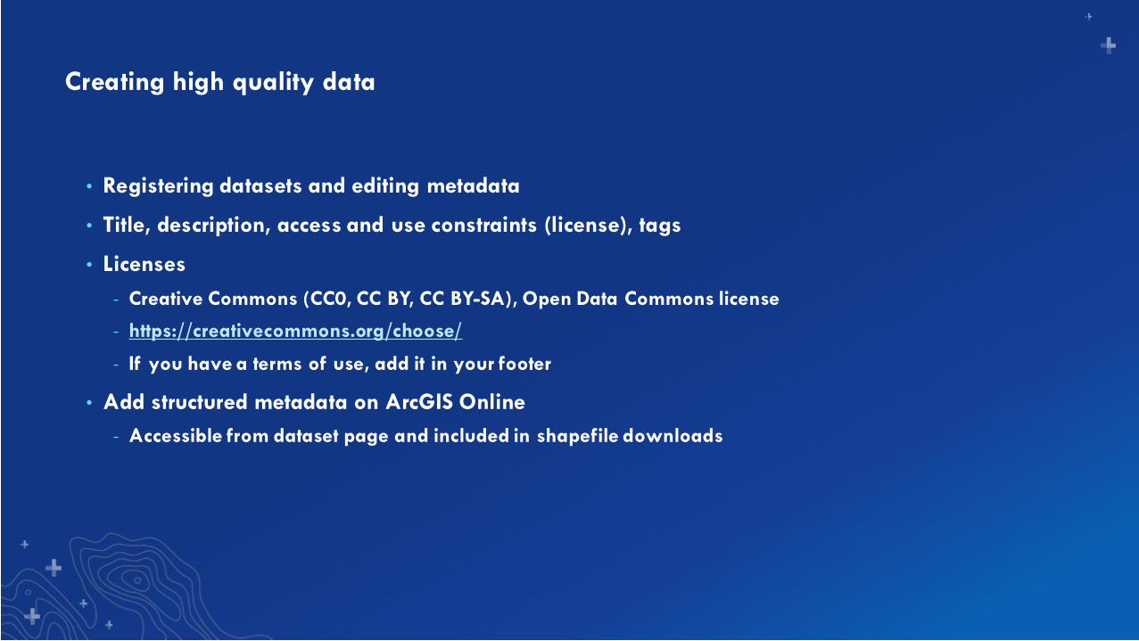
Creating high quality data
• Registering datasets and editing metadata
• Title, description, access and use constraints (license), tags
• Licenses
- Creative Commons (CC0, CC BY, CC BY-SA), Open Data Commons license
- https://creativecommons.org/choose/
- If you have a terms of use, add it in your footer
• Add structured metadata on ArcGIS Online
- Accessible from dataset page and included in shapefile downloads
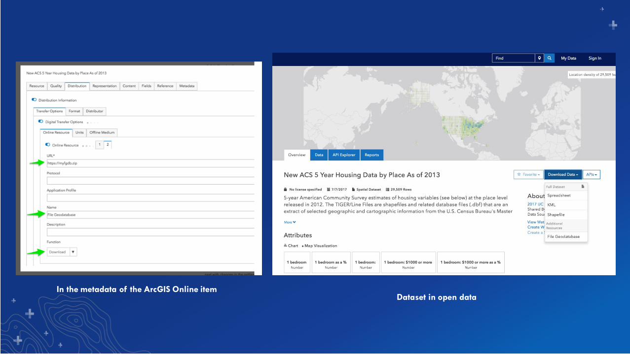
In the metadata of the ArcGIS Online itemDataset in open data
Adding other kinds of items
• Go beyond the feature service
- Web maps
- Web mapping applications
- Hub sites
- Hub initiatives
- PDFs, word docs
- External links
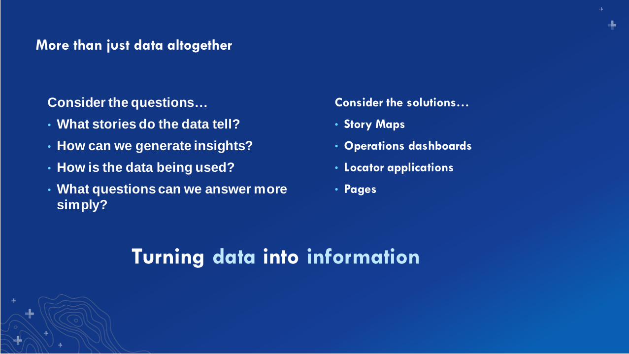
More than just data altogether
Consider the questions…
• What stories do the data tell?
• How can we generate insights?
• How is the data being used?
• What questions can we answer more
simply?
Consider the solutions…
• Story Maps
• Operations dashboards
• Locator applications
• Pages
Turning data into information
What’s next?For the open data capabilities of ArcGIS Hub
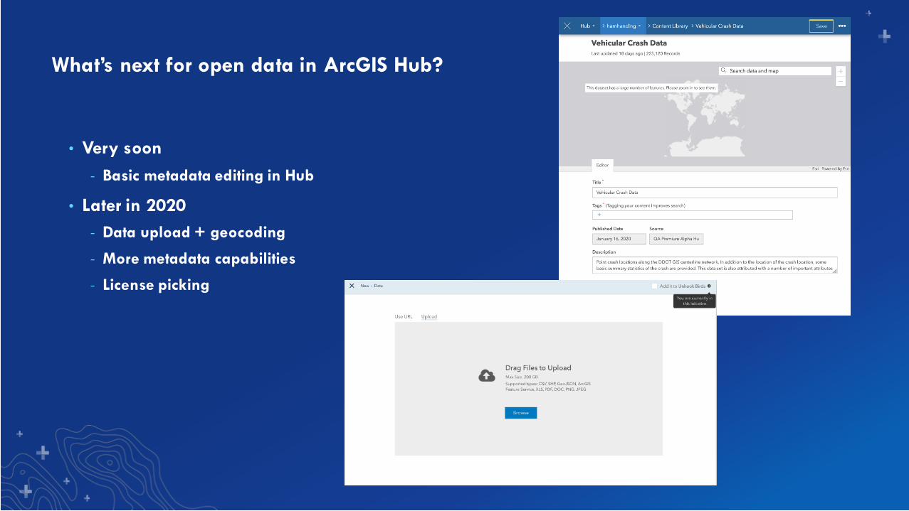
What’s next for open data in ArcGIS Hub?
• Very soon
- Basic metadata editing in Hub
• Later in 2020
- Data upload + geocoding
- More metadata capabilities
- License picking

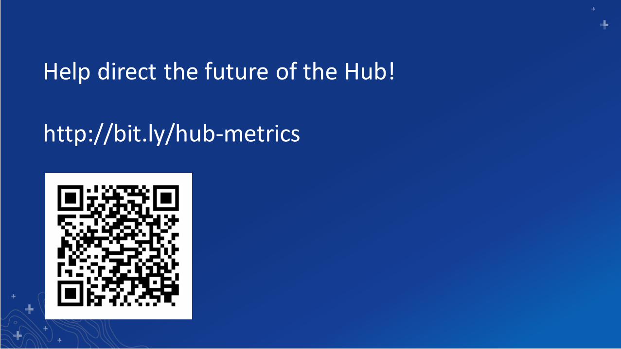
Help direct the future of the Hub!
http://bit.ly/hub-metrics
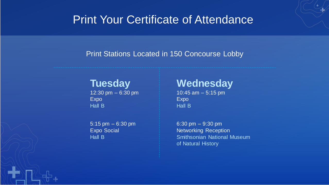
Print Your Certificate of Attendance
Print Stations Located in 150 Concourse Lobby
Tuesday12:30 pm – 6:30 pm
Expo
Hall B
5:15 pm – 6:30 pm
Expo Social
Hall B
Wednesday10:45 am – 5:15 pm
Expo
Hall B
6:30 pm – 9:30 pm
Networking Reception
Smithsonian National Museum
of Natural History
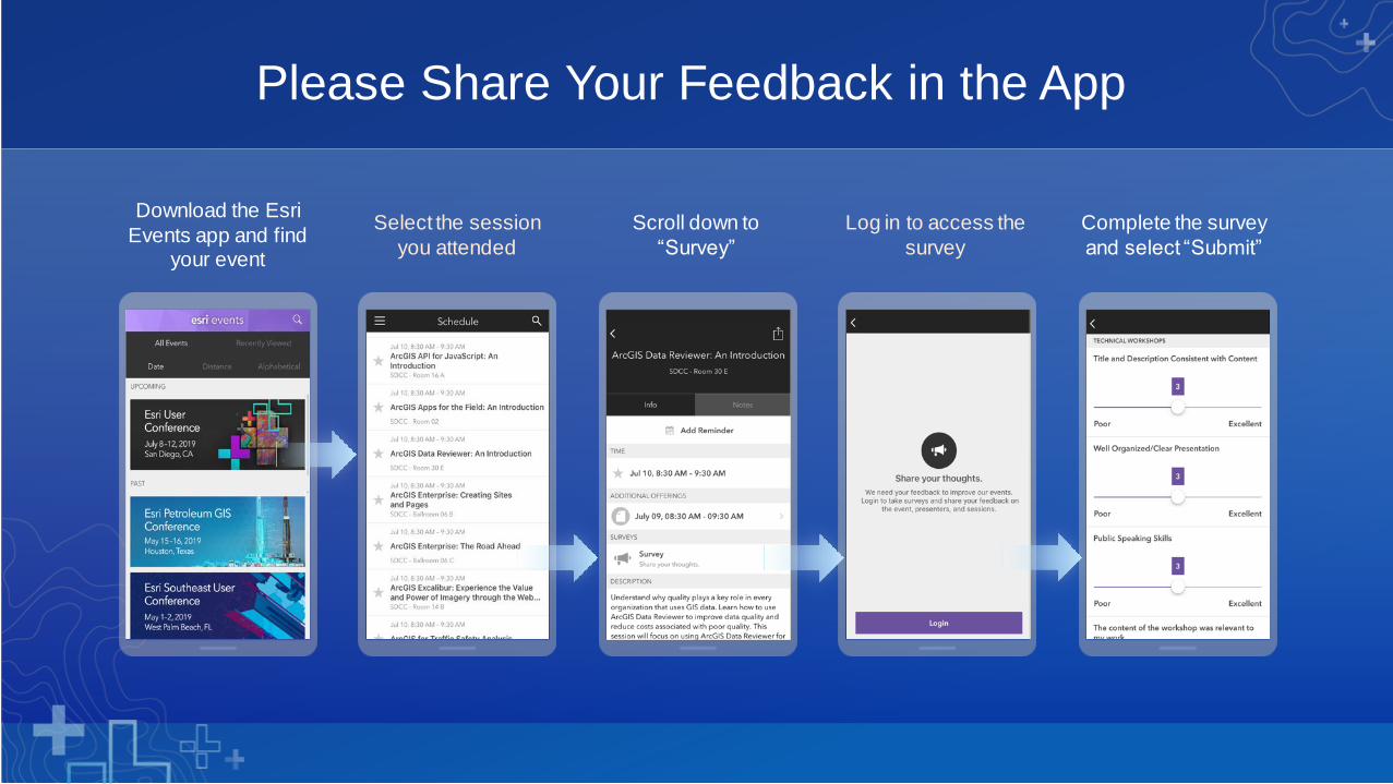
Download the Esri
Events app and find your event
Select the session
you attended
Scroll down to
“Survey”
Log in to access the
survey
Complete the survey
and select “Submit”
Please Share Your Feedback in the App


![[Fr] Atelier Open Data (Open Data workshop)](https://img.pdfslide.us/doc/110x75/558692fad8b42a4a7f8b4733/fr-atelier-open-data-open-data-workshop.jpg)