Embed Size (px)
Citation preview
Impervious Cover Reduction Action Plan
for
City of Vineland, Cumberland County, New Jersey
Prepared for the City of Vineland by the
Rutgers Cooperative Extension Water Resources Program
May 23, 2016

Table of Contents
Introduction ……………………………………………………………………………………… 1
Methodology …………………………………………………………………………………….. 1
Green Infrastructure Practices …………………………………………………………………… 8
Potential Project Sites ………………………………………………………………………….. 10
Conclusion ……………………………………………………………………………………... 11
Attachment: Climate Resilient Green Infrastructure
a. Green Infrastructure Sites
b. Proposed Green Infrastructure Concepts
c. Summary of Existing Conditions
d. Summary of Proposed Green Infrastructure Practices

1
Introduction
Located in Cumberland County New Jersey, the City of Vineland covers approximately 69 square
miles. Figures 1 and 2 illustrate that the City of Vineland is dominated by urban land uses. A total
of 36.6% of the municipality’s land use is classified as urban. Of the urban land in the City of
Vineland, rural residential is the dominant land use (Figure 3).
The New Jersey Department of Environmental Protection’s (NJDEP) 2012 land use/land cover
geographical information system (GIS) data layer categorizes the City of Vineland into many
unique land use areas, assigning a percent impervious cover for each delineated area. These
impervious cover values were used to estimate the impervious coverage for the City of Vineland.
Based upon the 2012 NJDEP land use/land cover data, approximately 11.4% of the City of
Vineland has impervious cover. This level of impervious cover suggests that the streams in the
City of Vineland are likely impacted.1
Methodology
The City of Vineland contains portions of eleven subwatersheds (Figure 4). For this impervious
cover reduction action plan, projects have been identified in three of these watersheds: the Maurice
River, Menantico Creek, and Parvin/Tarkiln Branch. Initially, aerial imagery was used to identify
potential project sites that contain extensive impervious cover. Field visits were then conducted
at each of these potential project sites to determine if a viable option exists to reduce impervious
cover or to disconnect impervious surfaces from draining directly to a local waterway or storm
sewer system. During the site visit, appropriate green infrastructure practices for the site were
determined. Sites that already had stormwater management practices in place were not considered.
1 Caraco, D., R. Claytor, P. Hinkle, H. Kwon, T. Schueler, C. Swann, S. Vysotsky, and J. Zielinski. 1998. Rapid
Watershed Planning Handbook. A Comprehensive Guide for Managing Urbanizing Watersheds. Prepared by Center
For Watershed Protection, Ellicott City, MD. Prepared for U.S. Environmental Protection Agency, Office of Wetlands,
Oceans and Watersheds and Region V. October 1998

2
Figure 1: Map illustrating the land use in the City of Vineland.
Land Use Types for the City of Vineland

3
Figure 2: Pie chart illustrating the land use in the City of Vineland.
Agriculture
13.8%
Barren Land
1.8%
Forest
32.7%Urban
36.6%
Water
0.7%
Wetlands
14.3%

4
Figure 3: Pie chart illustrating the various types of urban land use in the City of Vineland.

5
Figure 4: Map of the subwatersheds in the City of Vineland.
Subwatersheds of the City of Vineland

6
For each potential project site, specific aerial loading coefficients for commercial land use were
used to determine the annual runoff loads for total phosphorus (TP), total nitrogen (TN), and total
suspended solids (TSS) from impervious surfaces (Table 1). These are the same aerial loading
coefficients that NJDEP uses in developing total maximum daily loads (TMDLs) for impaired
waterways of the state. The percentage of impervious cover for each site was extracted from the
2012 NJDEP land use/land cover database. For impervious areas, runoff volumes were determined
for the water quality design storm (1.25 inches of rain over two-hours) and for the annual rainfall
total of 44 inches.
Preliminary soil assessments were conducted for each potential project site identified in the City
of Vineland using the United States Department of Agriculture Natural Resources Conservation
Service Web Soil Survey, which utilizes regional and statewide soil data to predict soil types in an
area. Several key soil parameters were examined (e.g., natural drainage class, saturated hydraulic
conductivity of the most limiting soil layer (Ksat), depth to water table, and hydrologic soil group)
to evaluate the suitability of each site’s soil for green infrastructure practices. In cases where
multiple soil types were encountered, the key soil parameters were examined for each soil type
expected at a site.
For each potential project site, drainage areas were determined for each of the green infrastructure
practices proposed at the site. These green infrastructure practices were designed to manage the
2-year design storm, enabling these practices to capture 95% of the annual rainfall. Runoff
volumes were calculated for each proposed green infrastructure practice. The reduction in TSS
loading was calculated for each drainage area for each proposed green infrastructure practice using
the aerial loading coefficients in Table 1. The maximum volume reduction in stormwater runoff
for each green infrastructure practice for a storm was determined by calculating the volume of
runoff captured from the 2-year design storm. For each green infrastructure practice, peak
discharge reduction potential was determined through hydrologic modeling in HydroCAD. For
each green infrastructure practice, a cost estimate is provided. These costs are based upon the
square footage of the green infrastructure practice and the real cost of green infrastructure practice
implementation in New Jersey.

7
Table 1: Aerial Loading Coefficients2
Land Cover TP load
(lbs/acre/yr)
TN load
(lbs/acre/yr)
TSS load
(lbs/acre/yr) High, Medium Density Residential
1.4
15
140
Low Density, Rural Residential
0.6
5
100
Commercial
2.1
22
200
Industrial
1.5
16
200
Urban, Mixed Urban, Other Urban
1.0
10
120
Agriculture
1.3
10
300
Forest, Water, Wetlands
0.1
3
40
Barren Land/Transitional Area
0.5
5
60
2 New Jersey Department of Environmental Protection (NJDEP), Stormwater Best Management Practice Manual,
2004.

8
Green Infrastructure Practices
Green infrastructure is an approach to stormwater management that is cost-effective, sustainable,
and environmentally friendly. Green infrastructure projects capture, filter, absorb, and reuse
stormwater to maintain or mimic natural systems and to treat runoff as a resource. As a general
principal, green infrastructure practices use soil and vegetation to recycle stormwater runoff
through infiltration and evapotranspiration. When used as components of a stormwater
management system, green infrastructure practices such as bioretention, green roofs, pervious
pavement, rain gardens, and vegetated swales can produce a variety of environmental benefits. In
addition to effectively retaining and infiltrating rainfall, these practices can simultaneously help
filter air pollutants, reduce energy demands, mitigate urban heat islands, and sequester carbon
while also providing communities with aesthetic and natural resource benefits3. A wide range of
green infrastructure practices have been evaluated for the potential project sites in Vineland. Each
practice is discussed below.
Disconnected downspouts
This is often referred to as simple disconnection. A downspout is simply
disconnected, prevented from draining directly to the roadway or storm
sewer system, and directed to discharge water to a pervious area (i.e., lawn).
Pervious pavements
There are several types of permeable pavement systems including porous asphalt, pervious
concrete, permeable pavers, and grass pavers. These surfaces are hard and support vehicle traffic
but also allow water to infiltrate through the surface. They have an underlying stone layer to store
stormwater runoff and allow it to slowly seep into the ground.
3 United States Environmental Protection Agency (USEPA), 2013. Watershed Assessment, Tracking, and
Environmental Results, New Jersey Water Quality Assessment Report.
http://ofmpub.epa.gov/waters10/attains_state.control?p_state=NJ

9
Bioretention systems/rain gardens
These are landscaped features that are designed to capture, treat, and
infiltrate stormwater runoff. These systems can easily be incorporated into
existing landscapes, improving aesthetics and creating wildlife habitat
while managing stormwater runoff. Bioretention systems also can be used
in soils that do not quickly infiltrate by incorporating an underdrain into the
system.
Downspout planter boxes
These are wooden boxes with plants installed at the
base of a downspout that provide an opportunity to
beneficially reuse rooftop runoff.
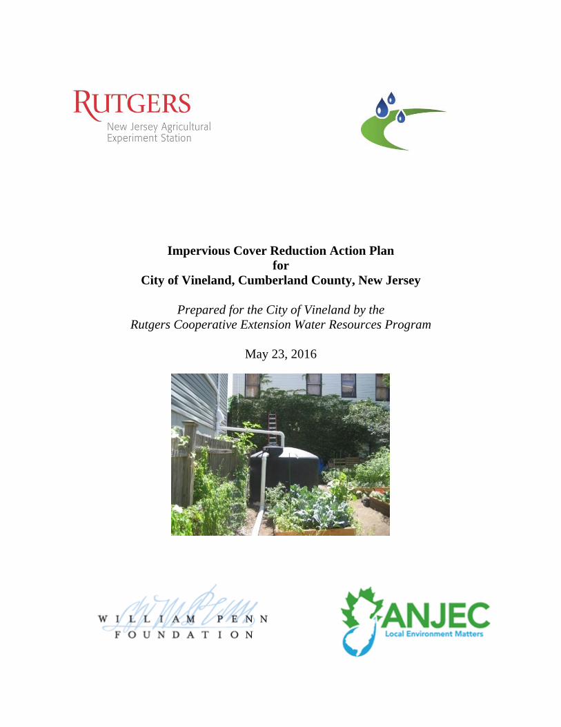
Rainwater harvesting systems (cistern or rain barrel)
These systems capture rainwater, mainly from rooftops, in cisterns or rain barrels. The water can
then be used for watering gardens, washing vehicles, or for other non-potable uses.
Bioswale
Bioswales are landscape features that convey stormwater from one
location to another while removing pollutants and providing water an
opportunity to infiltrate.

10
Stormwater planters
Stormwater planters are vegetated structures that are built into the
sidewalk to intercept stormwater runoff from the roadway or
sidewalk. Many of these planters are designed to allow the water to
infiltrate into the ground while others are designed simply to filter the
water and convey it back into the stormwater sewer system.
Tree filter boxes
These are pre-manufactured concrete boxes that contain a special soil
mix and are planted with a tree or shrub. They filter stormwater runoff
but provide little storage capacity. They are typically designed to
quickly filter stormwater and then discharge it to the local sewer
system.
Potential Project Sites
Attachment 1 contains information on potential project sites where green infrastructure practices
could be installed. The recommended green infrastructure practice and the drainage area that the
green infrastructure practice can treat are identified for each potential project site. For each
practice, the recharge potential, TSS removal potential, maximum volume reduction potential per
storm, and the peak reduction potential are provided. This information is also provided so that
proposed development projects that cannot satisfy the New Jersey stormwater management
requirements for major development can use one of the identified projects to offset a stormwater
management deficit. 4
4 New Jersey Administrative Code, N.J.A.C. 7:8, Stormwater Management, Statutory Authority: N.J.S.A. 12:5-3,
13:1D-1 et seq., 13:9A-1 et seq., 13:19-1 et seq., 40:55D-93 to 99, 58:4-1 et seq., 58:10A-1 et seq., 58:11A-1 et seq.
and 58:16A-50 et seq., Date last amended: April 19, 2010.

11
Conclusion
This impervious cover reduction action plan is meant to provide the municipality with a blueprint
for implementing green infrastructure practices that will reduce the impact of stormwater runoff
from impervious surfaces. These projects can be implemented by a wide variety of people such
as boy scouts, girl scouts, school groups, faith-based groups, social groups, watershed groups, and
other community groups.
Additionally, development projects that are in need of providing off-site compensation for
stormwater impacts can use the projects in this plan as a starting point. The municipality can
quickly convert this impervious cover reduction action plan into a stormwater mitigation plan and
incorporate it into the municipal stormwater control ordinance.

a. Green Infrastructure Sites

SITES WITHIN THE MAURICE RIVER
SUBWATERSHED:
1. Landis Intermediate School
2. Vineland Fire Department
SITES WITHIN THE MENANTICO CREEK
SUBWATERSHED:
3. Chestnut Assembly of God
4. South Vineland Methodist Church
5. Vineland High School
SITES WITHIN THE PARVIN
BRANCH/TARKILN BRANCH
SUBWATERSHED:
6. Magnolia Shopping Court
7. Vine Haven Adventist School
8. Vineland Learning Complex
9. Vineland Public Library
10. Vineland YMCA

b. Proposed Green Infrastructure Concepts

LANDIS INTERMEDIATE SCHOOL
Subwatershed:
Site Area:
Address:
Block and Lot:
Rain gardens lining the sidewalks can direct and infiltrate stormwater away from the school. Parking spots can be replaced with
pervious pavement to infiltrate stormwater and reduce erosion. Downspouts can be directed to downspout planter boxes and a rain
barrel to capture roof runoff. A preliminary soil assessment suggests that the soils have suitable drainage characteristics for green
infrastructure.
Recommended Green
Infrastructure Practices
Recharge
Potential
(Mgal/yr)
TSS Removal
Potential (lbs/yr)
Maximum Volume
Reduction Potential
(gal/storm)
Peak Discharge
Reduction Potential
(cu. ft./second)
Estimated
Size (sq. ft.)
Estimated
Cost
Bioretention systems 0.047 8 3,441 0.09 1,961 $9,805
Pervious pavement 0.357 60 26,180 0.71 3,060 $76,500
Planter boxes 0.011 2 n/a n/a 24 $2,000
Rainwater harvesting 0.004 1 100 0.01 100 (gal) $200
Impervious CoverExisting Loads from
Impervious Cover (lbs/yr)Runoff Volume from Impervious Cover (Mgal)
% sq. ft. TP TN TSS For the 1.25" Water Quality Storm For an Annual Rainfall of 44"
59 527,044 25.4 266.2 2,419.9 0.411 14.46
Maurice River
888,234 sq. ft.
61 West Landis Avenue
Vineland, NJ 08360
Block 3602, Lot 8


VINELAND FIRE DEPARTMENT
Subwatershed:
Site Area:
Address:
Block and Lot:
Stormwater is currently directed to a small garden on the south side of the building and to the sidewalk. Downspouts can be directed to a
cistern on the west side of the building to capture rainwater, which can be used for washing the firetrucks. A preliminary soil assessment
suggests that the soils have suitable drainage characteristics for green infrastructure.
Recommended Green
Infrastructure Practices
Recharge
Potential
(Mgal/yr)
TSS Removal
Potential (lbs/yr)
Maximum Volume
Reduction Potential
(gal/storm)
Peak Discharge
Reduction Potential
(cu. ft./second)
Estimated
Size (sq. ft.)
Estimated
Cost
Rainwater harvesting 0.046 8 1,000 0.09 1,000 (gal) $2,000
Impervious CoverExisting Loads from
Impervious Cover (lbs/yr)Runoff Volume from Impervious Cover (Mgal)
% sq. ft. TP TN TSS For the 1.25" Water Quality Storm For an Annual Rainfall of 44"
94 42,380 2.0 21.4 194.6 0.033 1.16
Maurice River
45,000 sq. ft.
110 North 4th Street
Vineland, NJ 08360
Block 2914, Lots 8-12


CHESTNUT ASSEMBLY OF GOD
Subwatershed:
Site Area:
Address:
Block and Lot:
Stormwater is currently directed to the parking lot and retention basins on the east and west side of the property. Parking spots by the
southeastern side of the building can be replaced with pervious pavement to capture and infiltrate stormwater. Downspouts can be
disconnected and directed to a rain garden adjacent to the building, which can capture, treat, and infiltrate roof runoff. A preliminary soil
assessment suggests that the soils have very suitable drainage characteristics for green infrastructure.
Recommended Green
Infrastructure Practices
Recharge
Potential
(Mgal/yr)
TSS Removal
Potential (lbs/yr)
Maximum Volume
Reduction Potential
(gal/storm)
Peak Discharge
Reduction Potential
(cu. ft./second)
Estimated
Size (sq. ft.)
Estimated
Cost
Bioretention system 0.183 31 13,404 0.36 1,755 $8,775
Pervious pavement 0.835 140 61,261 1.67 10,820 $270,500
Impervious CoverExisting Loads from
Impervious Cover (lbs/yr)Runoff Volume from Impervious Cover (Mgal)
% sq. ft. TP TN TSS For the 1.25" Water Quality Storm For an Annual Rainfall of 44"
21 238,673 11.5 120.5 1,095.8 0.186 6.55
Menantico Creek
1,124,291 sq. ft.
2554 East Chestnut Avenue
Vineland, NJ 08361
Block 4405, Lot 30


Subwatershed:
Site Area:
Address:
Block and Lot:
Stormwater is currently directed to the parking lot which connects to one storm drain on the property. Parking spots by the west and south
side of the building can be replaced with pervious pavement to capture and infiltrate stormwater. Downspout planter boxes can be installed
in the front of the building to capture rooftop runoff. A preliminary soil assessment suggests that the soils have suitable drainage
characteristics for green infrastructure.
Recommended Green
Infrastructure Practices
Recharge
Potential
(Mgal/yr)
TSS Removal
Potential (lbs/yr)
Maximum Volume
Reduction Potential
(gal/storm)
Peak Discharge
Reduction Potential
(cu. ft./second)
Estimated
Size (sq. ft.)
Estimated
Cost
Pervious pavement 0.610 102 13,404 0.36 4,400 $110,000
Planter boxes 0.011 2 n/a n/a 24 $2,000
Impervious CoverExisting Loads from
Impervious Cover (lbs/yr)Runoff Volume from Impervious Cover (Mgal)
% sq. ft. TP TN TSS For the 1.25" Water Quality Storm For an Annual Rainfall of 44"
68 51,663 2.5 26.1 237.2 0.040 1.42
Menantico Creek
75,673 sq. ft.
2724 South Main Road
Vineland, NJ 08361
Block 6701, Lot 42
SOUTH VINELAND UNITED METHODIST CHURCH


VINELAND HIGH SCHOOL
Subwatershed:
Site Area:
Address:
Block and Lot:
Parking spots in the south building lot can be replaced with pervious pavement to capture and infiltrate stormwater. Installing a rain
garden adjacent to the tennis courts can capture, treat, and infiltrate runoff as well as provide educational opportunities for students. A
preliminary soil assessment suggests that the soils have suitable drainage characteristics for green infrastructure.
Recommended Green
Infrastructure Practices
Recharge
Potential
(Mgal/yr)
TSS Removal
Potential (lbs/yr)
Maximum Volume
Reduction Potential
(gal/storm)
Peak Discharge
Reduction Potential
(cu. ft./second)
Estimated
Size (sq. ft.)
Estimated
Cost
Bioretention system 0.724 121 53,130 1.44 6,000 $30,000
Pervious pavement 2.428 407 178,114 4.84 20,000 $500,000
Impervious CoverExisting Loads from
Impervious Cover (lbs/yr)Runoff Volume from Impervious Cover (Mgal)
% sq. ft. TP TN TSS For the 1.25" Water Quality Storm For an Annual Rainfall of 44"
41 1,161,650 56.0 586.7 5,333.6 0.905 31.86
Menantico Creek
2,858,937 sq. ft.
2800 East Chestnut Avenue
Vineland, NJ 08361
Block 4501, Lot 42


MAGNOLIA SHOPPING COURT
Subwatershed:
Site Area:
Address:
Block and Lot:
Stormwater is currently directed to the parking lot which connects to multiple storm drains. Parking spots on the northern side of the
parking lot can be replaced with pervious pavement to capture and infiltrate stormwater. A rain garden adjacent to the building can
capture, treat, and infiltrate roof runoff as well as reduce ponding on the property. A preliminary soil assessment suggests that the soils
have suitable drainage characteristics for green infrastructure.
Recommended Green
Infrastructure Practices
Recharge
Potential
(Mgal/yr)
TSS Removal
Potential (lbs/yr)
Maximum Volume
Reduction Potential
(gal/storm)
Peak Discharge
Reduction Potential
(cu. ft./second)
Estimated
Size (sq. ft.)
Estimated
Cost
Bioretention system 0.081 14 5,924 0.16 750 $3,750
Pervious pavement 0.220 37 16,164 0.44 2,170 $54,250
Impervious CoverExisting Loads from
Impervious Cover (lbs/yr)Runoff Volume from Impervious Cover (Mgal)
% sq. ft. TP TN TSS For the 1.25" Water Quality Storm For an Annual Rainfall of 44"
89 69,079 3.3 34.9 317.2 0.054 1.89
Parvin / Tarkiln Branch
77,344 sq. ft.
1370 South Main Road
Vineland, NJ 08360
Block 5804, Lot 18


VINE HAVEN ADVENTIST SCHOOL
Subwatershed:
Site Area:
Address:
Block and Lot:
Sections of the courtyard can be replaced with pervious pavement to intercept and infiltrate stormwater. A preliminary soil assessment
suggests that the soils have suitable drainage characteristics for green infrastructure.
Impervious CoverExisting Loads from
Impervious Cover (lbs/yr)Runoff Volume from Impervious Cover (Mgal)
% sq. ft. TP TN TSS For the 1.25" Water Quality Storm For an Annual Rainfall of 44"
19 53,194 2.6 26.9 244.2 0.041 1.46
Parvin / Tarkiln Branch
286,845 sq. ft.
1155 East Landis Avenue
Vineland, NJ 08360
Block 4211, Lot 3
Recommended Green
Infrastructure Practices
Recharge
Potential
(Mgal/yr)
TSS Removal
Potential (lbs/yr)
Maximum Volume
Reduction Potential
(gal/storm)
Peak Discharge
Reduction Potential
(cu. ft./second)
Estimated
Size (sq. ft.)
Estimated
Cost
Pervious pavement 0.223 37 13,494 0.37 2,400 $60,000


VINELAND LEARNING COMPLEX
Subwatershed:
Site Area:
Address:
Block and Lot:
Parking spaces can be replaced with porous asphalt to infiltrate stormwater. Installing rain gardens can capture, treat, and infiltrate roof
runoff. Rainwater can be harvested into a cistern at the rear of the building for watering plants. Downspout planter boxes can be installed
along the building to reuse rooftop runoff. A preliminary soil assessment suggests that the soils have suitable drainage characteristics for
green infrastructure.
Recommended Green
Infrastructure Practices
Recharge
Potential
(Mgal/yr)
TSS Removal
Potential (lbs/yr)
Maximum Volume
Reduction Potential
(gal/storm)
Peak Discharge
Reduction Potential
(cu. ft./second)
Estimated
Size (sq. ft.)
Estimated
Cost
Bioretention systems 0.229 38 16,815 0.46 2,200 $11,000
Pervious pavement 0.388 65 28,454 0.77 3,900 $97,500
Planter boxes 0.034 6 n/a n/a 72 $6,000
Rainwater harvesting 0.036 6 1,000 0.07 1,000 (gal) $2,000
Impervious CoverExisting Loads from
Impervious Cover (lbs/yr)Runoff Volume from Impervious Cover (Mgal)
% sq. ft. TP TN TSS For the 1.25" Water Quality Storm For an Annual Rainfall of 44"
75 308,281 14.9 155.7 1,415.4 0.240 8.46
Parvin / Tarkiln Branch
412,321 sq. ft.
301 Southeast Boulevard
Vineland, NJ 08360
Block 4009, Lots 6


VINELAND PUBLIC LIBRARY
Subwatershed:
Site Area:
Address:
Block and Lot:
Stormwater is currently directed through connected downspouts to eight storm drains on the property. Parking spots by the north and
west side of the building can be replaced with pervious pavement to capture and infiltrate stormwater. Downspouts can be disconnected
and directed to rain gardens adjacent to the building, which can capture, treat, and infiltrate roof runoff as well as provide an educational
opportunity. A preliminary soil assessment suggests that the soils have very suitable drainage characteristics for green infrastructure.
Recommended Green
Infrastructure Practices
Recharge
Potential
(Mgal/yr)
TSS Removal
Potential (lbs/yr)
Maximum Volume
Reduction Potential
(gal/storm)
Peak Discharge
Reduction Potential
(cu. ft./second)
Estimated
Size (sq. ft.)
Estimated
Cost
Bioretention systems 0.126 21 18,535 0.50 1,390 $6,950
Pervious pavement 0.536 90 39,307 1.07 3,400 $85,000
Impervious CoverExisting Loads from
Impervious Cover (lbs/yr)Runoff Volume from Impervious Cover (Mgal)
% sq. ft. TP TN TSS For the 1.25" Water Quality Storm For an Annual Rainfall of 44"
65 58,744 2.8 29.7 269.7 0.046 1.61
Parvin / Tarkiln Branch
90,238 sq. ft.
1058 East Landis Avenue
Vineland, NJ 08360
Block 3116, Lot 27


VINELAND YMCA
Subwatershed:
Site Area:
Address:
Block and Lot:
Stormwater is currently directed to a parking lot which connects to multiple storm drains. Parking spots on the west side of the parking lot
can be replaced with pervious pavement to capture and infiltrate stormwater. A preliminary soil assessment suggests that the soils have
suitable drainage characteristics for green infrastructure.
Impervious CoverExisting Loads from
Impervious Cover (lbs/yr)Runoff Volume from Impervious Cover (Mgal)
% sq. ft. TP TN TSS For the 1.25" Water Quality Storm For an Annual Rainfall of 44"
51 118,923 5.7 60.1 546.0 0.093 3.26
Parvin / Tarkiln Branch
231,254 sq. ft.
1159 East Landis Avenue
Vineland, NJ 08360
Block 4211, Lot 4
Recommended Green
Infrastructure Practices
Recharge
Potential
(Mgal/yr)
TSS Removal
Potential (lbs/yr)
Maximum Volume
Reduction Potential
(gal/storm)
Peak Discharge
Reduction Potential
(cu. ft./second)
Estimated
Size (sq. ft.)
Estimated
Cost
Pervious pavement 0.507 85 37,198 1.01 4,900 $122,500


c. Summary of Existing Conditions

Summary of Existing Site Conditions
I.C. I.C. Water Quality Storm
Subwatershed/Site Name/Total Site Info/GI Practice Area Area Block Lot TP TN TSS I.C. Area Area (1.25" over 2-hours) Annual(ac) (SF) (lb/yr) (lb/yr) (lb/yr) % (ac) (SF) (Mgal) (Mgal)
MAURICE RIVER SUBWATERSHED 21.42 933,234 27.5 287.6 2,614.4 13.07 569,424 0.444 15.62
Landis Intermediate SchoolTotal Site Info 20.39 888,234 3602 8 25.4 266.2 2,419.9 59 12.10 527,044 0.411 14.46
Vineland Fire Department Total Site Info 1.03 45,000 2914 8, 9, 10, 11,12 2.0 21.4 194.6 94 0.97 42,380 0.033 1.16
MENANTICO CREEK SUBWATERSHED 93.18 4,058,901 70.0 733.3 6,666.6 33.33 1,451,986 1.131 39.82
Chestnut Assembly of GodTotal Site Info 25.81 1,124,291 4405 30 11.5 120.5 1,095.8 21 5.48 238,673 0.186 6.55
South Vineland United Methodist ChurchTotal Site Info 1.74 75,673 6707 42 2.5 26.1 237.2 68 1.19 51,663 0.040 1.42
Vineland High SchoolTotal Site Info 65.63 2,858,937 4501 42 56.0 586.7 5,333.6 41 26.67 1,161,650 0.905 31.86
PARVIN BRANCH / TARKILN BRANCH SUBWATERSHED 25.21 1,098,002 29.3 307.2 2,792.6 13.96 608,221 0.474 16.68
Magnolia Shopping CourtTotal Site Info 1.78 77,344 5804 18 3.3 34.9 317.2 89 1.59 69,079 0.054 1.89
Vine Haven Adventist SchoolTotal Site Info 6.59 286,845 4211 3 2.6 26.9 244.2 19 1.22 53,194 0.041 1.46
Vineland Learning ComplexTotal Site Info 9.47 412,321 4009 6 14.9 155.7 1,415.4 75 7.08 308,281 0.240 8.46
Vineland Public LibraryTotal Site Info 2.07 90,238 3116 27 2.8 29.7 269.7 65 1.35 58,744 0.046 1.61
Vineland YMCATotal Site Info 5.31 231,254 4211 4 5.7 60.1 546.0 51 2.73 118,923 0.093 3.26
Existing Annual LoadsRunoff Volumes from I.C.
1

d. Summary of Proposed Green Infrastructure Practices

Summary of Proposed Green Infrastructure Practices
Max Volume Peak DischargeRecharge TSS Removal Reduction Reduction Size of Unit Total I.C.
Subwatershed/Site Name/Total Site Info/GI Practice Area Area Potential Potential Potential Potential BMP Cost Unit Cost Treated(SF) (ac) (Mgal/yr) (lbs/yr) (gal/storm) (cfs) (SF) ($) ($) %
MAURICE RIVER SUBWATERSHED 17,862 0.41 0.465 78 30,721 0.90 6,145 $90,505 3.1%
1 Landis Intermediate SchoolBioretention systems 1,800 0.04 0.047 8 3,441 0.09 1,961 5 SF $9,805 0.3%Pervious pavement 13,700 0.31 0.357 60 26,180 0.71 3,060 25 SF $76,500 2.6%Planter boxes 430 0.01 0.011 2 n/a n/a 24 1,000 box $2,000 0.1%Rainwater harvesting 172 0.00 0.004 1 100 0.01 100 2 gal $200 0.0%Total Site Info 16,102 0.37 0.420 70 29,721 0.81 5,145 $88,505 3.1%
2 Vineland Fire Department Rainwater harvesting 1,760 0.04 0.046 8 1,000 0.09 1,000 2 gal $2,000 4.2%Total Site Info 1,760 0.04 0.046 8 1,000 0.09 1,000 $2,000 4.2%
MENANTICO CREEK SUBWATERSHED 183,900 4.22 4.792 802 319,313 8.67 42,999 $921,275 12.7%
3 Chestnut Assembly of GodBioretention system 7,015 0.16 0.183 31 13,404 0.36 1,755 5 SF $8,775 2.9%Pervious pavement 32,055 0.74 0.835 140 61,261 1.67 10,820 25 SF $270,500 13.4%Total Site Info 39,070 0.90 1.018 170 74,665 2.03 12,575 $279,275 16.4%
4 South Vineland United Methodist ChurchPervious pavement 23,400 0.54 0.610 102 13,404 0.36 4,400 25 SF $110,000 45.3%Planter boxes 430 0.01 0.011 2 n/a n/a 24 1,000 box $2,000 0.8%Total Site Info 23,830 0.55 0.621 104 13,404 0.36 4,424 $112,000 46.1%
5 Vineland High SchoolBioretention system 27,800 0.64 0.724 121 53,130 1.44 6,000 5 SF $30,000 2.4%Pervious pavement 93,200 2.14 2.428 407 178,114 4.84 20,000 25 SF $500,000 8.0%Total Site Info 121,000 2.78 3.153 528 231,244 6.28 26,000 $530,000 10.4%
PARVIN BRANCH / TARKILN BRANCH SUBWATERSHED 91,335 2.10 2.380 398 158,356 4.35 22,182 $448,950 15.0%
6 Magnolia Shopping CourtBioretention system 3,100 0.07 0.081 14 5,924 0.16 750 5 SF $3,750 4.5%Pervious pavement 8,460 0.19 0.220 37 16,164 0.44 2,170 25 SF $54,250 12.2%Total Site Info 11,560 0.27 0.301 50 22,088 0.60 2,920 $58,000 16.7%
Potential Management Area
1

Summary of Proposed Green Infrastructure Practices
Max Volume Peak DischargeRecharge TSS Removal Reduction Reduction Size of Unit Total I.C.
Subwatershed/Site Name/Total Site Info/GI Practice Area Area Potential Potential Potential Potential BMP Cost Unit Cost Treated(SF) (ac) (Mgal/yr) (lbs/yr) (gal/storm) (cfs) (SF) ($) ($) %
Potential Management Area
7 Vine Haven Adventist SchoolPervious pavement 8,560 0.20 0.223 37 13,494 0.37 2,400 25 SF $60,000 16.1%Total Site Info 8,560 0.20 0.223 37 13,494 0.37 2,400 $60,000 16.1%
8 Vineland Learning ComplexBioretention systems 8,800 0.20 0.229 38 16,815 0.46 2,200 5 SF $11,000 2.9%Pervious pavement 14,890 0.34 0.388 65 28,454 0.77 3,900 25 SF $97,500 4.8%Planter boxes 1,290 0.03 0.034 6 n/a n/a 72 1,000 box $6,000 0.4%Rainwater harvesting 1,380 0.03 0.036 6 1,000 0.07 1,000 2 gal $2,000 0.4%Total Site Info 26,360 0.61 0.687 115 46,269 1.30 7,172 $116,500 8.6%
9 Vineland Public LibraryBioretention systems 4,820 0.11 0.126 21 18,535 0.50 1,390 5 SF $6,950 8.2%Pervious pavement 20,570 0.47 0.536 90 39,307 1.07 3,400 25 SF $85,000 35.0%Total Site Info 25,390 0.58 0.662 111 39,307 1.07 4,790 $91,950 43.2%
10 Vineland YMCAPervious pavement 19,465 0.45 0.507 85 37,198 1.01 4,900 25 SF $122,500 16.4%Total Site Info 19,465 0.45 0.507 85 37,198 1.01 4,900 $122,500 16.4%
2