Embed Size (px)
Citation preview
Imagery Intelligence –IMINTRAF Aerial Imagery of the Atlantic Wall
Imagery Analysis seen from a Current Perspective
RAVERSIJDE, 23/05/14
Comandant d’Aviation Alain Vecchiato,Intelligence & Security General Service
Imagery Section SGRS-I/G OPS
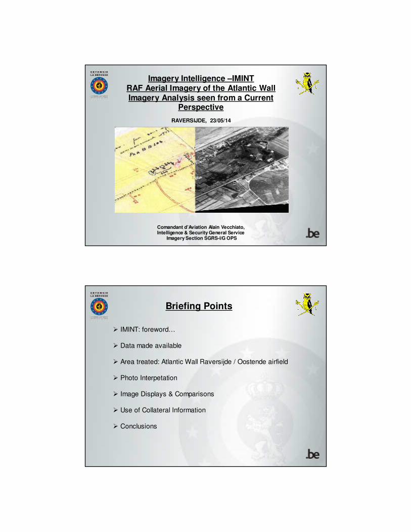
� IMINT: foreword…
� Data made available
� Area treated: Atlantic Wall Raversijde / Oostende airfield
� Photo Interpetation
� Image Displays & Comparisons
� Use of Collateral Information
� Conclusions
Briefing Points
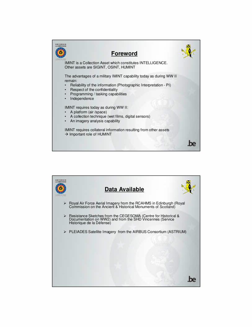
Foreword
IMINT is a Collection Asset which constitutes INTELLIGENCE.Other assets are SIGINT, OSINT, HUMINT
The advantages of a military IMINT capability today as during WW II
remain:• Reliability of the information (Photographic Interpretation - PI)
• Respect of the confidentiality• Programming / tasking capabilities
• Independence
IMINT requires today as during WW II:
• A platform (air /space)• A collection technique (wet films, digital sensors)
• An imagery analysis capability
IMINT requires collateral information resulting from other assets� Important role of HUMINT
Data Available
� Royal Air Force Aerial Imagery from the RCAHMS in Edinburgh (Royal Commission on the Ancient & Historical Monuments of Scotland)
� Resistance Sketches from the CEGESOMA (Centre for Historical & Documentation on WW2) and from the SHD Vincennes (Service Historique de la Défense)
� PLEIADES Satellite Imagery from the AIRBUS Consortium (ASTRIUM)
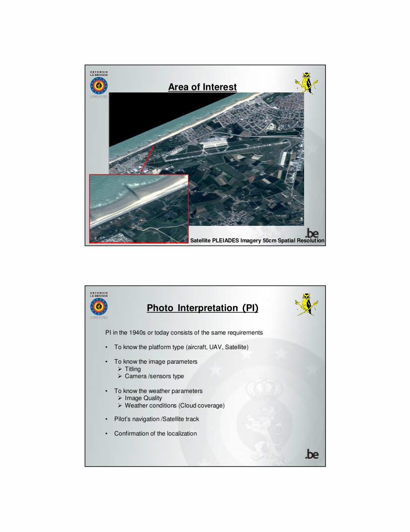
Area of Interest
Satellite PLEIADES Imagery 50cm Spatial Resolution
Photo Interpretation (PI)
PI in the 1940s or today consists of the same requirements
• To know the platform type (aircraft, UAV, Satellite)
• To know the image parameters
� Titling� Camera /sensors type
• To know the weather parameters� Image Quality
� Weather conditions (Cloud coverage)
• Pilot’s navigation /Satellite track
• Confirmation of the localization
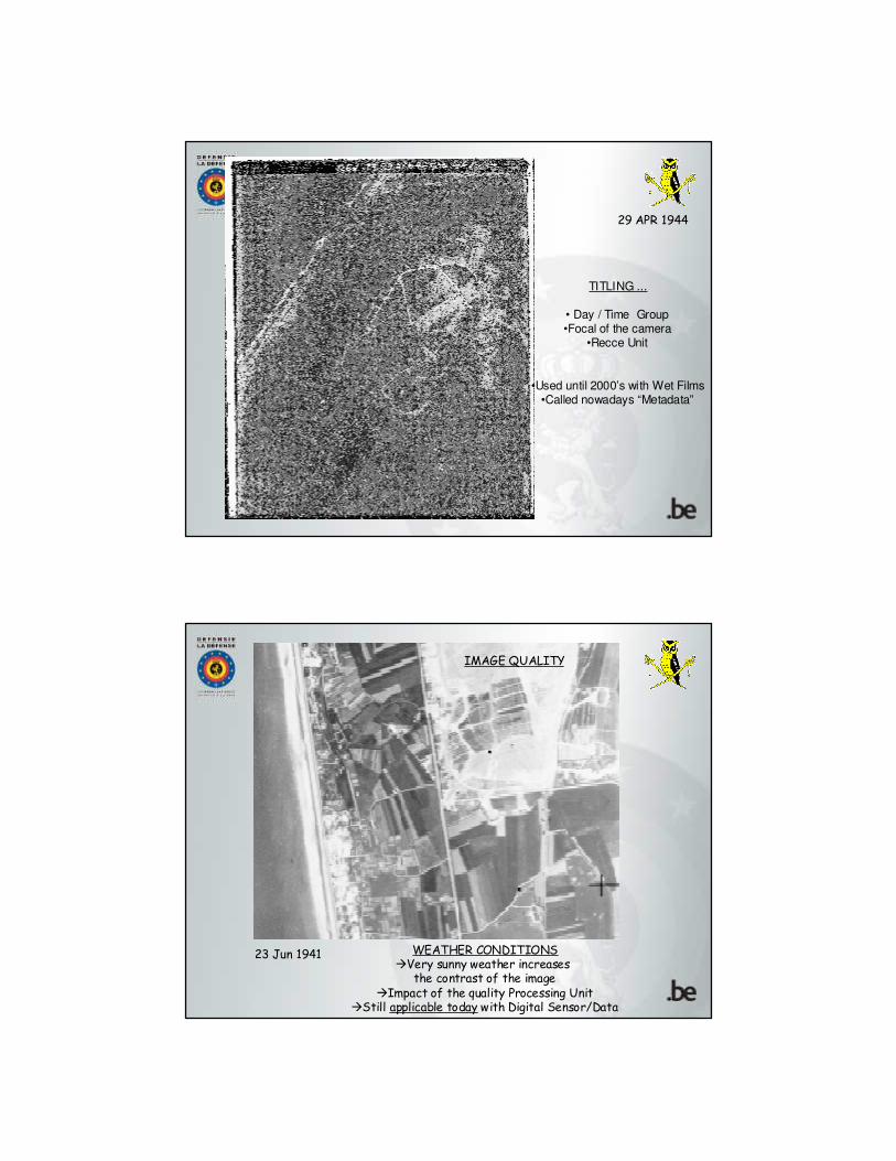
29 APR 1944
TITLING ...
• Day / Time Group•Focal of the camera
•Recce Unit
•Used until 2000’s with Wet Films•Called nowadays “Metadata”
23 Jun 1941 WEATHER CONDITIONS�Very sunny weather increases
the contrast of the image�Impact of the quality Processing Unit
�Still applicable today with Digital Sensor/Data
IMAGE QUALITY
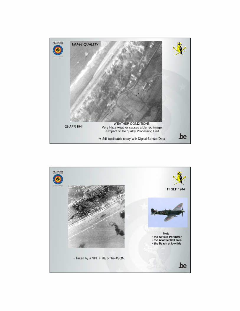
29 APR 1944WEATHER CONDITIONS
Very Hazy weather causes a blurred image�Impact of the quality Processing Unit
� Still applicable today with Digital Sensor/Data
IMAGE QUALITY
11 SEP 1944
• Taken by a SPITFIRE of the 4SQN.
Note:
• the Airfield Perimeter• the Atlantic Wall area
• the Beach at low tide
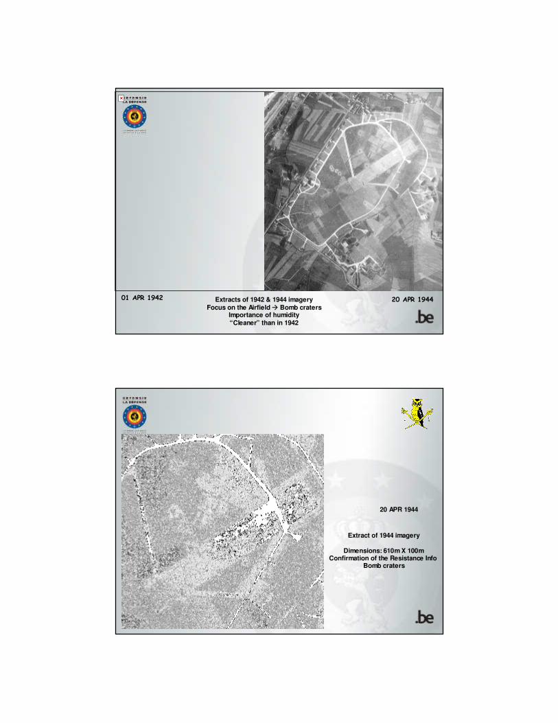
01 APR 1942 20 APR 1944Extracts of 1942 & 1944 imagery
Focus on the Airfield � Bomb cratersImportance of humidity
“Cleaner” than in 1942
20 APR 1944
Extract of 1944 imagery
Dimensions: 610m X 100mConfirmation of the Resistance Info
Bomb craters
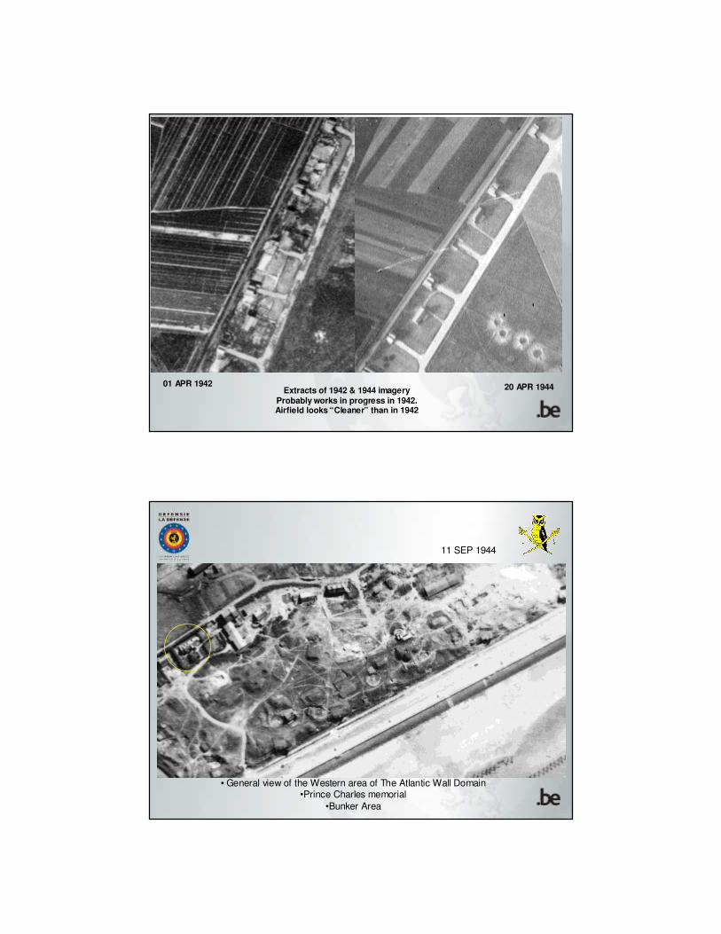
01 APR 1942 20 APR 1944Extracts of 1942 & 1944 imagery
Probably works in progress in 1942.Airfield looks “Cleaner” than in 1942
11 SEP 1944
• General view of the Western area of The Atlantic Wall Domain•Prince Charles memorial
•Bunker Area
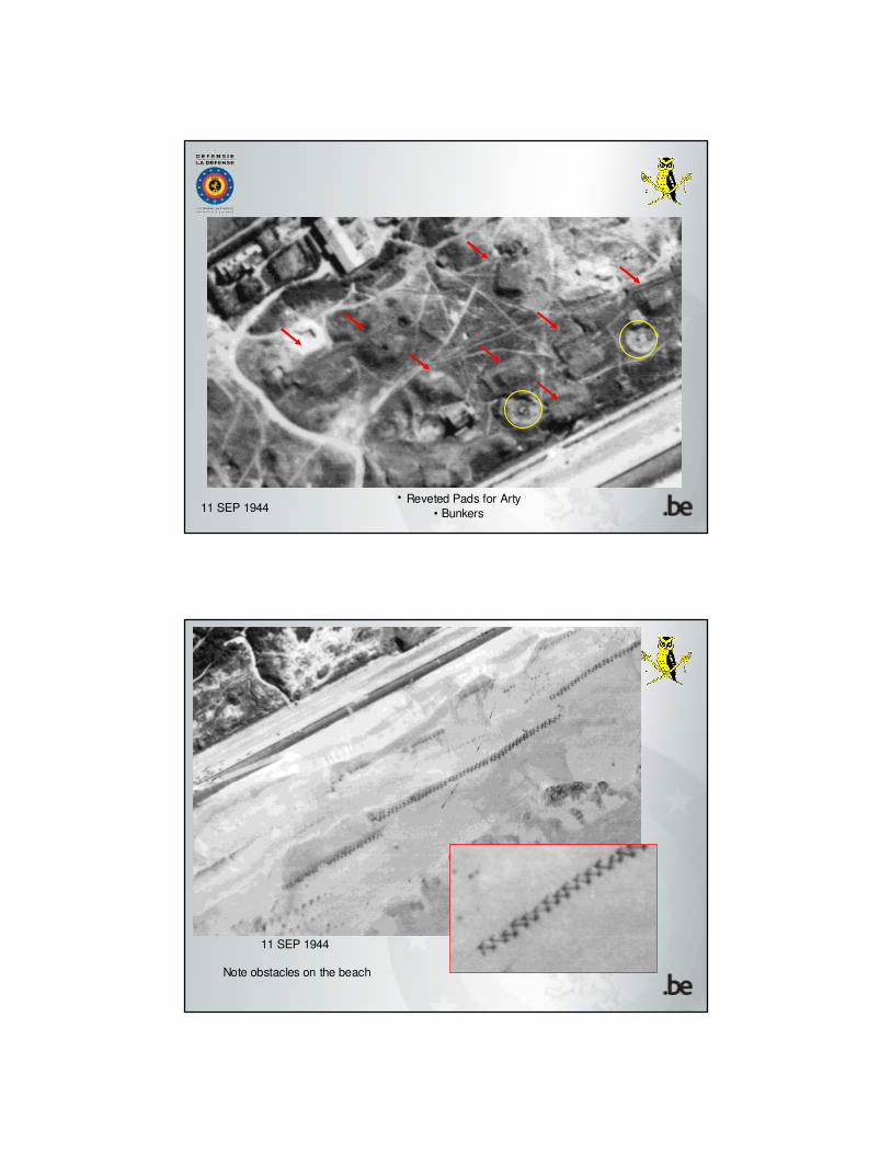
11 SEP 1944• Reveted Pads for Arty
• Bunkers
11 SEP 1944
Note obstacles on the beach
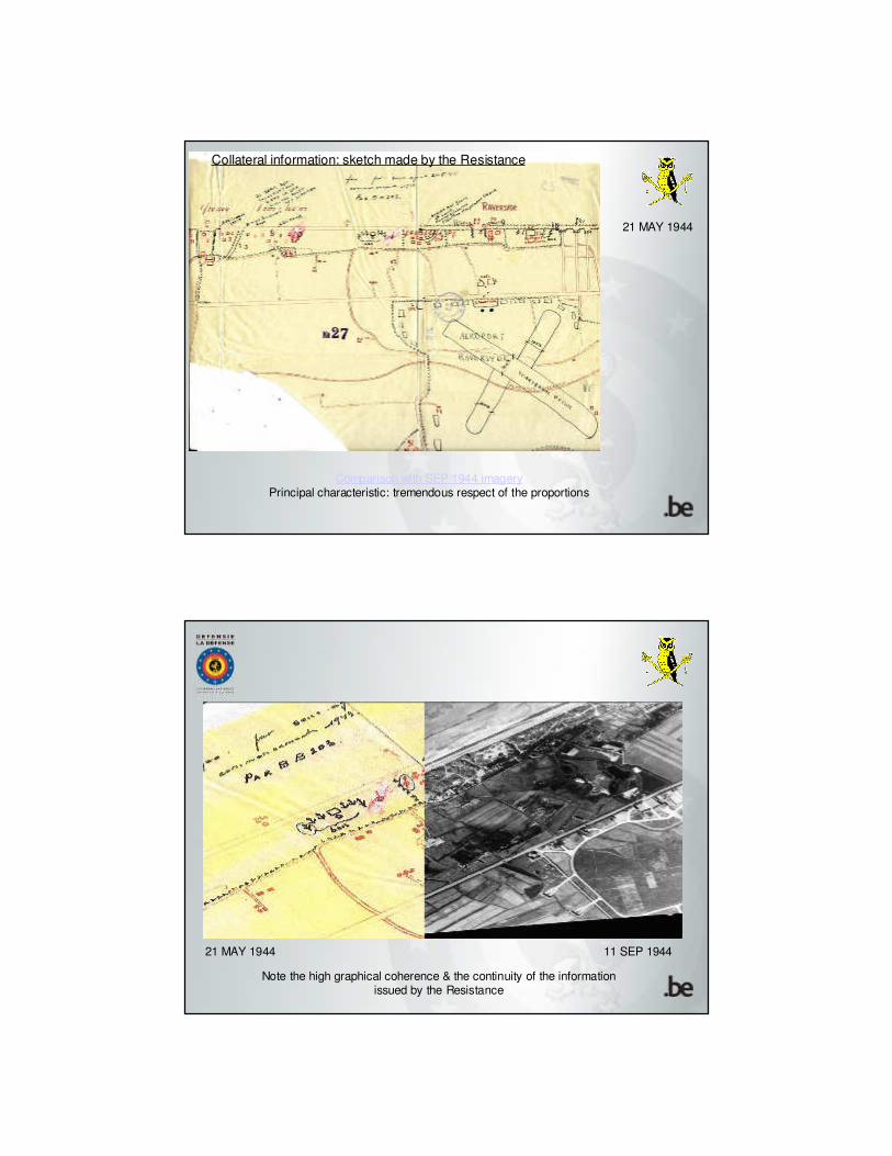
Comparison with SEP 1944 imageryPrincipal characteristic: tremendous respect of the proportions
21 MAY 1944
Collateral information: sketch made by the Resistance
Note the high graphical coherence & the continuity of the information issued by the Resistance
11 SEP 194421 MAY 1944
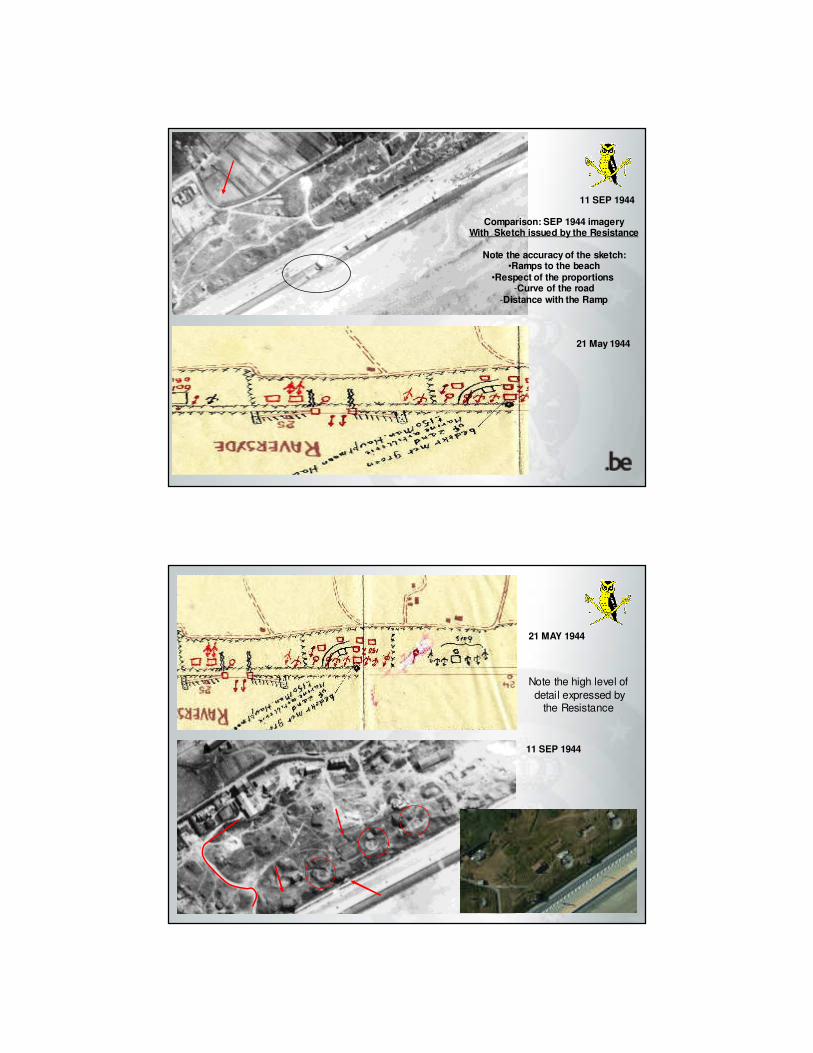
11 SEP 1944
Comparison: SEP 1944 imageryWith Sketch issued by the Resistance
Note the accuracy of the sketch:•Ramps to the beach
•Respect of the proportions -Curve of the road
-Distance with the Ramp
21 May 1944
21 MAY 1944
11 SEP 1944
Note the high level of
detail expressed bythe Resistance

Conclusions
� Photographic Interpretation during WW II and today follows the same basic rules
� Weather circumstances remain of a paramount importance
� Useful & accurate collateral information is indispensable
� Excellent information produced by the Resitance
� The human Photographic Interpretation cannot be replaced by the most sophisticated computer


![[RAF CAREERS] What Careers are there in the RAF?](https://img.pdfslide.us/doc/110x75/55cf8f58bb61ebe4598b4842/raf-careers-what-careers-are-there-in-the-raf.jpg)


![RAF Application Process [Pass]](https://img.pdfslide.us/doc/110x75/55cea953bb61eb09138b473e/raf-application-process-pass.jpg)