Embed Size (px)
Citation preview
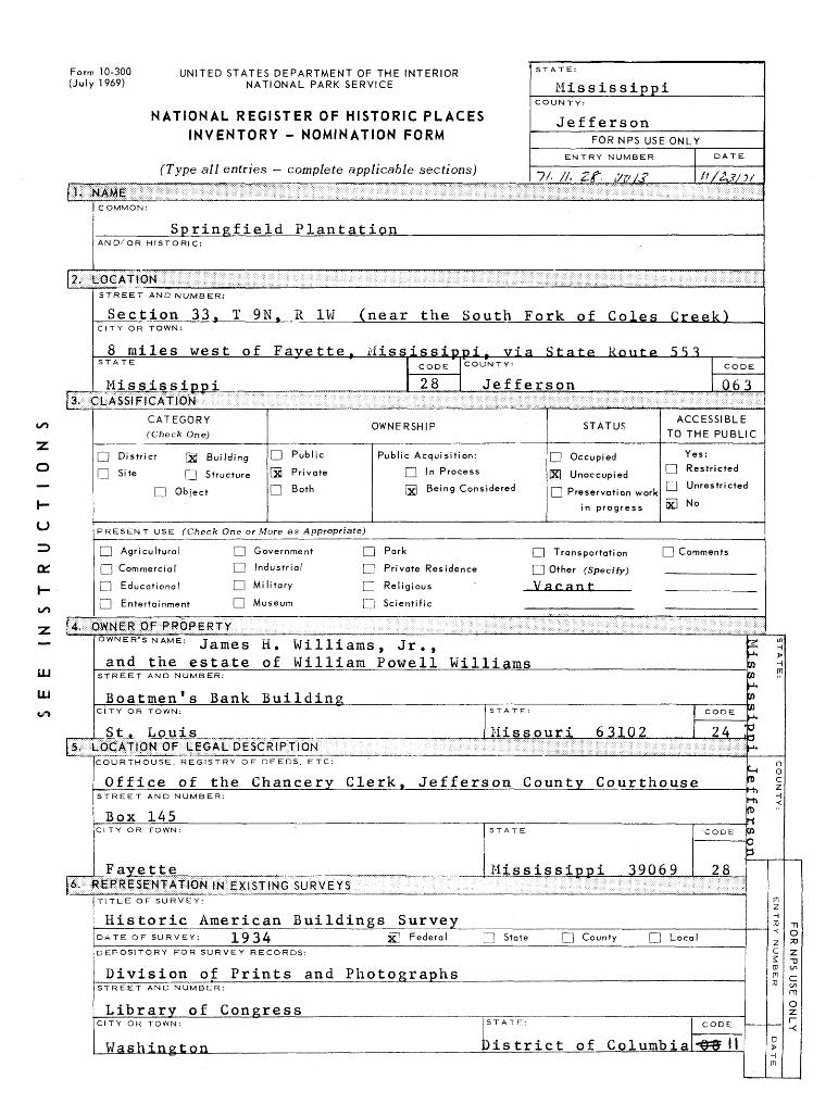
Form 10-300 UNITED STATES DEPARTMENT OF THE INTERIOR (July 1969) NATIONAL PARK SERVICE
NATIONAL REGISTER OF HISTORIC PLACES INVENTORY - NOMINATION FORM
( 1 ype all entries — complete applicable sections)
STATE:
MississippiCOUNTY:
JeffersonFOR NPS USE ONLY
ENTRY NUMBER DATE
7/- //. Zf. <7v/J' /-'/<2Jy?/
ill
C OMMON:
Springfield PlantationAND/OR HISTORIC:
STREET AND NUMBER:
Section 33, T 9N, R 1W (near the South Fork of Coles Creek)CITY OR TOWN:
8 miles west of Favette, Mississippi, via State Route 5 S 1STATE " CODE" COUNTY:
Mississiooi 28 Jef
CATEGORY OWNERSHIP ( Check One)
Q District [g Building CD Public Public Acquisition:
O Site rj Structure S Private Q l n Process
Q Object D Both txl Beip 9 Considered
PRESENT USE (Check One or More as Appropriate)
| | Agricultural | ] Government | | Park
Q Commercial D Industrial Q Private Residence
Q Educational HI] Mi itary Q] Religious
| | Entertainment I I Museum [ | Scientific
- •: •••; -. ... : . .- • : . .' \ . . - - .. -. ;^i%
jiii
CODE
ferson 063
,. TAT1IC ACCESSIBLE STATUS
TO THE PUBLIC
D Occupied Yes:ivi 1 1 • j C] Restricted IXI Unoccupied. — , „ , I 1 Unrestricted | _ 1 Preservation work —
in progress 2LI No
Q Transportation 1 1 Comments
PI Other fSpecifv)
V acan t
................S;:S:S'&:SS : i : : : S';i : i ; S ; : : :S;S:i::i;:S;:; : 3;'i:S
OWNER'S NAME: James H> Williams, Jr.,
and the estate of William Powell WilliamsSTREET AND NUMBER:
Boatmen's Bank BuildingCITY OR TOWN: STA"
St^ Louis MijiltliPB^M ' :: ' • :"v- : -: • '. ' : " ^^m&mmt•:•:•:•:•.•:•:•:•:•:•.•:•:•.•.•:•'•:•:•.•:•.•.••.•;.;.....;..•;.•>;.••.•.•.;.•.•..••.•.;....•... ••:• .-.;.•.••.• .. • .•:.... ....... . . .... . .....••:.•.•.:•;..:•:•:•::••:.•:•.•:•.•:•:•:•::
COURTHOUSE, REGISTRY OF DEEDS, ETC:
Office of the Chancery Clerk, JeffersonSTREET AND NUMBER:
Box 145Cl TY OR TOWN: STA-
Favette Mippiiiiliiiiiliif ;$£ixii WG . su R v E * s : •. : . : : :: . :: : .. . . .f.-. •.-.•.•.-.- •. . .-.•.-.-. . .•.•.-.-.•••••.•.•-;.••-••-;•••:-.•;•:•:-:•.•:•.•.•.•.•.•.•.- -,-. .-.-.• •.-.-.• •-•••- . -•••• ->:•: :••• x x ....•..-..- -.- • - . • - -••-..• . . ' . . . " .• . . • -. ....... - •. - . . .• . .
TE: CODE
ssouri 63102 24
County Courthouse
TE 'CODE
ssissippi 39069 28.- •.;. • :-;.•:•. .•:•_•...;: :•:-:•*-' :-:>;X;X:'. : : ...;. : .;.-.;,; : : .;:;.•.•.•.;.-...;•;•:•:•:•:•.•:•: : :''-:-:-:v-:->:''-:-: i '-Xx->x.x : x':': : . : : :
TITLE OF SURVEY:
Historic American Buildings SurveyDATE OF SURVEY: 1934 iXJ Federal [H State Q County Q LocaDEPOSITORY FOR SURVEY RECORDS:
Division of Prints and PhotographsSTREET AND NUMBER:
Library of CongressCITY OR TOWN: 5TAT
Washington }is
E: CODE
trict of Columbia ~&& II
S_1.•fl toH' CO£hJ.3o-1.
f— (n>i-h ro nen o 3
(/i >IT
COUN TY:
EN TRY NUMBER
DATE
Tl 0 70Z ~0 enC inm Ozr~ -<
CONDITION
(CfcecJc One)
llent D Good Q Fair |jj Deteriorated Q Ruins Q Unexposed
(Check One)
Altered D Unaltered
(Check One)
Moved Qj| Original Site
DESCRIBE THE PRESENT AND ORIGINAL (if known) PHYSICAL APPEARANCE
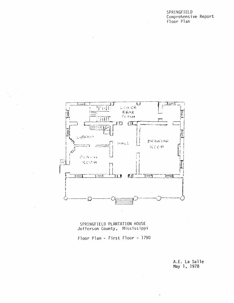
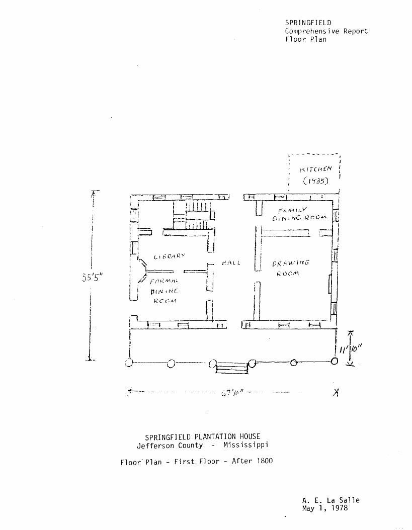
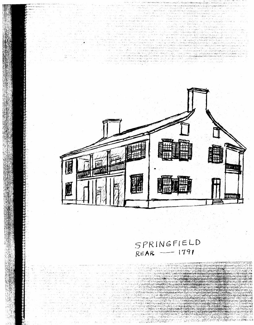
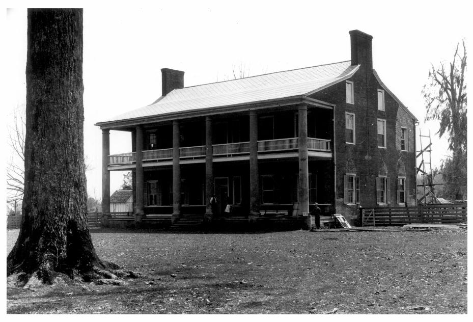
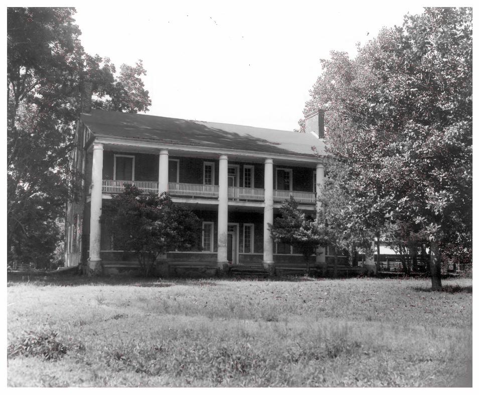
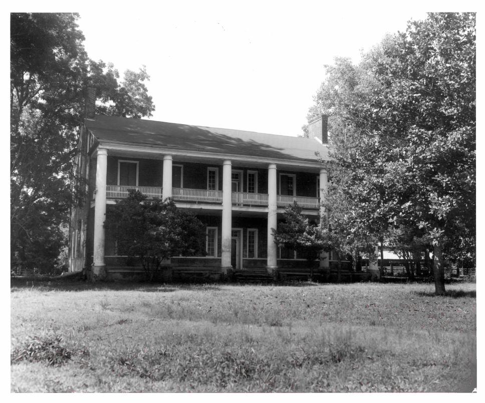
Springfield is a two-story residence with attic and basement, measuring 67 feet 10 inches in length and 55 feet 5 inches in depth. Ha_ndmade red brick are laid in Flemish bond on the facade (north elevation) and common bond on the side elevations. Interior chimneys project prominently above each gable of the broken-pitch roof, which on the north slopes to form a portico supported by six columns. The latter are approximations of the Tuscan order and made of triangular-shaped bricks covered with stucco. On the second floor of the portico is a balustrade of rectangular balusters, its railings inserted into the shafts of the intersecting columns. Fenestration on both floors of the facade is identical: a central doorway with ejLght-paned transom, flanked by detached side v lights with twelve panes each, and four windows symmetrically spaced within the intercolumniation. There are six openings on each side elevation, all of them windows except the door on the first floor east, which appears to have formerly been a window also. A 1934 Historic American Buildings Survey photograph shows 6 over 6 sashes being installed on the side elevations; a number of those which remain in front and rear windows are 12 over 12 and presumably original. Paneled reveals range in depth from 20 inches to 26 inches, and two-part wooden shutters are held open by wrought-iron fasteners attached to blocks of wood set flush into the brick walls. The louvered walls of the second floor rear and sides were enclosed with brick before 1920, and partitioning for three rooms was probably added then also. On the southwest corner of the first floor an outside small frame kitchen was built in the late 1930s and passage between house and kitchen was provided by removing bricks beneath a window in the common wall. An earlier kitchen, also frame, was locateid approximately 25 feet southeast of the central rear door.
It is not known what other alterations, if any, have been made in the original floor plan. The present layout of the first floor consists of a large central hallway (14 feet by 38 feet 3 inches) flanked by two rooms on the west and three rooms and a stairwell (with rudimentary, winding stair) on the east, all areas being of varying dimensions. The second floor is similar, although the expanse of hallway to the rear is interrupted by the middle room of the three formed by partition ing. The rooms and hallways of the main block total thirteen, whereas it is believed that originally Springfield had eight rooms and two hallways. The interior construction of the house includes yellow poplar and cypress flooring, cypress jambs, and yellow poplar ceiling spans, all of which appear to be original materials. The six-inch boards of the planked ceiling are laid tongue and groove, and in the attic, beams are joined by the mortise and tenon method and pegged. The crossbars of the "H" type ceiling supports are centered with king posts to which rafters are secured by mortise and tenon. In addition, metal
PERIOD (Check One or More as Appropriate)
G Pre-Columbian | G 16th Century
n 15th Century Q 17th Century
18th Century
19th Century
G 20th Century
SPECIFIC DATE(S) (If Applicable and Known) C 3. , 1800
AREAS OF SIGNIFICANCE (Check One or More as Appropriate)
Abor iginal
| | Prehistoric
G Historic
Q Agriculture
[xl Architecture
D Art
I I Commerce
| | Communications
j | Conservation
| | Education
| | Engineering
| | Industry
| | Invention
|| Landscape
Architecture
| | Literature
Q Military
G Music
Ixl Political
n Religion/Phi
losophy
G Science
| | Sculpture
| | Social/Human
itarian
G Theater
G Transportation
|| Urban Planning
G Other (-Specify)
h- uID
LU
LJ
TAT EMENT O F S1GNI FIC ANCE ^
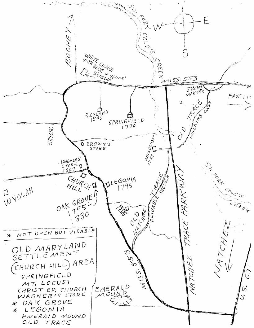
Thojnasjiarston Green, Jr. (1758-1813), guilder of Springfield, was a member of the first general assembly of the Territory of Mississippi and the second man to represent the territory in the U. S. Congress. He was a son of Colonel Thomas M. Green (1723-1805), who was instrumental in the estab lishment of the B^hort-lived Bourbon County (which included the Natchez district) by Georgia in 1785. Thomas M. Green, Jr., was a brother of Abner Green, territorial treasurer of Missis sippi, and brother-in-law of Cato West, acting governor of the territory, 1803-1805, and a Jefferson County delegate to the state constitutional convention of 1817. Colonel Thomas Hinds who distinguished himself in the Pensacola and New Orleans campaigns with Jackson and was also active in the territorial period and early statehood of Mississippi, was a son-in-law of Thomas M. Green, Jr. The Springfield estate was retained by members of the Green family until 1850, and in 1914 the house and 533 acres were acquired by James H. Williams, father of the present owner. Thomas M. Green, Jr. and his first wife, Martha Kirkland Green (1759-1805), are buried in the Green family cemetery located south of Springfield house.
Local tradition maintains that Andrew Jackson and Rachel Donelson Robards were married at Springfield in the summer of 1791. One of the earliest known references to the event is in The Memories of Fifty Years (1870)by W. H. Sparks, whose own wife was a daughter of Abner Green: "Jackson came and married her [Rachel], in the house of Thomas M. Green. 11 Sparks 1 relationship to the Green family would seemingly add credence to his account, but he diminishes his own reliability by such devices as attributing entire paragraphs of verbatim conversation to Jackson. In A. History of Mississippi by Robert Lowry and William H. McCardle (1891), the tradition of the Springfield marriage was restated, as well as elaborated:
General Andrew Jackson was married at the home of the Hon. Thomas Mars ton Green, on the northern bank of Coles Creek, in what is now Jefferson County, in the summer of 1791, to Mrs. Rachel Robards.... the cere-
_________mony was performed by Colonel Thomas Green,________
Cox, William E. "Springfield Historic House." Natchez TraceParkway: Resource Study Proposal NATR-H-18, 1968.Collections, Mississippi Department of Archives andHistory, Jackson, Mississippi.
Historic American Buildings Survey. Springfield Plantation.1 photograph, 1934.
Interview with Mr. Carter H. Anderson, Jefferson CountyHistorical Society, Fayette, Mississippi, April 25, 1971
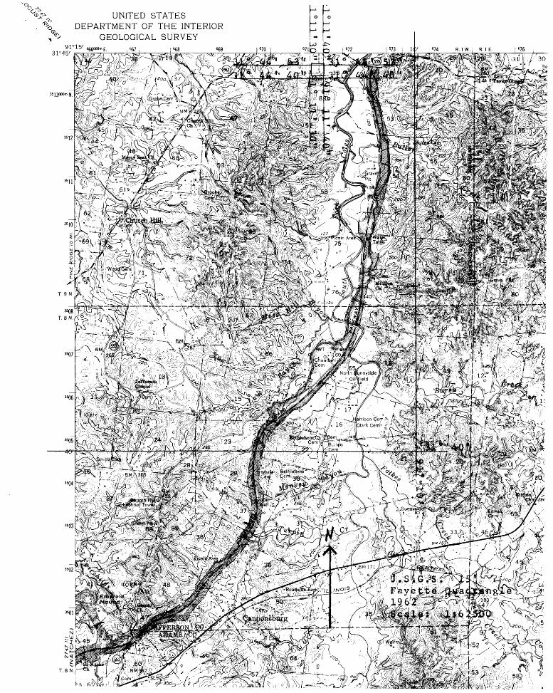
LATITUDE AND LONGITUDE COORDINATES
DEFINING A RECTANGLE LOCATING THE PROPERTY
NW
NE
SE
sw
L ATITU DE
Degrees Minutes Seconds31° 31° 31°
44- 44' 44'
53" 53" 40" 40'
LONGI TUDE
Degrees Minutes Seconds
91? 11- 30-91 IT 40"9f 11' 40"9? IT 30"
LATITUDE AND LONGITUDE COORDINATES
DEFINING THE CENTER POINT OF A PROPERTYOF LESS THAN TEN ACRES
L ATI TUDE
Degrees Minutes Seconds O . »
LONGI TUDE
Degrees Minutes Seconds
APPROXIMATE ACREAGE OF NOMINATED PROPERTY:
1L1ST ALL STATES AND COUNTIES FOR PROPERTIES OVERLAPPING STATE OR COUNTY BOUNDARIES
STATE: CODE COUNTY
m
NAME AND Tl TLE:
Dawn Maddox, Architectural HistorianOR CAN I Z ATI ON
Mississippi Department of Archives and History Aug. 11, 1971STREET AND NUMBER:
Post Office Box 571CITY OR TOWN:
Jackson Mississippi 39205
nH
O
z
_2_S_
As the designated State Liaison Officer for the Na
tional Historic Preservation Act of 1966 (Public Law
89-665), I hereby nominate this property for inclusion
in the National Register and certify that it has been
evaluated according to the criteria and procedures set
forth by the National Park Service. The recommended
level of significance of this nomination is:
National [^ State rjg Local [xj
I hereby certify that this property is included in the
National Register.
Chief, Office of Archeology and Historic Prfser
R. A. McLemore
Title Director, Miss. Dept. of Archives and History
Bate August 11, 1971
NOV 2 3 1971Bate
ATTEST:
Bate
Keeper of TliA National Register}
NOV 8 1971
rorm 10-300o (July 1969)
UNITED STATES DEPARTMENT OF THE INTERIOR NATIONAL PARK SERVICE
NATIONAL REGISTER OF HISTORIC PLACES
INVENTORY - NOMINATION FORM
(Continuation Sheet)
STATE
:vlis sissipniCOUN TY
Jeffers onFOR NPS USE ONLY
ENTRY NUMBER
?/• // Zf-(Number mil entries)
?•straps are bent around the rafters and bolted to the king posts,a braced peak arrangement which eliminates the need for a ridge pole.
Interior finish, confined to wainscoting, chair rails, baseboards, cornices, and mantelpieces, is unmistakably provincial yet imaginatively conceived and vigorously executed, a satisfying accent to the massive grace of the 'house itself. Mantelpieces, reflecting the Adam influence popularized in New England by Mclntire and Bulfinch, feature such embellishments as pilasters, paterae, reeding, and grooving, while cornices in the hallway, parlor, and master chamber on the second floor west repeat the gougework patterns from the mantelpieces in a variety of combin ations. (Its decorative woodcarving is one factor which suggests that Springfield was built at a later date than 1791, the year the Andrew Jackson-Rachel Robards marriage allegedly took place there. It seems unlikely that the Adamesque mode of interior architecture would have penetrated the Old Southwest a decade prior to its ascendancy in such centers of the au courant as Boston, Salem, and Charleston. On the other hand, it that the woodwork is of a later period than the house
is possible itself.)
8.who acted in his capacity of magistrate in and for Bourbon County.
No documentation for the above is given; in actuality, however, Bourbon County was officially abolished in 1788.
In 1937 a great-great-granddaughter of Thomas M. Green. Jr., Laura Lake Ihrie, wrote that "Jackson and Mrs. Robards were married in the great big downstairs room at Springfield. I have been told this many times, not only by my mother, but by other members of the family." The tradition had been questioned as early as 1910, however, when a letter written by E. R. Jones, a resident of Jefferson County, appeared in the Publications of the Mississippi Historical Socie ty for that year:
I never heard that Mrs. Robards was married to General Jackson in the home of Thos. Marston Green until it came out in HcCardle's History of Mississippi, such being contrary to tradition. ^
My father, Rev. Jno. G. Jones, was born in 1804 and resided for many years at Belle Grove, just across the Natchez Trace from
______Mrs. Robard's home, the site of which he
Form 10-300o ("July 1969)
UNITED STATES DEPARTMENT OF THE INTERIOR NATIONAL PARK SERVICE
NATIONAL REGISTER OF HISTORIC PLACES
INVENTORY - NOMINATION FORM
(Continuation Sheet)
STATE
Mississippi
JeffersonFOR NPS USE ONLY
ENTRY NUMBER
(Number mil •nfrf••;
8.often pointed out to me as our than a mile off. He used this
less "I
her own farm, near Greenville, and had a double log house with an open hall,
fear Major McCardle's vanity and his con nection with the Green family has led him into an error. Mrs. Robards, so the old people of the time while I was growing up about Greenville [an extinct settlement several miles east of Springfield] told me owned on itand here they say she was married to General Jackson. I am as sure as can be from test imony, that McCardle is wrong. I will also say that for many years of my life I was often with Alien Colier (colored), who was a body servant of General Thomas Hinds and was once a slave of Thomas Marston Green, and went as such to General Hinds, who
When I informed has said about
married Miss Laminda Green, him what McCardle's History Jackson f s at
so ;Green sOle i
house t
being married his reply was: "Twan'thouse - the Great House warn't built at that time - I members it, and Miss Robards don't have to go over thar to be married, when she had a good house of her own right by what da call the Jackson Springs."
The account has a convincing ring to it but it obviously raises more questions than it answers.
Despite long and diligent search by Jackson historians, no incontrovertible evidence to support or refute the tradition that the Jackson marriage occurred at Springfield has yet come to light. The role of Springfield Plantation in the political, economic, and cultural history of the Old Southwest is a genuine one, however. The Greens and their connections were one of the most prominent families in the formation of Mississippi as a territory and a state. Thomas M. Green, Jr., in three decades of residence in Jefferson County, was a prototype of the antebellum planter whose fortune was based on the cultivation of extensive land holdings in a single crop - cotton. These associations, in addition to the intrinsic architectural significance of Springfield and its proximity to the Old Natchez Trace, have prompted negotiations currently underway whereby the National Park Service of the Department of the Interior anticipates incorporating the house and adjoining acreage into the Natchez Trace Parkway..
form 10-300o (July 1969)
NATIONAL REGISTER OF HISTORIC PLACES
INVENTORY - NOMINATION FORM
(Continuation Sheet)
MississippiCOUNTY
JeffersonFOR NPS USE ONLY
ENTRY NUMBER
2-3'/ 7 /(Number mil
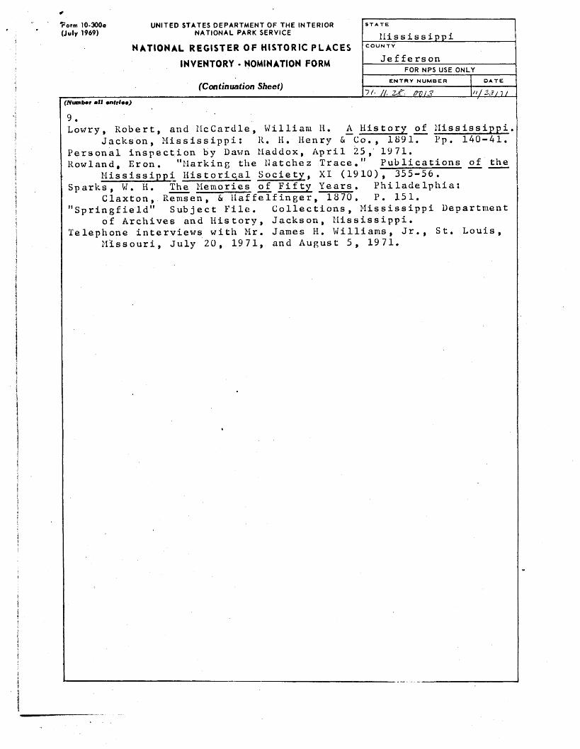
Lowry, Robert, and McCardle, William H.Jackson, Mississippi: R. H. Henry & Co.,
Personal inspection by Dawn Maddox, April 25, Rowland, Eron. "Marking the Natchez Trace."
Mississippi Historical Society, XI (1910), Sparks, W. H. The Memories of Fifty Years .
1870.
A^ History of Mississippi 1891. Pp. 140-41.
1971. Publications of the
Claxton, Remsen, & HaffeIfinger, "Springfield" Subject File. Collections,
of Archives and History, Jackson, Mississippi. Telephone interviews with Mr. James H. Williams, Jr.,
355-56. Philadelphia: P. 151.
Mississippi Department
St. LouisMissouri, July 20, 1971, and August 5, 1971.
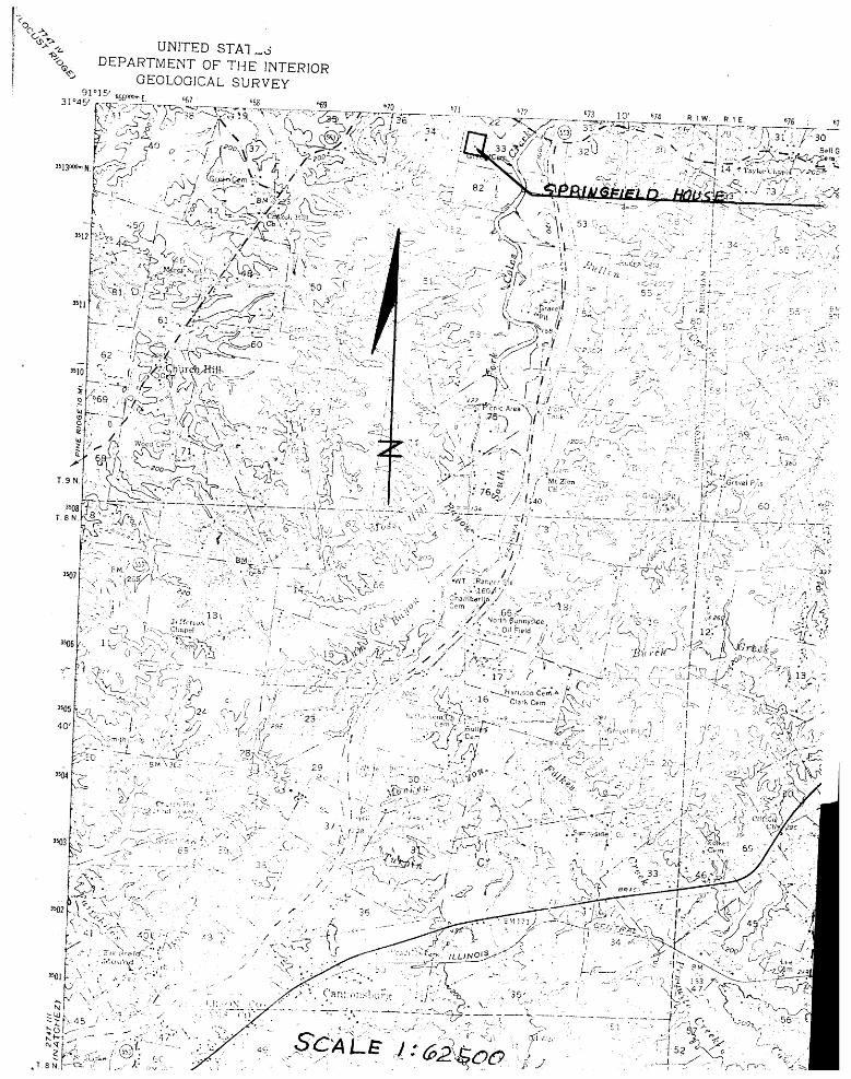
UNITED STATESDEPARTMENT OF THE INTERIOR
GEOLOGICAL SURVEY91°15'
31°45
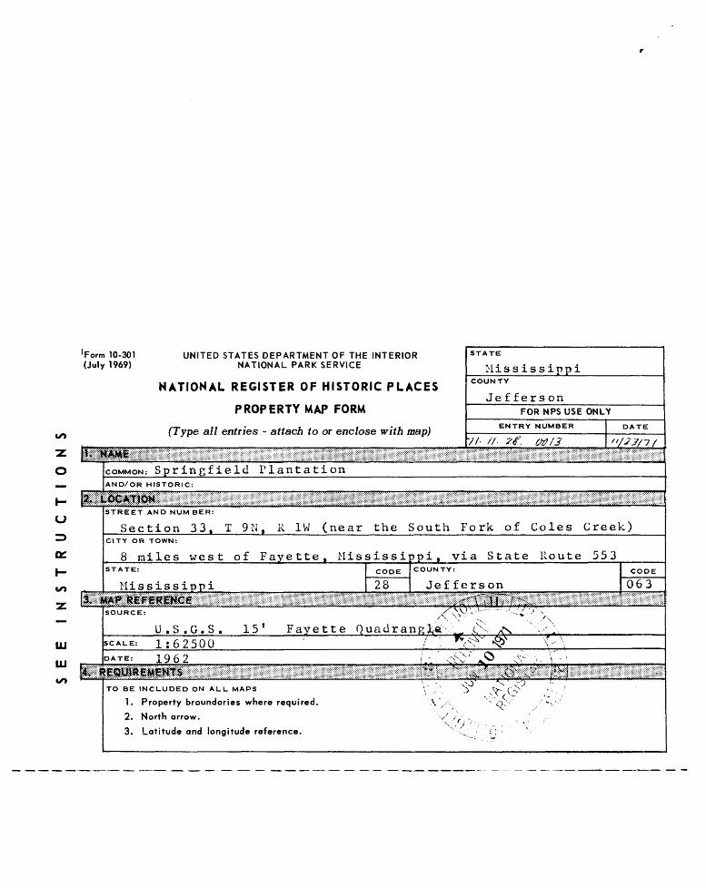
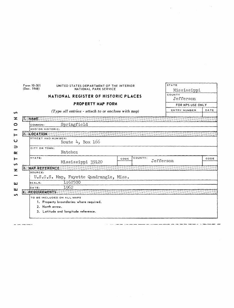
Form 10-301 UNITED STATES DEPARTMENT OF THE INTERIOR (July 1969) NATIONAL PARK SERVICE
NATIONAL REGISTER OF HISTORIC PLACES
PROPERTY MAP FORM
^ (Type all entries - attach to or enclose with map)
~z>
o
STATE
MississippiCOUNTY
Je f f ers onFOR NPS USE ONLY
ENTRY NUMBER
7(- //. Ztf< vtf/3DATE
'/23/~J /
COMMON: Springfield PlantationAND/OR HISTORIC:
l_u
h-
STREET AND NUM BER:
Section 33, T 9N f R 1W (near the South Fork of Coles Creek)CITY OR TOWN:
8 miles west of Fayette, Mississippi, via State Route 553STATE: CODE COUNTY:
Mississippi 28 JeffersonCODE
063
=
UJ
SOURCE: X^^-S^ v "' J-i^.'f^
U.S.G.S. 15' Fayette Quadrang fa\ .ex A-s ' . •' \SCAUE: 1:62500 ' / ' *
DATE: 1962 /.-. ' Ctv
^' ^ \--\
' *5^ o^'' ••- v -• >.*/>
TO BE INCLUDED ON ALL MAPS V ^
1. Property broundaries where required. V ,,2. North arrow. / //
X-V 3. Latitude and longitude reference. ',
s^ : - <', T .•' •• /N x- ;^ / " ••
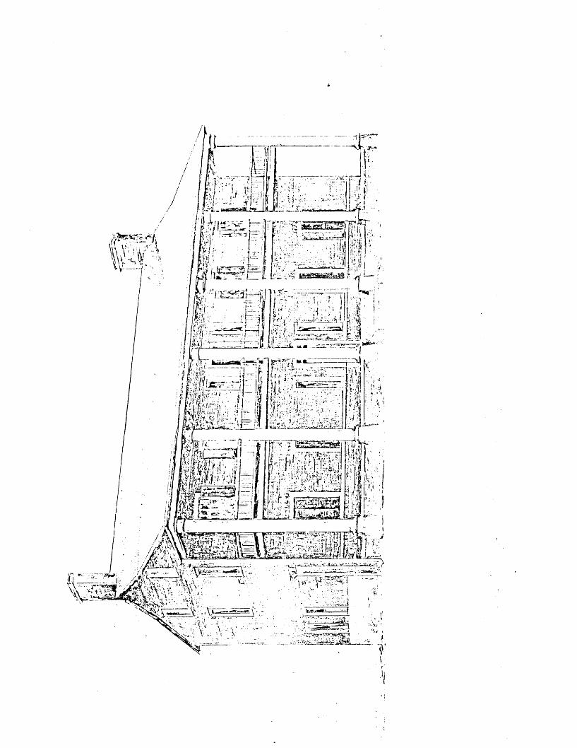
SPRINGFIELD Comprehensive Report Floor Plan
SPRINGFIELD PLANTATION HOUSE Jefferson County, Mississippi
Floor Plan - First Floor - 1790
A.E. La Salle May 1, 1978
SPRINGFIELD Comprehensive Report Floor Plan
l~\
IED
j^~
II
-o - c^sEEp"
\< ITCH EN j
Jii
!
I
o/*
-\i
//
SPRINGFIELD PLANTATION HOUSE Jefferson County - Mississippi
Floor Plan - First Floor - After 1800
A. E. La Salle May 1, 1978
ts,
s:er
r-
ij^^'^y^f ̂ >'v*?!'^§^^t^^s^Hf^f^
..riTO,^?^^^
„.......,.,,.,,,.., ,v,.. .,,,,,.»,,„Jlflill^^ If^if^f«^i?*|^ i* - •'••: -..• •^9^^^f?^ - •,, I:,:, • • : ?;:.',\j-'; . -
S%^V^.'^S^;^ ''•: " ••••"'-: •"'• "'V ••-.':•' !'' '•'".•<'.<....'..••.••i-^'i. ..i.1 ••„•;. ••''••••'»••'••' ••••!:"'^*!^-i^^Vj;4^i:i«7i!''''*'|Si<*:^S^ '-•.'-' •"1»'it,.r*,!^"f riiv:-::\, '..-'*-• . -'
{•• ksLl - -.-'! H
—1^?^
p^^,-^
-^2^
^*^
.p'^
Lje
^^^-^
f^^-^
c:^
^-—
rffi>
UNITED STA1_oDEPARTMENT OF THE INTERIOR
GEOLOGICAL SURVEY
T.9N
fe-^%-^T:%^^ !^T- >5° ^r ""-- {^. K 1 ( u / cfj—-^-^s'v^a £Psf;-\--: '*'.:\ v)0-' 35nr 4/7'Xi_ ^=,,,^, ; c^£/^^/f^'~\ ;b_ \ JVV,, - ( '-;
^ ,^
/ • ' -I ' l*^*v J I /-'• / •'- - '. '""
^'.•^^"^st^/'rt- ^^ ^'^">M; IK^AA,;-, : ^ :;lv*^'% rTj; 4v,- .1-A., :-/';'^£~J':-^'-LJ..-.-..-^'' ? '-'
*^on '\ "- '-"-^'^ Picnic Area \ ••'„'- " ^ it>;\ • .~"r^" • --—-••— i r -"" x '-^ ii -ZS-v V' T " ;;r ' / S/: /--v "•<>.!/ • --',»--T.DX .' ... "-••,'•'•?•'-"
:iL^ n\'-./ ,-..</! /^.^^;- >;~ r- • 1' ; .>, . ~.. v•"^'^•.?l^c:'--:^^--"• >. 7S . ''j >tr"?4rsvej P,ris ; ;' « v-k-^«; "Vf-V-?"' X-\ i-^;:--f'^l.^iw^ 6^^^' 1^
'0 : ; '' •' ^> ~-'^ f^.-~"••'-••'- '-';•'•• -"_'' />• I; ,/ C va, ;'/';... 'V tl' -r.r••-••• .v- • .)• (^ ., :- ",-' -''-*-•.;
•--"'•'• /---I ',: . I -; V u— '•. •" '' ••-•->• '•*'
^^ BK,^-^^^<^
j:
^^ R 1?-K+--f- > '"" , ....-/; :4" Oj^i', """/—yf ~~'-'-SK-'^tu-^-^r R-
.T.SN.I—-ch:'^: f^,--^•"»J".;-.52
Form 10-301 (Dec. 1968)
UNITED STATES DEPARTMENT OF THE INTERIOR NATIONAL PARK SERVICE
NATIONAL REGISTER OF HISTORIC PLACES
PROPERTY MAP FORM
(Type all entries - attach to or enclose with map)
STATE
MississippiCOUNTY
Jefferson
ENTRY NUMBE:R
COMMON: SpringfieldAND/OR HISTORIC:
u z> orI-uo
UJ
LU to
STREET AND NUM BER:
Route k-y Box 166CITY OR TOWN:
Watchez
Mississippi 39120COUNTY:
Jefferson
iiiiiiiiiiiiiiiU.S.G.S. Map, Fayette Quadrangle_, Miss
1:625001962
TO BE INCLUDED ON ALL MAPS
1. Property broundaries where required.
2. North arrow.
3. Latitude and longitude reference.

UNITED STATES DEPARTMENT OF THE INTERIOR NATIONAL PARK SERVICE
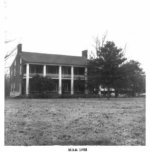
NATIONAL REGISTER OF HISTORIC PLACES
PROPERTY PHOTOGRAPH FORM
(Type all entries - attach to or enclose with photograph)
STATE
MississippiCOUNTY
JeffersonFOR NPS USE ONLY
ENTRY NUMBER
COMMON; Springfield PlantationAND/OR HISTORIC:
STREET AND NUMBER:
Section 33, T 9N, R 1W (near the South Fork of Coles Creek)CITY OR TOWN:
8 miles west of Fayette, Mississippi, via State Route 553STATE:
Mississippi 28COUNTY:
Jefferson 063
HOTO CREDIT; National Park ServiceDATE OF PHOTO: 1969
NEGATIVE FILED AT: Natchez Trace Parkwayjte
DESCRIBE VIEW. DIRECTION. ETC.
Facade and east elevation, looking southwes
hfci
•~'f •>.; "*&>•<^f £ v»
^i^-^Slte^t,
-•i.:-^
^:
at f*yrrre
TUPito, jtTi
UNITED STATES DEPARTMENT OF THE INTERIOR NATIONAL PARK SERVICE
NATIONAL REGISTER OF HISTORIC PLACES
PROPERTY PHOTOGRAPH FORM
(Type all entries • attach to or enclose with photograph)
COMMON: Springfield Plantation
STATE
MississippiCOUNTY
JeffersonFOR NPS USE ONLY
ENTRY NUMBER
AND/OR HISTORIC:
u
Of
STREET AND NUMBER:
Section 33. T 9N.R 1W (near the South Fork of C Creek)CITY OR TOWN:
8 miles west of Fayette, Mississippi, via State Route 553STATE:
Mississippi 28 Jefferson 063
PHOTO CREDIT: National Park ServiceDATE OF PHOTO: 1969
U4
III
FILED AT: Mississippi Department of Archives and HistoryP. 0. Box 571 JflckaQn.. Mtfl.s.Hl. «a««< 392Q5
DESCRIBE VIKW, DIRECTION,
Facade and east elevation, looking southwest.