Embed Size (px)
Citation preview
QuickTime™ and aH.264 decompressor
are needed to see this picture.
IFR Departures and Arrivals: Tips, Tricks, and Avoiding Common Errors

IFR DEPARTURES AND ARRIVALS: TIPS, TRICKS, AND AVOIDING COMMON ERRORS

Advantages And Disadvantages of Obtaining Your Instrument Clearance In The Air After Departing VFR.

Departure Procedure Climb Gradient And Calculating Your Rate Of Climb

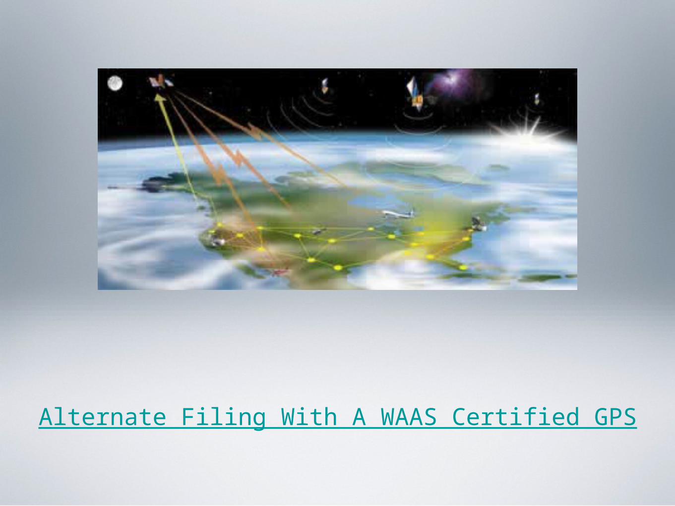
Alternate Filing With A WAAS Certified GPS

What Weather Forecasts Should I Use For My Destination And Alternate?
should i declare minimum fuel if i have an alternate?
what is a descend via clearance
star standard terminal arrival procedures: altitudes explained
Can I Use My GPS When An Arrival Requires DME?
IFR DEPARTURE AND ARRIVAL PROCEDURES : TIPS, TRICKS, AND AVOIDING COMMON ERRORS
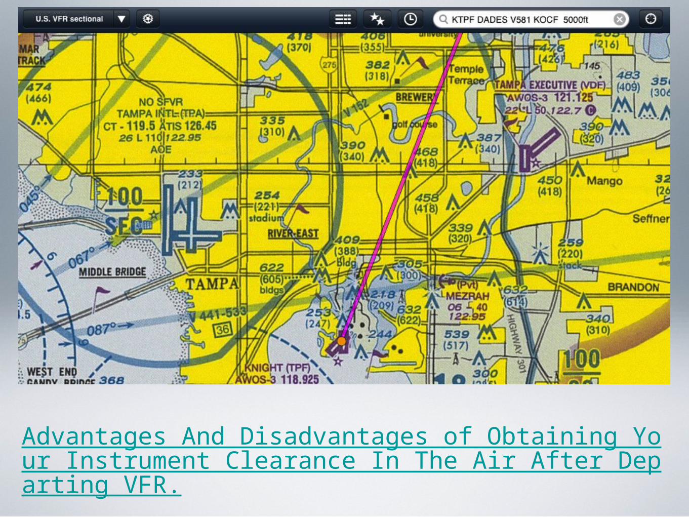
Advantages And Disadvantages of Obtaining Your Instrument Clearance In The Air After Departing VFR.
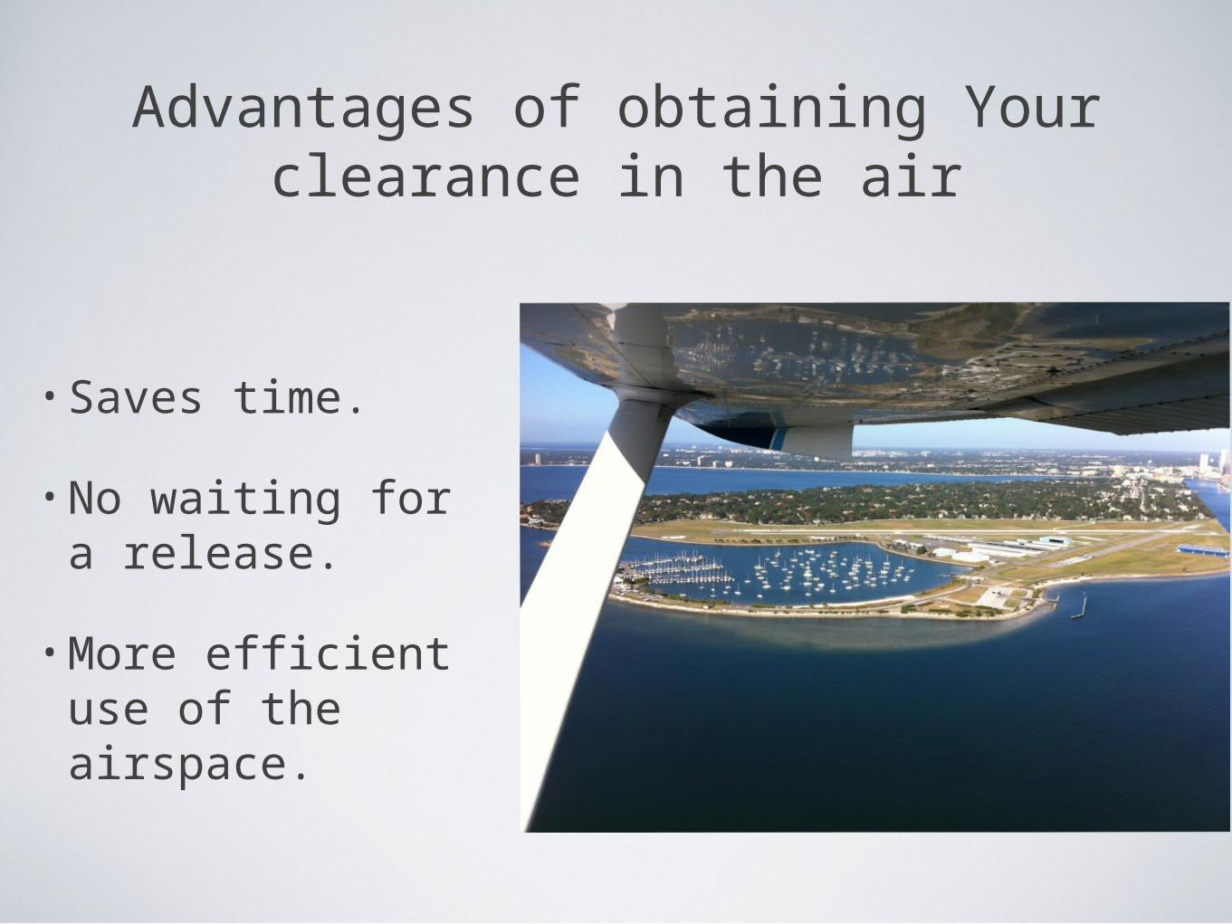
Advantages of obtaining Your clearance in the air
• Saves time.
• No waiting for a release.
• More efficient use of the airspace.
release time
• ATC uses an IFR release time in conjunction with traffic management procedures to separate departing aircraft from other traffic.
• A release time is a departure restriction issued to a pilot by ATC, specifying the earliest and latest time an aircraft may depart.
release time
• Once an aircraft is airborne and radar identified the following aircraft may be released for departure.
• Must meet the approved radar separation (3 miles laterally or 1,000 feet vertically) when the second aircraft comes airborne.

DisAdvantage of obtaining Your clearance in the air
• Flying out of busy airspace you may wait a long time before obtaining your clearance.
• Risk encountering instrument conditions before obtaining your clearance.

DisAdvantage of obtaining Your clearance in the air
• If you depart VFR and EDCT times are being issued you may run out of fuel before receiving a clearance.
• EDCT = Expect Departure Clearance Time.
Expect Departure Clearance Time
During Ground Delay Programs into busy airports all aircraft are impacted even General
Aviation aircraft.
EDCT - is a 10 minute window, and aircraft are required to depart within 5 minutes before or
after their assigned EDCT.
Expect Departure Clearance Time
You might be returning to the airport if you depart VFR and EDCT times are issued.
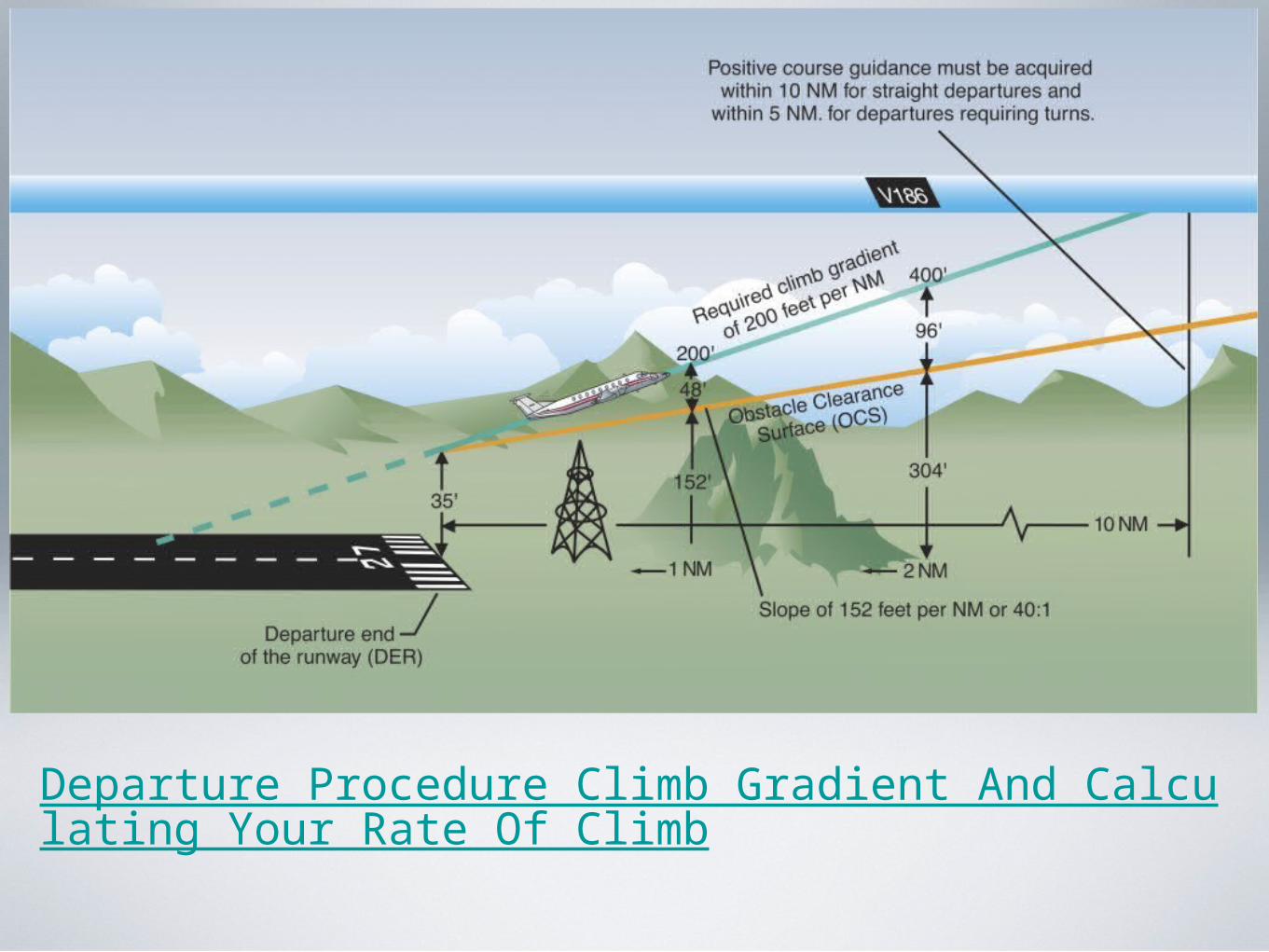
Departure Procedure Climb Gradient And Calculating Your Rate Of Climb
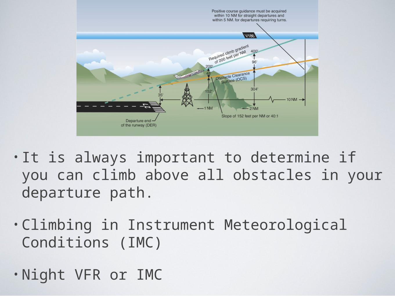
• It is always important to determine if you can climb above all obstacles in your departure path.
• Climbing in Instrument Meteorological Conditions (IMC)
• Night VFR or IMC
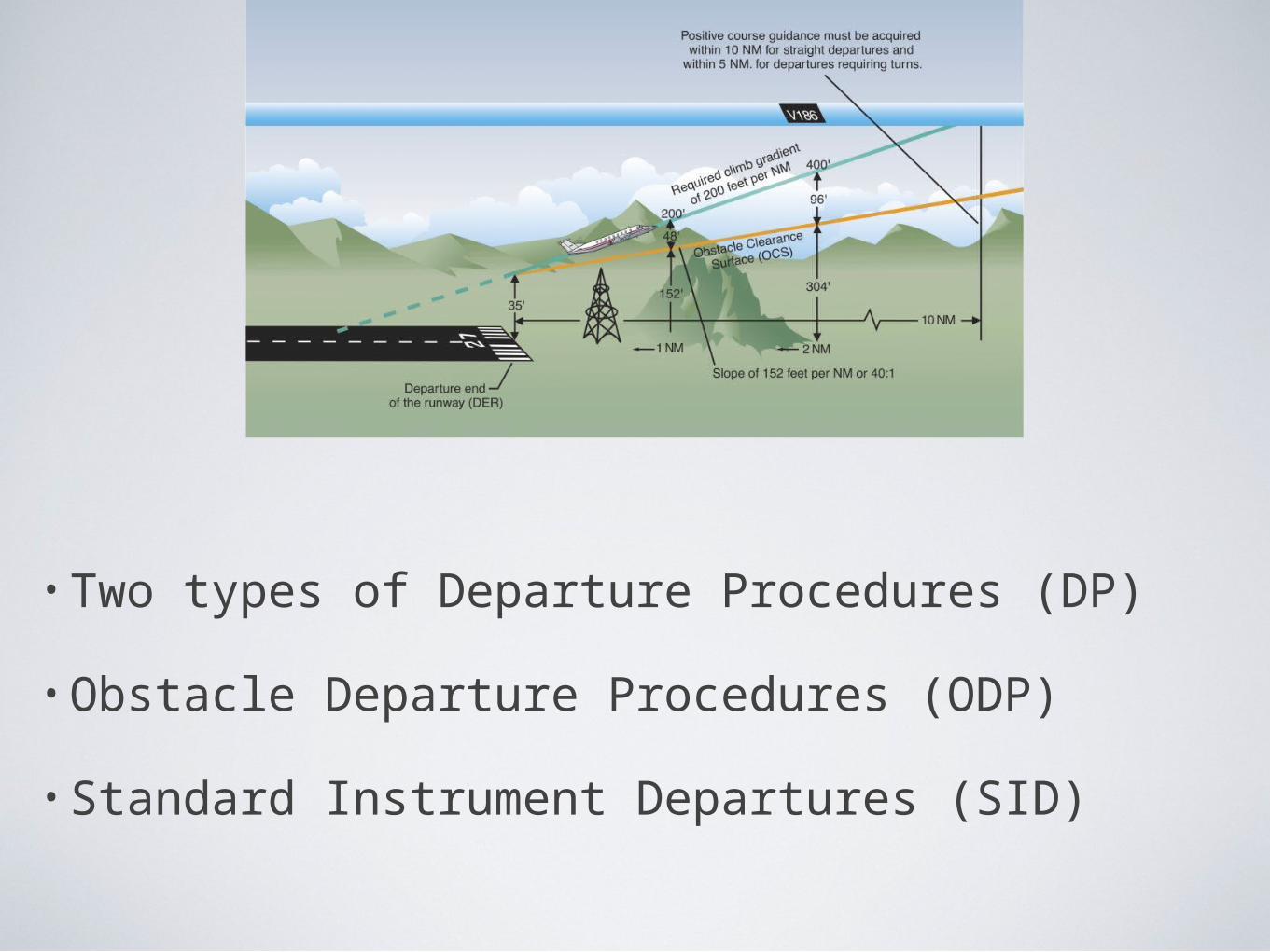
• Two types of Departure Procedures (DP)
• Obstacle Departure Procedures (ODP)
• Standard Instrument Departures (SID)
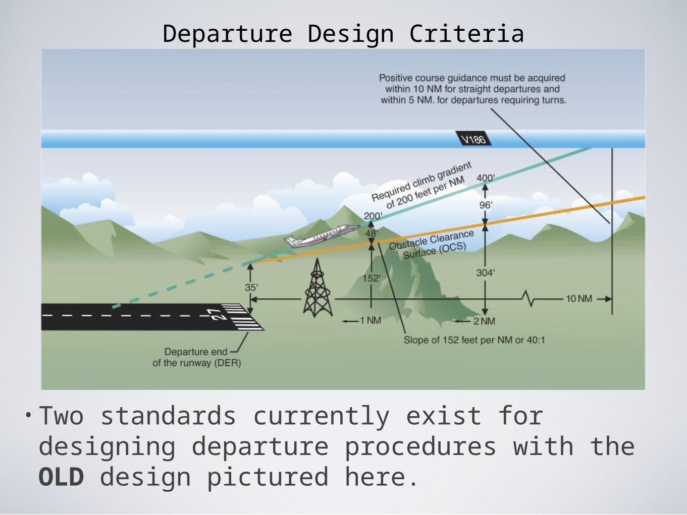
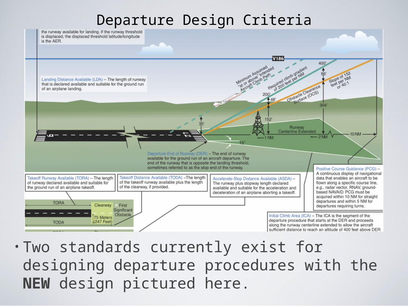
Departure Design Criteria
• Two standards currently exist for designing departure procedures with the OLD design pictured here.
Departure Design Criteria
• Two standards currently exist for designing departure procedures with the NEW design pictured here.
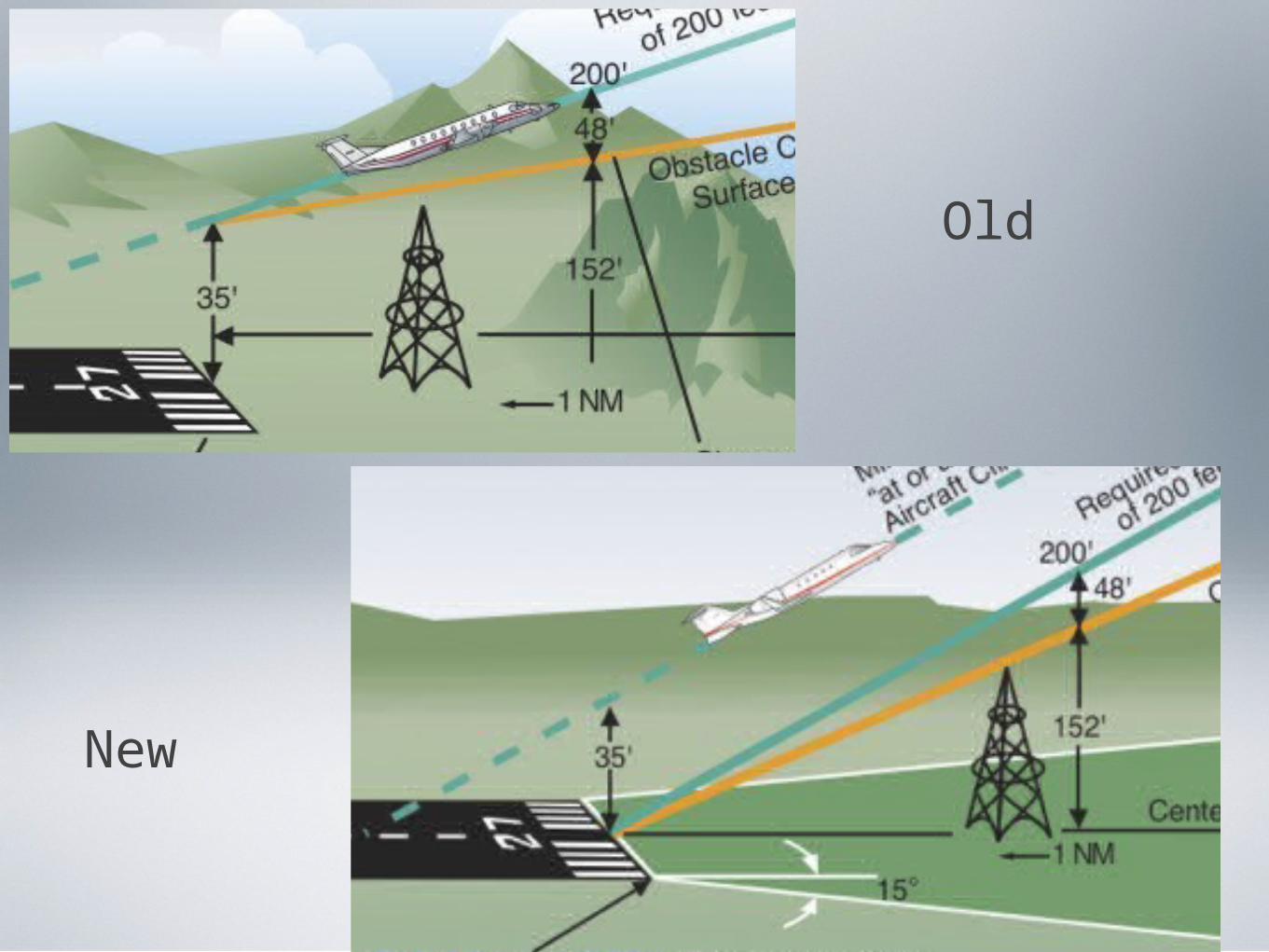
Old
New
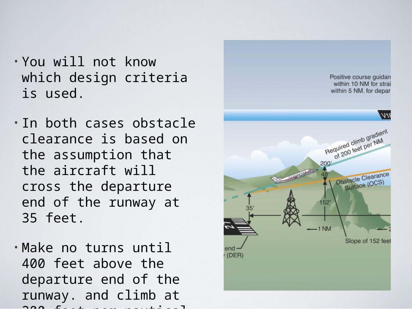
• You will not know which design criteria is used.
• In both cases obstacle clearance is based on the assumption that the aircraft will cross the departure end of the runway at 35 feet.
• Make no turns until 400 feet above the departure end of the runway. and climb at 200 feet per nautical.
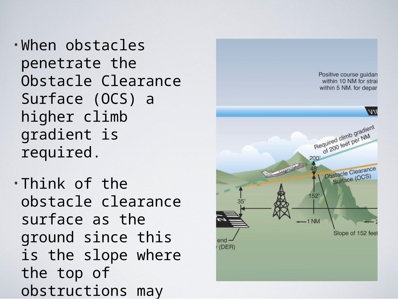
•When obstacles penetrate the Obstacle Clearance Surface (OCS) a higher climb gradient is required.
•Think of the obstacle clearance surface as the ground since this is the slope where the top of obstructions may be present.
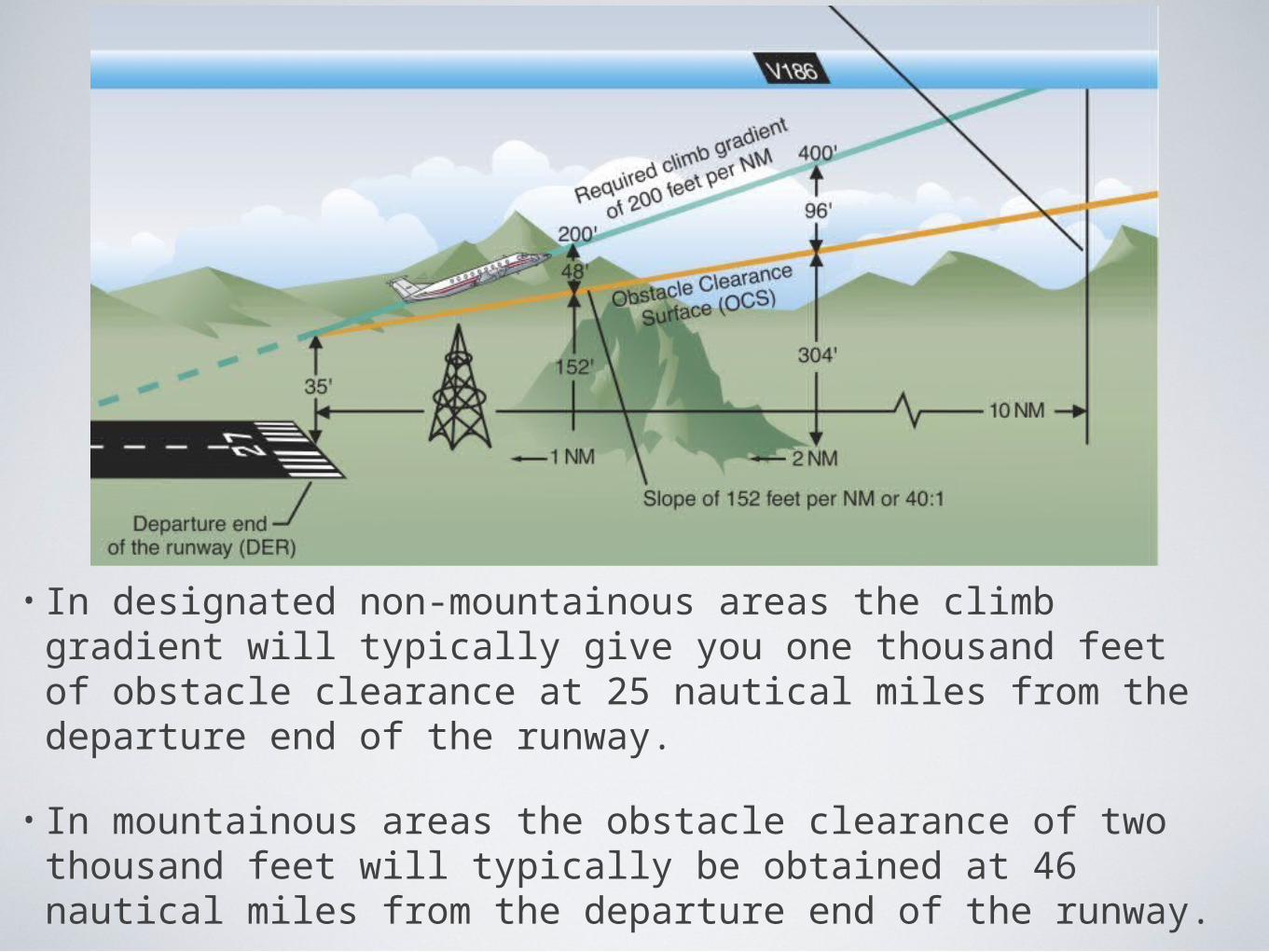
• In designated non-mountainous areas the climb gradient will typically give you one thousand feet of obstacle clearance at 25 nautical miles from the departure end of the runway.
• In mountainous areas the obstacle clearance of two thousand feet will typically be obtained at 46 nautical miles from the departure end of the runway.
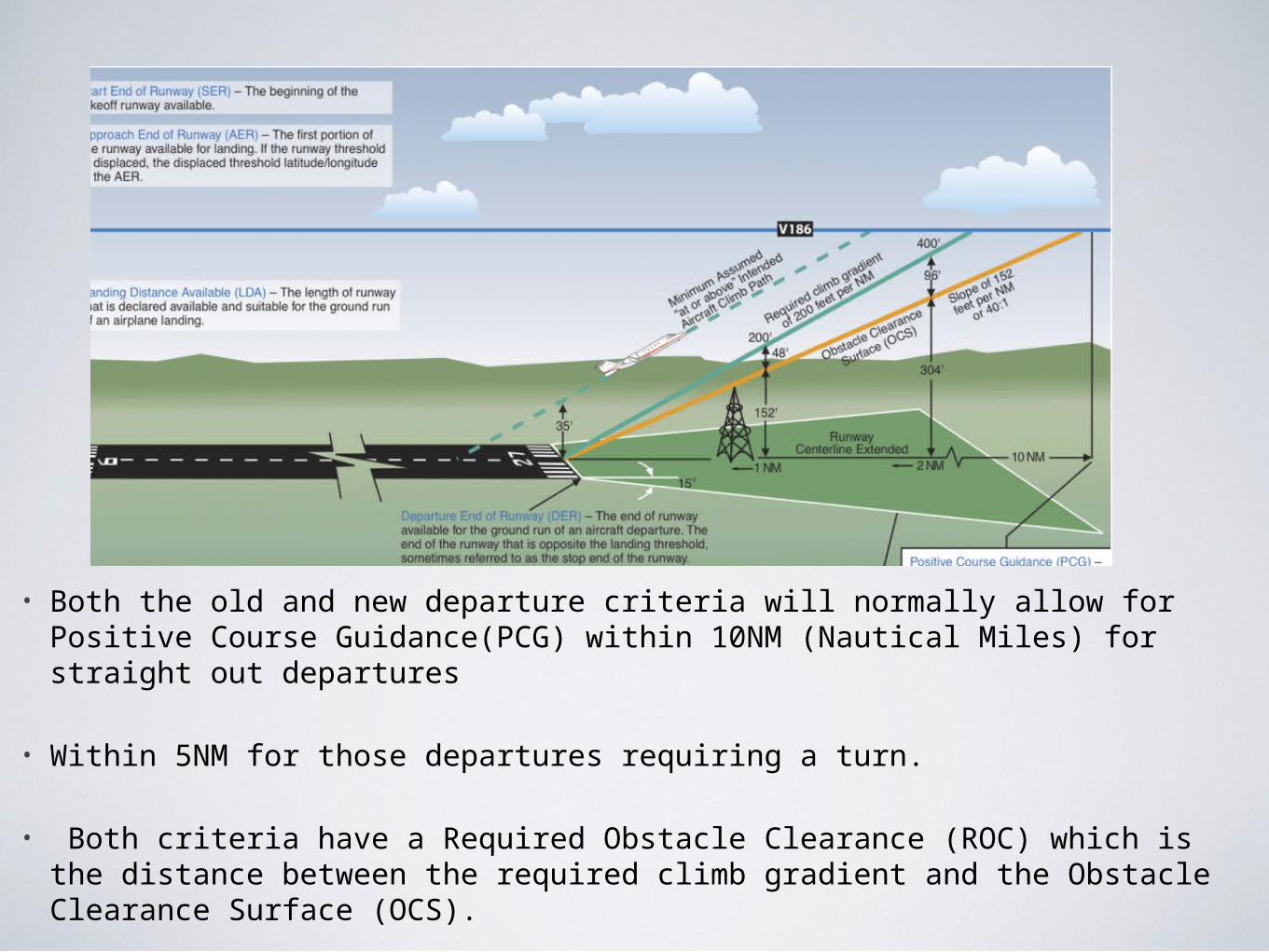
• Both the old and new departure criteria will normally allow for Positive Course Guidance(PCG) within 10NM (Nautical Miles) for straight out departures
• Within 5NM for those departures requiring a turn.
• Both criteria have a Required Obstacle Clearance (ROC) which is the distance between the required climb gradient and the Obstacle Clearance Surface (OCS).
Calculating Rate Of Climb Required
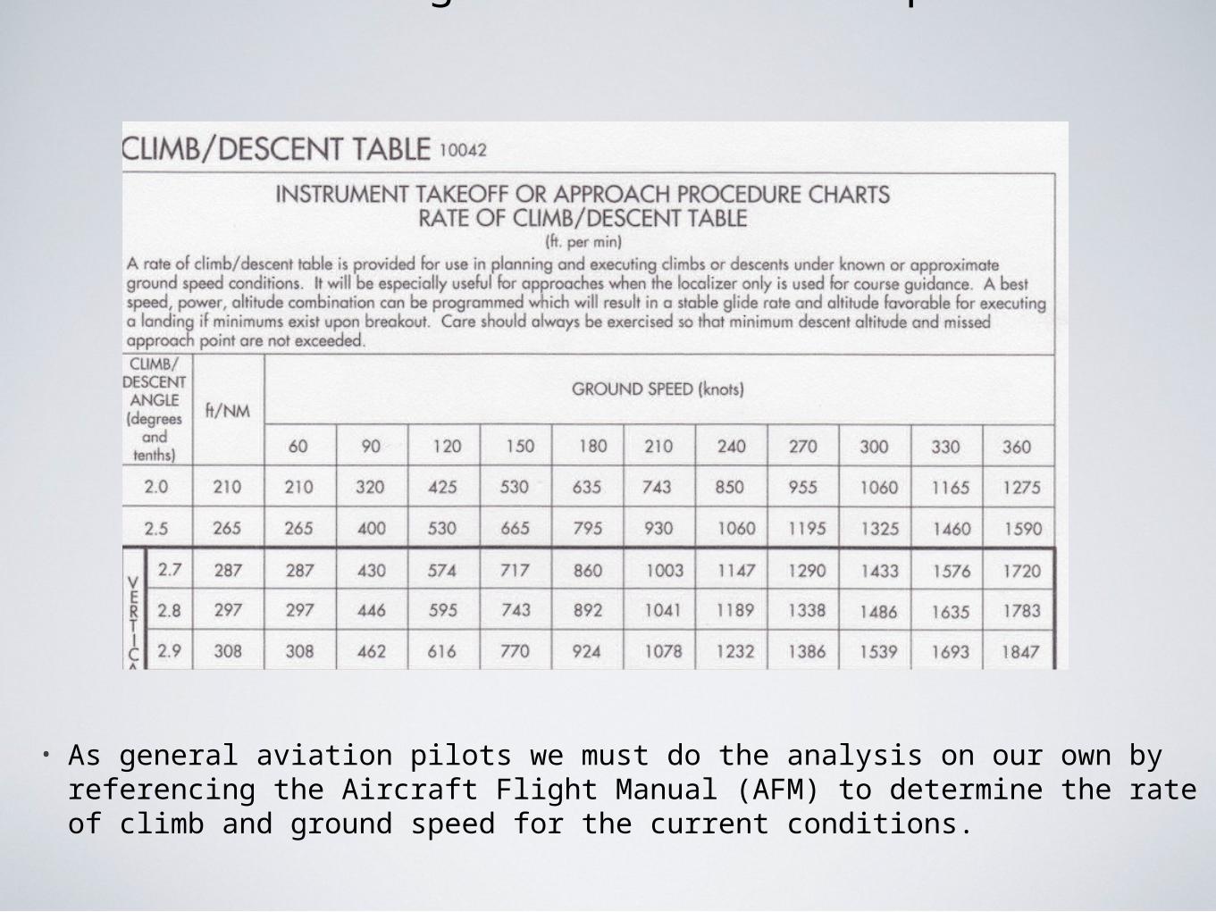
• As general aviation pilots we must do the analysis on our own by referencing the Aircraft Flight Manual (AFM) to determine the rate of climb and ground speed for the current conditions.
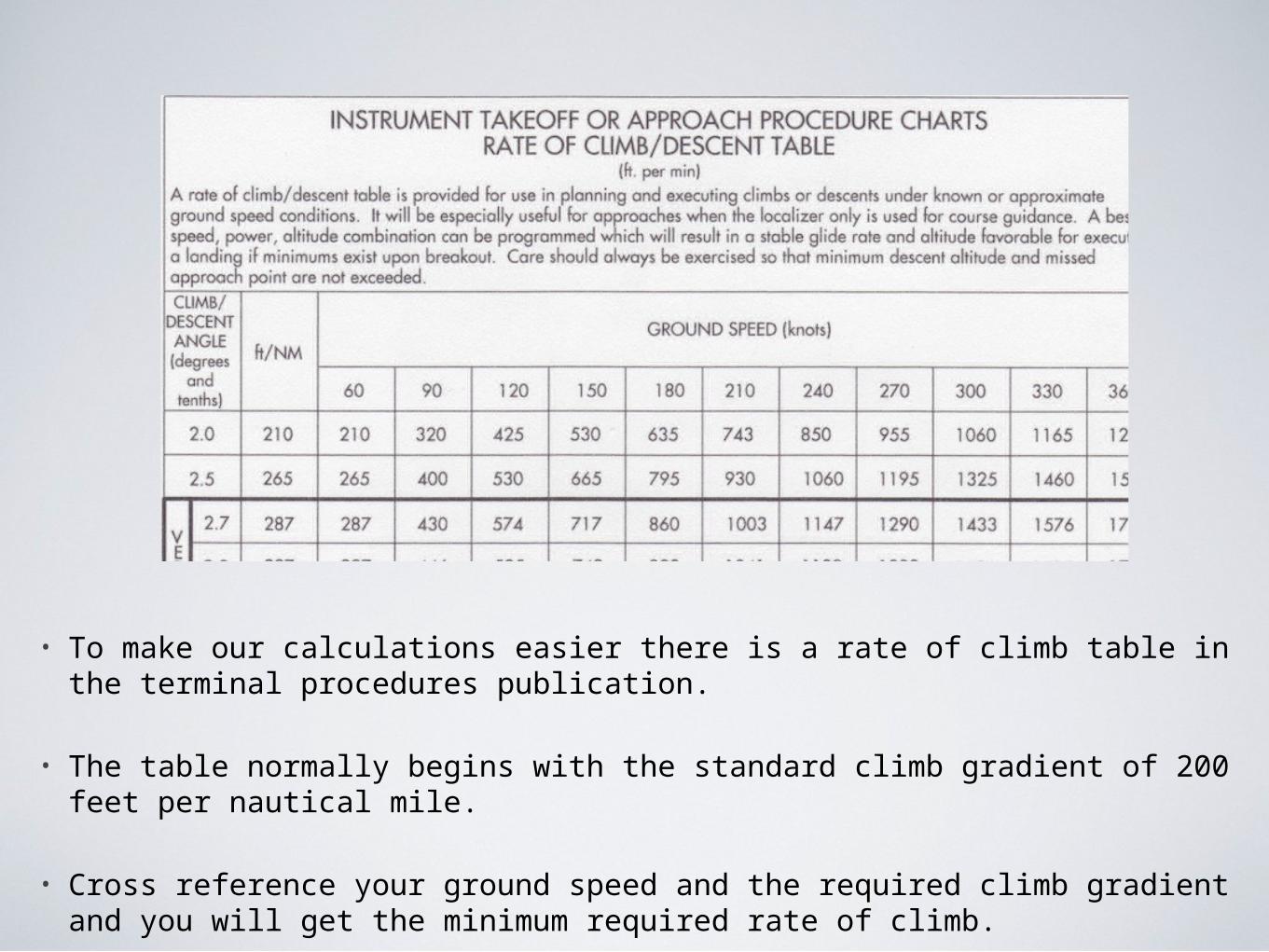
• To make our calculations easier there is a rate of climb table in the terminal procedures publication.
• The table normally begins with the standard climb gradient of 200 feet per nautical mile.
• Cross reference your ground speed and the required climb gradient and you will get the minimum required rate of climb.
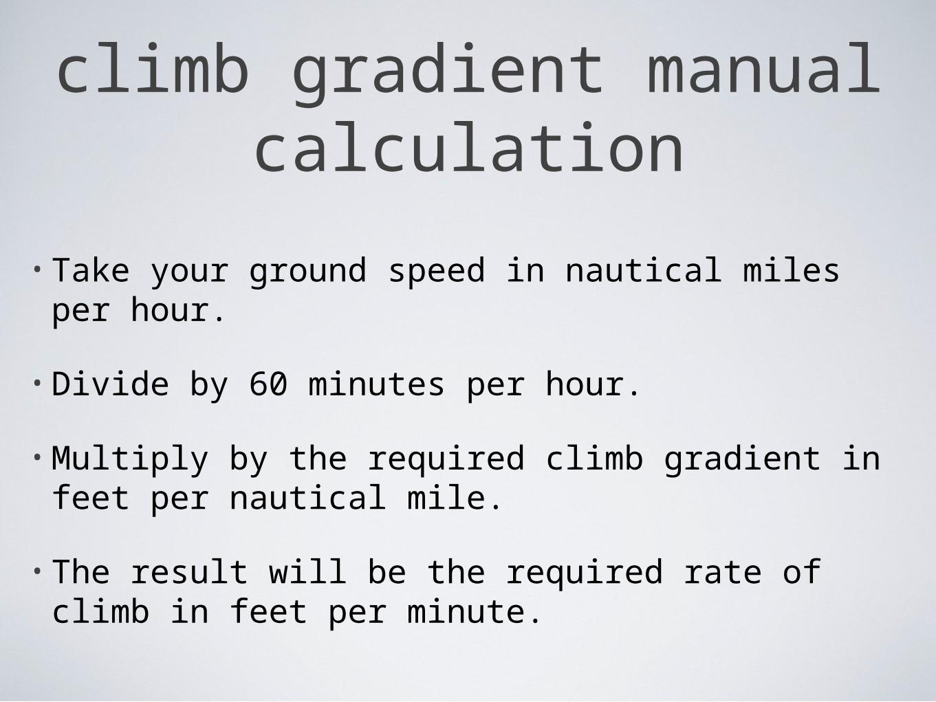
• Take your ground speed in nautical miles per hour.
• Divide by 60 minutes per hour.
• Multiply by the required climb gradient in feet per nautical mile.
• The result will be the required rate of climb in feet per minute.
climb gradient manual calculation
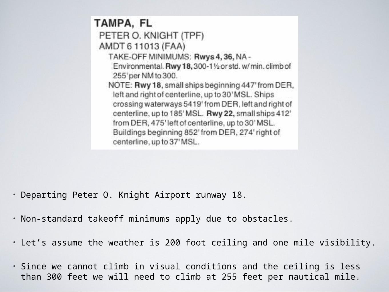
• Departing Peter O. Knight Airport runway 18.
• Non-standard takeoff minimums apply due to obstacles.
• Let’s assume the weather is 200 foot ceiling and one mile visibility.
• Since we cannot climb in visual conditions and the ceiling is less than 300 feet we will need to climb at 255 feet per nautical mile.
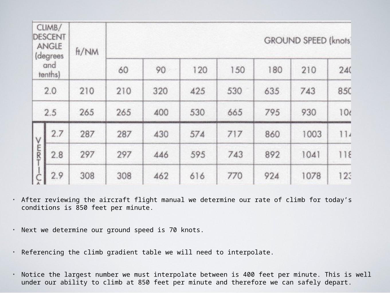
• After reviewing the aircraft flight manual we determine our rate of climb for today’s conditions is 850 feet per minute.
• Next we determine our ground speed is 70 knots.
• Referencing the climb gradient table we will need to interpolate.
• Notice the largest number we must interpolate between is 400 feet per minute. This is well under our ability to climb at 850 feet per minute and therefore we can safely depart.
• Take the required 255 feet per nautical mile and our ground speed of 70 knots and plug it into our formula:
• 70 nautical miles per hour divided by 60 minutes
• Result 1.167 KTS per minute.
• 1.167 KTS per minute times 255 feet per nautical mile.
• Result is 298 feet per minute required rate of climb.
• Well under our 850 feet per minute rate of climb.
If we wanted to calculate a more exact figure
Alternate Filing With A WAAS Certified GPS
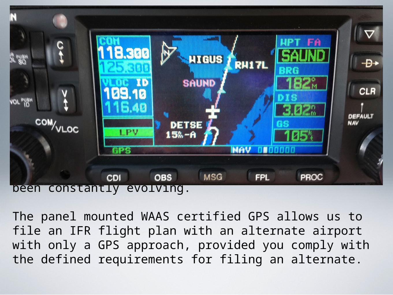
Since the advent of WAAS the rules and acceptable use of the panel mounted WAAS certified GPS has been constantly evolving.
The panel mounted WAAS certified GPS allows us to file an IFR flight plan with an alternate airport with only a GPS approach, provided you comply with the defined requirements for filing an alternate.
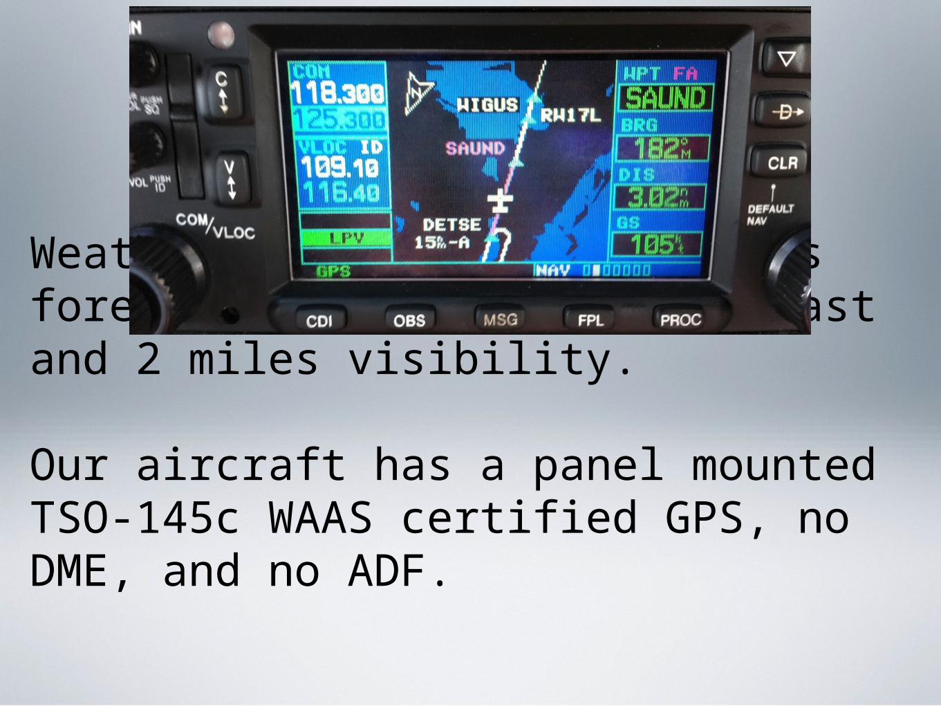
Weather at your destination is forecast to be 200 feet overcast and 2 miles visibility.
Our aircraft has a panel mounted TSO-145c WAAS certified GPS, no DME, and no ADF.
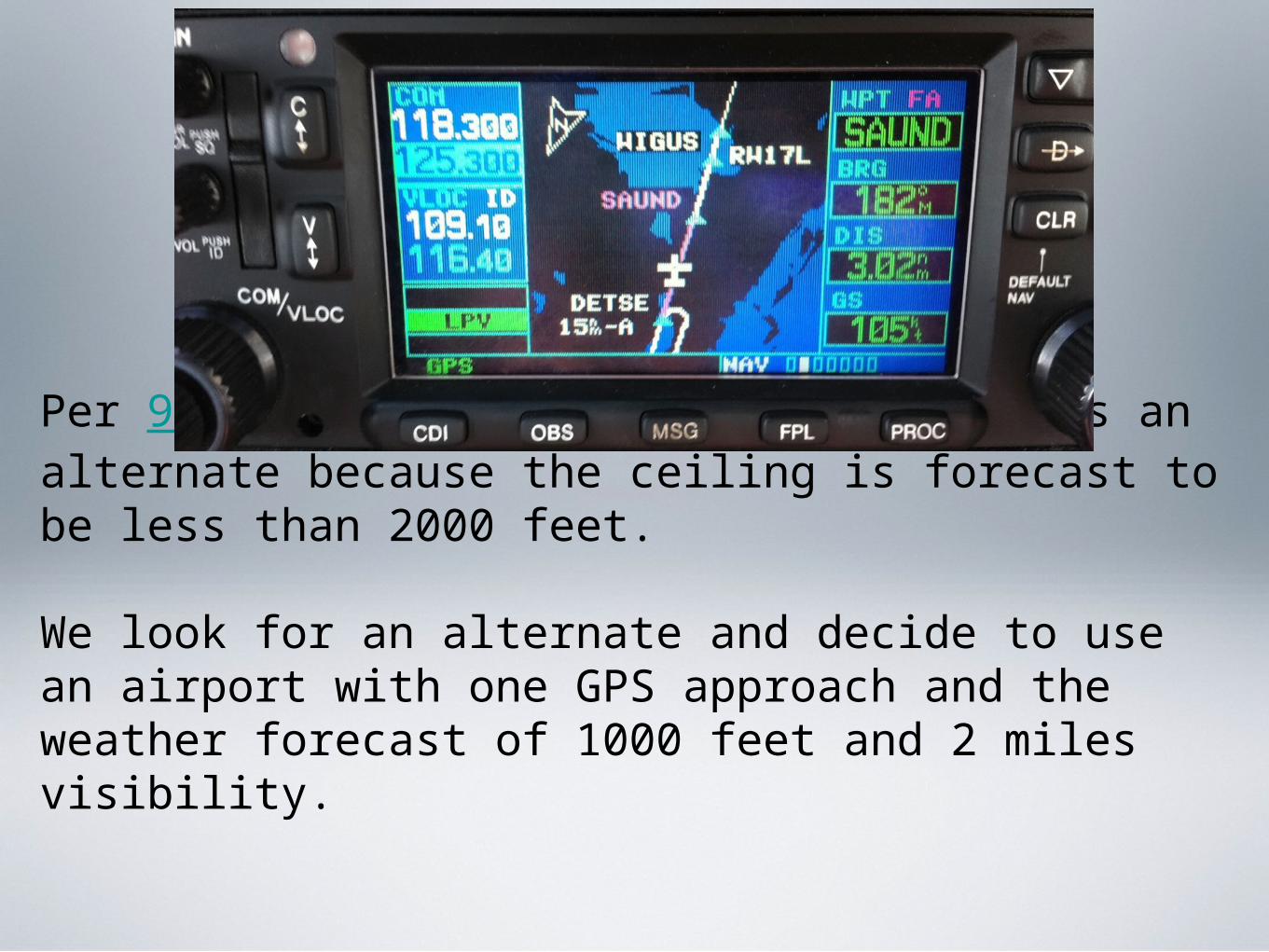
Per 91.169 the weather forecast requires an alternate because the ceiling is forecast to be less than 2000 feet.
We look for an alternate and decide to use an airport with one GPS approach and the weather forecast of 1000 feet and 2 miles visibility.
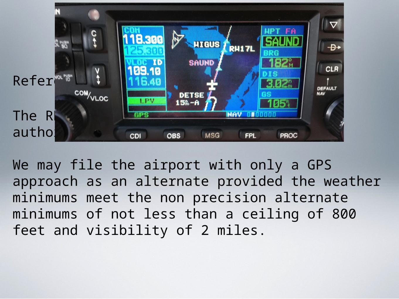
Reference AIM 1-1-20
The RNAV approach in our example is authorized as an alternate.
We may file the airport with only a GPS approach as an alternate provided the weather minimums meet the non precision alternate minimums of not less than a ceiling of 800 feet and visibility of 2 miles.
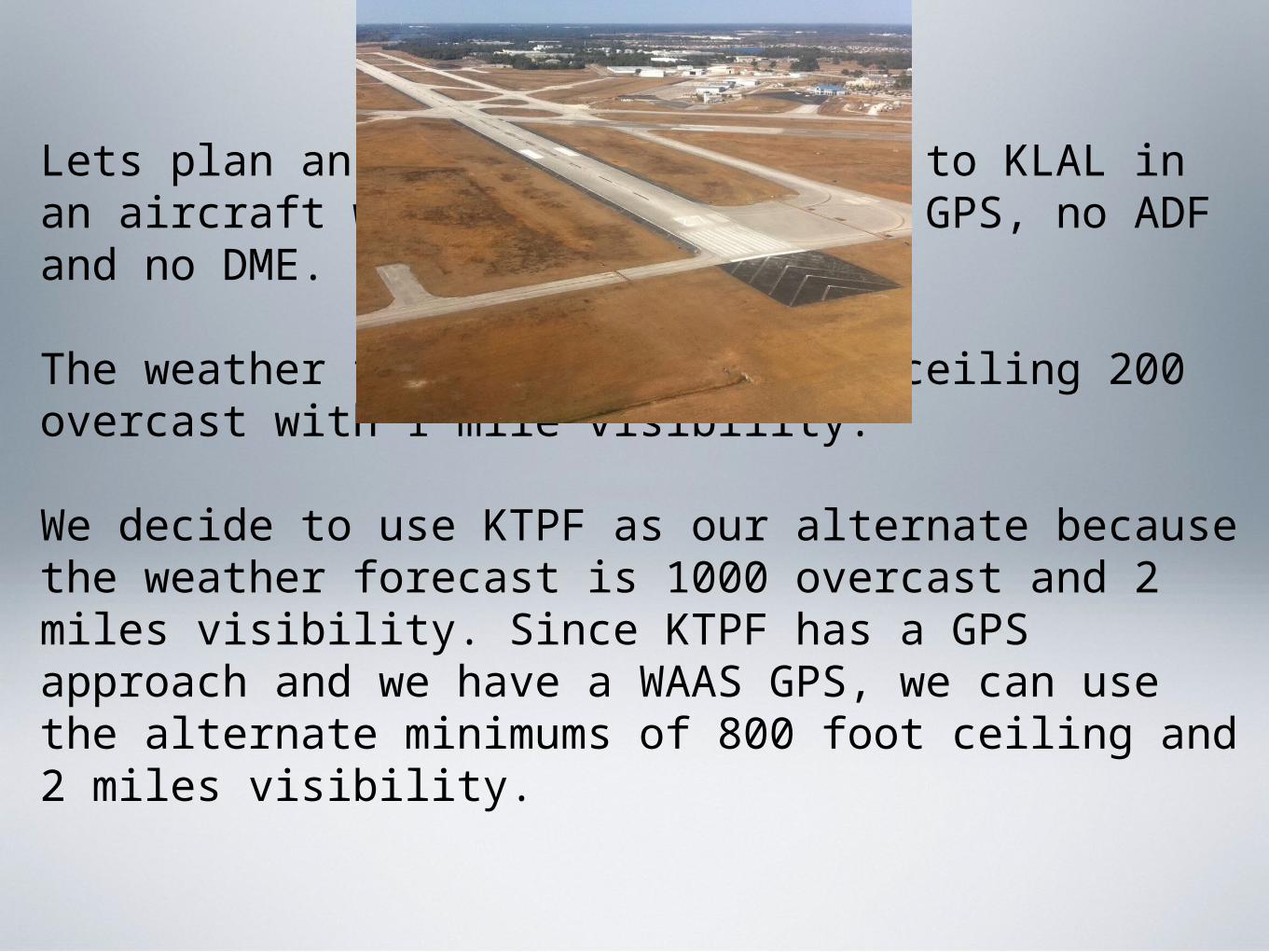
Lets plan an IFR flight from KORL to KLAL in an aircraft with a WAAS certified GPS, no ADF and no DME.
The weather forecast for KLAL is ceiling 200 overcast with 1 mile visibility.
We decide to use KTPF as our alternate because the weather forecast is 1000 overcast and 2 miles visibility. Since KTPF has a GPS approach and we have a WAAS GPS, we can use the alternate minimums of 800 foot ceiling and 2 miles visibility.
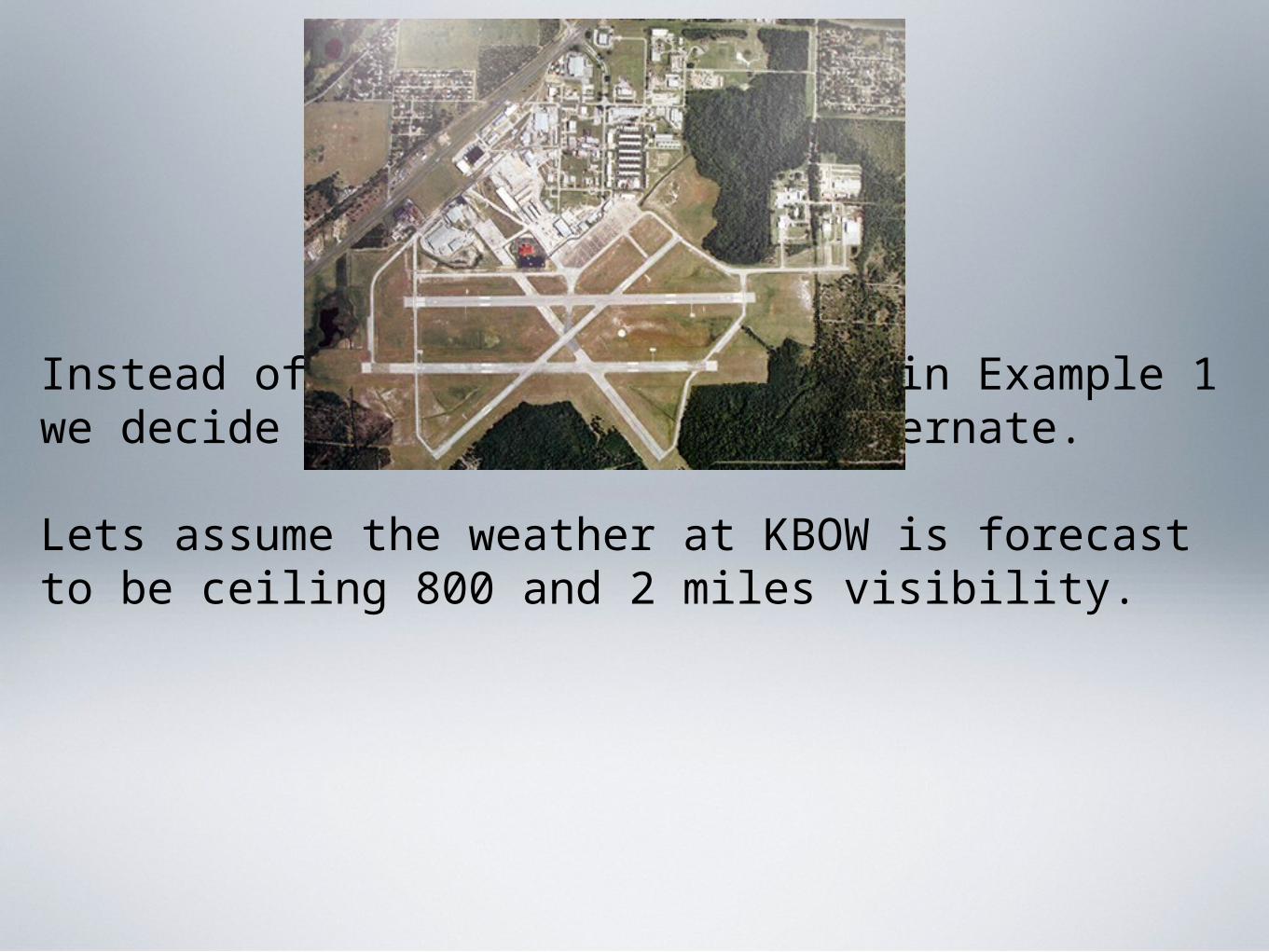
Instead of filing the alternate in Example 1 we decide to use KBOW as our alternate.
Lets assume the weather at KBOW is forecast to be ceiling 800 and 2 miles visibility.
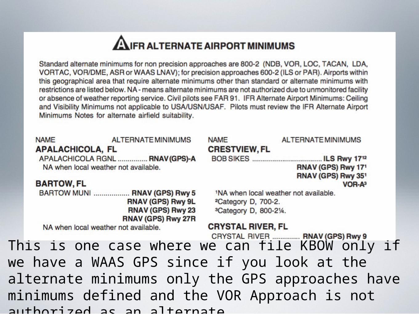
This is one case where we can file KBOW only if we have a WAAS GPS since if you look at the alternate minimums only the GPS approaches have minimums defined and the VOR Approach is not authorized as an alternate.
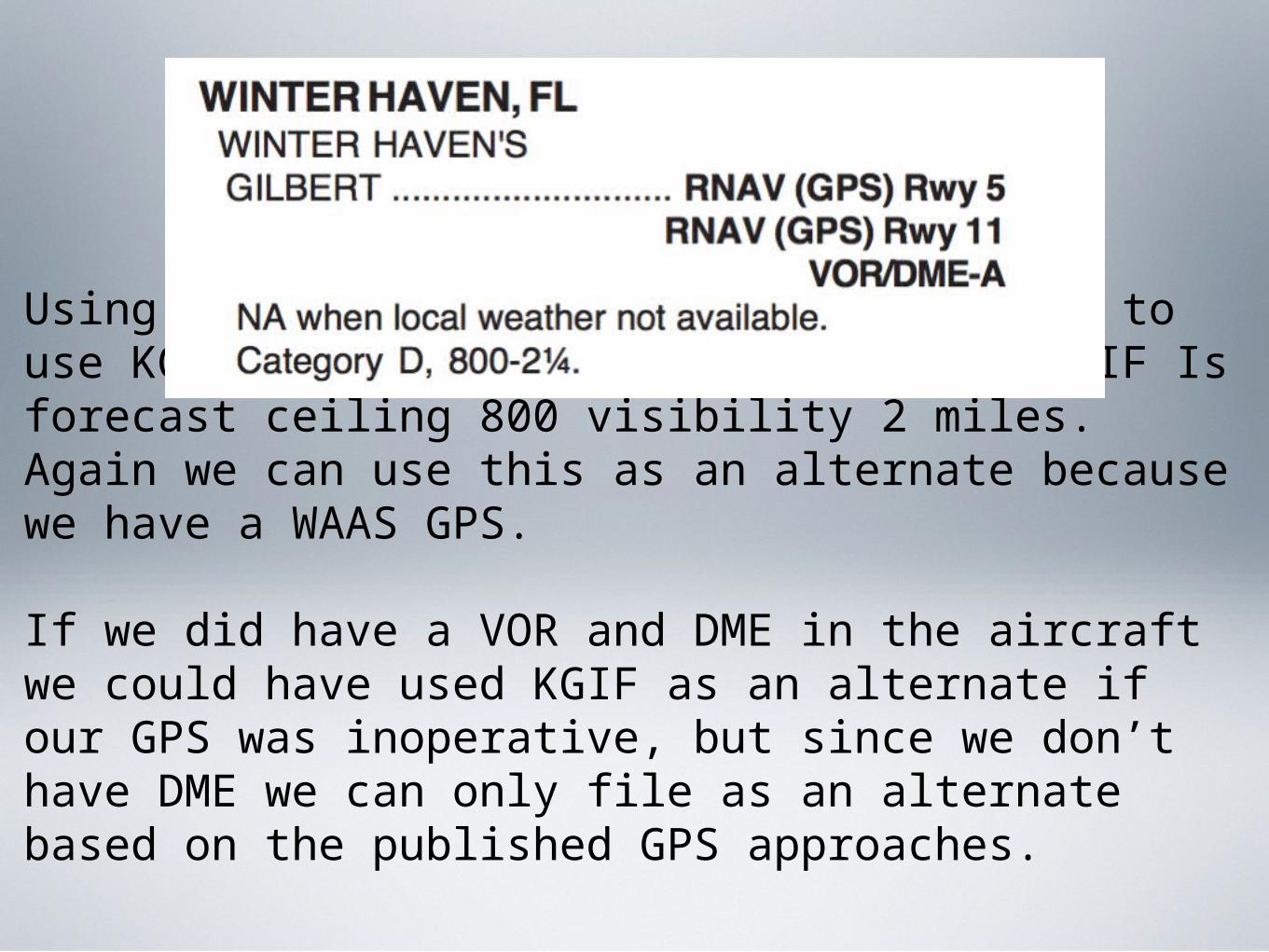
Using the same flight as above we decide to use KGIF as our alternate. Weather at KGIF Is forecast ceiling 800 visibility 2 miles. Again we can use this as an alternate because we have a WAAS GPS.
If we did have a VOR and DME in the aircraft we could have used KGIF as an alternate if our GPS was inoperative, but since we don’t have DME we can only file as an alternate based on the published GPS approaches.
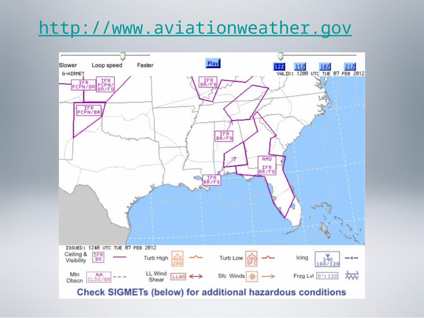
What Weather Forecasts Should I Use For My Destination And Alternate?
A review of the requirements for both weather reporting and when we should file an alternate.
As pilot in command for a flight under instrument flight rules we must become familiar with all available information concerning our flight which includes weather reports and forecasts (FAR 91.103 Preflight Action).
While preparing for our flight all available information should include both commercial and government publications including TV weather forecasts.
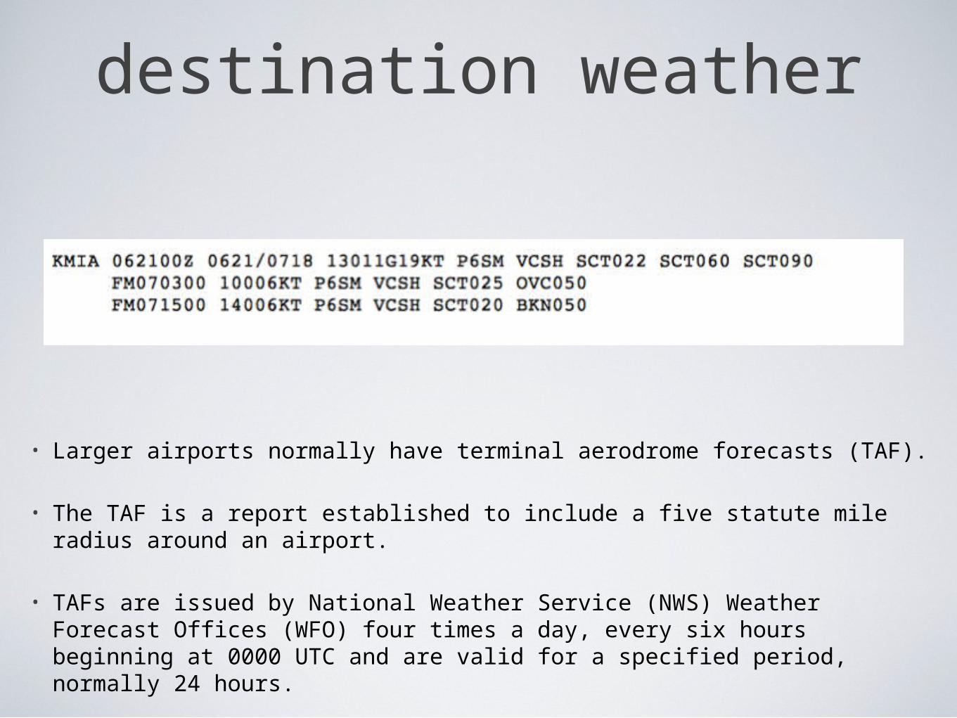
destination weather
• Larger airports normally have terminal aerodrome forecasts (TAF).
• The TAF is a report established to include a five statute mile radius around an airport.
• TAFs are issued by National Weather Service (NWS) Weather Forecast Offices (WFO) four times a day, every six hours beginning at 0000 UTC and are valid for a specified period, normally 24 hours.
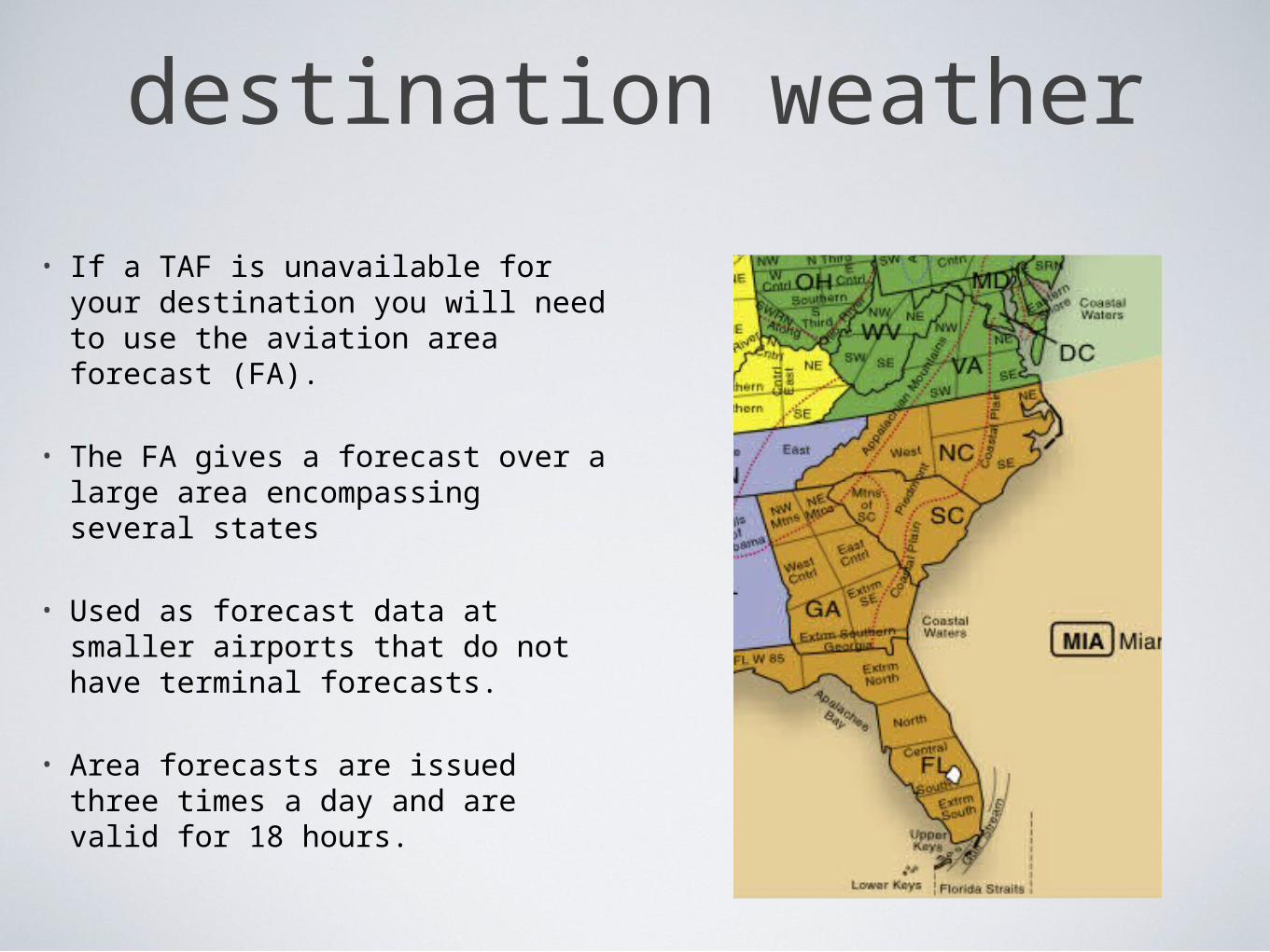
destination weather
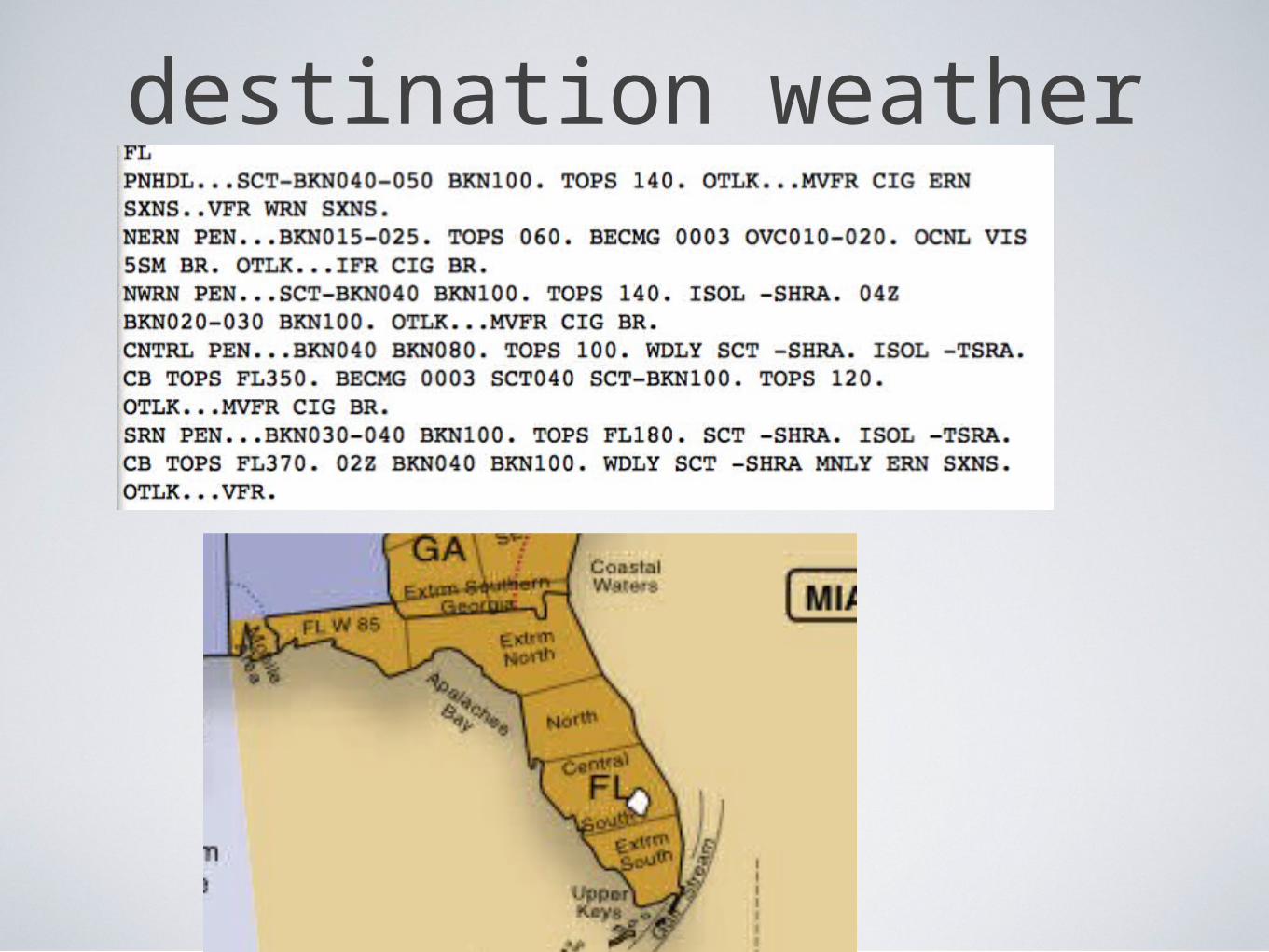
• If a TAF is unavailable for your destination you will need to use the aviation area forecast (FA).
• The FA gives a forecast over a large area encompassing several states
• Used as forecast data at smaller airports that do not have terminal forecasts.
• Area forecasts are issued three times a day and are valid for 18 hours.
destination weather
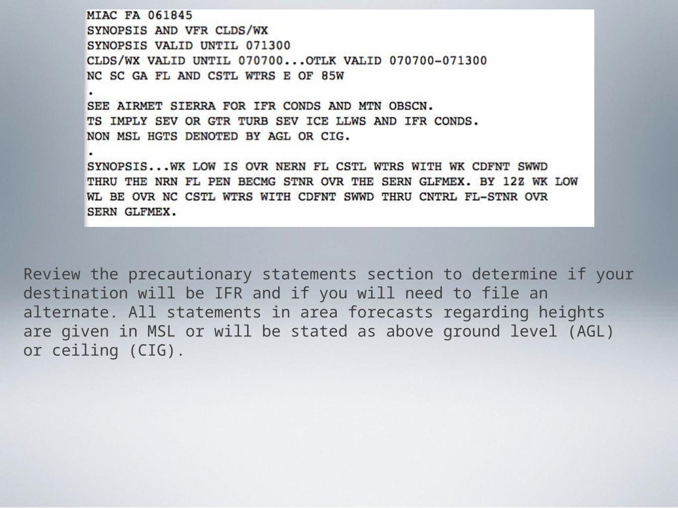
Review the precautionary statements section to determine if your destination will be IFR and if you will need to file an alternate. All statements in area forecasts regarding heights are given in MSL or will be stated as above ground level (AGL) or ceiling (CIG).
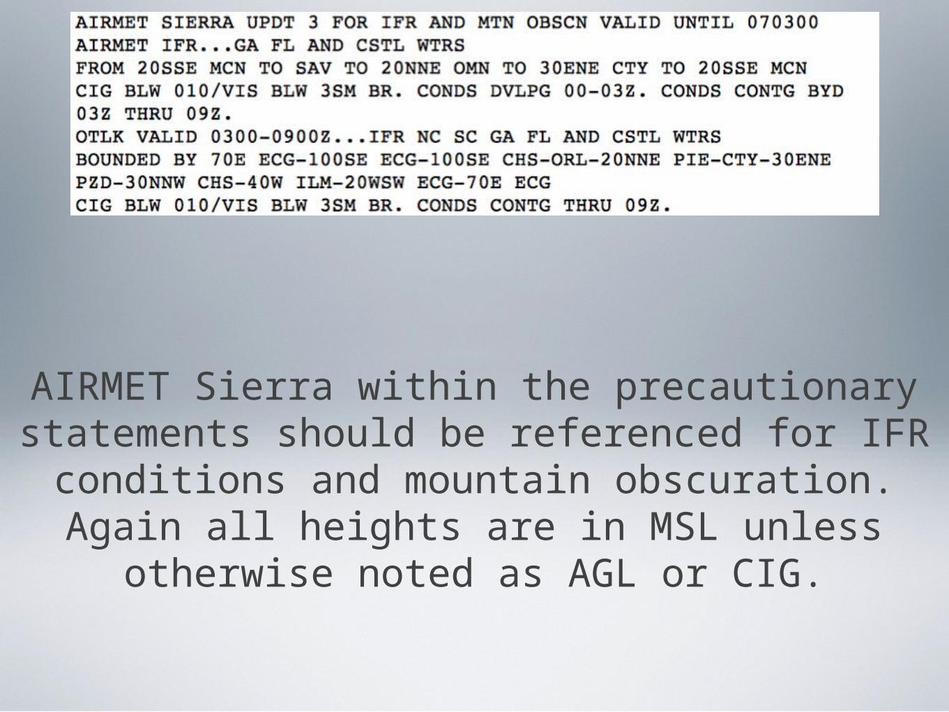
AIRMET Sierra within the precautionary statements should be referenced for IFR conditions and mountain
obscuration. Again all heights are in MSL unless otherwise noted as AGL or CIG.
Alternate Weather
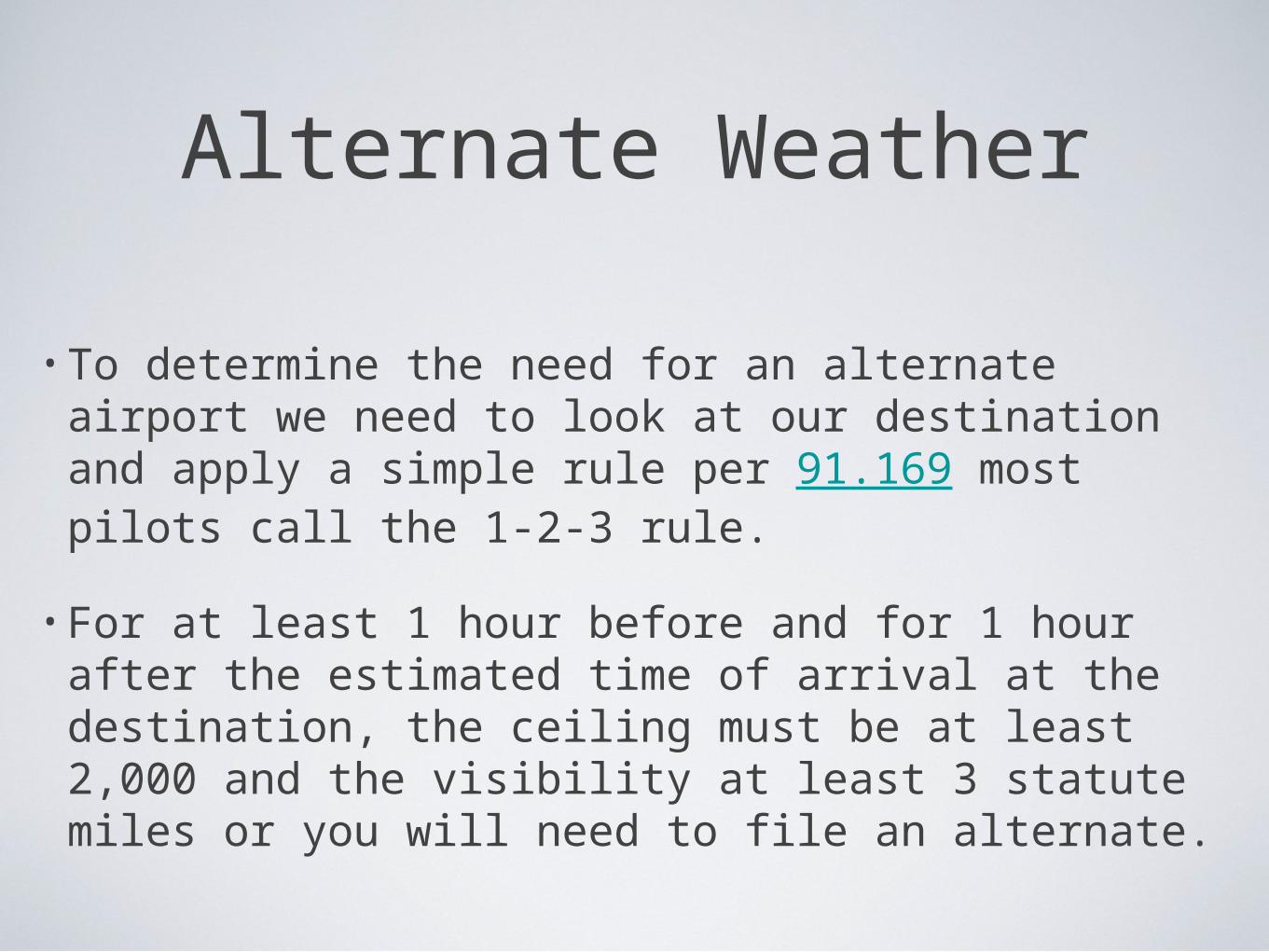
• To determine the need for an alternate airport we need to look at our destination and apply a simple rule per 91.169 most pilots call the 1-2-3 rule.
• For at least 1 hour before and for 1 hour after the estimated time of arrival at the destination, the ceiling must be at least 2,000 and the visibility at least 3 statute miles or you will need to file an alternate.
Alternate Weather
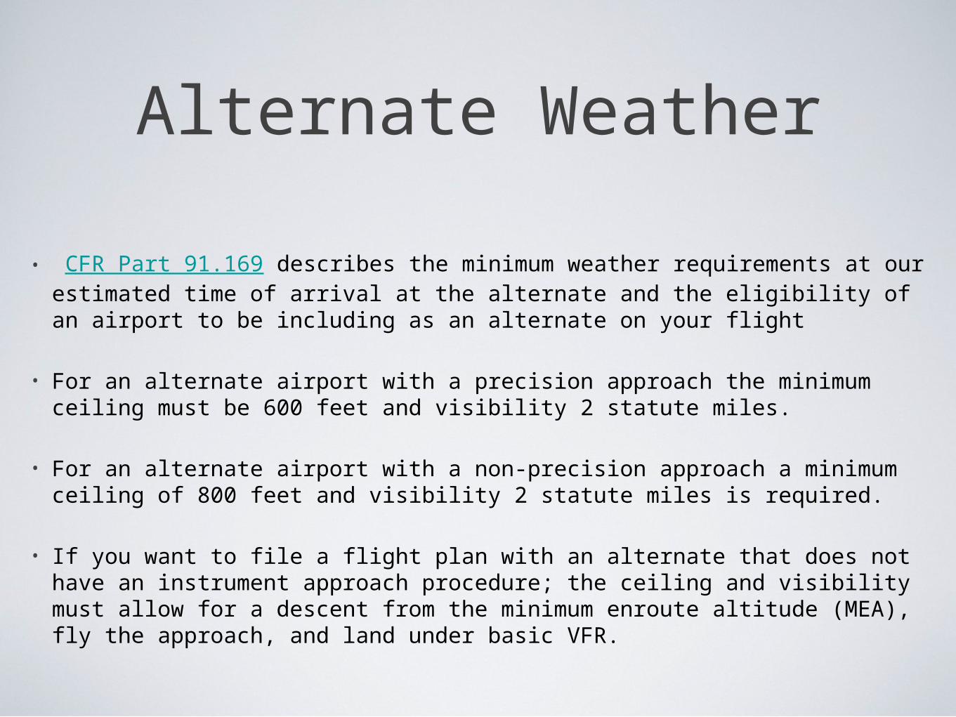
• CFR Part 91.169 describes the minimum weather requirements at our estimated time of arrival at the alternate and the eligibility of an airport to be including as an alternate on your flight
• For an alternate airport with a precision approach the minimum ceiling must be 600 feet and visibility 2 statute miles.
• For an alternate airport with a non-precision approach a minimum ceiling of 800 feet and visibility 2 statute miles is required.
• If you want to file a flight plan with an alternate that does not have an instrument approach procedure; the ceiling and visibility must allow for a descent from the minimum enroute altitude (MEA), fly the approach, and land under basic VFR.
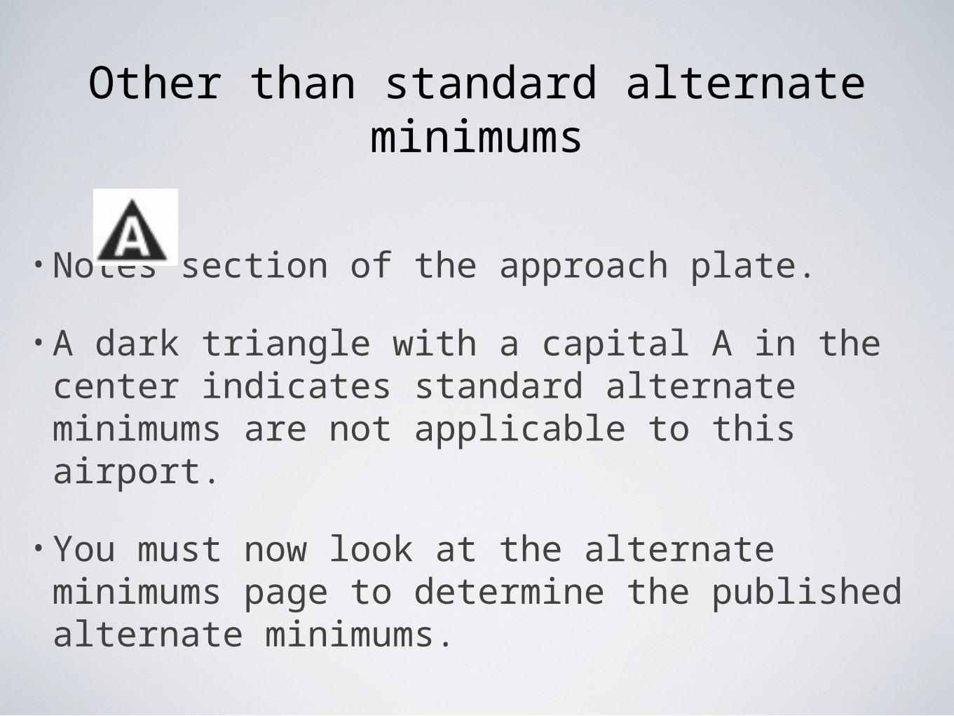
Other than standard alternate minimums
• Notes section of the approach plate.
• A dark triangle with a capital A in the center indicates standard alternate minimums are not applicable to this airport.
• You must now look at the alternate minimums page to determine the published alternate minimums.
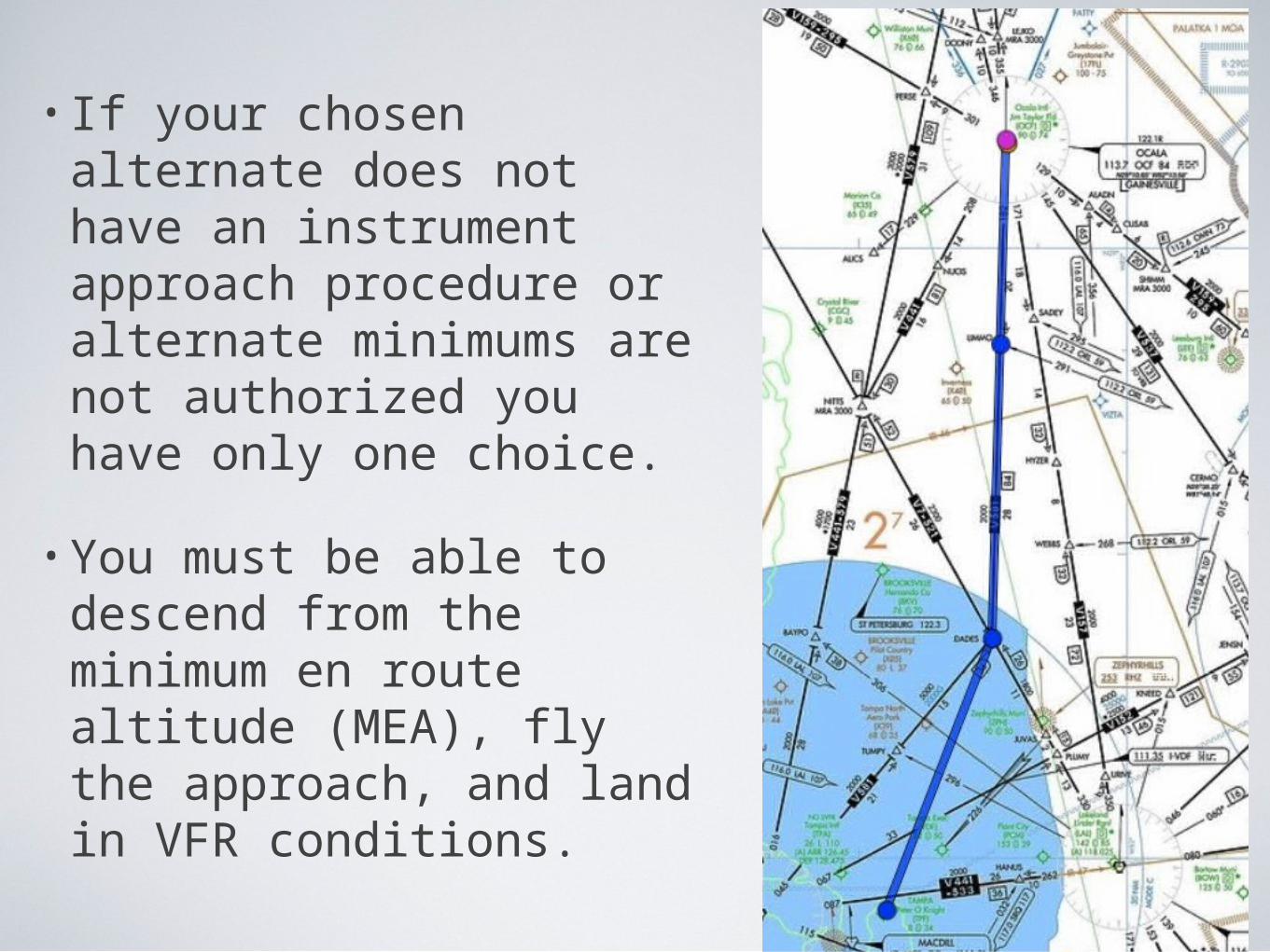
• If your chosen alternate does not have an instrument approach procedure or alternate minimums are not authorized you have only one choice.
• You must be able to descend from the minimum en route altitude (MEA), fly the approach, and land in VFR conditions.
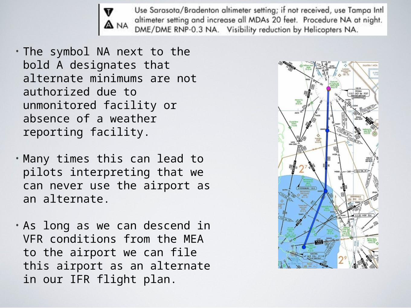
• The symbol NA next to the bold A designates that alternate minimums are not authorized due to unmonitored facility or absence of a weather reporting facility.
• Many times this can lead to pilots interpreting that we can never use the airport as an alternate.
• As long as we can descend in VFR conditions from the MEA to the airport we can file this airport as an alternate in our IFR flight plan.
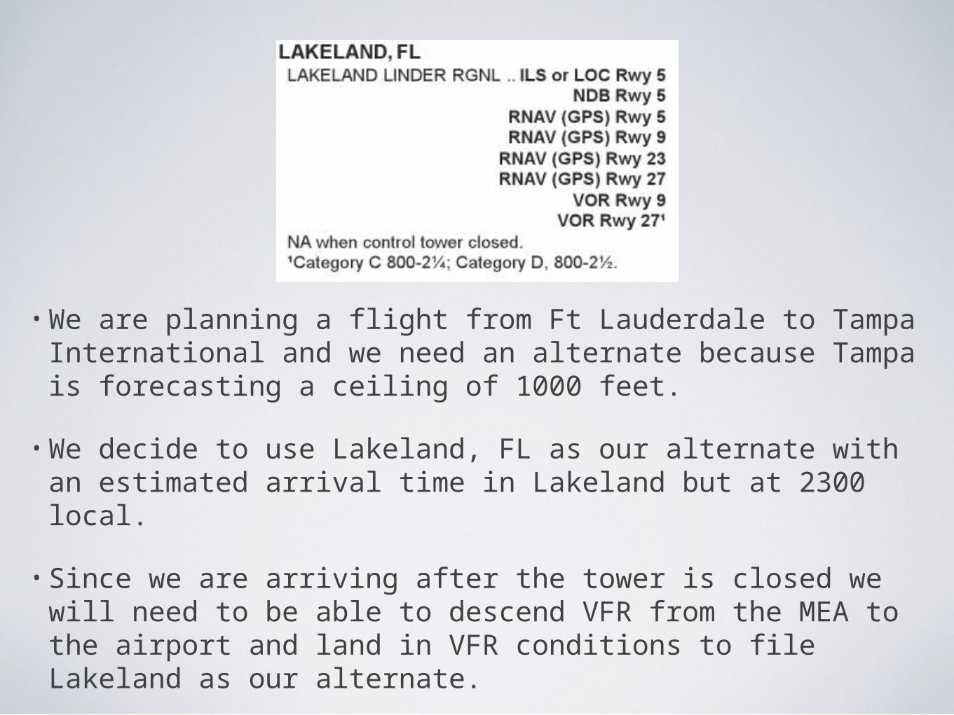
• We are planning a flight from Ft Lauderdale to Tampa International and we need an alternate because Tampa is forecasting a ceiling of 1000 feet.
• We decide to use Lakeland, FL as our alternate with an estimated arrival time in Lakeland but at 2300 local.
• Since we are arriving after the tower is closed we will need to be able to descend VFR from the MEA to the airport and land in VFR conditions to file Lakeland as our alternate.
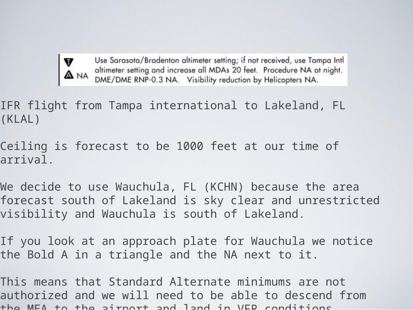
IFR flight from Tampa international to Lakeland, FL (KLAL)
Ceiling is forecast to be 1000 feet at our time of arrival.
We decide to use Wauchula, FL (KCHN) because the area forecast south of Lakeland is sky clear and unrestricted visibility and Wauchula is south of Lakeland.
If you look at an approach plate for Wauchula we notice the Bold A in a triangle and the NA next to it.
This means that Standard Alternate minimums are not authorized and we will need to be able to descend from the MEA to the airport and land in VFR conditions.

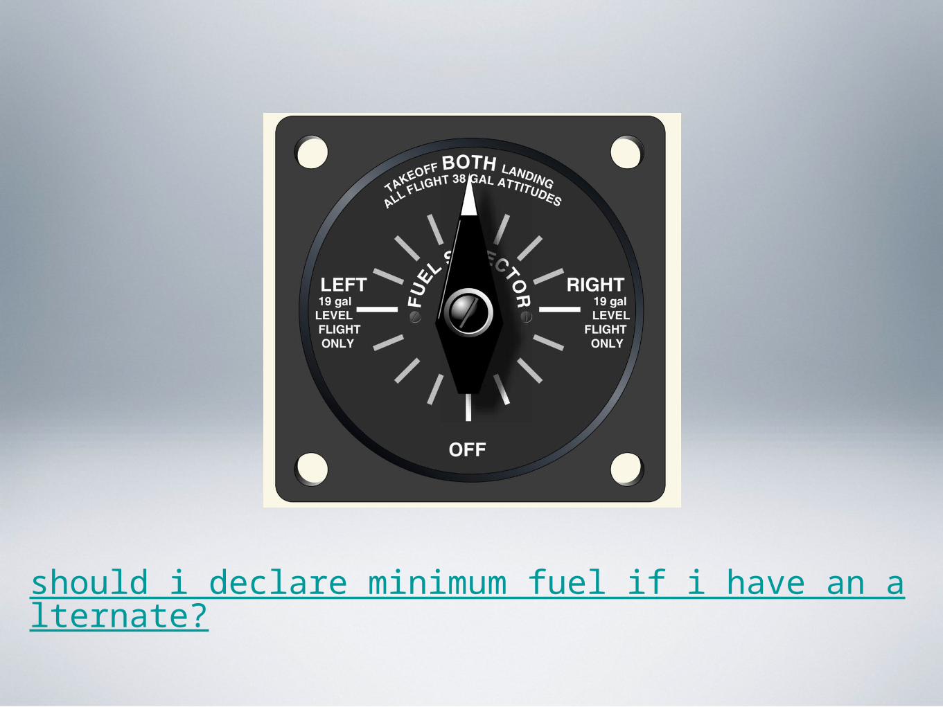
should i declare minimum fuel if i have an alternate?
should i declare minimum fuel if i have an alternate?
• If you have any problem or are experiencing a condition that would jeopardize the safety of the flight you should immediately let ATC know.
• Minimum Fuel is “when your fuel supply has reached a state where upon reaching your destination you cannot accept any undue delay”.
should i declare minimum fuel if i have an alternate?
• Declaring minimum fuel is an advisory to ATC and requires no paper work.
• If you need priority because you are low on fuel then you should declare an emergency and let ATC know how much fuel in minutes you have on board.
should i declare minimum fuel if i have an alternate?
• You have an alternate filed.
• Holding or delayed vectors let are issued by ATC.
• Let ATC know your fuel situation long before you need to proceed to your alternate.
• Communicating with ATC early about your fuel situation might enable you to get to your destination earlier.
should i declare minimum fuel if i have an alternate?
• If proceeding to the alternate and you are “Min Fuel” let ATC know.

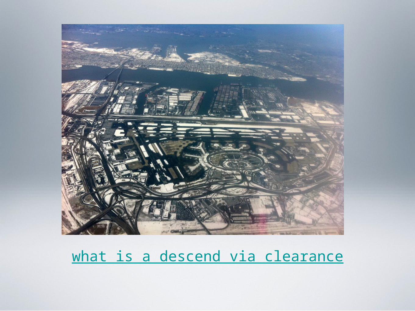
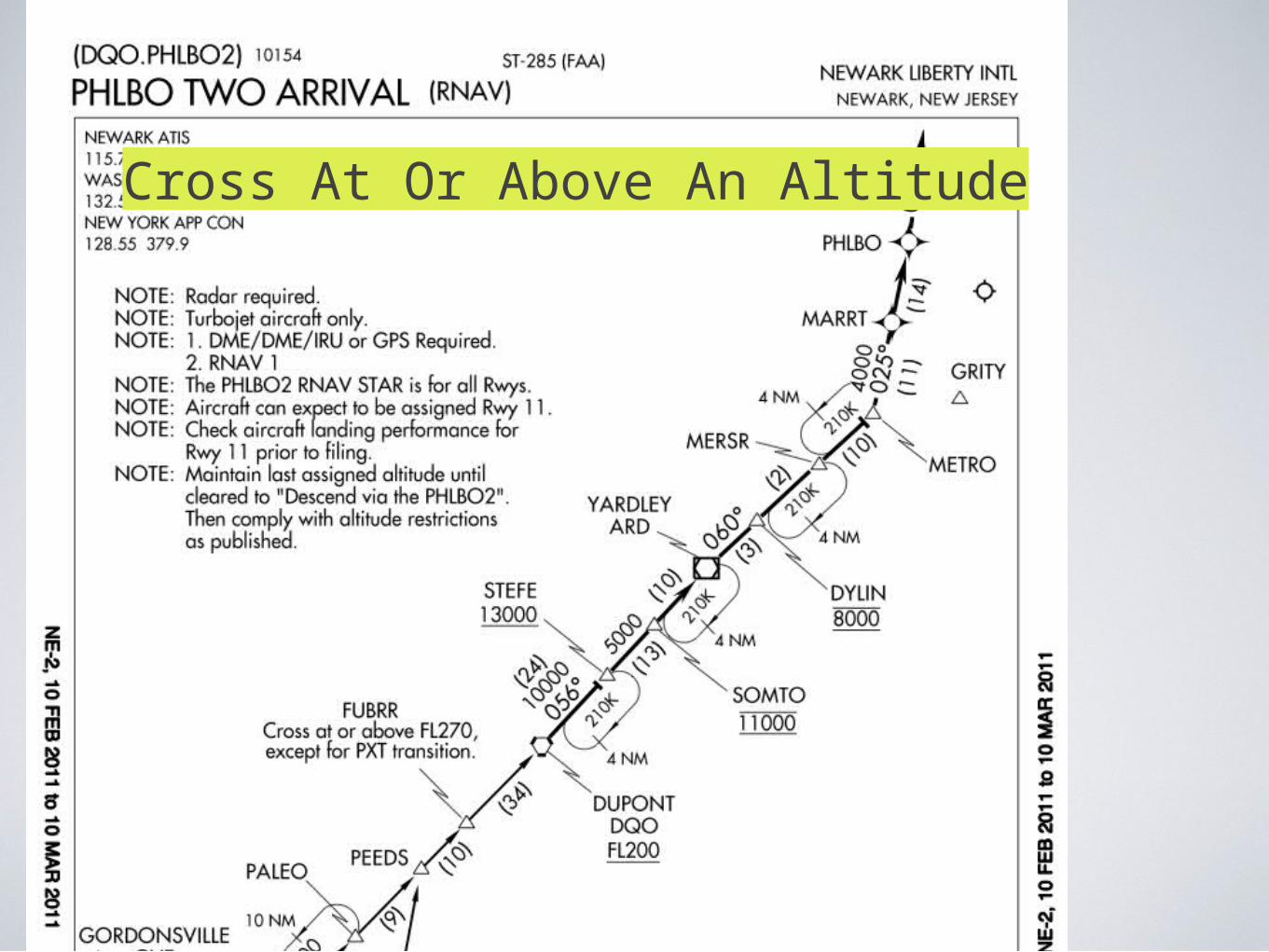
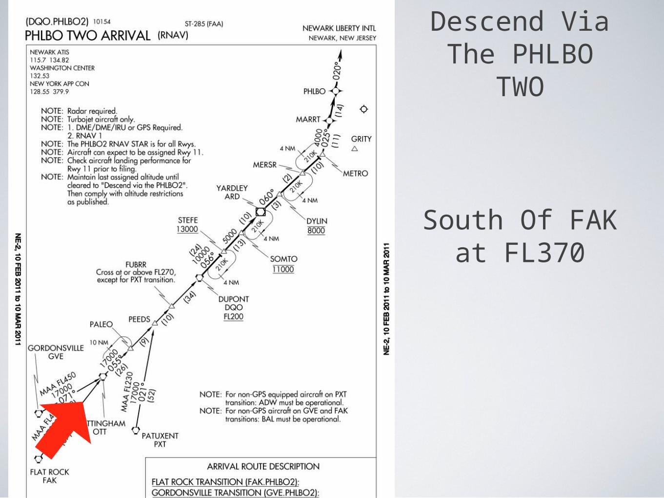
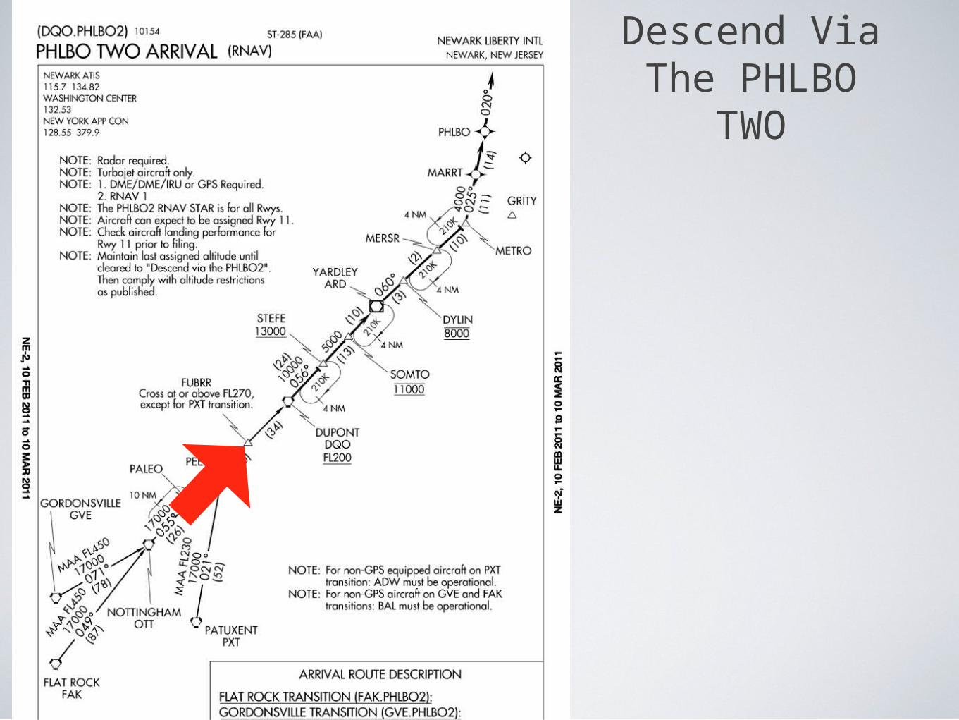
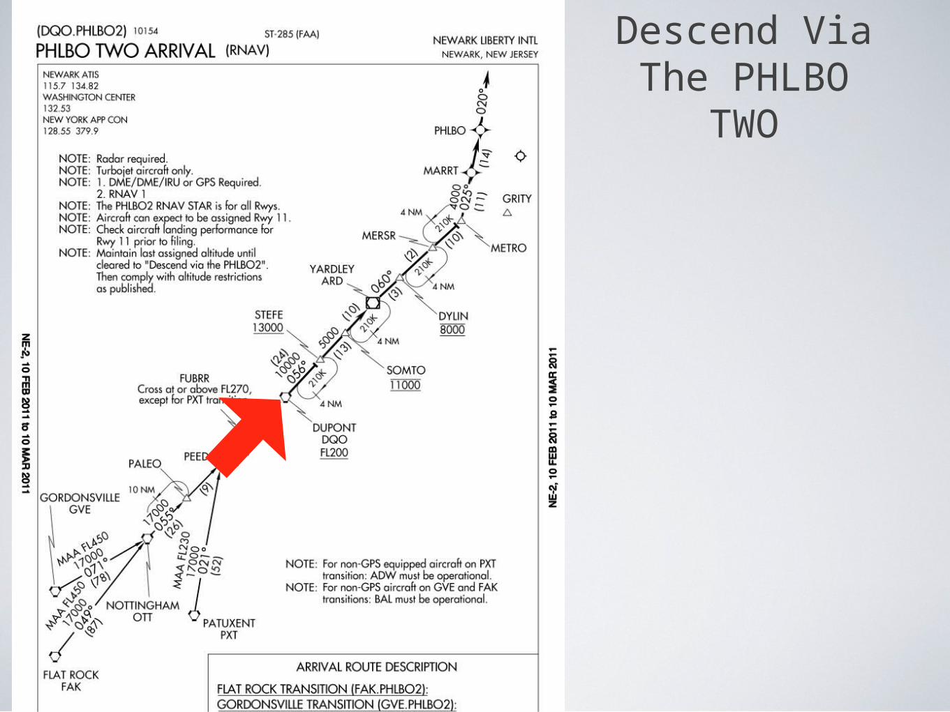
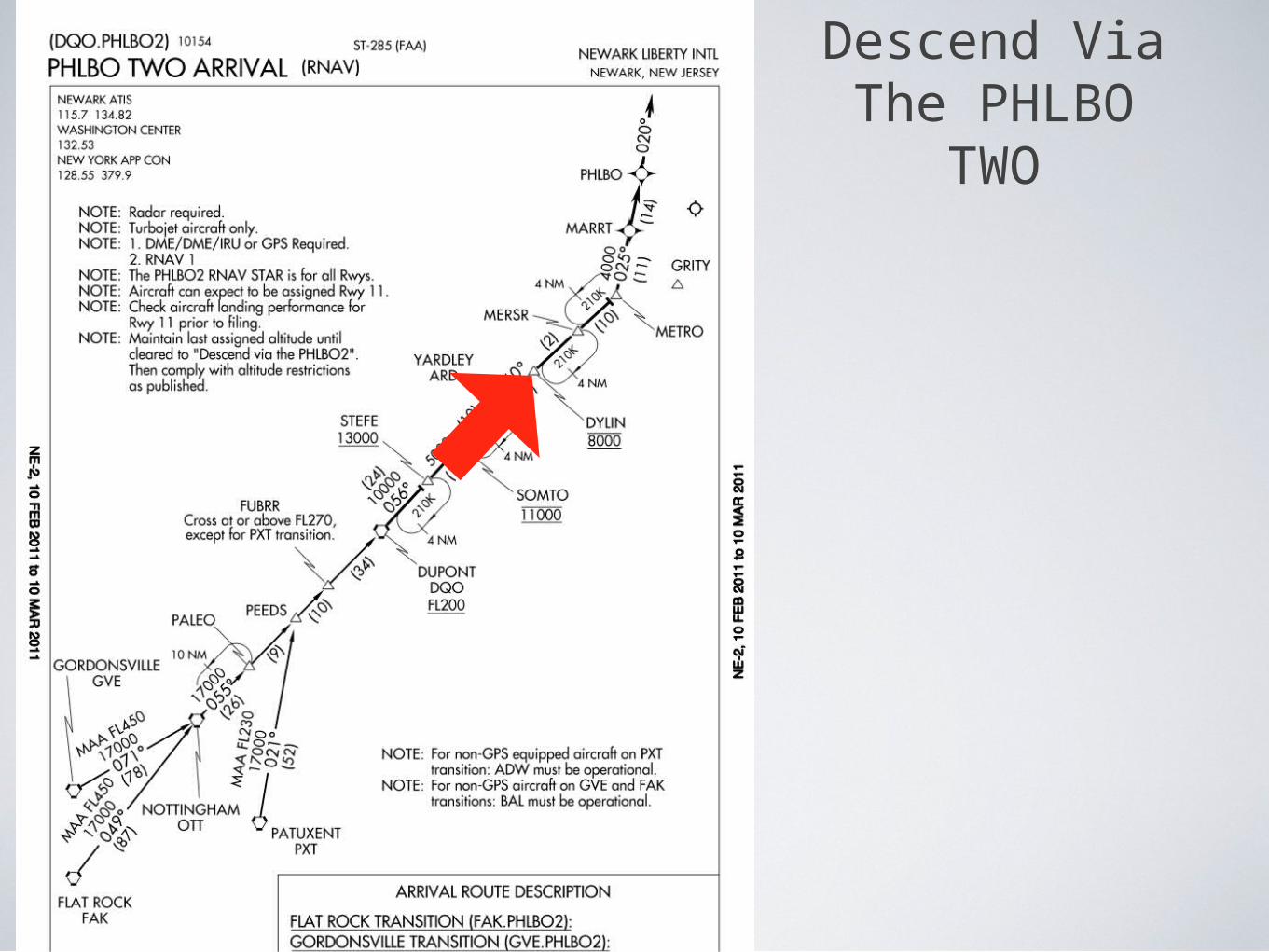
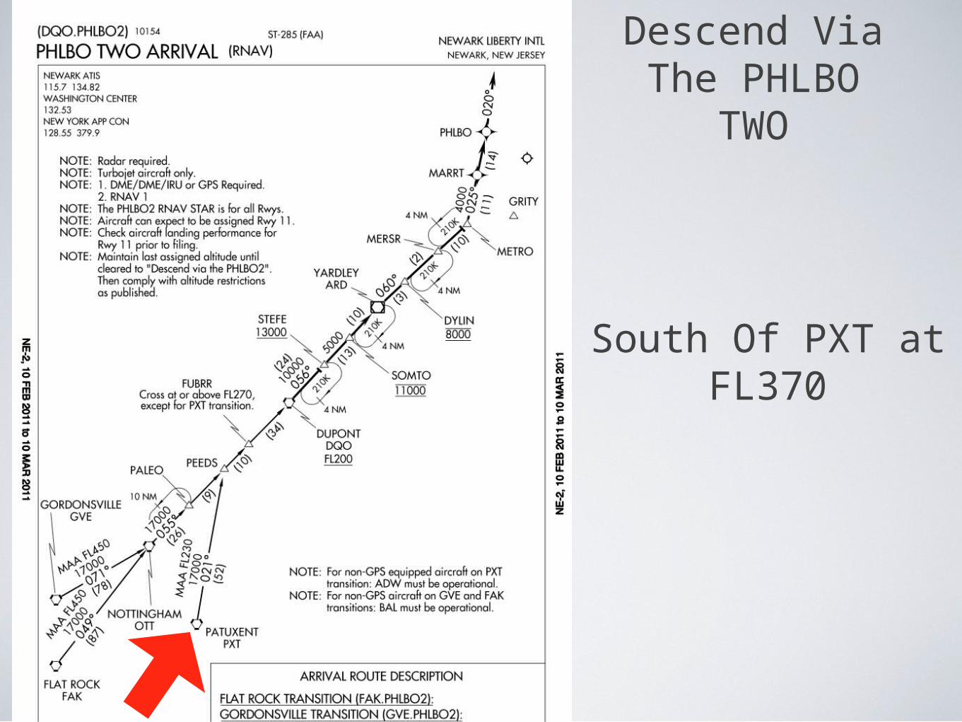
what is a descend via clearance
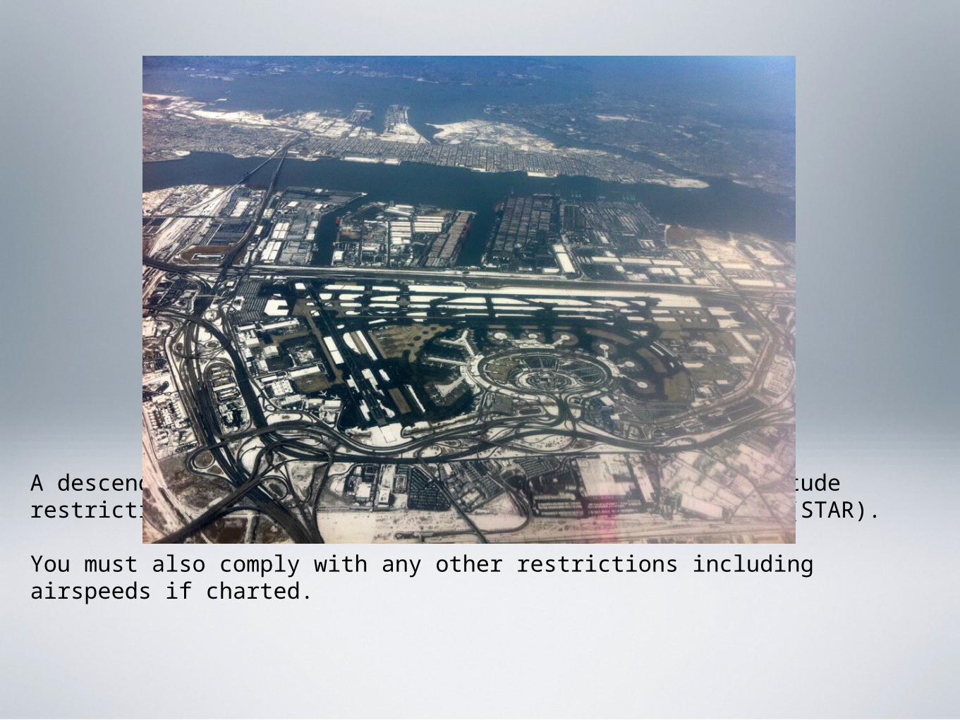
A descend via clearance instructs you to follow any altitude restrictions published on the standard terminal arrival (STAR).
You must also comply with any other restrictions including airspeeds if charted.
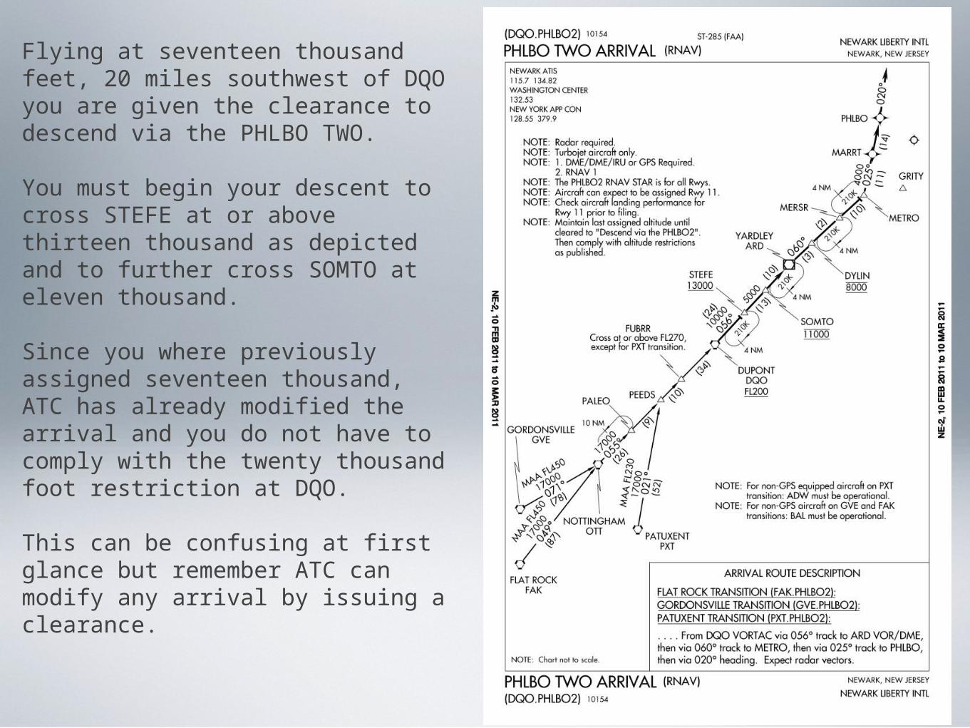
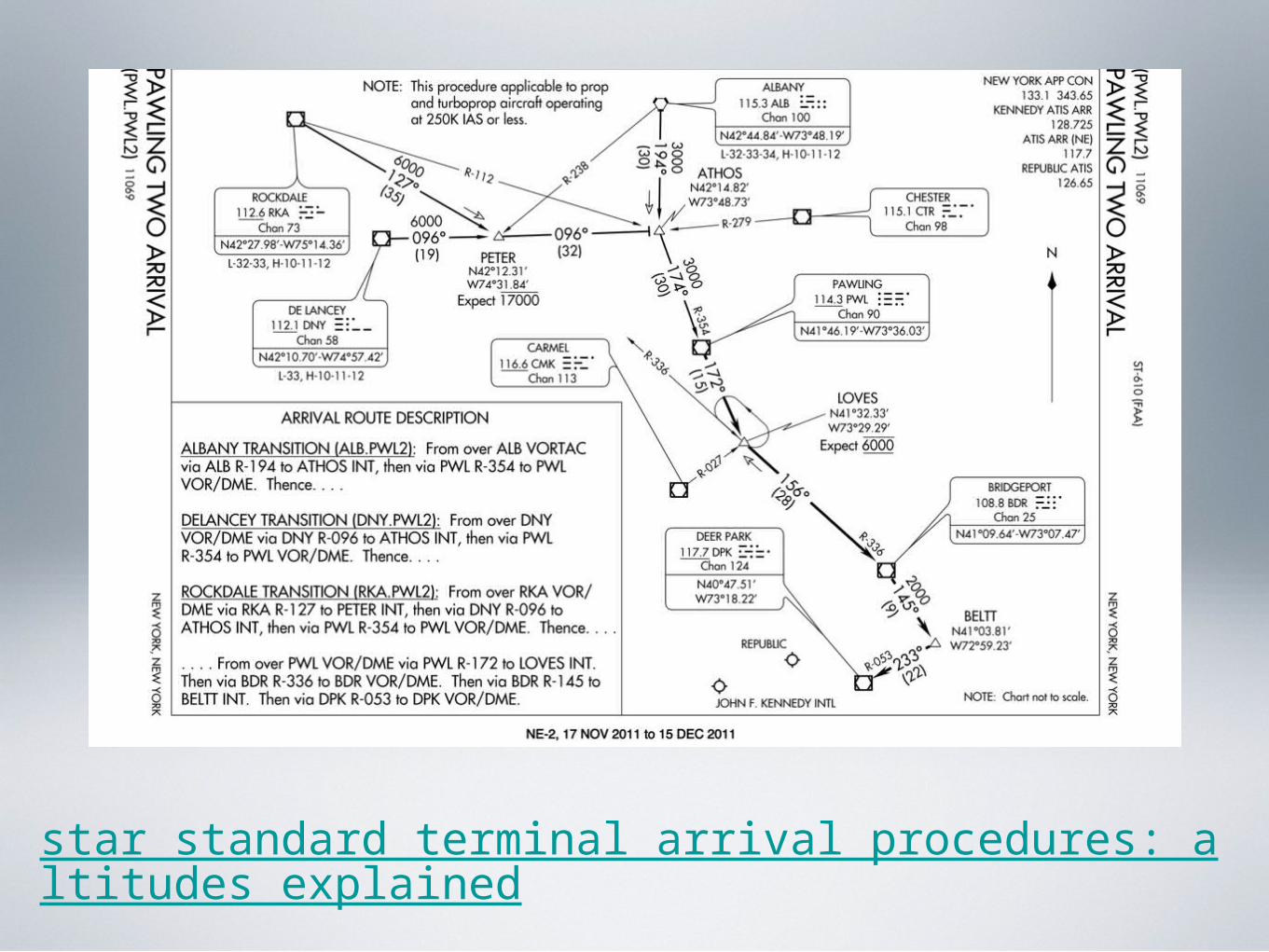
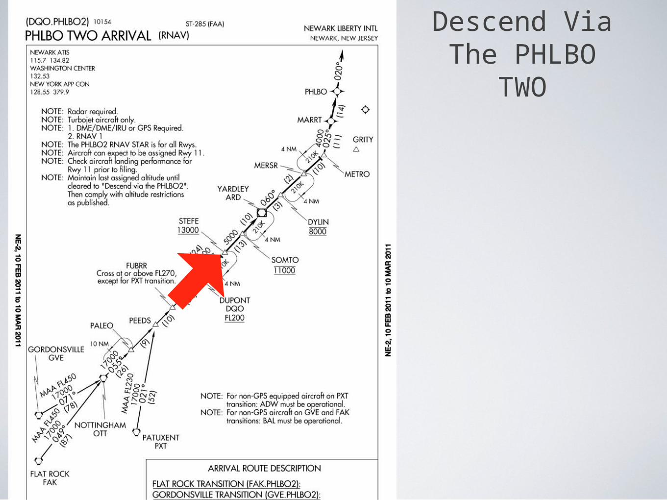
Flying at seventeen thousand feet, 20 miles southwest of DQO you are given the clearance to descend via the PHLBO TWO.
You must begin your descent to cross STEFE at or above thirteen thousand as depicted and to further cross SOMTO at eleven thousand.
Since you where previously assigned seventeen thousand, ATC has already modified the arrival and you do not have to comply with the twenty thousand foot restriction at DQO.
This can be confusing at first glance but remember ATC can modify any arrival by issuing a clearance.
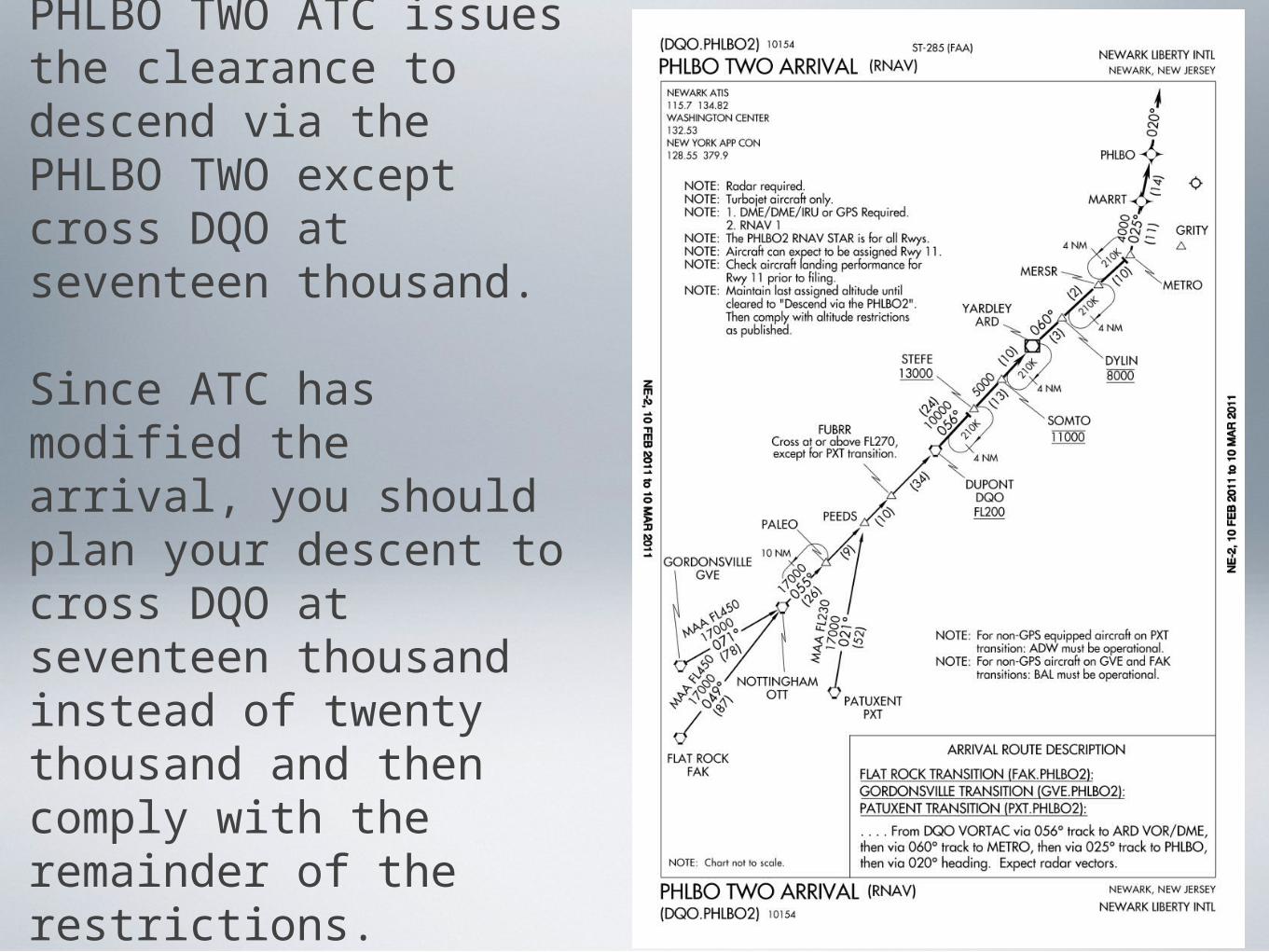
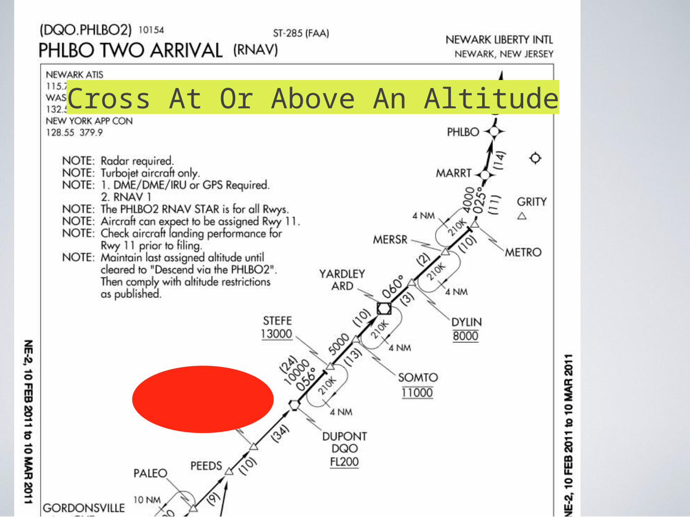
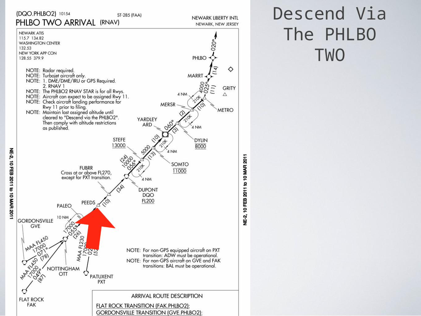
Arriving on the PHLBO TWO ATC issues the clearance to descend via the PHLBO TWO except cross DQO at seventeen thousand.
Since ATC has modified the arrival, you should plan your descent to cross DQO at seventeen thousand instead of twenty thousand and then comply with the remainder of the restrictions.
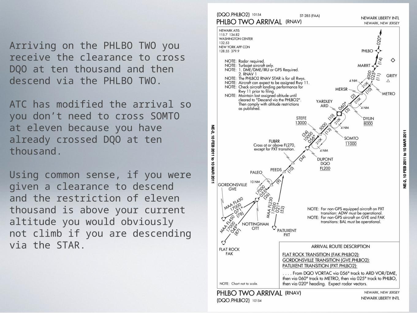
Arriving on the PHLBO TWO you receive the clearance to cross DQO at ten thousand and then descend via the PHLBO TWO.
ATC has modified the arrival so you don’t need to cross SOMTO at eleven because you have already crossed DQO at ten thousand.
Using common sense, if you were given a clearance to descend and the restriction of eleven thousand is above your current altitude you would obviously not climb if you are descending via the STAR.
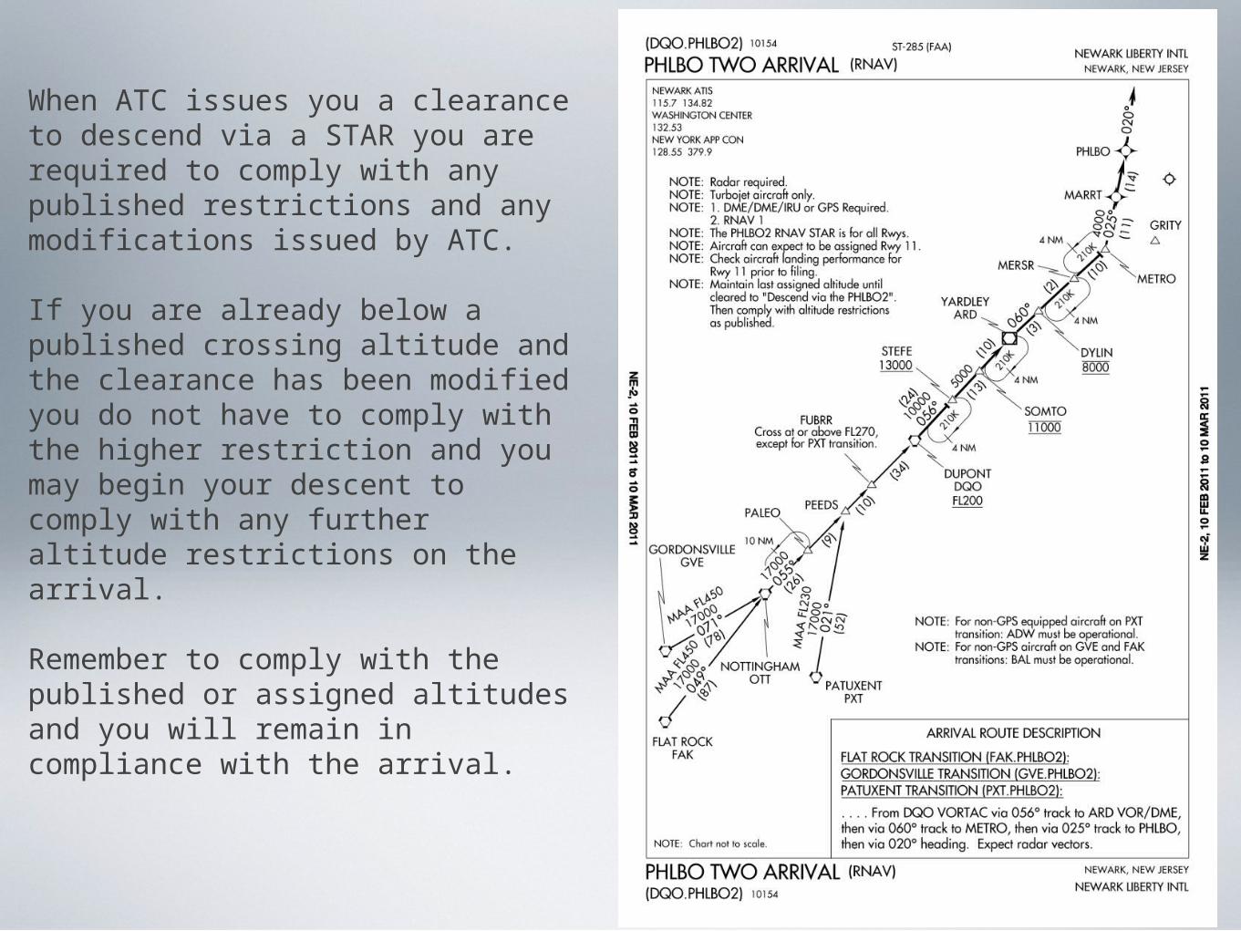
When ATC issues you a clearance to descend via a STAR you are required to comply with any published restrictions and any modifications issued by ATC.
If you are already below a published crossing altitude and the clearance has been modified you do not have to comply with the higher restriction and you may begin your descent to comply with any further altitude restrictions on the arrival.
Remember to comply with the published or assigned altitudes and you will remain in compliance with the arrival.
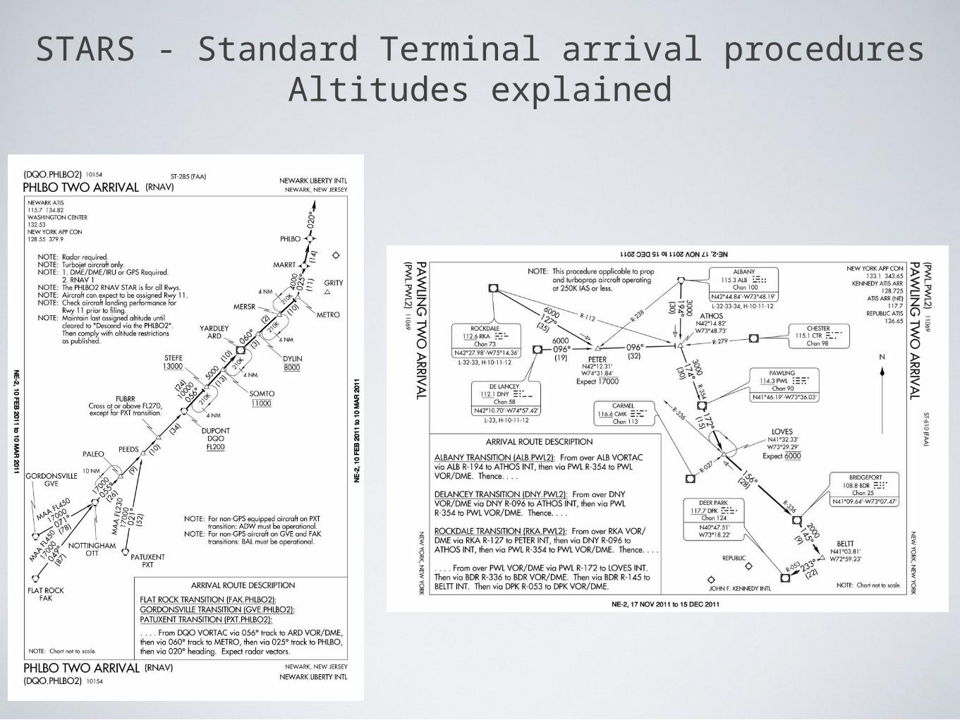
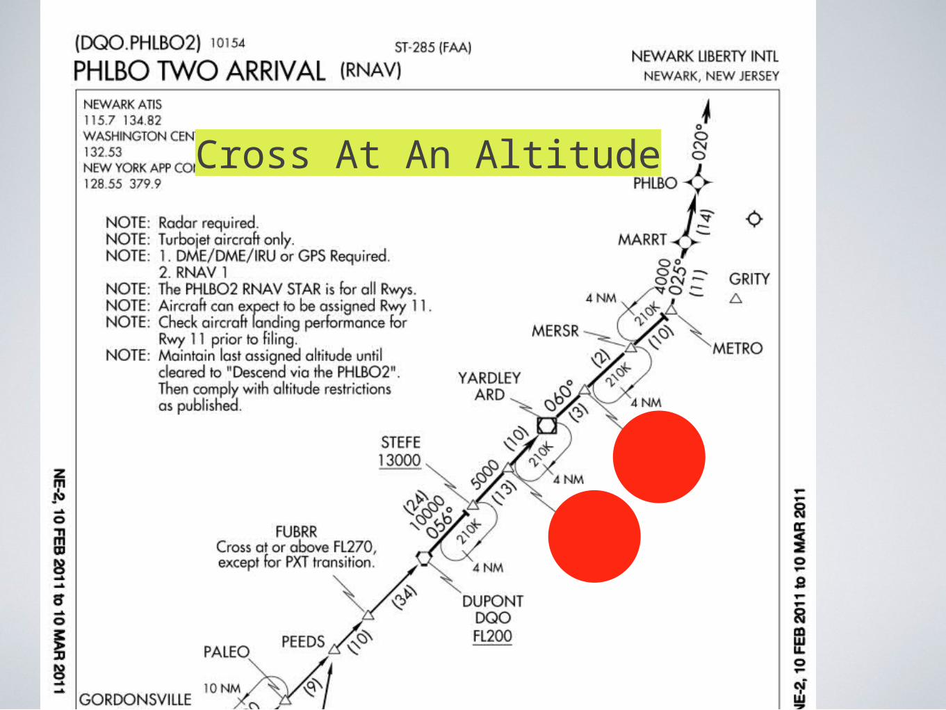
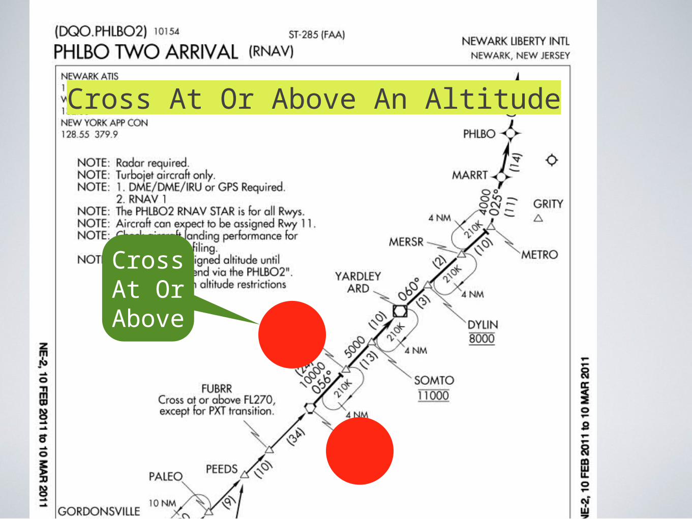
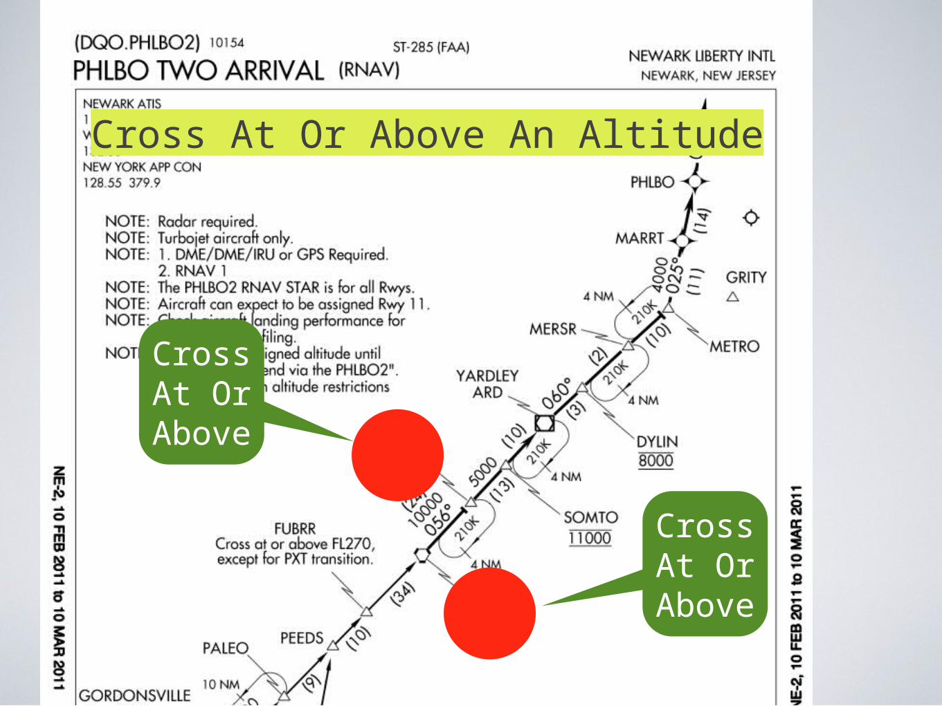
STARS - Standard Terminal arrival proceduresAltitudes explained
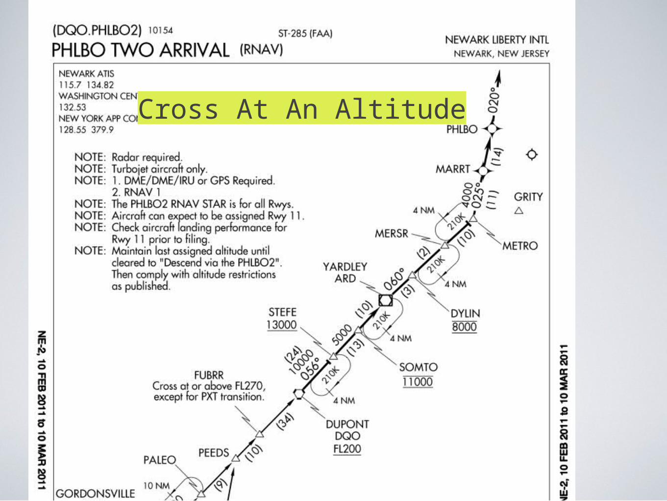
Cross At An Altitude
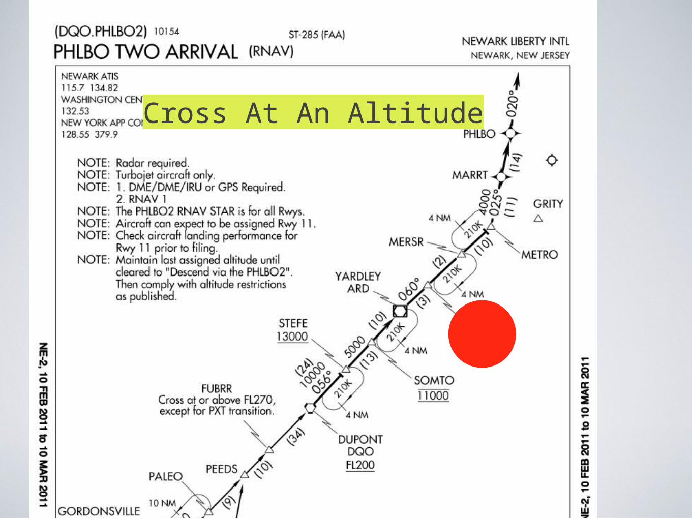
Cross At An Altitude
Cross At An Altitude
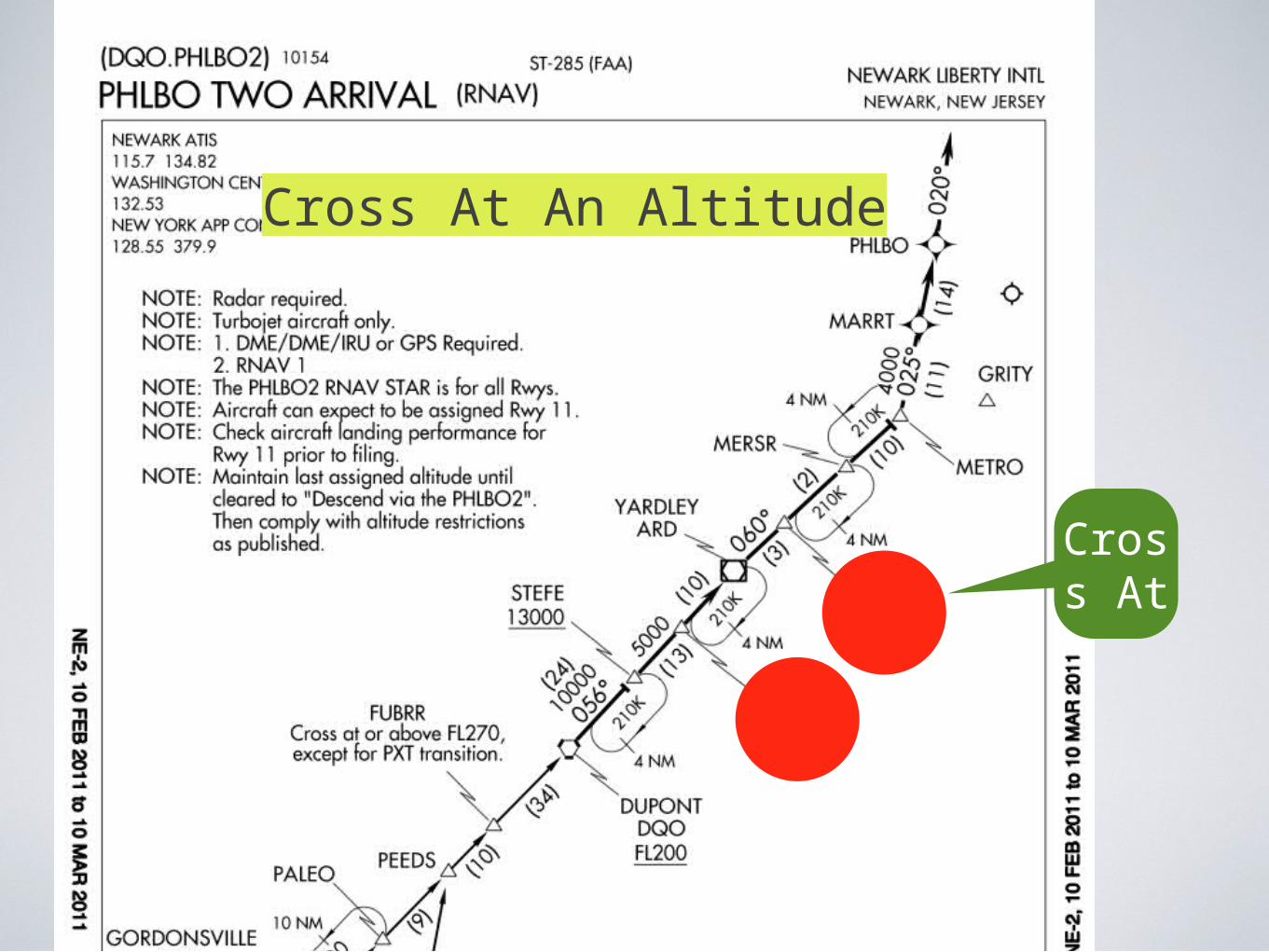
Cross At
Cross At An Altitude
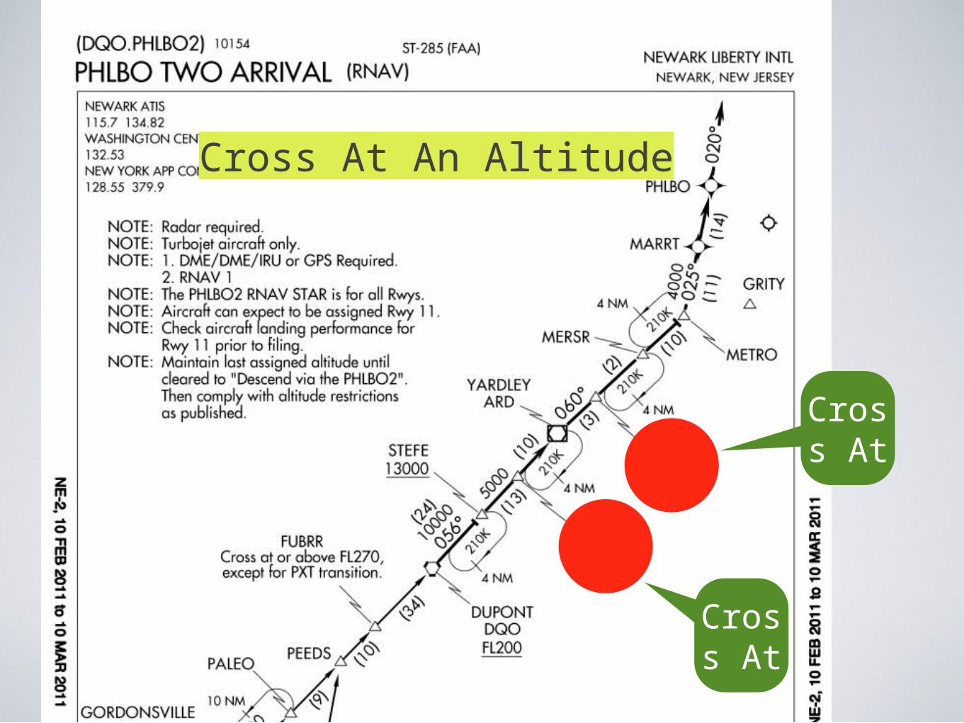
Cross At
Cross At
Cross At An Altitude
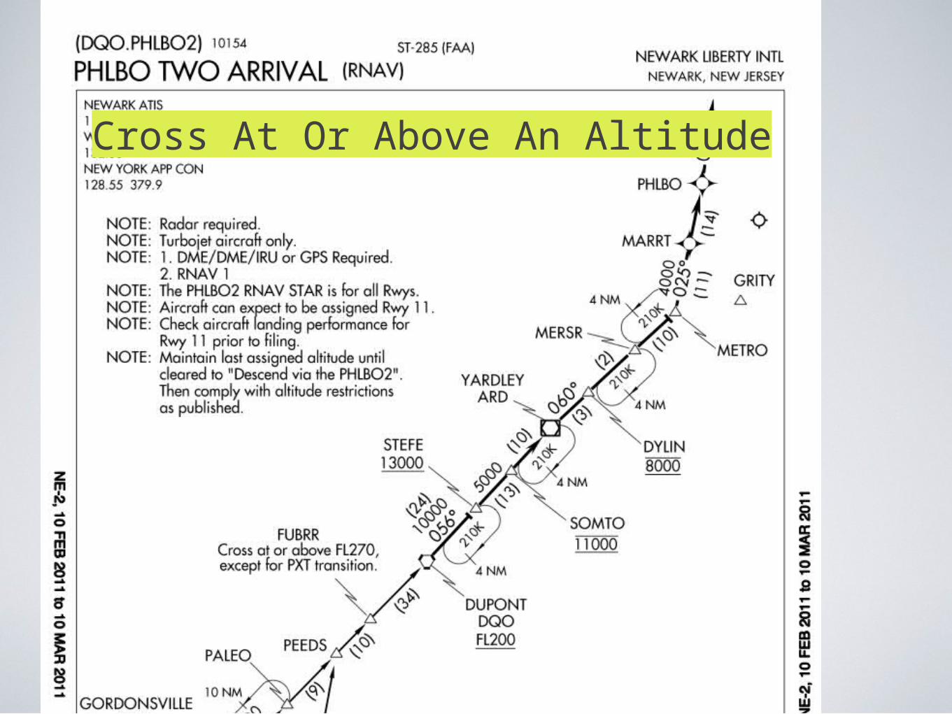
Cross At Or Above An Altitude
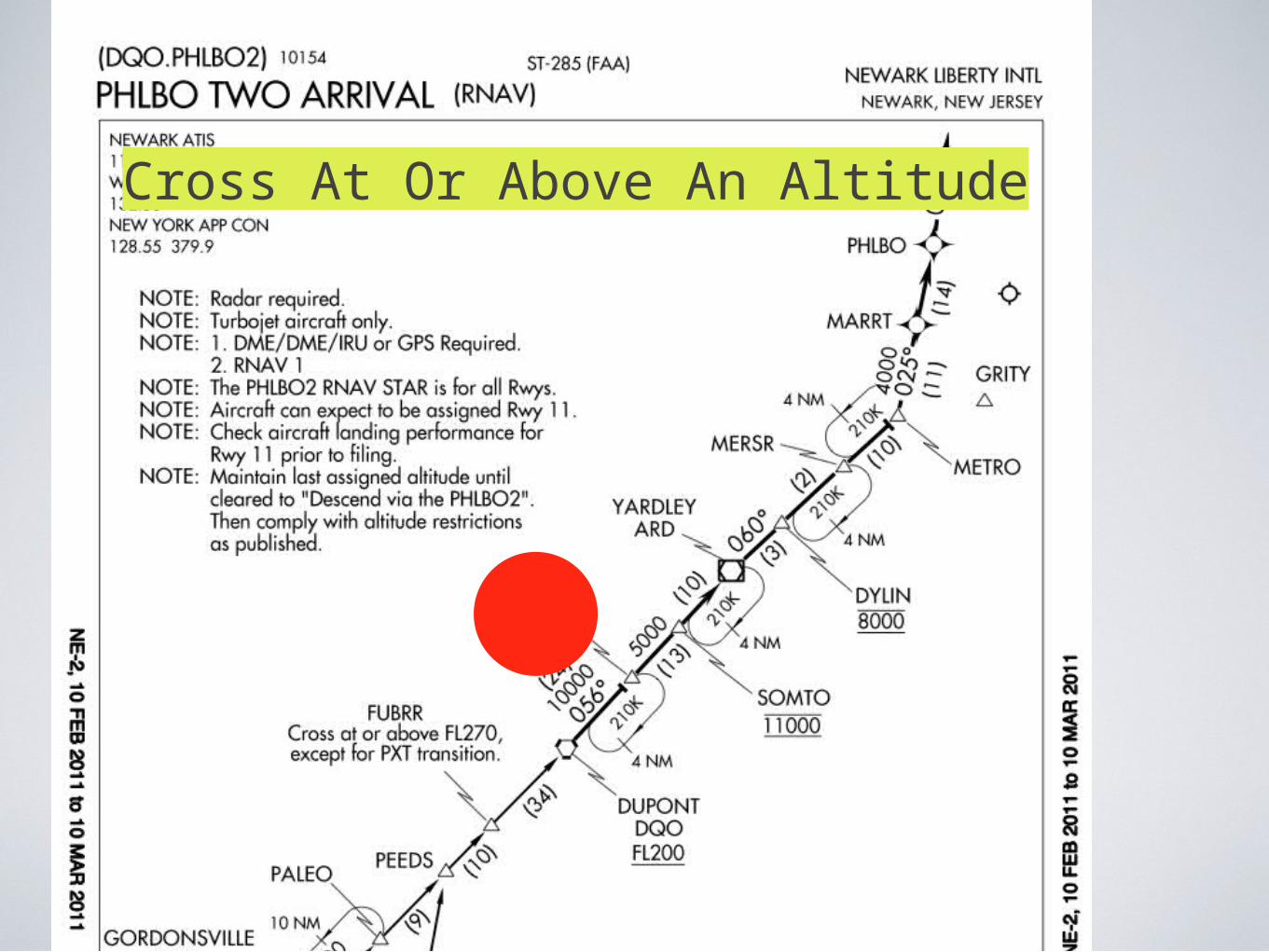
Cross At Or Above An Altitude
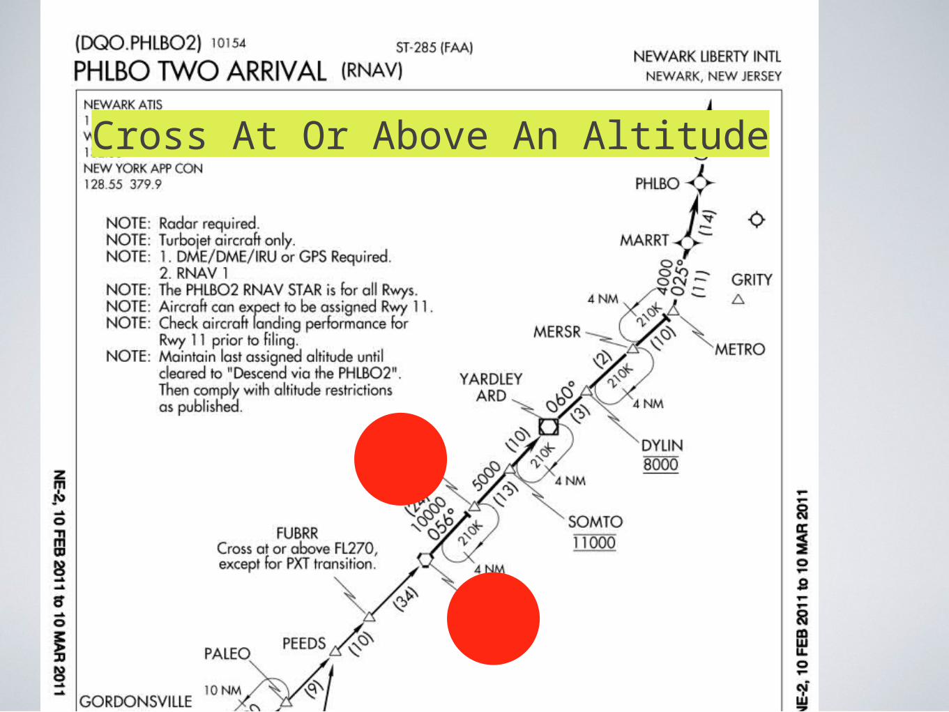
Cross At Or Above An Altitude
Cross At Or Above
Cross At Or Above An Altitude
Cross At Or Above
Cross At Or Above
Cross At Or Above An Altitude
Cross At Or Above An Altitude
Cross At Or Above An Altitude
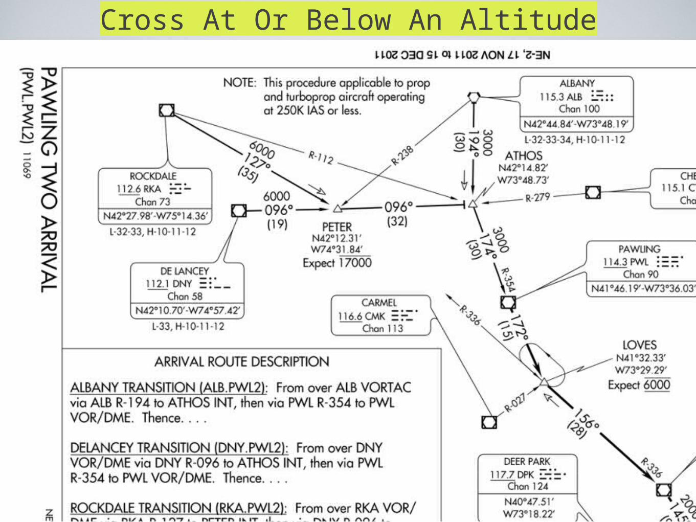
Cross At Or Below An Altitude
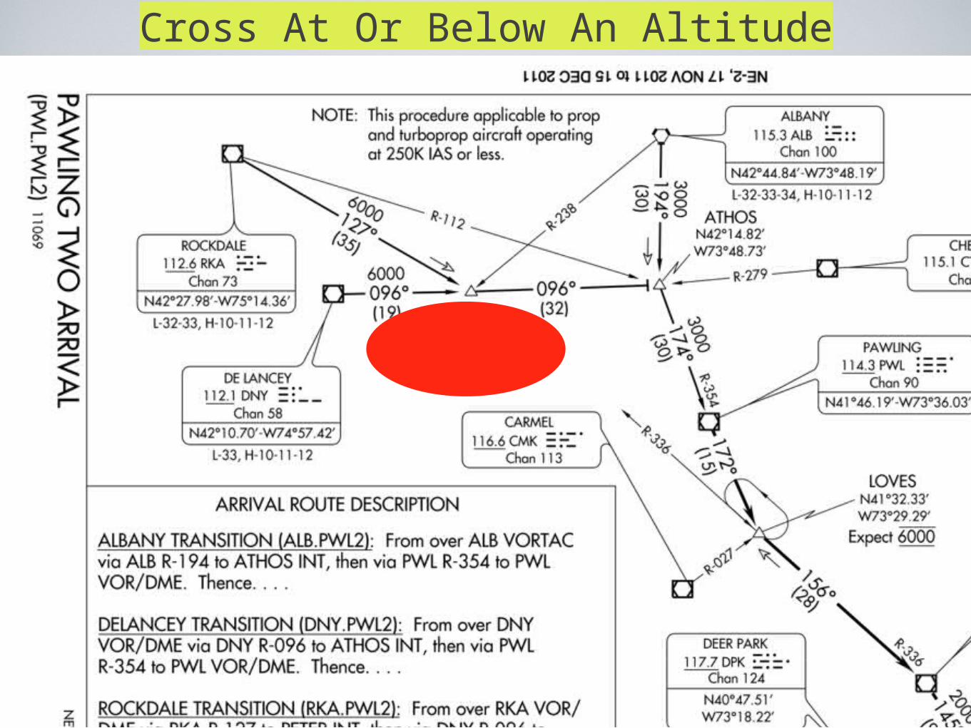
Cross At Or Below An Altitude
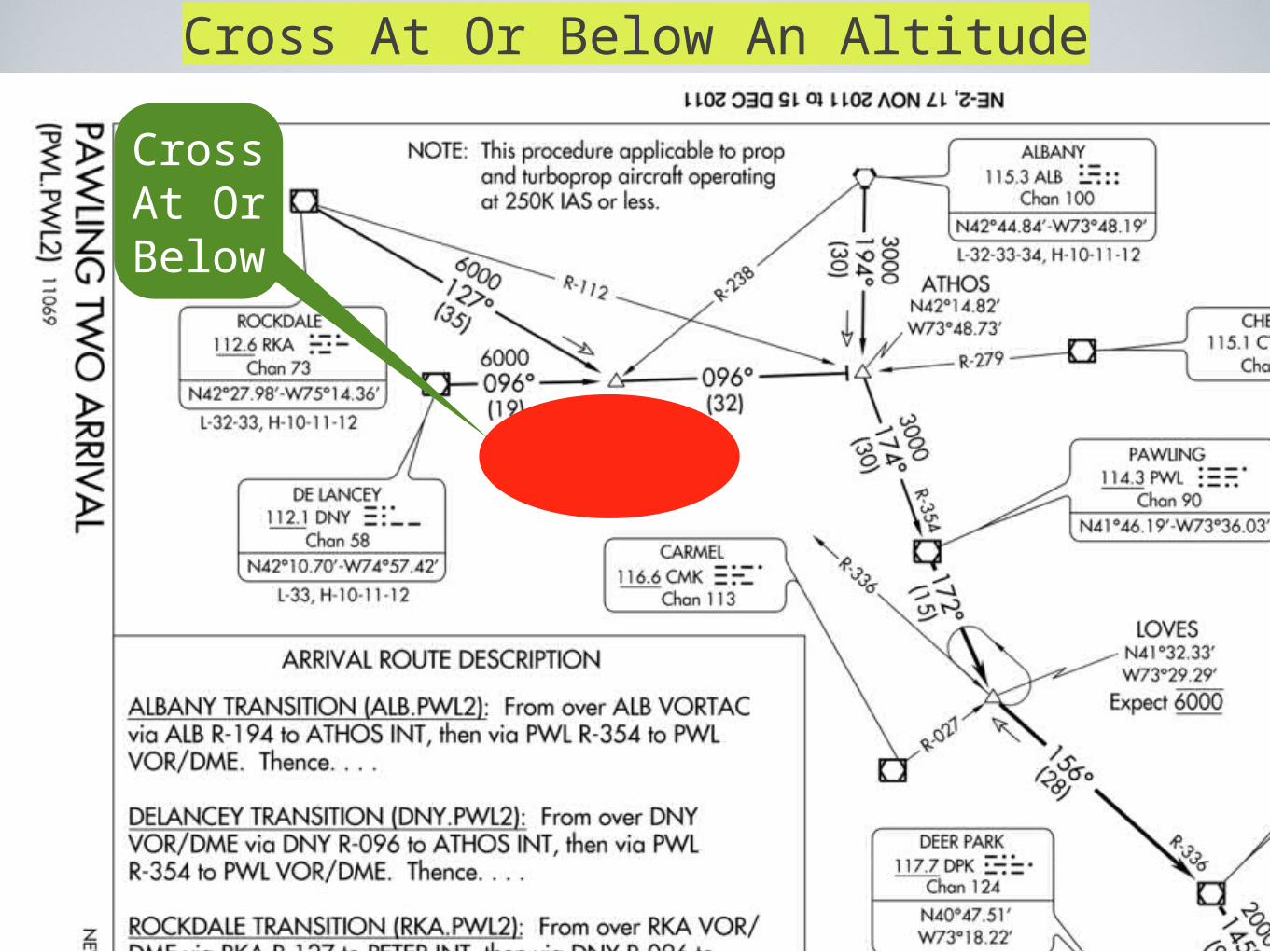
Cross At Or Below An Altitude
Cross At Or Below
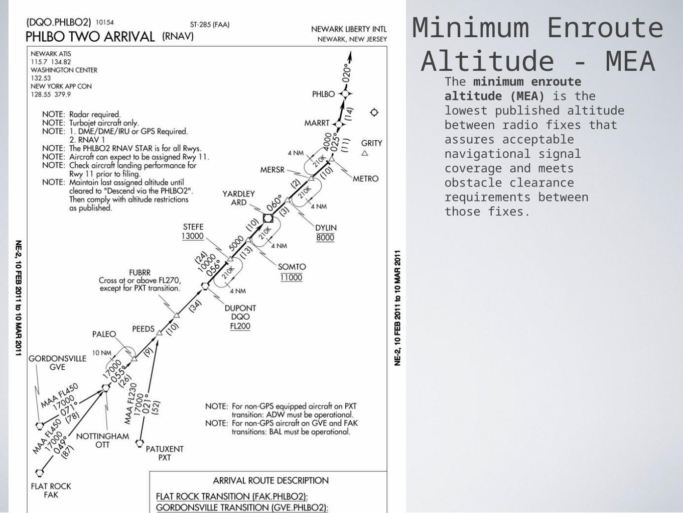
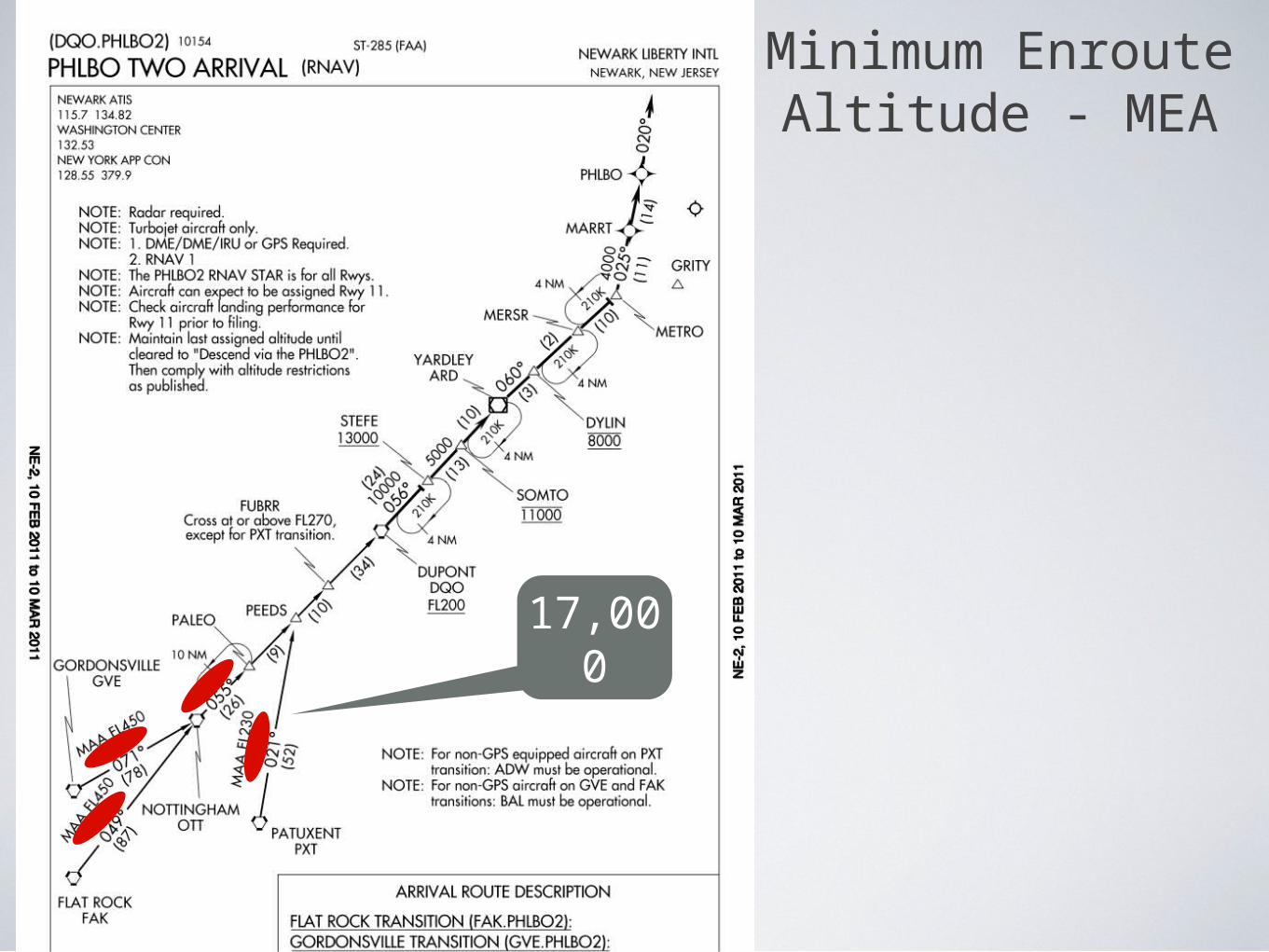
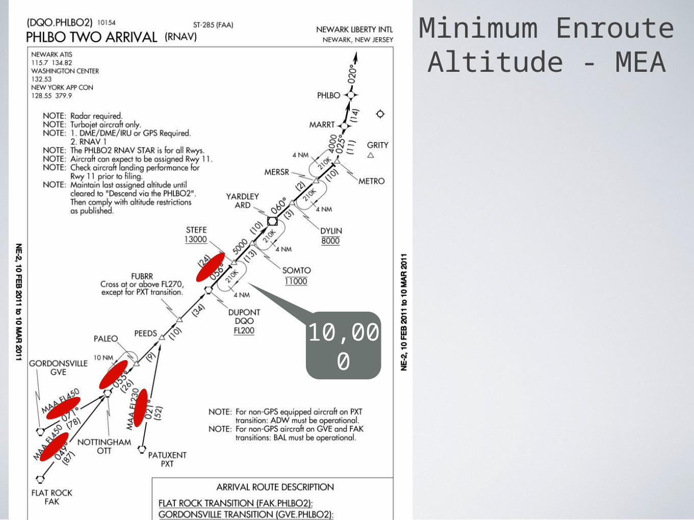
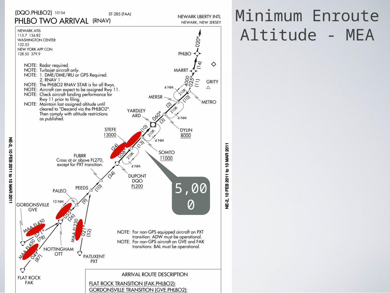
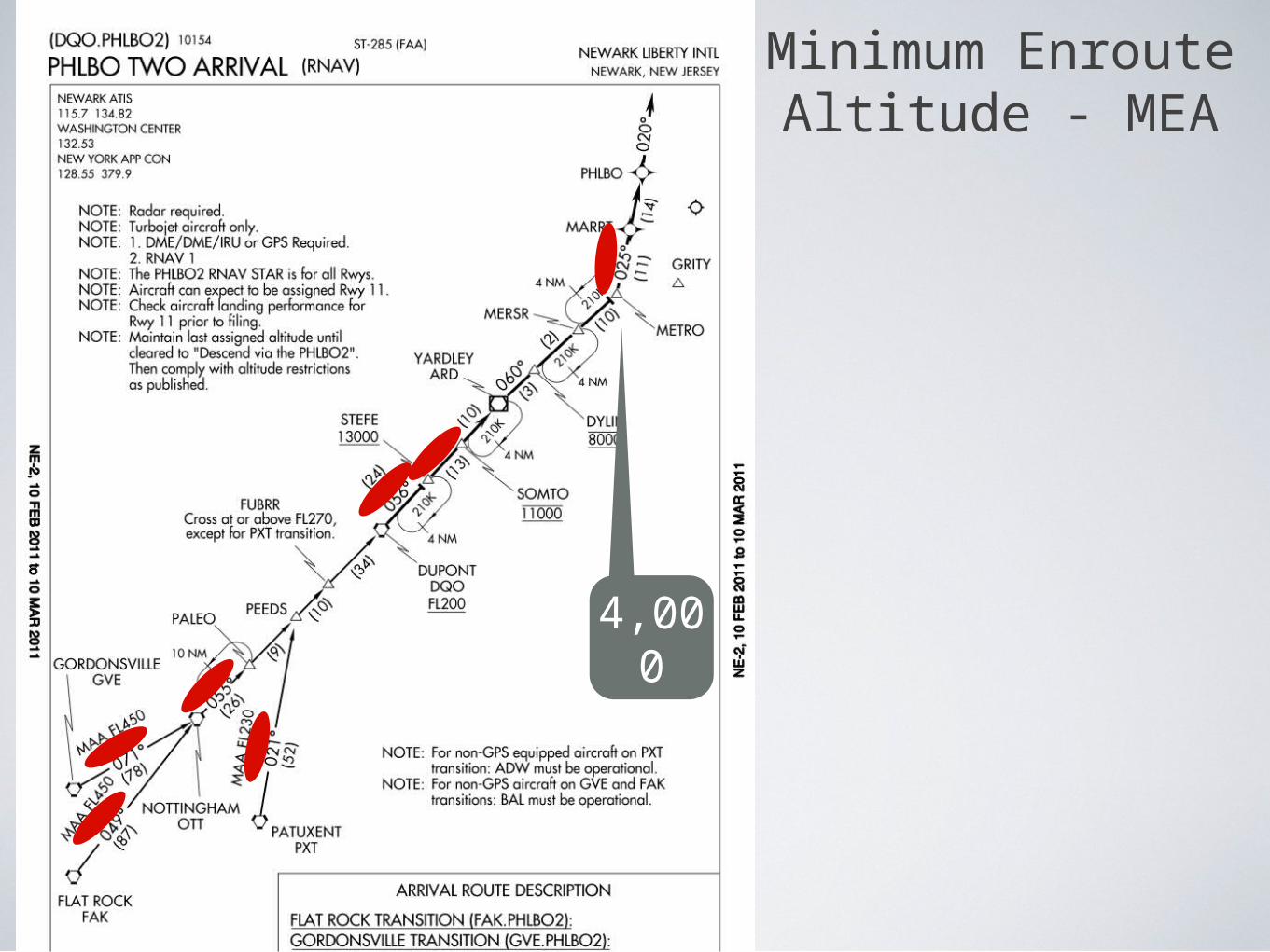
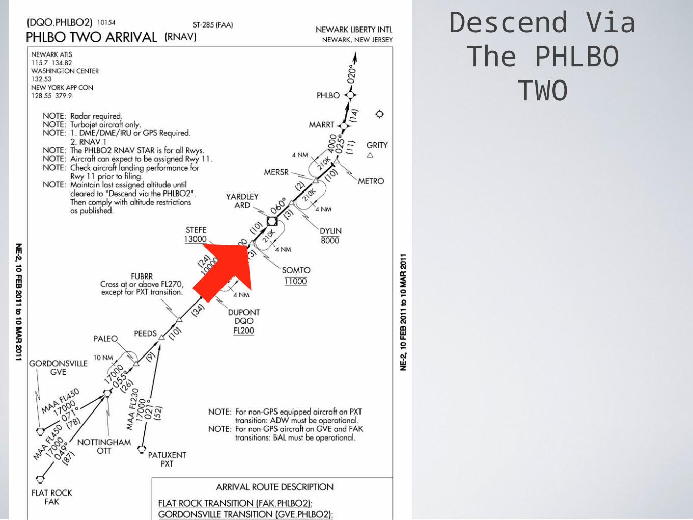
Minimum Enroute Altitude - MEA
The minimum enroute altitude (MEA) is the lowest published altitude between radio fixes that assures acceptable navigational signal coverage and meets obstacle clearance requirements between those fixes.
Minimum Enroute Altitude - MEA
17,000
Minimum Enroute Altitude - MEA
10,000
Minimum Enroute Altitude - MEA
5,000
Minimum Enroute Altitude - MEA
4,000
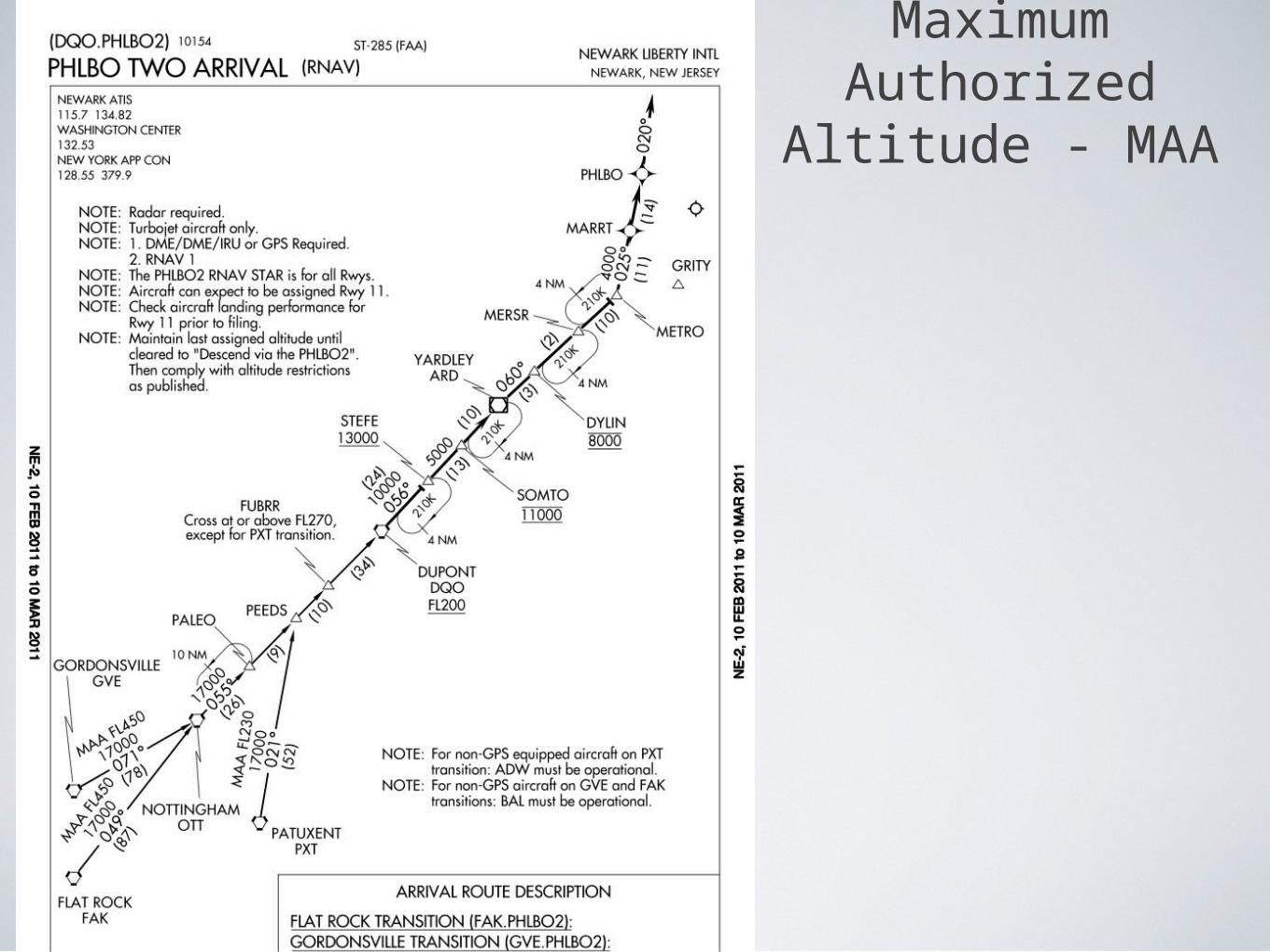
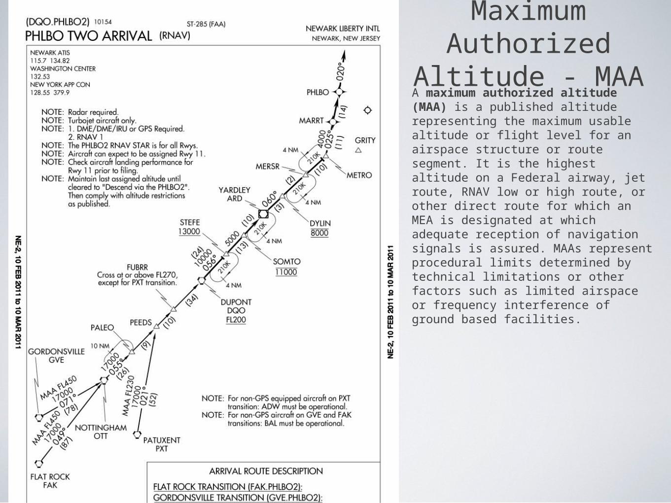
Maximum Authorized
Altitude - MAA
Maximum Authorized
Altitude - MAA
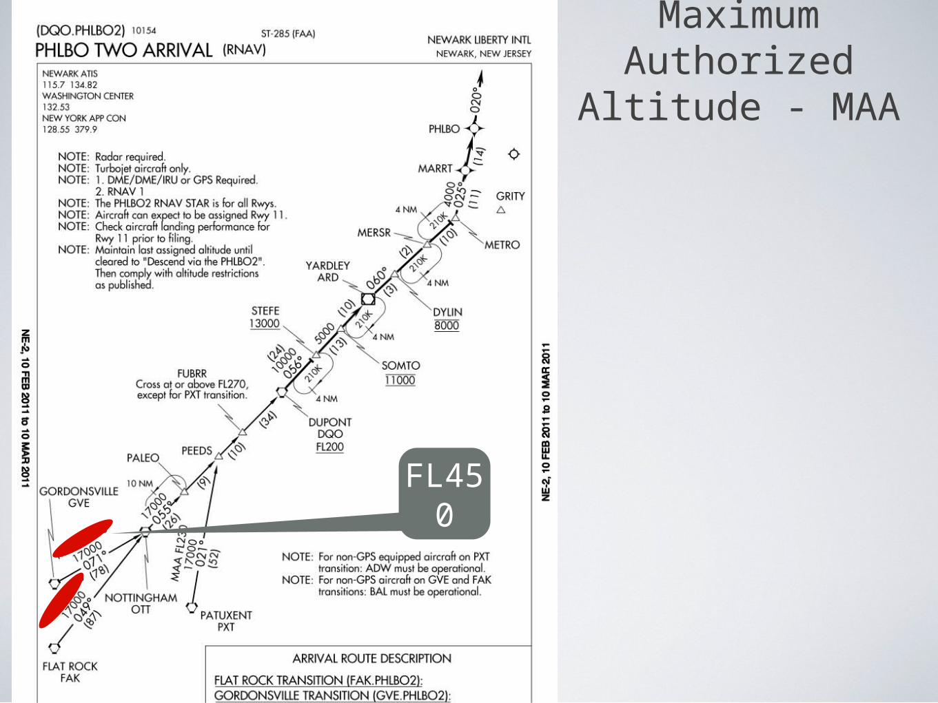
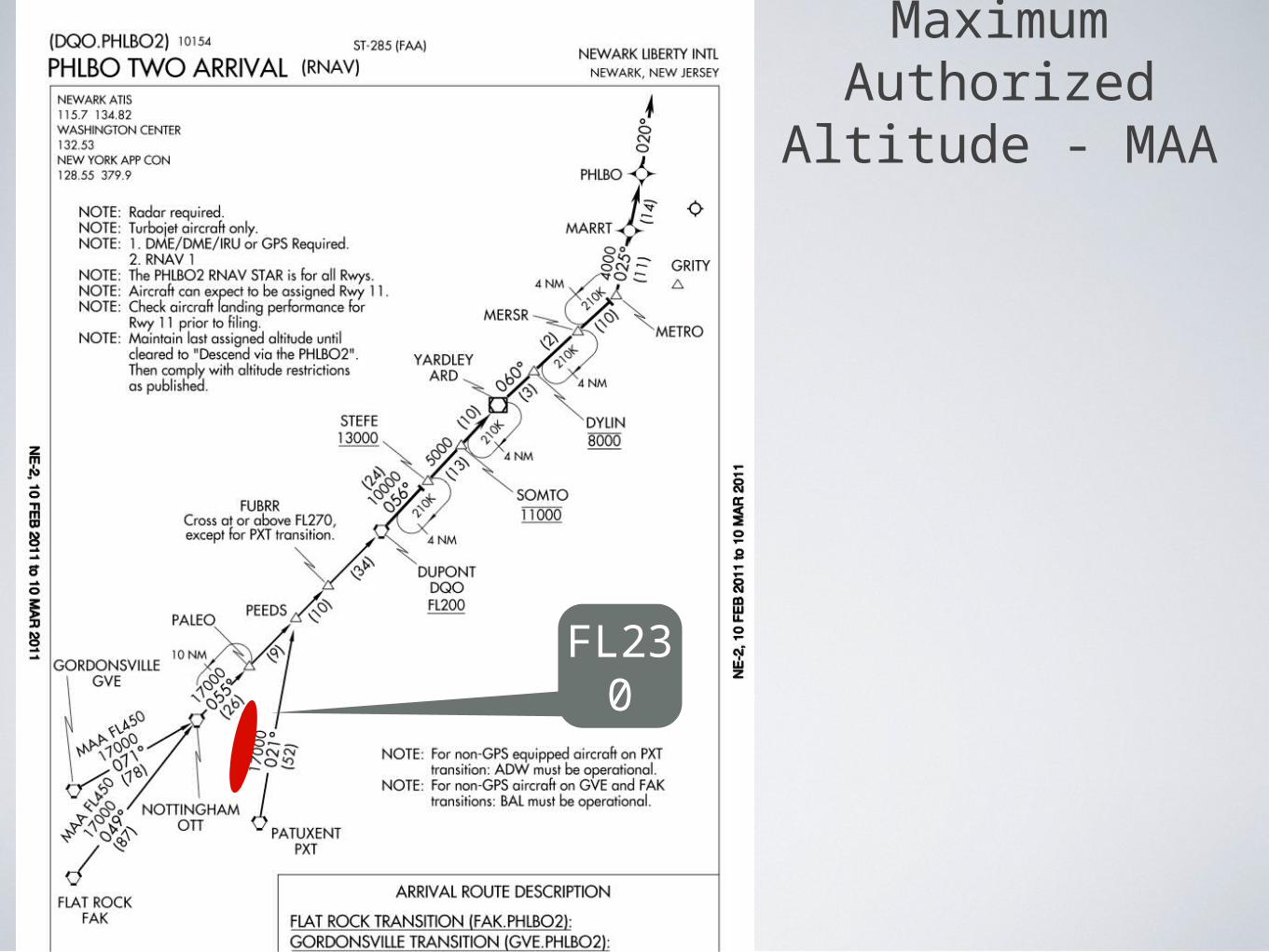
A maximum authorized altitude (MAA) is a published altitude representing the maximum usable altitude or flight level for an airspace structure or route segment. It is the highest altitude on a Federal airway, jet route, RNAV low or high route, or other direct route for which an MEA is designated at which adequate reception of navigation signals is assured. MAAs represent procedural limits determined by technical limitations or other factors such as limited airspace or frequency interference of ground based facilities.
Maximum Authorized
Altitude - MAA
FL450
Maximum Authorized
Altitude - MAA
FL230
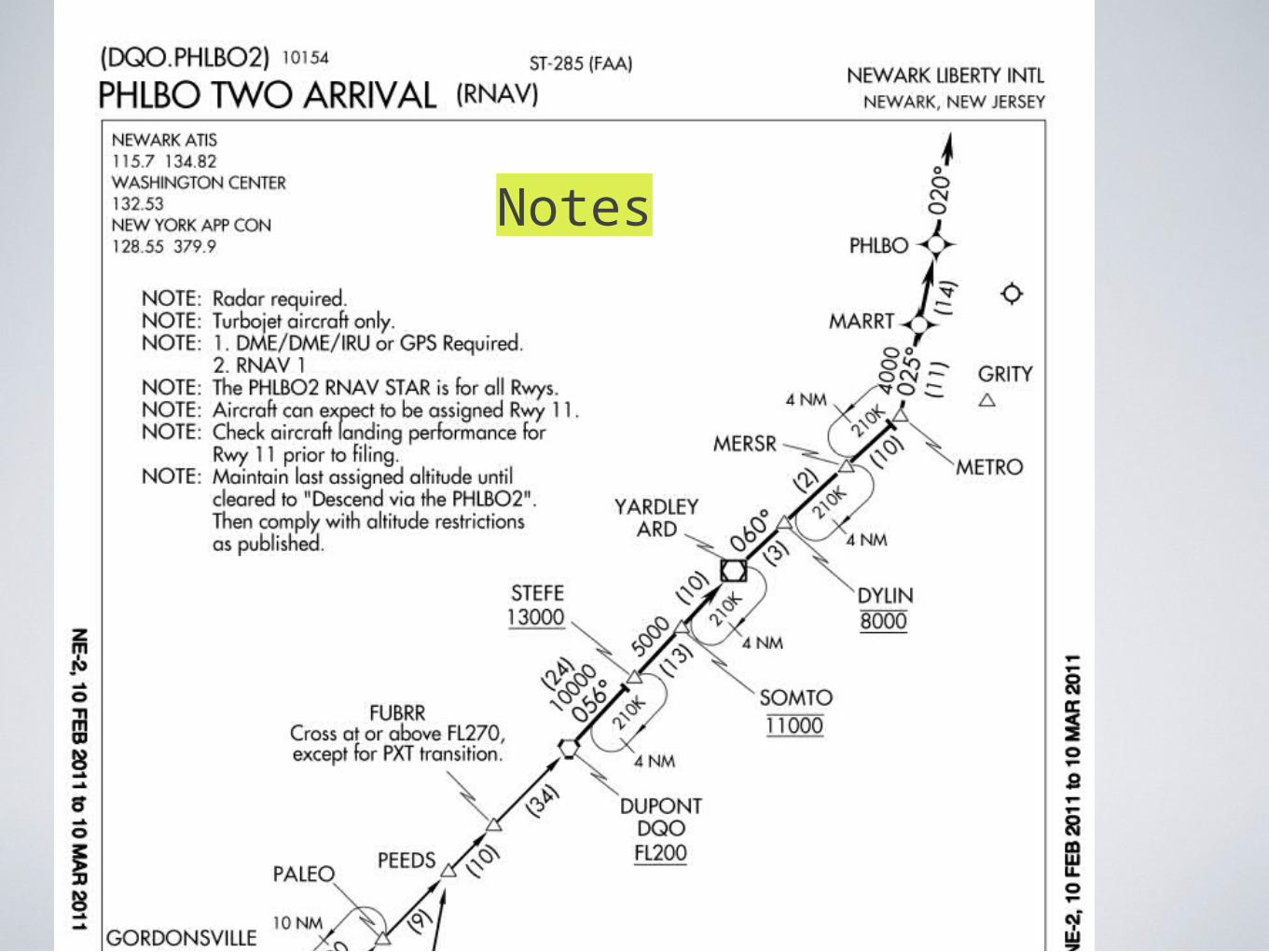
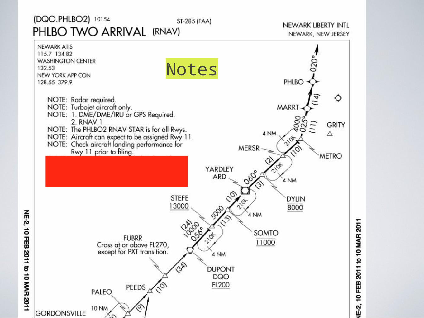
Notes
Notes
Descend Via The PHLBO
TWO
South Of FAK at FL370
Descend Via The PHLBO
TWO
Descend Via The PHLBO
TWO

Descend Via The PHLBO
TWO

Descend Via The PHLBO
TWO
Descend Via The PHLBO
TWO
Descend Via The PHLBO
TWO
South Of PXT at FL370
Descend Via The PHLBO
TWO

Descend Via The PHLBO
TWO

Descend Via The PHLBO
TWO
Descend Via The PHLBO
TWO
Descend Via The PHLBO
TWO

Descend Via The PHLBO
TWO
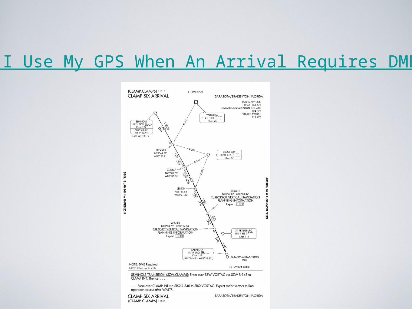
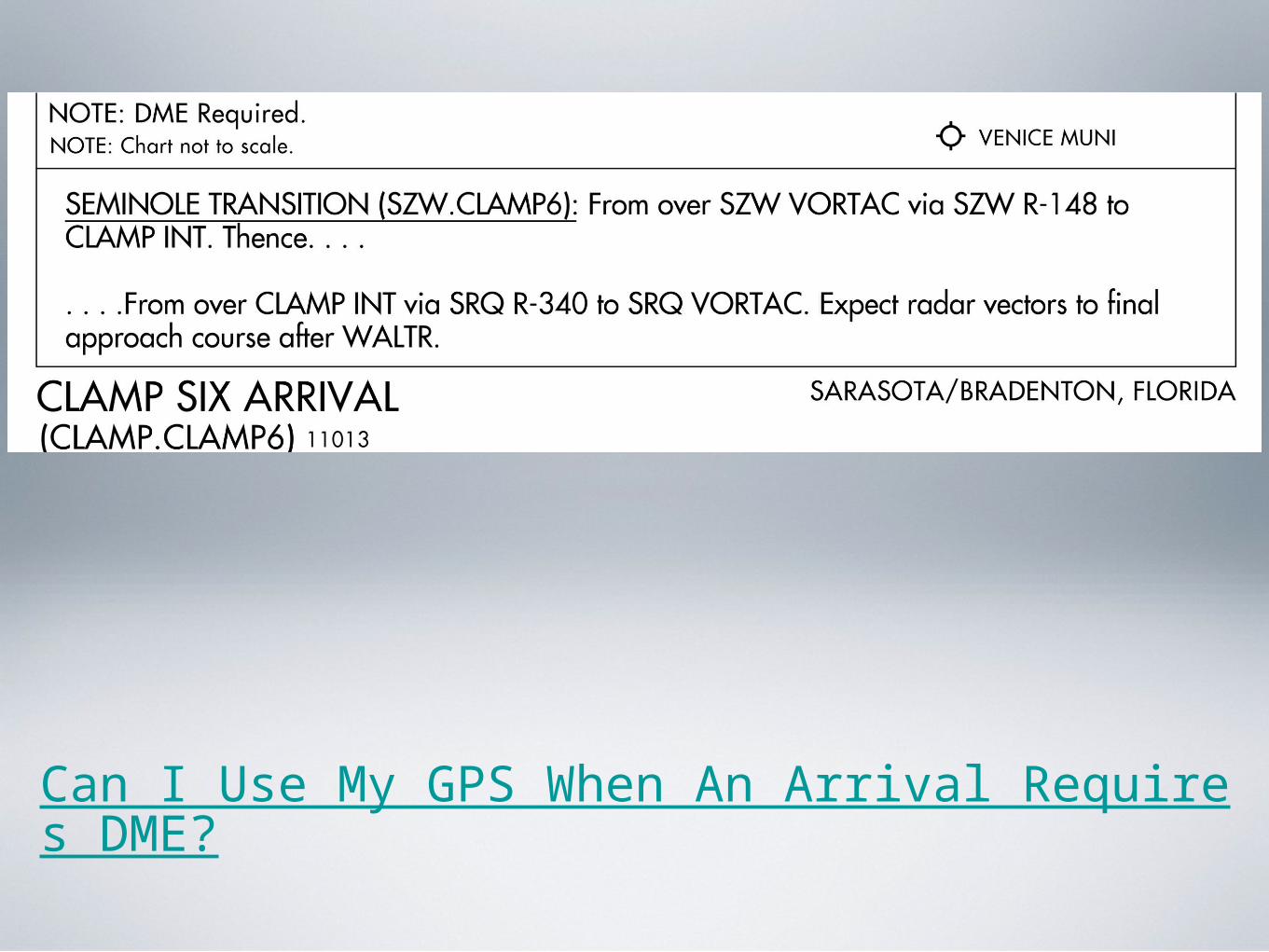
Can I Use My GPS When An Arrival Requires DME?
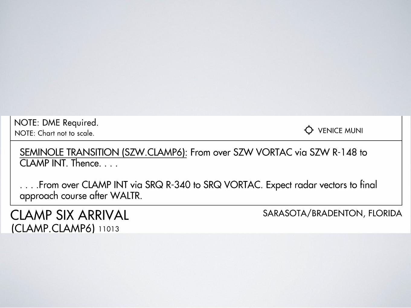
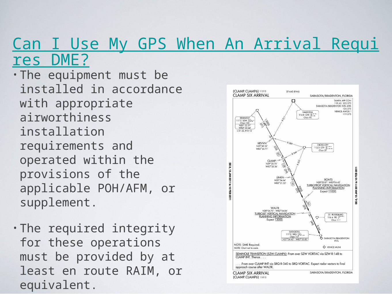
Can I Use My GPS When An Arrival Requires DME?• The equipment must be installed in accordance with appropriate airworthiness installation requirements and operated within the provisions of the applicable POH/AFM, or supplement.
• The required integrity for these operations must be provided by at least en route RAIM, or equivalent.

Can I Use My GPS When An Arrival Requires DME?
• Waypoints, fixes, intersections, and facility locations to be used for these operations must be retrieved from the GPS airborne database.
• The database must be current.
• If the required positions cannot be retrieved from the airborne database, the substitution of GPS for ADF and/or DME is not authorized
Can I Use My GPS When An Arrival Requires DME?
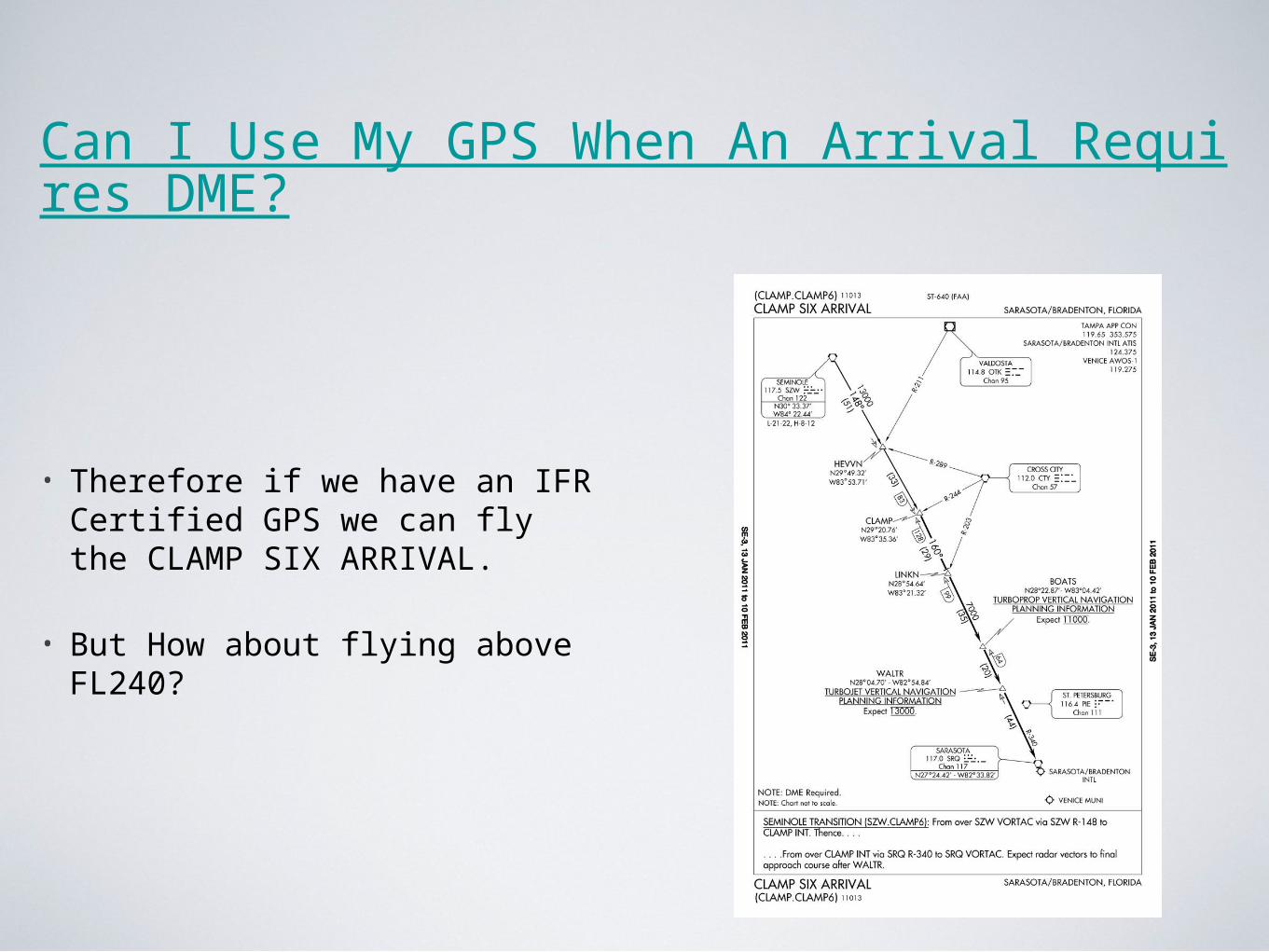
• Therefore if we have an IFR Certified GPS we can fly the CLAMP SIX ARRIVAL.
• But How about flying above FL240?
Can I Use My GPS When An Arrival Requires DME?
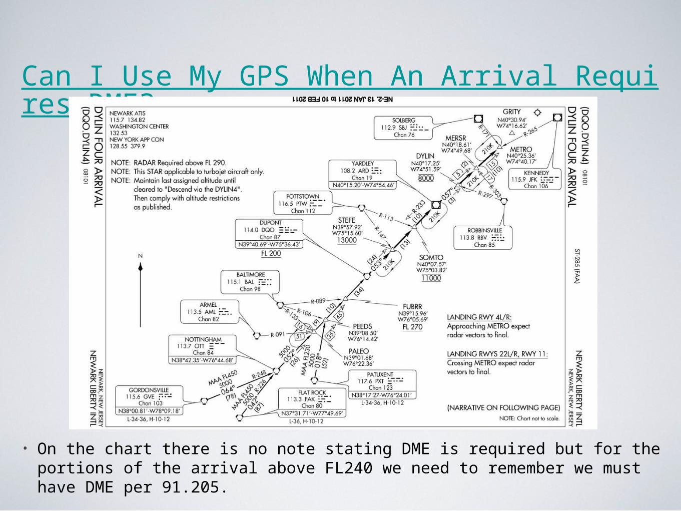
• On the chart there is no note stating DME is required but for the portions of the arrival above FL240 we need to remember we must have DME per 91.205.

Can I Use My GPS When An Arrival Requires DME?
• If we are flying this arrival below FL240 we will not need GPS or DME.

IFR DEPARTURES AND ARRIVALS: TIPS, TRICKS, AND AVOIDING COMMON ERRORS