Embed Size (px)
Citation preview
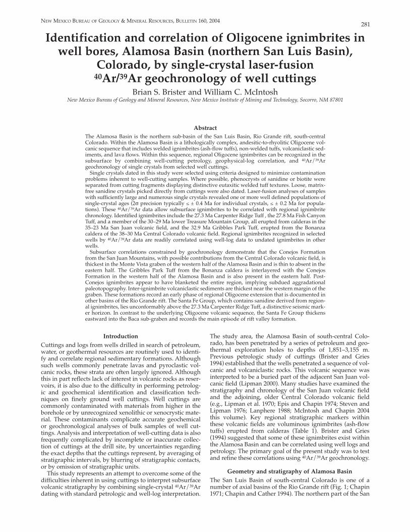
281 NEW MEXICO BUREAU OF GEOLOGY & MINERAL RESOURCES, BULLETIN 160, 2004
Identification and correlation of Oligocene ignimbrites in well bores, Alamosa Basin (northern San Luis Basin),
Colorado, by singlecrystal laserfusion 40Ar/39Ar geochronology of well cuttings
Brian S. Brister and William C. McIntosh New Mexico Bureau of Geology and Mineral Resources, New Mexico Institute of Mining and Technology, Socorro, NM 87801
Abstract The Alamosa Basin is the northern subbasin of the San Luis Basin, Rio Grande rift, southcentral Colorado. Within the Alamosa Basin is a lithologically complex, andesitictorhyolitic Oligocene volcanic sequence that includes welded ignimbrites (ashflow tuffs), nonwelded tuffs, volcaniclastic sediments, and lava flows. Within this sequence, regional Oligocene ignimbrites can be recognized in the subsurface by combining wellcutting petrology, geophysicallog correlation, and 40Ar/39Ar geochronology of single crystals from selected well cuttings.
Single crystals dated in this study were selected using criteria designed to minimize contamination problems inherent to wellcutting samples. Where possible, phenocrysts of sanidine or biotite were separated from cutting fragments displaying distinctive eutaxitic welded tuff textures. Loose, matrixfree sanidine crystals picked directly from cuttings were also dated. Laserfusion analyses of samples with sufficiently large and numerous single crystals revealed one or more well defined populations of singlecrystal ages (2σ precision typically ≤ ± 0.4 Ma for individual crystals, ≤ ± 0.2 Ma for populations). These 40Ar/39Ar data allow subsurface ignimbrites to be correlated with regional ignimbrite chronology. Identified ignimbrites include the 27.3 Ma Carpenter Ridge Tuff , the 27.8 Ma Fish Canyon Tuff, and a member of the 30–29 Ma lower Treasure Mountain Group, all erupted from calderas in the 35–23 Ma San Juan volcanic field, and the 32.9 Ma Gribbles Park Tuff, erupted from the Bonanza caldera of the 38–30 Ma Central Colorado volcanic field. Regional ignimbrites recognized in selected wells by 40Ar/39Ar data are readily correlated using welllog data to undated ignimbrites in other wells.
Subsurface correlations constrained by geochronology demonstrate that the Conejos Formation from the San Juan Mountains, with possible contributions from the Central Colorado volcanic field, is thickest in the Monte Vista graben of the western half of the Alamosa Basin and is thin to absent in the eastern half. The Gribbles Park Tuff from the Bonanza caldera is interlayered with the Conejos Formation in the western half of the Alamosa Basin and is also present in the eastern half. PostConejos ignimbrites appear to have blanketed the entire region, implying subdued aggradational paleotopography. Interignimbrite volcaniclastic sediments are thickest near the western margin of the graben. These formations record an early phase of regional Oligocene extension that is documented in other basins of the Rio Grande rift. The Santa Fe Group, which contains sanidine derived from regional ignimbrites, lies unconformably above the 27.3 Ma Carpenter Ridge Tuff, a distinctive seismic marker horizon. In contrast to the underlying Oligocene volcanic sequence, the Santa Fe Group thickens eastward into the Baca subgraben and records the main episode of rift valley formation.
Introduction The study area, the Alamosa Basin of southcentral ColoCuttings and logs from wells drilled in search of petroleum, rado, has been penetrated by a series of petroleum and geowater, or geothermal resources are routinely used to identi thermal exploration holes to depths of 1,851–3,155 m.fy and correlate regional sedimentary formations. Although Previous petrologic study of cuttings (Brister and Griessuch wells commonly penetrate lavas and pyroclastic vol 1994) established that the wells penetrated a sequence of volcanic rocks, these strata are often largely ignored. Although canic and volcaniclastic rocks. This volcanic sequence was
this in part reflects lack of interest in volcanic rocks as reser interpreted to be a buried part of the adjacent San Juan volvoirs, it is also due to the difficulty in performing petrolog canic field (Lipman 2000). Many studies have examined theic and geochemical identification and classification tech stratigraphy and chronology of the San Juan volcanic fieldniques on finely ground well cuttings. Well cuttings are and the adjoining, older Central Colorado volcanic fieldcommonly contaminated with materials from higher in the (e.g., Lipman et al. 1970; Epis and Chapin 1974; Steven andborehole or by unrecognized xenolithic or xenocrystic mate Lipman 1976; Lanphere 1988; McIntosh and Chapin 2004
rial. These contaminants complicate accurate geochemical this volume). Key regional stratigraphic markers withinor geochronological analyses of bulk samples of well cut these volcanic fields are voluminous ignimbrites (ashflow
tings. Analysis and interpretation of wellcutting data is also tuffs) erupted from calderas (Table 1). Brister and Griesfrequently complicated by incomplete or inaccurate collec (1994) suggested that some of these ignimbrites exist withintion of cuttings at the drill site, by uncertainties regarding the Alamosa Basin and can be correlated using well logs and
the exact depths that the cuttings represent, by averaging of petrology. The primary goal of the present study was to test stratigraphic intervals, by blurring of stratigraphic contacts, and refine these correlations using 40Ar/39Ar geochronology. or by omission of stratigraphic units.
This study represents an attempt to overcome some of the Geometry and stratigraphy of Alamosa Basin
difficulties inherent in using cuttings to interpret subsurface The San Luis Basin of southcentral Colorado is one of a volcanic stratigraphy by combining singlecrystal 40Ar/39Ar number of axial basins of the Rio Grande rift (Fig. 1; Chapindating with standard petrologic and welllog interpretation. 1971; Chapin and Cather 1994). The northern part of the San

282
Burroughs 1981; Keller et al. 1984;Gries 1985; Brister and Gries 1994; Kluth and Shaftenaar 1994). The Alamosa Basin is one of the deepest basinsof the rift in terms of thickness of riftrelated fill (approximately 5.6 km [3.5mi]; Brister and Gries 1994). The western part of the basin (Fig. 3) is thenorthtrending, easttilted Monte Vista graben (Burroughs 1981) that resulted from reactivation of a preexisting Laramide depression (Brister andChapin 1994). The deeper, eastern partof the basin is the northtrending, easttilted Baca graben (Burroughs 1981) that overlies a foundered Laramide highland (Brister and Gries 1994). TheMonte Vista and Baca grabens are separated by the structurally elevated, northtrending Alamosa horst (Burroughs 1981).
The general stratigraphy of theAlamosa Basin has been established byexamining the petrology of well cuttings (Brister and Gries 1994). In simplest terms, there are four main stratigraphic units present (Fig. 3). They are, from youngest to oldest: the lateOligocene to Pleistocene Santa FeGroup, an Oligocene volcanic and volcaniclastic sequence, a late Eocene(Laramide) red bed formation, and Precambrian crystalline basement. Inthe western half of the Alamosa Basin, all four units are interpreted to be present, whereas in the eastern half the
FIGURE 1—Index map of New Mexico and southern Colorado showing basins of the Rio Eocene is thin to absent. The base of the Grande rift, major Oligocene volcanic fields, and the Alamosa Basin. Oligocene volcanic sequence is an
unconformable surface, the “late Luis Basin, known as the Alamosa Basin (Burroughs 1981), Eocene erosion surface” of Epis and Chapin (1975), develis bounded by the Sangre de Cristo Range to the east, the oped upon prevolcanic Eocene red beds in the western San Juan volcanic field to the west, and San Luis Hills to the Monte Vista graben and Precambrian basement in the eastsouth (Fig. 2). Well control and geophysical data define the ern Baca graben (Brister and Chapin 1994; Brister and Griesgeneral geometry of the Alamosa Basin (e.g., Cordell 1978; 1994).
TABLE 1—Ages and source calderas of selected regional ignimbrites from the San Juan and Central Colorado volcanic fields, Colorado. ** = mean of two or more published sample ages, * = ages increased by 1% to adjust for interlaboratory calibration related to differences in accepted monitor ages. Ignimbrite Caldera 40Ar/39 Ar age (Ma) Mineral References
San Juan volcanic field ignimbrites Sunshine Peak Tuff Nelson Mountain Tuff
Lake CitySan Luis
22.93 ± 0.02 26.39 ± 0.08*
sanidine sanidine
6 3
Rat Creek Tuff San Luis 26.71 ± 0.07* biotite 3 Snowshoe Mountain Tuff Creede 27.07 ± 0.10* biotite 3 Carpenter Ridge Tuff Fish Canyon Tuff Masonic Park Tuff
Bachelor La Garita Mount Hope
27.38 ± 0.12 27.84 ± 0.05 28.60 ± 0.23*
sanidine sanidine biotite
7 2 5
Treasure Mountain Group Chiquito Peak Tuff South Fork Tuff Ra Jadero Tuff Ojito Creek Tuff La Jara Canyon Tuff Black Mountain Tuff
Platoro Platoro/Summitville Platoro/Summitville Platoro Platoro Platoro
28.41 ± 0.07** 28.76 ± 0.07 28.77 ± 0.07** 29.1 ± 0.3 29.3 ± 0.3 29.4 ± 0.4
sanidine sanidine sanidine biotite biotite biotite
5 5 5 1 1 1
Conejos Formation lavas and tuffs 29.4 ± 33.1 biotite, hornblende 4,5 Central Colorado volcanic field ignimbrites Gribbles Park Tuff Bonanza 32.90 ± 0.06 sanidine 7
References: 1—Balsley 1994; 2—Deino and Potts 1990; 3—Lanphere 1988; 4—Colucci et al. 1991; 5—Lipman et al.1996; 6—Bove et al. 2000; 7—McIntosh and Chapin 2004 this volume.

petroleum exploration wells. None of these wells yieldedevidence of economic petroleum resources. However, geothermal potential cannot be ruled out. Three additionalpetroleum exploration wells were drilled between 1989 and1995 at basin margins (Brister and Chapin 1994; Watkins1996), but are not considered in this paper.
Openhole geophysical well logs for eight of the wells inFigure 4 are available from commercial sources. The types ofwell logs available vary by age of well. Spontaneous potential and electrical resistivity were found to be the most useful log types for correlation purposes in the volcanic
Well data used in studyWells in the Alamosa Basin and data availabilityMinor gas produced from shallow water wells drew interestin the petroleum potential of the Alamosa Basin in the early1950s (Gries 1985). At least 12 wells have been drilled in thebasin for the purpose of exploration for petroleum or geothermal resources. Nine of those wells were selected for thisstudy. These wells, numbered in this paper from west to eastas wells 1 through 9 (Figs. 2, 4; Table 2) were drilled between1951 and 1981. Well number 4 was drilled as a geothermaltest (Phetteplace and Kunze 1983), whereas the others were
FIGURE 2—Simplified geologic map of southcentral Coloradoshowing locations of Alamosa Basin wells studied (after Tweto1979). Calderas depicted in the eastern part of the San Juan volcanicfield are: P = Platoro, SM = Summitville, LG = La Garita, MH =
Mount Hope, B = Bachelor, C = Creede, SR = South River, SL = SanLuis, CP = Cochetopa Park (after Steven and Lipman 1976; Lipmanet al. 1996; and Lipman 2000). The Bonanza caldera (BZ) is thesouthernmost caldera of the Central Colorado volcanic field.
283

284
FIG
URE
3—
Gen
eral
ized
wes
teas
t st
ruct
ural
cro
ss s
ectio
n th
atde
rived
from
the S
an Ju
an v
olca
nic f
ield
(Olig
ocen
e), T
cg =
inte
rbed
de
pict
s ge
omet
ry a
nd s
tratig
raph
ic un
its w
ithin
the
Ala
mos
a Ba
sinde
d vo
lcani
c an
d vo
lcani
clast
ic Co
nejo
s Fo
rmat
ion
and
Grib
bles
as in
terp
rete
d fro
m s
eism
ic an
d w
ell d
ata.
Fig
ure
simpl
ified
from
Pa
rk T
uff (
Olig
ocen
e), T
e =
Eoce
ne re
d be
ds, p
C– =
Prec
ambr
ian
crys
Br
ister
and
Grie
s (19
94).
Abb
revi
atio
ns fo
r stra
tigra
phic
units
: Tsf
=
talli
ne b
asem
ent.
A =
strik
e slip
mot
ion
into
the p
age,
T =
strik
e slip
sedi
men
tary
uni
ts o
f th
e Sa
nta
Fe G
roup
(up
per
Olig
ocen
e–m
otio
n ou
t of t
he p
age.
Plei
stoc
ene)
, Tt
= ig
nim
brite
s an
d in
terb
edde
d vo
lcani
clast
ic un
its
TABL
E 2—
Loca
tion
and
dept
h in
form
atio
n fo
r wel
ls in
the A
lam
osa
Basin
cons
ider
ed in
this
stud
y. Fo
rmat
ion
dept
h da
ta re
porte
d as
top–
base
/thi
ckne
ss (f
t).
Wel
l #
12
3 4
56
7 8
9
Op
erat
or
Tenn
esse
e G
as
Orr
in T
ucke
r W
. F. C
arr
Ener
gy S
ervi
ces
Am
erad
a Re
serv
e O
il W
. F. C
arr
Coug
ar
Am
oco
Map
coPe
trole
um
Petro
leum
Wel
l n
ame
Stat
e B #
1 Th
omas
#1
Kenn
edy
&
Ala
mos
a #1
Co
lora
do S
tate
N
BH A
lam
osa
J. M
. Cro
w
Crow
#1
Map
co S
tate
Will
iam
s #1
Geo
ther
mal
F
#1
#13
3 #1
#1
32
Year
dri
lled
19
59
1951
19
52
1981
19
59
1979
19
52
1981
19
74
Loc
atio
n S
ec. T
R
14, 4
1N 7
E 13
, 41N
8E
11, 4
1N 9
E 15
, 37N
10E
16
, 39N
10E
33
, 40N
11E
4, 3
9N 11
E 3,
39N
11E
32, 4
0N 1
2E
KB
Ele
vati
on
7,67
5 7,
606
7,57
4 7,
550
7,56
9 7,
539
7,53
6 7,
537
7,60
0 D
epth
ran
ge/t
hic
kn
ess
(ft)
Car
pen
ter
Rid
ge T
uff
2,
072–
2,15
2/80
3,
650–
3,80
0/15
0 4,
114–
4,17
8/64
2,
530–
2,59
0/60
1,
744–
1,79
2/48
5,
154–
5,17
2/18
5,
630–
5,68
6/56
6,
105–
6,20
8/10
3 8,
620–
8,69
0/70
Fish
Can
yon
Tu
ff
2,36
8–2,
536
168
3,88
4–4,
010/
126
4,21
2–4,
350/
138
2,59
0–2,
740/
150
1,79
2–1,
940/
148
5,17
2–5,
268/
96
5,68
6–5,
804/
118
6,27
0–6,
428/
158
8,70
0–9,
000/
300
Mas
onic
Par
k T
uff
(?)
N
ot re
cogn
ized
N
ot re
cogn
ized
4,
759–
4,90
2/14
3 2,
920–
3,16
0/24
0 2,
190–
2,32
0/13
0 5,
536–
5,68
6/15
0 6,
082–
6,24
0/15
8 6,
578–
6,74
4/16
6 9,
060–
9,18
8/11
8 L
ower
Tre
asu
re M
oun
tain
3,
434–
3,48
8/54
5,
212–
5,26
8/56
5,
414–
5,52
0/ 0
6 3,
580–
3,70
0/12
0 2,
430–
2,49
0/60
5,
916–
6,01
2/96
6,
294–
6,39
2/98
6,
802–
6,92
8/12
6 9,
252–
9,32
4/72
Gro
up
Gri
bb
les
Par
k T
uff
6,
048–
6,09
8/50
N
ot re
cogn
ized
N
ot d
eep
enou
gh
5,47
0–5,
840/
370
2,76
5–2,
990/
225
6,02
0–6,
295/
275
6,43
0 to
>6,
581/
>151
6,93
4–7,
174/
240
9,32
4 to
>9,
490/
>166
Con
ejos
For
mat
ion
3,
488–
7,81
0/4,
322
5,26
8 to
>8,
023/
>2,7
55 5
,520
to >
6,8
31/>
1,31
1 3,
700–
6,37
0/2,
670
2,49
0–4,
310/
1,82
0 6,
012–
6,68
0/66
8 63
92 to
>65
81/>
189
6,92
8–7,
364/
436
9,32
4 to
>9,
490/
>166
Form
atio
n a
t b
ase
Oli
goce
ne
Eoce
ne
Not
dee
p en
ough
N
ot d
eep
enou
gh
Eoce
ne
Eoce
ne
Prec
ambr
ian
Not
dee
p en
ough
Pr
ecam
bria
n N
ot d
eep
enou
ghTo
tal
dep
th (
ft)
10,3
50
8,02
3 6,
831
7,12
5 6,
072
7,01
1 6,
581
7,47
4 9,
490
Sam
ple
s U
.S.G
.S.
U.S
.G.S
/I.S
.L.M
. N
o sa
mpl
es
Priv
ate
U.S
.G.S
. Pr
ivat
e N
o sa
mpl
es
No
sam
ples
Pr
ivat
e, U
.S.G
.S.

285
FIGURE 4—Westeast statigraphic cross section from wells 1 through 9 depicted in Figure 2. Correlations are dashed where inferred. Intervals sampled for geochronologic analysis are noted by circled sample number. The stratigraphic datum is the top of Carpenter Ridge Tuff based on welllog interpretation. The horizon
tal scale is arbitrary and the vertical scale is noted. See Table 2 for details concerning the depths of the various stratigraphic units. SP = spontaneous potential log, RES = resistivity log, GR = gamma raylog, RHOB = bulk density log.

286
FIGURE 5—Photograph showing typical size of well cuttings from the Alamosa Basin. Sample is from the Fish Canyon Tuff in samples from the depth range of 2,440–2,450 ft (744–747 m) in well 1. Scale bar is 10 mm wide.
geophysical logs, subjective eliminationof probable cavings, and a fair amount of estimation of factors such as lagtime errors.
Applying highresolution geochronologic methods to such lowresolution samples is a somewhat dubious process. We attempted to mitigate this concern by careful sample selection from the center of thick ignimbrites, as identified from cutting petrology and welllog signatures, with the assumption that the resulting ages would be representative of the sampled unit. As the results reported here show, although the effects of caving contamination are unavoidable, they can be recognized and subjectively eliminated byhand picking of cuttings and by using singlecrystal datingmethods. Comparison to outcrop samples
For this project, we used geochronology rather than petrology to identify specific regional ignimbrites, but petrology aided in selection of samples for geochronologic analysis. Outcrop samples representative of established regional ignimbrites were collected, and thin sections were prepared for comparison with well cuttings. Most samples were from the San Juan Mountains, but one previously unnamed welded ignimbrite was collected from the Sangre de Cristo Range east of Fort Garland (Fig. 2). A sample of this biotiterichignimbrite, described by Kearney (1983) as possibly correlative to the Treasure Mountain Group (informally termed here the “tuff of Sangre de Cristo Creek”), was dated (sample 906; Table 3; Appendix 1). This sample locality is the only reported outcrop of ignimbrite on the east side of thenorthern San Luis Basin. Based on its 29.95 Ma age, the tuff of Sangre de Cristo Creek probably correlates with one of the ignimbrites in the lower Treasure Mountain Group of the San Juan volcanic field, although there are some problems with this interpretation, as discussed below. Cutting examination methodology
The well cuttings used for this research were selected from archived collections, typically stored in bags sequentially
cuttings to the surface (termed “lag”)varies within and between wells and makes it difficult to accurately determine (“depthcorrect”) the depth from which cuttings originate.
Additionally, flow of drilling mud upthe annulus is variably turbulent due toborehole rugosity (surface roughness), telescoping borehole diameter, and washouts (localized borehole diameter excursions). Turbulence may cause cuttings to become mixed with previouslydrilled cuttings or with fragmentsderived from the borehole wall (such contaminants are typically termed“cavings” in the drilling industry).Also, the mud/cuttings separationprocess at the rig is typically crude, and the personnel assigned to the task are often the least experienced members ofthe drilling crew and may be uneducated as to the diligence required for collecting samples accurately and “ontime.” The sum of these problems is that when cuttings are examined after drilling (sometimes years later, as in the case of this study), evaluating whichwell cuttings accurately represent correctly determined depths requires a combination of careful comparison to
sequence. These logs were unavailable over the depth interval of interest in well number 9, apparently due to logging difficulties; therefore gamma ray and density logs were substituted in that well.1
Well cuttings representing parts of the Oligocene strata insix wells (wells 1, 2, 4, 5, 6, and 9) were examined to identify and sample probable ignimbrite units for geochronology. Samples were obtained from private collections and from the U.S. Geological Survey core facility in Denver, Colorado. No samples were available for wells 3, 7, and 8. Sampleamounts available for geochronologic analysis ranged from a few cutting chips (Fig. 5) to several grams of chips. Lack ofsufficient cutting chips prevented sampling of all tuffs in some wells. Limitations of well cuttings as samples for geochronology Figure 6 demonstrates the drilling process and factors that affect the quality and reliability of well cuttings as representative samples of a drilled interval. During drilling, fluid(mud) is pumped down the inside of drill pipe. At the bottom of the string of drill pipe, the mud exits through holes in the drill bit and returns up the annulus (outside) of the drill pipe to return to the surface. The mud is screened to remove solids generated by the drilling process and then is returned to the drill pipe by the mud pump. One of the purposes of the mud is to clean the hole of drilling solids and tocarry this material to the surface for examination. In thisprocess, millimetersize rock chips are lifted away from the bit, preventing them from being reground. Another function of the mud is to cake (coat) the borehole wall to prevent fluid infiltration and keep the wall from eroding or disintegrating. Drilling mud varies in chemistry, viscosity, density, and, consequently, its ability to lift the cuttings and build a protective mudcake. The time it takes drilling mud to carry
1The petroleum industry has not adopted metric standards of measurement in the United States, thus log depths and thickness noted in the figures and tables are expressed in feet. Approximate metric conversions are included in the text.

FIGURE 6—Cartoon illustrating drilling operation, circulation of drilling mud, and method of obtaining wellcuttings.
287

288
FIGURE 7—Thin section photomicrograph of welded Carpenter Ridge Tuff from approximate depth of 649 m (2,130 ft), well 1, western Alamosa Basin. Field of view is 1 mm (width).
labeled in 10 ft (3 m) intervals. Lagtime errors in the depth assignment of well cuttings were assessed by comparing thefirst appearance and abundance of weldedtuff cuttings with high electrical resistivity on geophysical logs. Depth corrections were applied where necessary. By examining samples sequentially from top to bottom within individualwells, many cavings were recognized and eliminated. Cuttings were examined by binocular microscope and, where sample volume allowed, thin sections were prepared to confirm lithology (Fig. 7). Recognition of ignimbrites inwell cuttings was made primarily on the basis of texture, particularly evidence of eutaxitic textures characteristic of incipient to dense welding. Identifying first appearance of anew unit by petrology (e.g., color, crystal size, texture, and composition) was critical for distinguishing between ignimbrite units that were closely spaced in depth. Voluminous regional ignimbrites were initially identified on the basis ofthickness, welllog character, and distinctive petrology, particularly phenocryst content. Petrophysical characteristics of ignimbrites
Readers unfamiliar with well logs and petrophysical interpretation techniques are referred to Asquith (1982) for a basic reference on the subject. Welllog interpretation and correlation were helpful for identifying ignimbrites andother stratigraphic units within Alamosa Basin wells, particularly where well cuttings were of low quality or were not available. The ignimbrites in the Alamosa Basin that are strongly welded have distinctive corresponding geophysical signatures. The most obvious correlation is with the electrical resistivity log. Resistivity appears to mimic weldingzonation, where the most resistive units correspond to tuffs that are most densely welded. In this case, resistivity typically exceeds 10 times that of the interlayered volcaniclastic units or nonwelded tuffs. The formation density log wassimilarly useful in well number 9 where a resistivity log was unavailable. Most of the wells predate the availability of density logs. Welded units also tend to show negativedeflection of the spontaneous potential curve relative to interlayered volcaniclastic units and nonwelded tuffs. A less reliable indicator of tuffs is the gammaray log that was available for only three wells. Elevated gamma ray valuesaided in identification of some ignimbrites in well number 9.
40Ar/39Ar geochronology
The successful use of 40Ar/39Ar geochronology of well cuttings to identify regional ignimbrites in the subsurfacedepends critically on several factors, including: 1) sufficient
cutting fragments from known depths must be available, 2)single cuttings must be dated to required precision, and 3) the chronology of surface outcrops of regional ignimbrites must be sufficiently well established for comparison. Thefollowing paragraphs consider these three requirements.
The first requirement for geochronologic identification ofsubsurface ignimbrites is that cuttings fragments from ignimbrite intervals must be available in sufficient quantityand size for dating, ideally accompanied by minimal contaminants. Previous sections discussed the difficulty ofdetermining accurate depths of origins for cuttings, andexplained the origin of ubiquitous contaminant cuttings,which are typically anomalously young fragments derived from up hole (cavings). Anomalously old fragments could result from xenolithic or xenocrystic contamination, or from older clasts in sedimentary intervals. Such anomalous cutting fragments can in some cases be recognized and removed by hand picking or other methods. In practice,contaminants are not always entirely removed before dating, so mixed populations of multiple ages are expected to be common, not rare, even in carefully selected samples ofwell cuttings. Mixed populations of well cuttings can stillyield highprecision singlecutting dates suitable for correlation purposes, provided that data from anomalous contaminants can be recognized and weeded out by inspection, leaving a single population of age data from representative cuttings. The subjective judgment required to make these decisions can be bolstered by attention to stratigraphic order and welllog correlations among adjacent wells.
The second requirement for geochronologic identificationof subsurface ignimbrites, that available cuttings must beprecisely datable, depends on the nature of the datingmethod employed and on the cuttings themselves. An effective analytical approach for the problem is 40Ar/39Ar laserfusion of individual sanidine crystals. This singlecrystalapproach allows identification of individual age populations of crystals, and precludes misinterpretations based on mixing of multiple age populations, a problem inherent in multicrystal (bulk) analyses. The wellestablished singlecrystal laserfusion method (Deino and Potts 1990; Ganseckiet al. 1998; McIntosh and Chamberlin 1994) can date typicalindividual sanidine crystals as small as 250 µm to a precision of ± 1% or better. This level of precision, in the case of the present study, is sufficient to distinguish among most potentially correlative regional ignimbrites. In this study, sanidine crystals from well cuttings exist both as loose crystals (not uncommonly abraded) and as phenocrysts withinlithic fragments. Lithic fragment cuttings have the advantage of providing matrix textures for evaluation of whether the fragments represent ignimbrites or other contaminantlithologies. In practice, the largest sanidine crystals are commonly loose within the cuttings. Many lack clinginggroundmass, preventing assessment of groundmass texture. It is not possible to readily assess whether these crystals were derived from ignimbrites in the drilled interval or were derived from cavings, xenoliths, or nonignimbritelithologies. However, in spite of their questionable heritage,loose crystals have the distinct advantage of being largerthan phenocrysts within lithic cuttings, so they can be datedmore precisely. As described below, both types of sanidine crystals were dated in this study.
For the majority of samples, only sanidine crystals were analyzed. Singlecrystal dating of biotite was employed fora few sanidinepoor or sanidinefree samples. A multicrystal bulk biotite separate was analyzed from the one outcrop sample in this study, because the potential for biotite contamination was deemed low and the bulk stepheatingapproach allowed increased precision relative to singlecrystal analyses.

289
TABLE 3—Summary of 40Ar/39Ar results from Alamosa Basin well cuttings. L# is laboratory number, Irrad is irradiation batch, Sample type is material from which crystals were separated (lithic = eutaxic cutting fragments only, bulk = loose crystals plus lithic cuttings), n is number of analyses used in mean, nt is total number of analyses, K/Ca and Age are mean values calculated for population of crystals interpreted as representing subsurface ignimbrite
Correlative Sample Age regional
Well Sample Field number L# Irrad type Mineral analysis n nt K/Ca Age ±2σσ ignimbrite
1 1 1 1
1 2 3 4
Tenn 212040 Tenn 244050 Tenn 253040 Tenn 346080
50713 50711 50712 50716
NM115 NM115 NM115 NM115
lithic lithic lithic lithic
sanidine sanidine sanidine biotite
laser fusion 12 laser fusion 14 laser fusion 0 laser fusion 14
14 14 8
14
44.1 27.37 0.09 60.1 27.79 0.09
low precision data 19.0 30.17 0.23
Carpenter RidgeFish Canyon? lower Treasure Mountain?
2 2
5 6
Tuck 3675 Tuck 390005
50723 50724
NM115 NM115
lithic lithic
sanidine sanidine
laser fusion 10 laser fusion 12
10 12
40.7 55.0
27.44 27.92
0.09 0.10
Carpenter RidgeFish Canyon
4 7 ES 250030 5078 NM33 bulk sanidine laser fusion 6 10 11.9 23.21 0.30 ? 4 4 4
8 9
10
ES 256090 ES 304070 ES 550030
5077 5076
50720
NM33 NM33 NM115
bulk bulk lithic
sanidine sanidine sanidine
laser fusion laser fusion laser fusion
2 4 7
2 9 8
91.2 13.1 60.4
27.22 28.91 32.92
0.15 0.21 0.11
Carpenter RidgeChiquito Peak?Gribbles Park
5 11 Amer 176070 51248 NM123 bulk sanidine laser fusion 16 19 58.5 27.70 0.16 ? 5 11 Amer 176070 50714 NM115 lithic biotite laser fusion 15 15 14.6 32.68 0.40 ? 5 12 Amer 182030 51247 NM123 bulk sanidine laser fusion 9 10 69.6 27.79 0.09 ? 5 12 Amer 182030 50719 NM115 lithic biotite laser fusion 14 14 9.7 32.32 0.19 ? 5 13 Amer 1930 51265 NM123 bulk sanidine laser fusion 2 2 72.2 27.76 0.11 ? 5 13 Amer 1930 50715 NM115 lithic biotite laser fusion 11 14 18.5 32.58 0.32 ? 5 14 Amer 21802200 51251 NM123 bulk sanidine laser fusion 10 12 49.8 27.79 0.19 ? 5 14 Amer 21802200 50722 NM115 lithic biotite laser fusion 12 15 16.4 32.17 0.40 ? 5 15 Amer 246070 51266 NM123 bulk sanidine laser fusion 6 7 36.3 28.03 0.15 ? 5 16 Amer 286070 51250 NM123 bulk sanidine laser fusion 3 4 63.0 27.76 0.28 ? 5 16 Amer 286070 50721 NM115 lithic biotite laser fusion 14 14 11.7 32.24 0.30 ? 6 17 Res 518090 51286 NM123 bulk sanidine laser fusion 1 4 44.5 25.13 0.09 ? 6 18 Res 521040 5079 NM33 bulk sanidine laser fusion 5 8 15.0 27.88 0.14 ? 6 19 Res 561040 51267 NM123 bulk sanidine laser fusion 12 13 58.6 27.40 0.58 ? 6 20 Res 620030 51285 NM123 bulk sanidine laser fusion 5 5 60.2 27.93 0.39 ? 9 9 9 9 9 9 9 9 9
21 21 22 23 24 25 26 27 28
Map 856070Map 856070Map 86908700Map 90909100Map 930450Map 936070Map 937080Map 93909400Map 94009410
51249 50718 50717 5075 6202 6199 6201 6200 6203
NM123 bulk NM115 lithic NM115 lithic NM33 bulk NM45 bulk NM45 bulk NM45 bulk NM45 bulk NM45 bulk
sanidine sanidine sanidine sanidine sanidine sanidine sanidine sanidine sanidine
laser fusion 0 laser fusion 0 laser fusion 10 laser fusion 0 laser fusion 10 laser fusion 11 laser fusion 11 laser fusion 13 laser fusion 13
2 5
10 4
12 14 15 15 15
multimodal data all plagioclase
60.9 28.00 0.15 all xenocrysts
57.8 32.90 0.12 54.7 32.86 0.12 54.6 32.84 0.14 82.0 33.03 0.19 58.2 32.77 0.13
? ? Fish Canyon? Gribbles Park Gribbles Park Gribbles Park Gribbles Park Gribbles Park
tuff of Sangre de Cristo Creek outcrop29 Brister 906 50725 NM115 outcrop biotite furnace
step heat 12 12 24.5 29.95 0.12 lower Treasure
Mountain?
Methods: Sample preparation: crushing, LST heavy liquid, Franz, HF, handpicking.Irradiation: four separate in vacuo 7–14 hr irradiations (NM33, NM45, NM115, NM123), D3 position, Nuclear Science Center, College
Station, TX. Neutron flux monitor: sample FC1 of interlaboratory standard Fish Canyon Tuff sanidine with an assigned age of 27.84 Ma (Deino and
Potts 1990), equivalent to Mmhb1 at 520.4 Ma (Samson and Alexander 1987); samples and monitors irradiated in alternating holes inmachined Al discs.
Laboratory: New Mexico Geochronology Research Laboratory, New Mexico Institute of Mining and Technology, Socorro, NM. Instrumentation: Mass Analyzer Products 21550 mass spectrometer on line with automated, allmetal extraction system.Heating: sanidine and biotite from cuttings—singlecrystal laserfusion, 10W continuous CO2 laser; bulk biotite from outcrop sample—
3.7 mg aliquot in resistance furnace. Reactive gas cleanup: SAES GP50 getters operated at 20°C and ~450°C; SCLF—1–2 min., RFIH—9 min.Error calculation: all errors reported at ±2 σ, means ages calculated using inverse variance weighting of Samson and Alexander (1987),Decay constant and isotopic abundances: Steiger and Jaeger (1977).Complete data set in Appendix. Analytical parameters:
(
Electron multiplier sensitivity = 1 to 3 x 10¹⁷ moles/pA; typical system blanks were 470, 3 , 0.6 , 3, 3.0 x 10¹⁸ moles (laser) and 1,800, 38, 1.5,5, 8(furnace) at masses 40, 39, 38, 37, 36 respectively; . Jfactors determined to a precision of ± 0.2% using SCLF of 4–6 crystals from each of 4–6 radial positions around irradiation vessel. Correction factors for interfering nuclear reactions, determined using Kglass and CaF2,
40Ar/39Ar) K = 0.00020 ± 0.0003; (36Ar/37Ar) Ca = 0.00026 ± 0.00002; and (39Ar/37Ar) Ca = 0.00070 ± 0.00005.
The third requirement for geochronologic identification of history of the regional volcanic fields has been enhanced bysubsurface ignimbrites is the necessity of having a wellcon decades of field and laboratorybased studies, which havestrained chronology for exposed regional ignimbrites that included mapping, observations of superposition, measurecan be compared with data from subsurface ignimbrites. ments of flow direction, determination of areal distribution The stratigraphy and chronology of potentially correlative of units, and studies of petrology, geochemistry, and paleoregional ignimbrites in southcentral Colorado is relatively magnetism (e.g., Lipman et al. 1970, 1996; Epis and Chapinwell established. Understanding of the complex geologic 1974; Steven and Lipman 1976; Lanphere 1988). 40Ar/39Ar

290
sanidine or biotite age determinations for 30–23 Ma SanJuan volcanic field ignimbrites are summarized in Lipman (2000). A 40Ar/39Ar sanidinebased chronology and stratigraphic framework has also recently been developed for the 37–32 Ma regional ignimbrites of the adjacent CentralColorado volcanic field (McIntosh and Chapin this volume).Table 1 summarizes 40Ar/39Ar ages of selected regional ignimbrites from these two volcanic fields. Sample preparation and analysis
Two types of samples were prepared from well cuttings drilled from ignimbrite intervals: 1) sanidine crystals separated from bulk samples containing both lithic fragments and free crystals, and 2) sanidine or biotite crystals separated from lithic fragments only (free crystals excluded). The terms “bulk” and “lithic” are used to distinguish between the sample types in Table 3, Figures 8 and 9, and Appendix1. In both sample types, obvious contaminant cuttings were removed by hand picking. Most bulk samples includedlarge, matrixfree sanidine crystals, similar in size to rock fragments in the cuttings (typically 1–3 mm in diameter).These larger crystals may have been liberated from the rock groundmass by the drill bit and be representative of the ignimbrite drilled, or they may originate from xenolithic or xenocrystic material (older rock fragments entrained in theignimbrite) or other nonignimbrite lithologies. Alternatively, groundmassfree crystals may come from uphole contaminants (cavings) derived from the borehole wall during drilling. In the lithic sample type, lithology and texture of the matrix aids interpretation of the origin of individual fragments, allowing removal of many apparent contaminating lithic components. Unfortunately, phenocrysts contained within individual lithic cutting fragments tend to berelatively small, in some cases too small to yield precise results.
Rock fragments from both bulk and lithic samples were lightly crushed to free crystals from enclosing matrix, then sanidine crystals were separated using a combination of standard magnetic, density liquid, and handpicking methods. Biotite was separated from some rockfragment samples that lacked sanidine. Sanidine and/or biotite separatesfrom a total of 29 wellcutting samples and biotite from the one outcrop sample (sample number 906) were deemed suitable for 40Ar/39Ar analysis. Fish Canyon Tuff sanidine with an assumed age of 27.84 Ma (Deino and Potts 1990)was included as a monitor mineral during irradiation andanalysis. Single crystals of sanidine, biotite, and monitorsanidine were analyzed by CO2 laser fusion at the New Mexico Geochronology Research Laboratory. A bulk aliquot of biotite separate from the single outcrop sample (906 in Appendix 13Brister01) was analyzed using resistancefurnace stepheating. Details of separation and analytical methods are included in the footnote to Table 3, and the complete analytical data are presented in Appendix 1. Analytical results
Singlecrystal laserfusion 40Ar/39Ar analyses yielded generally precise, accurate age determinations for most of thesanidine crystals analyzed in this study. The precision (± 2σ)for most of the analyses is between ± 0.3% and ± 1%. Some of the smaller crystals yielded less precise results; sanidine analyses with precision worse than ± 2% were disregarded. 40Ar/39Ar dates obtained from biotite are somewhat less precise than the sanidine results. The precision of singlecrystal biotite analyses typically ranged from ± 0.6% to ± 3%; analyses with precision worse than ± 4% were discarded. The one outcrop sample analyzed by bulk stepheatingof biotite yielded a flat age spectrum and a weighted mean age with a precision of ± 0.4%.
Precise singlecrystal results were obtained from all but
two of the 28 cutting samples dated in this study. As a firstpass filter of the data, singlecrystal data were discarded if they were insufficiently precise (criteria described above), iftheir K/Ca ratios indicated a plagioclase composition(K/Ca < 0.5), or if they yielded preCenozoic ages indicatingxenocrystic or detrital contamination. Results from two samples were discarded following this firstpass filtering. One (sample 3, Appendix 1) had small crystals that yielded imprecise results, and the other (sample 21, Appendix 1) contained only one crystal that was not preCenozoic. Of the 26 samples that yielded precise results, 16 samples from four wells (wells 1, 2, 4, and 9; Fig. 8) yielded data that are readily interpretable and support correlations with regional ignimbrites. Interpretation of results from ten samples from the remaining two wells (wells 5 and 6) is problematic, as discussed below.
Of the 16 samples with readily interpretable results, nine (samples 2, 4, 5, 6, 8, 10, 22, 24, and 28; Table 3; Fig. 4) yielded simple, singlemode age populations. Data from five other samples (samples 1, 9, 25, 26, and 27; Fig. 8) are slightly multimodal. The majority of dated crystals from each of these samples form a single dominant mode, accompaniedby a small minority of crystals with aberrant ages interpreted as being due to caving or xenocrystic contamination. Thetwo remaining samples (samples 7 and 21; Fig. 8) both from the base of the Santa Fe Group, yield strongly multimodal ages. This multimodality probably reflects detrital origin with crystals derived from various ignimbrites eroded from the volcanic field. The ages of populations of crystals from wells 1, 2, 4, and 9, with singlemode or slightly multimodalage distributions, closely match the ages of regional ignimbrites in the adjacent San Juan and Central Colorado volcanic fields. Proposed correlations are shown in Figures 4 and 8 and are further discussed in later sections; these ages and proposed correlations agree well with stratigraphic order and with correlations among wells based on cutting petrology and welllog characteristics.
Data from wells 5 and 6 (Fig. 9) are problematic and cannot readily be used to identify regional ignimbrites. Singlecrystal data from samples from well 5 are paradoxically bimodal in both lithology and age. All five samples from a variety of depths contain loose sanidine crystals and biotiterich eutaxitic cuttings but lack sanidinebearing lithic cuttings. Virtually all of the analyzed biotites yielded apparent singlecrystal ages near 32 Ma, whereas the sanidines yielded ages ranging from 28 to 23 Ma. The consistent coexistence of 32Ma biotiterich lithic fragments with much younger(possibly caved) loose sanidine crystals throughout much of the volcanic interval in this well is difficult to explain, as is the lack of a stratigraphic progression of ages among eitherthe sanidine or the biotite. Four samples of cuttings from well 6 lacked sanidine or biotiterich lithic cuttings. Loosesanidine crystals from these four samples, like those from well 5, lack any apparent systematic relationship between drilling depth and age. We are uncertain why cutting samples from wells 5 and 6 produced confusing and unsystematic results. The average size of lithic cuttings from these wells was unusually fine, which may have effectively increased the relative amount of contaminants in the cutting samples. Alternatively, the samples from these two wells may not have been collected in a systematic manner duringdrilling so that the depths assigned to the dated cuttingsamples may be inaccurate. In any case, age data from samples from wells 5 and 6 were disregarded and were not applied to ignimbrite correlations.
Alamosa Basin stratigraphy interpreted from geochronologic results
One of the goals for this project was to develop a methodol

291
FIGURE 8—Compilation of singlecrystal 40Ar/39Ar results fromwells 1, 2, 4, and 9. Each point depicts a singlecrystal date with ± 1σerror bars. Symbols for sample type, mineralogy, and interpretationof each data point are identified in the explanation. Groups of pointsrepresent data from individual samples, numbered as in Table 3.Fourdigit number above each group of data points is sample depth
in feet. Curves at left are relative probability distributions (Deinoand Potts 1992) for the cumulative singlecrystal data from eachsampling interval. Gray bands along these curves and text along theleft margin provide names and ages of probable correlative regional ignimbrites.

292
FIGURE 9—Compilation of problematic singlecrystal 40Ar/39Ar results from wells 5 and 6. As in Figure 8, each point depicts a singlecrystal date with ± 1σ error bars and groups of points represent data from individual samples, numbered as in Table 3. Symbols for sample type and mineralogy are identified in the explanation. In contrast to Figure 8, samples from different depths are arrayed horizontally across the diagram, with sample depths shown at the top of the figure. Curves at left show relative probability distributions
ogy for selecting samples from well cuttings that would yield reliable analytical results. Another was to confirm and refine the volcanic stratigraphy of an area that is buried beneath thousands of feet of postvolcanic basin fill by correlation with dated volcanic units in adjacent exposed areas. In this paper, we demonstrate that specific tuffs can indeed be correlated among adjacent wells, across the basin, and to outcrops. One advantage in applying geochronology to borehole cuttings in the Alamosa Basin is that the entire subsurface stratigraphic section at any one location can bequantified in terms of age, stratigraphic position, and thickness of units. This advantage would be particularly usefulfor other undissected depositional basins where outcrops are limited or entirely unavailable.
The Oligocene volcanic and volcaniclastic sequence in theAlamosa Basin includes a lower part derived from both the San Juan and Central Colorado volcanic fields and an upperpart derived entirely from the San Juan volcanic field. The lower part consists primarily of intermediate compositionvolcaniclastic deposits and subordinate andesitic lava flows, in part erupted from the nearby Summer Coon stratovolcano (denoted on Fig. 2), and assigned to the Conejos Formation (Lipman 1968) of the San Juan volcanic field.
that are cumulative for all of the data from wells 5 and 6. It is difficult to explain the consistent presence of both 32Ma biotiterich lithic fragments and much younger loose sanidine crystal throughout the thickness of well 5. Also puzzling is the lack, in both wells 5 and 6, of a stratigraphic progression of ages among either the sanidine or the biotite. Possible explanations for these problematic data are discussed in the text.
Interlayered with the Conejos Formation is the Gribbles Park Tuff, a regional rhyolitic ignimbrite erupted from the Bonanza caldera (Varga and Smith 1984) of the CentralColorado volcanic field (McIntosh and Chapin 2004 this volume). The upper part of the Oligocene sequence containsseveral voluminous ignimbrites from San Juan volcanic field calderas, west of the Alamosa Basin (Fig. 2; Table 1). The densely welded Carpenter Ridge Tuff (Olson et al. 1968;Lipman 2000), selected as the stratigraphic reference datum in Figure 4, is a distinctive marker near the top of thesequence that is easily recognized as an electricallyresistive unit in geophysical logs and as a strongamplitude peak in seismic records (Brister and Gries 1994). Other prominent welded tuffs are the Fish Canyon Tuff (Olson et al. 1968; Lipman 2000), upper Treasure Mountain Group sanidinebearing tuffs (Lipman et al. 1970, 1996), and lower Treasure Mountain Group sanidinefree, biotiterich tuffs (Lipmanand Steven 1970; Lipman 1975; Lipman et al. 1996).Interlayered with the San Juan volcanic field welded tuffs are volcaniclastic deposits including fluvial sandstone, conglomerate and shale, eolian sandstone, and nonweldedand/or reworked tuffs.
Figure 4 summarizes interpretations of the subsurface

293
volcanic stratigraphy and the distribution of specific regional ignimbrites within the Alamosa Basin. In general, the ignimbrites thicken and thin from well to well, independent ofthe cumulative thickness of the entire volcanic sequence. There is no evidence from our data for discrete, temporallypersistent paleovalleys, in contrast to the persistent paleovalleys in the Central Colorado volcanic field to the northdescribed by McIntosh and Chapin (2004 this volume).Instead, the ignimbrites appear to have blanketed theregion, implying generally subdued aggradational paleotopography. The ignimbrites probably originally extended eastward at least as far as the present Sangre de Cristo Range, but they have since been eroded at the surface. Each dated formation is discussed in more detail separately below, from oldest to youngest. Conejos Formation and Gribbles Park Tuff
Well cuttings and geophysical logs indicate that intermediatecomposition volcaniclastic sediments and lavas dominate the lower parts of the volcanic interval in each of thenine studied wells in the Alamosa Basin. This interval is interpreted to be equivalent to the Conejos Formation asdefined by Lipman (1989). Volcaniclastic rocks of the Conejos Formation include volcanic breccias, matrixsupported boulder mudflow deposits, massive bouldercobble fluvial conglomerates, and a variety of fluvial to lacustrinesandstone and mudstone deposits. Minor tuffs from vents in the San Juan volcanic field have also been documented (e.g.,Tuff of Rock Creek of Dungan et al. 1989). Within the San Juan volcanic field, the Conejos Formation is overlain by theTreasure Mountain Group (approximately 29.5 Ma; Lipman 2000).
Because the Conejos andesitic interval lacks sanidine orbiotite, it was not directly dated in the course of this study, although the 30.17 ± 0.23 Ma age of the overlying biotiterich tuff provides a minimum age constraint and the interlayered 32.9 Ma Gribbles Park Tuff provides an additional age constraint. The Conejos Formation appears to thinmarkedly eastward from a thickness of 1,317 m (4,322 ft) inwell 1, to 133 m (436 ft) in well 8, which equates to eastward thinning at a rate of approximately 28 m per km (57 ft per mi). Similarly, andesitic lava flows within the ConejosFormation thin dramatically eastward (Fig. 4). This is consistent with the Conejos Formation in the Alamosa Basin being derived from the Summer Coon stratovolcano and others to the west (Lipman 1968) rather than from local vents within the basin. It is also possible that some of thisinterval in the Alamosa Basin is derived from sources farther north in the Central Colorado volcanic field (McIntoshand Chapin 2004 this volume). The eastward thinning of theConejos Formation section suggests that it was thin orabsent as far east as the present Sangre de Cristo Range. This reinforces the conclusion of Brister and Gries (1994) thatConejostype clasts in the Miocene and younger riftvalleyfill of the Alamosa Basin were derived from erosion of the west flank of the rift valley, rather than from the east flank. The thickness distribution of the Conejos clearly suggeststhat the western Monte Vista graben of the Alamosa Basin was subsiding during Conejos deposition. In the MonteVista graben, the Conejos Formation overlies Eocene red beds that accumulated in the precursor Monte Vista pullapart basin attributed to late Laramide wrench faulting(Brister and Chapin 1994). The coincidence of thickening ofthe two formations in this area suggests that the wrenchrelated Laramide basin was reactivated during regional Oligocene tectonic extension.
Interlayered within the lower third of the Conejos Formation interval in the Alamosa Basin is a rhyolitic ignimbrite interpreted as the Gribbles Park Tuff, the youngest
regional ignimbrite in the Central Colorado volcanic field, erupted from the Bonanza caldera at 32.9 Ma. Heretofore the Gribbles Park Tuff was not known to exist in the San Luis Basin south of the Bonanza caldera at the northern end of the basin. Sanidine crystals from this interval in wells 4 and 9 yielded ages of 32.9 Ma. Gribbles Park Tuff or related dacitic units are probably also present in wells 1, 5, and 6, although no datable sanidines were obtained from these wells. Estimating the thickness of the Gribbles Park Tuff is problematic due to inconclusive geophysical log control, but it ranges from a minimum of approximately 15 m (50 ft) in well 1 to a maximum of approximately 113 m (370 ft) in well4. Several wells drilled in the San Juan Mountains west ofthe Summer Coon volcano have penetrated tuffs in the lower Conejos Formation (B. S. Brister, unpublished research); one of these tuffs could potentially correlate to the Gribbles Park Tuff. Lower Treasure Mountain Group
Lower Treasure Mountain Group ignimbrites are recognizable in the subsurface of the Alamosa Basin as a series of stacked sanidinepoor, biotiterich, thin tuffs that generally lack welllog evidence for strong welding. Average thickness of the composite unit in wells 1 through 9 is 27 m (89 ft). In outcrop in the San Juan volcanic field, the lower Treasure Mountain Group includes three biotiterich, sanidinefree largevolume ignimbrites erupted from the Platoro caldera: Ojito Creek Tuff (29.1 ± 0.3 Ma), La Jara Canyon Tuff (29.3 ± 0.3 Ma), and Black Mountain Tuff (29.4 ± 0.4 Ma; Balsley 1994; Lipman et al. 1996). The only data obtainedfrom this interval in the subsurface of the Alamosa Basin is the 30.17 ± 0.23 Ma biotite age derived from well 1 (Figs. 4, 8). Although this age determination is somewhat older thanpublished age determinations from the lower Treasure Mountain Group (Balsley 1994; Lipman et al. 1996), it agrees closely with the 29.95 ± 0.12 Ma age determined from the lithogically similar tuff of Sangre de Cristo Creek (outcrop sample 906, Table 3), exposed in the Sangre de Cristo Mountains east of well 9. The similarity of lithology and40Ar/39Ar ages suggests that the dated biotiterich tuff in well 1 correlates with the tuff of Sangre de Cristo Creek, representing a San Juan ignimbrite that was extensive enough to cross the entire width of the Alamosa Basin. The regional correlation of this ignimbrite is somewhat uncertain. Thesanidinefree, biotiterich lithology, together with the fact that the ignimbrite directly overlies Conejoslike andesitic lavas, strongly suggests a correlation with one of the ignimbrites in the lower Treasure Mountain Group. In contrast, the discrepancy between our 30 Ma age determinations andthe published 29.1–29.4 Ma ages for the lower Treasure Mountain Group suggests that this ignimbrite might actually be a tuff within the 29.4–33.1 Ma Conejos Formation(Colucci et al. 1991; Lipman et al. 1996). However, ignimbrites in the generally andesitic Conejos Formation typically lack phenocrystic biotite (Colucci et al. 1991). Resolution of this correlation problem will require additional work. Upper Treasure Mountain Group One or more sanidinebearing upper Treasure Mountain Group ignimbrites are interpreted to be present in eastern Alamosa Basin wells 4 through 9, although they are thin in well 3 and absent in wells 1 and 2. Dated upper Treasure Mountain Group sanidinebearing ignimbrites in the SanJuan volcanic field (Table 1) include Chiquito Peak Tuff (28.4 Ma), South Fork Tuff (28.8 Ma), and Ra Jadero Tuff (28.8 Ma), all erupted from the Summitville/Platoro caldera complex (Lipman et al. 1996; Lipman 2000). Masonic Park Tuff (28.6 Ma), erupted from the Mount Hope caldera of the San

294
Juan volcanic field, has a similar age but lacks sanidine(Lipman et al. 1996; Lipman 2000). The upper Treasure Mountain Group interval in the subsurface of the Alamosa Basin has an average thickness in wells 3 through 9 of 48 m (157 ft). The absence, or nearabsence, of this unit in wells 1, 2, and 3 may be due to local blocking of the path of the outflow sheet by the preexisting Summer Coon volcano. Onlyone sample (sample 9, well 4) from the entire upper Treasure Mountain Group interval was successfully dated. It yieldeda few sanidine crystals with a 28.5 ± 0.2 Ma age, suggesting correlation with the 28.4 Ma Chiquito Peak Tuff. Fish Canyon Tuff The 27.8 Ma Fish Canyon Tuff was positively identified inwells 1, 2, and 9, and is almost certainly present in other wells. The Fish Canyon Tuff, erupted from the La Garita caldera, is the most voluminous regional ignimbrite of SanJuan volcanic field and one of the largest known ignimbritesin the world, with an estimated volume in excess of 5,000 km3 (Lipman 2000). Geophysical logs and wellcuttinglithology indicate that the Fish Canyon Tuff is strongly welded across the entire width of the Alamosa Basin. The contact of the Fish Canyon Tuff with the overlying Carpenter Ridge Tuff is indistinct in some wells. Average thickness of this ignimbrite in the subsurface of the Alamosa Basin is approximately 48 m (156 feet). It generally thinsgradually eastward; although it appears to be thickest in theeasternmost well (well 9). This interpretation is probably, in part, an artifact of lack of definitive resistivity log data in that well. Fish Canyon Tuff from Alamosa Basin wells contains abundant large (1–3 mm) sanidine crystals. Free crystals from this unit, apparently dislodged from the borehole wall during drilling, are the greatest contributor of cavingcontaminant crystals in wellcutting samples from underlying units (Figs. 8, 9). Carpenter Ridge Tuff
The uppermost welded tuff identifiable from well logs andcuttings is the 27.3 Ma Carpenter Ridge Tuff, which was erupted from the Bachelor caldera and is the second largestoutflow sheet in the San Juan volcanic field (volume > 1,000km3; Lipman 2000). Virtually all sanidine crystals from this interval in wells 1, 2, and 4 yielded ages near 27.3 Ma, inclose agreement with ages determined from outcrops of Carpenter Ridge Tuff (Lipman 2000; McIntosh and Chapin2004 this volume). Carpenter Ridge Tuff can be identified in the remaining wells on the basis of being the shallowestwelded tuff. There is some uncertainty about the lower contact of the Carpenter Ridge Tuff in wells 6, 7, and 9 where it apparently rests directly on the Fish Canyon Tuff. Thickness of the Carpenter Ridge Tuff in Alamosa Basin wells ranges from 6 to 50 m (from 20 to 164 ft), averaging 22 m (72 ft), with no apparent directional trends in thickness. Santa Fe Group Petrologic and petrophysical characteristics suggest that the Carpenter Ridge Tuff is overlain in several wells by tuffaceous sandstone. Geochronology reveals that samples collected near the base of the Santa Fe Group contain mixedprovenance sanidine crystals derived from San Juan volcanic field ignimbrites. Sanidine crystals from this interval in wells 4 and 9 correspond to the Sunshine Peak Tuff (22.9Ma, Lake City caldera, beyond the western edge of Fig. 2),Nelson Mountain Tuff (26.4 Ma, San Luis caldera), and Fish Canyon Tuff (27.8 Ma, La Garita caldera). Above these basal samples, the Santa Fe Group contains increasingly higherconcentrations of lithic fragments derived from the Conejos Formation and Precambrian rocks.
Conclusions
Confirmation of regional ignimbrites within basin The analytical results of this geochronologic study confirmthe observations of Brister and Gries (1994) concerning thepresence and significance of ignimbrites within the Alamosa Basin. Highprecision 40Ar/39Ar dating now allows conclusive correlation with established regional ignimbrites andmapping of their extent within the limitations of the wellcontrol. Regional outflow sheets appear to have blanketedsubdued aggradational topography across the area. In addition, the well control demonstrates that the Oligocene volcanic sequence rests directly on Precambrian basement in the eastern half of the basin. This has negative implicationsfor petroleum exploration seeking Cretaceous targets in thebasin. Given that the top of the welded Carpenter Ridge Tuff is an excellent seismic reflector (Brister and Gries 1994), seismic methods can be used to map this marker as an approximate base of the Santa Fe Group. The Santa Fe Group is animportant aquifer in the basin; having the capability to accurately determine its thickness and extent could aid in ourunderstanding of regional water resources
An important new discovery is that the Gribbles Park Tuff is now known to have a larger extent than previously determined, definitely existing within the basin south of theBonanza caldera, where it appears to have blanketed a broad area. This contrasts with its distribution in the Central Colorado volcanic field where it is found mainly within paleovalleys. Its apparent widespread distribution raises the possibility that it may also be found interlayered with the lower Conejos Formation in the San Juan Mountains. Earlystage tectonic extension and basin subsidence
The Oligocene volcanic and volcaniclastic sequencedescribed in this paper clearly preserves a record of an early or prerift period of tectonic extension. Subsidenceand associated accumulation of bimodal volcanic rocks in the Alamosa Basin began before 32.9 Ma, the age of the Gribbles Park Tuff, and perhaps as early as 35 Ma, the probable maximum age assigned to the Conejos Formation in theSan Juan volcanic field (Lipman et al. 1970). This closelymatches observations made elsewhere in the Rio Grande rift region (e.g., Cather 1989, Mack et al. 1994), where an early extensional event preceded the formation of axial rift basins at about 26 Ma (Chapin and Cather 1994). A fundamental change in the morphology of the Alamosa Basin occurred after Carpenter Ridge Tuff emplacement (post27.3 Ma). The beginning of riftrelated east tilting is marked by an unconformity developed upon the Carpenter Ridge Tuff (Lipmanand Mehnert 1975). The unconformity is exposed on thesouthwestern flank of the Alamosa Basin where the Hinsdale Basalt lies upon the unconformity (Lipman 1976).Farther south, the Hinsdale Basalt has a maximum approximate age of 25–27 Ma (Lipman and Mehnert 1975;Thompson et al. 1986; Thompson and Machette 1989;Chapin and Cather 1994). The Hinsdale Basalt is absent inthe wells studied here; therefore in wells 4 and 9, where the unconformity was roughly bracketed by geochronology, the unconformity is younger than 27.3 Ma (age of the CarpenterRidge Tuff ) but older than lower Santa Fe Group sediments that contain 22.9Ma sanidine and are thus younger than 22.9 Ma.Potential applications in other basins
The potential for application of 40Ar/39Ar geochronology towell cuttings in other basins and volcanic fields is verygood, provided that volcanic units containing suitable minerals for dating are present. Successful identification of regional volcanic units using well cuttings is most likely tosucceed where regional stratigraphy has already been well

295
established, where singlecrystal dating methods are applied to subjectively selected well cutting samples, andwhere results are interpreted in conjunction with independent forms of data such as geophysical well logs.
Acknowledgments
The authors acknowledge Charles E. “Chuck” Chapin, whohas devoted much of his career to the study of the tectonic development and Tertiary stratigraphy of the Southern Rocky Mountain region. Chuck has instilled a strong interest in these topics in his many students, the authors included. Robbie Gries and Dick Burroughs assisted in locatingprivate collections of well cuttings and provided useful related well information. The U.S. Geological Survey Core Research Center allowed access to key well cuttings analyzed for this study. Mineral separations and geochronologic analyses were performed by Richard Esser, Lisa Peters, and other staff of the New Mexico Geochronology Research Lab at New Mexico Institute of Mining and Technology. Thanks to reviewers Chuck Chapin, Steve Cather, and Ren Thompson.
References Asquith, G. B., 1982, Basic well log analysis for geologists: American
Association of Petroleum Geologists, 216 pp. Balsley, S. D., 1994, A combined stratigraphic, chronologic, and
petrologic study of an Oligocene postcollapse pyroclastic sequence, southeastern San Juan Mountains, Colorado—the middle tuff member of the Treasure Mountain Tuff: UnpublishedPh.D. dissertation, Southern Methodist University, 214 pp.
Bove, D. J., Hon, K., Budding, K. E., Slack, J. F., Snee, L. W., Yeoman, R. A., 2000, Geochronology and geology of late Oligocene throughMiocene volcanism and mineralization in the western San Juan Mountains, Colorado: U.S. Geological Survey, Openfile Report OF 990347, 33 pp.
Brister, B. S., and Chapin, C. E., 1994, Sedimentation and tectonicsof the Laramide San Juan sag, Southwestern Colorado: TheMountain Geologist, v. 31, no. 1, pp. 2–18.
Brister, B. S., and Gries, R. R., 1994, Tertiary stratigraphy and tectonic development of the Alamosa Basin (northern San Luis Basin),Rio Grande rift, southcentral Colorado; in Keller, G. R., and Cather, S. M. (eds.), Basins of the Rio Grande rift—structure, stratigraphy, and tectonic setting: Geological Society of America, Special Paper 291, pp. 39–58.
Burroughs, R. L., 1981, A summary of the geology of the San LuisBasin, Colorado and New Mexico, with emphasis on the geothermal potential for the Monte Vista graben: Colorado Geological Survey, Special Publication 17, 30 pp.
Cather, S. M., 1989, PostLaramide tectonic and volcanic transition in westcentral New Mexico; in Anderson, O. J., Lucas, S. G., Love, D. W., and Cather, S. M. (eds.), Southeastern Colorado Plateau:New Mexico Geological Society, Guidebook 40, pp. 91–97.
Chapin, C. E., 1971, The Rio Grande rift; Part I, Modifications andadditions; in James, H. L. (ed.), San Luis Basin: New Mexico Geological Society, Guidebook 22, pp. 191–201.
Chapin, C. E., and Cather, S. M., 1994, Tectonic setting of the axialbasins of the northern and central Rio Grande rift; in Keller, G. R., and Cather, S. M. (eds.), Basins of the Rio Grande rift—structure, stratigraphy, and tectonic setting: Geological Society of America, Special Paper 291, pp. 5–23.
Colucci, M. T., Dungan, M. A., Ferguson, K. M., Lipman, P. W., and Moorbath, S., 1991, Precaldera lavas of the southeast San Juan volcanic field—parent magmas and crustal interactions: Journal of Geophysical Research, v. 96, no. B8, pp. 13,413–13,434.
Cordell, L., 1978, Regional geophysical setting of the Rio Granderift: Geological Society of America, Bulletin, v. 89, no. 7, pp. 1073–1090.
Deino, A. L., and Potts, R., 1990, Singlecrystal of 40Ar/39Ar datingof the Olorgesailie Formation, southern Kenya rift: Journal ofGeophysical Research, v. 95, no. B6, pp. 8453–8470.
Dungan, M. A., Thompson, R. A., Stormer, J. S., O’Neill, J. M., 1989, Rio Grande rift volcanism—northeastern Jemez zone, New Mexico; in Chapin, C. E., and Zidek, J. (eds.), Field excursions tovolcanic terranes in the western United States, Volume I—
Southern Rocky Mountain region: New Mexico Bureau of Mines and Mineral Resources, Memoir 46, pp. 435–486.
Epis, R. C., and Chapin, C. E., 1974, Stratigraphic nomenclature of the Thirtynine Mile volcanic field, central Colorado: U.S. Geological Survey, Bulletin 1395C, 23 pp.
Epis, R. C., and Chapin, C. E., 1975, Geomorphic and tectonic implications of the postLaramide, late Eocene erosion surface in the Southern Rocky Mountains; in Curtis, B. F. (ed.), Cenozoic history of the Southern Rocky Mountains: Geological Society ofAmerica, Memoir 144, pp. 45–74.
Gansecki, C. A., Mahood, G. A., and McWilliams, M., 1998, New ages for the climactic eruptions at Yellowstone; singlecrystal 40Ar/39Ar dating identifies contamination: Geology, v. 26, no. 4, pp. 343–346.
Gries, R. R., 1985, Seismic lines in the San Luis Valley, southcentral Colorado; in Gries, R. R., and Dyer, R. C. (eds.), Seismic exploration of the Rocky Mountain region: Rocky MountainAssociation of Geologists and Denver Geophysical Society, pp. 267–274.
Kearney, B. C., 1983, Volcanic stratigraphy and structure of the La Veta Pass area, northern Sangre de Cristo Mountains, southcentral Colorado: Unpublished M.S. thesis, Southern MethodistUniversity, 67 pp.
Keller, G. R., Cordell, L., Davis, G. H., Peeples, W. J., and White, G., 1984, A geophysical study of the San Luis Basin; in Baldridge, W. S., Dickerson, P. W.., Riecker, R. E., and Zidek, J. (eds.), Rio Granderift—northern New Mexico: New Mexico Geological Society, Guidebook 35, pp. 51–58.
Kluth, C. F., and Schaftenaar, C. H., 1994, Depth and geometry ofthe northern Rio Grande rift in the San Luis Basin, southcentral Colorado; in Keller, G. R.,and Cather, S. M. (eds.), Basins of the Rio Grande rift—structure, stratigraphy, and tectonic setting: Geological Society of America, Special Paper 291, pp. 27–37.
Lanphere, M. A., 1988, Highresolution of 40Ar/39Ar chronology of Oligocene volcanic rocks, San Juan Mountains, Colorado: Geochimica et Cosmochimica Acta, v. 52, pp. 1425–1434.
Lipman, P. W., 1968, Geology of Summer Coon volcanic center, eastern San Juan Mountains, Colorado; in Epis, R. C. (ed.), Cenozoicvolcanism in the Southern Rocky Mountains: Colorado School ofMines, Quarterly, v. 63, no. 3, pp. 211–236.
Lipman, P. W., 1975, Evolution of the Platoro caldera complex and related volcanic rocks, southeastern San Juan Mountains, Colorado: U.S. Geological Survey, Professional Paper 852, 128 pp.
Lipman, P. W., 1976, Geologic map of the Del Norte area, eastern San Juan Mountains, Colorado: U.S. Geological Survey, Miscellaneous Investigations Map I952, scale 1:48,000.
Lipman, P. W., 1989, Oligocene–Miocene San Juan volcanic field,Colorado, Introduction; in Chapin, C. E., and Zidek, J. (eds.), Fieldexcursions to volcanic terranes in the western United States, Volume I—Southern Rocky Mountain region: New Mexico Bureau of Mines and Mineral Resources, Memoir 46, pp. 303–305.
Lipman, P. W., 2000, Central San Juan caldera cluster—regional volcanic framework; in Bethke, P. M., and Hay, R. L. (eds.), Ancient Lake Creede—its volcanotectonic setting, history of sedimentation, and relation to mineralization in the Creede mining district: Geological Society of America, Special Paper 346, pp. 9–69.
Lipman, P. W., and Mehnert, H. H., 1975, Late Cenozoic basaltic volcanism and development of the Rio Grande depression in the Southern Rocky Mountains; in Curtis, B. F. (ed.), Cenozoic history of the Southern Rocky Mountains: Geological Society ofAmerica, Memoir 144, pp. 119–154.
Lipman, P. W., and Steven, T. A., 1970, Reconnaissance geology andeconomic significance of the Platoro caldera, southeastern San Juan Mountains, Colorado: U.S. Geological Survey, Professional Paper 700C, pp. C19–C29.
Lipman, P. W., Steven, T. A., and Mehnert, H. H., 1970, Volcanic history of the San Juan Mountains, Colorado, as indicated by potassiumargon dating: Geological Society of America, Bulletin, v. 81, no. 8, pp. 2329–2352.
Lipman, P. W., Dungan, M. A., Brown, L. L., and Deino, A., 1996, Recurrent eruption and subsidence at the Platoro caldera complex, southeastern San Juan volcanic field, Colorado—new talesfrom old tuffs: Geological Society of America, Bulletin, v. 108, no. 8, pp. 1039–1055.
Mack, G. H., Nightengale, A. L., Seager, W. R., and Clemons, R. E., 1994, The Oligocene Goodsight–Cedar Hills half graben near Las

296
Cruces and its implications to the evolution of the Mogollon–Datil volcanic field and the southern Rio Grande rift; in Chamberlin, R. M., Kues, B. S., Cather, S. M., Barker, J. M., and McIntosh, W. C. (eds.), Mogollon Slope, westcentral New Mexicoand eastcentral Arizona: New Mexico Geological Society, Guidebook 45, pp. 135–142.
McIntosh, W. C., and Chamberlin, R. M., 1994, 40Ar/39Ar geochronology of middle to late Cenozoic ignimbrites, maficlavas, and volcaniclastic rocks in the Quemado region, New Mexico; in Chamberlin, R. M., Kues, B. S., Cather, S. M., Barker, J. M., and McIntosh, W. C. (eds.), Mogollon slope: New Mexico Geological Society, Guidebook 45, pp. 165–185.
McIntosh, W. C., and Chapin, C. E., 2004, Geochronology of the Central Colorado volcanic field, Colorado; in Cather, S. M., McIntosh, W. C., and Kelley, S. A. (eds.), Tectonics, geochronology, and volcanism in the Southern Rocky Mountains and RioGrande rift: New Mexico Bureau of Geology, Bulletin 160, pp. 205–238.
Olson, J. C., Hedlund, D. C., and Hansen, W. R., 1968, Tertiary volcanic stratigraphy in the Powderhorn–Black Canyon region, Gunnison and Montrose Counties, Colorado: U.S. Geological Survey, Bulletin 1251C, 29 pp.
Phetteplace, D. R., and Kunze, J. F., 1983, Geothermal exploration well for the City of Alamosa, Colorado, Final Report: U.S. Department of Energy, Contract Number DEFC0781ID12259, 124 pp.
Samson, S. D., and Alexander, E. C., Jr., 1987, Calibration of the
interlaboratory 40Ar/39Ar dating standard, Mmhb1: Chemical Geology, v. 66, no. 12, pp. 27–34.
Steiger, R. H., and Jager, E., 1977, Subcommission on geochronology—convention on the use of decay constants in geo and cosmochronology: Earth and Planetary Science Letters, v. 36, pp. 359–362.
Steven, T. A., and Lipman, P. W., 1976, Calderas of the San Juan volcanic field, southwestern Colorado: U.S. Geological Survey, Professional Paper 958, 35 pp.
Thompson, R. A., Dungan, M. A., Lipman, P. W., 1986, Multiple differentiation processes in earlyrift calcalkaline volcanics, northern Rio Grande rift, New Mexico: Journal of GeophysicalResearch, v. B 91, no. 6, pp. 6046–6058.
Thompson, R. A., and Machette, M. N., 1989, Geologic map of theSan Luis Hills area, Conejos and Costilla Counties, Colorado: U.S.Geological Survey, Miscellaneous Investigations Series Map I1906, scale 1:50,000.
Tweto, O., 1979, Geologic map of Colorado: U.S. Geological Survey, scale 1:500,000.
Varga, R. J., and Smith, B. M., 1984, Evolution of the early OligoceneBonanza caldera, northeast San Juan volcanic field, Colorado: Journal of Geophysical Research, v. 89, no. B10, pp. 8679–8694.
Watkins, T. A., 1996, Geology of the northeastern San Luis Basin,Saguache County, Colorado; in McGowan, I. R., Cain, D., and Smith, K. (eds.), Hydrogeology of the San Luis Valley and environmental issues downstream from the Summitville mine: Geological Society of America, Annual Meeting Field Guide, 7 p. (unpaginated).