Embed Size (px)
Citation preview
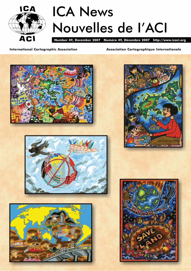
ICA NewsNouvelles de I’ACI Number 49, December 2007 Numéro 49, Dècembre 2007 http://www.icaci.org
International Cartographic Association Association Cartographique Internationale
ICA NEWS December 2007
ICA Executive Committee 2007-2011William CartwrightPresidentDepartment of Geospatial ScienceRMIT UniversityGPO Box 2476VMelbourne, Victoria 3001Australiatelephone: +61 3 9925 2423email: [email protected]
David FairbairnSecretary-General and TreasurerSchool of Civil Engineering and GeosciencesUniversity of Newcastle upon TyneNewcastle upon Tyne NE1 7RUUnited Kingdomtelephone: +44 191 222 6353email: [email protected]
Derek ClarkeVice-PresidentChief Directorate, Surveys and MappingPrivate Box X10Mowbray 7705South AfricaTelephone: +27 21 658 4300email: [email protected]
Georg GartnerVice-PresidentInstitute of Geoinformation and CartographyVienna University of TechnologyErzherzog Johann Platz 11040 ViennaAustriatelephone: +43 1 58801 12611email: [email protected]
Pablo Domingo Gran LópezVice-PresidentInstituto Geográfico MilitarNueva Santa Isabel 1640Santiago de ChileChiletelephone: +562 460 6801email: [email protected]
Menno-Jan KraakVice-PresidentDepartment of Geo-Information ProcessingInternational Institute for Geo-Information Science and Earth ObservationPO Box 67500 AA EnschedeThe Netherlandstelephone: + 31 53 4874 463email: [email protected]
Zhilin LiVice-PresidentDepartment of Land Surveying and Geo-InformaticsHong Kong Polytechnic UniversityHung Hom, KowloonHong Kongtelephone: +852 2766 5960email: [email protected]
Anne RuasVice-PresidentLaboratoire COGITInstitut Géographique National2 Avenue Pasteur94160 Saint MandéFrancetelephone: +33 1 43 98 84 32email: [email protected]
Timothy F. TrainorVice-PresidentGeography DivisionUnited States Census Bureau4600 Silver Hill RoadWashington DC 20233United States of Americatelephone: +1 301 763 9161email: [email protected]
Milan KonecnýPast-PresidentDepartment of GeographyMasaryk UniversityKotlárská 2611 37 BrnoCzech Republictelephone: +420 5 4949 5135email: [email protected]
Igor DreckiEditor ICA NewsGeo-graphics UnitSchool of Geography, Geology and Environmental ScienceThe University of AucklandPrivate Bag 92019AucklandNew Zealandtelephone: +64 9 3737 999email: [email protected]
1.M Yafie Abdillah (8 years)
My Creation My WorldSD Bani Saleh 6
Bekasi 17116, West JavaIndonesia
2.Fadilah Dina Putri (11)
Javanese Traditional Painting (Membatic)
SD Muh SokonandiYogyakarta, DIY
Indonesia
3.Caleb Ang (15)
Together Fighting TerrorismSMA Negeri 1
Ambon 97123, MalukuIndonesia
4.Achmad Qodim Syafaatullah (11)
Many Nations One WorldSD MINU PucangSidoarjo, East Java
Indonesia
5.Reno Adytia C.S. (11)
Jakarta 6th February 2007SD Xaverius 3
Bandarlampung, LampungIndonesia
About the CoverDue to the problem with postal delivery services, the originals of Indonesian maps supplied for the Barbara Petchenik Children’s Map Award were missing from the display at the International Cartographic Exhibition in Moscow, Russia. We reproduce them here to fulfil the promise made to the Indonesian delegation by the ICA Executive Committee.
3.
4.
2.
5.
1.
ICA NEWS December 2007 1
Dear Colleagues
Welcome to this first International Cartographic Association Newsletter produced by new Editor Igor Drecki of New Zealand. I am sure that readers will continue to regard this publication as the voice of the ICA, providing information about its activities and collaborations with sister societies and international mapping and GI Science bodies.
I would like to acknowledge the work of outgoing editor Graciella Metternicht. Over many years as editor Professor Metternicht has worked very hard to ensure that this important vehicle for carrying ICA news has been produced for global information dissemination. Graciella will continue her involvement with the Association as Chair of the Commission on Mapping from Satellite Imagery.
This edition sees a new Executive Committee for the International Cartographic Association for 2007-2011. The new Executive comprises members that come from all corners of the globe (the names of the new Committee are presented in the left).
I take-over from Milan Konecny as President, and I will value his support as Past -President for input of expert knowledge about the ICA and its international affiliations and responsibilities. Professor Konecny has worked tirelessly for the ICA and he has established links with other global spatial data projects like Global Mapping, Global Spatial Data Infrastructure and Digital Earth. Under his leadership the ICA has signed Memorandums of Understanding with the United Nations Office for Outer Space Mapping and with the Pan-American Institute of Geography and History. His work has progressed the status and profile of the ICA internationally.
A number of long-serving members of the ICA Executive have now retired from their positions with ICA. I would like to acknowledge their contributions.
Past-President Bengt Rystedt has served the ICA Executive for many years, most recently as President and past-President. He has had a major role in developing formal operational documents for the ICA and represented the Association on the Joint Board of Geo-Spatial Information Societies and Chaired its Disaster Management Group. Bengt’s efforts for the ICA have furthered its professional operations and international standing. Thank you Bengt.
Ferjan Ormeling retires as Secretary-General / Treasurer of the ICA. As well as his position as Secretary-General / Treasurer that he has held since 1999, has been involved in ICA activities since 1967. He also was Chair of the ICA Commission on Education and Training from 1987-1999. Also, he has represented ICA at UN Group of Experts on Geographical names. Professor Ormeling continues to contribute to the ICA and he is the new Chair of the Publications Committee. Thank you Ferjan.
A number of Vice-Presidents have also retired from their involvement with the ICA Executive Committee:
Vladimir Tikunov, also former Chair, ICA Commission on •Education and Training. Vladimir continues his involvement as Chair of the Working Group for GIS and Sustainable Development
Ramon Lorenzo Martinez, also Director of the 22nd International •Cartographic Association Conference, ÃCoruña conference, 2005. Ramon worked with NMOs to develop a closer association with the ICA. As part of these efforts he organized a special
session for NMOs at the Moscow ICC.
Kirsi Virrantaus, who spent two terms as Vice-President and •was Chair of the ICA Commission on Uncertain and Imprecise Geographic Information. Kirsi also developed the ICA Research Agenda. I am glad to say that Kirsi will continue to develop the Research Agenda for the Association
Robert McMaster, also spent two terms as Vice-President and •was Chair of the Publications Committee
Haggai Nyapola, also Chair of the ICA Commission on Mapping •Africa for Africa and a member of the International Steering Committee for Global Mapping
Thank you for your efforts on behalf of the Association.
A number of Commission / WG Chairs also retired at the August 2007 General Assembly. Their on-going involvement with the Association through the ‘workhouses’ of the ICA – Commissions and Working Groups – have ensured that the science of the discipline has been further advanced. These colleagues are:
Hal Moellering - Chair, ICA Commission on Spatial Data •Standards, and Editor of the recently-published book: World Spatial Metadata Standards
Jonathan Rowell - Chair, ICA Commission on Maps and •Graphics for Blind and Partially Sighted People
Ron Furness - Chair, ICA Commission on Marine Cartography •and one of the champions of the CoastGIS conferences
Ewa Krzywicka-Blum - Chair, ICA Commission on Gender and •Cartography
László Zentai - Chair, ICA Commission on Education and •Training and one of the co-organisers of the successful Joint Commissions Seminar in 2005 in Madrid, a pre-ÃCoruña ICA conference event
Lorenz Hurni - Chair, ICA Commission on Mountain •Cartography (Professor Hurni continues as Vice-Chair of this Commission)
Patrick Wiegand - Chair, ICA Commission on Cartography and •Children
Alexei Postnikov - Chair, ICA Commission on the History of •Cartography
Antony Cooper - Co-Chair, ICA Commission on Incremental •Updating and Versioning (Dr Cooper continues his ICA involvement as Chair of the Standards Commission)
Ammatzia Peled - Co-Chair, ICA Commission on Incremental •Updating and Versioning
Thank-you to all of these colleagues.
Also, three of the new ICA Vice-Presidents end their terms as
President’s Report
Pre
siden
t’s Rep
ort
ICA NEWS, DECEMBER 2007 - CoNtENtS
President's Report 1-2
the 23rd International Cartographic Conference 3-9
Commissions’ Reports 10-17
Conference Reports 18-19
tail Pieces 20
ICA NEWS December 20072
Pre
siden
t’s Rep
ort
President’s ReportChairs or co-Chairs of Commissions: Menno-Jan Kraak - Chair, ICA Commission on Visualization and Virtual Environments; Anne Ruas - Co-Chair, ICA Commission on Generalisation and Multiple Representation; and Timothy Trainor - Chair, ICA Commission on Atlases. Thank you for your work over many years with these Commissions.
The Moscow Conference was again a venue for colleagues to meet and further the agenda of the ICA. I would like to thank the Local Organising Committee, led by its Deputy Chairman Dr. Alexandr Borodko, Head of The Federal Agency of Geodesy and Cartography, The Ministry of Transport of the Russian Federation. I would also like to note the efforts of ICA ‘links’ to the conference organisation, Vladimir Tikunov and Kira Shingareva.
At ICC 2007, four prestigious ICA awards were presented: the Carl Mannerfelt Gold Medal, the highest award of the ICA, which recognises excellence in scholarship and research in Cartography and GI Science; and ICA Honorary Fellowships. Jack Dangermond (USA) was awarded the Carl Mannerfelt Gold Medal and Honorary Fellowships were awarded to Graciela Metternicht (Australia), Helen Kerfoot (Canada) and Kira Shingareva (Russia). My congratulations to these award recipients.
Also in Moscow, the Research Agenda on Cartography and GI Science, developed by Kirsi Virrantaus and David Fairbairn was endorsed. The agenda specifies the areas of research activities that the ICA will address, namely:
Geographic Information•Metadata and SDIs•Geospatial Analysis and Modelling•Usability•Geovisualization, Visual Analytics•Map production•Cartographic Theory•History of Cartography and GI Science•Education•Society•
As noted earlier, Professor Virrantaus has volunteered to continue to develop the Research Agenda, in collaboration with Vice-Presidents Anne Ruas and Menno-Jan Kraak. Any input into the Research Agenda from colleagues is welcomed.
The ICA also recognises the support of many international organisations. Details of these supporting organisations are provided inside the back cover of this newsletter.
For information, the Executive Committee meeting was held in Moscow, immediately after the General Assembly. The next, and the first formal meeting will be held in Vienna, February 3 and 4, 2008.
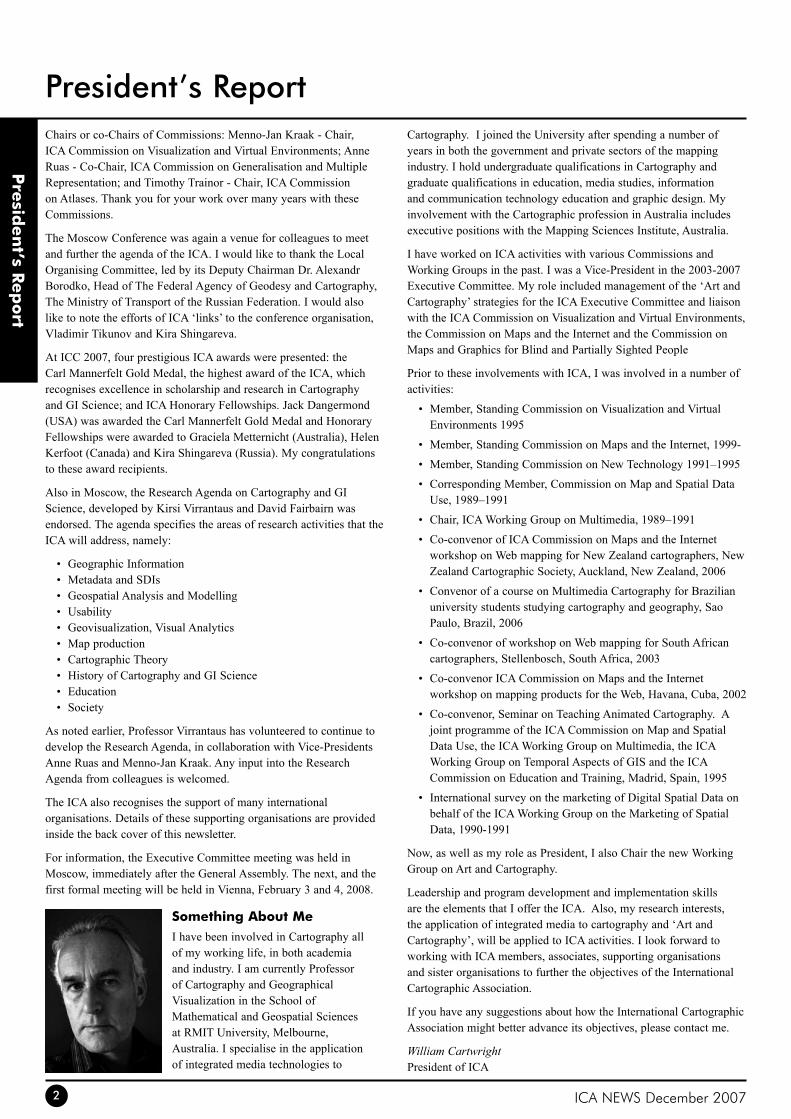
Something About MeI have been involved in Cartography all of my working life, in both academia and industry. I am currently Professor of Cartography and Geographical Visualization in the School of Mathematical and Geospatial Sciences at RMIT University, Melbourne, Australia. I specialise in the application of integrated media technologies to
Cartography. I joined the University after spending a number of years in both the government and private sectors of the mapping industry. I hold undergraduate qualifications in Cartography and graduate qualifications in education, media studies, information and communication technology education and graphic design. My involvement with the Cartographic profession in Australia includes executive positions with the Mapping Sciences Institute, Australia.
I have worked on ICA activities with various Commissions and Working Groups in the past. I was a Vice-President in the 2003-2007 Executive Committee. My role included management of the ‘Art and Cartography’ strategies for the ICA Executive Committee and liaison with the ICA Commission on Visualization and Virtual Environments, the Commission on Maps and the Internet and the Commission on Maps and Graphics for Blind and Partially Sighted People
Prior to these involvements with ICA, I was involved in a number of activities:
Member, Standing Commission on Visualization and Virtual •Environments 1995
Member, Standing Commission on Maps and the Internet, 1999-•
Member, Standing Commission on New Technology 1991–1995•
Corresponding Member, Commission on Map and Spatial Data •Use, 1989–1991
Chair, ICA Working Group on Multimedia, 1989–1991•
Co-convenor of ICA Commission on Maps and the Internet •workshop on Web mapping for New Zealand cartographers, New Zealand Cartographic Society, Auckland, New Zealand, 2006
Convenor of a course on Multimedia Cartography for Brazilian •university students studying cartography and geography, Sao Paulo, Brazil, 2006
Co-convenor of workshop on Web mapping for South African •cartographers, Stellenbosch, South Africa, 2003
Co-convenor ICA Commission on Maps and the Internet •workshop on mapping products for the Web, Havana, Cuba, 2002
Co-convenor, Seminar on Teaching Animated Cartography. A •joint programme of the ICA Commission on Map and Spatial Data Use, the ICA Working Group on Multimedia, the ICA Working Group on Temporal Aspects of GIS and the ICA Commission on Education and Training, Madrid, Spain, 1995
International survey on the marketing of Digital Spatial Data on •behalf of the ICA Working Group on the Marketing of Spatial Data, 1990-1991
Now, as well as my role as President, I also Chair the new Working Group on Art and Cartography.
Leadership and program development and implementation skills are the elements that I offer the ICA. Also, my research interests, the application of integrated media to cartography and ‘Art and Cartography’, will be applied to ICA activities. I look forward to working with ICA members, associates, supporting organisations and sister organisations to further the objectives of the International Cartographic Association.
If you have any suggestions about how the International Cartographic Association might better advance its objectives, please contact me.
William CartwrightPresident of ICA
ICA NEWS December 2007 3
ICC
Con
fere
nce
The 23rd International Cartographic ConferenceSummertime in MoscowThe 23rd International Cartographic Conference (ICC) took place in Moscow in August and provided an opportunity for cartographers from around the world to meet, present, debate and network at a high intellectual level. The quality of papers and posters presented was excellent, and the programme covered the full range of cartographic activity – research, production, use, history and applications areas.
26 themes were established by the Russian organising committee, most reflecting the areas of interest of the ICA Commissions and Working Groups. The most popular sessions reflected current topics of significant interest, such as SDIs, generalization, electronic atlases, history and research & development. More than 500 papers and nearly 150 posters were presented, and more than 1000 delegates from 62 different countries attended.
The conference was opened by the Russian Minister for Transport, Igor Levitin, who expressed pleasure in welcoming cartographers from around the world. The conference director was Alexander Borodko, the Head of the Federal Agency for Geodesy and Cartography, whose opening address invited delegates to discover the strengths of the heritage and current state of Russian cartography. Such strengths were particularly evident in the International Cartographic Exhibition, the usual display of stunning and innovative mapping visible every two years at ICCs. Here over 900 maps, atlases, globes and electronic atlases were on show, along with 200 hydrographic chart products, representing the best cartography from around the world. The children’s map competition was held alongside, and a full technical exhibition from commercial companies also occupied the trade hall of the All-Russia Exhibition Centre. In addition the exhibition ‘Masterpieces of the Russian Cartography’ in the Russian State Library showed a glimpse of the massive stock of historical maps stored there.
The General Assembly which took place during the ICC is reported elsewhere in this issue of ICA News. Many further meetings took place around the conference. Each Commission set up a business meeting, open to all, to report on activity over the past 4 years and to develop plans for the 2007-2011 period. There were meetings of other special interest groups such as students and members of the Joint Board of Geospatial Information Societies. An important gathering of National Mapping Organisations directors and staff, organised by ICA Past-President Konecny, Ramon Lorenzo (Spain) and Alexander Borodko also took place during the conference. This meeting was particularly important in maintaining and developing the vital links between ICA and national mapping agencies worldwide.
ICCs are busy occasions, with many activities, intellectual and social, taking place. ICA was pleased to have the opportunity to visit Moscow to experience these.
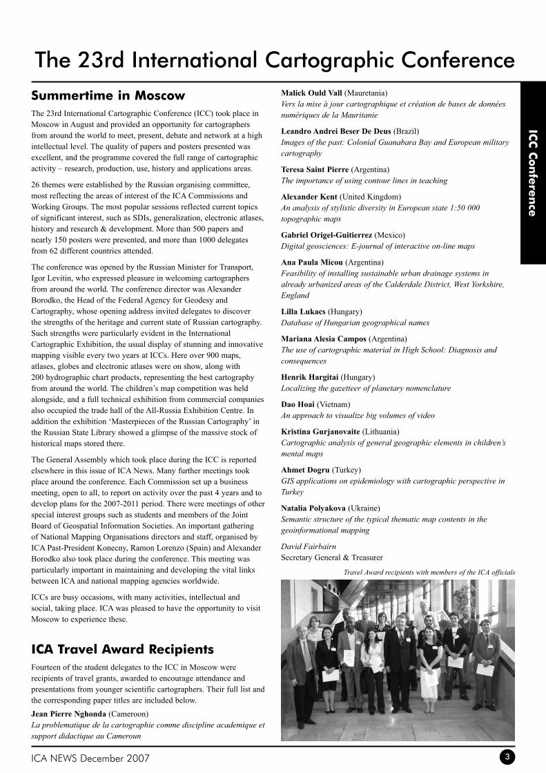
ICA travel Award RecipientsFourteen of the student delegates to the ICC in Moscow were recipients of travel grants, awarded to encourage attendance and presentations from younger scientific cartographers. Their full list and the corresponding paper titles are included below.
Jean Pierre Nghonda (Cameroon) La problematique de la cartographie comme discipline academique et support didactique au Cameroun
Malick Ould Vall (Mauretania) Vers la mise à jour cartographique et création de bases de données numériques de la Mauritanie
Leandro Andrei Beser De Deus (Brazil) Images of the past: Colonial Guanabara Bay and European military cartography
Teresa Saint Pierre (Argentina) The importance of using contour lines in teaching
Alexander Kent (United Kingdom)An analysis of stylistic diversity in European state 1:50 000 topographic maps
Gabriel Origel-Guitierrez (Mexico)Digital geosciences: E-journal of interactive on-line maps
Ana Paula Micou (Argentina)Feasibility of installing sustainable urban drainage systems in already urbanized areas of the Calderdale District, West Yorkshire, England
Lilla Lukacs (Hungary)Database of Hungarian geographical names
Mariana Alesia Campos (Argentina)The use of cartographic material in High School: Diagnosis and consequences
Henrik Hargitai (Hungary)Localizing the gazetteer of planetary nomenclature
Dao Hoai (Vietnam)An approach to visualize big volumes of video
Kristina Gurjanovaite (Lithuania)Cartographic analysis of general geographic elements in children’s mental maps
Ahmet Dogru (Turkey)GIS applications on epidemiology with cartographic perspective in Turkey
Natalia Polyakova (Ukraine)Semantic structure of the typical thematic map contents in the geoinformational mapping
David FairbairnSecretary General & Treasurer
Travel Award recipients with members of the ICA officials
ICA NEWS December 20074
ICC
Con
fere
nce
The 23rd International Cartographic Conference14th General Assembly of the ICAICA is grateful that delegates from Member Nations attended the General Assembly meetings in Moscow and participated in the important business of receiving reports of officers and Commission Chairs for the 2003-2007 period; approving the financial management of ICA; voting on modifications to the Statutes of ICA; accepting national reports on cartographic activity from Member Nations; and confirming ICA Awards bestowed by the Awards Committee.
In addition, Member Nations voted on the location for the 15th GA of ICA, and on the members of the Executive Committee 2007-2011 and establishment and/or continuation of Commissions and their chairs for 2007-2011. The results of these are as follows:
Location for the 15th General Assembly of ICAParis, France4-9 July 2011
Executive CommitteePresidentWilliam Cartwright, RMIT University, Australia
Secretary General & TreasurerDavid Fairbairn, Newcastle University, UK
Vice-PresidentsDerek Clarke, Surveys and Mapping, South AfricaGeorg Gartner, Technische Universität Wien, AustriaPablo Gran, Instituto Geografico Militar, ChileMenno-Jan Kraak, ITC, NetherlandsZhilin Li, Hong Kong Polytechnic University, ChinaAnne Ruas, Institut Géographique National, FranceTimothy Trainor, Census Bureau, USA
Past-PresidentMilan Konecny, Masaryk University, Czech Republic
Editor ICA NewsIgor Drecki, University of Auckland, New Zealand
Commissions and ChairsCartography and Children Jesus Reyes Nunez, Eötvös Loránd Tudományegyetem, HungaryTemenoujka Bandrova, University of Architecture, Civil Engineering and Geodesy, Bulgaria
Digital Technologies and Cartographic HeritageEvangelos Livieratos, Aristotle University of Thessaloniki, Greece
Education and TrainingDavid Fraser, RMIT University, Australia
Generalisation and Multiple RepresentationWilliam Mackaness, University of Edinburgh, UKSebastien Mustière, Institut Géographique National, France
Geospatial Analysis and ModelingBin Jiang, Högskolan i Gävle, Sweden
Geospatial Data StandardsAnthony Cooper, Council for Scientific and Industrial Research, South Africa
GeovisualizationGennady Andrienko, Fraunhofer IAIS, Germany
History of CartographyElri Liebenberg, Pretoria, South Africa
Management and Economics of Map ProductionPhilippe de Maeyer, Universiteit Gent, BelgiumErkki-Sakari Harju, Karttakeskus, Finland
Map ProjectionsDaan Strebe, Mapthematics, USA
Mapping from Satellite ImageryGraciela Metternicht, University of South Australia, Australia
Maps and Graphics for Blind and Partially Sighted PeopleDan Jacobson, University of Calgary, Canada
Maps and SocietyChris Perkins, University of Manchester, UK
Maps and the InternetMichael Peterson, University of Nebraska (Omaha), USA
Marine CartographyPatricio Carrasco, Servicio Hidrográfico y Oceanográfico de la Armada de Chile
Mountain CartographyKarel Kriz, Universität Wien, Austria
National and Regional AtlasesPeter Jordan, Ost- und Südosteuropa-Institut, Austria
Planetary CartographyKira Shingareva, Moscow State University for Geodesy and Cartography, Russia
Theoretical CartographyAlexander Wolodtschenko, Technische Universität Dresden, Germany
Ubiquitous MappingTakashi Morita, Hosei University, Japan
Under-represented Groups and CartographyWiesławaŻyszkowska,UniwersytetWrocławski,Poland
Use and User IssuesCorné van Elzakker, ITC, Netherlands
Working Groups and ChairsArt and CartographyWilliam Cartwright, RMIT University, Australia
Cartography on Early Warning and Crisis ManagementMilan Konecny, Masaryk University, Czech Republic
Mapping Africa for AfricaDerek Clarke, Surveys and Mapping, South Africa
You are welcome to approach any of the above-named persons to discuss and clarify ICA and cartographic activities which you and cartographers from your nation may be interested in.
David FairbairnSecretary General & Treasurer

ICA NEWS December 2007 5
ICC
Con
fere
nce
ICA AwardsCarl Mannerfelt Gold MedalJack DangermondJack Dangermond is a unique outstanding promoter of cartography, mapping and geography. His products created with strong confidence in the power of cartography and geography have influenced hundreds of government officials, private companies and millions of everyday users including pupils and students from basic schools to technical schools and universities all over the world. He is able to bridge the gap between research ideas and intentions of cartographers on one side, and real practical needs of users from many different fields on the other side.
Jack Dangermond is the founder and president of ESRI. Founded in 1969 and headquartered in Redlands, California, ESRI is widely recognized as the technical and market leader in geographic information system (GIS) software, pioneering innovative solutions for working with spatial data on the desktop, across the enterprise, in the field, and on the Web. ESRI has the largest GIS software install base in the world with more than one million users in more than 300,000 organizations worldwide. He fostered the growth of ESRI from a small research group to an organization of over 3,100 employees, known internationally for GIS software development, training, and services. Jack holds six honorary doctorates: California Polytechnic University-Pomona, State University of New York at Buffalo, University of West Hungary, City University in London, University of Redlands in California, and Ferris State University in Michigan.
Jack Dangermond supports development of new cartographic tools in cartographic generalization and cartographic visualization, creation of digital atlases and approaches promoting cartography in many various areas of human activities from crises management situations to the issues of healthy geography. He is a supporter of distributing and sharing knowledge and creation of capacity building through fundamental projects on the United Nations level – such as Global Mapping – providing opportunities for young users to become a part of the development of cartography by means of grants devoted to application of cartographic and geographic approaches in solving problems of the contemporary world.
Jack Dangermond helped to highlight and make globally visible one of the most successful ICA ideas by publishing – together with the ICA – the best drawings from Barbara Petchenik Contest in a book called “Children Map the World: Selection from the Barbara Petchenik Children’s World Map Competition”.
He promotes the ICA and cartography in general, and stresses the role of cartography in solving global problems. He supports projects highlighting cartographic and geographic science potentials in the process of designing information/knowledge-based society on a global scale. He supports ideas of ICA by creating new widely-known series of cartographic publications, and has published several very influential books, such as Imhoff’s “Three-Dimensional Representation of the Relief”. He still continues in publishing contemporary cartographic books helping to share the latest ideas of cartographers from all over the world.
Similarly as Joel Morrisson and David Rhind have been pioneers of the new era of digital cartography, Jack Dangermond is a pioneer
of the delimitation and definition of the role of cartography and geographic information in the realization of the Global Millennium Goals and in the creation of an Information/Knowledge–based Society.
For his outstanding contribution to cartography and geographic information science Jack Dangermond is honored with the highest award of ICA – the Mannerfelt Gold Medal.
ICA Honorary FellowshipKira B ShingarevaKira B. Shingareva is professor at the Moscow State University for Geodesy and Cartography. She graduated from the Dresden Technical University at 1961 and received her Ph.D in 1974, and became Doctor of Science in 1992. She has hold positions as principal scientist at the Planetary Cartography Laboratory and at the Laboratory of Comparative Planetology at the Institute of Space Researches at the Academy of Science.
At the University she participated in the National Space program by mapping the Moon, Mars, Phobos and Venus. She is author of more than 150 publications, among them “Atlas of Terrestrial Planets and their Moons” and “Space Activity in Russia – Background, Current State, Perspectives”.
Since 1995 Professor Shingareva has been active in the ICA. She has been co-chairman of the ICA Planetary Cartography Working Group 1995-1999 and chairman of ICA Planetary Cartography Commission for two consecutive terms, 1999-2007. Among the achievements of her ICA activities we find “Series of multilingual maps of planets and their moons”, “Glossary on planetary cartography” and “Specialised map-oriented Databases on planetary cartography”.
Kira Shingareva has served ICA in an exemplary way. In spite of limited resources she has organised and documented several commissions meeting, and always reported the activities of her commission to the Executive Committee in a timely manner.
For her outstanding services to ICA Dr. Shingareva is awarded an Honorary Fellowship of ICA.
Graciela I MetternichtGraciela Metternicht has for the last 10 years been teaching at Curtin University, Perth Australia and is since July, 2007 professor of Geospatial Systems and Environmental Management at the School of Natural and Built Environments, University of South Australia, Adelaide, Australia. In 1985 she finished an education in cartography at Santa Fe, Argentina. In 1992 she received an MSc in Integrated Map and Geo-information Production at ITC in the Netherlands and in 1996 a PhD in Geography at the State University of Gent, Belgium.
Graciela Metternicht´s publication record contains over 100 works and she is active member of many organisations. In 1999 she took the responsibility to be the editor of ICA News, the newsletter of ICA. She changed its outlook by having the winning Barbara Petchenik entries on its cover, and made these children’s drawings an ICA trademark. She has been instrumental in having the ICA News available on the web as well, and has been the intermediary for the start of a Spanish and probably also a German translation. For the
The 23rd International Cartographic Conference
ICA NEWS December 20076
ICC
Con
fere
nce
ICA News she started new sections, like her editorials and the special features, and she started to display the logo’s of ICA’s supporting affiliate member on the back cover.
Since 2004 she is acting chair of the ICA Commission on Mapping from Satellite Images for which she has organised workshops in Africa, Latin America and Asia, and an active member of several other ICA commissions.
For her outstanding service to ICA, especially as editor of ICA News, Graciela Metternicht is awarded an Honorary Fellowship of ICA.
Helen KerfootHelen Kerfoot was already presented with a diploma for outstanding services to ICA as member of the Local Organising Committee that organised the 1999 International Cartographic Conference in Ottawa. She has played an even more important role for cartographers worldwide however as chairperson of the United Nations Group of Experts on Geographical Names (UNGEGN) standing advisory commission of the Economic and Social Council of the United Nations.
After a BSc in Geology, Geography and Anthropology in Britain she took up a job as geography teacher in Canada, but from 1971 she was a researcher and field party leader in the Canadian Arctic, for Indian and Northern Affairs, where she must have become interested in toponymy. In 1975 she joined the Toponymy section and the Canadian Permanent Commission on Geographical Names secretariat, at the Ministry of Energy, Mines and Resources in Ottawa, where she was appointed researcher for Northwest Territory toponymic data. From 1992 -1998 she was head, Geographical Names Section of Natural Resources Canada, since when she has been an Emeritus scientist. She is a past president of the Canadian Society of the Study of Names, which she presided over from 1997-2003. She was delegated by the Canadian Government to the United Nations Group of Experts on Geographical Names in 1987, was elected as vice-chair in 1994 and elected as chairperson of UNGEGN in 2002.
Since then she has succeeded in turning UNGEGN into a more professional body and in bringing its work in line with current Spatial Data Infrastructure-initiatives. She is one of the few experts with hands-on experience in practically all fields of toponymic standardization. Her drive to attend all the meetings of UNGEGN working groups, her participation in toponymy courses world wide, in scientific seminars and technical meetings as well as her endeavours to make all UNGEGN ‘jurisprudence’ on geographical names accessible through its website have benefited the whole spatial information community, as geographical names standardisation is a most important aspect in the exchange and linking of geospatial data.
For her services and contribution to cartography and geographic information Helen Kerfoot is awarded an Honorary Fellowship of the International Cartographic Association.
Based on the citations above the ICA Awards Committee decides unanimously to propose to the ICA Executive Committee to award Jack Dangermond with the Mannerfelt Gold Medal, and Kira Shingareva, Graciela Mettermicht and Helen Kerfoot with the ICA Honorary Fellowship.
Bengt RystedtChair of the Awards Committee
the International Cartographic ExhibitionThe International Cartographic Exhibition was organized in conjunction with the International Cartographic Conference that was held from 4 to 10 August 2007. In total, 27 countries submitted entries for this exhibition. All entries were very well displayed and lightened in pavilion 69 of the all-Russian Exhibition Centre. A high quality catalogue was made available to all conference participants and the international jury received all the support they needed for their judging of the entries.
The best products were selected in 9 categories by an official international jury with the following members:
Corné van Elzakker (The Netherlands) (Chair)•Vladimir Zhukovsky (Russia)•Cynthia Brewer (USA)•Takashi Morita (Japan)•Haggai Nyapola (Kenya)•Philippe DeMaeyer (Belgium)•Miljenko Lapaine (Croatia)•
AtlasesIn recognition of the high standard of Russian atlas cartography there are two winners in this category:
WINNERSRussia RU10 Atlas of MoscowSplendid, up-to-date (data from January 2007!) and very complete multimedia representation of Moscow on paper with 2D and 3D maps, anaglyphs, aerial and other photographs, etc.
Russia RU1 National Atlas of Russia. Vol. 2: Nature, ecology.Volume 2 of the extensive 15 volumes National Atlas of Russia. Extremely thorough piece of scientific work in the well-known and famous Russian physical geographical tradition.
SECOND PLACEIran IR17 Atlas of Protected Areas of IranBi-lingual (Persian and English) well-designed and well-produced atlas which firmly convinces the users of the need to protect natural areas.
THIRD PLACEEstonia EE4 Estonian Cruising Guide 2006-2007Atlas of all (small) harbours for yacht sailors in Estonia. For each harbour there is a set of maps at various scales (hydrographic, harbour settlement and hinterland), oblique aerial photographs and text information.
Hydrographic/Nautical ChartsWINNERRussia RU175 Central Arctic Basin, Admirality No. 91115Splendid cartographic overview of the Central Arctic Basin with a good colour confrontation.
SECOND PLACESweden SE8 Sankt Anna ArchipelagoVery clear and easy-to-read hydrographic map of a complex island area.
THIRD PLACEFinland FI17 Korppoo TurkuStandard hydrographic map, but with a high standing quality in the representation of a complicated area.
MultimediaThe jury decided NOT to nominate any winners for this category.
The 23rd International Cartographic Conference
ICA NEWS December 2007 7
ICC
Con
fere
nce
The multimedia products were not really accessible to the visitors of the International Cartographic Exhibition. There were problems of installation and language problems.
For future exhibitions, it is proposed to ask countries to submit either posters or simple movies (Quicktime or WMV) demonstrating the functionalities of a multimedia application.
Recreation and orienteering MapsWINNERJapan JP10 Super bird’s eye view of AsahikawaVery effective annotated virtual reality representation.
SECOND PLACECzech Republic CZ10 Cykloatlas ČeskoUser-friendly loose-leaf cycling atlas with all the information required by cyclists, including height profiles and detailed maps and route information.
THIRD PLACESpain ES82 Map and guide of Garajonay National ParkAttractive design with a nice representation of the 3rd dimension of the terrain. Deft relief represented with dense contours overlayed by subtle color and texture differences for land cover and land use types. Trails are symbolized with small foot prints in an inviting way that contrasts well with other boundary lines. Label styles are well categorized and slight halos make them readable against detailed park terrain.
Relief Models and GlobesWINNERRussia RU01 Physical Globe 1 : 40,000,000Impressive touchable globe, produced by digital means.
SECOND PLACESpain ES53 Relief model of CatalunyaPlastic real 3D relief map with indication of height differences of the sea floor as well.
THIRD PLACECzech Republic CZ14 Plastická Mapa BeskydyGood example of a well designd and produced plastic relief model.
Satellite Images/Satellite Image MapsWINNERUnited States of America US8 Nighttime Lights of the WorldVery didactic representation with an integration of fires and light.
SECOND PLACENorway NO15 From Tärna to Træna Very attractive and appealing satellite image of an area along the Arctic Circle.
THIRD PLACERussia RU9 Moscow from KosmosNice integration of remote sensing image and cartographic map.
thematic MapsWINNERFrance FR24 Carte Géologique harmonisée du département de l’HeraultWell-designed and clear map, with a good colour selection and nice hill-shading in the background.
SECOND PLACESouth Africa ZA2 Vegetation Map of South Africa, Lesotho and SwazilandLarge map at scale 1: 250,000. Map editors have managed to select proper colours for the 435 map units to be represented.
THIRD PLACEChina CN27 Map of Dujiangyan Irrigation AreaMap designers have coped very well with the problem of superimposing various map layers (topography, geological strata, irrigation zones). Traces of streams still appear very clearly.
topographic MapsWINNERNew Zealand NZ1 Topographic map of Aoraki / Mt Cook Alpine AreaAppealing colours and map design. Good registration on road features. Impressive detailed contouring.
SECOND PLACESpain ES98 National Topographic Map of Campo de CartagenaExample of a well designed and appealing topographical map, which may easily be used for a variety of purposes. Expert use of light textures. Simplified urban block structure establishes road pattern without overpowering design.
THIRD PLACECzech Republic CZ39 Topomapa Základni Mapa CR 1 : 25,000Well designed and produced modern topographic map of high standing. Trail detail meshes well with subtle topographic rendering. Gray and green color use in urban area symbolization is distinctive.
Urban Maps/town PlansWINNERSweden SE18 Översiktskarta SolnaBeautiful overview map of the town of Solna, obviously based on a user-centered design approach. . Well structured use of hues to organize image with brown/ orange/red for urban areas and greens for open areas. The design incorporates detailed hierarchies and shows care in label placement.
SECOND PLACERussia RU84 IrkutskModern cartographic representation of the urban area of Irkutsk. The map presents good detail in buildings, and the light colours produce a readable design. Tint bands emphasize boundary locations with an appealing design.
THIRD PLACESpain ES105 Street Directory of PamplonaWell-designed street directory on which measurements can be made easily.
otherWINNERPoland PL31 Geographical Atlas of Europe, Vol. I and II, for blind and visually handicapped peopleAtlas for blind and visually handicapped people that can also be used by sighted people. Modern production techniques. Complete atlas.
SECOND PLACESwitzerland CH5 Urner Hiking and Bikemap GotthardMixture of a topographic and recreational map with a very good relief representation, as we know from the Swiss.
THIRD PLACEUnited States of America US48 Map of Census BoundariesMap showing the solution to the always difficult problem of showing administrative boundaries for areas at varied levels that nest and intersect, while maintaining contrast with the road and shoreline base information.
Corné van ElzakkerChair, International Jury
The IHO award for the best entry at hydrographic charts exhibition was won by Australia, with the 2nd and 3rd prizes for Japan and the Netherlands.
The 23rd International Cartographic Conference
ICA NEWS December 20078
the Barbara Petchenik Children’s Map CompetitionThe theme of the competition was Many nations, one world and a total of 174 works were submitted from 36 countries of five continents:
AFRICA (1 country)• : South Africa
AMERICA (4)• : Argentina, Brazil, Canada, United States
AUSTRALIA/NEW ZEALAND (1)• : New Zealand (2 submissions)
ASIA (14)• : Bahrain, China, India, Indonesia, Iran, Japan, Kuwait, Malaysia, Oman, Philippines (4), Qatar, Saudi Arabia, Sri Lanka (4), United Arab Emirates
EUROPE (16)• : Bulgaria, Croatia, Czech Republic, Finland, Germany, Hungary, Lithuania, Netherlands, Norway, Poland, Russian Federation, Slovak Republic, Spain, Sweden, Ukraine, United Kingdom
The Judging Committee was formed by:
Elri Liebenberg (South Africa)•Diah Kresnawati (Indonesia)•Vit Vozenilek (Czech Republic)•Nikolaj Komedchikov (Russia)•Jesús Reyes Nuñez (Hungary) (Chair)•
The Judging Committee meetings for the selection of winner drawings were held in the morning of August 7 and 8. The Committee evaluated the submitted maps by each age group and decided to give two awards in the first age group (under 9 years), two awards in the second age group (9-12 years) and three awards in the last age group (13-15 years):
Under 9 YearsM. Yafie Abdillah (8 years) My Creation, My World (ID-1)SD Bani Saleh 6 Bekasi, West Java Indonesia
Bita Porrang (8) (no title) (IR-1)Adl Tehran Iran
9-12 YearsAlexandra Gavin (11) Many Nations, One World (UK-4)St. Hughs Primary School Timperley, Cheshire United Kingdom
Joanna Ivanova Ivanova (12) The World Peace in Childrens’ Eyes (BG-4)Drawing School “Specter” Sofia Bulgaria
13-15 YearsYasmin Ahmed Ali (14)(no title) (QA-5)Qatar
Marta Londzin (13) We Have Different Colours of Skin, But We Are All Children (PL-1)SzkołaPodstawowaTowarzystwaEwangelickiegowCieszynieCieszyn Poland
Svitlana Moskalenko (14) Marry Dancing (UA-5)Secondary School No. 2 Bashtanka Ukraine
The authors of the selected maps received a diploma and 50 US dollars. The Judging Committee also decided to give a special award (only diploma) to the youngest participant in the competition: Sama Salah Al Sayed (4 years) from Qatar.
A public vote in each age group was organized by the Local Organizer Committee. 185 participants voted till 16:30 on August 8. Based on these votes, the winners by age group are as follows:
Under 9 YearsLukas Kareiva (7) A Lot Of Countries In One World (LT-1) 17 votesDariausirGirėnoVid.MokyllaRadviliškis Lithuania
9-12 YearsSamuel Zúñiga Vélez (9) I Want an Equal World For All (ES-4) 14 votesColegio San Ignacio de Loyola Alcala de Henares Spain
Katarzyna Fojcik (11) Music Joins Us (PL-4) 14 votesSzkołaPodstawowanr.1im.AdamaMickiewiczaMarklowice Poland
13-15 YearsRita Galkina (15) Mr. Humankind or the Faith in World Cosmopolism (RU-5) 23 votesMoscow Russia
The winners by public vote received a diploma and 50 US dollars.
In relation to the public vote, an unfortunate situation should be mentioned caused by the loss of original Indonesian maps, provoking that only their scanned copies were presented in the Exhibition from the second day. The Chair of Jury would like to ask the ICA Executive Committee and organizers of the next competitions/exhibitions to make all efforts to avoid similar situations in the future. At same time, we support the solution offered by ICA President to present all the Indonesian maps on the front cover of this edition of ICA News.
The Judging Committee thanks the support received by the Local Organizer Committee, especially from Nikolai Komedchikov and Alexander Khropov during the counting of public votes and the preparing of diplomas for the winners.
Scanned artwork of all entries is now available from the following website: www.icaci.org/petchenik2007.
Jesús Reyes NuñezChair, Judging Committee
ICC
Con
fere
nce
The 23rd International Cartographic Conference
ICA NEWS December 2007 9
ICC
Con
fere
nce
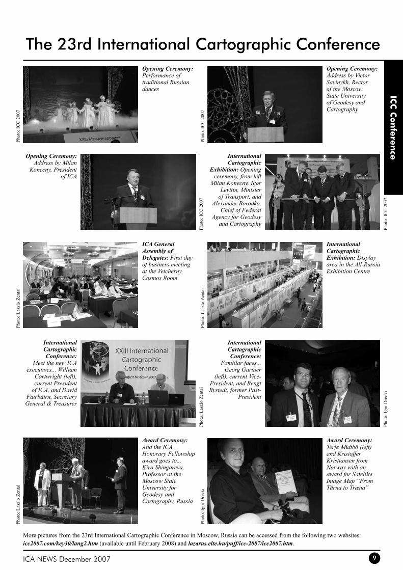
The 23rd International Cartographic ConferenceOpening Ceremony: Performance of traditional Russian dances
Opening Ceremony: Address by Milan
Konecny, President of ICA
International Cartographic
Exhibition: Opening ceremony, from left
Milan Konecny, Igor Levitin, Minister
of Transport, and Alexander Borodko,
Chief of Federal Agency for Geodesy
and Cartography
International Cartographic Exhibition: Display area in the All-Russia Exhibition Centre
International Cartographic Conference:
Familiar faces... Georg Gartner
(left), current Vice-President, and Bengt Rystedt, former Past-
President
Award Ceremony: Terje Midtbö (left) and Kristoffer Kristiansen from Norway with an award for Satellite Image Map “From Tärna to Træna”
Award Ceremony: And the ICA Honorary Fellowship award goes to... Kira Shingareva, Professor at the Moscow State University for Geodesy and Cartography, Russia
International Cartographic Conference:
Meet the new ICA executives... William
Cartwright (left), current President
of ICA, and David Fairbairn, Secretary General & Treasurer
ICA General Assembly of Delegates: First day of business meeting at the Vetcherny Cosmos Room
Opening Ceremony: Address by Victor Savinykh, Rector of the Moscow State University of Geodesy and Cartography
More pictures from the 23rd International Cartographic Conference in Moscow, Russia can be accessed from the following two websites: icc2007.com/key30/lang2.htm (available until February 2008) and lazarus.elte.hu/puff/icc-2007/icc2007.htm.
Phot
o: IC
C 2
007
Phot
o: L
aszl
o Ze
ntai
Phot
o: L
aszl
o Ze
ntai
Phot
o: L
aszl
o Ze
ntai
Phot
o: L
aszl
o Ze
ntai
Phot
o: Ig
or D
reck
i
Phot
o: Ig
or D
reck
iPh
oto:
ICC
200
7Ph
oto:
ICC
200
7
Phot
o: IC
C 2
007
ICA NEWS December 200710
Rep
orts
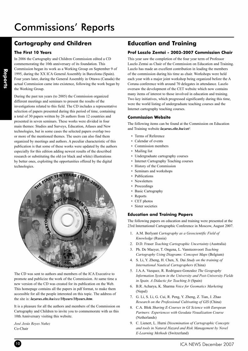
Cartography and Childrenthe First 10 YearsIn 2006 the Cartography and Children Commission edited a CD commemorating the 10th anniversary of its foundation. This Commission began its work as a Working Group on September 9 of 1995, during the XX ICA General Assembly in Barcelona (Spain). Four years later, during the General Assembly in Ottawa (Canada) the actual Commission came into existence, following the work began by the Working Group.
During the past ten years (to 2005) the Commission organized different meetings and seminars to present the results of the investigations related to this field. The CD includes a representative selection of papers presented during this period of time, containing a total of 30 papers written by 26 authors from 12 countries and presented in seven seminars. These works were divided in four main themes: Studies and Surveys, Education, Atlases and New technologies, but in some cases the selected papers overlap two or more of the mentioned themes. The users can also find them organized by meetings and authors. A peculiar characteristic of this publication is that some of these works were updated by the authors especially for this edition adding newest results of the described research or substituting the old (or black and white) illustrations by better ones, exploiting the opportunities offered by the digital technologies.
The CD was sent to authors and members of the ICA Executive to promote and publicize the work of the Commission. At same time a new version of the CD was created for its publication on the Web. This homepage contains all the papers in pdf format, to make them accessible for all the people interested on this topic. The address of the site is: lazarus.elte.hu/ccc/10years/10years.htm.
It is a pleasure for all the authors and members of the Commission on Cartography and Children to invite you to commemorate with us this 10th Anniversary visiting this website.
José Jesús Reyes NuñezCo-Chair
Education and trainingProf Laszlo Zentai - 2003-2007 Commission ChairThis year saw the completion of the four year term of Professor Laszlo Zentai as Chair of the Commission on Education and Training. Laszlo has made an excellent contribution in leading the members of the commission during his time as chair. Workshops were held each year with a major joint workshop being organized before the A Coruna conference with around 70 delegates in attendance. Laszlo oversaw the development of the CET website which now contains many items of interest to those involved in education and training. Two key initiatives, which progressed significantly during this time, were the world listing of undergraduate teaching courses and the Internet cartography teaching courses.
Commission WebsiteThe following items can be found at the Commission on Education and Training website lazarus.elte.hu/cet/:
Terms of Reference•Calendar of events •Commission members•Mailing list•Undergraduate cartography courses•Internet Cartography Teaching courses•History of the Commission•Seminars and workshops•Publications•Newsletters•Proceedings•Basic Cartography•Reports•CET photos•Sister societies•
Education and training PapersThe following papers on education and training were presented at the 23rd International Cartographic Conference in Moscow, August 2007.
A.M. Berlyant 1. Cartography as a Geoscientific Field of Knowledge (Russia)D.D. Fraser 2. Teaching Cartographic Uncertainty (Australia)Ph. De Maeyer, T. Ongena, L. Vansteenvoort 3. Teaching Cartography Using Diagrams: Concepot Maps (Belgium)S. Li, Y. Zheng, H. Chen, X. Dai 4. Study on the training of International Nautical Cartographers (China)J.A.A. Vazquez, R. Rodriguez-Gonzalez 5. The Geography Information System in the University and Post-University Fields in Spain. A Didactic for Teaching It (Spain)B.R. Acharya, K. Sharma 6. Voice for Geomatics Marketing (Nepal)G. Li, S. Li, G. Cui, R. Peng, Y. Zheng, Z. Tian, J. Zhao 7. Research on the Professional Cultivating of GIS (China)C.A. Blok 8. Sharing E-Courses in GI Science with European Partners: Experiences with Geodata Visualization Course (Netherlands)C. Lienert, L. Hurni 9. Dissemination of Cartographic Concepts and tools in Natural Hazard and Risk Management by Novel E-Learning Methods (Switzerland)
Commissions’ Reports
ICA NEWS December 2007 11
Rep
orts
O. Schnabel, R. Stopper, L. Hurni 10. New Modular Approach for Knowledge-Transfer in Multimedia Cartography: The E-learning Project Cartouche (Switzerland)Guszlev, L. Zentai 11. Collaborative Curriculum Development in Webmapping (Hungary)O. Cerba, M. Baranova 12. Online Tutorial Materials & DocBook (Czech Republic)D. DiBiase 13. Introducing the First Edition of the GIS&T Body of Knowledge (USA)G. Gartner, M.P. Peterson 14. Experiences from Hands-On Webmapping Workshops of the ICA Commission on Maps and the Internet (Austria, USA)M. Murad-al-Shaikh 15. Challenges in Cartographic Training (USA)P. Carballo Cruz, M.J. Iniesto Alba 16. The Digital Atlas of Galician in Surveying Engineering Education (Spain)Ph. De Maeyer, J. Verbeken, M. Brondeel, L. Vansteenvoort, T. 17. Ongena Online GIS and Geomatics Encyclopedia in Support of Cartographic Education (Belgium)J.P. Nghonda, S. Zacharie 18. La Problematique De La Cartographie Commee Discipline Academique Et Support Didactique Au Cameroun (Cameroon)A.P. Karpik, D.V. Lisitsky, E.V. Komissarova, E.S. Utrobina, 19. V.S. Pisarev New Methods in Domestic Cartographic and Geodetic Training (Russia)L. Zentai 20. Application of Web 2.0 in cartographic education: Is It Time for Cartography 2.0? (Hungary)J. Nikander, K. Virrantaus 21. Learning environment on spatial data algorithms (Finland)N.J. Bakker 22. EduGIS, WebGIS for Secondary Schools (Netherlands)J.-A. Schwarz, H. Asche 23. Web Based Training Units in GI Science: Applying the Potential of New Media to Class and Self Teaching of Geoinformation Concepts and Applications (Germany)
Commission Meeting at the 23rd ICCA CET meeting was held at the ICA conference on Tuesday the 7th August.
The following delegates attended this meeting:
Laszlo Zentai, Eotvos University, Hungary•David Fraser, RMIT University, Australia•Vladimir Tikunov, Moscow State University, Russia•David D. Biase, Penn State University, USA•Makram Murad-al-shaikh, ESRI, USA•Diah K. Kresnawati, Bakosvrtanal, Indonesia•Lill Yaolin, Wuhan University, P.R. China•Irina Rotanova, Altai State University, Russia•Rufino Peizez, Technical University Madrid, Spain•Ahmet Ozgur Dogru, Instanbul Technical University, Turkey•Lienbeth Vansteencoot, Ghent University, Belgium•Oztug Bildirici, Selcuk University, Turkey•Necla Uwgtekin, Instanbul University of Technology, Turkey•
At the meeting the Commission’s Terms of Reference were presented and discussed.
Commission Involvement for 2007-2011The new chair of the Commission of Education and Training, David Fraser is seeking input from all those involved in education and training. If you feel that you can contribute to the activities of the commission please contact him as shown below:
David FraserSchool of Mathematical and Geospatial SciencesRMIT UniversityGPO Box 2476V,Melbourne, 3001AustraliaFax: +61 3 9663 2517Tel: +61 3 9925 3265E-mail: [email protected]: fraseratrmit
Generalisation and Multiple RepresentationMap Generalisation WorkshopThe ICA Commission on Generalisation and Multiple Representation will host a two day workshop in Montpellier, June 20-21, 2008. This 11th Workshop of the Commission will be held jointly with EuroSDR, and immediately precede the 13th International Symposium on Spatial Data Handling (sdh-sageo.teledetection.fr/).
The workshop draws from a breadth of disciplines covering geographical modelling, representing geographies at multiple levels of detail, and automation of design. Details of how to participate in the workshop are available at: ica.ign.fr/
We warmly encourage you to submit a paper to this workshop - the deadline for draft submissions being 1 March 2008. They say Montpellier is a beautiful place!
William MackanessSebastien MustiereChairs
Geospatial Analysis and ModelingPapers from the 1st Commission WorkshopA set of themed papers, developed from the first ICA Workshop on Geospatial Analysis and Modeling held in July 2006 in Vienna, Austria, has recently appeared in the international journal Computers, Environment and Urban Systems, Volume 31, Issue 5, Pages 477-616 (September 2007). These papers were guest edited by Bin Jiang.
Bin JiangChair
Geospatial Data StandardsCommission Meeting in St PetersburgThe ICA Commission on Spatial Data Standards held its annual meeting from 28 July to 4 August 2007 at the Geographic Institute at St Petersburg State University in St Petersburg, Russia, where we
Commissions’ Reports

ICA NEWS December 200712
Commissions’ Reports
Rep
orts
were hosted by Prof German Kuroshev. In addition to hosting our meeting, Prof Kuroshev facilitated our visa applications and travel arrangements in St Petersburg and to Moscow, for which are are very grateful.
This was the last meeting of the Commission to be chaired by Prof Hal Moellering (USA), who founded the Commssion as a Working Group back in 1989. After 18 years at the helm, Prof Moellering stepped down at the 14th ICA General Assembly in Moscow, Russia. The highlight of the Commission’s work over that period was the publication of three books:
Spatial Data Transfer Standards: Current International Status •(1991);Spatial database transfer standards 2: characteristics for assessing •standards and full descriptions of the national and international standards in the world (1997); andWorld Spatial Metadata Standards: Scientific and Technical •Characteristics, and Full Descriptions with Crosstable (2005, still in print).
In St Petersburg, the Commission’s work focused on modelling spatial data infrastructures (SDIs) using the Reference Model for Open Distributed Processing (RM ODP) and the Unified Modeling Language (UML). We have modelled an SDI from the Enterprise and Information Viewpoints of RM ODP previously, and we concentrated on completing our modelling of the Computation Viewpoint of an SDI. The Commission also discussed spatial semantics and ontology, and their impact on, and relevance to, cartography and standards.
The Commission also holds mini-meetings during the year, when some members of the Commission happen to be together at other meetings. Mini-meetings were held in Havana, Cuba, from 8 to 10 February 2007 (attached to Geomatica 2007) and in Rome Italy, on 29 May 2007 (attached to ISO/TC 211).
The terms of reference for the 2007-2011 cycle for the Commission were approved at the 14th ICA General Assembly, with the name being changed to the Commission on Geospatial Data Standards and the chair being Antony Cooper (South Africa).
Finally, we were very saddened to learn of the death of Prof Alexander Martynenko, soon after the ICA meetings in Russia. Prof Martynenko represented Russia on the Commission for many years, contributing to both the technical work of the Commission and its spirit – including the provision of fine Russian vodka for the annual Commission toast at our Commission banquet.
Antony CooperChair
GeovisualizationUpcoming Commission MeetingsICA Commission on Geovisualization plans to organize two Workshops in 2008:
Geovisualization of dynamics, movement, and change1. at the AGILE conference (May 2008, Girona, Spain)
Geovisual analytics for spatial decision support2. at the GIScience conference (most likely in September 2008, Canada)
Both workshops are subject to acceptance by the corresponding conferences.
Gennady AndrienkoChair
History of CartographyUpcoming Symposium on History of CartographyThe ICA Commission on the History of Cartography is planning to hold a Symposium on the History of Cartography which will take place at Portsmouth University in the United Kingdom in September 2008. The meeting will be open to cartographers, geographers, historians, map collectors, academics and lay persons interested in the history of cartography in the 19th and 20th centuries.
Date: Wednesday 10 to Friday 12 September 2008Venue: University of Portsmouth, United KingdomTheme: Shifting boundaries: cartography in the 19th and 20th centuries
The Commission welcomes paper and poster submissions investigating
the impact of new technologies,•colonial cartography,•military cartography, and•marine cartography•
during the 19th and 20th centuries.
Abstracts should reflect recent research findings including post-graduate doctoral theses and preference will be given to submissions incorporating suitable image documentation. Submission of abstracts will only be accepted in an electronic format (MS Word and PDF) according to technical guidelines which will be detailed on the Commission’s website. Paper presentations will last 25 minutes with 10 minutes discussion time and the written text of papers should not exceed 12 single spaced A4 pages, image material included. Paper and poster presentations will carry the same weight and participants presenting poster papers will also have to submit full-length papers.
Circulars and DeadlinesFirst (Preliminary Call for Papers): 31 October 2007Second (Definitive) Call for Papers: 31 January 2008
ICA NEWS December 2007 13
Commissions’ Reports
Rep
orts
Submission of abstracts: 31 March 2008Acceptance of papers/posters: 15 April 2008Submission of papers/posters: 30 July 2008
WebsiteThe above information will also appear on the Commission’s website www.icahistcarto.org which is still under construction, but should be functional by the end of November 2007. By January 2008 the website will also carry the Membership Form for colleagues who would like to join the Commission, more information on the Symposium, as well as the Registration Form which you will be able to submit online.
Queries can be directed to Prof Elri Liebenberg (Chair) at [email protected], Dr Imre Josef Demhardt (Vice-Chair) at [email protected], and Dr Peter Collier (Vice-Chair) at [email protected].
Elri LiebenbergChair
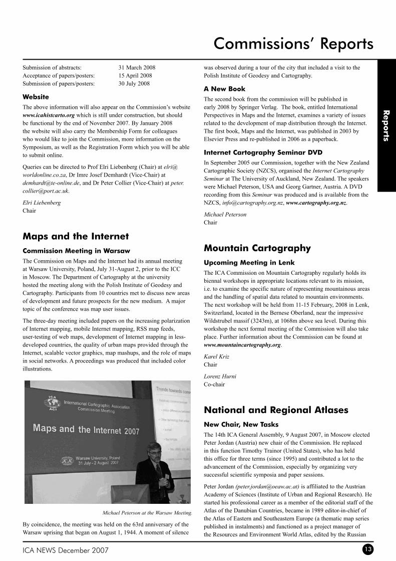
Maps and the InternetCommission Meeting in WarsawThe Commission on Maps and the Internet had its annual meeting at Warsaw University, Poland, July 31-August 2, prior to the ICC in Moscow. The Department of Cartography at the university hosted the meeting along with the Polish Institute of Geodesy and Cartography. Participants from 10 countries met to discuss new areas of development and future prospects for the new medium. A major topic of the conference was map user issues.
The three-day meeting included papers on the increasing polarization of Internet mapping, mobile Internet mapping, RSS map feeds, user-testing of web maps, development of Internet mapping in less-developed countries, the quality of urban maps provided through the Internet, scalable vector graphics, map mashups, and the role of maps in social networks. A proceedings was produced that included color illustrations.
Michael Peterson at the Warsaw Meeting.
By coincidence, the meeting was held on the 63rd anniversary of the Warsaw uprising that began on August 1, 1944. A moment of silence
was observed during a tour of the city that included a visit to the Polish Institute of Geodesy and Cartography.
A New BookThe second book from the commission will be published in early 2008 by Springer Verlag. The book, entitled International Perspectives in Maps and the Internet, examines a variety of issues related to the development of map distribution through the Internet. The first book, Maps and the Internet, was published in 2003 by Elsevier Press and re-published in 2006 as a paperback.
Internet Cartography Seminar DVDIn September 2005 our Commission, together with the New Zealand Cartographic Society (NZCS), organised the Internet Cartography Seminar at The University of Auckland, New Zealand. The speakers were Michael Peterson, USA and Georg Gartner, Austria. A DVD recording from this Seminar was produced and is available from the NZCS, [email protected], www.cartography.org.nz.
Michael PetersonChair
Mountain CartographyUpcoming Meeting in LenkThe ICA Commission on Mountain Cartography regularly holds its biennal workshops in appropriate locations relevant to its mission, i.e. to examine the specific nature of representing mountainous areas and the handling of spatial data related to mountain environments. The next workshop will be held from 11-15 February, 2008 in Lenk, Switzerland, located in the Bernese Oberland, near the impressive Wildstrubel massif (3243m), at 1068m above sea level. During this workshop the next formal meeting of the Commission will also take place. Further information about the Commission can be found at www.mountaincartography.org.
Karel KrizChair
Lorenz HurniCo-chair
National and Regional AtlasesNew Chair, New tasksThe 14th ICA General Assembly, 9 August 2007, in Moscow elected Peter Jordan (Austria) new chair of the Commission. He replaced in this function Timothy Trainor (United States), who has held this office for three terms (since 1995) and contributed a lot to the advancement of the Commission, especially by organizing very successful scientific symposia and paper sessions.
Peter Jordan ([email protected]) is affiliated to the Austrian Academy of Sciences (Institute of Urban and Regional Research). He started his professional career as a member of the editorial staff of the Atlas of the Danubian Countries, became in 1989 editor-in-chief of the Atlas of Eastern and Southeastern Europe (a thematic map series published in instalments) and functioned as a project manager of the Resources and Environment World Atlas, edited by the Russian
ICA NEWS December 200714
Rep
orts
Academy of Sciences, between 1994 and 1995.
At a Commission meeting in Moscow it was decided to reassume the Commission’s old goal of editing a “cookbook” for atlas editors highlighting methodological problems specific for national, regional, city and thematic atlases and to concentrate all efforts on achieving this goal within the next four years. For this purpose an editorial board has been installed in the meantime, besides the chair composed of Hartmut Asche (Germany), René Sieber (Switzerland) and Donna Williams (Canada). This board will develop a list of contents and try to find authors for the individual chapters by the end of January 2008, when in conjunction with a symposium on Art and Cartography (organized by Georg Gartner) a coordinative meeting of the group of authors is to take place in Vienna (Austria). Any ideas regarding the contents of this “cook book” are welcome.
The Commission is also in the process of developing a new website, which will be hosted by the Institute of Geography and Regional Research, University of Vienna, and contain a.o. a collection of links to web atlases.
Peter JordanChair
Planetary CartographyCommission Sessions at the 23rd ICCAt the beginning of XXI century a lot of space exploration projects (flights to Mars, permanent base on the Moon, studying of asteroids and giant-planets moons with their detailed mapping etc.) have been officially announced. It explained why this time five sessions on Planetary Cartography took place in ICC program. There were 20 papers for oral presentations.
R.L.Kirk (USA) pointed out that the pace of lunar exploration is about to accelerate dramatically, with as many of seven new missions planned for the current decade. These missions, of which the most important for cartography are SMART-1 (Europe), SELENE (Japan), Chang’E-1 (China), Chandrayaan-1 (India), and Lunar Reconnaissance Orbiter (USA), will return a volume of data exceeding that of all previous lunar and planetary missions combined. Framing and scanner camera images, including multi-spectral and stereo data, hyper-spectral images, synthetic aperture radar (SAR) images, and laser altimetry will all be collected, including, in most cases, multiple datasets of each type. Substantial advances in international standardization and cooperation, development of new and more efficient data processing methods, and availability of resources for processing and archiving will all be needed if the next generation of missions are to fulfil their potential for high-precision mapping of the Moon in support of subsequent exploration and scientific investigation.
It was also outlined (M.I.Shpekin, Russia, E.Lazarev, Russia) that returning to idea of permanent base creating on the Moon promises also return not only to its mapping, but especially to specification of coordinate uniform system, positions of the gravity center and the center of its geometrical figure that is necessary for the further investigation development.
The paper presented to ICC by M.Waehlisch (J.Albertz, S.Gehrke, M.Waehlisch et al (Germany) informed the auditorium that the standard map series of the Mars Express mission is the Topographic Image Map Mars 1:200,000. The planet Mars is covered by altogether 10,372 sheets in equal-area map projections, 10,324 of them in Sinusoidal Projection, supplemented by 48 polar sheets in Lambert Azimuthal Projection. An average sheet of the Topographic Image Map Mars 1:200,000 displays approximately 120x120 km; considering an HRSC image width of 60 km in highest resolution of 12 m/pixel, it is evident that mosaics of adjacent orbits are necessary to cover the mapped area. Until the present day, a variety of topographic and also thematic maps of different Martian regions has been produced – including, e.g., the first large-scale maps of the north-polar region, which combine HRSC imagery and Mars Orbiter Laser Altimeter (MOLA) contours. Furthermore, it has been shown that HRSC data of highest resolution are suitable for mapping in scales up to 1:100 000 and even 1:50 000, which can be systematically achieved by dividing standard sheets into quarters and sixteenth, respectively.
T.Duxbury (USA) has explained that the Mars Express mission is completing its global coverage of Mars in stereo at 100 m spatial resolution or better. MGS, Odyssey and Mars Express continue to provide limited surface coverage at the 1 to 20 m resolution. Currently the new Mars Reconnaissance Orbiter is producing images at the 10’s of cm level. All of these datasets provide a rich and historic perspective of Mars covering nearly five decades and allow global cartographic map products to be produced in visual and infrared at the 100 m level with specialized cartographic maps being produced for landing sites at the meter or sub-meter spatial resolution level. This work was produced at the Jet Propulsion Laboratory, California Institute of Technology under contract to the National Aeronautics and Space Administration, NAS 7-2170.5c, within the NASA Mars Data Analysis Program and the MGS, Odyssey, Mars Express and MRO Participating Scientist Programs.
United States Geological Survey (USGS) and Lunar and Planetary Laboratory (LPL, University of Arizona, USA) represented the paper about methods and first results of ultrahigh resolution topographic mapping of Mars (R.L.Kirk, E.Howington-Kraus, M.R.Rosiek et al, USA). The Mars Reconnaissance Orbiter (MRO) arrived at Mars on 10 March 2006 and began its primary science phase in November. The High Resolution Stereo Imaging Experiment (HiRISE) on MRO is the largest, most complex camera ever flown to another
Commissions’ Reports
Randolph Kirk (USA) and Kira Shingareva (Russia) discuss at the Congress Hall.
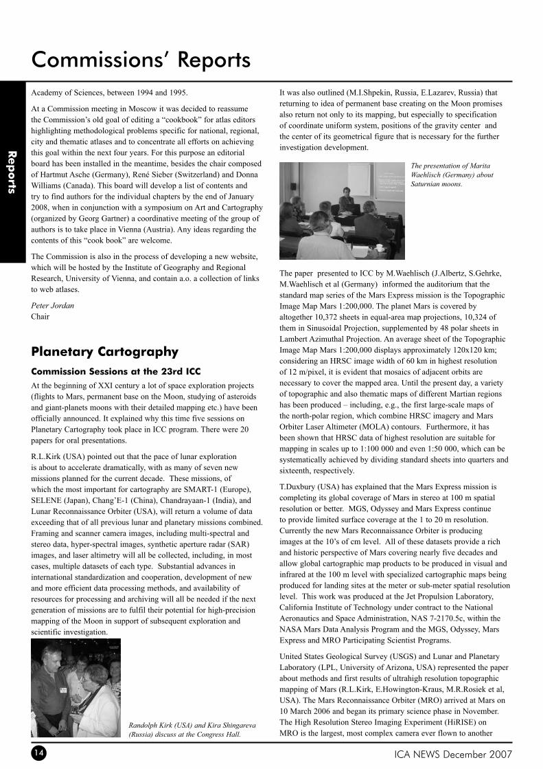
The presentation of Marita Waehlisch (Germany) about Saturnian moons.

ICA NEWS December 2007 15
Rep
orts
Commissions’ Reports
planet. Plans call for this scanner to image roughly 1% of Mars by area at a pixel scale of 0.3 m during the next Mars year. Among the thousands of images will be ~1000 stereopairs that will provide an unprecedented three-dimensional view of the Martian surface at meter scale. These stereopairs will provide a tremendous amount of information for focused scientific studies, landing site selection and validation, and the operation of future landers and rovers. The main goal is the approach to generating geodetically controlled digital topographic models (DTMs) from such stereopairs, as first results, and plans for future DTM production. The approach to the photogrammetric processing of HiRISE images follows that which was had previously described for the MOC and the Mars Express High Resolution Stereo Camera (HRSC). It is used the USGS in-house digital cartographic software ISIS to do initial processing, including ingestion, decompression, and radiometric calibration of the images. “Three-dimensional” photogrammetric processing steps, including control and DTM creation and editing, are performed on a photogrammetric workstation running the commercial software SOCET SET (® BAE Systems).
The data on mapping satellites of giants-planets have been submitted in reports: First Stereoscopic Radar Images of Titan (R.L.Kirk, E.Howington-Kraus, K.L.Mitchell et al, USA), A High-Resolution Atlas of the Saturnian Moon Enceladus derived from Cassini Images (T.Roatsch, M.Waehlisch et all., Germany).
Development of cartographic projections for Solar System small bodies was considered by M.Fleis (M.Fleis, M.M.Borisov et al, Russia). Special interest was caused a new cylindrical conformal projection and a new azimuthal projection for asteroid Eros offered by her. The formulae of these projections are devised for the case of matching ellipsoid revolution axis with major (not minor, as usual) axis of ellipse. Formulae are obtained without approximations and are true even for eccentricity.
A number of reports has been devoted to the planetary nomenclature, including the message on Gazetteer localization (H.Hargitai, Hungary), about the geostatistical analysis of a DB nomenclature lists as a method on mental research of extraterrestrial territories (I.Karachevtseva, E.Cherepanova, et al, Russia). The project of creating a multilingual map series for giants-planets satellites, first of
all, so called Jupiter galileaen satellites was considered also.
Kira Shingareva (Russia) underlined that it is not only the period of intensive extraterrestrial mapping, but also simultaneously a period of extraterrestrial geography evolution. Remote sensing data play crucial role in extraterrestrial territories mapping issues. Methods developed for processing of Earth images and Earth mapping have been successfully adapted to extraterrestrial territories researches with needed changes and additions taking into account the specific character of celestial bodies. Tremendous data flow requires new approaches to information processing. On the basis conducting analysis of the present map materials, including data systematization on particular parameters and separate bodies, some conclusions and development perspectives are already formulated. First of all the extraterrestrial mapping problems face the corresponding commissions and working groups of such international organizations, as ISPRS and ICA. Coordination of these group efforts is necessary for the successful decision of problems.
Today representatives of Russia, USA, Germany, Hungary, Canada most actively cooperate in this direction. However the circle of the countries showing interest to mapping extraterrestrial territory and specificity connected to it, steadily extends. Especially it became appreciable last years when the new stage was outlined in development of space exploration.
Kira B.ShingarevaChair
E.N.Lazarev
theoretical CartographyCommission Activities 2003-2007The ICA Commission on Theoretical Cartography held its last meeting (period 2003-2007) in Moscow on Monday, August 6, 2007 during 23rd ICA Conference. The topics of the meeting included:
Chairs report related on the Commission activities for 2003-2007 •(A.Wolodtschenko)Cartosemiotic glossary (Y.Ferland/A.Wolodtschenko)•Ontological seminar/project (M.Denil)•Next seminar in Vilnius 2007 (G.Beconyte/A.Wolodtschenko)•Seminar in Altai 2008 (I.Rotanova)•Terms of reference for 2007-2011•Miscellanea and discussion•
The Commission held three seminars on Cartography and Cartosemiotics in Vilnius, Lithuania in 2003, 2004 and 2005. In 2006, it organised a theoretical symposium on Cartographic Thinking, Geo-Information and Modern Society in Wuhan, China 2006. During 5-10 August 2006, the Commission organised a study trip Cartosemiotic European Heritage with visit to four European museums with prehistoric maps, i.e. Dolni Vestonice in Czech Republik and Kiev, Melitopol and Simferopol, all in Ukraine. A pre-ICC 2007 seminar on Map Language and Geo-Information was held in Moscow on August 4, 2007.
At the ICC in Moscow eight sessions were devoted to Theoretical Cartography theme and 22 posters were presented during the technical sessions.
Tom Duxbury (USA) as a session chair and Manfred Buchrouthner (Germany) presenting the maps of terrestrial planets and their moons.
Maria Fleis (Russia) presents the work of her scientific group about cartographic projections for Solar System small bodies.
ICA NEWS December 200716
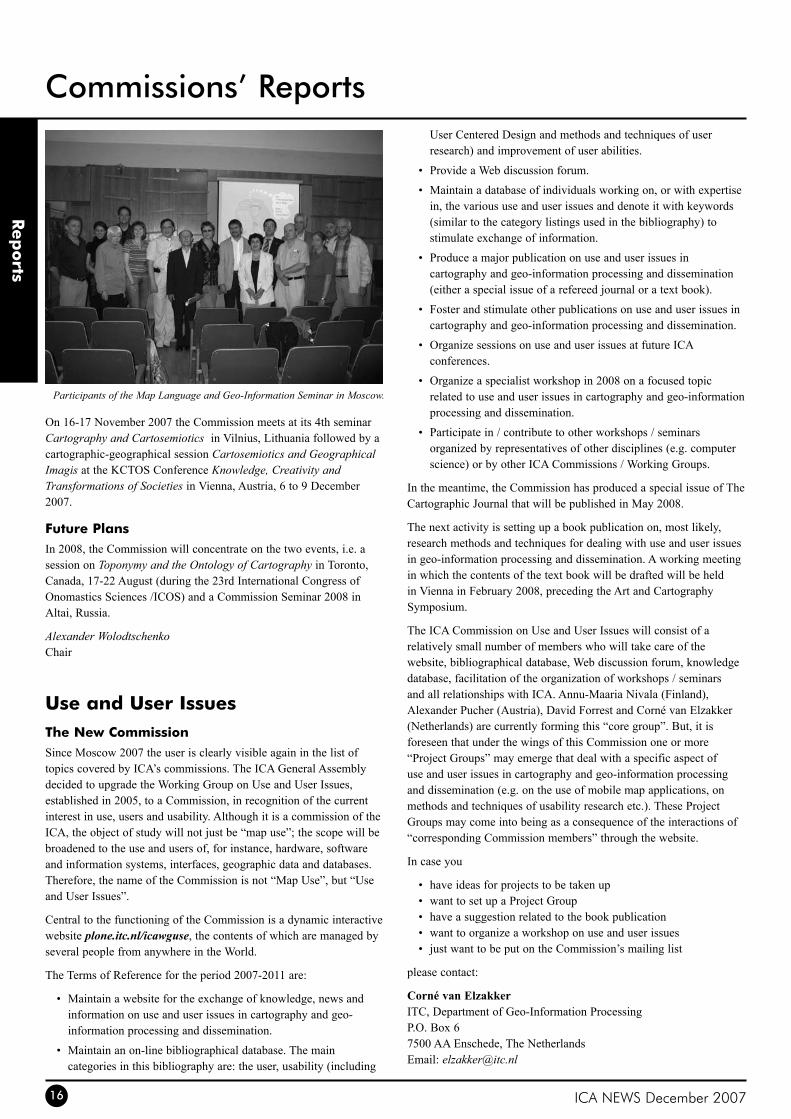
Participants of the Map Language and Geo-Information Seminar in Moscow.
On 16-17 November 2007 the Commission meets at its 4th seminar Cartography and Cartosemiotics in Vilnius, Lithuania followed by a cartographic-geographical session Cartosemiotics and Geographical Imagis at the KCTOS Conference Knowledge, Creativity and Transformations of Societies in Vienna, Austria, 6 to 9 December 2007.
Future PlansIn 2008, the Commission will concentrate on the two events, i.e. a session on Toponymy and the Ontology of Cartography in Toronto, Canada, 17-22 August (during the 23rd International Congress of Onomastics Sciences /ICOS) and a Commission Seminar 2008 in Altai, Russia.
Alexander WolodtschenkoChair
Use and User Issuesthe New CommissionSince Moscow 2007 the user is clearly visible again in the list of topics covered by ICA’s commissions. The ICA General Assembly decided to upgrade the Working Group on Use and User Issues, established in 2005, to a Commission, in recognition of the current interest in use, users and usability. Although it is a commission of the ICA, the object of study will not just be “map use”; the scope will be broadened to the use and users of, for instance, hardware, software and information systems, interfaces, geographic data and databases. Therefore, the name of the Commission is not “Map Use”, but “Use and User Issues”.
Central to the functioning of the Commission is a dynamic interactive website plone.itc.nl/icawguse, the contents of which are managed by several people from anywhere in the World.
The Terms of Reference for the period 2007-2011 are:
Maintain a website for the exchange of knowledge, news and •information on use and user issues in cartography and geo-information processing and dissemination.
Maintain an on-line bibliographical database. The main •categories in this bibliography are: the user, usability (including
User Centered Design and methods and techniques of user research) and improvement of user abilities.
Provide a Web discussion forum.•
Maintain a database of individuals working on, or with expertise •in, the various use and user issues and denote it with keywords (similar to the category listings used in the bibliography) to stimulate exchange of information.
Produce a major publication on use and user issues in •cartography and geo-information processing and dissemination (either a special issue of a refereed journal or a text book).
Foster and stimulate other publications on use and user issues in •cartography and geo-information processing and dissemination.
Organize sessions on use and user issues at future ICA •conferences.
Organize a specialist workshop in 2008 on a focused topic •related to use and user issues in cartography and geo-information processing and dissemination.
Participate in / contribute to other workshops / seminars •organized by representatives of other disciplines (e.g. computer science) or by other ICA Commissions / Working Groups.
In the meantime, the Commission has produced a special issue of The Cartographic Journal that will be published in May 2008.
The next activity is setting up a book publication on, most likely, research methods and techniques for dealing with use and user issues in geo-information processing and dissemination. A working meeting in which the contents of the text book will be drafted will be held in Vienna in February 2008, preceding the Art and Cartography Symposium.
The ICA Commission on Use and User Issues will consist of a relatively small number of members who will take care of the website, bibliographical database, Web discussion forum, knowledge database, facilitation of the organization of workshops / seminars and all relationships with ICA. Annu-Maaria Nivala (Finland), Alexander Pucher (Austria), David Forrest and Corné van Elzakker (Netherlands) are currently forming this “core group”. But, it is foreseen that under the wings of this Commission one or more “Project Groups” may emerge that deal with a specific aspect of use and user issues in cartography and geo-information processing and dissemination (e.g. on the use of mobile map applications, on methods and techniques of usability research etc.). These Project Groups may come into being as a consequence of the interactions of “corresponding Commission members” through the website.
In case you
have ideas for projects to be taken up•want to set up a Project Group•have a suggestion related to the book publication•want to organize a workshop on use and user issues•just want to be put on the Commission’s mailing list•
please contact:
Corné van ElzakkerITC, Department of Geo-Information ProcessingP.O. Box 67500 AA Enschede, The NetherlandsEmail: [email protected]
Rep
orts
Commissions’ Reports
ICA NEWS December 2007 17
Rep
orts
WG Art and Cartographythe First SymposiumThe International Cartographic Association has established a new Working Group on Art and Cartography. It proposes to foster closer collaborations between artists and cartographers.
Its first ‘formal’ activity is the Art and Cartography - Cartography and Art Symposium to be held in Vienna, Austria, 1-2 February 2008. The symposium will bring-together practicing artists, architects and cartographers and those involved in research and education in the fields.
Conference organisers are : William Cartwright (RMIT, Melbourne, Australia), Georg Gartner (TUWien Vienna, Austria) and Antje Lehn (Academy of Fine Arts, Vienna, Austria). Their thoughts about the fusion between art and cartography are provided below:
Antje LehnTo explain the interest I take in the relation of cartography and art today I would like to refer to Umberto Eco´s text “On the Impossibility of Drawing a Map of the Empire on a Scale of 1 to 1”. Eco describes the hopeless attempt to create a map which represents the world in the same scale and this attempt proves that there is no such thing like a true map. And when we accept the fact that all maps only function under the premise of omitting or distorting parts of reality we can see that there is not such a large gap between scientific and artistic cartography. In fact sometimes artists capture a lot of information in their maps which the cartographers „rational“ map could never describe. Even if artists at first sight seem to have more freedom the strategies of mapping are very similar in arts as in cartography.
The rational and irrational should not be simply divided up between the scientific and the artistic, in fact we can see beyond the cliche that reality always consists of both. And that’s what maps are about, and what makes them so intriguing: they are communicating views of our world – and help us to understand the complexity of it.
If we succeeded to look over the borders of our discipline and understand different ways of defining place we might finally arrive to learn how to represent the world much better than a „perfect“ representation of the same size would do. Even if Google earth is becoming more and more precise it is only one possible representation of the world from a very special angel. The only way we can get closer to a complete representation of the world is by communicating on different models of representation and precision.
Georg GartnerMaps tell stories about the world. To be more precise, they depict parts of the space around us and represent it. The main keywords being applicable to this process are abstraction, scale and communication. Abstraction is needed to pinpoint the relevant information about real and virtual objects and phenomenon. In this process the information becomes both, more fuzzy as well as more visible. This is due to the context of scale. Maps are representing space in an aggregated form. In order to be able to communicate aggregated and abstract representations of space aesthetics play a key role. All three challenges, abstraction – scaling – communication of space, are interpreted by artist with specific view and ideas. The exchange of artistic and scientific approaches might lead to heterogenous results, but will be an exiting experiment for those who
are willing to get involved.
William CartwrightUnderstanding how technology works is important, but the partnership between art and science, and their contributions to the discipline, are as important. In my opinion ART provides the ‘public face’ of cartography (and if we include the cartographer’s passion when designing particular products, perhaps the soul as well) and science complements this by ensuring that what is presented is scientifically correct, and what could be called ‘scientifically elegant’ as well. Science or technology, it is argued, needs not always to take on the primary roles in cartography. However, technology is needed to ensure that the designed product can be produced and delivered and science is necessary to ensure ‘correct’ and rigorous products. However, the resulting artifact, designed and produced by balancing the art, science and technology attributes, as a street artist juggler might balance a chainsaw, a watermelon and a table tennis ball, has recently been biased towards science and technology, with art being relegated to the position of ‘afterthought’ (thinking about the art elements after the product’s specifications are ‘locked’ within a science foundation and technology-driven production and delivery ‘envelope’. Cartography is different from other contemporary disciplines insofar as it can design, develop and deliver products with an art or a technology or a science ‘flavour’. But we need to address how to make ART-biased cartography as relevant as science or technology-biased cartography.
Contributions were solicited from Cartography and the Arts addressing the topics of:
Maps as artistic artefacts - aspects of artistic and graphical •expressions with and through maps in cartography (contemporary and historic)Explorations of different interpretations of space and place using •New Media and experimental art forms - depicting space with narratives, paintings, graphics, sound, animations, installations, time based media and other non-traditional cartographic artefacts
As well as written papers contributions were also encouraged as posters, installations, artwork, film, video, web applications and experimental media. Symposium Proceedings will include papers and annotated catalogue entries. It is also proposed, that a book will ensue.
For further information see cartography.tuwien.ac.at/artandcartography or contact either William Cartwright, [email protected], or Georg Gartner, [email protected].
William CartwrightChair
ICA Advanced Summer SchoolMeeting in UrumqiThe third ICA Advanced Summer School was held in Urumqi, China, from 27 to 31 August 2007. It was organised in response to the invitation received from the Xinjiang Institute of Ecology and Geography (XIEG), Chinese Academy of Science.
The Advanced Summer School has received great attention from
Commissions’ Reports
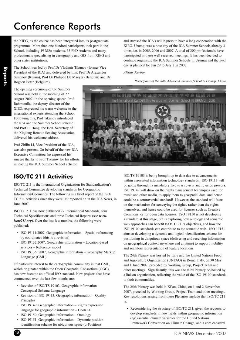
ICA NEWS December 200718
Rep
orts
Conference Reportsthe XIEG, as the course has been integrated into its postgraduate programme. More than one hundred participants took part in the School, including 19 MSc students, 55 PhD students and many professionals specialising in cartography and GIS from XIEG and other sister institutions.
The School was led by Prof Dr Vladimir Tikunov (former Vice President of the ICA) and delivered by him, Prof Dr Alexander Simonov (Russia), Prof Dr Philippe De Maeyer (Belgium) and Dr Bogaert Peter (Belgium).
The opening ceremony of the Summer School was held in the morning of 27 August 2007. In the opening speech Prof Rahmutulla, the deputy director of the XIEG, expressed his warm welcome to the international experts attending the School. Following this, Prof Tikunov introduced the ICA and the Summer School scheme and Prof Li Hong, the Hon. Secretary of the Xinjiang Remote Sensing Association, delivered his welcome address.
Prof Zhilin Li, Vice President of the ICA, was also present. On behalf of the new ICA Executive Committee, he expressed his sincere thanks to Prof Tikunov for his efforts in leading the ICA Summer School scheme
and stressed the ICA’s willingness to have a long cooperation with the XIEG. Urumqi was a host city of the ICA Summer Schools already 3 times, i.e. in 2005, 2006 and 2007. A total of 300 professionals have participated in these well received meetings. It has been decided to continue organising the ICA Summer Schools in Urumqi and the next one is planned for Jun 29 to July 2 in 2008.
Alishir Kurban
Participants of the 2007 Advanced Summer School in Urumqi, China.
ISo/tC 211 ActivitiesISO/TC 211 is the International Organization for Standardization’s Technical Committee developing standards for Geographic Information/Geomatics. The following is a brief report of the ISO/TC 211 activities since they were last reported on in the ICA News, in June 2007.
ISO/TC 211 has now published 27 International Standards, four Technical Specifications and three Technical Reports (see www.isotc211.org). Over the last few months, the following were published:
ISO 19111:2007, Geographic information – Spatial referencing •by coordinates (this is a revision)ISO 19132:2007, Geographic information – Location-based •services – Reference modelISO 19136: 2007, Geographic information – Geography Markup •Language (GML)
Of particular interest to the cartographic community is that GML, which originated within the Open Geospatial Consortium (OGC), has now become an official ISO standard. New projects that have commenced over the last few months are:
Revision of ISO/TS 19103, Geographic information – •Conceptual Schema LanguageRevision of ISO 19113, Geographic information – Quality •PrinciplesISO 19149, Geographic information – Rights expression •language for geographic information – GeoRELISO 19150, Geographic information – Ontology•ISO 19151, Geographic information – Dynamic position •identification scheme for ubiquitous space (u-Position)
ISO/TS 19103 is being brought up to date due to advancements within associated information technology standards. ISO 19113 will be going through its mandatory five year review and revision process. ISO 19149 will draw on the rights management techniques used for music and other media, to apply them to geospatial data, and hence could be a controversial standard! However, the standard will focus on the mechanism for conveying the rights, rather than the rights themselves, and hence could be used for licenses such as Creative Commons, or for open data licenses. ISO 19150 is not developing a standard at this stage, but is exploring how ontology and semantic web approaches can benefit ISO/TC 211’s objectives, and how the ISO 19100 standards can contribute to the semantic web. ISO 19151 aims at developing a dynamic and logical identification scheme for positioning in ubiquitous space (delivering and receiving information on geographical context anywhere and anytime) to support mobility and seamless representation of feature locations.
The 24th Plenary was hosted by Italy and the United Nations Food and Agriculture Organization (UNFAO) in Rome, Italy, on 30 May and 1 June 2007, preceded by Working Group, Project Team and other meetings. Significantly, this was the third Plenary co-hosted by a liaison organization, reflecting the value of the ISO 19100 standards to their communities.
The 25th Plenary was held in Xi’an, China, on 1 and 2 November 2007, preceded by Working Group, Project Team and other meetings. Key resolutions arising from these Plenaries include that ISO/TC 211 is:
Reconsidering the structure of ISO/TC 211, given the requests to •develop standards in new fields within geographic information (eg: essential climate variables for the United Nations Framework Convention on Climate Change, and a core cadastral
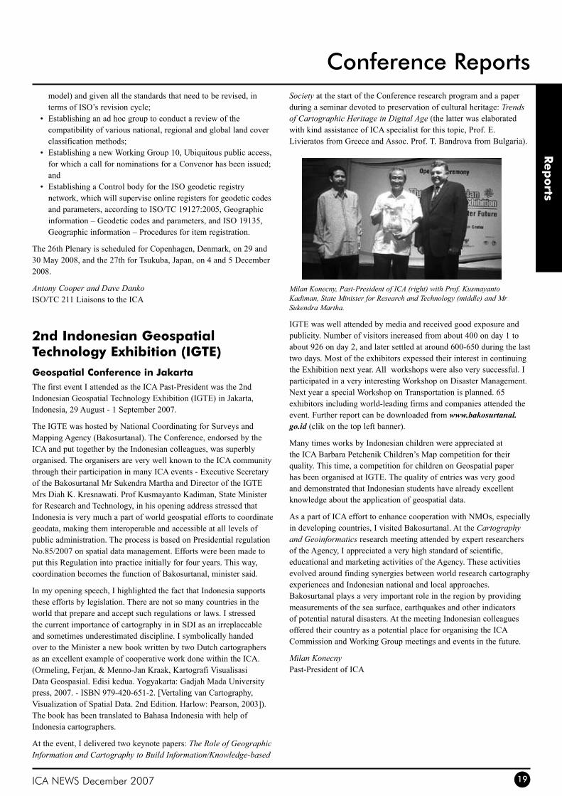
ICA NEWS December 2007 19
Rep
orts
Conference Reportsmodel) and given all the standards that need to be revised, in terms of ISO’s revision cycle;Establishing an ad hoc group to conduct a review of the •compatibility of various national, regional and global land cover classification methods;Establishing a new Working Group 10, Ubiquitous public access, •for which a call for nominations for a Convenor has been issued; andEstablishing a Control body for the ISO geodetic registry •network, which will supervise online registers for geodetic codes and parameters, according to ISO/TC 19127:2005, Geographic information – Geodetic codes and parameters, and ISO 19135, Geographic information – Procedures for item registration.
The 26th Plenary is scheduled for Copenhagen, Denmark, on 29 and 30 May 2008, and the 27th for Tsukuba, Japan, on 4 and 5 December 2008.
Antony Cooper and Dave DankoISO/TC 211 Liaisons to the ICA
2nd Indonesian Geospatial technology Exhibition (IGtE)Geospatial Conference in JakartaThe first event I attended as the ICA Past-President was the 2nd Indonesian Geospatial Technology Exhibition (IGTE) in Jakarta, Indonesia, 29 August - 1 September 2007.
The IGTE was hosted by National Coordinating for Surveys and Mapping Agency (Bakosurtanal). The Conference, endorsed by the ICA and put together by the Indonesian colleagues, was superbly organised. The organisers are very well known to the ICA community through their participation in many ICA events - Executive Secretary of the Bakosurtanal Mr Sukendra Martha and Director of the IGTE Mrs Diah K. Kresnawati. Prof Kusmayanto Kadiman, State Minister for Research and Technology, in his opening address stressed that Indonesia is very much a part of world geospatial efforts to coordinate geodata, making them interoperable and accessible at all levels of public administration. The process is based on Presidential regulation No.85/2007 on spatial data management. Efforts were been made to put this Regulation into practice initially for four years. This way, coordination becomes the function of Bakosurtanal, minister said.
In my opening speech, I highlighted the fact that Indonesia supports these efforts by legislation. There are not so many countries in the world that prepare and accept such regulations or laws. I stressed the current importance of cartography in in SDI as an irreplaceable and sometimes underestimated discipline. I symbolically handed over to the Minister a new book written by two Dutch cartographers as an excellent example of cooperative work done within the ICA. (Ormeling, Ferjan, & Menno-Jan Kraak, Kartografi Visualisasi Data Geospasial. Edisi kedua. Yogyakarta: Gadjah Mada University press, 2007. - ISBN 979-420-651-2. [Vertaling van Cartography, Visualization of Spatial Data. 2nd Edition. Harlow: Pearson, 2003]). The book has been translated to Bahasa Indonesia with help of Indonesia cartographers.
At the event, I delivered two keynote papers: The Role of Geographic Information and Cartography to Build Information/Knowledge-based
Society at the start of the Conference research program and a paper during a seminar devoted to preservation of cultural heritage: Trends of Cartographic Heritage in Digital Age (the latter was elaborated with kind assistance of ICA specialist for this topic, Prof. E. Livieratos from Greece and Assoc. Prof. T. Bandrova from Bulgaria).
Milan Konecny, Past-President of ICA (right) with Prof. Kusmayanto Kadiman, State Minister for Research and Technology (middle) and Mr Sukendra Martha.
IGTE was well attended by media and received good exposure and publicity. Number of visitors increased from about 400 on day 1 to about 926 on day 2, and later settled at around 600-650 during the last two days. Most of the exhibitors expessed their interest in continuing the Exhibition next year. All workshops were also very successful. I participated in a very interesting Workshop on Disaster Management. Next year a special Workshop on Transportation is planned. 65 exhibitors including world-leading firms and companies attended the event. Further report can be downloaded from www.bakosurtanal.go.id (clik on the top left banner).
Many times works by Indonesian children were appreciated at the ICA Barbara Petchenik Children’s Map competition for their quality. This time, a competition for children on Geospatial paper has been organised at IGTE. The quality of entries was very good and demonstrated that Indonesian students have already excellent knowledge about the application of geospatial data.
As a part of ICA effort to enhance cooperation with NMOs, especially in developing countries, I visited Bakosurtanal. At the Cartography and Geoinformatics research meeting attended by expert researchers of the Agency, I appreciated a very high standard of scientific, educational and marketing activities of the Agency. These activities evolved around finding synergies between world research cartography experiences and Indonesian national and local approaches. Bakosurtanal plays a very important role in the region by providing measurements of the sea surface, earthquakes and other indicators of potential natural disasters. At the meeting Indonesian colleagues offered their country as a potential place for organising the ICA Commission and Working Group meetings and events in the future.
Milan KonecnyPast-President of ICA
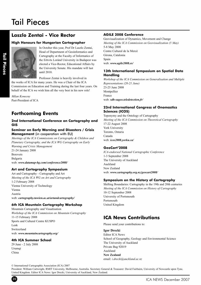
ICA NEWS December 200720
Laszlo Zentai - Vice RectorHigh Honours for Hungarian Cartographer
In October this year, Prof Dr Laszlo Zentai, Head of Department of Geoinformatics and Cartography at the Faculty of Informatics of the Eötvös Loránd University in Budapest was elected a Vice-Rector, Educational Affairs by the University Senate. His mandate will last until 2010.
Professor Zentai is heavily involved in the works of ICA for many years. He was a Chair of the ICA Commission on Education and Training during the last four years. On behalf of the ICA we wish him all the very best in his new role!
Milan KonecnyPast-President of ICA
Forthcoming Events2nd International Conference on Cartography and GISSeminar on Early Warning and Disasters / Crisis Management (in cooperation with EU)Meetings of the ICA Commissions on Cartography & Children and Planetary Cartography, and the ICA WG Cartography on Early Warning and Crisis Management21-24 January 2008BorovetsBulgariaweb: www.datamap-bg.com/conference2008/
Art and Cartography SymposiumArt and Cartography - Cartography and ArtMeeting of the ICA WG on Art and Cartography1-2 February 2008Vienna University of TechnologyViennaAustriaweb: cartography.tuwien.ac.at/artandcartography/
6th ICA Mountain Cartography WorkshopMountain Cartography and VisualisationWorkshop of the ICA Commission on Mountain Cartography11-15 February 2008Sports and Cultural Centre KUSPOLenkSwitzerlandweb: www.mountaincartography.org/
4th ICA Summer School29 June - 2 July 2008UrumqiChina
AGILE 2008 ConferenceGeovisualization of Dynamics, Movement and ChangeMeeting of the ICA Commission on Geovisualization (5 May)5-8 May 2008Centre Cultural de la MercèGirona, CataloniaSpainweb: www.agile2008.es/
13th International Symposium on Spatial Data HandlingWorkshop of the ICA Commission on Generalisation and Multiple Representations (20-21 June)23-25 June 2008MontpellierFranceweb: sdh-sageo.teledetection.fr/
23rd International Congress of onomastics Sciences (ICoS)Toponymy and the Ontology of CartographyMeeting of the ICA Commission on Theoretical Cartography17-22 August 2008York UniversityToronto, OntariaCanadaweb: icos2008.yorku.ca/
GeoCart’2008ICA-endorsed National Cartographic Conference1-3 September 2008The University of AucklandAucklandNew Zealandweb: www.cartography.org.nz/geocart2008/
Symposium on the History of CartographyShifting Boundaries: Cartography in the 19th and 20th centuriesMeeting of the ICA Commission on History of Cartography10-12 September 2008University of PortsmouthPortsmouthUnited Kingdom
ICA News ContributionsPlease send your contributions to:
Igor DreckiEditor ICA NewsSchool of Geography, Geology and Environmental ScienceThe University of AucklandPrivate Bag 92019AucklandNew Zealandemail: [email protected]
tail P
iece
s
Tail Pieces
© International Cartographic Association (ICA) 2007President: William Cartwright, RMIT University, Melbourne, Australia. Secretary General & Treasurer: David Fairbairn, University of Newcastle upon Tyne, United Kingdom. Editor ICA News: Igor Drecki, University of Auckland, New Zealand.
ICA NEWS December 2007
Bundesamt für Kartographie und Geodäsieattn Prof Dr D.Grünreich, Director Richard Strauss-Allee 1160598 Frankfurt am MainGermanyweb: www.bkg.bund.de
Centro Argentino de Cartografíaattn. Agrim. Juan Abecian, President Av. Cabildo 381 1426 Buenos Aires Argentinae-mail: [email protected]: www.elagrimensor.com.ar/centrodecartografia/
Dubai MunicipalityPublic Libraries Section PO Box 67 Dubai United Arab Emiratesweb: www.dm.gov.ae/
East View Cartographicc. o. Julie Horns 3020 Harbor Lane North Minneapolis Minnesota 55447 United States of Americae-mail: [email protected]: www.cartographic.com/
Eko-Graf Publishing Houseal. Lipowa 3953-124 Wroclaw Polandweb: www.www.ekograf.pl/
ESRIattn. Thierry Kressmann 380 New York Street Redlands California 92373 ESRI United States of Americae-mail: [email protected]: www.esri.com/
Geographical Survey InstituteKitasato 1 Tsukuba-shi Ibaraki-Ken 305-0811 Japane-mail: [email protected]: www.gsi.go.jp/
Indian National Cartographic Association (INCA)mr. G. N. Saha, President c. o. NATMO CGO Complex (7th floor), DF Block Salt Lake City, Calcutta 700 064 Indiaweb: www.incaindia.org/
Institut Cartografic de CatalunyaJaume Miranda i Canals, Director Parc de Montjuïc 08038 Barcelona Spaine-mail: [email protected]: www.icc.es/
Institut Géographique Nationalm. Jean-Philippe Lagrange, Directeur pour les activités internationales et européennes 136 bis, Rue de Grenelle 75007 Paris Francee-mail: [email protected]: www.ign.fr/
Instituto Geográfico Nacional Españac. o. Sebastian Mas Mayoral Ministerio de Fomento General Ibáñez de Ibero 3 28003 Madrid Spaine-mail: [email protected]: www.ign.es/
Intergraphattn. mr. Scott Seeley and Shanthi Lindsey Digital Map Production Systems PO Box 240000 Huntsville Alabama 35813 United States of Americae-mail: [email protected] or [email protected]: www.intergraph.com/
ItCCorné van Elzakker PO Box 6 7500 AA Enschede The Netherlandse-mail: [email protected]: www.itc.nl/
National Hydrographic officeK. R. Srinivasan, Chief Hydrographer 107A Rajpur Road Dehra Dun 248 001 Indiae-mail: [email protected]: www.hydroindia.com/
Navionics Hydrographerc. o. Cdr. (ret) Guglielmo Mammucari Via Vespucci 289 55049 Viareggio Italye-mail: [email protected]: www.navionics.it/
NavteqJ. Martin Rowell PO Box 450 5500 AL Veldhoven The Netherlandse-mail: [email protected]: www.navteq.com/
Moscow State University for Geodesy and CartographyVictor P. Savinykh, Rector 4 Gorokhovsky By-street Moscow 103064 Russiae-mail: [email protected]: www.miigaik.ru/
PPWKdr. Beata Konopska al. Bohaterow Wrzesnia 9 02-389 Warszawa Polandfax: +22 58 51 801 e-mail: [email protected] or [email protected]: www.ppwk.pl/
Regional Centre for Mapping of Resources for Development (RCMBD)dr. W. K. Ottichilo, Director General PO Box 632-00618 0500 Nairobi Kenyae-mail: [email protected]: www.rcmrd.org/
Rectasdr. Olajide Kufoniyi, Director PMB 5545 Ile-Ife, Osun State Nigeriae-mail: [email protected] or [email protected]: www.rectas.org/
Star Informatic Publishing Solutionsattn. Paul Dure, Head Tramstraat 69 9052 Gent Belgiume-mail: [email protected]: www.star.be/
Union of Chambers of turkish Engineers and Architects, Chamber of Surveying and Cadastre Engineers (UCtEA-CSCE)prof. dr. Dogan Ucar, Head of the Cartography Standing Commission Sümer-1 Sokak nr. 12-10 06440 Kizilay Ankara Turkeye-mail: [email protected]: www.hkmo.org.tr/
United States Geological Survey (USGS)dr. John A. Kelmelis National Mapping Division 12201 Sunrise Valley Drive Reston Virginia 20192 United States of Americae-mail: [email protected]: www.usgs.gov/
ICA welcomes new Affiliate Members; for more information contact Secretary General, David Fairbairn at [email protected]
Affiliate Members of the ICA
The following organizations support the International Cartographic Association:
Intergraph:www.intergraph.com Star Informatic:www.star.be
Navigation Technologies Corporation:www.navtech.com ESRI:www.esri.com