Embed Size (px)
Citation preview

ESA UNCLASSIFIED – For Official Use
IAP Meeting the Challengesof the “Port of the Future”
TSC Workshop, 10/03/2016ESA Directorate of Telecommunicationsand Integrated Applications

ESA UNCLASSIFIED – For Official Use
Section 1
What IAP has been doing in the transport sector
Section 2
How “port of the future” needs and challenges are understood
Section 3
How IAP might meet these challenges

ESA UNCLASSIFIED – For Official Use
IAP addresses transport and infrastructure needs
ESA UNCLASSIFIED – For Official Use
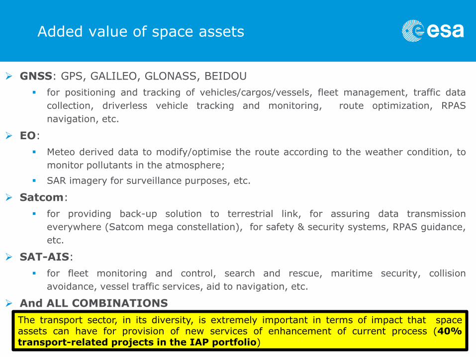
Added value of space assets
GNSS: GPS, GALILEO, GLONASS, BEIDOU
for positioning and tracking of vehicles/cargos/vessels, fleet management, traffic data
collection, driverless vehicle tracking and monitoring, route optimization, RPAS
navigation, etc.
EO:
Meteo derived data to modify/optimise the route according to the weather condition, to
monitor pollutants in the atmosphere;
SAR imagery for surveillance purposes, etc.
Satcom:
for providing back-up solution to terrestrial link, for assuring data transmission
everywhere (Satcom mega constellation), for safety & security systems, RPAS guidance,
etc.
SAT-AIS:
for fleet monitoring and control, search and rescue, maritime security, collision
avoidance, vessel traffic services, aid to navigation, etc.
And ALL COMBINATIONS
The transport sector, in its diversity, is extremely important in terms of impact that spaceassets can have for provision of new services of enhancement of current process (40%transport-related projects in the IAP portfolio)

ESA UNCLASSIFIED – For Official Use
Geography of ARTES20 Transport ProjectsSample of 23 projects
Distribution of transport modes1
Project’s prime location
1 multimodal projects are also integrated in the different modes
• 23 ARTES 20 demonstration projects dedicated to transport of freight, passengers and linkedto logistics activities were analysed and categorized per transport mode, e.g. maritime(36%), road (22%), train (11%)
• These projects involve 73 companies from 15 different European countries as prime orsubcontractors

ESA UNCLASSIFIED – For Official Use
Users and customers geography
International footprint
users and customers location during the demonstration19 countries
Main categories of users and customers
main customer categories

ESA UNCLASSIFIED – For Official Use
Space assets usages
Multimodal applications capture more value from the space assets and their combinations:they increase their usage
SatCom and GNSS is the space asset impacting the highest number of transport means.
IAP projects are evenly spread among the different transport sectors.
Out of the X studied projects that are linked to the medium [water; road; train; air; urban], about <25%, 25% < n < 75%, > 75% of the projects use the space asset [satcom; EO images; Meteo/ocen EO derived data; SAT-AIS; GNSS]
WATER ROAD TRAIN AIR URBAN MULTI
SatCom
EO Images
Meteo/OceanEO Derived Data
SAT-AIS
GNSS

ESA UNCLASSIFIED – For Official UseWATER ROAD TRAIN AIR URBAN MULTI
Projects mainly target objectives that impact safety, cost and value creation
Objectives of the projectsSample of 23 projects
0
2
4
6
8
10
12
14
16
18
20
Safety Cost Time Service to
Customers -
Quality
Service to
Customers -
Added Value
Environment Turnover Other

ESA UNCLASSIFIED – For Official Use
How IAP understand the needs and challenges of the Port of the Future

ESA UNCLASSIFIED – For Official Use
Relevant future trends
Digital Future - cloud, big data, IoT introduce
new services, products, business and delivery
models, but also present significant challenges,
as robotic technologies replacing workers, privacy
concerns and cybersecurity threats.
Global marketplace – Global merchandise trade
forecasts to grow 8% annually to 2030 outpacing
the GDP growth.
Economic shift– Driven by trade liberation,
economic reforms, free movement of technology,
emerging market economy are increasingly
important players
Of the digital data today was created in the last 2 years
Global trade as a share of GDP increased from

ESA UNCLASSIFIED – For Official Use
Climate change – Rising greenhouse gas emissions
(GHGs) are causing climate change and driving a
complex mix of unpredictable changes to the
environment while further taxing the resilience of natural
and built systems. Achieving the right combination of
adaptation & mitigation policies is required.
Resources management - The pressures of population
growth, economic growth and climate change will place
increased stress on essential natural resources including
water, food, arable land and energy.
Urbanization – UN reports percentage of world
population living in cities to increase from 54% to 66%
by 2050 implying need for investments in rail, ports,
airports, water, telecommunications…
Relevant future trends

ESA UNCLASSIFIED – For Official Use
Example of ports challenges
1. Efficient movement of ports freight with regard to safety
and security goals
2. Multimodal transport operations cost-effective and
automated.
3. Sustainable maintenance, repair and reconfiguration.
4. Capacity management with reduced costs and land use.
5. Lower environmental impact and climate change
adaptation.
6. Integration in the urban surrounding environment
connecting with the hinterland transport network
7. Seamless transport chains for passengers and freight.
Service to customer
Cost
Environment
Cost
Environment
Service to customer
Service to customer
Time
Environment
Turnover
ESA UNCLASSIFIED – For Official Use
Current IAP projects meeting the port challenges
WATER ROAD TRAIN AIR URBAN MULTI
Efficient movement of ports freight with regard to safety and security goals
Multimodal operations cost-effective and automated
Sustainable maintenance, repair and reconfiguration
Capacity management with reduced costs and land use
Lower environmental impact and climate change adaptation
Integration in the urban surrounding environment connecting with the hinterland transport network
Seamless transport chains for passengers and freight
PLANET2
RTICM
Europort
i-PortS2BAS
EOMST
SAMOLOSA
TIM
i-Port
SAMOLOSA
SAFERDANUBE
SEMAFORS i-TRAQ
EASY
EASY
NG-RMP
NG-RMP
EOMSTMapp
Xcit’ID
Xcit’ID
S2BAS
SASS@SEA
SASS@SEA
FLYSAFE
FLYSAFE
PLASMA
BLUE BELT
DG-TRAC
GAF
GAF
3INSAT
AMTRAC
SIMONA
Europort i-Port

ESA UNCLASSIFIED – For Official Use
I-PORT - Optimising Intermodal Freight Transport through European Ports
I-Port is an ARTES20 IAP demonstration project led by Aimes (UK), in conjunction with Avanti (UK), Container Port (UK), ISL (DE), DBH (DE)
I-Port integrates space with logistics data to:• track the location of vessels and trucks, • compute the estimated time of arrival and optimal
routing for vessels and trucks, • optimize container movement by accessing
container locations,• enable adjustments of vehicle slots in the port
terminal.
The I-PORT mobile app is: • used by drivers to interact with the companies • used by haulers to track their subcontractors and
own vehicles, providing 100% tracking coverage.
The I-PORT portal is: used in the office by shipping lines eg. ACL, as a step towards ensuring they get 100% tracking coverage of shipments
https://artes-apps.esa.int/projects/i-port-0

ESA UNCLASSIFIED – For Official Use
EUROPORT - Optimising Intermodal Freight Transport
EUROPORT is an ESA IAP demonstration project led by GMV Innovating Solutions (PL), in conjunction with TIS.pt (PT), GMV SKYSOFT (PT).
The objective is to provide sustainable services based on the use of satellite assets to end users involved in intermodal freight transport through European ports in order to optimize the intermodal transport chain.
EUROPORT integrates space with logistics data to:
• Optimize the accuracy of the Estimated Time of Arrival (ETA) and Departure (ETD) of ships in ports;
• Optimize the accuracy of the estimated time of arrival and departure of trucks to/from terminal and port gates;
• Improve port gate-in and gate-out operations in order to reduce time spent in these operations;
• Improve the efficiency of pick-up and delivery operations in the yard.
https://artes-apps.esa.int/projects/europort

ESA UNCLASSIFIED – For Official Use
NG-RMP- Next Generation RecognisedMaritime Picture
NG-RMP is an ESA IAP demonstration project led by Skytek (IE), in conjunction with ExactEarth (CA), Irish Naval Services (IE), LuxSpace(LU), NSC (IE) and UCC (IE).
NG-RMP service will provide a complete end-to-end solution for the generation of anadvanced recognised maritime picture (RMP) for the Irish Naval Services (INS).
The system will provide support using multiple external data sources ranging from space toterrestrial assets for RMP generation.
The service will visualise the solution onto operators workstations and provide support duringdaily INS HQ Irish coastal water monitoring.
https://artes-apps.esa.int/projects/ng-rmp

ESA UNCLASSIFIED – For Official Use
SAFERDANUBE Satellite Assistance for Danube Navigation
SAFERDANUBE is an ESA IAPdemonstration project led byRartel S.A. (RO), in conjunctionwith e-geos(IT).
Navigation on the Danube Riveris limited by the presence ofsand banks(dry periods) and icebanks(winter), phenomenawhich impact navigation safetyand continuity and effectivenessof goods and passengers’transport operations.
SAFERDANUBE service will helpthe Romanian RiverAdministration of the LowerDanube (AFDJ) in improvingsafety and fluency of the navaltraffic during the winter andsummer periods.
https://artes-apps.esa.int/projects/saferdanube
ESA UNCLASSIFIED – For Official Use
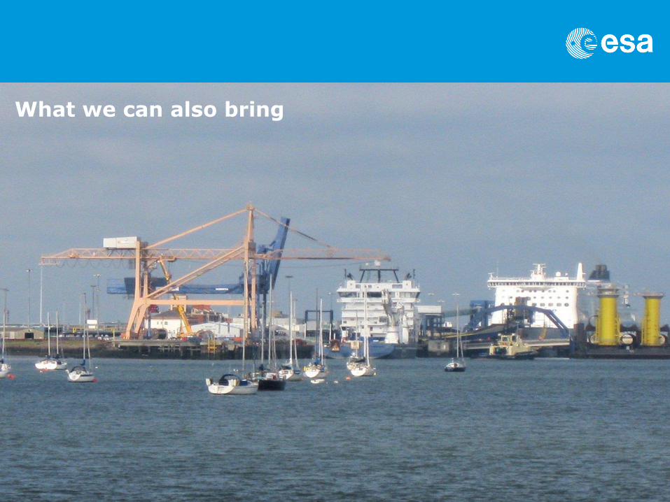
What we can also bring

ESA UNCLASSIFIED – For Official Use
IAP strategic partnerships with European organisations

ESA UNCLASSIFIED – For Official Use
European Commission - INEA
INEA develops the European transport
infrastructure policy supporting the 9 TEN-T
corridors with following objectives:
remove bottlenecks
build missing cross-border connections
promote modal integration and interoperability
integrate rail freight corridors
Promote clean fuel
Promote innovative transport solutions
Develop advancing telematics applications for efficient infrastructure use
integrate urban areas into the TEN-T
enhance safety
Support the development of the space component

ESA UNCLASSIFIED – For Official Use
Final considerations
IAP could address the “Port of the Future”
challenges by:
Supporting the development and
demonstration of services based on the
integration of space and terrestrial assets
Providing experience and lessons learned
from past projects in the transport sector
Developing new partnerships
Support industrial actors to reach export
markets (e.g. MENA region through SMAP)
Complementing existing mechanisms (INEA)
Collaborating in existing projects for specific
space related aspects
Let’s innovate together and collaborate


![IAP antagonists sensitize murine osteosarcoma cells to ... · IAP activity within cells can be reduced by Smac/ Diablo, a natural IAP antagonist protein [14, 15]. A number of “IAP](https://img.pdfslide.us/doc/110x75/5c25d3f409d3f28d198c1460/iap-antagonists-sensitize-murine-osteosarcoma-cells-to-iap-activity-within.jpg)