Embed Size (px)
Citation preview
I-PLACE3S Overview
King County HealthScape Seminar
Gordon Garry, Sacramento Area Council of GovernmentsSeptember 10, 2008
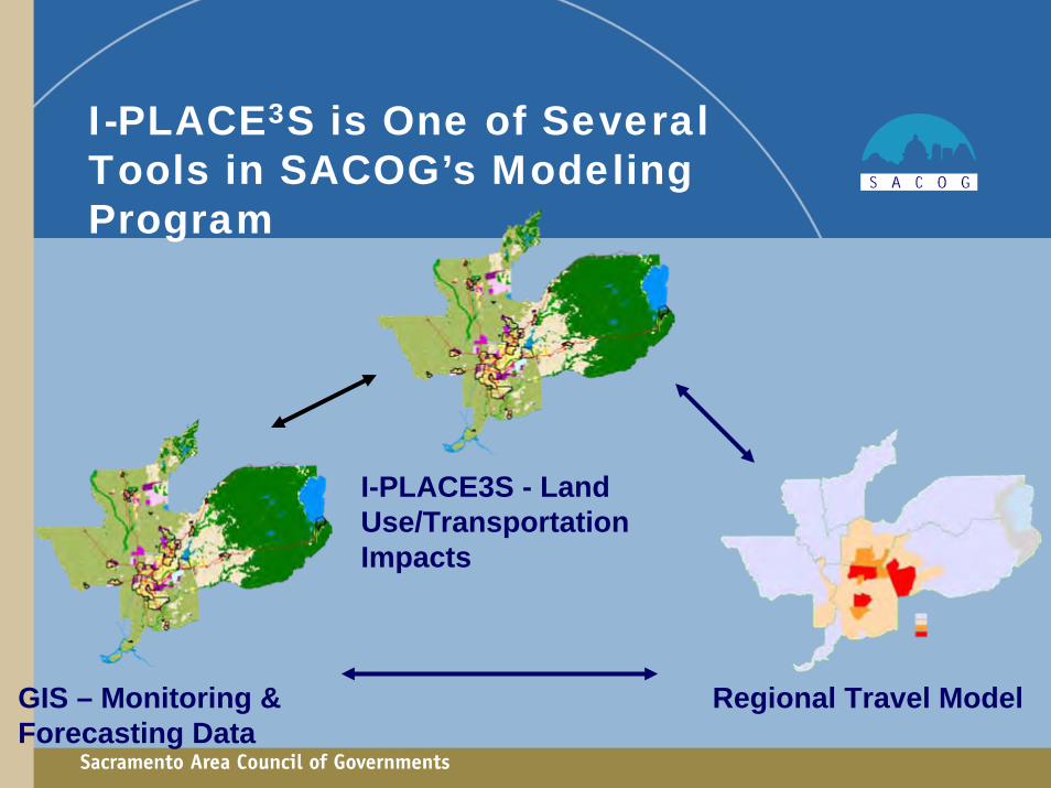
Regional Travel Model
I-PLACE3S - Land Use/Transportation Impacts
I-PLACE3S is One of Several Tools in SACOG’s Modeling Program
GIS – Monitoring & Forecasting Data
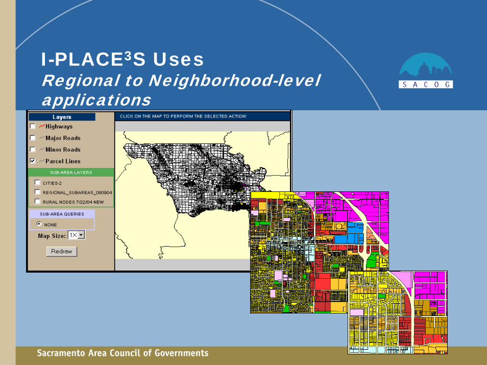
I-PLACE3S UsesRegional to Neighborhood-level applications
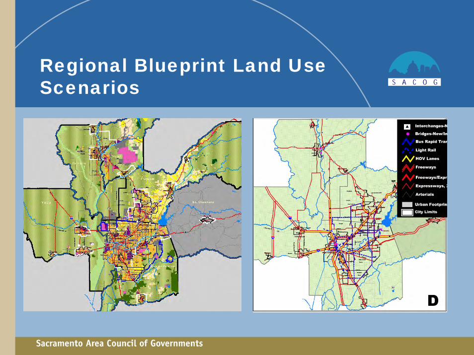
Regional Blueprint Land Use Scenarios

Regional Transportation Plan Public Workshops
• Edit roadway links or roadway projects
• Edit transit routes

Neighborhood Study Area Land Use Scenario
Roseville Fairgrounds
Changes from base case:
• 700 more employees
• 400 more dwelling units
• - 7 % VMT
74 Acres

Local Land Use Plan Updates
• Two cities used I-PLACE3S to develop General Plan land use scenarios
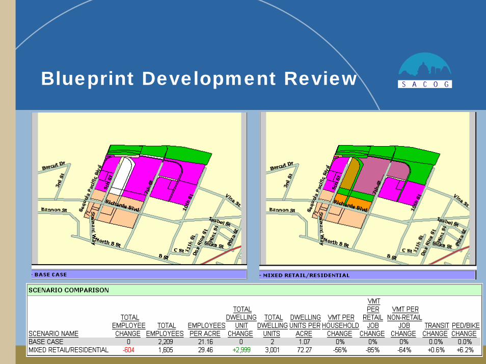
Blueprint Development Review

“Place Types” are the Building Blocks
User-Defined, includes:
• Inventoried allowed land uses
• Land uses that might not yet exist in codes (e.g. mixed use)
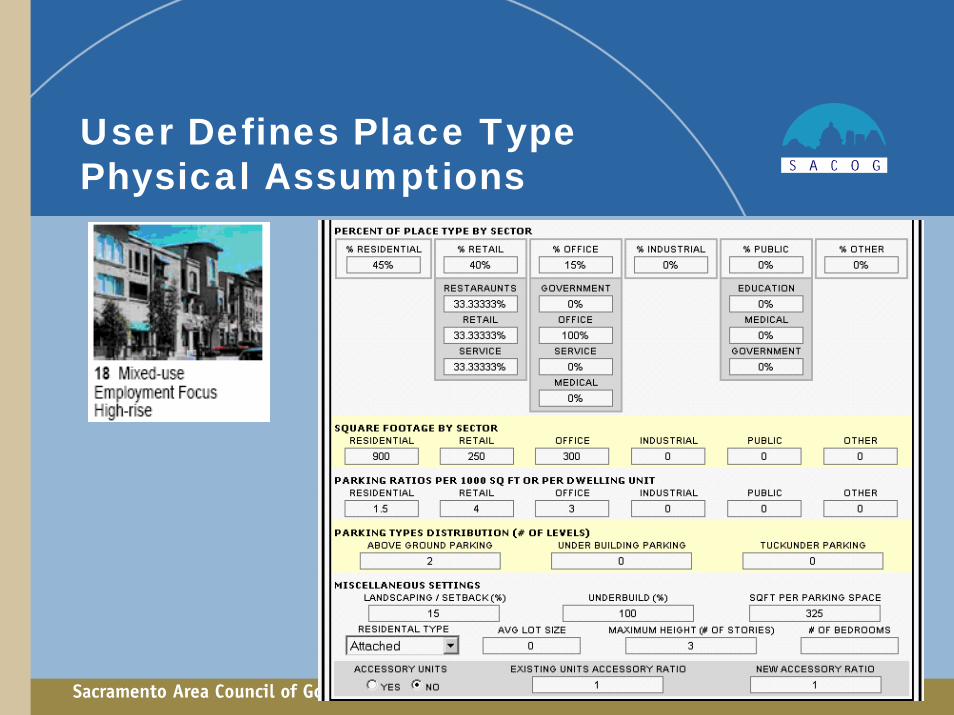
User Defines Place Type Physical Assumptions

I-PLACE3S Provides Calculated Yield
Calculated Maximum Dwelling Units/Acreand Employees/Acre
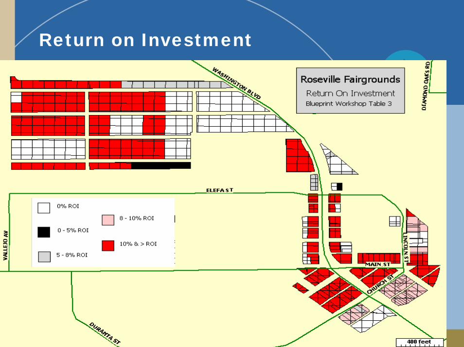
Return on Investment

Other Parameters and Variables
• Define Constrained Lands
• Vary development densities (gross and net)
• Redevelopment Rate
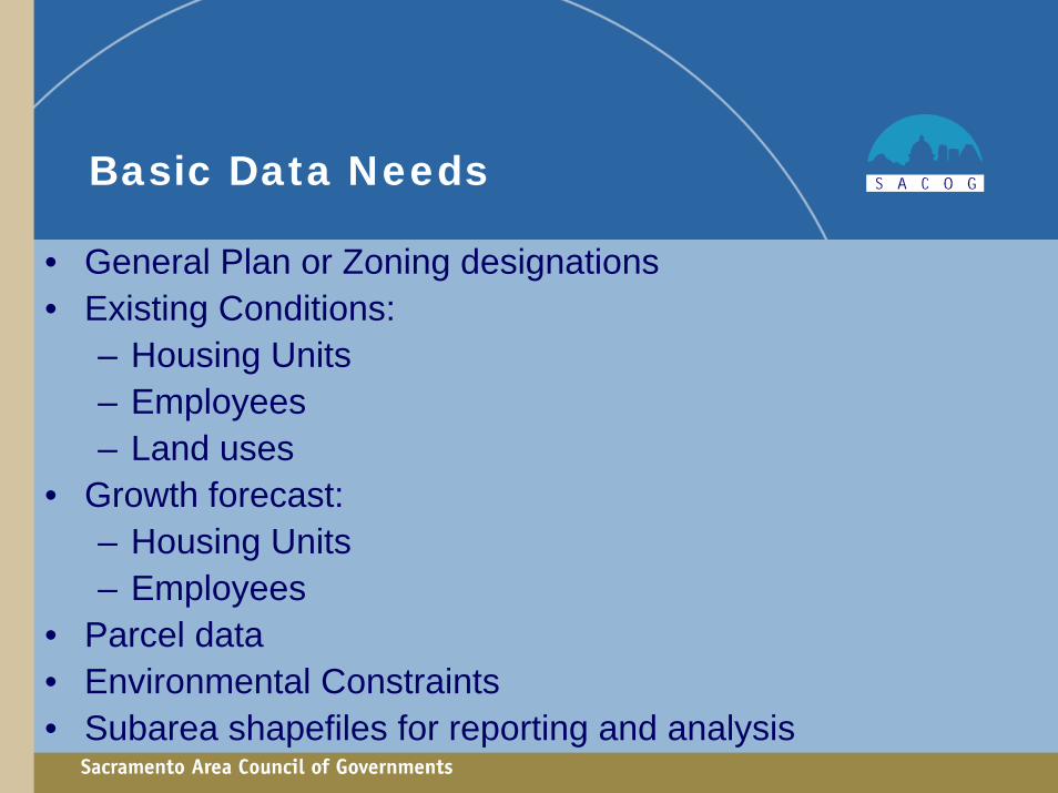
Basic Data Needs
• General Plan or Zoning designations• Existing Conditions:
– Housing Units– Employees– Land uses
• Growth forecast:– Housing Units– Employees
• Parcel data • Environmental Constraints• Subarea shapefiles for reporting and analysis
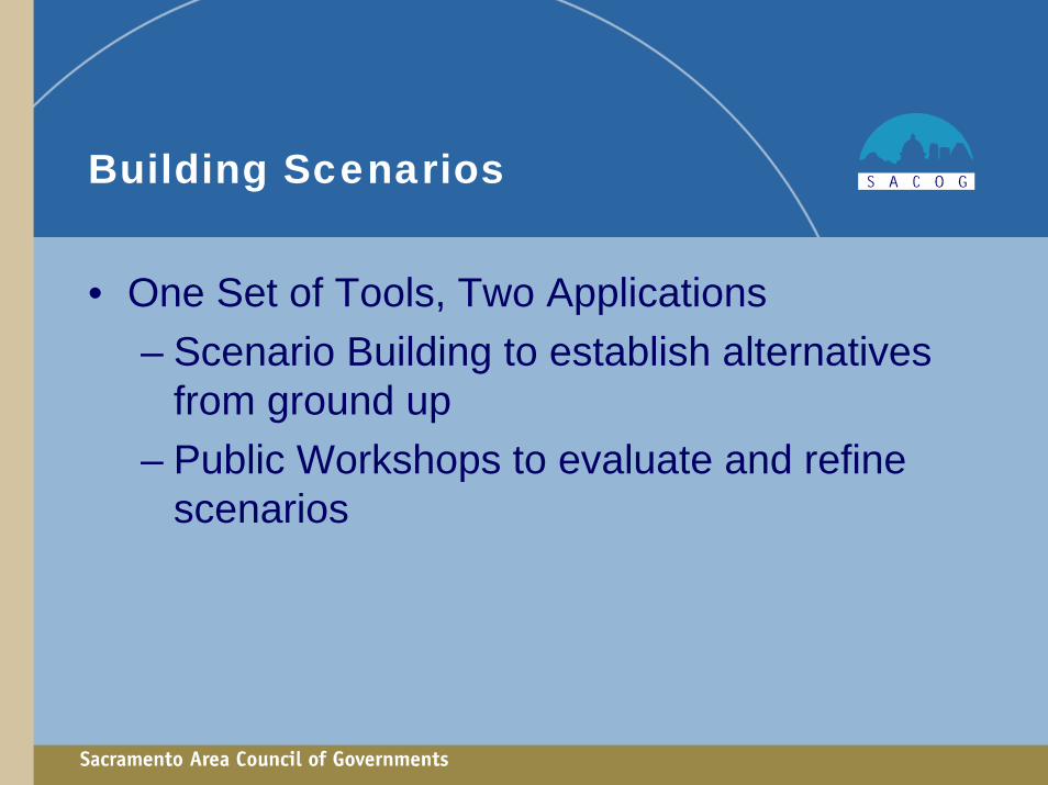
Building Scenarios
• One Set of Tools, Two Applications – Scenario Building to establish alternatives
from ground up– Public Workshops to evaluate and refine
scenarios

Blueprint Planning Land Use Alternatives
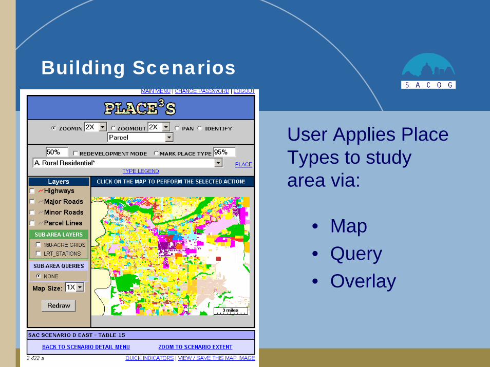
Building Scenarios
• Map• Query• Overlay
User Applies Place Types to study area via:
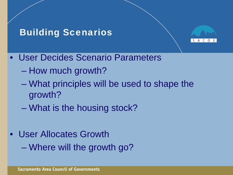
Building Scenarios
• User Decides Scenario Parameters– How much growth?– What principles will be used to shape the
growth?– What is the housing stock?
• User Allocates Growth– Where will the growth go?

Performance Measures to Compare Alternative Planning Scenarios
• Total jobs and dwelling units• Density by land use type• Mix of uses (defined by land use type)• Economic feasibility (Return on Investment)• Vehicle mile traveled and vehicle trips per
household• Change in walk/bike and transit mode shares• Export data to regional travel model• Mobile source air emissions

Compare Alternative Land Use Scenarios

New Module: I-PLACE3S Energy Module
Place Type Energy Settings -The I-PLACE3S Energy Module has energy usage information for various "sector types". Place types must be mapped to these sector types in order to determine the energy usage for each place type.
Future Applications Under Development• Rural landscapes evaluation• CO2 emissions calculation added to I-PLACE3S
SACMET travel model• Infrastructure costs impacts
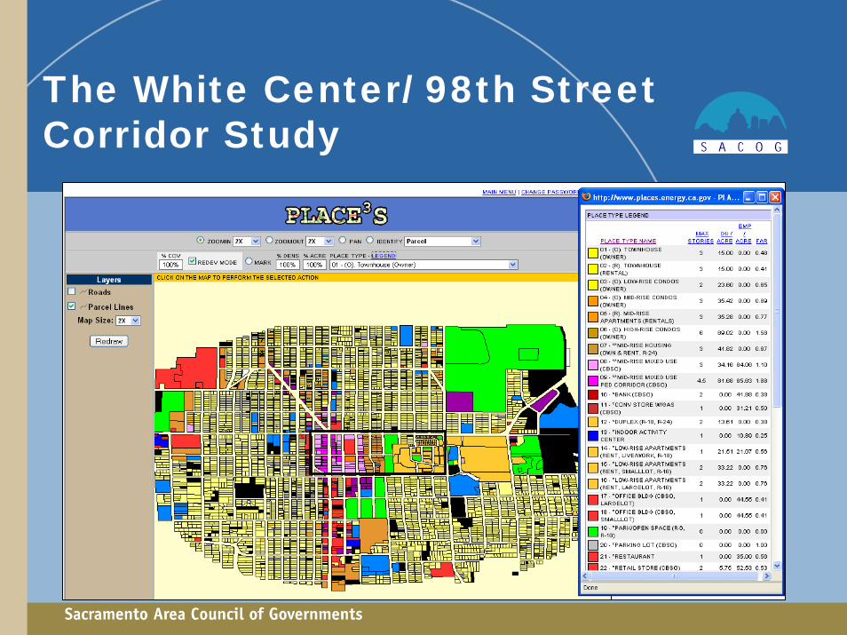
The White Center/ 98th Street Corridor Study
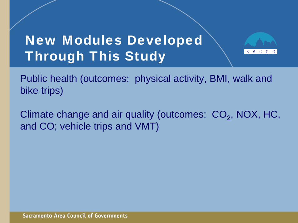
New Modules Developed Through This Study
Public health (outcomes: physical activity, BMI, walk and bike trips)
Climate change and air quality (outcomes: CO2, NOX, HC, and CO; vehicle trips and VMT)
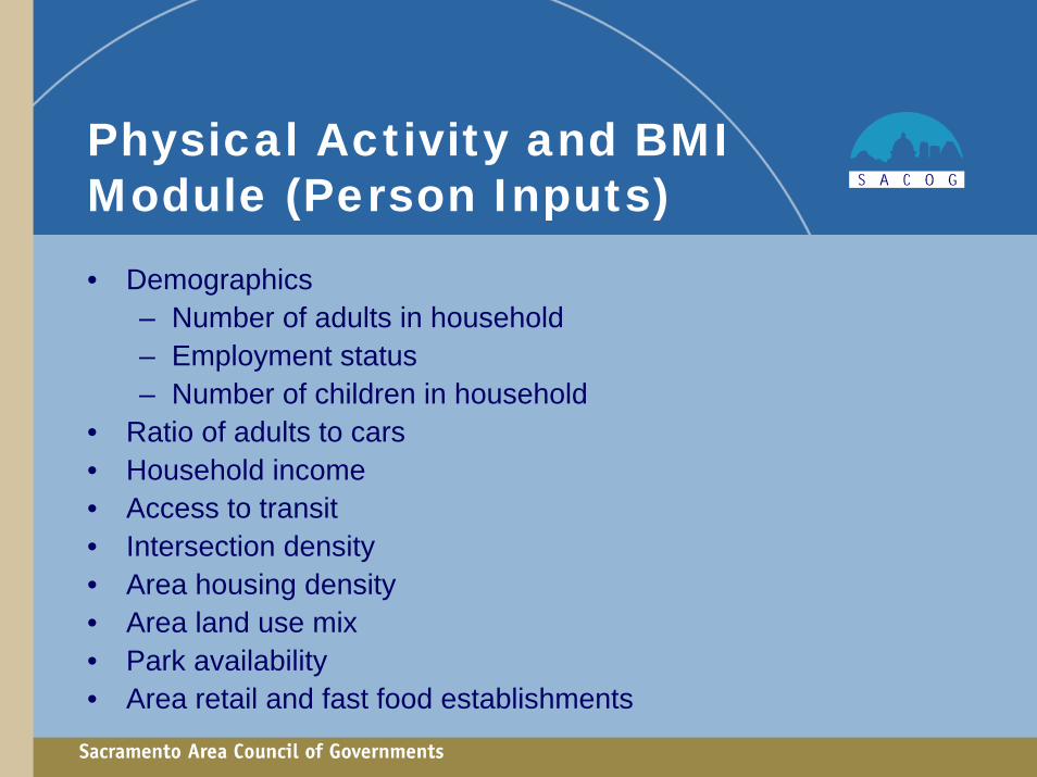
Physical Activity and BMI Module (Person Inputs)• Demographics
– Number of adults in household– Employment status– Number of children in household
• Ratio of adults to cars• Household income• Access to transit• Intersection density• Area housing density• Area land use mix• Park availability• Area retail and fast food establishments

Climate Change Module (Household Inputs)• Household demographics
– Working adults– Non-working adults– Children
• Household Income• Access to transit• Area intersection density• Household area density• Area mix of land uses
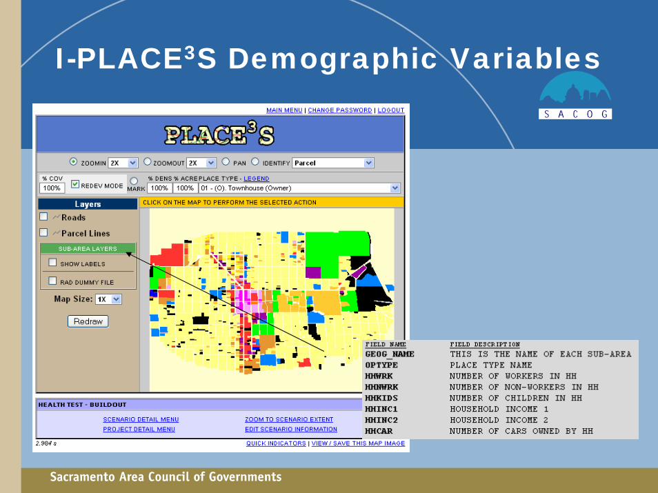
I-PLACE3S Demographic Variables


![Untitled-1 [] I Ill Il I I I I I I I I I I I I I I I I I I I I I I I I I I I I I I I I I I I I I I I I Ill I . Title: Untitled-1 Author: admin Created Date: 6/17/2013 5:18:51 PM](https://img.pdfslide.us/doc/110x75/5aae5d277f8b9a59478bf97f/untitled-1-i-ill-il-i-i-i-i-i-i-i-i-i-i-i-i-i-i-i-i-i-i-i-i-i-i-i-i-i-i-i-i.jpg)