Embed Size (px)
Citation preview
Engineers Ireland IAH/GSI Joint meeting 3 March 2015
Jenny Lightfoot
Hydrogeological assessments for shale gas exploration
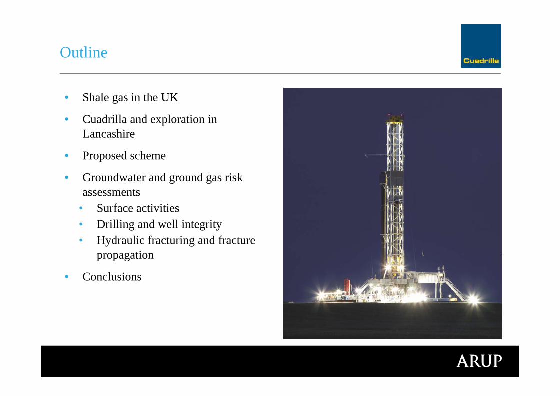
Outline
• Shale gas in the UK
• Cuadrilla and exploration in Lancashire
• Proposed scheme
• Groundwater and ground gas risk assessments
• Surface activities• Drilling and well integrity• Hydraulic fracturing and fracture
propagation
• Conclusions

• >2000 wells
• DECC register
• Largest onshore oilfield in Western Europe – Wytch Farm
• Many similarities – drilling, well integrity, surface activities
• Some differences - fracture propagation in shale, flowbackmanagement
Existing UK onshore oil and gas
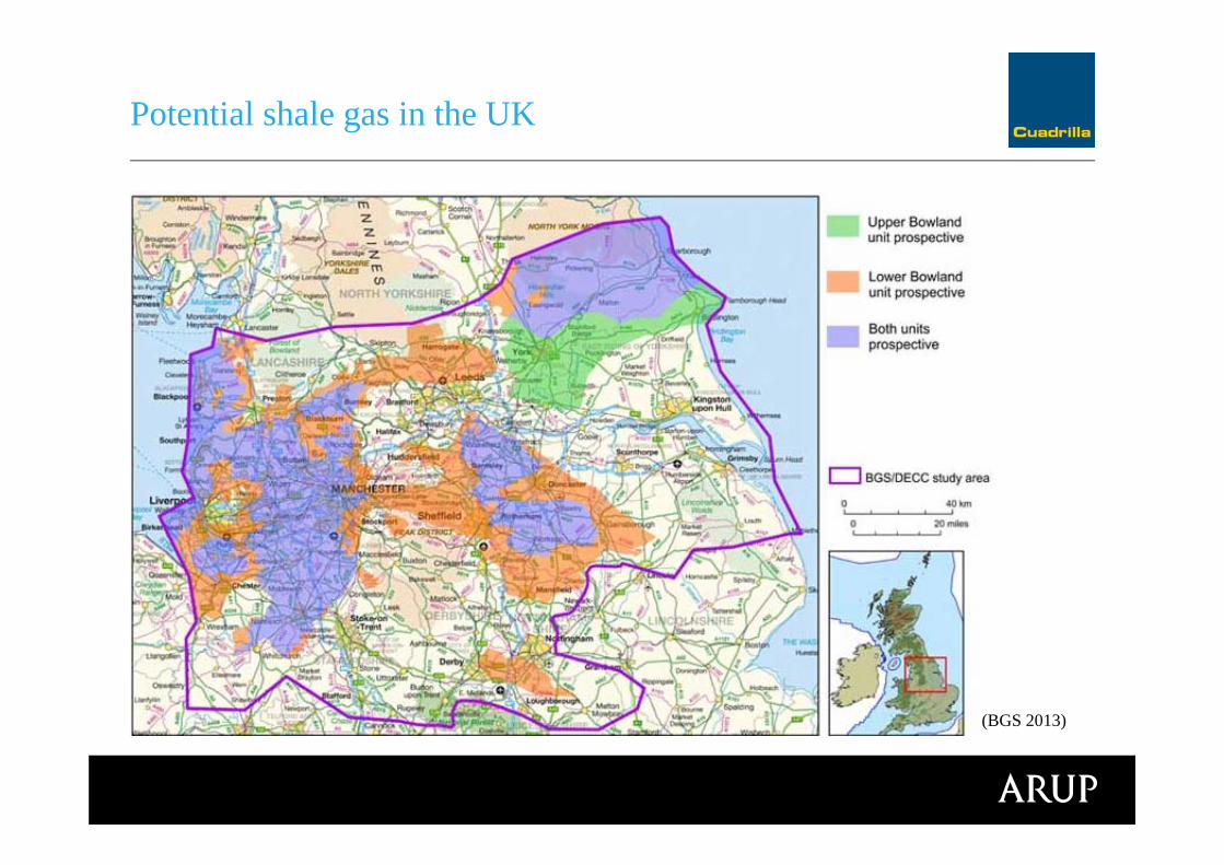
Potential shale gas in the UK
(BGS 2013)
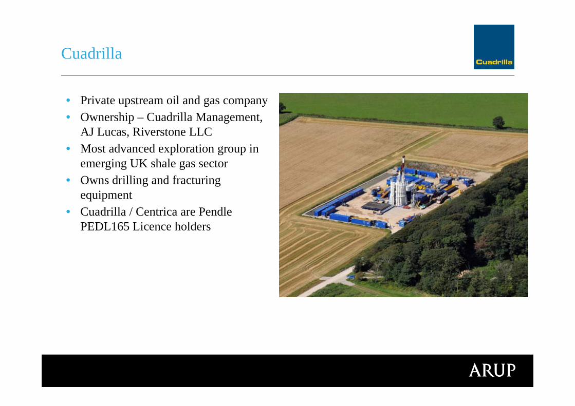
• Private upstream oil and gas company• Ownership – Cuadrilla Management,
AJ Lucas, Riverstone LLC• Most advanced exploration group in
emerging UK shale gas sector• Owns drilling and fracturing
equipment• Cuadrilla / Centrica are Pendle
PEDL165 Licence holders
Cuadrilla

PEDL165 exploration
(Cuadrilla 2013) (Cuadrilla 2013)
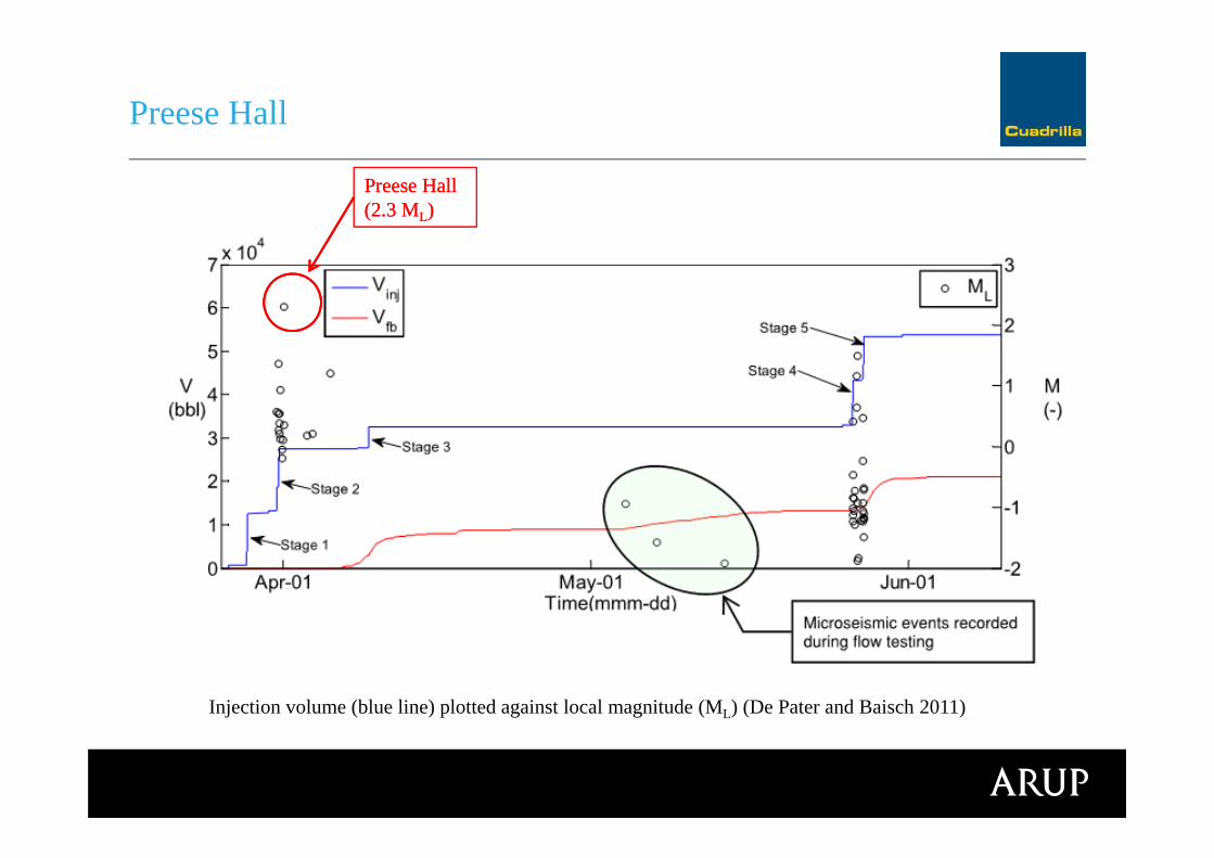
Preese Hall
Preese Hall (2.3 ML)Preese Hall (2.3 ML)
Injection volume (blue line) plotted against local magnitude (ML) (De Pater and Baisch 2011)
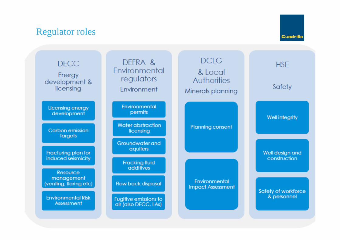
Regulator rolesRegulation

Regulatory approvals for a wellRegulation
• Environment Agency• Onshore oil and gas exploratory operations: technical guidance • Environmental permitting, waste management, groundwater protection
• European Water Framework Directive/Groundwater Daughter Directive ‘hazardous substances/non-hazardous pollutants’ (prevent/limit)
• EA Position Statement C6 – not within SPZ1 or where unacceptable risk to groundwater
Groundwater Protection: RegulationRegulation
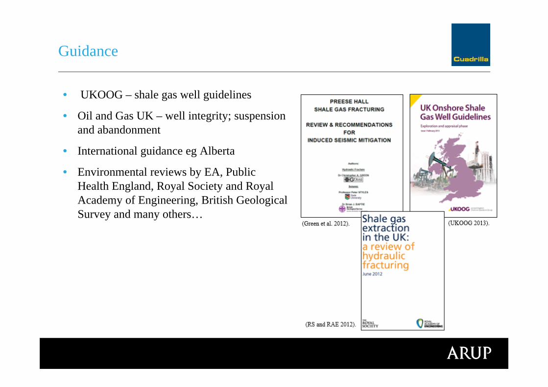
• UKOOG – shale gas well guidelines
• Oil and Gas UK – well integrity; suspension and abandonment
• International guidance eg Alberta
• Environmental reviews by EA, Public Health England, Royal Society and Royal Academy of Engineering, British Geological Survey and many others…
GuidanceRegulation
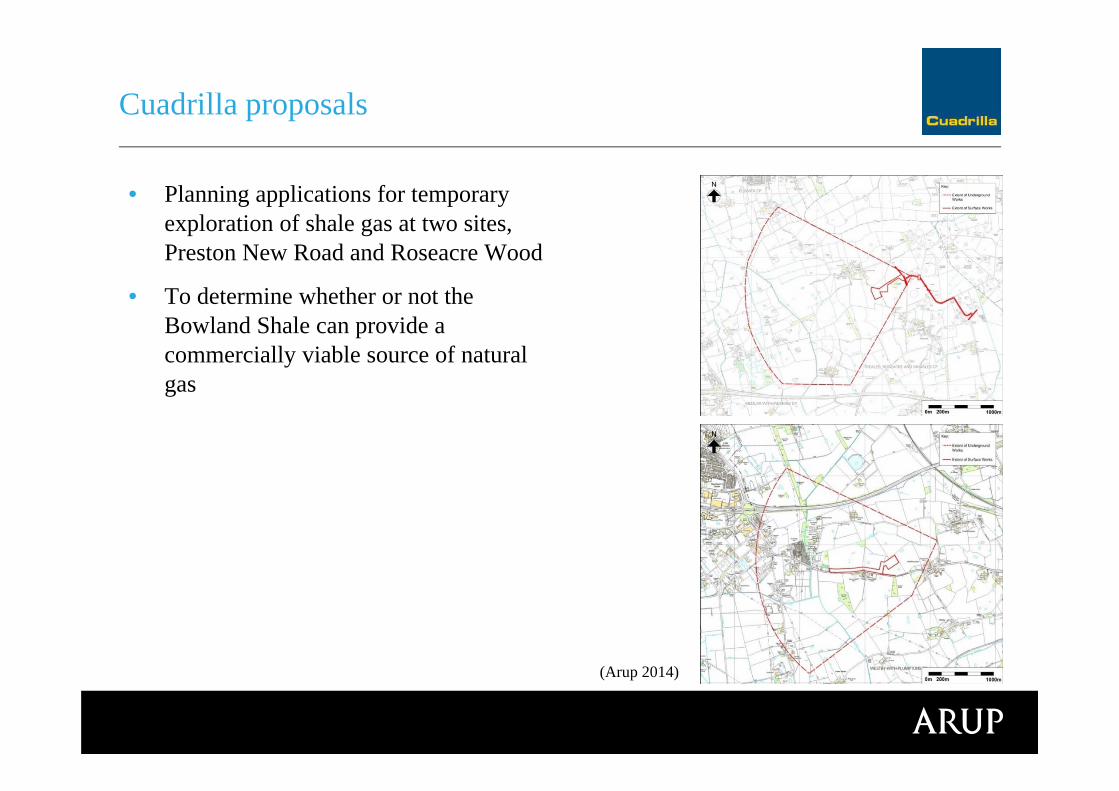
Cuadrilla proposals
• Planning applications for temporary exploration of shale gas at two sites, Preston New Road and Roseacre Wood
• To determine whether or not the Bowland Shale can provide a commercially viable source of natural gas
The planning applications
(Arup 2014)
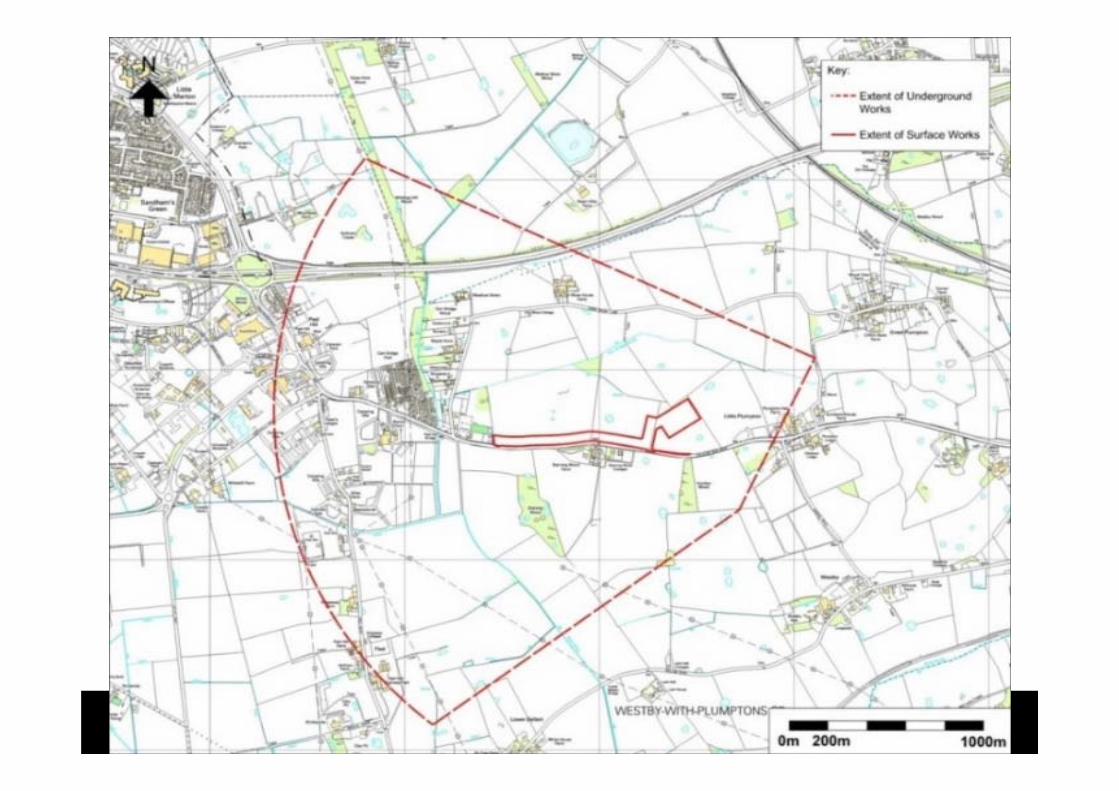
Proposed explorationThe planning applications

Cuadrilla proposals
Construction
Drilling
Hydraulic fracturing
Well testing
Suspend and apply for production
Decommission wells
Project proposals
http://www.cuadrillaresources.com/news/media-and-image-library/
Video – ‘A Surface Story’
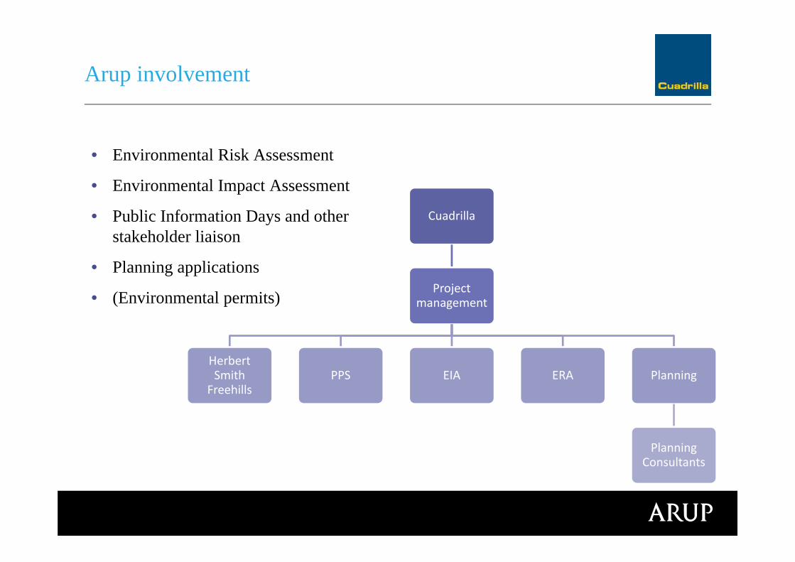
• Environmental Risk Assessment
• Environmental Impact Assessment
• Public Information Days and other stakeholder liaison
• Planning applications
• (Environmental permits)
Arup involvement
Cuadrilla
Project management
Herbert Smith
FreehillsPPS EIA ERA Planning
Planning Consultants

Technical Chapters:
Air Quality
Archaeology and Cultural Heritage
Community and Socio-economics
Ecology
Greenhouse Gas Emissions
Hydrogeology and Ground Gas
Induced Seismicity
Land Use
Lighting
Noise
Public Health
Resources and Waste
Transport
Water Resources
Arup Environmental Statement
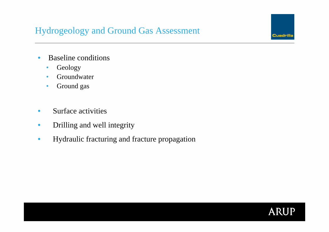
• Baseline conditions • Geology• Groundwater• Ground gas
• Surface activities
• Drilling and well integrity
• Hydraulic fracturing and fracture propagation
Hydrogeology and Ground Gas Assessment
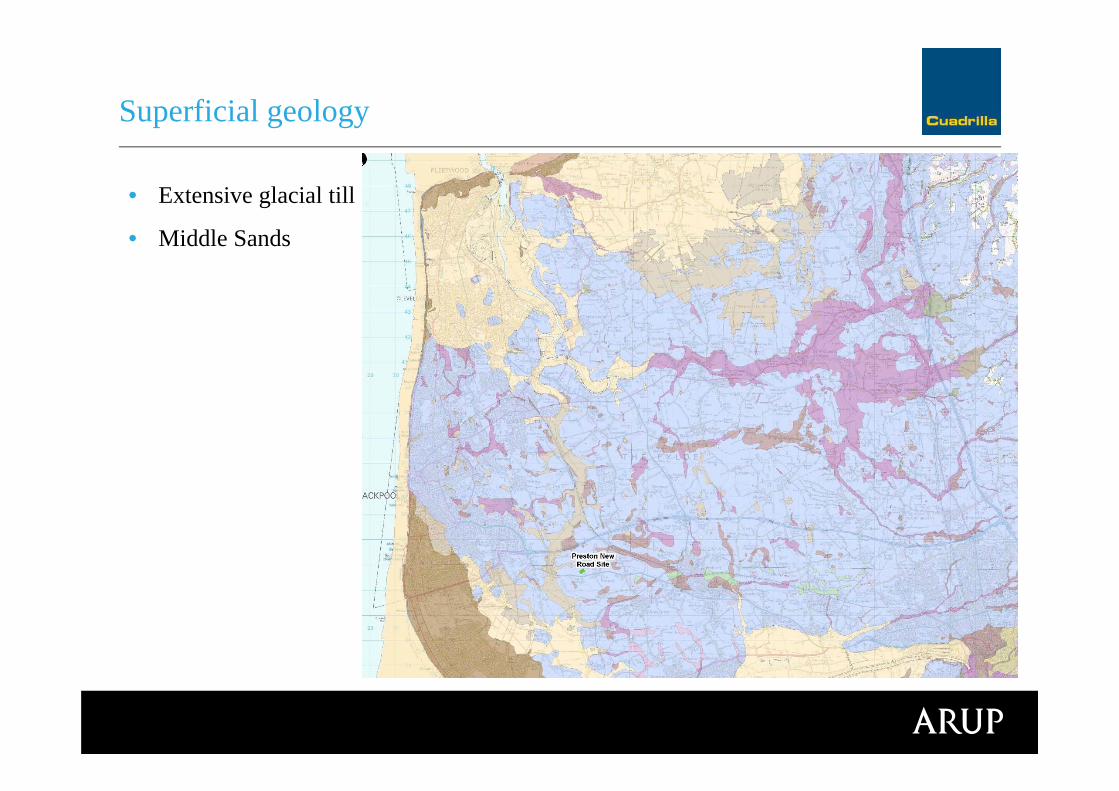
• Extensive glacial till
• Middle Sands
Superficial geology
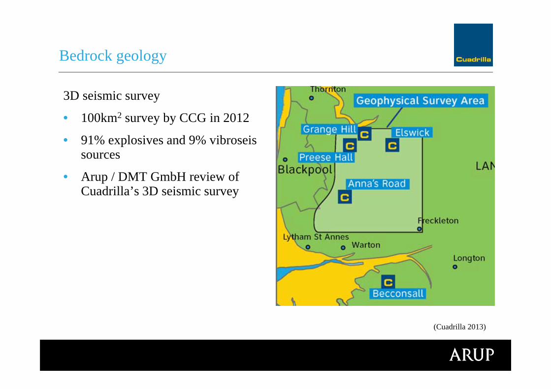
3D seismic survey
• 100km2 survey by CCG in 2012
• 91% explosives and 9% vibroseissources
• Arup / DMT GmbH review of Cuadrilla’s 3D seismic survey
Bedrock geology
(Cuadrilla 2013)
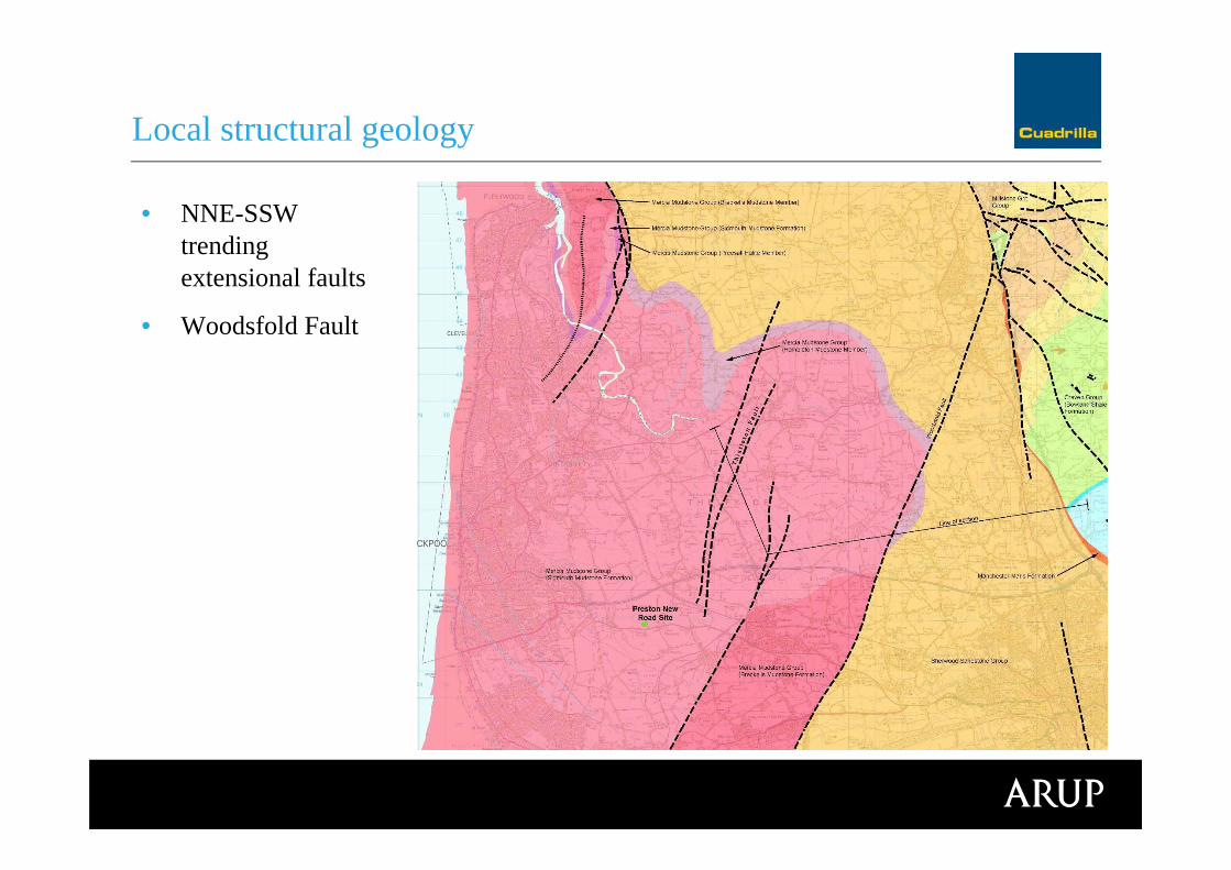
• NNE-SSW trending extensional faults
• Woodsfold Fault
Local structural geology

BGS Geol section
Bedrock geology

Groundwater abstraction
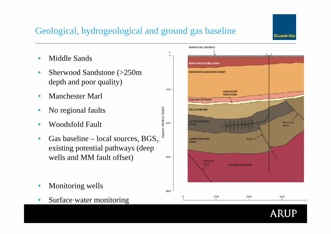
• Middle Sands
• Sherwood Sandstone (>250m depth and poor quality)
• Manchester Marl
• No regional faults
• Woodsfold Fault
• Gas baseline – local sources, BGS,, existing potential pathways (deep wells and MM fault offset)
• Monitoring wells
• Surface water monitoring
Geological, hydrogeological and ground gas baseline
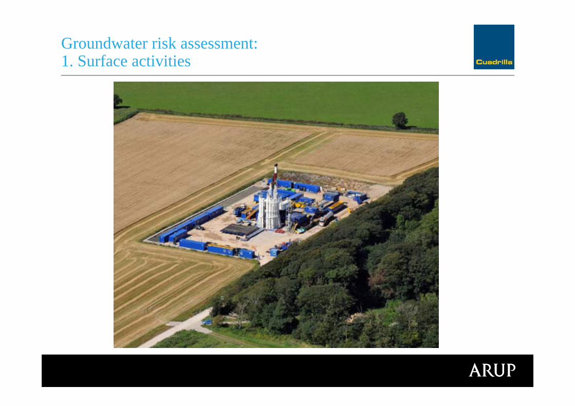
Groundwater risk assessment: 1. Surface activities
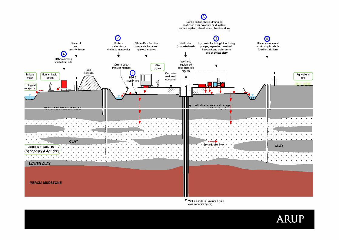
Groundwater risk assessment: 1. Surface activities
S-P-R assessment
• Sources – spill of fluids on the well pad, release of contaminated runoff, off site vehicle spill, fire fighting foam, high pressure fluid release
• Receptors - Middle Sands gw, surface water, surrounding farm land, off site human health (contact with contamwater)
• Pathways
Probability of S-P-R linkage
Consequence of S-P-R linkage
Evaluate risk magnitudes
Groundwater risk assessment: 1. Surface activities
Groundwater risk assessment: 2. Drilling and well integrity
http://www.cuadrillaresources.com/news/media-and-image-library/
Video – ‘Well Design’
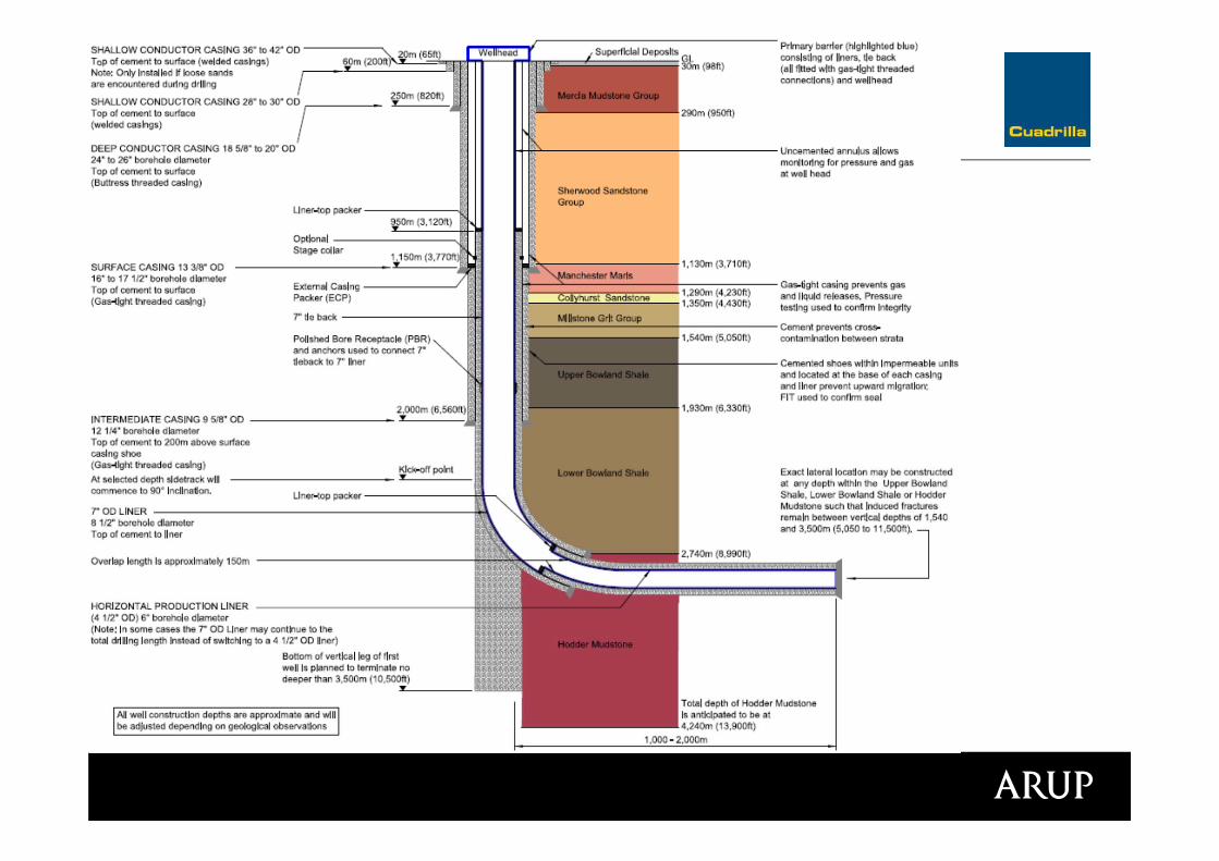
Well schematic
Groundwater risk assessment: 2. Drilling and well integrity
‘Embedded mitigation’
• Wells drilled, constructed and integrity tested in accordance with regulatory requirements and industry best practice
• No hazardous substances in drilling fluids above the Manchester Marl
• Drilling fluid additives identified in the environmental permit
• Well barriers and verification
• Approved abandonment design
Groundwater risk assessment: 2. Drilling and well integrity
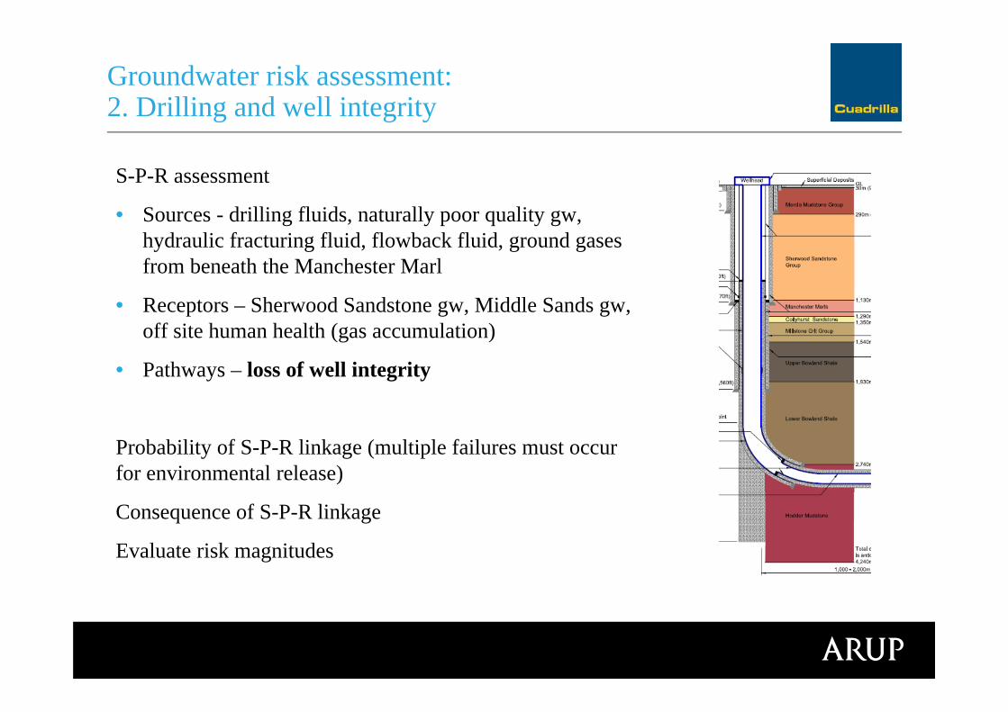
S-P-R assessment
• Sources - drilling fluids, naturally poor quality gw, hydraulic fracturing fluid, flowback fluid, ground gases from beneath the Manchester Marl
• Receptors – Sherwood Sandstone gw, Middle Sands gw, off site human health (gas accumulation)
• Pathways – loss of well integrity
Probability of S-P-R linkage (multiple failures must occur for environmental release)
Consequence of S-P-R linkage
Evaluate risk magnitudes
Groundwater risk assessment: 2. Drilling and well integrity

Groundwater risk assessment: 3. Hydraulic fracturing and fracture propagation
http://www.cuadrillaresources.com/news/media-and-image-library/
Video – ‘What is Hydraulic Fracturing?’
‘Embedded mitigation’
• Hydraulic Fracturing Programme
• Fracturing fluid composition
• Sampling of fracturing fluid and flowback
• Monitoring and management of fracture growth
Groundwater risk assessment: 3. Hydraulic fracturing and fracture propagation

Fracturing fluid composition
• Water
• Sand proppant
• Polyacrylamide
• Dilute hydrochloric acid
• Re-use of flowback fluid
No hazardous substances (GWD)
Full disclosure
Groundwater risk assessment: 3. Hydraulic fracturing and fracture propagation
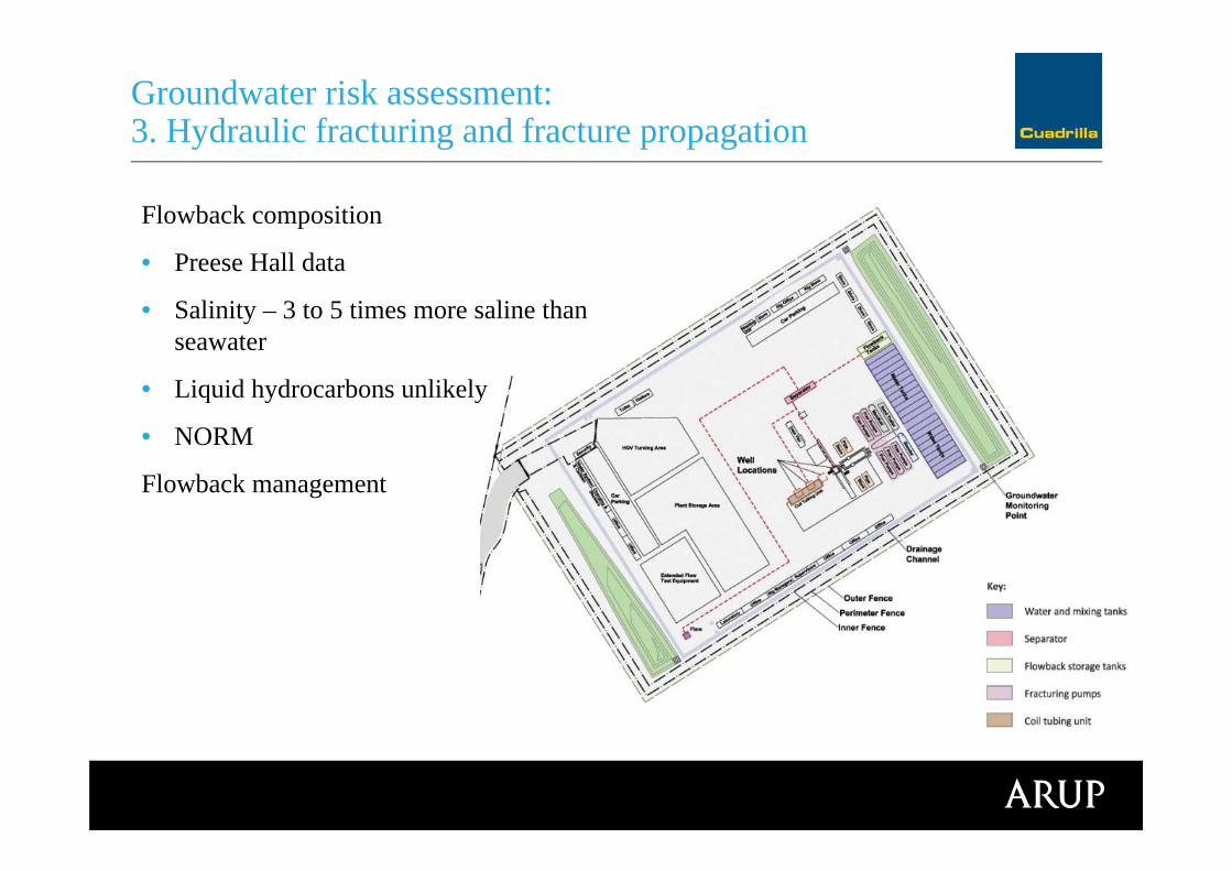
Flowback composition
• Preese Hall data
• Salinity – 3 to 5 times more saline than seawater
• Liquid hydrocarbons unlikely
• NORM
Flowback management
Groundwater risk assessment: 3. Hydraulic fracturing and fracture propagation
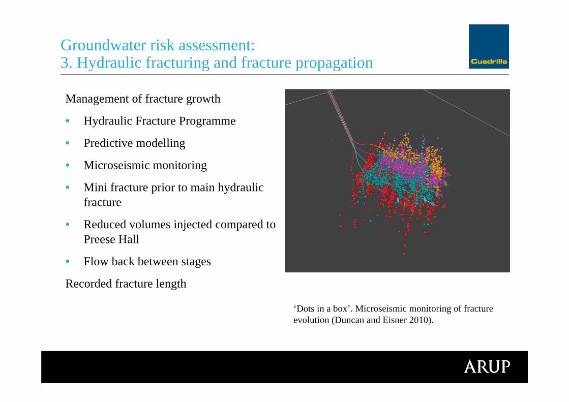
Management of fracture growth
• Hydraulic Fracture Programme
• Predictive modelling
• Microseismic monitoring
• Mini fracture prior to main hydraulic fracture
• Reduced volumes injected compared to Preese Hall
• Flow back between stages
Recorded fracture length
Groundwater risk assessment: 3. Hydraulic fracturing and fracture propagation
‘Dots in a box’. Microseismic monitoring of fracture evolution (Duncan and Eisner 2010).
Groundwater risk assessment: 3. Hydraulic fracturing and fracture propagation
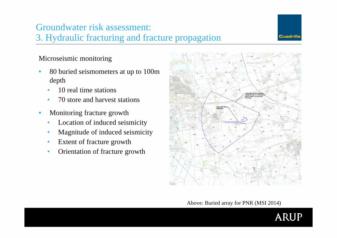
Microseismic monitoring
• 80 buried seismometers at up to 100m depth
• 10 real time stations• 70 store and harvest stations
• Monitoring fracture growth • Location of induced seismicity • Magnitude of induced seismicity • Extent of fracture growth • Orientation of fracture growth
Above: Buried array for PNR (MSI 2014)

S-P-R assessment
• Sources – hydraulic fracturing fluid, naturally poor quality groundwater, ground gases from Bowland Shale
• Receptors – Sherwood Sandstone gw, Middle Sands gw, off site human health (gas accumulation)
• Pathways – fractures propagating beyond target zone connecting to preferential flowpaths
Probability of S-P-R linkage (multiple connected pathways required)
Consequence of S-P-R linkage
Evaluate risk magnitudes
Groundwater risk assessment: 3. Hydraulic fracturing and fracture growth

Conclusions

• Groundwater and ground gas risks are highly site specific
• Well design and site implementation (drilling and site management practices) are important
• Risks associated with Cuadrilla’s proposals at PNR assessed as not greater than ‘low/not significant’
• Regulator approval secured
• Monitoring and data collection to build evidence base and public confidence
• Assessments are in the public domain http://www.cuadrillaresources.com/our-sites/locations/preston-new-road/
Conclusions
• Cuadrilla for the collaborative efforts in developing the planning documents, particularly Nick Mace, HuwClarke, Andrew Quarles and Eric Vaughan
• Arup EIA team, particularly Michael Chendorain, Catriona Neath, Tom Berry, Des Correia, Richard Bickers.
• External technical review – Tony Batchelor and others at GeoScience Ltd
Acknowledgements

Any questions?
Thank you