Embed Size (px)
Citation preview
hydro-meteorological networkof Vietnam in AMY08
Nguyen Thi Tan ThanhNational Hydro – Meteorological Service of Vietnam (VNHMS)
Asian MONSOON YEAR 2008 (amy08) Workshop Bali, Indonesia, September 03 - 04, 2007

CONTENTCONTENT
1. Introduction
2. Network of Stations in AMY08
3. Operational H-M Models in NCHMF
4. Collaboration in MAHASRI

1. Introduction1. Introduction
- Up to now, Vietnam H-M network has more than 1200 stations and gauging places.- Very limited number of stations are in the GBSN or RBSN: 25 synoptic stations, 03 upper – air stations are sending TA and TB, 02 PILOT stations.- Need to know the standard data requirement for AMY08, which can contribute by all countries.- Improving the operational H-M forecasting system is a strong demanding to VNHMS

2 – Network of Stations in AMY082 – Network of Stations in AMY08
2.1. Meteorological station network
8obs/day, all Met.elements, except Solar Radiation.
- AWS in Danang city
- 57 class I
- 7 class II
Among this:
- 25 International reported stations
- 39 National synoptic reported Stations

2 – Network of Stations in AMY08 (cont.)2 – Network of Stations in AMY08 (cont.)
2.2. Upper – Air Station Network:- 5 radiosounding stations: 2obs./day
at 00Z and 12Z, only 3 stations international reported TA, TB, TC, TD + 2 new stations + higher spatial resolution.
- 8 PILOT stations: 00Z2.3. Weather Radar Network- 3 conventional weather radar
stations in the Northern part of VN: 3 PPI – 256 km scans at 0.5, 1.5, 2.5deg. in 10min
- 3 DWSR in the Southern part of VN: 14 elevations volume scan in 240km

2 – Network of Stations (cont.)2 – Network of Stations (cont.)
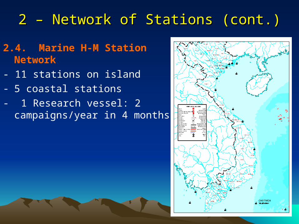
2.4. Marine H-M Station Network
- 11 stations on island- 5 coastal stations
- 1 Research vessel: 2 campaigns/year in 4 months
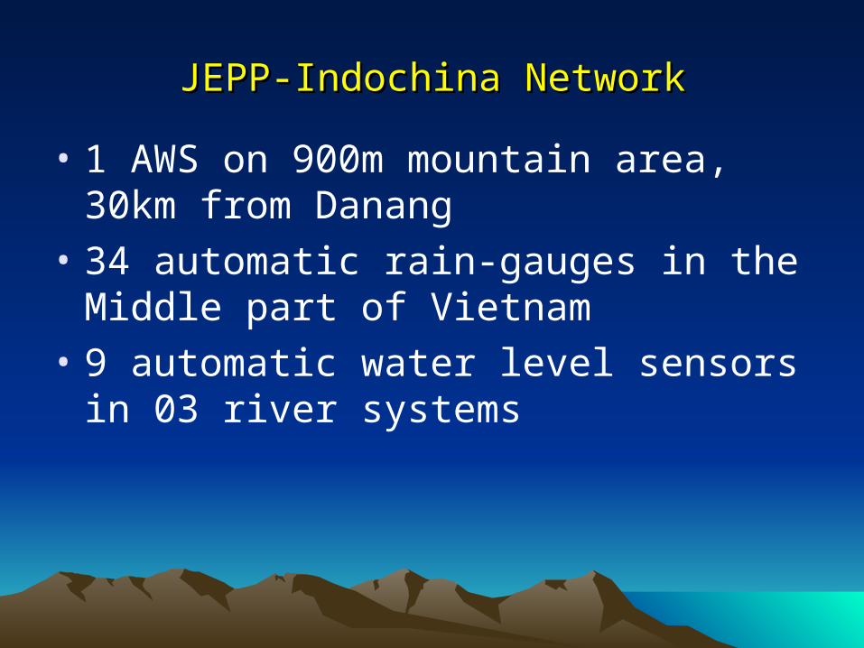
JEPP-Indochina NetworkJEPP-Indochina Network
• 1 AWS on 900m mountain area, 30km from Danang
• 34 automatic rain-gauges in the Middle part of Vietnam
• 9 automatic water level sensors in 03 river systems

3. Operational H-M Models in NCHMF of Vietnam

3.1. International GTS channels
• HaNoi - MOSCOW: 100 bps
• HaNoi -Bejing: 75 bps
• HaNoi - Bangkok: 1200bps
• PCVSAT: HaNoi - Bejing: 9600bps

3.2. NWP models
• Run operationally HRM (28 km) since 5/2002, (14km) since 7/2004.
• ETA model run (22 km) in experimental mode since June 2005, semi-operational (May, 2006)
• Barotropic models for TC tracking (BARO & BAR) for typhoon season 2003, 2004, 2005, 2006
• Post processing (display & diagnostic output): GSM(JMA), TLAPS (BoM), AVN(NCEP), NOGAPS, ECMWF ...
• Other software to serve as tools for forecasters

Initial & Boundary
data (GME) taken from
DWD(~165 MB/1
run)
RHMC
PC-basedLINUX-OS
4 nodes (8 CPU)
Run_Gme2hrm
Run_ Hrm
Graphics
Output (Grib, ASCII)
Other models (WAM, Storm Surge)
Hydrological Model
LAN-NCHMF
WEB site
Ftp- Server NCHMF
(Archive GME)
Output
FLOW CHART OF THE OPERATIONAL GME-HRM MODEL
at NCHMF
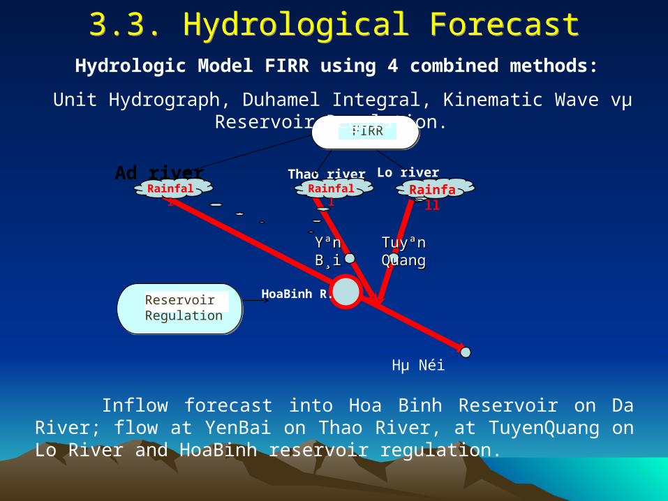
Ad river Thao river Lo river
Hµ Néi
HoaBinh R.
Rainfall
Rainfall
Rainfall
Yªn Yªn B¸iB¸i
Tuyªn Tuyªn QuangQuang
FIRRFIRRFIRR
Reservoir Regulation
Inflow forecast into Hoa Binh Reservoir on Da River; flow at YenBai on Thao River, at TuyenQuang on Lo River and HoaBinh reservoir regulation.
Hydrologic Model FIRR using 4 combined methods:
Unit Hydrograph, Duhamel Integral, Kinematic Wave vµ Reservoir Regulation.
3.3. Hydrological Forecast
3.3. Hydrological Forecast

Observed and forecasted
rainfall
DEM
Forest Coverage
Map
MARINE MODEL
Out put Q~t
Distributed Model MARINE (France) with DEM và GIS, rainfall-runoff forecast inflow into Hoa Binh Reservoir on Da River

Main menu of the Software
Icons of zoom in, zoom out, move screen
Coordinates of mouse pointer
Check box to display/hide Hydro-Met stations
Map of river network, hydromet stations, diverge,
retard areas
Forecasting year
Flood forecasting scheme for upstream Red River
Tools to zoom in. zoom out, move
screen
Popup menu
Short-term flood forecasting software for the Red River system with lead time 6 – 48hours; using rainfall-runoff, related water
level/discharges methods, SSARR model and step multi-regression

4. International Collaboration 4. International Collaboration 1. To develop a National Data Integration System2. Higher temporal resolution of data can be
conducted with the financial support.3. Implementation of 4D - Data Assimilation.4. To improve the operational numerical models in
NCHMF of Vietnam5. To improve HM operational forecasting
technology, especially the forecasts of weather disturbances, floods and flash floods
6. Capacity building: training, workshop, education, exchange scientists etc...

Thank you very much Thank you very much for your attention!for your attention!