Embed Size (px)
Citation preview
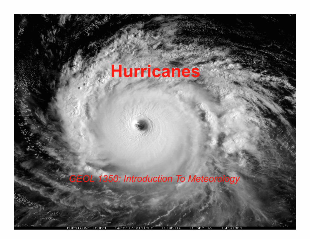
1
Hurricanes
GEOL 1350: Introduction To Meteorology
2
3
• In the tropics, diurnal and seasonal changes in temperature are small compared with high latitudes.
• The daily heating of the surface and high humidity favor the development of cumulus clouds and afternoon thunderstorms.
• Most of these are individual thunderstorms that are not severe. Sometimes, however, they grow together into loosely organized systems called non-squall clusters. On other occasions, the thunderstorms will align into a row of vigorous convective cells or a squall line.
4
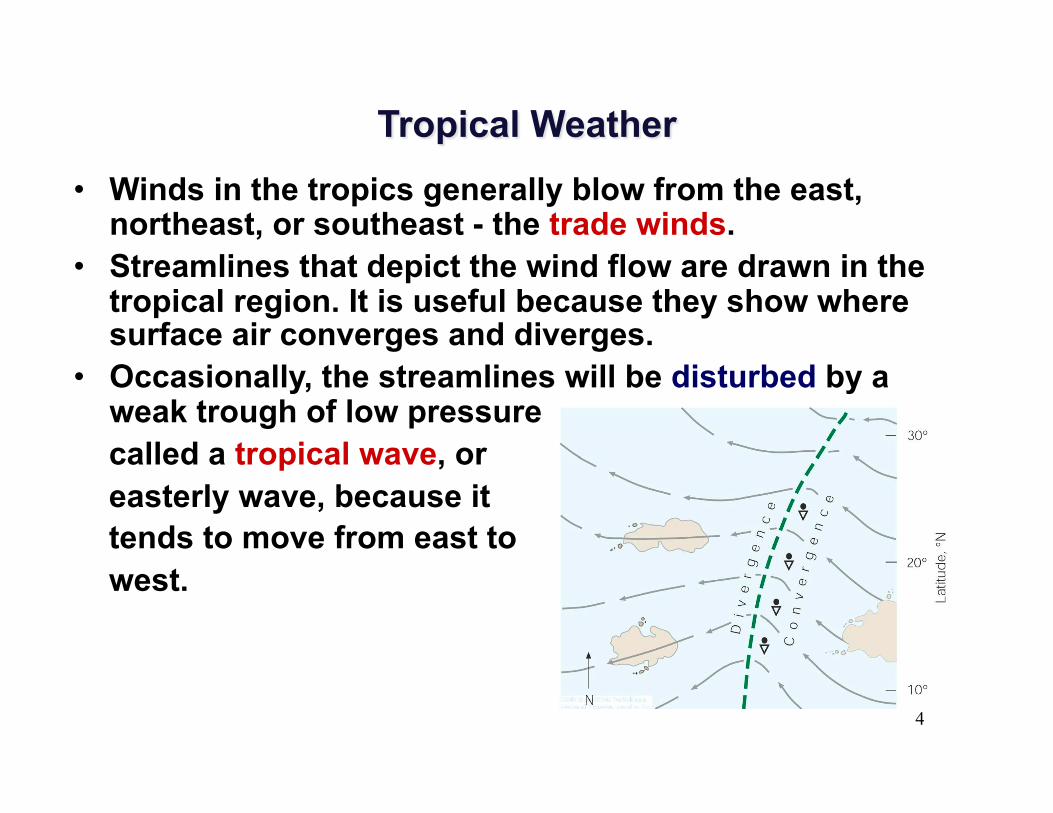
• Winds in the tropics generally blow from the east, northeast, or southeast - the trade winds.
• Streamlines that depict the wind flow are drawn in the tropical region. It is useful because they show where surface air converges and diverges.
• Occasionally, the streamlines will be disturbed by a weak trough of low pressure
called a tropical wave, or easterly wave, because it tends to move from east to west.
5
• Hurricane is an intense storm of tropical origin, with sustained winds exceeding 64 knots (74 mi/hr), which forms over the warm northern Atlantic and eastern North Pacific oceans.
• In the western North Pacific, it is called typhoon, in India a cyclone, and in Australia a tropical cyclone. By international agreement, tropical cyclone is the general term for all hurricane-type storms that originate over tropical waters.
6
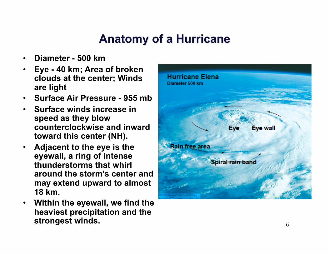
• Diameter - 500 km • Eye - 40 km; Area of broken
clouds at the center; Winds are light
• Surface Air Pressure - 955 mb • Surface winds increase in
speed as they blow counterclockwise and inward toward this center (NH).
• Adjacent to the eye is the eyewall, a ring of intense thunderstorms that whirl around the storm’s center and may extend upward to almost 18 km.
• Within the eyewall, we find the heaviest precipitation and the strongest winds.
7
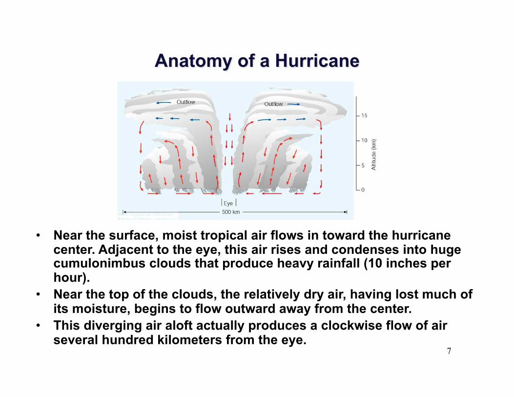
• Near the surface, moist tropical air flows in toward the hurricane center. Adjacent to the eye, this air rises and condenses into huge cumulonimbus clouds that produce heavy rainfall (10 inches per hour).
• Near the top of the clouds, the relatively dry air, having lost much of its moisture, begins to flow outward away from the center.
• This diverging air aloft actually produces a clockwise flow of air several hundred kilometers from the eye.
8
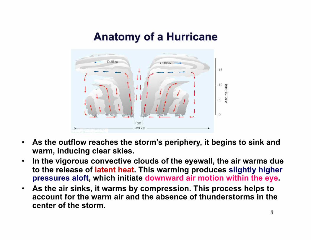
• As the outflow reaches the storm’s periphery, it begins to sink and warm, inducing clear skies.
• In the vigorous convective clouds of the eyewall, the air warms due to the release of latent heat. This warming produces slightly higher pressures aloft, which initiate downward air motion within the eye.
• As the air sinks, it warms by compression. This process helps to account for the warm air and the absence of thunderstorms in the center of the storm.
9
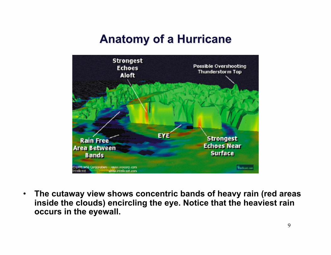
• The cutaway view shows concentric bands of heavy rain (red areas inside the clouds) encircling the eye. Notice that the heaviest rain occurs in the eyewall.
10
• Where and how do hurricanes form? • Tropical waters where the winds are light • Humidity is high in a deep layer extending up
through the troposphere • Surface water temperature is warm, typically
26.5°C (80°F) or greater over a vast area

11
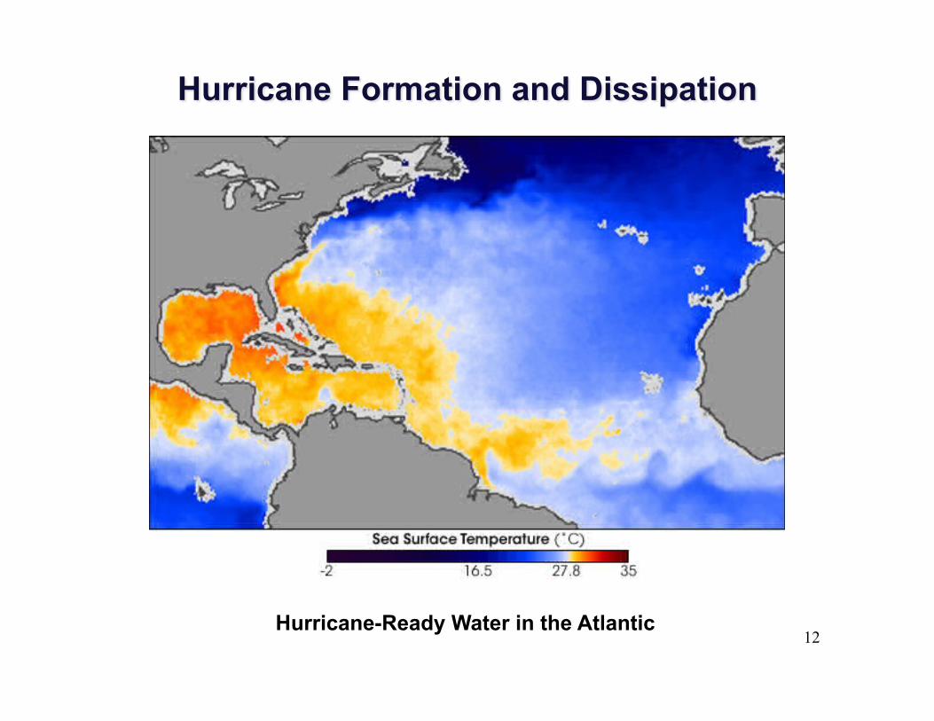
12 Hurricane-Ready Water in the Atlantic
13
• Where and how do hurricanes form? • Hurricanes usually form over the tropical and
subtropical North Atlantic and North Pacific oceans.
• Hurricane season normally runs from June through November.
14
• Energy for a hurricane comes from the direct transfer of sensible heat and latent heat from the warm ocean surface.
• For a hurricane to form, a cluster of thunderstorms must become organized around a central area of surface low pressure.
15
• One theory proposed that a hurricane forms in the following manner:
1. Trade wind inversion is weak and that thunderstorms start to organize along the ITCZ, or along a tropical wave.
2. In the deep moist conditionally unstable environment, a huge amount of latent heat is released inside the clouds during condensation.
3. The process warms the air aloft, causing the temperature near the cluster of thunderstorms to be much higher than the air temperature at the same level farther away.
16
4. This situation causes a horizontal pressure gradient aloft that induces the air aloft to move outward, away from the region of higher pressure in the anvils of the cumulonimbus clouds.
5. This diverging air aloft, coupled with warming of the vertical air column, causes the surface pressure to drop and a small area of surface low pressure to form.
17
6. Air now begins to spin counterclockwise and in toward the region of surface low pressure.
7. As the air moves inward, its speed increases. 8. As the air moves over the warm water, small
swirling eddies transfer heat energy from the ocean surface into the overlying air. The warmer the water and the greater the wind speed, the greater the transfer of sensible and latent heat into the air above.
18
9. As the air sweeps in toward the center of low pressure, the rate of heat transfer increases because the wind speed increases.
10. Similarly, the higher wind speed causes greater evaporation rates, and the overlying air becomes nearly saturated.
11. The turbulent eddies then transfer the warm moist air upward, where the water vapor condenses to fuel new thunderstorms.
19
• Hurricane is similar to that of a heat engine.
• In a hurricane, heat is taken in near the warm ocean surface, converted to kinetic energy, and lost at its top through radiational cooling.
• The maximum strength a hurricane can achieve is proportional to the difference in air temperature between the tropopause and the surface, and to the potential for evaporation from the sea surface.
• The warmer the ocean surface, the lower the minimum pressure of the storm, and the higher its wind.
20
• If the hurricane remains over warm water, it may survive for a long time.
• Hurricanes weaken rapidly when they travel over colder water and lose their heat source.
• Studies show that if the water beneath the eyewall of the storm cools by 2.5 C, the storm’s energy source is cut off, and the storm will dissipate.
• Even a small drop in water temperature beneath the eyewall will noticeably weaken the storm.
21
• A hurricane can also weaken if the layer of warm water beneath the storm is shallow.
• Hurricane also dissipate rapidly when they move over a large landmass. They not only lose their energy source but friction with the land surface causes surface winds to decrease and blow more directly into the storm, an effect that causes the hurricane’s central pressure to rise.
22
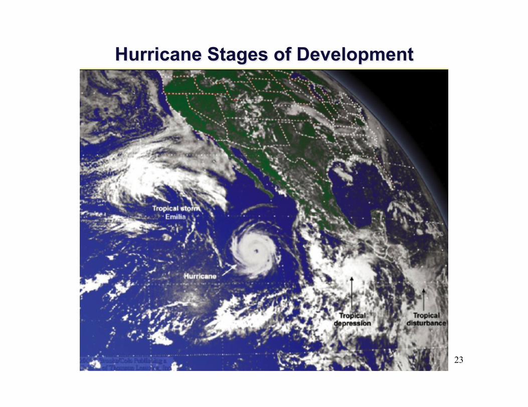
• Hurricanes go through a set of stages from birth to death
• Initially, a tropical disturbance shows up as a mass of thunderstorms with only slight wind circulation.
• The tropical disturbance becomes a tropical depression when the winds increase to between 20-34 knots.
• When the winds are between 35-64 knots, the tropical depression becomes a tropical storm.
• The tropical storm is classified as a hurricane only when its wind exceed 64 knots (74 miles per hour).
23
24
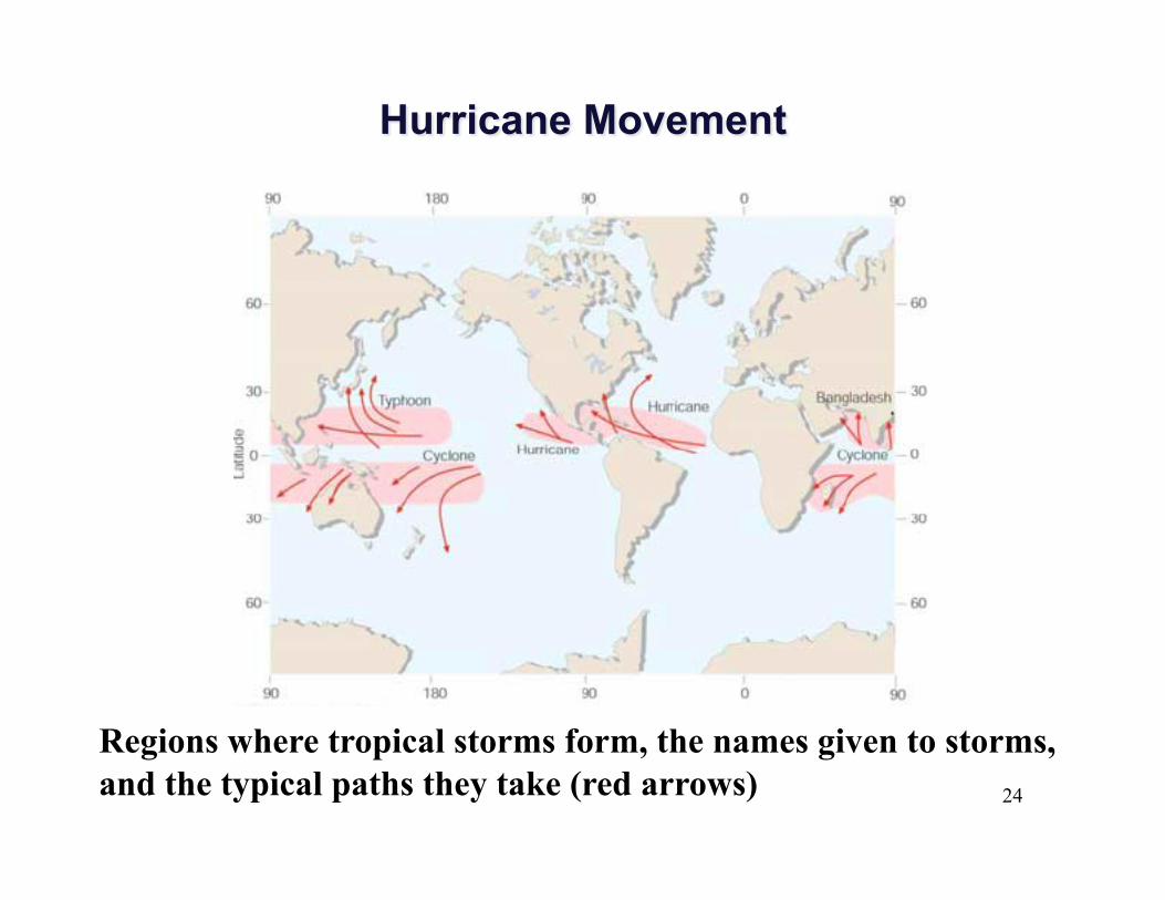
Regions where tropical storms form, the names given to storms, and the typical paths they take (red arrows)

25
Regions where tropical storms form, the names given to storms, and the typical paths they take (red arrows)
26
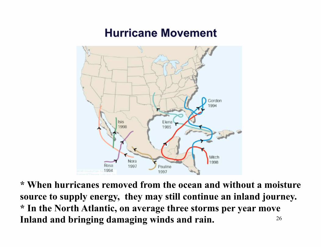
* When hurricanes removed from the ocean and without a moisture source to supply energy, they may still continue an inland journey. * In the North Atlantic, on average three storms per year move Inland and bringing damaging winds and rain.
27
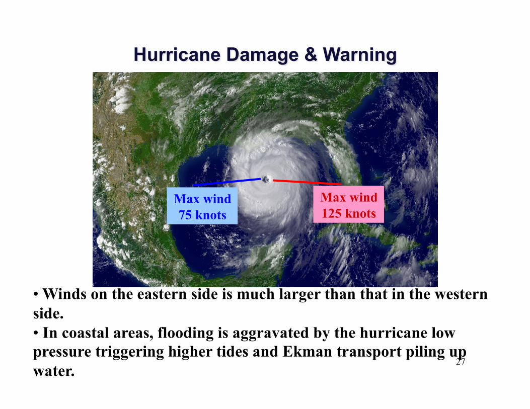
• Winds on the eastern side is much larger than that in the western side. • In coastal areas, flooding is aggravated by the hurricane low pressure triggering higher tides and Ekman transport piling up water.
Max wind 75 knots
Max wind 125 knots
28
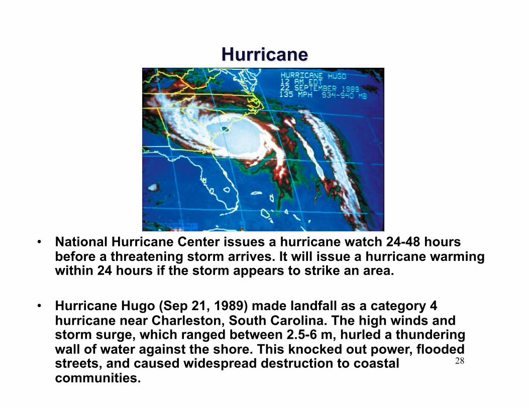
• National Hurricane Center issues a hurricane watch 24-48 hours before a threatening storm arrives. It will issue a hurricane warming within 24 hours if the storm appears to strike an area.
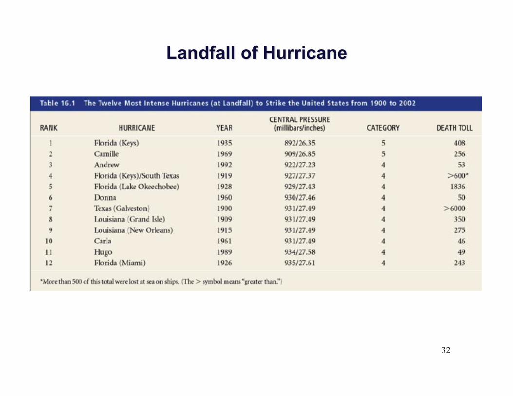
• Hurricane Hugo (Sep 21, 1989) made landfall as a category 4 hurricane near Charleston, South Carolina. The high winds and storm surge, which ranged between 2.5-6 m, hurled a thundering wall of water against the shore. This knocked out power, flooded streets, and caused widespread destruction to coastal communities.
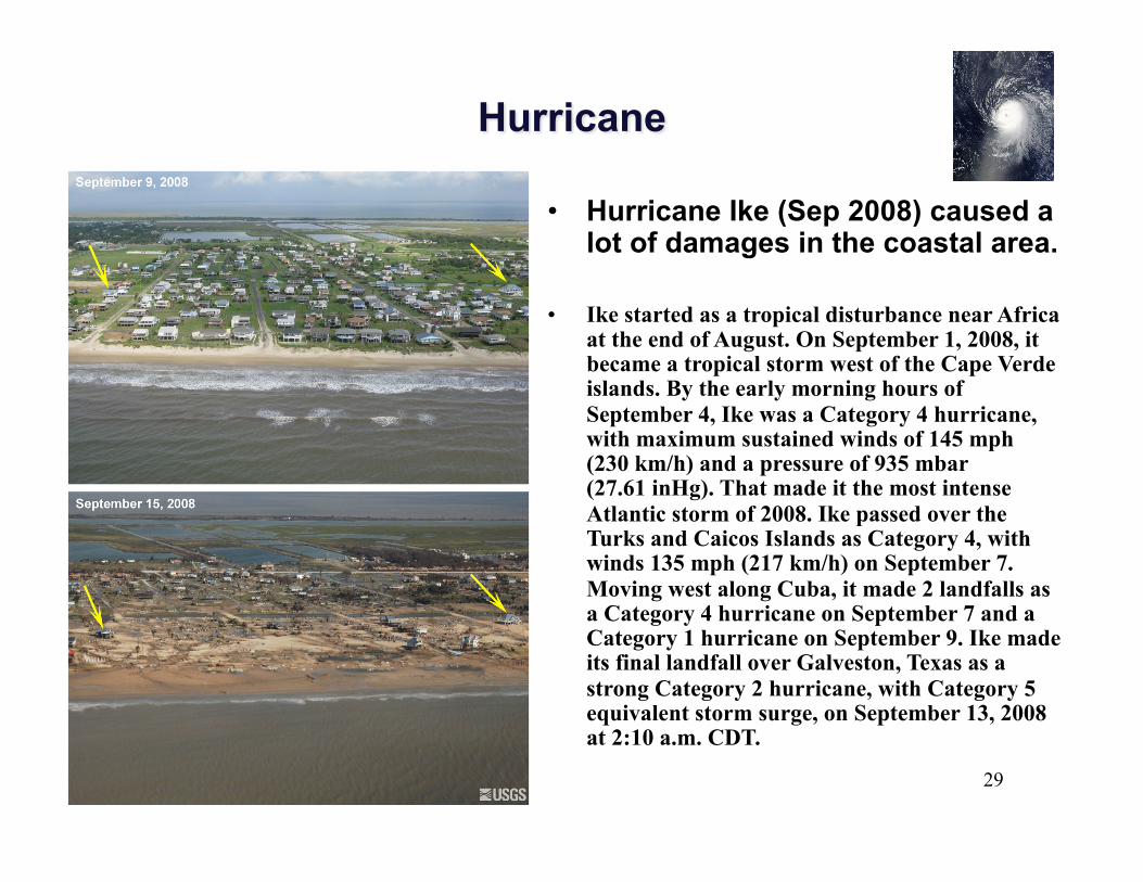
29
• Hurricane Ike (Sep 2008) caused a lot of damages in the coastal area.
• Ike started as a tropical disturbance near Africa at the end of August. On September 1, 2008, it became a tropical storm west of the Cape Verde islands. By the early morning hours of September 4, Ike was a Category 4 hurricane, with maximum sustained winds of 145 mph (230 km/h) and a pressure of 935 mbar (27.61 inHg). That made it the most intense Atlantic storm of 2008. Ike passed over the Turks and Caicos Islands as Category 4, with winds 135 mph (217 km/h) on September 7. Moving west along Cuba, it made 2 landfalls as a Category 4 hurricane on September 7 and a Category 1 hurricane on September 9. Ike made its final landfall over Galveston, Texas as a strong Category 2 hurricane, with Category 5 equivalent storm surge, on September 13, 2008 at 2:10 a.m. CDT.
30
• Saffir-Simpson scale was developed to estimate the possible damage a hurricane’s sustained winds and storm surge could do to a coastal area.
• The scale numbers (range from 1 to 5) are based on actual conditions at some time during the life of the storm.
• Category 1 (wind > 64 knots) hurricanes are the weakest
• Category 5 (wind > 135 knots) are the most intense • Category 3 (wind > 96 knots) and above are
considered intense
31
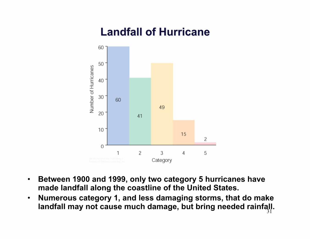
• Between 1900 and 1999, only two category 5 hurricanes have made landfall along the coastline of the United States.
• Numerous category 1, and less damaging storms, that do make landfall may not cause much damage, but bring needed rainfall.
32
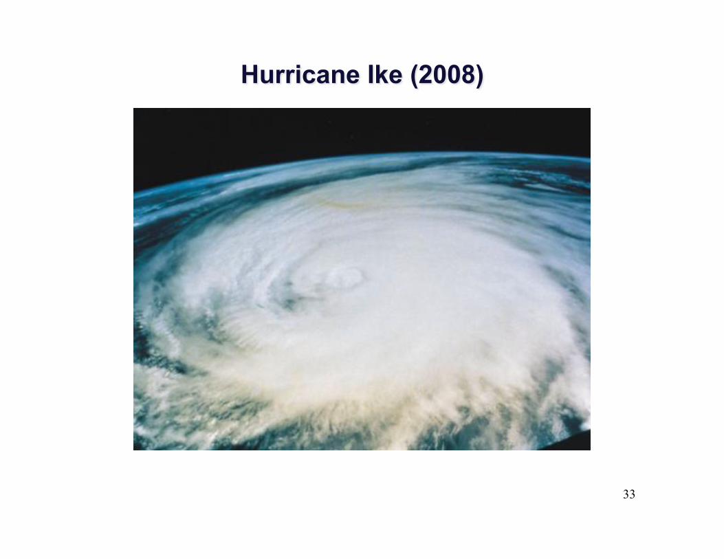
33
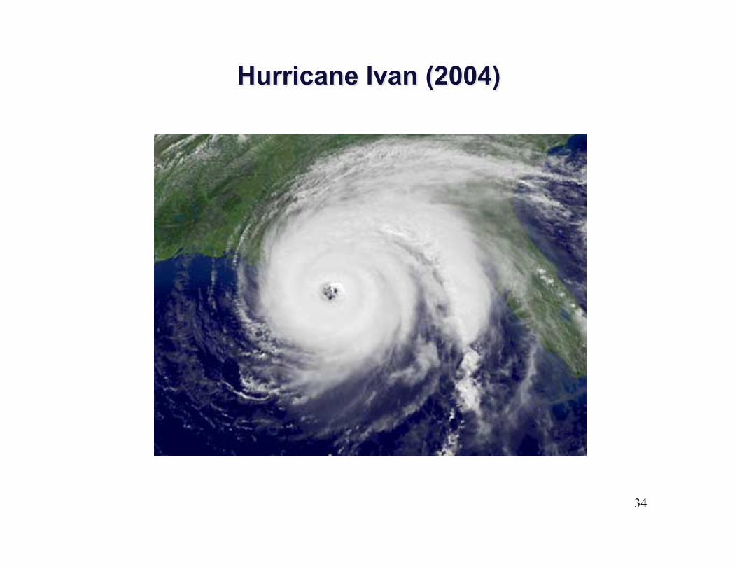
34

35
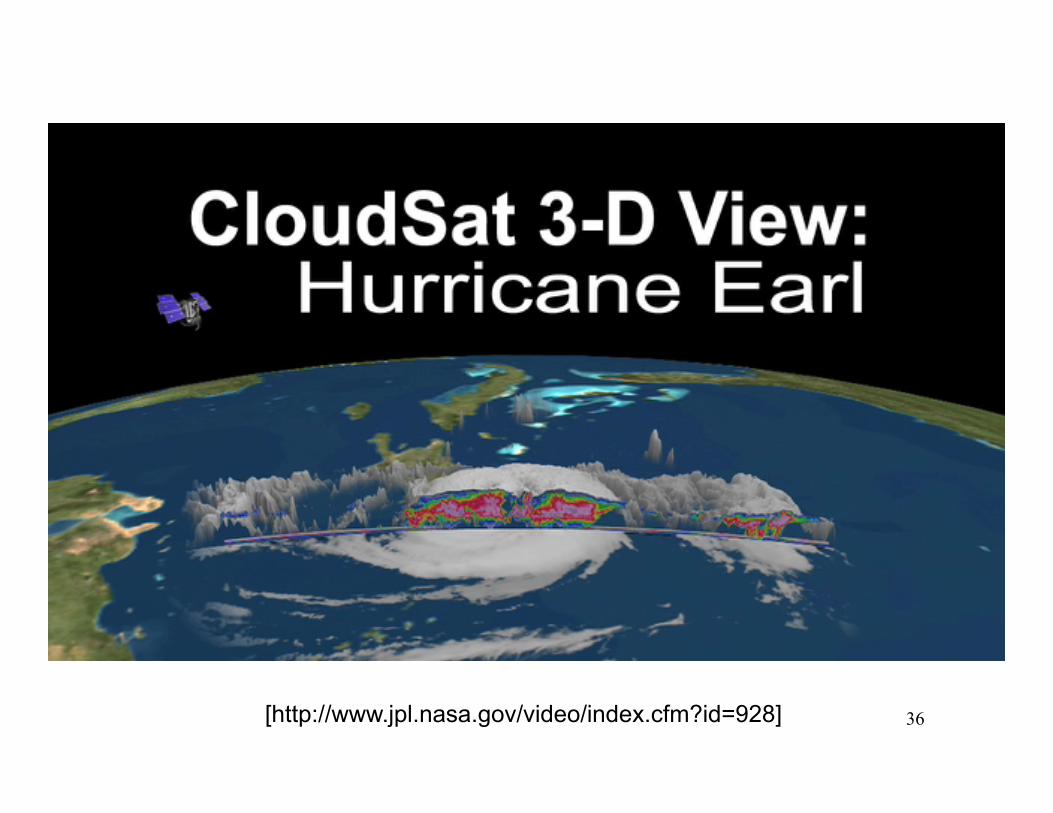
36 [http://www.jpl.nasa.gov/video/index.cfm?id=928]
37
1. Hurricanes are tropical cyclones with winds that exceed 64 knots (74 mi/hr) and blow counterclockwise about their center in the Northern Hemisphere.
2. A hurricane consists of a mass of organized thunderstorms that spiral in toward the extreme low pressure of the storm’s eye.
3. The heaviest rain, and the highest winds occur outside the eye, in the region known as the eyewall. In the eye itself, the air is warm, winds are light, and skies may be broken or overcast.
4. Hurricanes are born over warm tropical waters where the air is humid, surface winds converge, and thunderstorms become organized in a region of weak upper level winds.
5. The energy source for hurricane comes primarily from the warm tropical oceans and from the release of latent heat.
6. The Saffir-Simpson hurricane scale was developed to estimate the potential destruction that a hurricane can cause.
SUMMARY