Embed Size (px)
Citation preview
hurricanes.notebook November 01, 2010
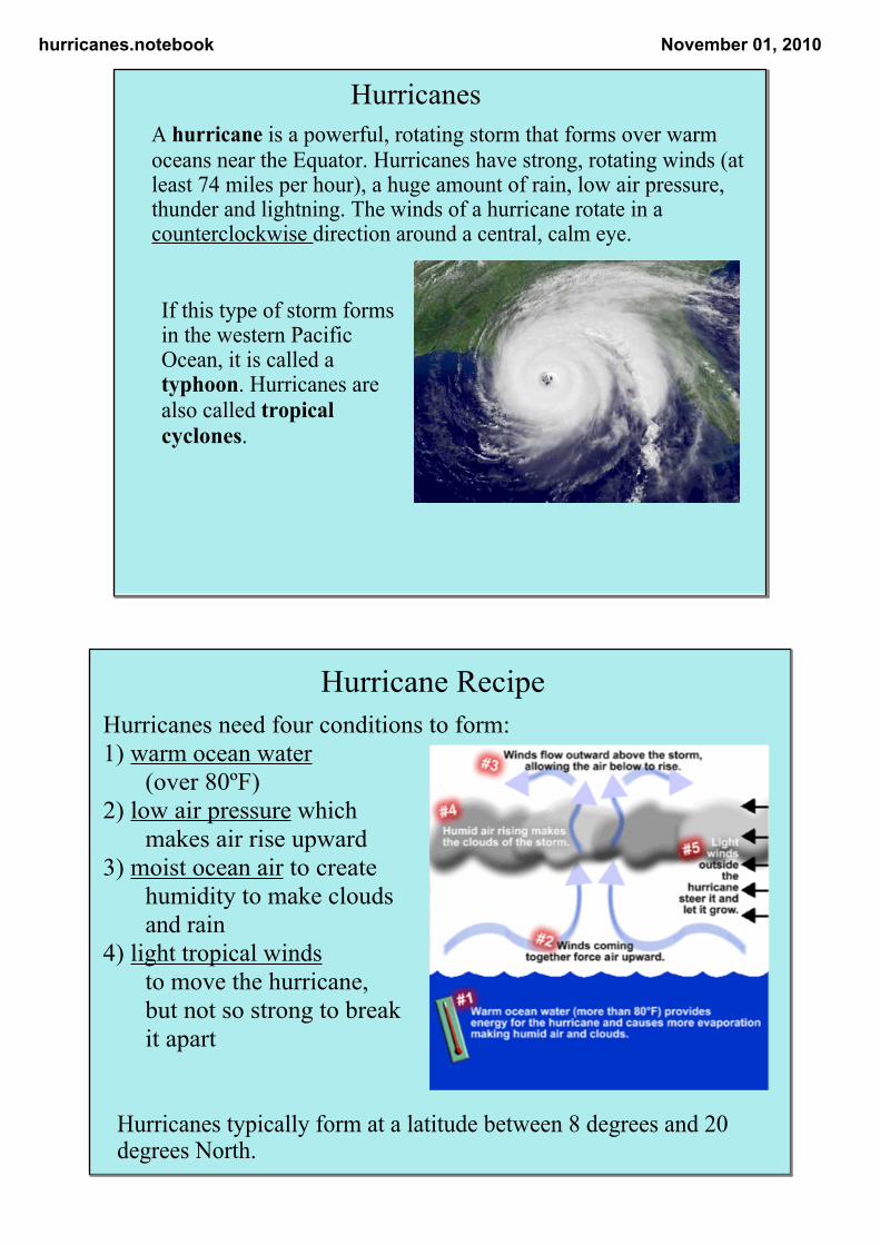
A hurricane is a powerful, rotating storm that forms over warm oceans near the Equator. Hurricanes have strong, rotating winds (at least 74 miles per hour), a huge amount of rain, low air pressure, thunder and lightning. The winds of a hurricane rotate in a counterclockwise direction around a central, calm eye.
If this type of storm forms in the western Pacific Ocean, it is called a typhoon. Hurricanes are also called tropical cyclones.
Hurricanes
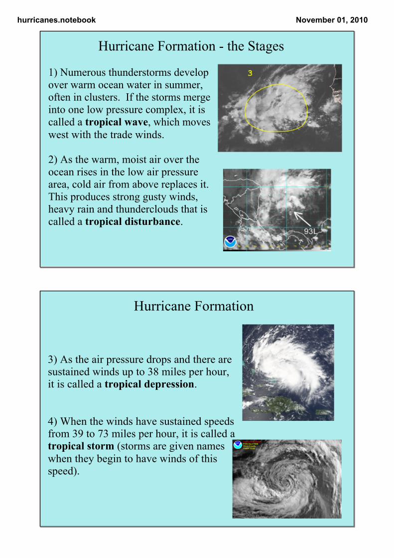
Hurricanes need four conditions to form: 1) warm ocean water
(over 80ºF) 2) low air pressure which
makes air rise upward 3) moist ocean air to create
humidity to make clouds and rain
4) light tropical winds to move the hurricane, but not so strong to breakit apart
Hurricane Recipe
Hurricanes typically form at a latitude between 8 degrees and 20 degrees North.
hurricanes.notebook November 01, 2010
1) Numerous thunderstorms develop over warm ocean water in summer, often in clusters. If the storms merge into one low pressure complex, it is called a tropical wave, which moves west with the trade winds.
2) As the warm, moist air over the ocean rises in the low air pressure area, cold air from above replaces it. This produces strong gusty winds, heavy rain and thunderclouds that is called a tropical disturbance.
Hurricane Formation the Stages
3) As the air pressure drops and there are sustained winds up to 38 miles per hour, it is called a tropical depression.
4) When the winds have sustained speeds from 39 to 73 miles per hour, it is called a tropical storm (storms are given names when they begin to have winds of this speed).
Hurricane Formation
hurricanes.notebook November 01, 2010
5) The storm becomes a hurricane when there are sustained winds of over 73 miles per hour.
6) The End of a Storm:When a hurricane travels over land or cold water, its energy source (warm water) is gone and the storm weakens, quickly dying.
Hurricane Formation
Hurricane formation
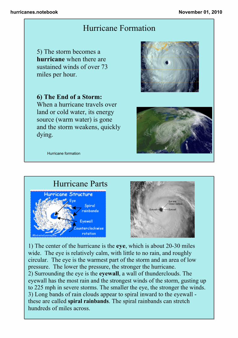
1) The center of the hurricane is the eye, which is about 2030 miles wide. The eye is relatively calm, with little to no rain, and roughly circular. The eye is the warmest part of the storm and an area of low pressure. The lower the pressure, the stronger the hurricane. 2) Surrounding the eye is the eyewall, a wall of thunderclouds. The eyewall has the most rain and the strongest winds of the storm, gusting up to 225 mph in severe storms. The smaller the eye, the stronger the winds. 3) Long bands of rain clouds appear to spiral inward to the eyewall these are called spiral rainbands. The spiral rainbands can stretch hundreds of miles across.
Hurricane Parts
hurricanes.notebook November 01, 2010
Hurricane Dangers
Hurricanes deliver massive amounts of rain. A particularly large storm can dump dozens of inches of rain in just a day or two, much of it inland. That amount of rain can create flooding, especially in the path of the hurricane's center.
In addition, high sustained winds within the storm can cause widespread structural damage. These winds can roll over vehicles, collapse walls and blow over trees.
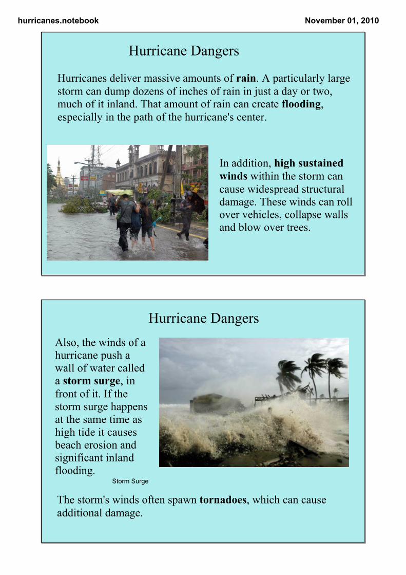
Also, the winds of a hurricane push a wall of water called a storm surge, in front of it. If the storm surge happens at the same time as high tide it causes beach erosion and significant inland flooding.
The storm's winds often spawn tornadoes, which can cause additional damage.
Hurricane Dangers
Storm Surge
hurricanes.notebook November 01, 2010
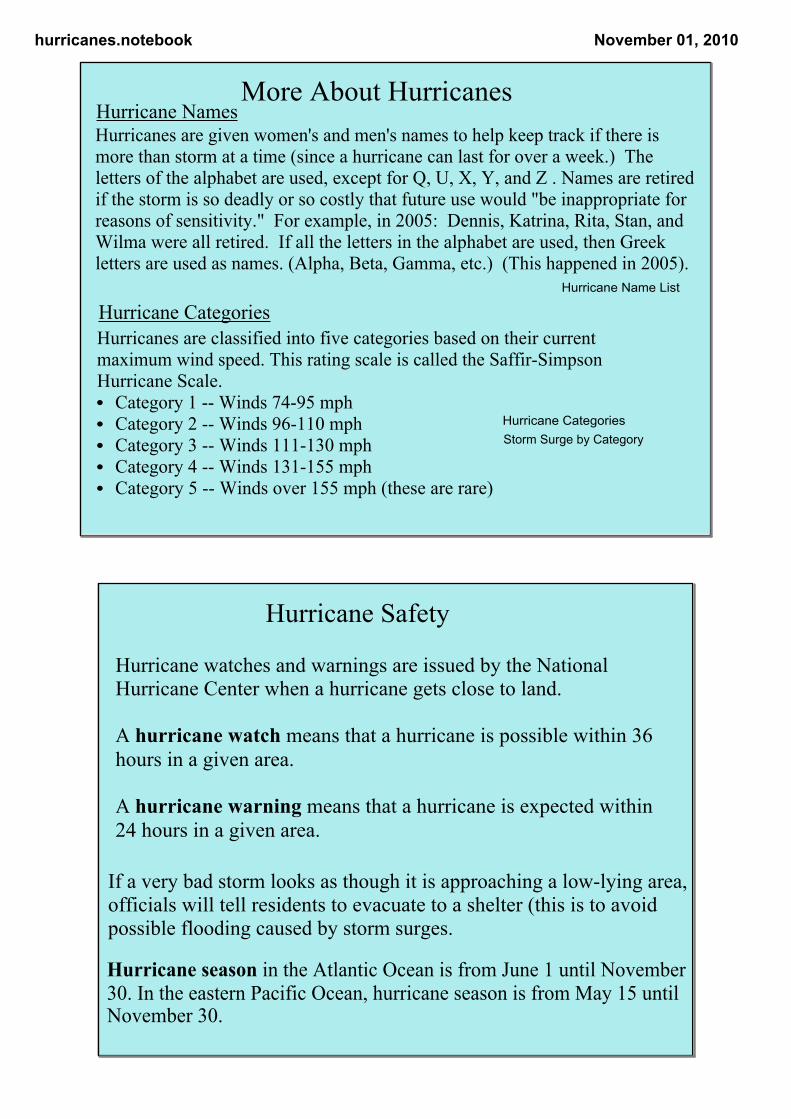
Hurricanes are given women's and men's names to help keep track if there is more than storm at a time (since a hurricane can last for over a week.) The letters of the alphabet are used, except for Q, U, X, Y, and Z . Names are retired if the storm is so deadly or so costly that future use would "be inappropriate for reasons of sensitivity." For example, in 2005: Dennis, Katrina, Rita, Stan, and Wilma were all retired. If all the letters in the alphabet are used, then Greek letters are used as names. (Alpha, Beta, Gamma, etc.) (This happened in 2005).
Hurricanes are classified into five categories based on their current maximum wind speed. This rating scale is called the SaffirSimpson Hurricane Scale. • Category 1 Winds 7495 mph • Category 2 Winds 96110 mph • Category 3 Winds 111130 mph • Category 4 Winds 131155 mph • Category 5 Winds over 155 mph (these are rare)
More About Hurricanes
Hurricane Name List
Hurricane CategoriesStorm Surge by Category
Hurricane Names
Hurricane Categories
Hurricane watches and warnings are issued by the National Hurricane Center when a hurricane gets close to land.
A hurricane watch means that a hurricane is possible within 36 hours in a given area.
A hurricane warning means that a hurricane is expected within 24 hours in a given area.
Hurricane Safety
If a very bad storm looks as though it is approaching a lowlying area, officials will tell residents to evacuate to a shelter (this is to avoid possible flooding caused by storm surges.
Hurricane season in the Atlantic Ocean is from June 1 until November 30. In the eastern Pacific Ocean, hurricane season is from May 15 until November 30.
hurricanes.notebook November 01, 2010
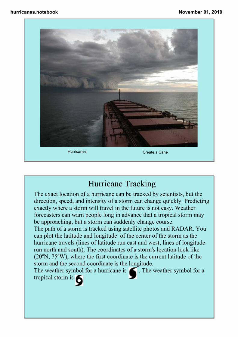
Create a CaneHurricanes
Hurricane TrackingThe exact location of a hurricane can be tracked by scientists, but the direction, speed, and intensity of a storm can change quickly. Predicting exactly where a storm will travel in the future is not easy. Weather forecasters can warn people long in advance that a tropical storm may be approaching, but a storm can suddenly change course. The path of a storm is tracked using satellite photos and RADAR. You can plot the latitude and longitude of the center of the storm as the hurricane travels (lines of latitude run east and west; lines of longitude run north and south). The coordinates of a storm's location look like (20ºN, 75ºW), where the first coordinate is the current latitude of the storm and the second coordinate is the longitude. The weather symbol for a hurricane is . The weather symbol for a tropical storm is .
hurricanes.notebook November 01, 2010
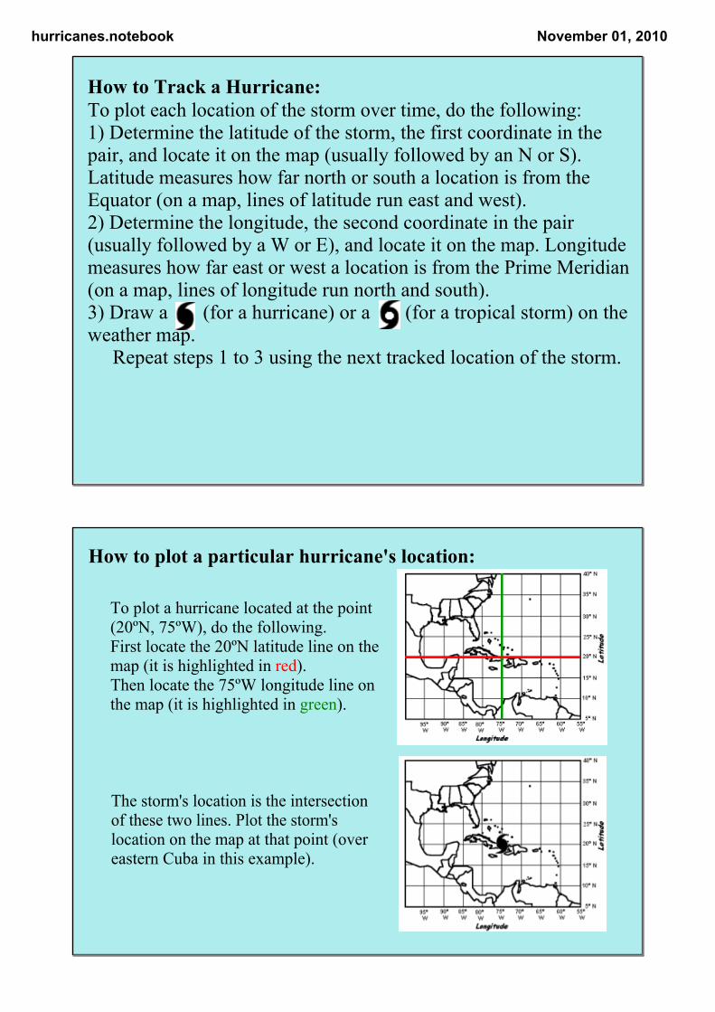
How to Track a Hurricane: To plot each location of the storm over time, do the following: 1) Determine the latitude of the storm, the first coordinate in the pair, and locate it on the map (usually followed by an N or S). Latitude measures how far north or south a location is from the Equator (on a map, lines of latitude run east and west). 2) Determine the longitude, the second coordinate in the pair (usually followed by a W or E), and locate it on the map. Longitude measures how far east or west a location is from the Prime Meridian (on a map, lines of longitude run north and south). 3) Draw a (for a hurricane) or a (for a tropical storm) on the weather map. Repeat steps 1 to 3 using the next tracked location of the storm.
The storm's location is the intersection of these two lines. Plot the storm's location on the map at that point (over eastern Cuba in this example).
To plot a hurricane located at the point (20ºN, 75ºW), do the following. First locate the 20ºN latitude line on the map (it is highlighted in red). Then locate the 75ºW longitude line on the map (it is highlighted in green).
How to plot a particular hurricane's location:
hurricanes.notebook November 01, 2010
10o
45o
40o
30o
25o
20o
15o
35o
40o45o100o 90o 80o
70o
60o
50o55o
65o75o
85o95o
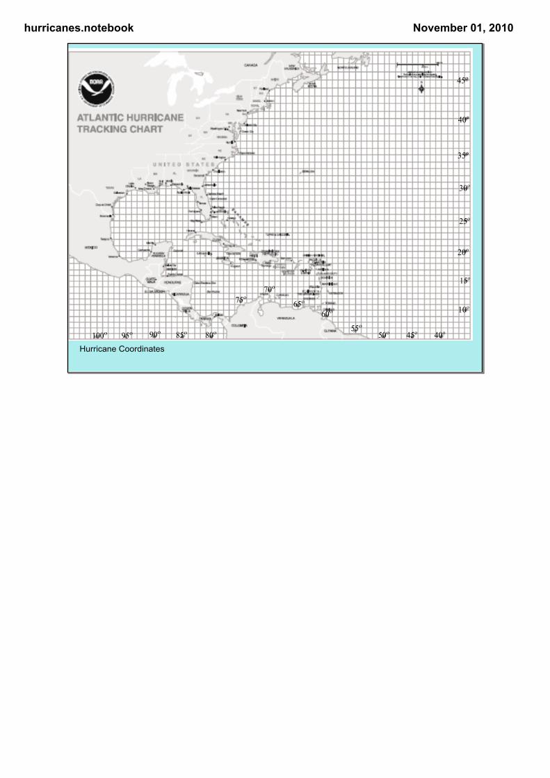
Hurricane Coordinates