Embed Size (px)
Citation preview
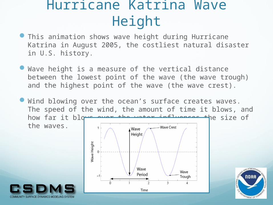
Hurricane Katrina Wave HeightThis animation shows wave height during Hurricane Katrina in
August 2005, the costliest natural disaster in U.S. history.
Wave height is a measure of the vertical distance between the lowest point of the wave (the wave trough) and the highest point of the wave (the wave crest).
Wind blowing over the ocean’s surface creates waves. The speed of the wind, the amount of time it blows, and how far it blows over the water influences the size of the waves.
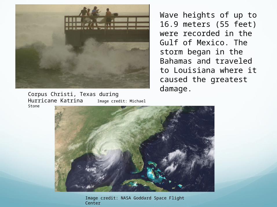
Image credit: NASA Goddard Space Flight Center
Wave heights of up to 16.9 meters (55 feet) were recorded in the Gulf of Mexico. The storm began in the Bahamas and traveled to Louisiana where it caused the greatest damage.
Corpus Christi, Texas during Hurricane Katrina Image credit: Michael Stone
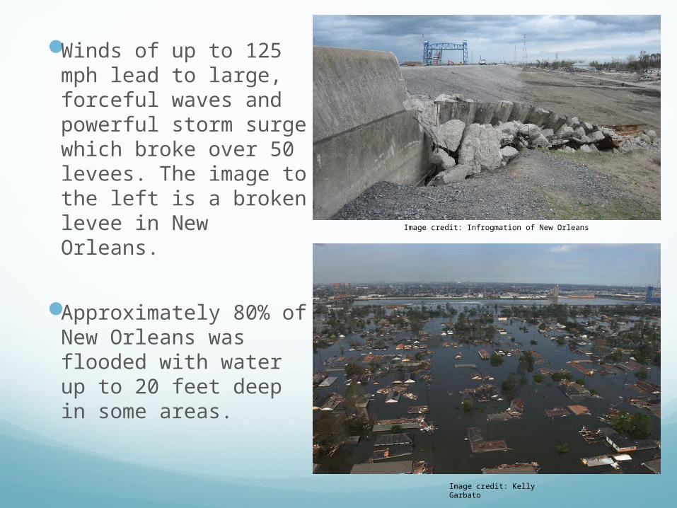
Winds of up to 125 mph lead to large, forceful waves and powerful storm surge which broke over 50 levees. The image to the left is a broken levee in New Orleans.
Approximately 80% of New Orleans was flooded with water up to 20 feet deep in some areas.
Image credit: Kelly Garbato
Image credit: Infrogmation of New Orleans