Embed Size (px)
Citation preview
HUMAN
GEOGRAPHY
By Brett Lucas

POLITICAL GEOGRAPHY

Overview
States
Nationalism
National Boundaries
U.S. Political Geography

States

Defining States
Problems of defining states
Korea: one state or two?
China and Taiwan: one state or two?
Western Sahara
Varying sizes of states
Development of the State Concept
Development of the state concept
Ancient and medieval states
Colonies

United Nations Members
The UN has increased from 51 Member-States in 1945 to 192 in 2007. There are also
some Stateless Nations in the world.

Antarctica: National Claims
Antarctica is the
only large
landmass that is
not part of a state,
but several
countries claim
portions of it

Stateless Nations
Nations of people with no official State boundaries.
A State is a territory on the ground, usually an official line on a map.
A Nation is the people who live within the territory, which means not all nations have STATES.
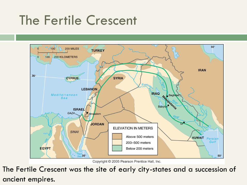
The Fertile Crescent
The Fertile Crescent was the site of early city-states and a succession of
ancient empires.

Colonial Possessions, 1914
By the outbreak of World War I, European states held colonies throughout the
world, especially throughout Africa and in much of Asia
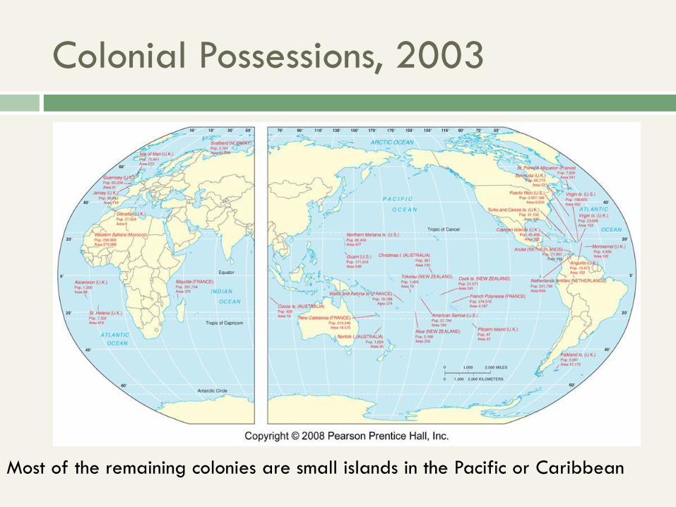
Colonial Possessions, 2003
Most of the remaining colonies are small islands in the Pacific or Caribbean
Nationalism
Nationalism
Nations, states, and nation-states
Centripetal and centrifugal forces
State boundaries and shapes

Nationalism

Nationalism

From culture…
Languages and dialects
Cause or symbol of cultural difference
Diffusion by migration or conquest
Religious beliefs and practices
Spatial distribution, diffusion, landscape
…to territory
Languages and territory
Official languages, multilingualism
Religion and territory
Religion as differentiator
Control of sacred sites
Freedom to practice religion

Political Geography
How is space divided into territories?
Distribution of political phenomena
Spatial patterns of control
Conflicts over territories and borders

States & Sovereignty
Independent political unit
Permanent population, defined territory
Control over internal and foreign affairs
(sovereignty)
Recognized by other states
States & Sovereignty
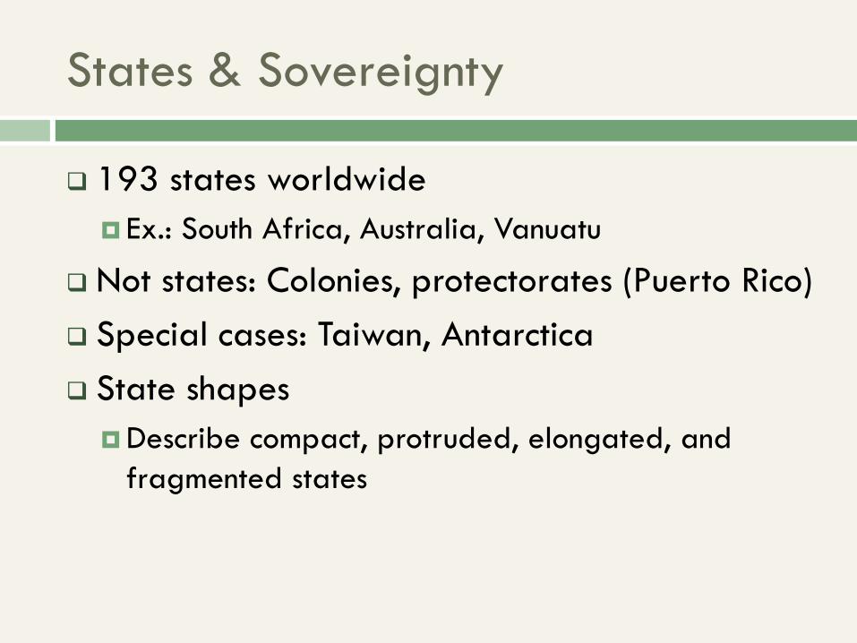
193 states worldwide
Ex.: South Africa, Australia, Vanuatu
Not states: Colonies, protectorates (Puerto Rico)
Special cases: Taiwan, Antarctica
State shapes
Describe compact, protruded, elongated, and
fragmented states

Compact State
A politico-geographic term to
describe a state that possesses a
circular, oval, or rectangular
territory in which the distance
from the center to any point on
the boundary exhibits little
variation
Cambodia, Uruguay, and Poland
are examples

Elongated State
A state whose territory is
decidedly long and
narrow; its length is at
least six times greater than
its average width
Chile, Vietnam, and Laos
are classic examples

Protruded State
A Type of territorial
shape that exhibits a
narrow, elongated land
extension leading away
from the main body of
the territory
Thailand and Myanmar
are leading examples
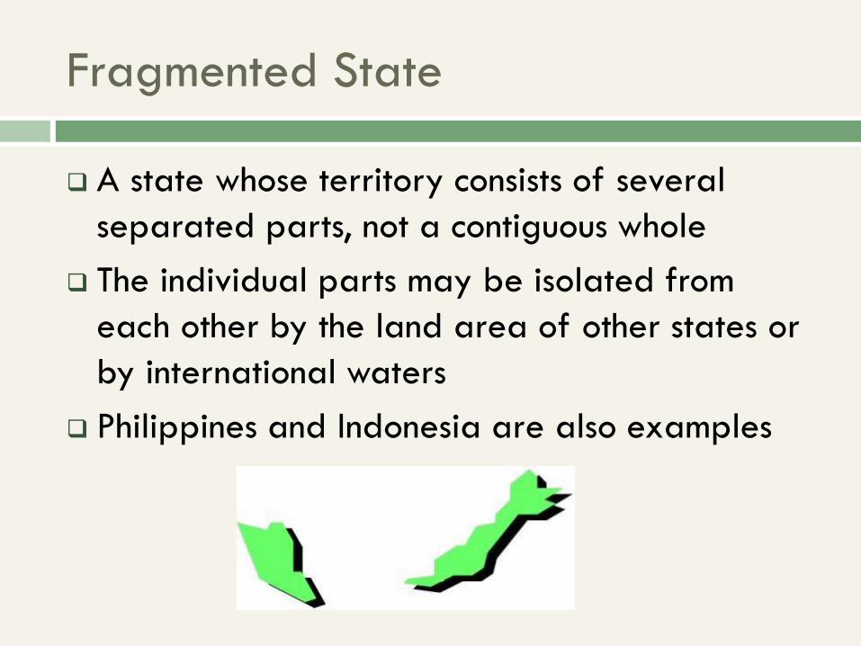
Fragmented State
A state whose territory consists of several
separated parts, not a contiguous whole
The individual parts may be isolated from
each other by the land area of other states or
by international waters
Philippines and Indonesia are also examples

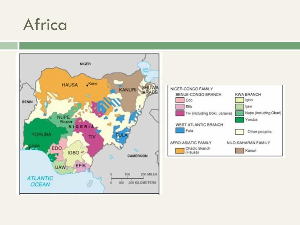
African States
Southern, central,
and eastern
Africa include
states that are
compact,
elongated,
protruded,
fragmented, and
perforated
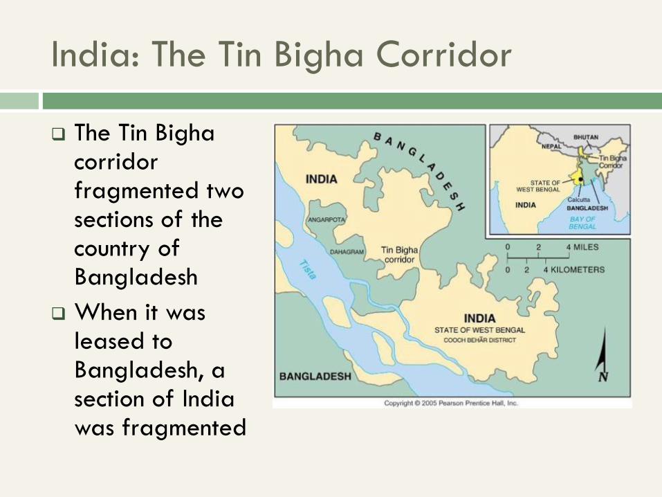
India: The Tin Bigha Corridor
The Tin Bigha corridor fragmented two sections of the country of Bangladesh
When it was leased to Bangladesh, a section of India was fragmented

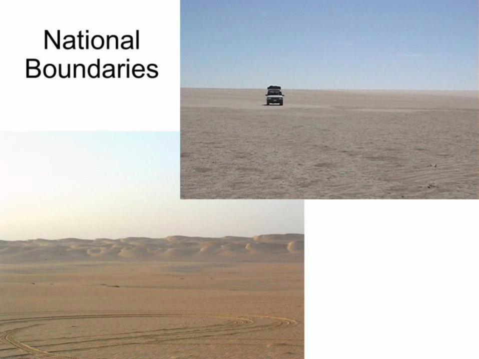
Frontiers in the Arabian Peninsula
Several states in
the Arabian
Peninsula are
separated by
frontiers rather
than precise
boundaries

Aozou Strip: A Geometric Boundary
The straight
boundary between
Libya and Chad
was drawn by
European powers,
and the strip is the
subject of
controversy
between the two
countries

Division of Cyprus
Cyprus has been divided into Green and Turkish portions since 1974

What is a Nation?
Group with a common decent, culture,
language or religion
Occupying a particular territory
Strong sense of unity
“An imagined political community”

Nation-states
When a nation and a state are the same
A sovereign territory with a distinct nation, or
people
Stronger in theory than reality
Examples: Iceland and Japan

States without a Nation
Multinational states (Switzerland, U.S.)
May still exhibit nationalism
Newly independent states (Africa, Central
Asia)
Common identity may be less contentious
Africa

Nations without States
Distinct group of people without sovereign
territory
Kurds, Basques, First Nations, Palestinians
Often seek autonomy or independence

Israel and Palestine
Under Muslim control since Crusades
WWI: Great Britain mandate
Jewish migration allowed; increase during and after
WWII
UN partition in 1947

Israel and Palestine
Independence in 1948
War the next day
1949 armistice line
current international
standard

Israel and Palestine

Israel and Palestine
1967 Six-Day War
Israel’s preemptive war
Sinai Peninsula, Gaza, West Bank
1973 Yom Kippur War (Ramadan War)
Israel defends itself
U.S. support leads to oil crisis

Israel and Palestine
1979 Camp David Accords
Peace with Egypt
First recognition of Israel by Arab state
1981 Golan Heights annexed
1994 start of a Palestinian state

Israel and Palestine

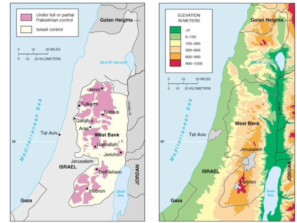
Obstacles to peace
Jewish settlements in West Bank
Jerusalem
Physical geography
Topography and security
Water

Separatist movements
Territory (homeland)
Nationality
Peripheral location
Social and/or economic inequality

Centripetal Forces
Holding a state together
Nationalism
Self-identification with the state
Acceptance of national goals
Iconography

Centripetal Forces
Central institutions
Schools, churches, military
Infrastructure
Transportation and communication networks

Centrifugal Forces
Destabilize a state
Nationalism
Persecution by majority
Desire for autonomy
Geographic fragmentation

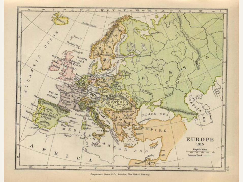
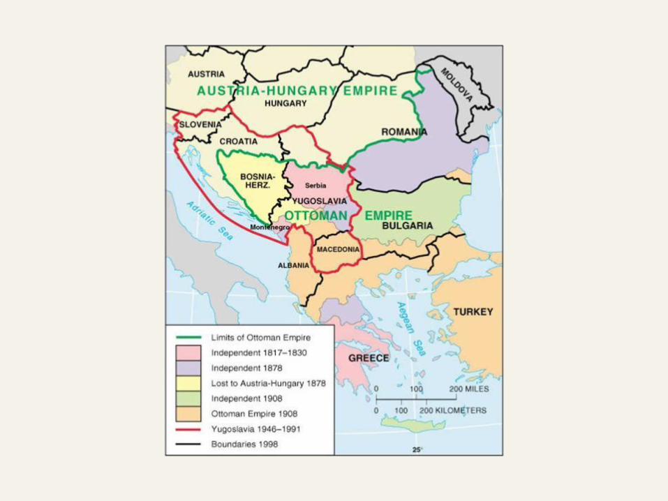
Balkan Peninsula
History of ethnic, religious, linguistic diversity
Ruled by Austria-Hungary, Ottomans
Assassination sparked WWI
Yugoslavia created by Allies


Balkan Peninsula
WWII: Croatians welcome Germans
Soviets and Tito liberate the country
Communist dictatorship 1953-1980
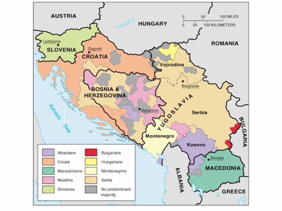
Six autonomous republics
Five nationalities, four languages, three religions
(two alphabets)

Balkan Peninsula
New countries: Slovenia, Croatia, Macedonia,
Yugoslavia (Serbia)
Bosnia and Herzegovina
40% Bosnian Muslim, 32% Serbian, 18% Croatian
(4.2 million total)
Ethnic cleansing of Bosnian Muslims

Balkan Peninsula
250,000 dead; 2.7 million refugees of 4.2
million (half returned)
Dayton Accords (1995)
Two republics
Rotating presidency


Balkan Peninsula
Multinational state: Yugoslavia
Nations: Serbia, Bosnia
States: Bosnia and Herzegovina, Croatia
Nation-state: Slovenia

Cooperation among States
Political and military cooperation
The United Nations
Regional military alliances
Economic cooperation
The European Union

The European Union and NATO
NATO and the European Union have expanded and
accepted new members as the Warsaw Pact and
COMECON have disintegrated

The European Union and NATO
European Boundary Changes
Twentieth-century boundary changes in Europe,
1914 to 2003
Germany’s boundaries changed after each world
war and the collapse of the Soviet Union
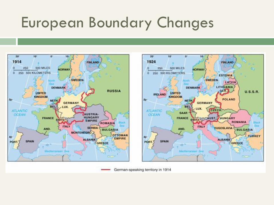
European Boundary Changes

European Boundary Changes

National Boundaries

National Boundaries
Limits of sovereignty
Three-dimensional
14 miles of ocean; 200 miles of fishing rights
Frontier zones vs. boundaries
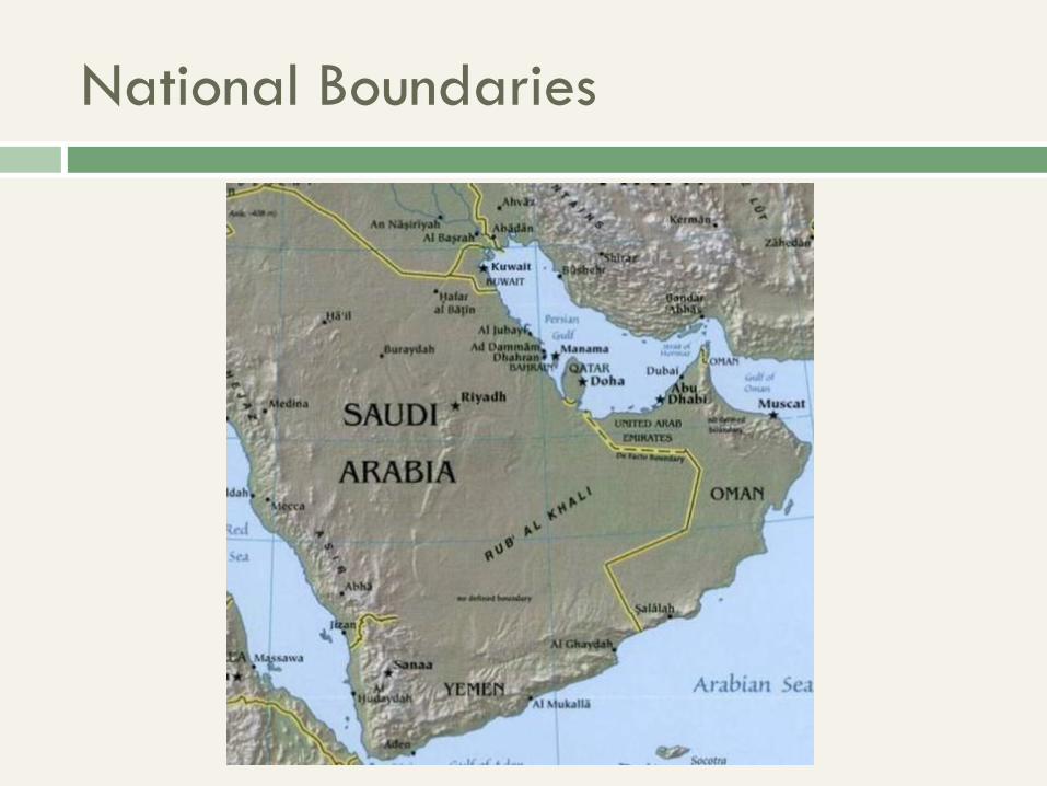
National Boundaries
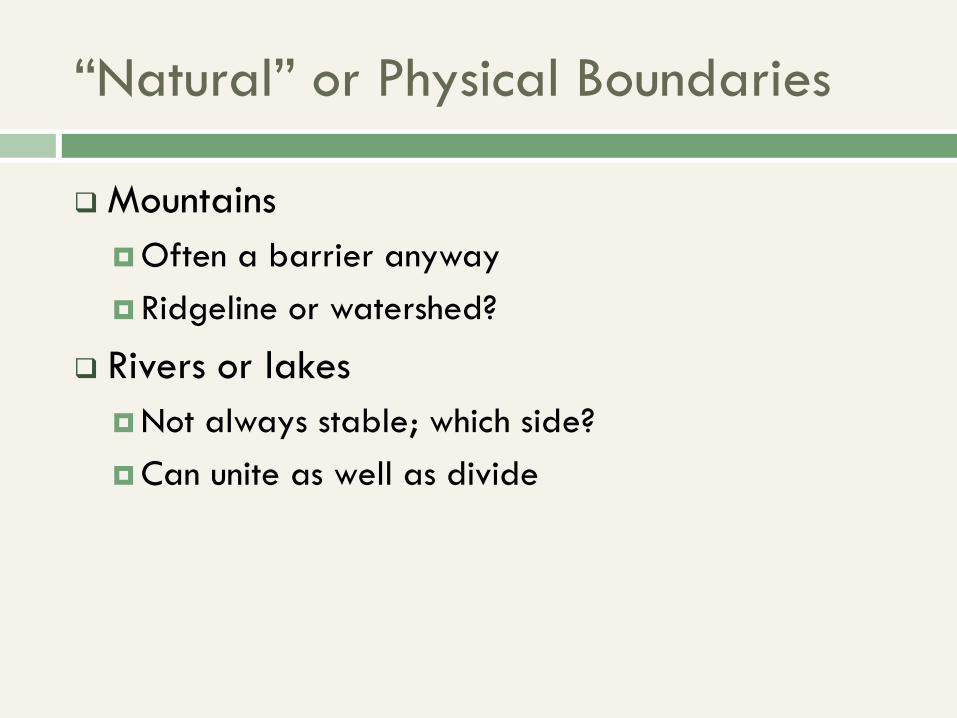
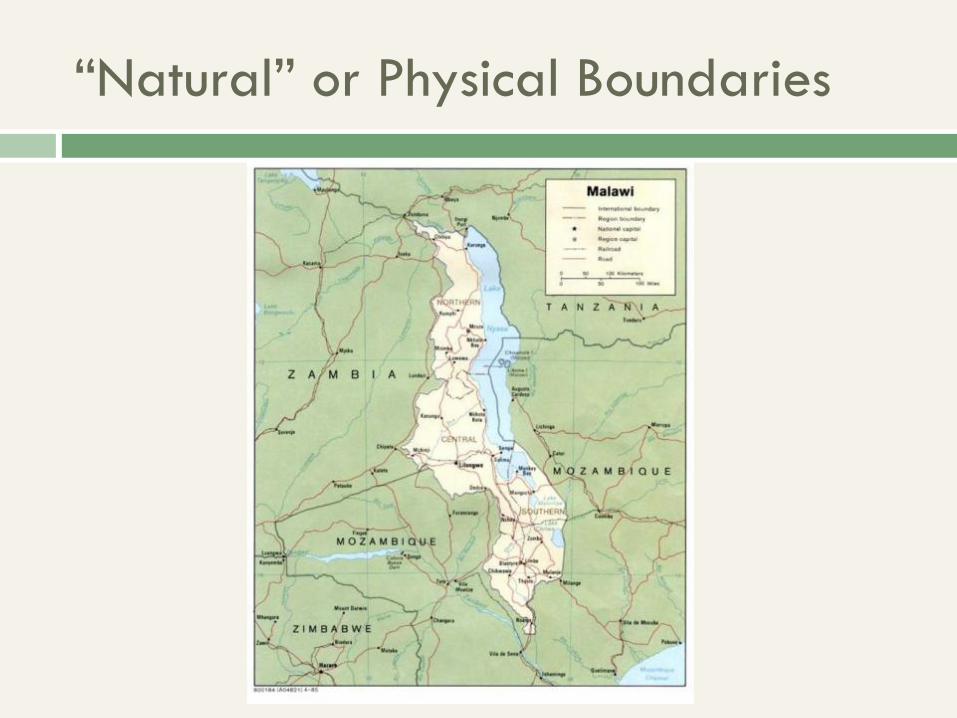
“Natural” or Physical Boundaries
Mountains
Often a barrier anyway
Ridgeline or watershed?
Rivers or lakes
Not always stable; which side?
Can unite as well as divide

“Natural” or Physical Boundaries
“Natural” or Physical Boundaries

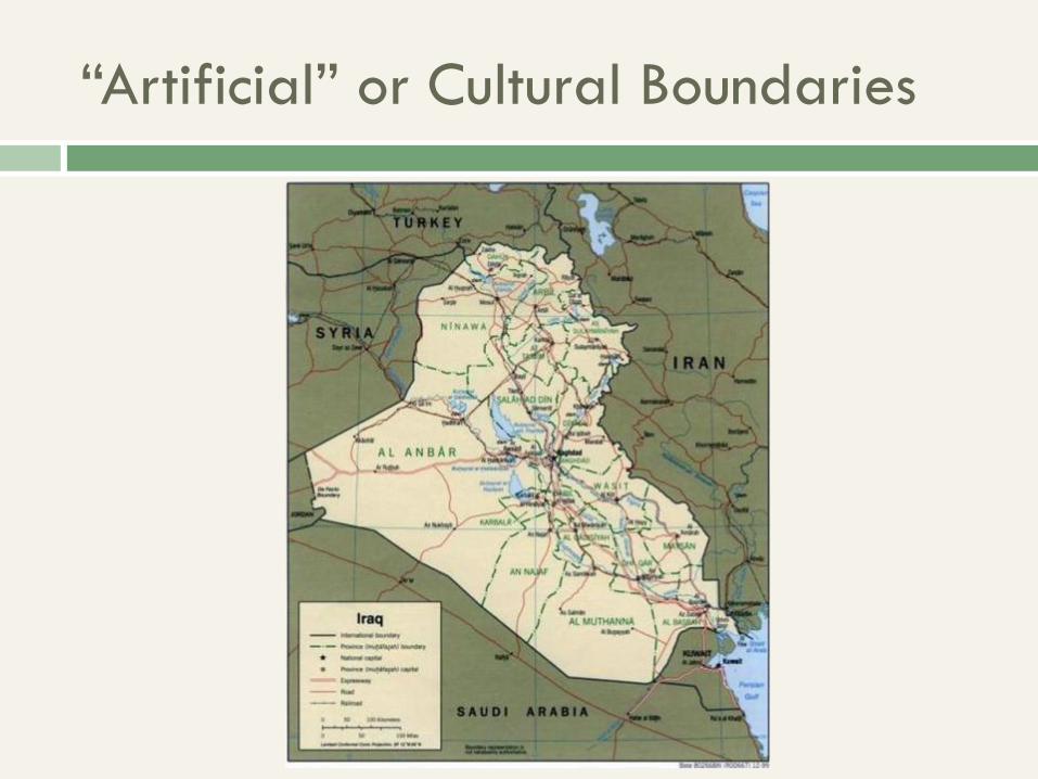
“Artificial” or Cultural Boundaries
Geometric
Parallels or meridians
Typically sparsely settled
Religious or linguistic
Criteria for dividing states

“Artificial” or Cultural Boundaries
“Artificial” or Cultural Boundaries


Ethnic Groups in Southwest Asia
Ethnic boundaries do not match country boundaries, especially in Iraq,
Iran, Afghanistan, and Pakistan

Antecedent vs. Subsequent
Antecedent
Drawn before dense settlement
Subsequent
After cultural landscape is established
Consequent
Take landscape into account
Superimposed
No regard for cultural landscape


Boundaries as sites of conflict
Landlocked states
Water as boundary
Rivers across boundaries
Nations not matching state boundaries
Resource access or use

Internal State Structure
Core area: historical center
Densest population, largest cities
Most economically developed
Ex.: Moscow, London, eastern U.S.
Not found in all countries


Unitary vs. Federal States
Unitary: highly centralized, homogeneous
Strong national identity
Centralization in core area
European cores, newly independent states


Unitary vs. Federal States
Federal: decentralized government
Provinces or states have considerable responsibility
Capital often deliberately created in core, or
periphery


U.S. Political Geography

Election 2000: Regional Differences
Presidential election results by county and state illustrate differences in
regional voting patterns

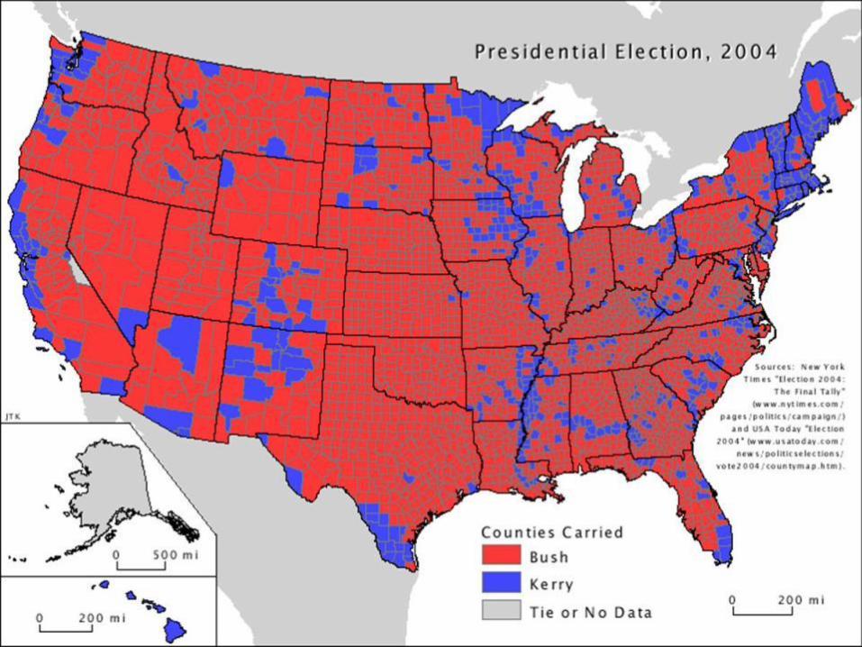

2008 Election
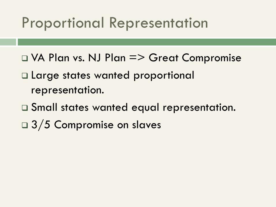
Proportional Representation
VA Plan vs. NJ Plan => Great Compromise
Large states wanted proportional
representation.
Small states wanted equal representation.
3/5 Compromise on slaves

Proportional Representation
100 Senators, 435 Representatives
Basis for Electoral College
All votes are not equal
Minimum representation
Winner-take-all

Reapportionment
Population changes with migration
Need to reapportion seats
Based on Census
Every state keeps at least one Representative
Method of equal proportions
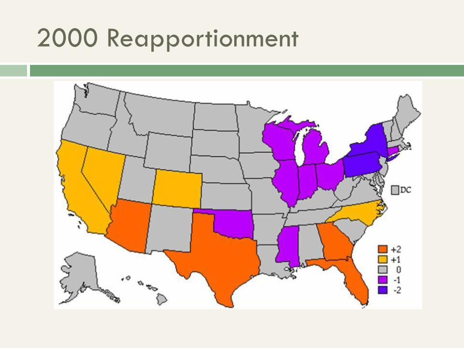
2000 Reapportionment

2010 Reapportionment

Redistricting
Redrawing district boundaries based on
reapportionment
In most states, done by legislature
Meant to maintain equality of votes
Can be manipulated

Gerrymandering
Discriminatory redistricting
Consolidating power
Diluting opponents’ power

Gerrymandering
Racist gerrymandering after Civil War
Put all minorities in one district
Dilute them among all districts
1982 Voting Rights Act
Majority-minority districts
Constitutional issues


Gerrymandering: Florida & Georgia
State legislature
boundaries were
drawn to maximize the
number of legislators
for Republicans in
Florida and Democrats
in Georgia
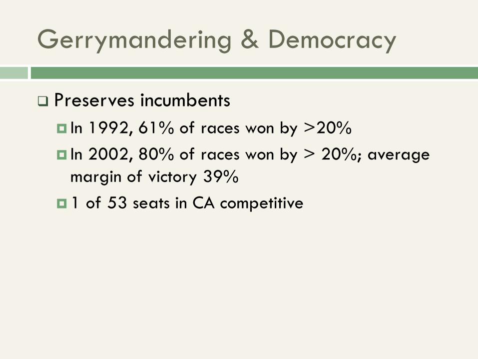
Gerrymandering & Democracy
Preserves incumbents
In 1992, 61% of races won by >20%
In 2002, 80% of races won by > 20%; average
margin of victory 39%
1 of 53 seats in CA competitive
Gerrymandering & Democracy
Removes decision-making from voters
“Candidates choose the voters”
More polarized Congress