Embed Size (px)
Citation preview

http://upload.wikimedia.org/wikipedia/commons/a/ae/EastHanSeismograph.JPG
“SEISMOSCOPE” INVENTED IN CHINA IN 133 BC (HAN DYNASTY)

Collapsed buildings: Dec. 7, 1988, Armenia, M6.9, ~25,000 people died
http://www.pep.bc.ca/images/hazard_prep/Earthquake_Photos/11_236.jpg
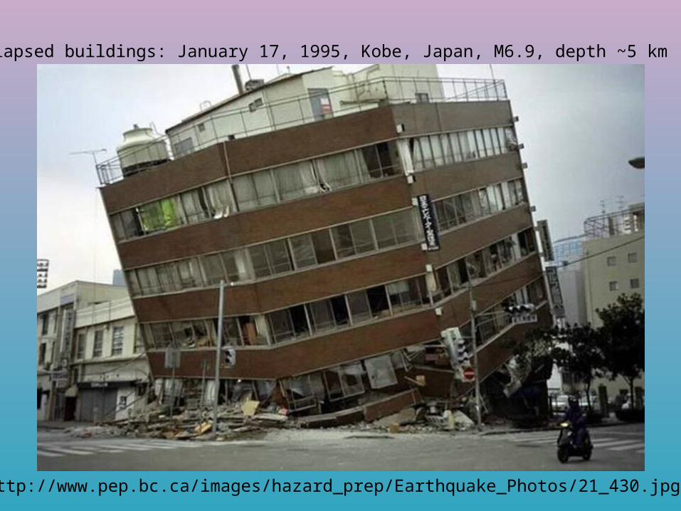
Collapsed buildings: January 17, 1995, Kobe, Japan, M6.9, depth ~5 km
http://www.pep.bc.ca/images/hazard_prep/Earthquake_Photos/21_430.jpg
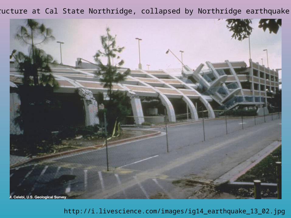
Parking structure at Cal State Northridge, collapsed by Northridge earthquake (01/17/94)
http://i.livescience.com/images/ig14_earthquake_13_02.jpg

http://911research.wtc7.net/wtc/analysis/compare/docs/taiwan_six.jpg
September 21, 1999 M 7.6 Taichung, Taiwan, killing 2,375 people.The quake toppled 13,000 high-rise apartments

CollapsedBuildings:1985 Mexico City
http://pro.corbis.com/images/OF008330.jpg?size=67&uid=%7BEE6BD845-A8E9-4559-ABB5-6965E039DF17%7D

Building collapse styles, Mexico City earthquake, 1985


Collapsed transportation infrastructure: Kobe 1995
http://www.maelor-humanities.org.uk/GCSEhum/Resources/PP-photos/pp-KeyIss-1/kobe-earthquake.jpg

Collapsed freeway, 1989 Loma Prieta earthquake, CA
http://earthquake.usgs.gov/regional/nca/3Dgeologic/images/Cypress_LCluff_sm.jpg
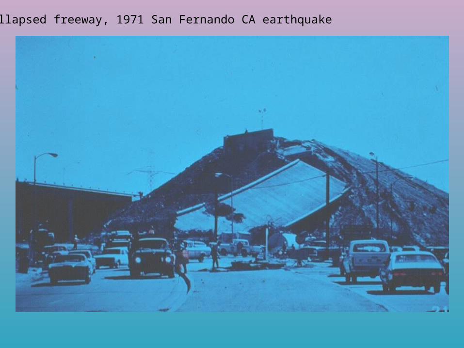
Collapsed freeway, 1971 San Fernando CA earthquake
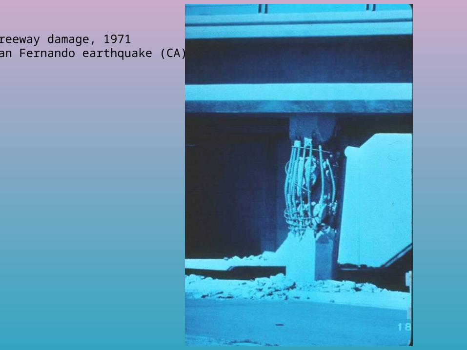
Freeway damage, 1971San Fernando earthquake (CA)

Collapsed freeway, 1971 San Fernando CA earthquake

Collapsed Infrastructure: 1964 Good Friday earthquake, Alaska
http://www.pep.bc.ca/images/hazard_prep/Earthquake_Photos/7_155.jpg

http://www.johnmartin.com/earthquakes/eqshow/images/64700405.GIF
COMPRESSED RAILROAD, 1964 GOOD FRIDAY EARTHQUAKE, ALASKA

COLLAPSED BRIDGE, NIIGATA, JAPAN, JUNE 16, 1964, M=7.4
http://www.johnmartin.com/earthquakes/eqshow/images/64700409.GIF

Soil Liquefaction: magnitude 7.4 earthquake on June 16, 1964 in Niigata, Japan
http://www.pep.bc.ca/images/hazard_prep/Earthquake_Photos/1_25.jpg
Ground moving and liquefaction on street
Ground moving and liquefaction in park

Foundered/fractured ground: 1964 Good Friday earthquake, Anchorage hts., AK
http://upload.wikimedia.org/wikipedia/commons/a/a5/AlaskaQuake-Turnagain.jpg
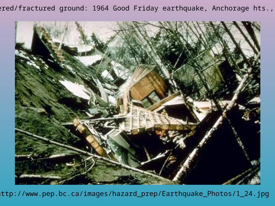
Foundered/fractured ground: 1964 Good Friday earthquake, Anchorage hts., AK
http://www.pep.bc.ca/images/hazard_prep/Earthquake_Photos/1_24.jpg
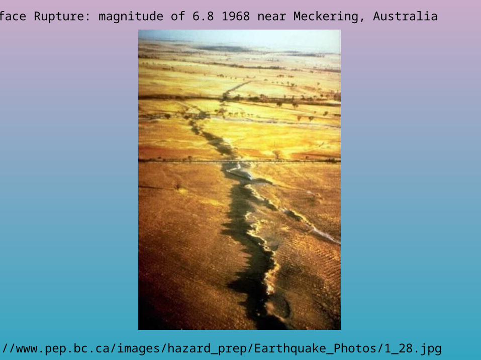
Surface Rupture: magnitude of 6.8 1968 near Meckering, Australia
http://www.pep.bc.ca/images/hazard_prep/Earthquake_Photos/1_28.jpg

http://www.johnmartin.com/earthquakes/eqshow/images/64700410.GIF
LANDSLIDING UNDER RAILROAD, SEATTLE, WA, APRIL 29, 1965, M=6.5

Landslides: 1994 Northridge earthquake, CA
http://pubs.usgs.gov/of/1995/ofr-95-0213/fig16tmb.gif
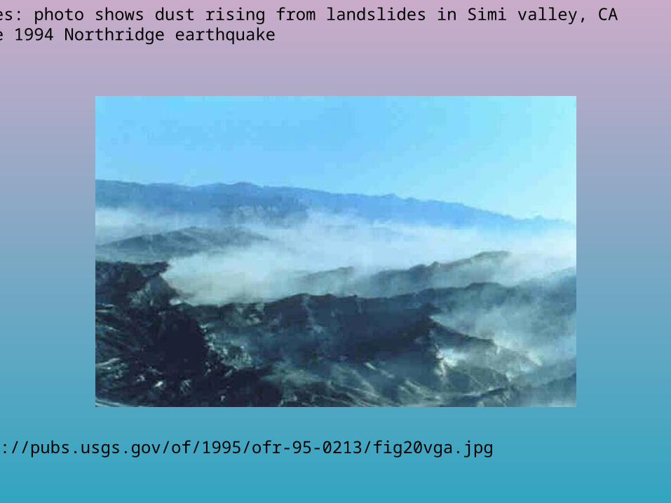
Landslides: photo shows dust rising from landslides in Simi valley, CAafter the 1994 Northridge earthquake
http://pubs.usgs.gov/of/1995/ofr-95-0213/fig20vga.jpg

Landslides: aftershock of 2008 Seichuan earthquake, China
http://www.telegraph.co.uk/telegraph/multimedia/archive/00672/landslide-flee1_672381n.jpg

Landslides: 2008 Seichuan earthquake, China
http://news.xinhuanet.com/english/2008-05/15/xin_00205051509394532409750.jpg

Landslides: 2008 Seichuan earthquake, China
http://2.bp.blogspot.com/_a2JvElU8gh4/SCgx2yl8BbI/AAAAAAAAAF0/HTAxwpUnrwc/s1600/PICT3094%2Bcorrected.jpg

Dammed rivers: 2008 Seichuan earthquake, China
http://scienceblogs.com/highlyallochthonous/2008/05/chengdhu_for_2008135.jpg

http://www.geonet.org.nz/images/news/2008/landslide_view.jpg

Cracked earthen dam: after 1994 Northridge earthquake
http://www.emporia.edu/earthsci/student/dahms3/los_angeles_dam.jpg
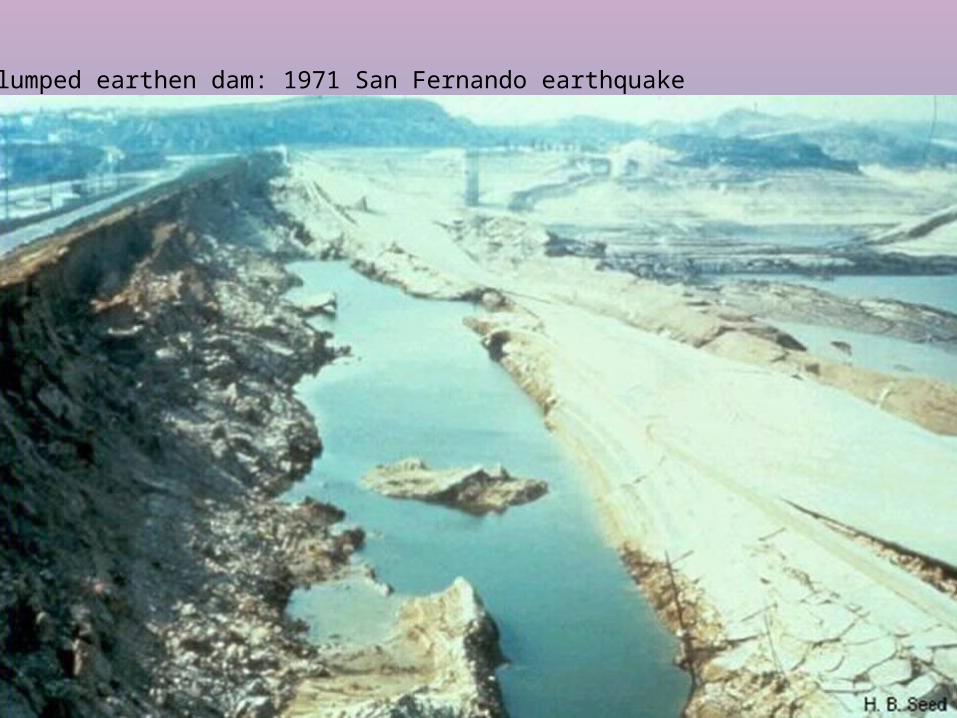
Slumped earthen dam: 1971 San Fernando earthquake
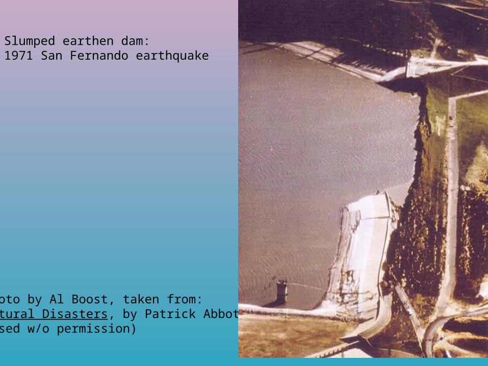
Slumped earthen dam: 1971 San Fernando earthquake
Photo by Al Boost, taken from:Natural Disasters, by Patrick Abbot(used w/o permission)
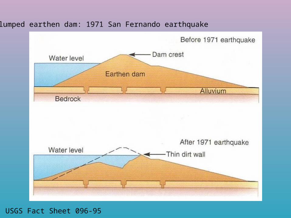
Slumped earthen dam: 1971 San Fernando earthquake
USGS Fact Sheet 096-95

Sand blow:
http://topex.ucsd.edu/es10/lectures/lecture12/sand_blow.jpg

Sand blow in Rann southwest of Khadir Island. New salt marks area of vented water following the earthquake. Photograph by M. Tuttle
http://www.ceri.memphis.edu/gujarat/images/Photo8.jpg
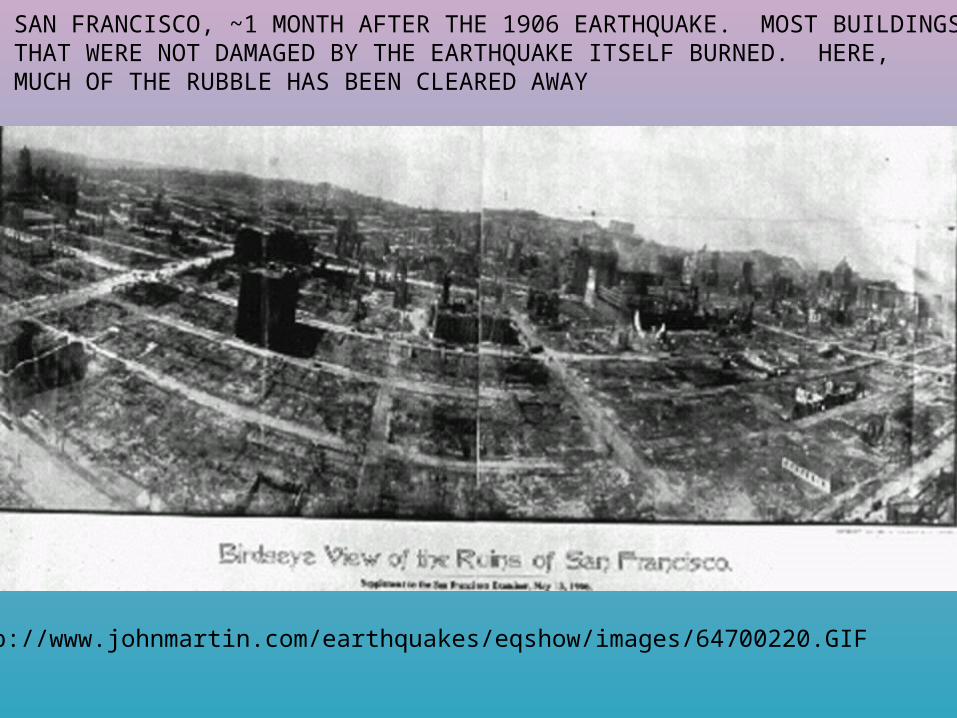
SAN FRANCISCO, ~1 MONTH AFTER THE 1906 EARTHQUAKE. MOST BUILDINGSTHAT WERE NOT DAMAGED BY THE EARTHQUAKE ITSELF BURNED. HERE, MUCH OF THE RUBBLE HAS BEEN CLEARED AWAY
http://www.johnmartin.com/earthquakes/eqshow/images/64700220.GIF

http://pubs.usgs.gov/of/1996/ofr-96-0263/


![Han Dynasty, 206 B.C.E.-220 C.E. “People of the Han” original Chinese Paper invented [105 B.C.E.] Silk Road trade develops; improves life](https://img.pdfslide.us/doc/110x75/5697bff11a28abf838cbb197/han-dynasty-206-bce-220-ce-people-of-the-han-original-chinese.jpg)


