Embed Size (px)
DESCRIPTION
http://fiatech.org/images/stories/events/techconference/2010/presentations/academic_research_advancements/improving-safety-in-urban-excavation-with-mobile-info-and-viz-techs.pdf
Citation preview

1
Sanat A. Talmaki Vineet R. Kamat Suyang Dong Associate Professor
Graduate Students
Construction Engineering and Management Program Department of Civil and Environmental Engineering
University of Michigan
Improving Safety in Urban Excavation with Mobile Information and Visualization Technologies
2 2
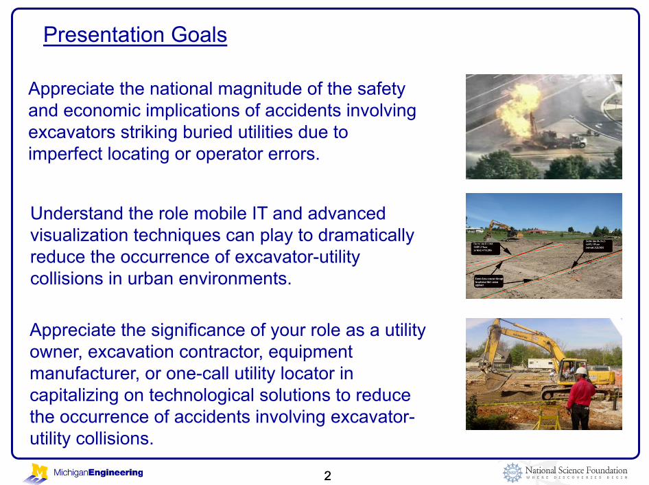
Presentation Goals
Appreciate the national magnitude of the safety and economic implications of accidents involving excavators striking buried utilities due to imperfect locating or operator errors.
Understand the role mobile IT and advanced visualization techniques can play to dramatically reduce the occurrence of excavator-utility collisions in urban environments.
Appreciate the significance of your role as a utility owner, excavation contractor, equipment manufacturer, or one-call utility locator in capitalizing on technological solutions to reduce the occurrence of accidents involving excavator-utility collisions.

3
Damage to Underground Utilities during Excavation has been a Long-Standing Problem with Significant Economic and Safety
Implications
Electricity Gas
Water
Sewer Petroleum
Telephone
Cable TV
Fiber Optic (data)
3
4 4
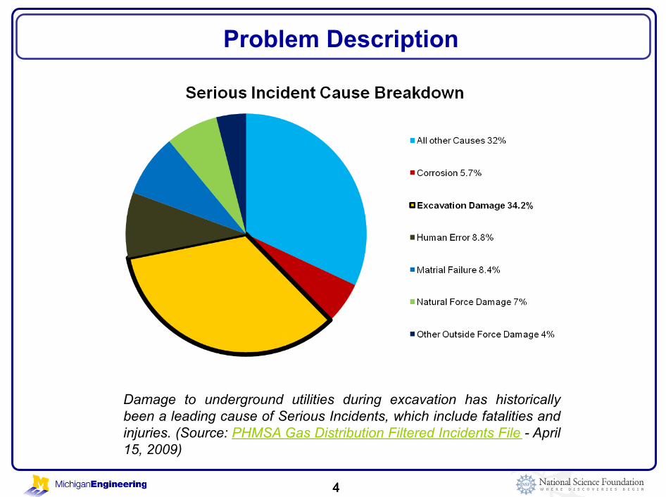
Problem Description
Damage to underground utilities during excavation has historically been a leading cause of Serious Incidents, which include fatalities and injuries. (Source: PHMSA Gas Distribution Filtered Incidents File - April 15, 2009)
4

5 5
" Gas Distribution Statistics
2004-2007:
Total fatalities = 52
Total injuries = 132
Total damage to property = $612 million
Total value of gas lost =
$7 million
Problem Description
Cary, NC (October 11, 2007) A drilling contractor hit a natural gas line that burned out of control for 6 hours, closing a major roadway intersection and forcing the evacuation of nearby businesses.
5
Source: PHMSA Gas Distribution Filtered Incidents File- April 15, 2009, http://www.phmsa.dot.gov/
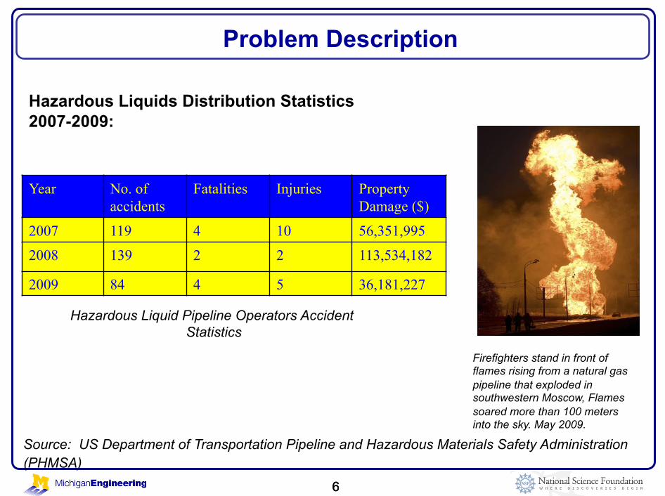
6 6
Problem Description
6
Source: US Department of Transportation Pipeline and Hazardous Materials Safety Administration (PHMSA)
Year No. of accidents
Fatalities Injuries Property Damage ($)
2007 119 4 10 56,351,995 2008 139 2 2 113,534,182
2009 84 4 5 36,181,227
Hazardous Liquid Pipeline Operators Accident Statistics
Firefighters stand in front of flames rising from a natural gas pipeline that exploded in southwestern Moscow, Flames soared more than 100 meters into the sky. May 2009.
Hazardous Liquids Distribution Statistics 2007-2009:

7 7
" One-Call Utility Location System to act as clearing house for all buried utility locations
" Avoid third-party damage to existing underground utilities due to unknown or mislocated utilities.
" Utility location in terms of size, depth and utility materials that can be detected in presence of utility congestion.
Current Practices of Incident Prevention
Current practice of calling MISS DIG and marking utilities on surface using spray paint
7

8 8
Current Field Process with One-Call Locator System
Current practice of calling MISS DIG and marking utilities on surface using spray paint
8
MISS DIG informs member company
Excavator calls MISS DIG Office
Member Company sends out
Field Locator Approximate Horizontal
Location marked with stakes/paint/
flags

9
Excavator Operator’s View
The surface markings and spray paint are long gone!

10
Interface for the collision avoidance augmented reality system
Excavator Operator First-Person View – Visual Simulation

11
Virtual Reality Visualization

12
Milgrim’s Reality-Virtuality Continuum
Virtual Reality Versus Augmented Reality

13
Augmented Reality Visualization

14
Integrated Collision Avoidance Framework

15
Integrated Collision Avoidance Framework Components

16 16
Technical Approach and System Components
16
Augmented Reality (AR)
Global Positioning
System (GPS)
Geophysical Technologies
Geographic Information Systems (GIS)
Technical Approach
Ground Penetrating Radar

17 17
Status of Archived As-Built Information
17
" Significant percentage of buried utility data is archived on paper drawings (or scanned drawings, e.g. PDF)
Preprocessing to create GIS map and identify utility lines.

18 18
Pre-Processing of Archived As-Built Information
18
Original Drawing
Converted to GIS Shapefiles
Converted to 3D Models

19 19
Technical Approach and System Components
19
Augmented Reality (AR)
Global Positioning
System (GPS)
Geophysical Technologies
Geographic Information Systems (GIS)
Technical Approach
Ground Penetrating Radar
20
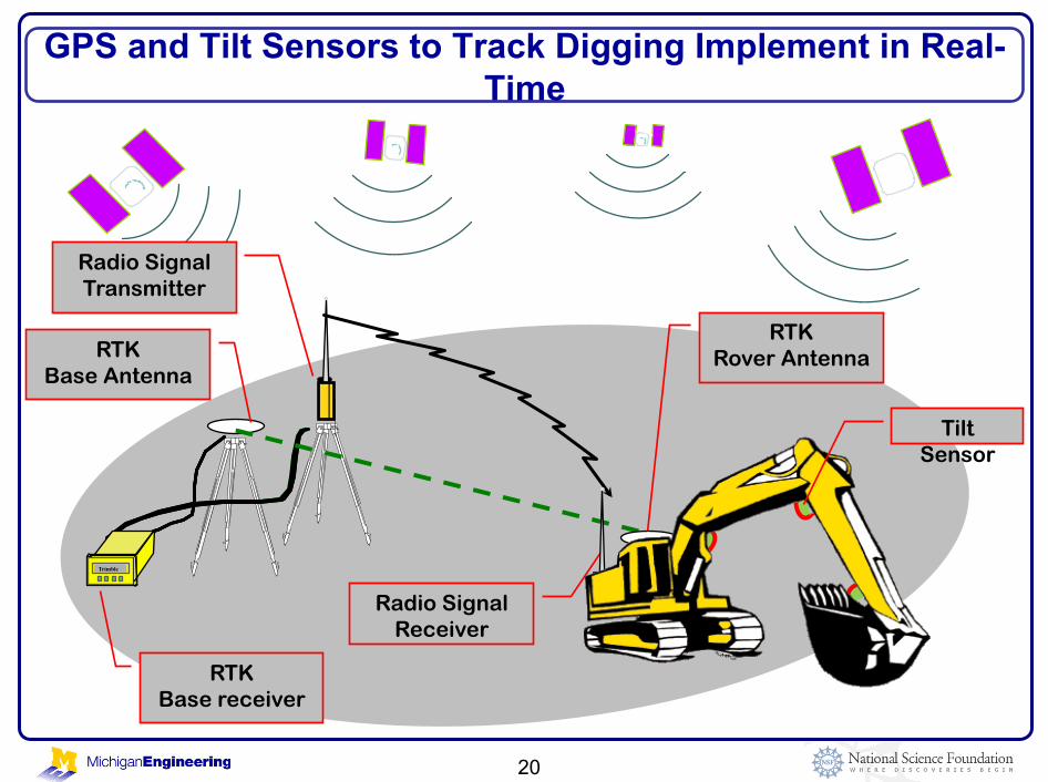
GPS and Tilt Sensors to Track Digging Implement in Real-Time
Trimble
Radio Signal Transmitter
RTK Base Antenna
RTK Base receiver
Radio Signal Receiver
RTK Rover Antenna
Tilt Sensor

21
Collision Avoidance by Tracking Digging Implement in Real-Time
Not in range 5 feet
1 foot

22 22
Technical Approach and System Components
22
Augmented Reality (AR)
Global Positioning
System (GPS)
Geophysical Technologies
Geographic Information Systems (GIS)
Technical Approach
Ground Penetrating Radar
23 23
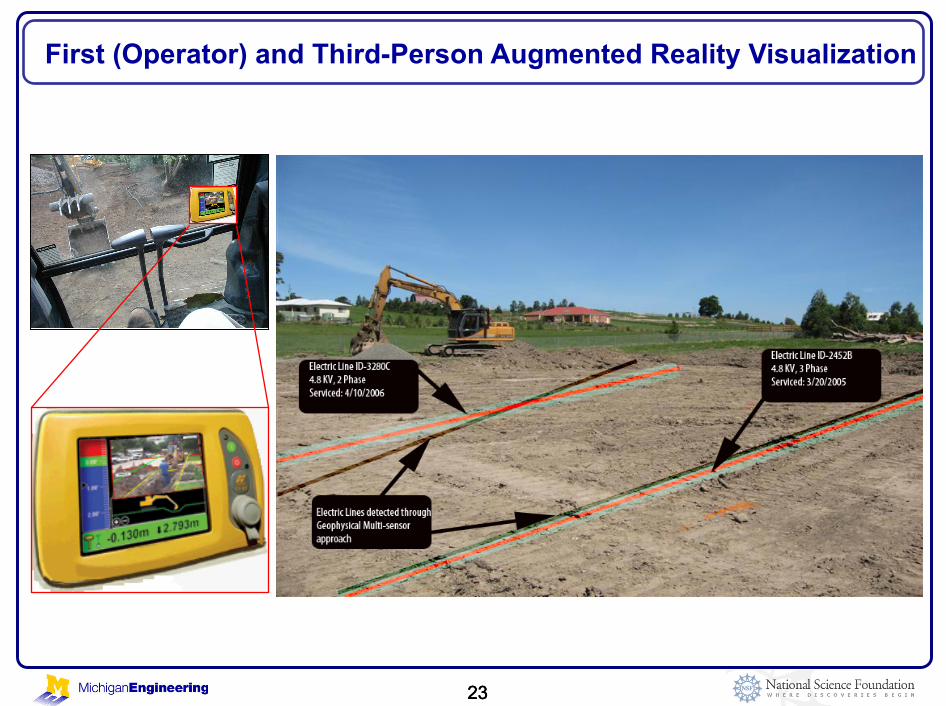
First (Operator) and Third-Person Augmented Reality Visualization
23

24
Developed mobile computing backpack
Prototype for Third-Person Augmented Reality Visualization

25 25
" The proposed technical approach encompasses 3 principal ideas:
Tracking of excavator’s digging implement along with approximate sensing of buried utility locations using geophysical technologies
Visualization of 3D GIS buried utilities data in real-time using Augmented Reality
Implementation of Collision Avoidance System based on proximity queries between excavator’s current location and known location of utilities buried in the vicinity
Summary of Technical Approach
25
26 26
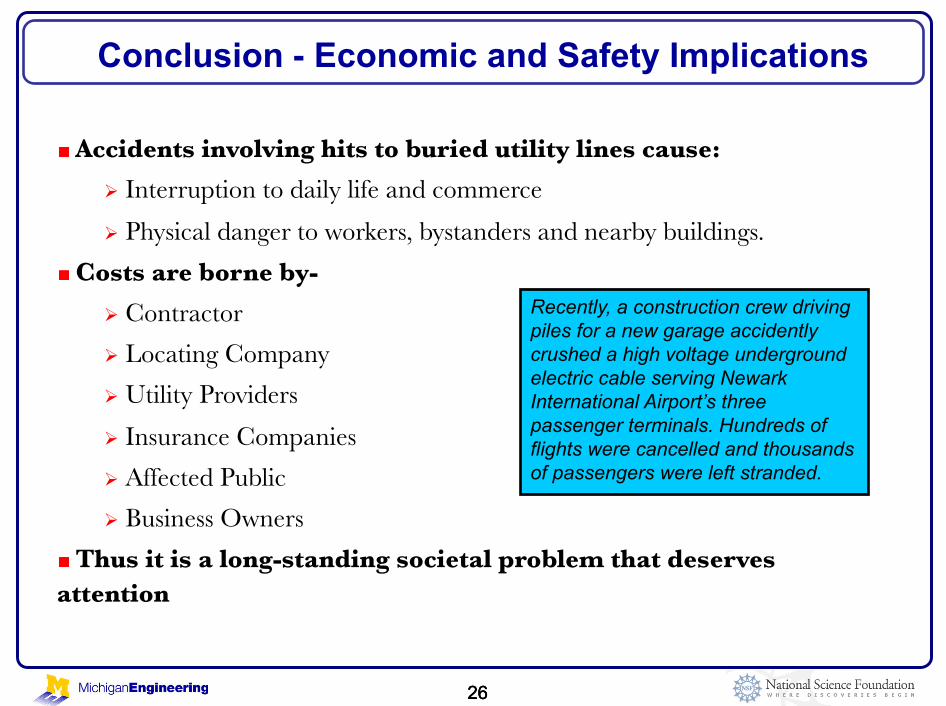
" Accidents involving hits to buried utility lines cause:
Interruption to daily life and commerce
Physical danger to workers, bystanders and nearby buildings.
" Costs are borne by-
Contractor
Locating Company
Utility Providers
Insurance Companies
Affected Public
Business Owners
" Thus it is a long-standing societal problem that deserves attention
Conclusion - Economic and Safety Implications
26
Recently, a construction crew driving piles for a new garage accidently crushed a high voltage underground electric cable serving Newark International Airport’s three passenger terminals. Hundreds of flights were cancelled and thousands of passengers were left stranded.

27 27
U.S. National Science Foundation • The presented work is supported by the US National Science
Foundation (NSF) through grants CMMI-0448762 and CMMI- 0726493. NSF’s support is gratefully acknowledged. Any opinions, findings, conclusions, and recommendations expressed in this paper are those of the presenter and do not necessarily reflect the views of the NSF.
DTE Energy Company • Mr. Ronnie May • Mr. James DeKimpe, Mr. William Terrasi • Mr. John Squires, Mr. Steven Facine • Mr. Roger Lane
FIATECH • Ms. Nicole Testa Boston • Dr. Sami Kazi, VTT
Acknowledgments