Embed Size (px)
Citation preview

How to Read a Map
• A Map is a graphic source which shows a place and important information about it.
• There are many types of maps and they have the same basic type of information.
• What kinds of information do remember could
be on a map?

All maps should have…
• Titles to tell us what the map is a map of and what is special about it.
• A Compass Rose to give us the directions on a map.• A Key to tell us what the symbols on a map stand
for. What are some symbols you may see in a key?• A Scale to tell us the distance in miles or kilometers
that 1 inch or 1 millimeter is equal to.

Latitude & longitude lines are found on a map. Each location on a map has a latitude and
longitude so we can always find it.
Which lines go north and south on a map?Latitude or Longitude
Which lines go east and west on a map?Latitude or Longitude
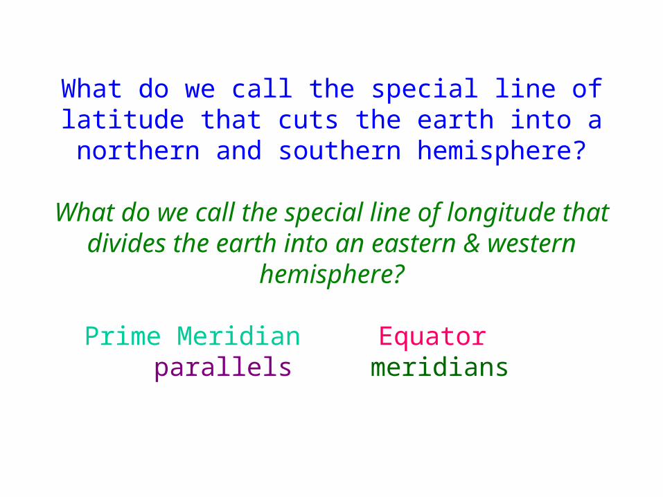
What do we call the special line of latitude that cuts the earth into a northern and southern hemisphere?
What do we call the special line of longitude that divides the earth into an eastern & western
hemisphere?
Prime Meridian Equator parallels meridians

There are many types of maps…• What is the name of a map that is
round like a ball and is on a pole?• What do we call a map that
shows geographic features of a place?
• What do we call a map that shows something special about a place like population, or religion?
• Special purpose map
• Globe
• Geographical map
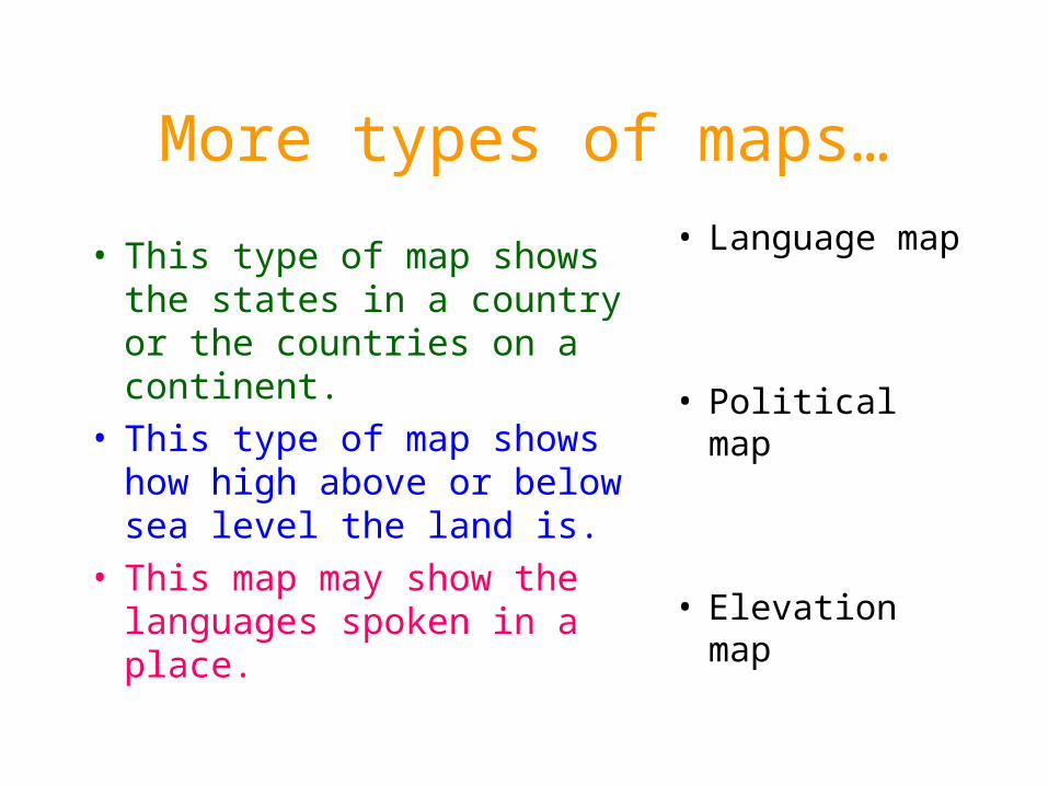
More types of maps…
• This type of map shows the states in a country or the countries on a continent.
• This type of map shows how high above or below sea level the land is.
• This map may show the languages spoken in a place.
• Language map
• Political map
• Elevation map

Do you know…• What do map makers use on a map
key instead of color when the map is printed in black and white?
• What is the name of the imaginary pole that runs through the globe?
• What are the large areas of land masses on a map called?
• What are the large areas of blue on a map or globe?
• How much of the earth’s surface is covered with water? Land?
• 2/3 or 75%
• 1/3 or 25%
• Bodies of water
• Continents
• Shading/patterns
• The axis

Can you name the
• Continents?
• Majors oceans/seas?
• Large body of ice at
the South Pole?
• The continent that is a country?
Can you find these on a map?
• The continent you live on
• The continent of Africa
• Where you live
• The axis on a globe

Be sure to study for your map test!
• Take home your social studies book and review the map section at the front of the text book
• Take home your review sheet and study from it a little each night
Good Luck to you!