Embed Size (px)
Citation preview
How to make a map in 25 How to make a map in 25 years!years!
ETeMII, workshop Reference Data
Rome, 18 October 2000 ir.L.M.Murre

ContentContent
The Dutch Topographical Base Map– Historical overview– The philosophy– The organisation– The product
Access and Dissemination– Institutional issues– Organisational issues

Historical overviewHistorical overview
1975 Cadastre receives governmental order
End 80’s financial problems 1992 signing general agreement
– national foundation (Joint Venture)– regional PPP’s
1998 Strategy Plan 1998-2002
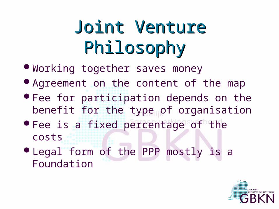
Joint Venture PhilosophyJoint Venture Philosophy
Working together saves money Agreement on the content of the map Fee for participation depends on the
benefit for the type of organisation Fee is a fixed percentage of the costs Legal form of the PPP mostly is a
Foundation

National partners:- Cadastre- KPN Telecom
NJV DTBM
Organisational modelOrganisational model
Regional Joint Ventures
Regional Utility Comp.
Umbrella organisations:
- Union of Dutch municipal.
- Union of Water Comp.
- Union of Water boards
- Union of Energy Comp.
Gemeenten
Municipalities
Independent
Municipalities
Cadastre

OrganisationsOrganisations
National Joint Venture (foundation)– members are umbrella organisations on
national level an two national organisations 11 Regional Joint Ventures
– utility companies, municipalities, water boards etc.
50 Municipalities
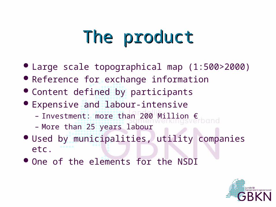
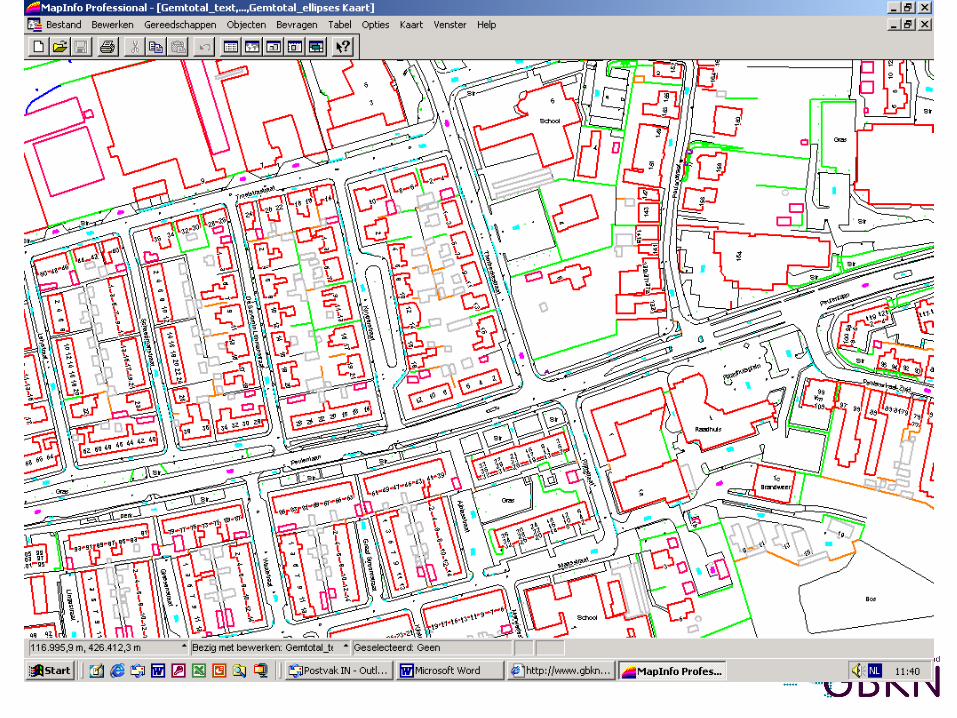
The productThe product
Large scale topographical map (1:500>2000) Reference for exchange information Content defined by participants Expensive and labour-intensive
– Investment: more than 200 Million €– More than 25 years labour
Used by municipalities, utility companies etc. One of the elements for the NSDI

Users Applications
•Utility Companies (energy, water telecom etc.)•Municipalities•Water boards•Cadastre•Others...
•Planning•Building activities•Managing of rural estate and assets (and data about the rural estates and assets)

Combination with cable-information and boundary-info

Access to digital Photographs
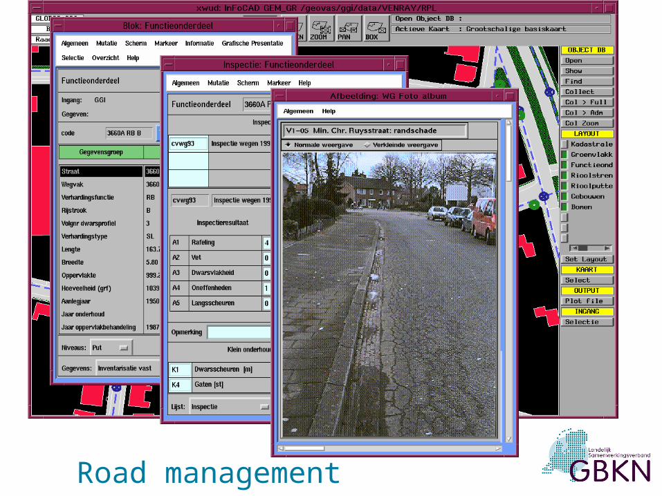
Road management

Access and DisseminationAccess and Dissemination
Institutional Issues– Product reference guide or object
catalogue, based on the Geo-information Terrain Model
– No mandates for free access, participation in the joint venture is needed
– Code of conduct about use (licensed)– Different prices (high)– Ownership is in hand of the RJV
Access and Dissemination Access and Dissemination (cont(cont.).)
Organisational issues– RJV’s have small offices for managing the
data, updating and distribution– Most of the the data management is done
by the Cadastre– No sets of metadata are available– The attitude is changing to customer-
oriented

Access and Dissemination Access and Dissemination (cont.)(cont.)
Organisational Issues (cont.)– The product is changing to an information-
service – Plans for changing the national
organisation model– Accessibility by Internet is in progress– Feasibility study started for Authentic
Registration (NSDI) together with other registrations (Buildings, TOP10vector)

New organisational modelNew organisational model
Base Map HollandBase Map HollandNational Participants, like:CadastreKPN-telecomNUON, UPC, etc.Umbrella Organisations
RJV-representative
NJV DTBM
MB
Office Base Map Holland
Regional Joint
Ventures

User/Viewer
dataset
dataset
dataset
VIEW Telfort
Amsterdam

Thank You for your attention!