Embed Size (px)
Citation preview
How Much Habitat is Enough?
Third Edition
At a minimum, the greater of (a) 10%
of each major watershed and 6% of
each subwatershed,
or (b) 40% of the historic watershed
wetland coverage, should be
protected and restored.
30 m wide naturally vegetation
adjacent to streams, greater
depending on conditions
75% of stream length should be
naturally vegetated
Significant impairment in stream
water quality and quantity is highly
likely above 10% impervious land
cover and can often begin before
this threshold is reached. In urban
systems a second threshold is
likely reached at the 25 to 30%
level.
30% watershed
forest cover is a high
risk minimum, 50%
cover is a low risk
cover. Focus on restoring and creating
grassland habitat in existing and
potential grassland landscapes. forest patches should be within
2 km of each other or other
supporting habitat feature
Wetlands that are in close proximity to
each other, based on their functions, or
that are in close proximity to other
natural features, should be given high
priority in terms of landscape planning.
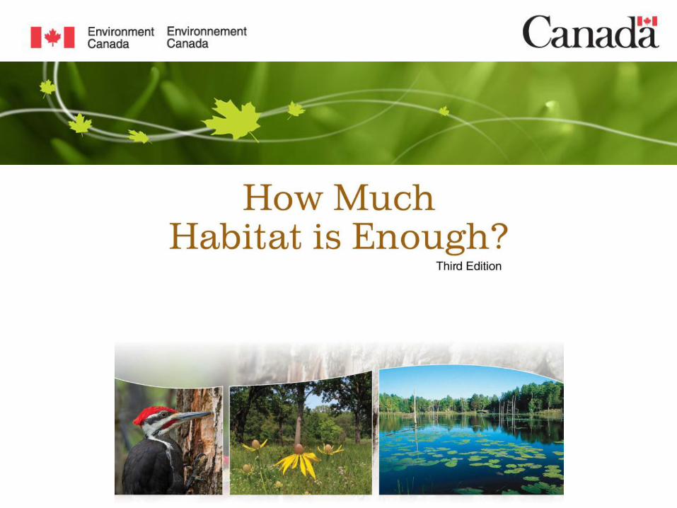
• 21 guidelines and supporting text based on an extensive literature review
• Focus on federal terrestrial biodiversity portfolio: migratory
birds, Species at Risk, Great Lakes related habitat, globally and
nationally rare, etc.
• Forest, wetland, riparian/watershed & grassland
• well used in various NHS, watershed, and other land use plans
as well by community groups, post-secondary classrooms,
general conservation biology primer
Page 3 – December-2-13
HMHE3 - Grasslands
Habitat Type and Area
• Focus on restoring and creating grassland habitat in existing
and potential grassland landscapes.
• Maintain, restore and create native grassland patches to their
historic extent and type at a county, municipal and/or watershed
scale considering past presence and current conditions.
Page 4 – December-2-13
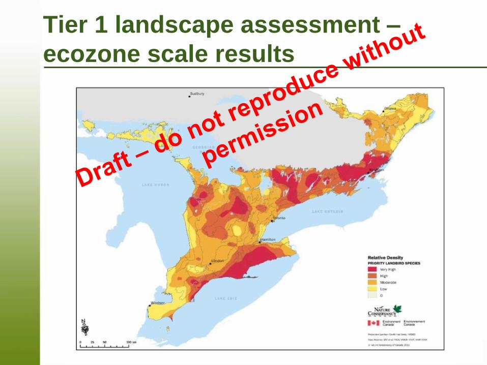
Tier 1 landscape assessment –
ecozone scale results

Page 5 – December-2-13
Tier 1 landscape assessment –
ecozone scale results
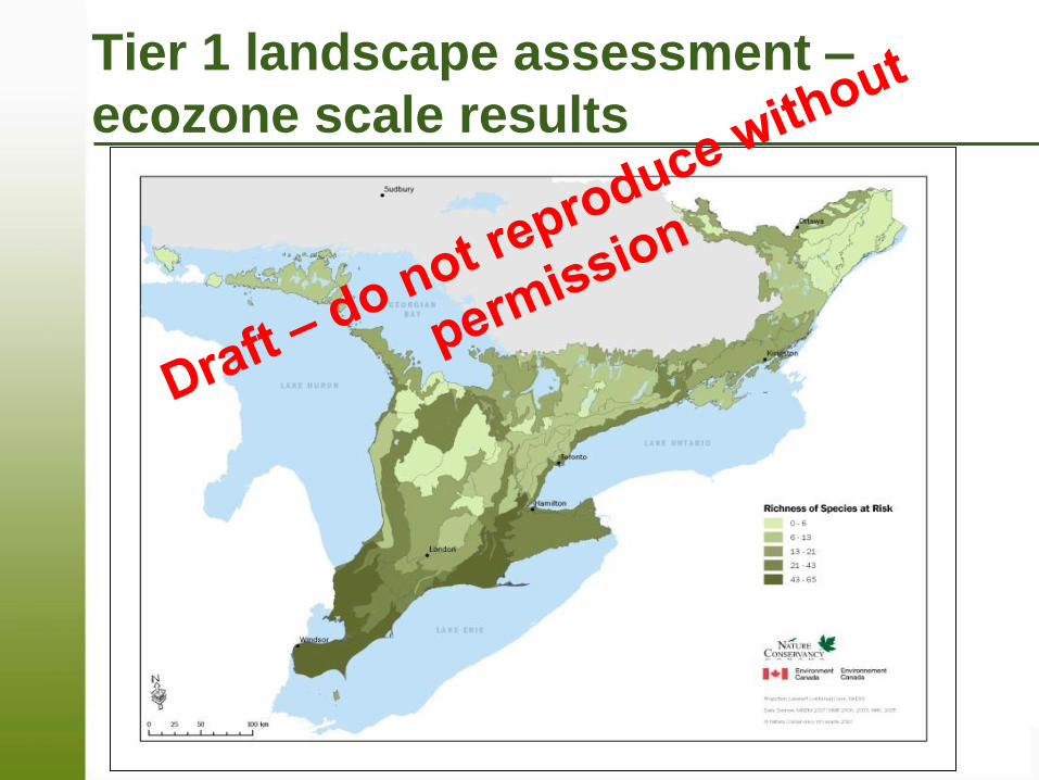
Page 6 – December-2-13
Tier 1 landscape assessment –
ecozone scale results
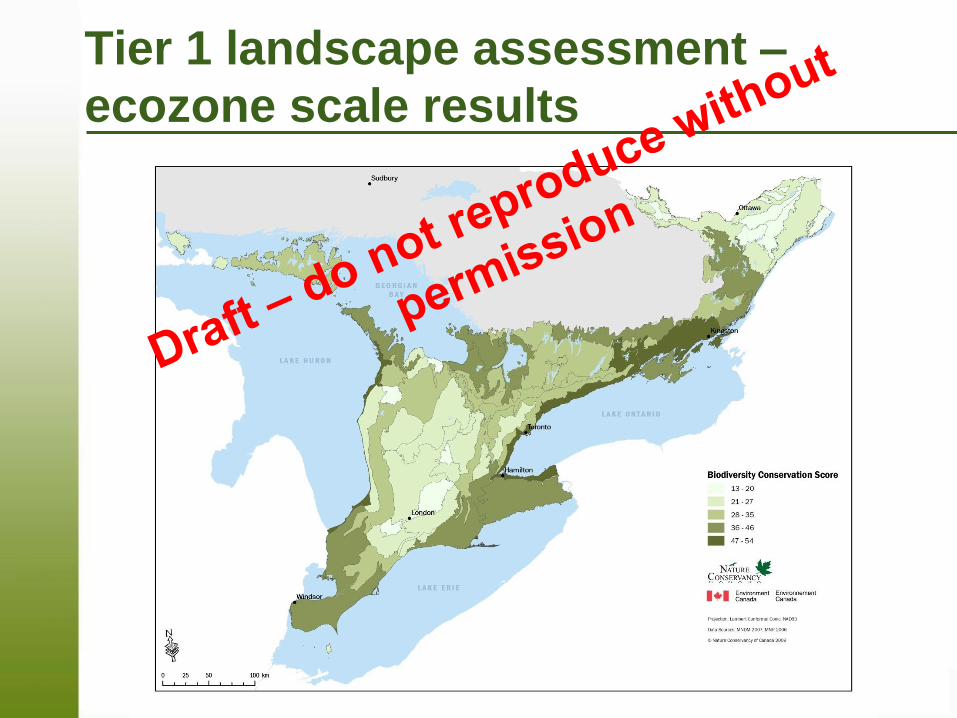
Page 7 – December-2-13
Tier 1 landscape assessment –
ecozone scale results
Page 8 – December-2-13
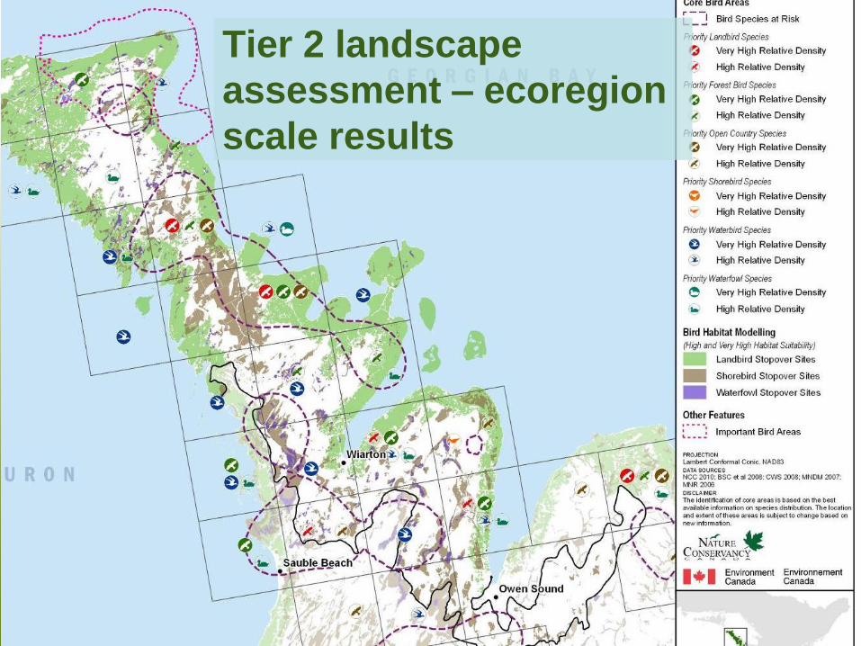
Bird relative density Tier 2 landscape
assessment – ecoregion
scale results
Page 9 – December-2-13
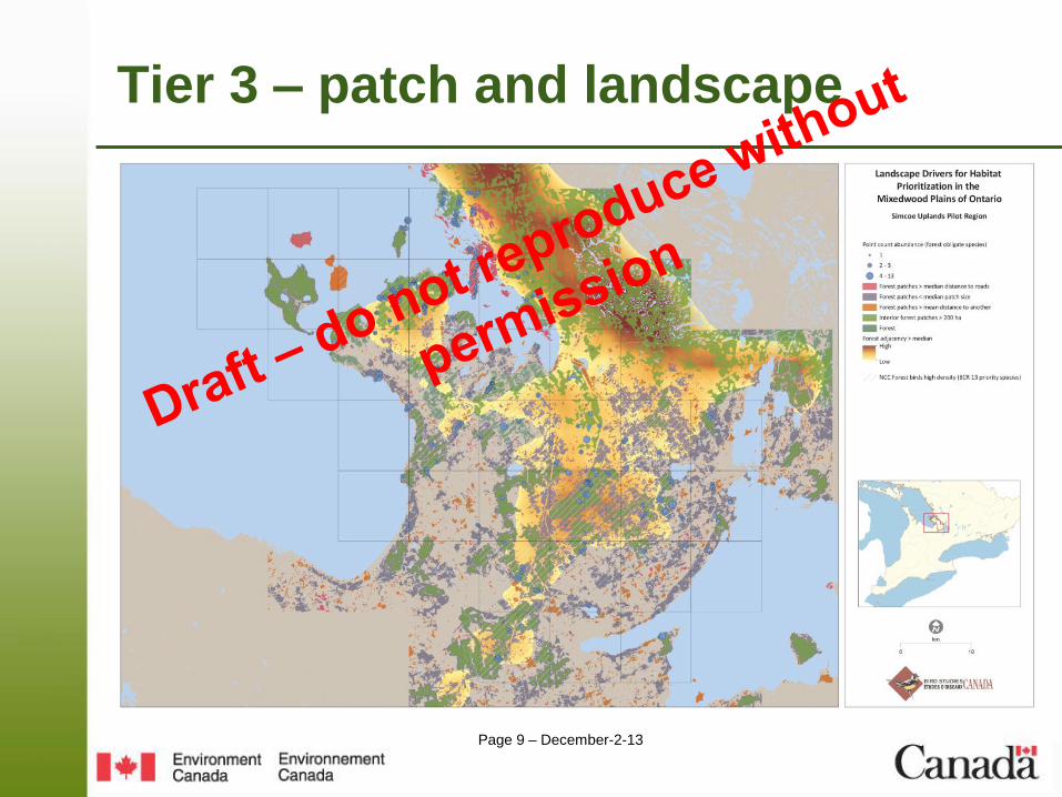
Tier 3 – patch and landscape
Page 10 – December-2-13
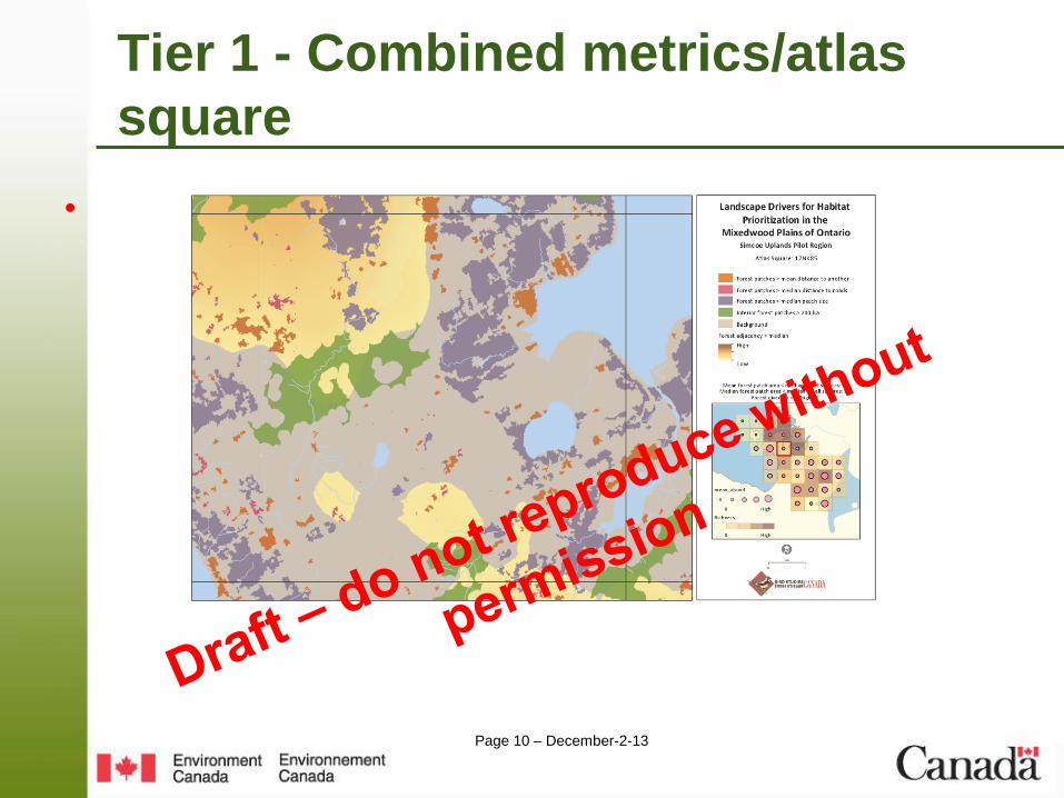
Tier 1 - Combined metrics/atlas
square
•
Page 11 – December-2-13
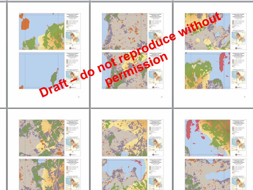
Tier 3 – initial pilot results
• x
Page 12 – December-2-13
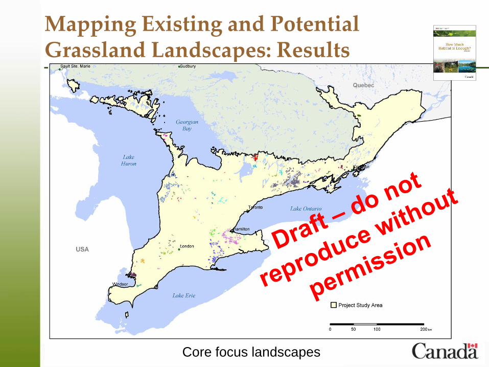
Mapping Existing and Potential Grassland Landscapes: Results
Core focus landscapes
Page 13 – December-2-13
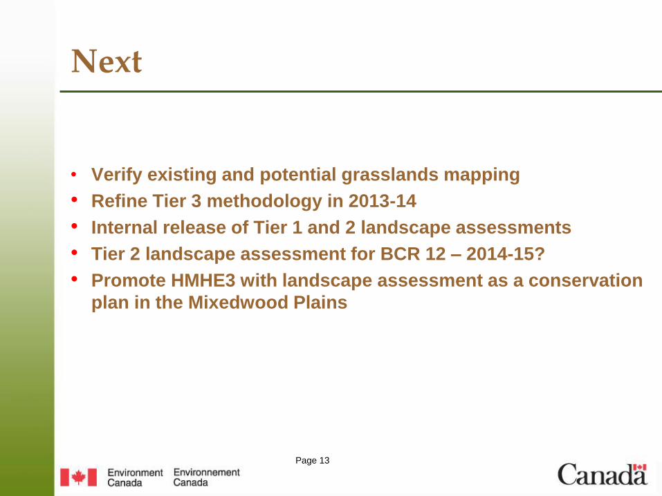
Next
• Verify existing and potential grasslands mapping
• Refine Tier 3 methodology in 2013-14
• Internal release of Tier 1 and 2 landscape assessments
• Tier 2 landscape assessment for BCR 12 – 2014-15?
• Promote HMHE3 with landscape assessment as a conservation
plan in the Mixedwood Plains