Embed Size (px)
Citation preview
How do Earth processes affect How do Earth processes affect our everyday lives?our everyday lives?
Natural events such as Natural events such as volcanic eruptions, volcanic eruptions, earthquakes, landslides, floods earthquakes, landslides, floods and gigantic sea waves make and gigantic sea waves make headlines and affect many headlines and affect many people in obvious ways. people in obvious ways.

Affects Although we cannot prevent most of
these natural disasters from happening, the more knowledge we have about what causes them, the better we will be able to predict, and possibly control the severity of impact.
GeologistsScottish geologist James Hutton, the
eighteenth-century geologist developed the theory of uniformitarianism.
English geologist Sir Charles Lyell is given the most credit for advancing the basic principles of modern geology.
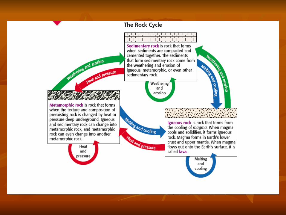
The Rock CycleSome people believe that "once a rock, always that rock". But that is not always true. Rocks take different forms at different times. A long time ago our earth was very volcanic. As these volcanoes cooled and vast oceans swept over the earth, the cooled lava was broken or crushed into small pieces. These small pieces were cemented together to become sedimentary rocks.
Rock Cycle contd. These rocks were buried and the heat
and pressure changed them into metamorphic rocks. They might even have melted and become igneous rocks once more. As you can tell, a rock may change many times and the rock you hold today may look entirely different to someone a long time from now.
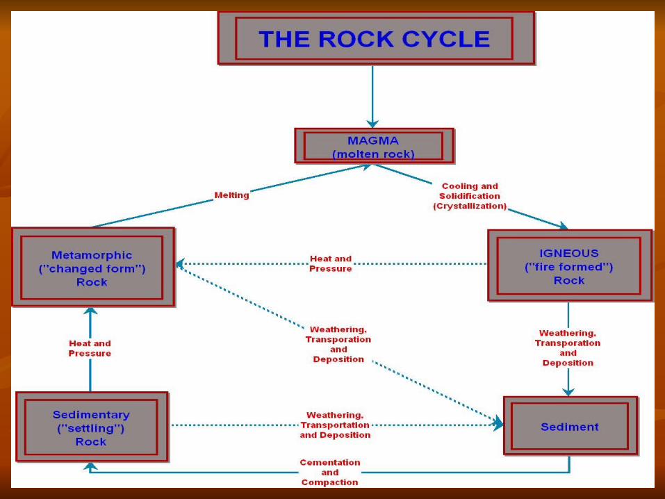
The Rock CycleThe Rock Cycle
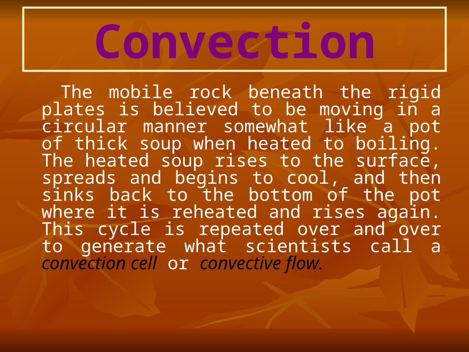
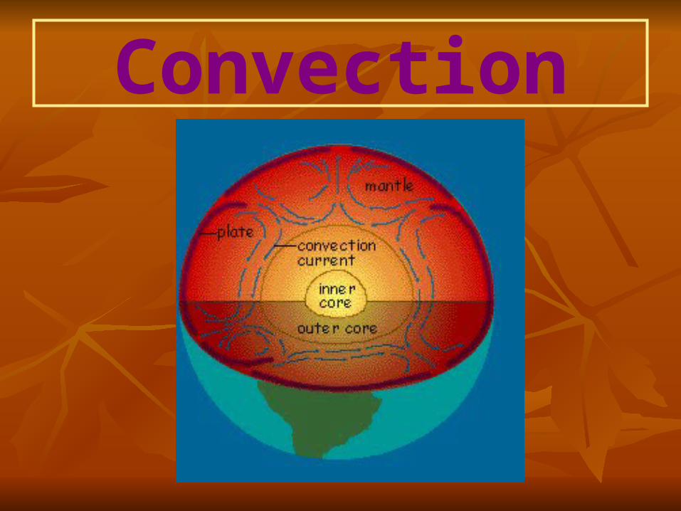
Convection The mobile rock beneath the rigid plates
is believed to be moving in a circular manner somewhat like a pot of thick soup when heated to boiling. The heated soup rises to the surface, spreads and begins to cool, and then sinks back to the bottom of the pot where it is reheated and rises again. This cycle is repeated over and over to generate what scientists call a convection cell or convective flow.
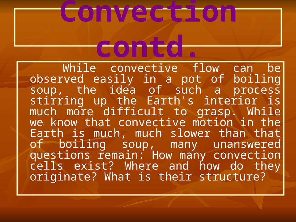
Convection contd. While convective flow can be observed
easily in a pot of boiling soup, the idea of such a process stirring up the Earth's interior is much more difficult to grasp. While we know that convective motion in the Earth is much, much slower than that of boiling soup, many unanswered questions remain: How many convection cells exist? Where and how do they originate? What is their structure?
Convection
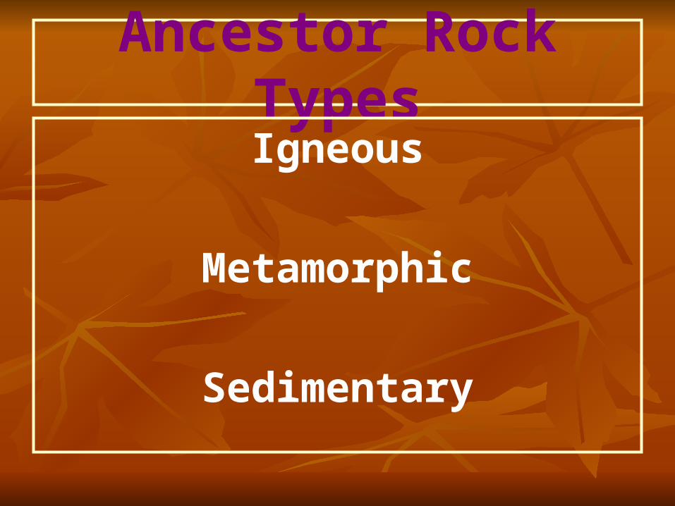
Ancestor Rock TypesIgneous
Metamorphic
Sedimentary
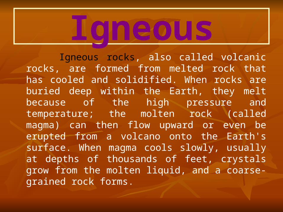
Igneous Igneous rocks, also called volcanic rocks, are
formed from melted rock that has cooled and solidified. When rocks are buried deep within the Earth, they melt because of the high pressure and temperature; the molten rock (called magma) can then flow upward or even be erupted from a volcano onto the Earth's surface. When magma cools slowly, usually at depths of thousands of feet, crystals grow from the molten liquid, and a coarse-grained rock forms.
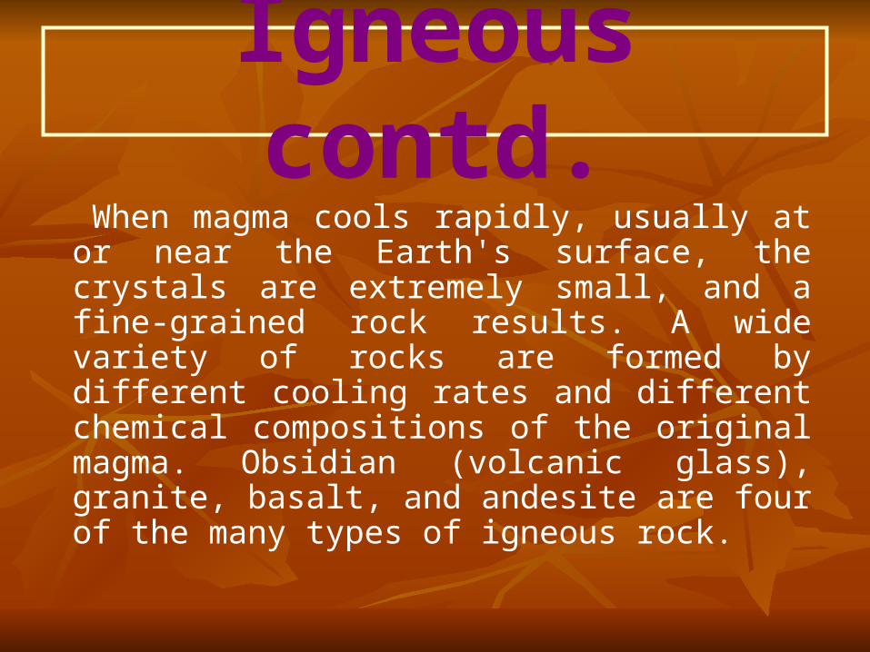
Igneous contd. When magma cools rapidly, usually at or
near the Earth's surface, the crystals are extremely small, and a fine-grained rock results. A wide variety of rocks are formed by different cooling rates and different chemical compositions of the original magma. Obsidian (volcanic glass), granite, basalt, and andesite are four of the many types of igneous rock.
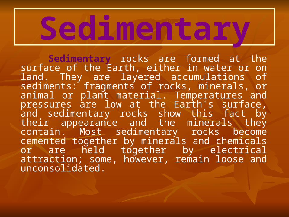
Sedimentary Sedimentary rocks are formed at the surface of
the Earth, either in water or on land. They are layered accumulations of sediments: fragments of rocks, minerals, or animal or plant material. Temperatures and pressures are low at the Earth's surface, and sedimentary rocks show this fact by their appearance and the minerals they contain. Most sedimentary rocks become cemented together by minerals and chemicals or are held together by electrical attraction; some, however, remain loose and unconsolidated.
Sedimentary contd. The layers are normally parallel or nearly parallel
to the Earth's surface; if they are at high angles to the surface or are twisted or broken, some kind of Earth movement has occurred since the rock was formed. Sedimentary rocks are forming around us all the time. Sand and gravel on beaches or in river bars look like the sandstone and conglomerate they will become. Compacted and dried mud flats harden into shale. Scuba divers who have seen mud and shells settling on the floors of lagoons find it easy to understand how sedimentary rocks form.
Metamorphic Sometimes sedimentary and igneous rocks
are subjected to pressures so intense or heat so high that they are completely changed. They become metamorphic rocks, which form while deeply buried within the Earth's crust. The process of metamorphism does not melt the rocks, but instead transforms them into denser, more compact rocks. New minerals are created either by rearrangement of mineral components or by reactions with fluids that enter the rocks.
Metamorphic contd.
Some kinds of metamorphic rocks--granite gneiss and biotite schist are two examples--are strongly banded or foliated. (Foliated means the parallel arrangement of certain mineral grains that gives the rock a striped appearance.) Pressure or temperature can even change previously metamorphosed rocks into new types.
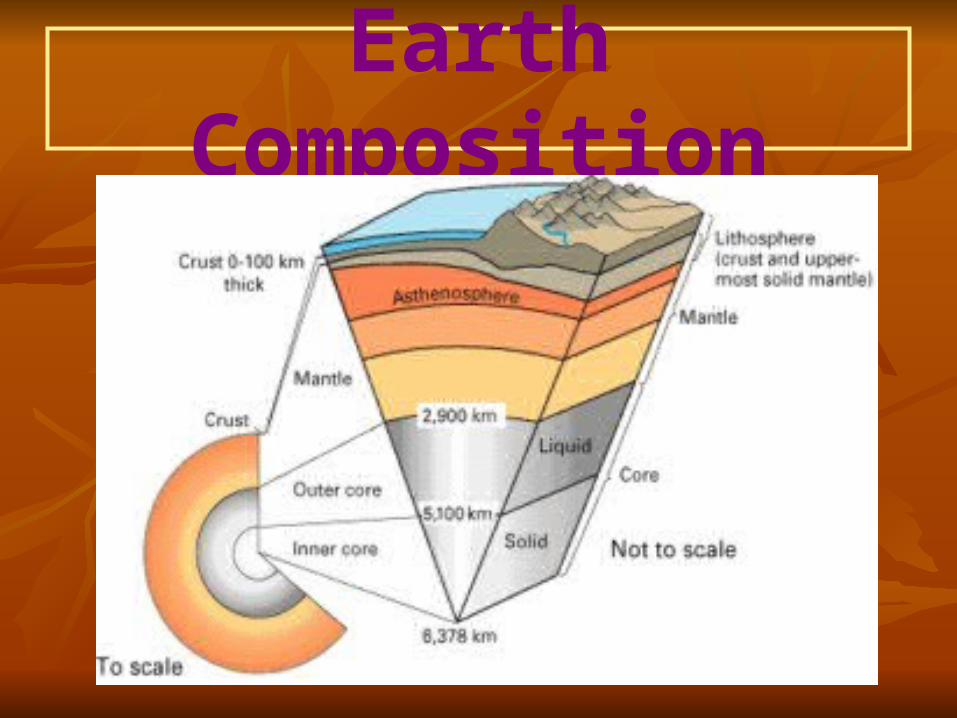
Earth Composition The Earth is not just a ball of solid
rock. It is made of several layers with different physical properties and compositions. Scientists think about the Earth’s layers in two ways; by their composition and physical properties.
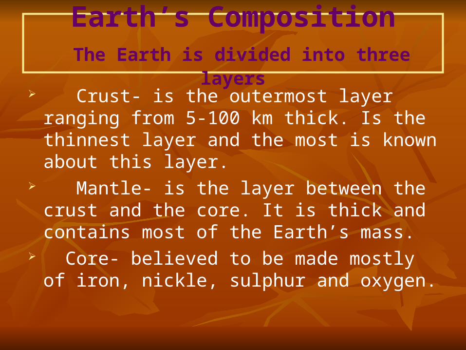
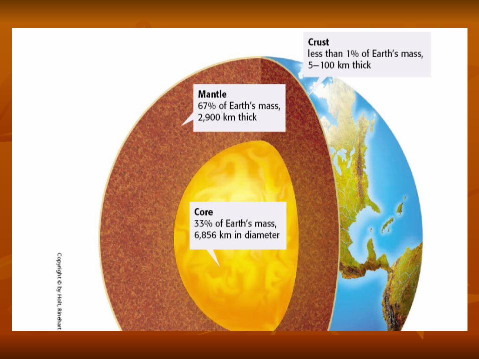
Earth’s Composition The Earth is divided into three layers
Crust- is the outermost layer ranging from 5-100 km thick. Is the thinnest layer and the most is known about this layer.
Mantle- is the layer between the crust and the core. It is thick and contains most of the Earth’s mass.
Core- believed to be made mostly of iron, nickle, sulphur and oxygen.
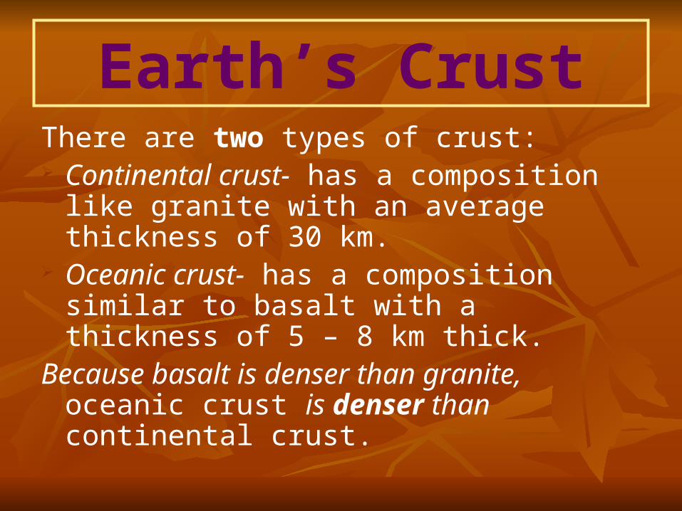
Earth’s CrustThere are two types of crust: Continental crust- has a composition like
granite with an average thickness of 30 km.
Oceanic crust- has a composition similar to basalt with a thickness of 5 – 8 km thick.
Because basalt is denser than granite, oceanic crust is denser than continental crust.
PHYSICAL PROPERTIESPHYSICAL PROPERTIES
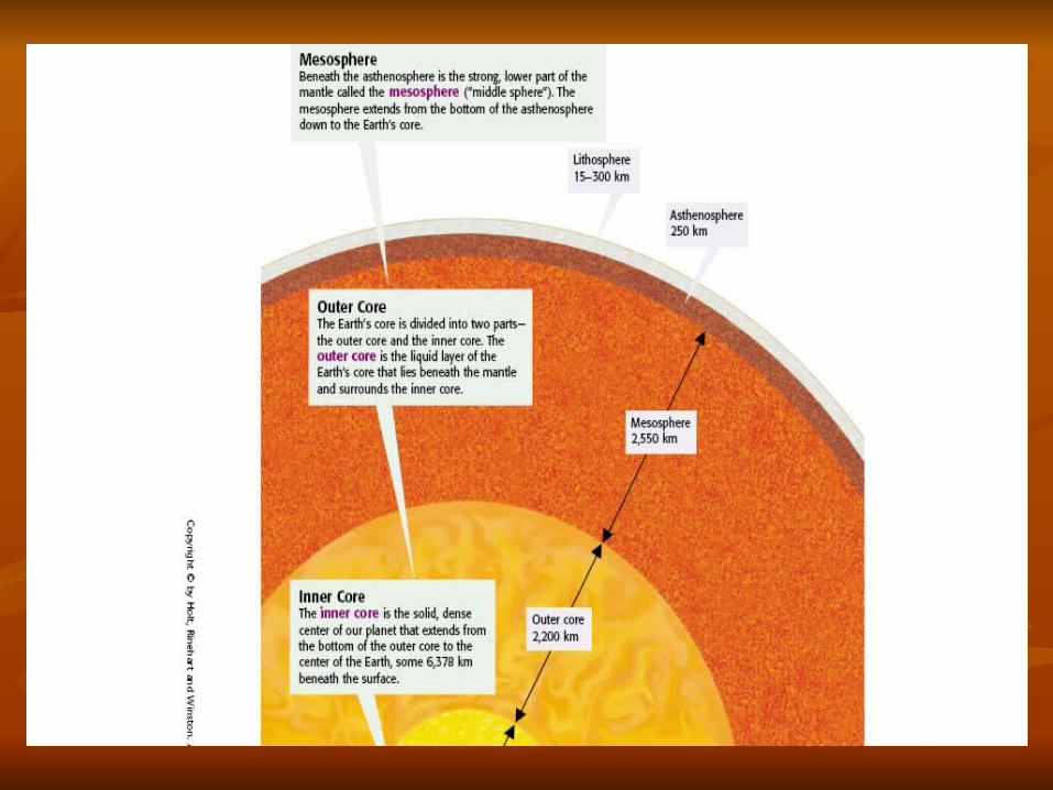
FIVE LAYERSFIVE LAYERS
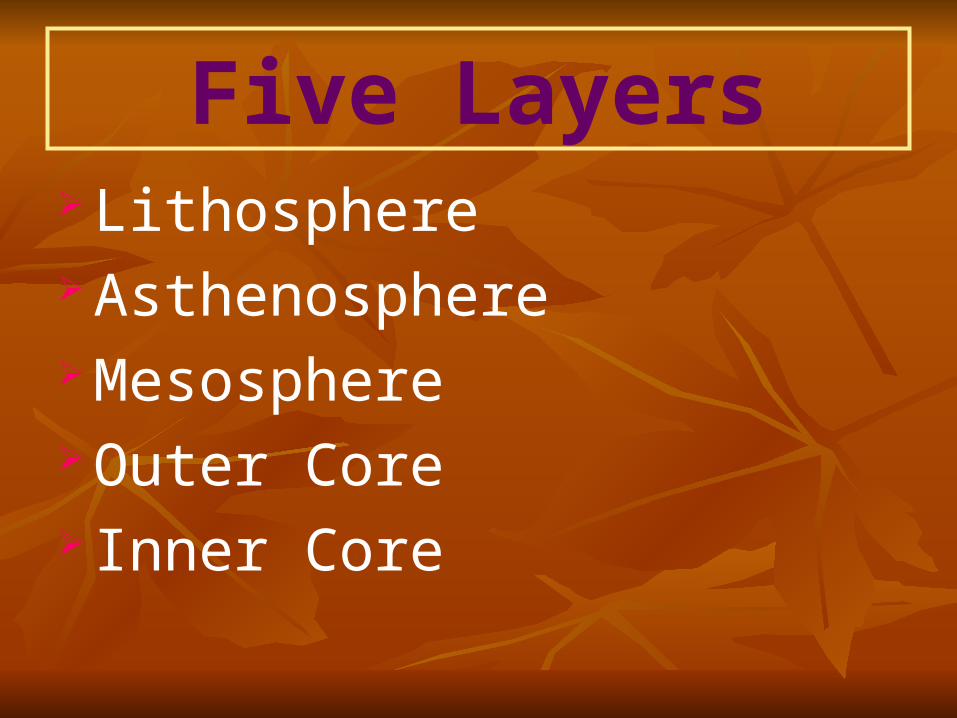
Five Layers Lithosphere Asthenosphere Mesosphere Outer Core Inner Core
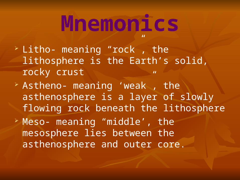
Mnemonics Litho- meaning “rock”, the lithosphere is
the Earth’s solid, rocky crust Astheno- meaning ‘weak”, the
asthenosphere is a layer of slowly flowing rock beneath the lithosphere
Meso- meaning “middle’, the mesosphere lies between the asthenosphere and outer core.
Earth Structure
Earth Structure
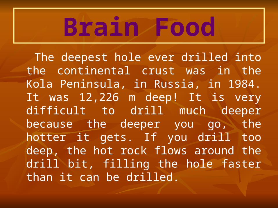
Brain Food The deepest hole ever drilled into the
continental crust was in the Kola Peninsula, in Russia, in 1984. It was 12,226 m deep! It is very difficult to drill much deeper because the deeper you go, the hotter it gets. If you drill too deep, the hot rock flows around the drill bit, filling the hole faster than it can be drilled.
Earth Composition
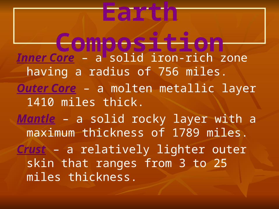
Earth CompositionInner Core – a solid iron-rich zone having a
radius of 756 miles.
Outer Core – a molten metallic layer 1410 miles thick.
Mantle – a solid rocky layer with a maximum thickness of 1789 miles.
Crust – a relatively lighter outer skin that ranges from 3 to 25 miles thickness.
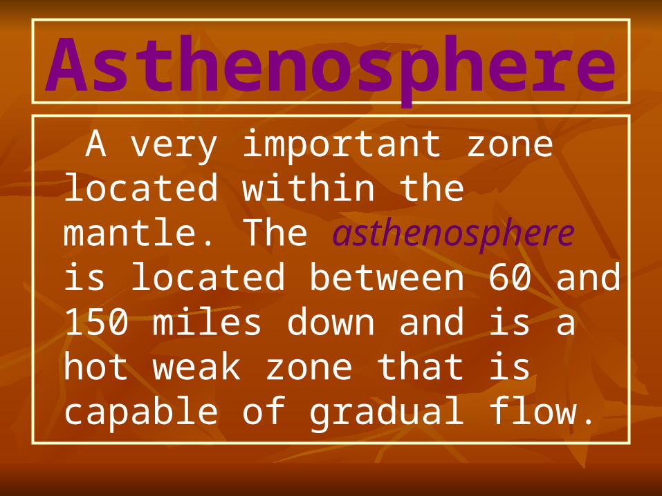
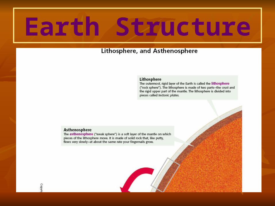
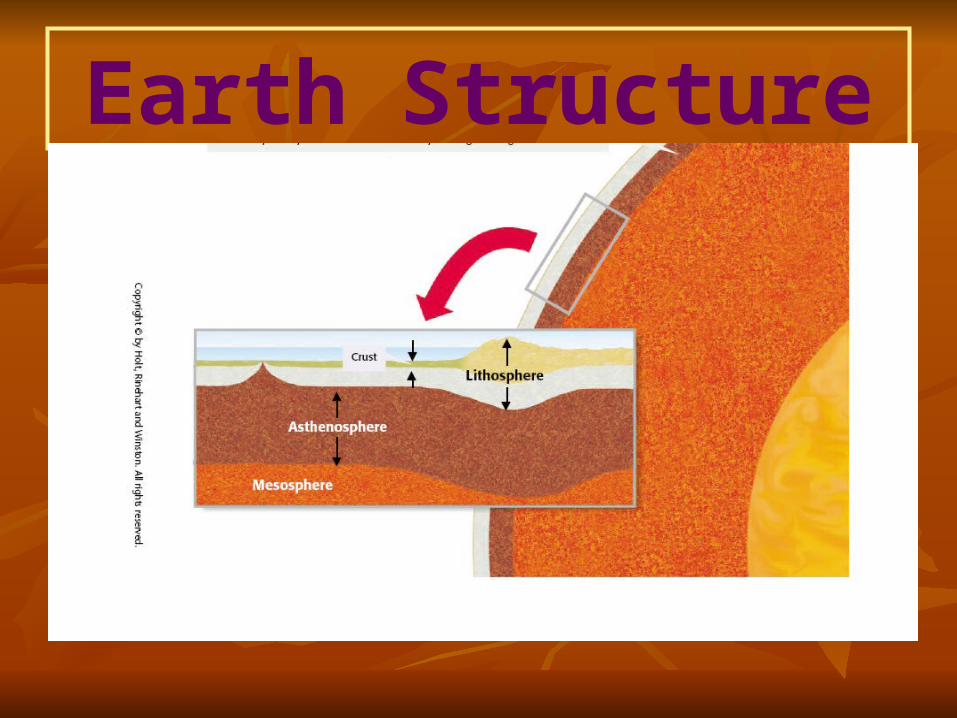
Asthenosphere A very important zone located
within the mantle. The asthenosphere is located between 60 and 150 miles down and is a hot weak zone that is capable of gradual flow.
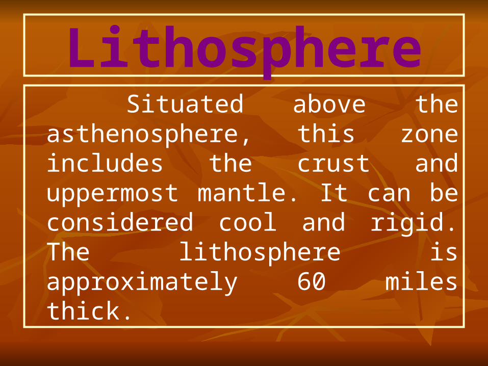
Lithosphere Situated above the
asthenosphere, this zone includes the crust and uppermost mantle. It can be considered cool and rigid. The lithosphere is approximately 60 miles thick.
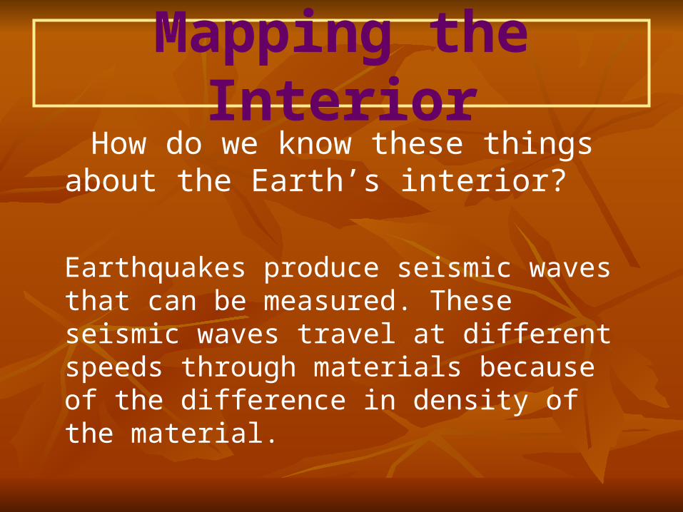
Mapping the Interior How do we know these things about
the Earth’s interior?
Earthquakes produce seismic waves that can be measured. These seismic waves travel at different speeds through materials because of the difference in density of the material.
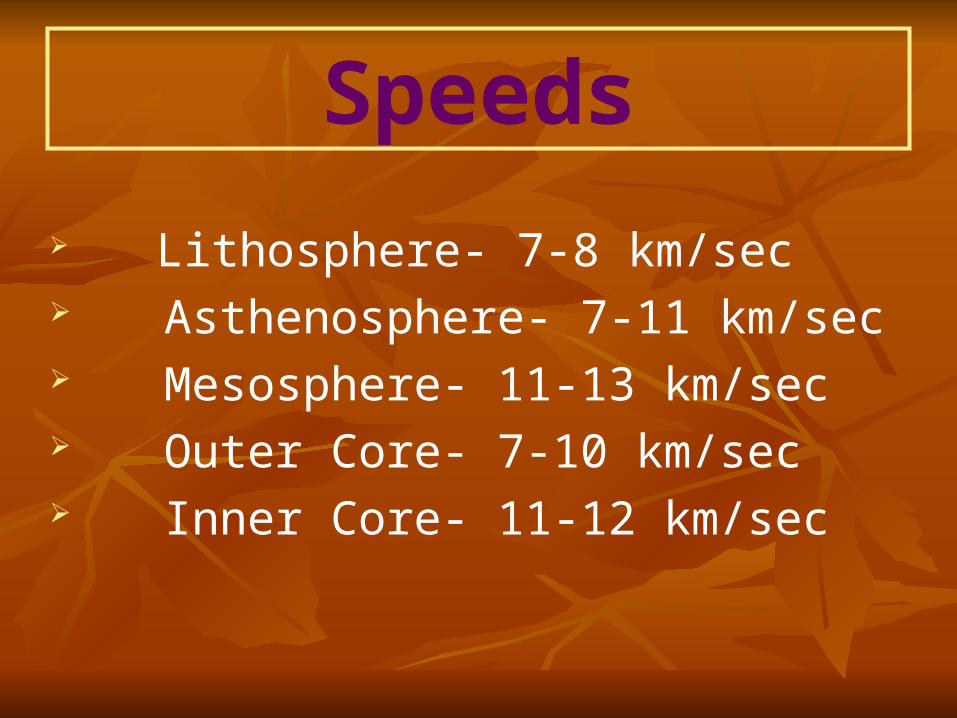
Speeds
Lithosphere- 7-8 km/sec Asthenosphere- 7-11 km/sec Mesosphere- 11-13 km/sec Outer Core- 7-10 km/sec Inner Core- 11-12 km/sec
Quiz1. The crust is the Earth’s only solid layer.
2. The inner core of the Earth is solid and made primarily of iron.
3. Temperature and pressure increase toward the center of the Earth.
4. The asthenosphere is the thinnest.

Answers1.1. FalseFalse
2.2. TrueTrue
3.3. TrueTrue
4.4. FalseFalse
Plate Tectonic Theory According to the plate tectonics
model, The Earth’s rigid outer shell, the lithosphere, is broken into several individual pieces called plates that move over the asthenosphere. Further, it is known that these rigid plates are slowly, but nevertheless continually moving.
Plate Tectonic Theory
This motion is driven by a thermal engine, the result of an unequal distribution of heat within the Earth. As hot material gradually moves up from deep within the planet and spreads laterally, the plates are set in motion. Ultimately, this movement of Earth’s plates generates earthquakes, volcanic activity and mountain building.
Jigsaw Puzzle Look at the world map on the following
slide and notice that each tectonic plate fits the other tectonic plates that surround it. The lithosphere is like a giant jigsaw puzzle. Also, notice that not all tectonic plates are the same. Compare the size and composition, some have both types of crust and some have only one type of crust.
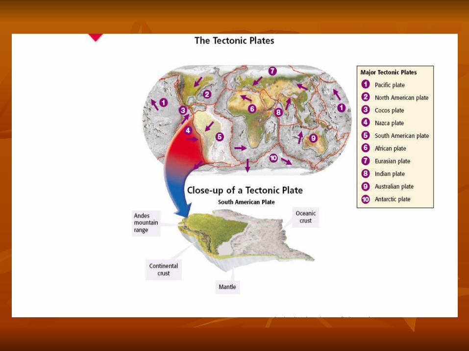
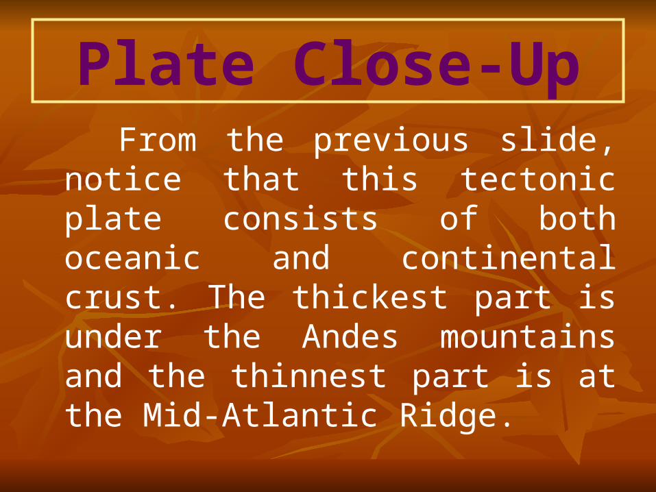
Plate Close-Up From the previous slide, notice that
this tectonic plate consists of both oceanic and continental crust. The thickest part is under the Andes mountains and the thinnest part is at the Mid-Atlantic Ridge.
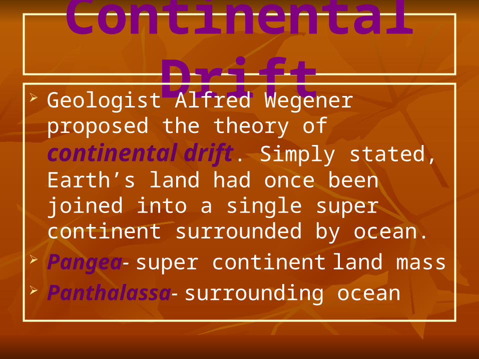
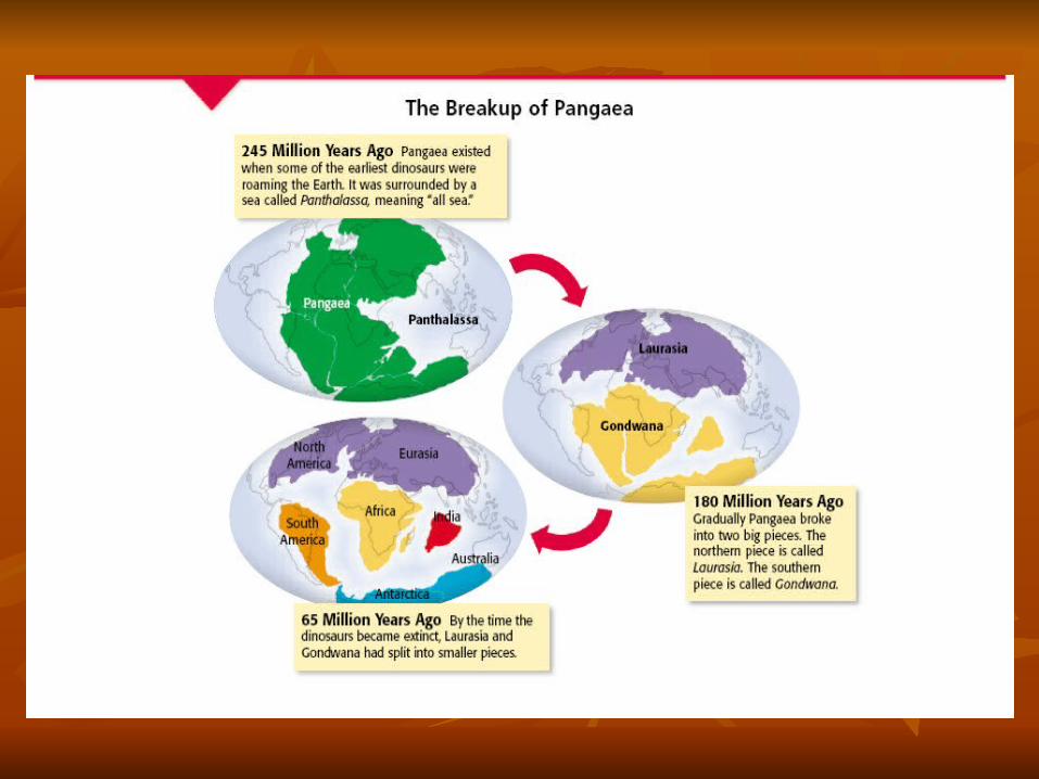
Continental Drift Geologist Alfred Wegener proposed the
theory of continental drift. Simply stated, Earth’s land had once been joined into a single super continent surrounded by ocean.
Pangea- super continent land mass Panthalassa- surrounding ocean
Continental Drift Theory
The continental drift theory explained why the shorelines of different continents fit together like a puzzle, why the same fossil animals and plants are found on different continents and how different mountain ranges were once part of a larger continuous mountain range.
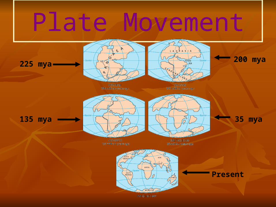
Plate Movement
225 mya
Present
200 mya
35 mya135 mya
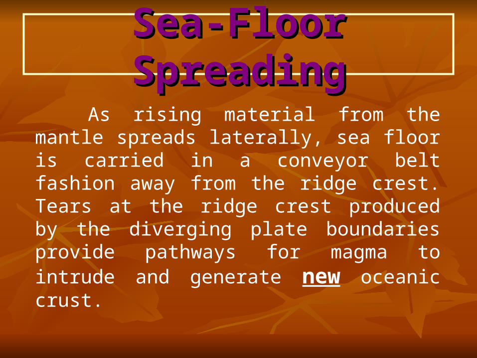
Sea-Floor SpreadingSea-Floor Spreading
As rising material from the mantle spreads laterally, sea floor is carried in a conveyor belt fashion away from the ridge crest. Tears at the ridge crest produced by the diverging plate boundaries provide pathways for magma to intrude and generate new oceanic crust.
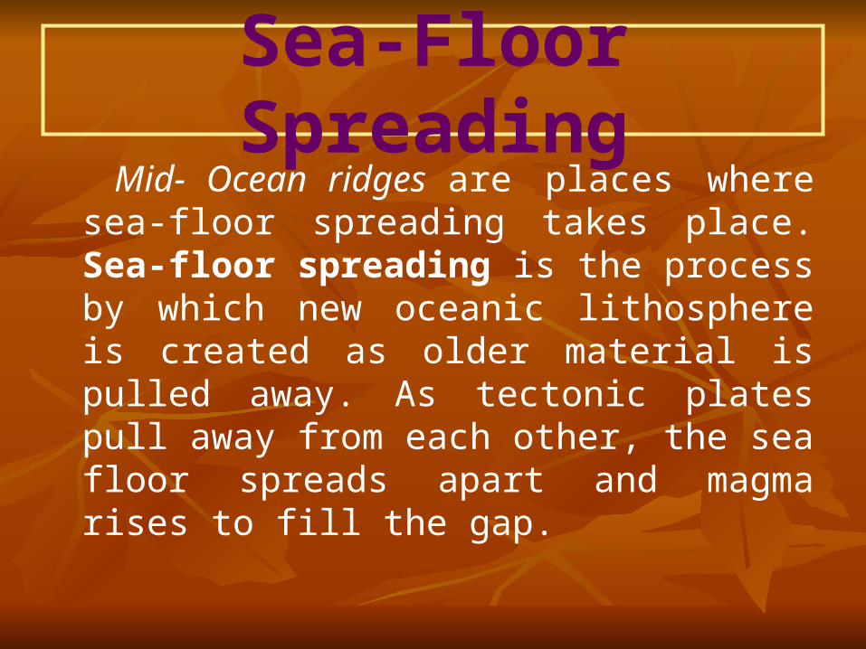
Sea-Floor Spreading Mid- Ocean ridges are places where sea-
floor spreading takes place. Sea-floor spreading is the process by which new oceanic lithosphere is created as older material is pulled away. As tectonic plates pull away from each other, the sea floor spreads apart and magma rises to fill the gap.
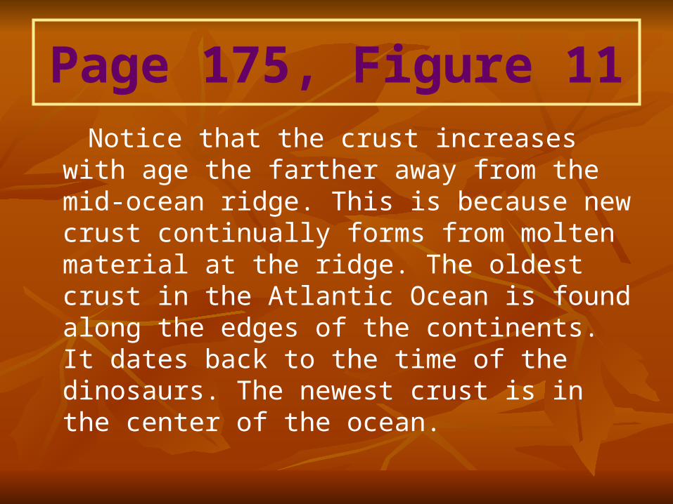
Page 175, Figure 11 Notice that the crust increases with age
the farther away from the mid-ocean ridge. This is because new crust continually forms from molten material at the ridge. The oldest crust in the Atlantic Ocean is found along the edges of the continents. It dates back to the time of the dinosaurs. The newest crust is in the center of the ocean.
Connection In the 1950’s scientists broadcast In the 1950’s scientists broadcast
sonar waves toward the sea floor and sonar waves toward the sea floor and measured how long it took the waves measured how long it took the waves to return. The echoes revealed the to return. The echoes revealed the existence of oceanic valleys and existence of oceanic valleys and mountains. In short, the ocean floors mountains. In short, the ocean floors turned out to be as varied as the turned out to be as varied as the continents.continents.
Quiz1. If the Earth’s crust is growing at mid-
ocean ridges, why doesn’t the Earth itself grow?
2. What was pangea?
Answers1. Because the Earth’s crust is part of the
rock cycle.
2. The large landmass that later broke up to form two supercontinents and then fragmented further to form the six continents of today.
Magnetic Reversals
The molten rock at the mid-ocean ridges contains tiny grains of magnetic minerals. These mineral grains act like compasses and align with the magnetic field of the Earth. Once the molten rock cools, the record of these tiny compasses is literally set in stone and is slowly carried away from the spreading center as sea-floor spreading occurs This new rock records the direction of Earth’s magnetic field. When Earth’s magnetic poles change place, it’s called magnetic reversal. This record of magnetic reversals was final proof that sea-floor spreading does occur.
Paleomagnetism A compass needle points toward the
magnetic north pole because it aligns with the Earth’s magnetic field. Tiny particles of iron-bearing magnetic minerals are found in magma. These minerals act like miniature compass needles; as they cool to form new sea floor, their magnetic fields align with the Earth’s magnetic field.
Paleomagnetism The orientation of the Earth’s magnetic field
at that particular time becomes frozen in the rock as it solidifies. The Earth’s magnetic field reverses periodically but at irregular intervals once every 300,000 to 500,000 years. A magnetometer measures the amount and direction of residual magnetism in a rock sample.
Plate Tectonics Theory Plate tectonics theory is that the Earth’s
Lithosphere is divided into tectonic plates that move around on top of the asthenosphere. An incredible amount of energy is needed to move something as massive as a tectonic plate! We still don’t know exactly why they move. But, recently scientists have come up with some possible answers.
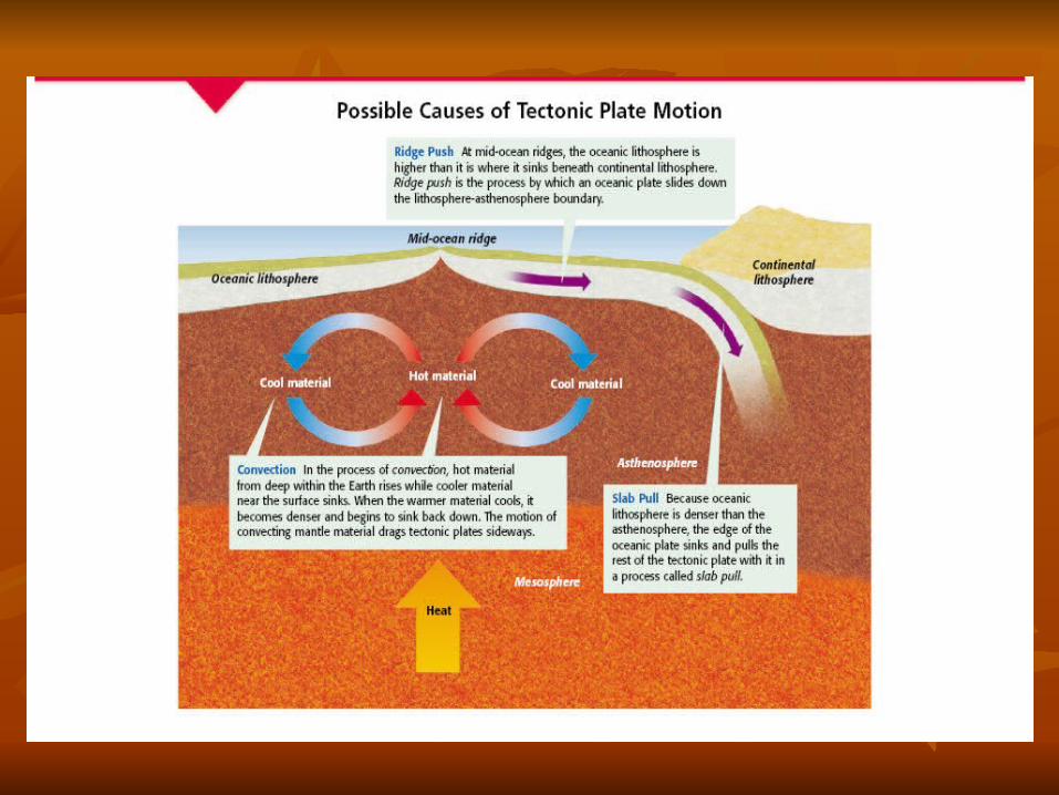
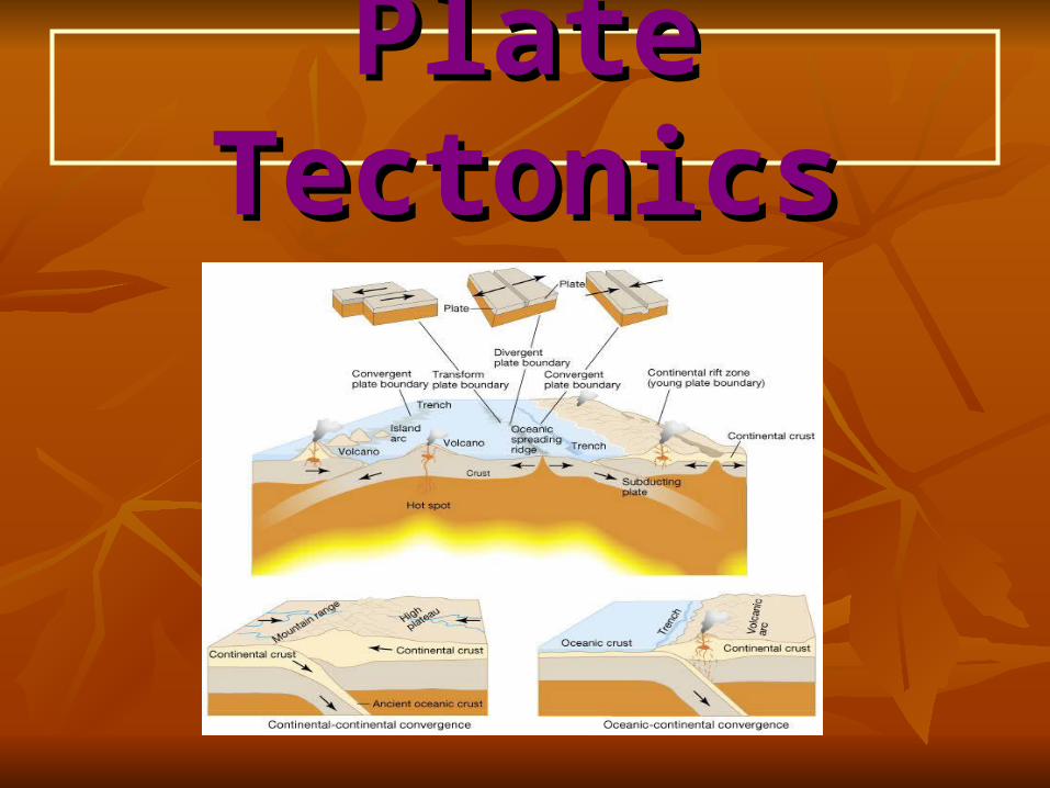
Plate TectonicsPlate Tectonics
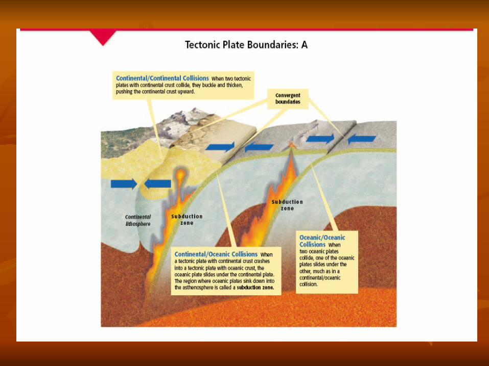
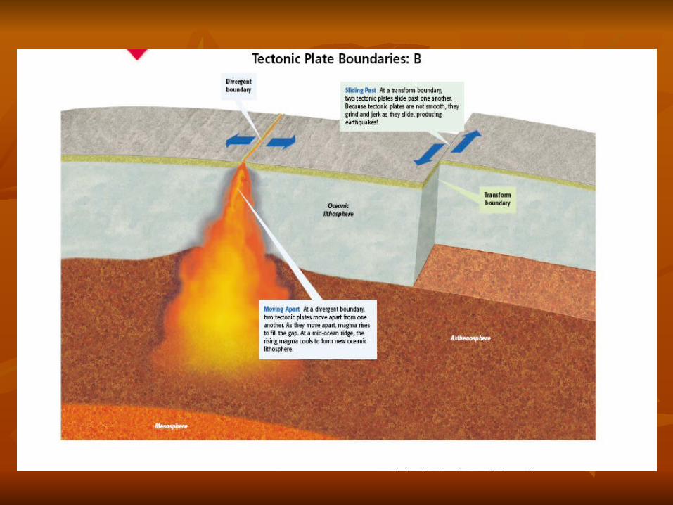
Plate Boundaries Divergent plate boundaries- zones where
plates move apart, as magma rises to the surface, leaving a gap between them. (Sea floor spreading)
Convergent plate boundaries- zones where plates move together, causing one of the slabs of lithosphere to be consumed (subduction zone) into the mantle as it descends beneath an overriding plate. Andes Mountains in South America.
Plate Boundaries
Transform plate boundaries- zones where plates slide sideways past each other, scraping and deforming as they pass. (San Andreas Fault)
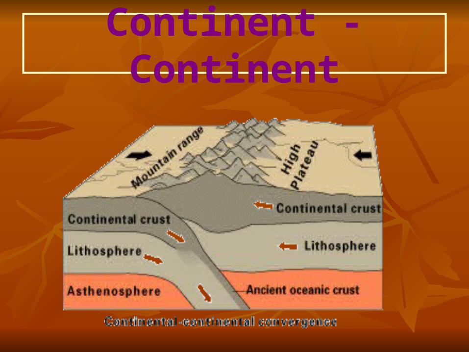
Continent - Continent
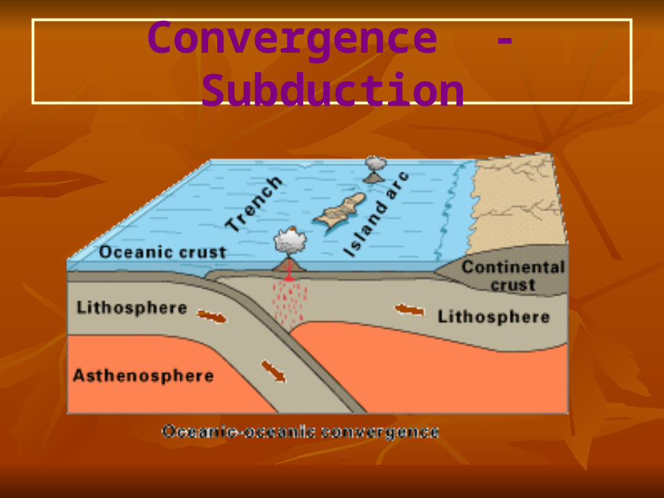
Convergence - Subduction
Practice
The distance between New York and Paris increases every year. Currently, the two cities are moving apart by about 2 cm per year. This may not sound like much, but calculate the increase in distance in 1 million years. How much will the distance increase in 100 million years?
Practice Answers 20 km
2000 km
Quiz1. Why are there several categories of
convergent plate boundaries?2. Tell where you would expect to see the
following features: a. tall, wrinkled mountains of a continent b. a long parallel ridge on the ocean floor
surrounded by parallel zones of magnetic reversal.
3. Explain the process of subduction
Answers1. Plates that are pushed together behave
differently, depending on their composition and density.
2. a. convergent continental/continental boundary
b. divergent boundary3. A denser oceanic crust is forced beneath
a less dense oceanic or continental plate at a convergent boundary.
Tracking Plate Motion Scientists use a network of satellites
called the Global Positioning System. Radio signals are continuously beamed from satellites to ground stations, which record the exact distance between the satellites and the ground station. By measuring the time it takes for the GPS ground stations to move a certain distance, scientists can measure the rate of each tectonic plate.
Deforming the Crust When rock changes its shape due to
stress, this reaction is called deformation. Stress is the amount of force per unit area that is put on a given material. Much like bending and then breaking uncooked spaghetti noodles, rock layers can bend when stress is placed on them. But, when more stress is placed on them, they can break.
Types of Stress Compression- this is a type of stress
when an object is squeezed, or when two tectonic plates collide. The Rocky Mountains and the Cascade Range are two examples of compression at convergent zones.
Tension- this type of stress occurs when forces act to stretch an object. Tension occurs at divergent plate boundaries.
Folding
Folding occurs when rock layers bend due to stress in the Earth’s crust. We assume that all sedimentary rock layers started out as horizontal layers. So, when you see a fold, deformation has occurred.
Types of Folding Anticline Syncline Monocline When tectonic forces put stress on rock
layers, they can cause the layers to bend. Anticlines and synclines form when horizontal stress acts on rock. Monoclines form when vertical stress acts on rock. (See page 182, Figure 17.)
Faulting The surface along which rocks break
and slide is called a fault. There are three major types of faulting. A fault will have two sides, the hanging wall and footwall. Movement of the hanging wall and the footwall with relationship to each other, determines which type of fault it is.
Normal Faults
The movement of a normal fault causes the hanging wall to move down with relation to the footwall. Normal faults usually occur when tectonic forces cause stress tension that pulls rocks apart. (Page 183, Figure 20).
Reverse Faults The movement of a reverse fault
causes the hanging wall to move up in relation to the footwall– the “reverse” of a normal fault. Reverse faults usually happen when tectonic forces cause stress compression that pushes rocks together. Page 183, Figure 21.
Strike-Slip Faults A third major type of fault is
called a strike-slip fault. They occur when opposing forces cause rock to break and move horizontally. The San Andreas Fault in California is a strike-slip fault.
Self-Check How is folding different from faulting?
When folding occurs, sedimentary rock strata bend but do not break. When faulting occurs, sedimentary rock strata break along a fault and the fault blocks on either side move relative to each other.
Mountain Building When tectonic plates undergo
compression or tension, they can form mountains in several different ways. Three of the most common types of mountains are:
Folded Mountains Fault-block Mountains Volcanic Mountains
Folded Mountains Folded mountains form when rock layers
are squeezed together and pushed upward. The Appalachian mountains were once as great as the Himalayas. The Appalachian mountains have been worn down by hundreds of millions of years of weathering and erosion. Both are examples of folded mountains.
Fault-Block
Where tectonic forces put enough tension on the Earth’s crust, a large number of normal faults can result. Fault-block mountains form when this faulting causes large blocks to drop down relative to other blocks. (Page 186, Figure 25).
Volcanic Mountains Most of the world’s major volcanic
mountains are located at convergent boundaries. Volcanic mountains form when molten rock erupts onto the Earth’s surface. They form from new material being added to the Earth’s surface. There are so many volcanic mountains around the rim of the Pacific Ocean that explorers named it the Ring of Fire.
Quiz
1. What three features form when rock layers bend?
2. Why are the Appalachian Mountains now located in the middle of the North American Continent?
Answers1. Anticlines, synclines and monoclines.
2. The Appalachian Mountains formed when North America and Africa collided. In time, the plates separated and so much new crust was created that the mountains were no longer at the plate boundaries.
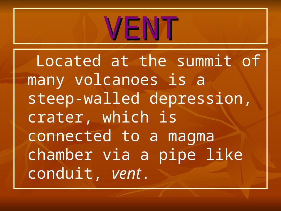
VENTVENT Located at the summit of many
volcanoes is a steep-walled depression, crater, which is connected to a magma chamber via a pipe like conduit, vent.
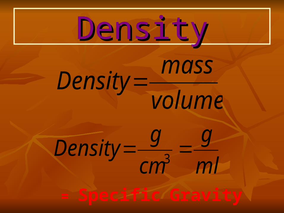
DensityDensity
volume
massDensity
ml
g
cm
gDensity
3
= Specific Gravity
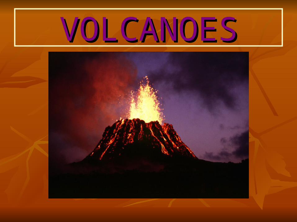
VOLCANOESVOLCANOES
VOLCANOESVOLCANOES Most of the more than 600 active
volcanoes that have been identified are located in the vicinity of convergent plates. Further, extensive volcanic activity occurs out of view along sea floor spreading centers of the oceanic ridge system.
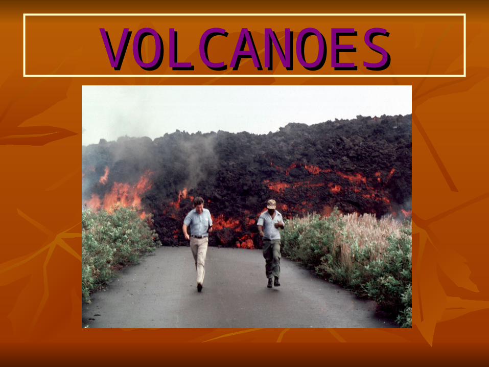
VOLCANOESVOLCANOES
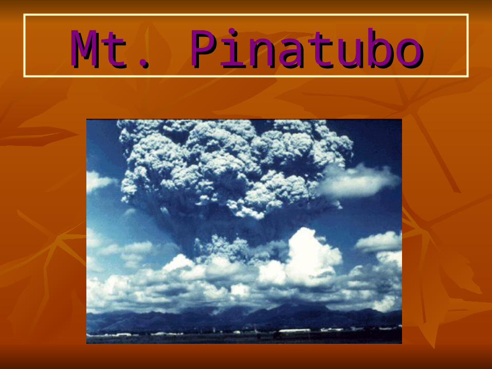
Mt. PinatuboMt. Pinatubo
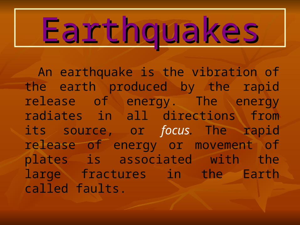
EarthquakesEarthquakes An earthquake is the vibration of the
earth produced by the rapid release of energy. The energy radiates in all directions from its source, or focus. The rapid release of energy or movement of plates is associated with the large fractures in the Earth called faults.
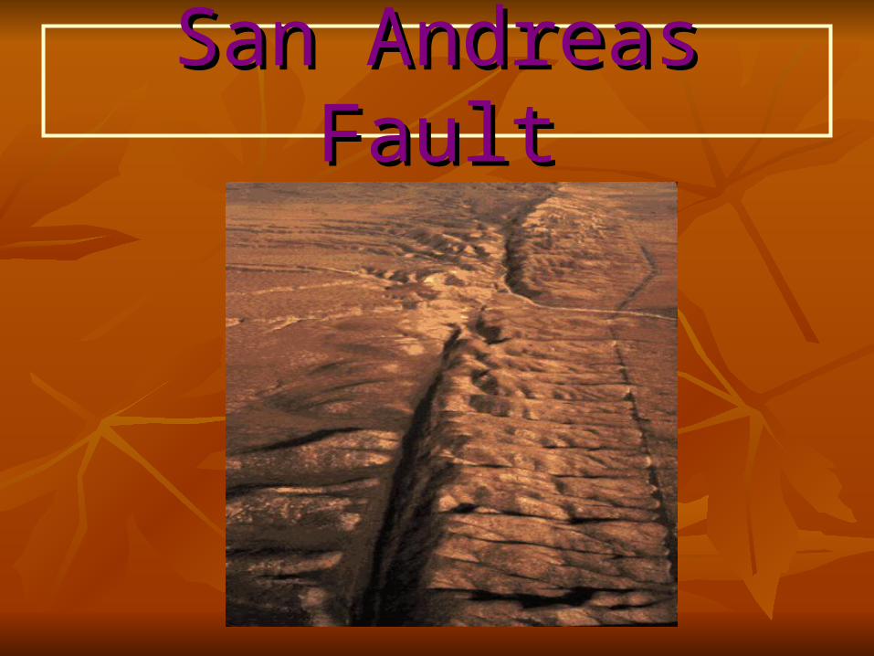
San Andreas FaultSan Andreas Fault
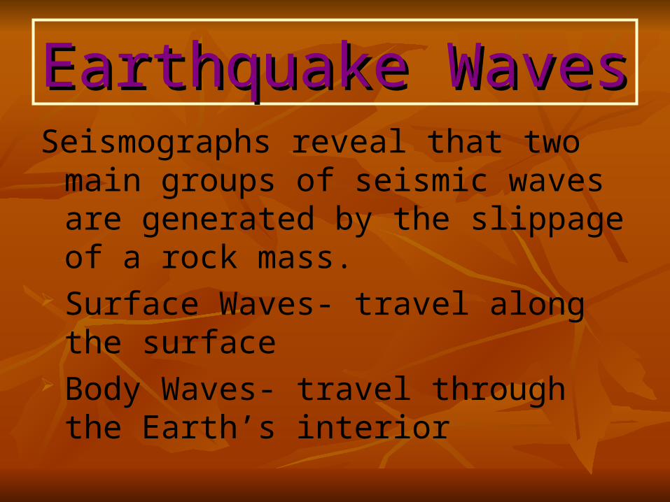
Earthquake WavesEarthquake WavesSeismographs reveal that two main groups
of seismic waves are generated by the slippage of a rock mass.
Surface Waves- travel along the surface Body Waves- travel through the Earth’s
interior
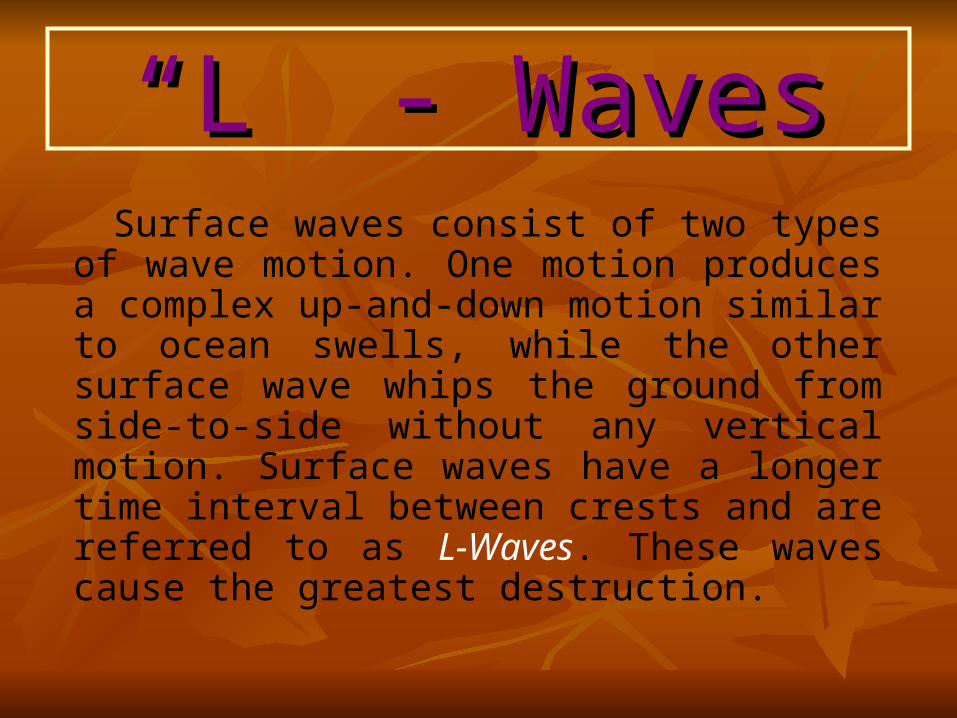
““L” - WavesL” - Waves Surface waves consist of two types of wave
motion. One motion produces a complex up-and-down motion similar to ocean swells, while the other surface wave whips the ground from side-to-side without any vertical motion. Surface waves have a longer time interval between crests and are referred to as L-Waves. These waves cause the greatest destruction.
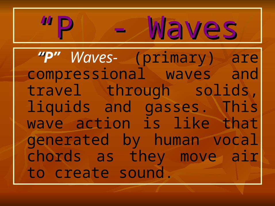
““P” - WavesP” - Waves “ “P” Waves- (primary) are
compressional waves and travel through solids, liquids and gasses. This wave action is like that generated by human vocal chords as they move air to create sound.
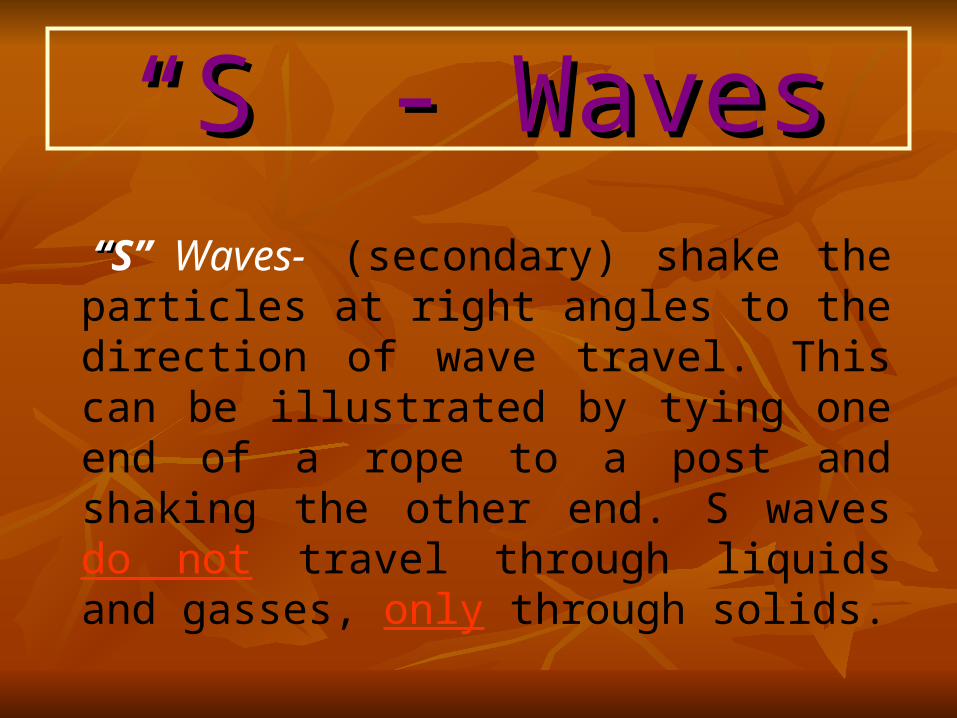
““S” - WavesS” - Waves “ “S” Waves- (secondary) shake the
particles at right angles to the direction of wave travel. This can be illustrated by tying one end of a rope to a post and shaking the other end. S waves do not travel through liquids and gasses, only through solids.
EarthquakesEarthquakesThe epicenter is the location on the surface of the Earth directly above the focus (source) and can be measured by a seismograph.Seismograph- A device used to measure the low frequency waves generated by an earthquake. They are placed at over 100 locations throughout the world and provided geologists with data about the Earth’s composition, by understanding the characteristics of the low frequency waves generated by an earthquake.
Richter ScaleRichter Scale The Richter Scale is used worldwide to describe
earthquake magnitude. Using Richter’s scale, the magnitude is determined by measuring the amplitude of the largest wave recorded on the seismograph. Large-magnitude earthquakes will cause the seismograph pen to be displaced farther than small-magnitude earthquakes.
EarthquakesEarthquakes
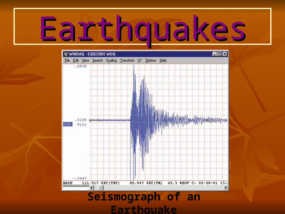
Seismograph of an Earthquake
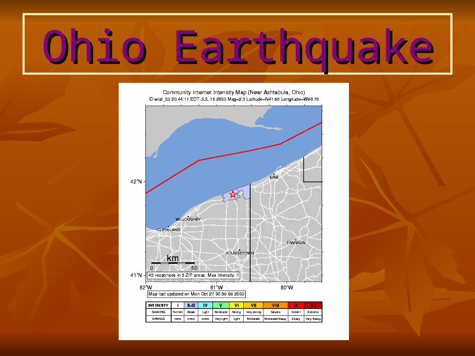
Ohio EarthquakeOhio Earthquake


![Physical modeling of tsunamis generated by three ......[2] Tsunamis are water waves generated by impulsive disturbances such as submarine earthquakes and landslides, volcanic eruptions](https://img.pdfslide.us/doc/110x75/605705a83642e512411472aa/physical-modeling-of-tsunamis-generated-by-three-2-tsunamis-are-water.jpg)