Embed Size (px)
Citation preview

History of the Ouachita Trail 1970-1997 by John Archer
John Archer retired in 1997 from the U.S. Forest Service after 42 years of federal government service. From 1970-1997, he was Ranger for the Jessieville District of the Ouachita National Forest. John, a graduate of North Carolina State University with a BS in Forest Management, began his Forest Service career on the Cherokee National Forest (TN). Before coming to the Jessieville RD, John was a Forester on the Cumberland NF (KY), Forester and then Assistant Ranger on the Daniel Boone NF (KY), and Ranger on the Jefferson NF (VA). John and wife Sue live in the Hot Springs, AR area. They have two children, two grandchildren, and two great-grandchildren. John enjoys photography and shooting his pistols and antique M-1 rifle.
1 May 2011
I was the District Ranger in the early 1970s on the Jessieville District of the Ouachita Na-tional Forest. One day Art Cowley, Forest Recreation Staff Specialist, stopped by our office that was in an old CCC building on Indi-ana Avenue in Hot Springs. We were going to participate in a new program with the State called Green Thumb. The State would hire and pay workers and the Forest Service would furnish the work. It was a program to employ senior folks to do good work and supplement their income. Art told me about his idea of building a foot-trail across the Ouachita Na-tional Forest. It sounded like a great idea.
In a short time, each Ouachita NF Ranger District that would be involved had a Green Thumb crew of five to eight people. Art had plotted out a general route for the trail on a Forest map. He had the locations where the trail would enter and leave each District. I presented the trail proposal to my District Staff. Most were a little apprehensive about whether the trail would be used by the public. Leonard Ernst was our Resource Assistant; he would be our trail construction manager. The problem was Leonard had never been around trail construction. Luckily, I had quite a bit of trail experience as District Ranger of the Mt. Rogers National Recreation Area in Virginia.
The District had just received new USGS Topo Maps for the middle of the District going east to west. All we had previous to this were planimetric maps which would be useless for locating a trail. We got the new maps out and taped together enough to put a rough loca-tion for the trail. One of the first things I no-ticed was that we had two major creeks to cross. They were North Fork and Irons Fork.
Irons Fork was a long way off so we didn’t worry about that crossing. I didn’t figure we would get money to construct a bridge across either; though we could cross North Fork on the State Highway 298 bridge. At that time Highway 298 (Possum Kingdom Road) was dirt and gravel. The section by the road was close to some pretty scenery and might be a good place to train the crew and start construction. Leonard and I went out to flag the first sec-tion of trail. I took a picture that has faded over the years. It took about two weeks to build the trail to the North Fork Road. Now the crew was ready to start building west from Highway 7.
The Green Thumbers started digging west toward Highway 298. My idea was to build trail connecting little used old roads and put it through as quickly as possible. We would then backtrack and replace the roads with dug, single-track trail on a more permanent location. Construction went good through most of 1971. The crew moved to Ouachita Pinnacle and continued west from the tower site. We used a considerable part of FS Road 107 on the east end of Blue Mountain as trail. That part would have to be relocated later. On one occasion, the crew encountered a mountain lion while driving to the tower site. The crew was walking over two miles to get to
their work which seemed to be a lot for peo-ple their age. We decided to move to the other end and continue east from where the North Fork of the Ouachita River section ended. The trail progressed well until the walking distance got excessive again. There was a four-mile section in between that seemed unreachable by the Green Thumb Crew. The shortest way to the top was to hike straight up the mountain. The Forest Supervisor gave us enough money to use some of our younger people to build that section. We had enough for four people for two weeks.
Dillard Graves was the FS crew leader. He would locate the trail as well as help with construction. Wimp Adams, Dewey Watson, and Earl Teal were the crew. They had worked for a couple of days, and I hiked up on the mountain to see how they were doing. There were lots of rocks where they were working. Progress was slow. Wimp was a long-time resident of Possum Kingdom, an area south of Blue Mountain. He told me of a trail that was used years ago by a man named Joe Noles. It was around the time of the Civil War that Noles, who lived north of Blue Mountain, carried corn on his back from his place on the North Fork, to the grist mill in Possum Kingdom. The trail went down the ridge top of the mountain. Wimp said, “Here it is.” He kicked some leaves back and there was a smooth place. It took some imagina-tion but you could almost see the Joe Noles Trail. You could feel it because there was a tread or path with few rocks. Some of the old trail was lined with rocks. We could resurrect that trail much easier than we could build a new one. The only problem was the Joe Noles Trail didn’t pay much attention to slope. When the ridge top went up steeply, so went the trail. Some places were over 20% grade. I made the decision to use this old historic trail
Gravel Highway 298 (1970) aka Possum Kingdom Road
Ouachita Trail Dedication left: Alvis Owen, Ouachita NF Supervisor
right: Judy Koffman, Green Thumbs Director AR
Arboretum in Oklahoma and discovered that 3M sold sign-making materials. We could buy brown aluminum back ground material and reflector letters; just make the sign with those materials and mount it on a ¾-inch board that was cut to size. All the early signs were made this way. Later, Green Thumb furnished a crew to make routed signs; the Forest Service bought the equipment. They worked for years in their shop on Indiana Avenue in Hot Springs.
Between signs we marked the trail with a triangular reflecting marker. These were neat. The trouble was they made good sou-venirs. Dillard came in one day and said that log trucks had been picking up lost Texans on the Gladstone Road. That road runs parallel to the trail about one to three miles to the north. We decided to mark the trail with blue paint. This helped lots.
Leonard Ernst was transferred south and was replaced by Tom Hawks. Tom came to us with trail construction experience. Even bet-ter, he liked to get out and flag the location on the ground. He did a lot of good work locating the trail section from Highway 298 west to Highway 27. The big problem was how to cross Irons Fork. We looked up and down the creek. We decided on a beautiful place where we could make a crossing with a cable bridge. Engineering in the Forest Super-visors office vetoed that idea. The Forest Engi-neer had worked on the Cherokee National Forest in Tennessee where they had several swinging cable bridges. People would get them swinging and would eventually pull out an anchor making the bridge unsafe. We ended up crossing the creek on Road 148 at a gravel crossing.
In mid-1974, Tom Hawks was promoted to District Ranger on a District in the mountains of Georgia. Rex Mann replaced Tom as our District staff person in charge of the trail. Dillard Graves, our Engineering Technician, was doing most of the relocation for the final trail location. Rex and I were checking a sec-tion of the trail on the north side of Blue Mountain that replaced Road 107 with a sin-gle-track trail. An owl flew out of a tree and glided down and crossed the trail. Rex said, “Look at that hoot owl!” We noticed that backpackers had been camping at that loca-tion. That place became known as Hoot Owl Gap. Later we located a wildlife water hole nearby. I know that water holes are not the best source of drinking water but it’s better than walking a mile to a creek.
History of the Ouachita Trail 1970-1997 John Archer
________________________________________________________________________________________________________________________________________________________________________________________________________________________________________________
as part of the Ouachita Trail. We could relo-cate later if we got too much use and it eroded. To my knowledge the trail remains at that location.
By August 1972, we had a walkable trail of 21 miles going from Highway 7 to Highway 298. Leonard got a call from the leader of a Boys Club from Memphis, Tennessee. They would like to take a backpack trip on the Ouachita Trail. He put them on to our new trail. They decided to hike the entire 21 miles in three days. I went out and met with them. There were a lot of young boys in the group. I took their picture. To my knowledge, they were the first group to backpack on the Ouachita Trail. They didn’t make the whole 21 miles.
One of the problems we had in early days of the trail was signage. Signs were to be or-dered from the Regional Sign Shop. A District had to have a completed sign plan approved by the Regional Sign Coordinator before a sign order could be processed. I had an approved sign plan for my District in Virginia before coming to the Ouachita. It would take a month for a person to complete. There are a lot of signs on a 100,000 plus acre District with several hundred miles of road. We were working on the sign plan as time allowed so we could order signs for the trail. Jim Wen-ner, Forest Recreation Staff, called me one day and asked, “How would you like to make your own signs.” Jim had been assigned the job of Forest Sign Coordinator by the Forest Supervisor in addition to his other jobs. He had been working with a representative from the 3M Company on a big sign for the Kerr
During the mid 1970s the Forest Service was requiring employees working with tools in the woods to wear government contracted steel-toed boots. The low bid on the contract was by a company I had never heard of. We were getting a lot of complaints about those boots. Rex said that he would find out if the com-plaints were justified. He planned to walk the section of trail from Ouachita Pinnacle to Highway 298, and do some painting and check on trail condition. He wore the dastardly boots. I dropped him off at the tower and went on with what I was doing that day. Later I was to pick him up at the 298 trailhead. I got a radio call from Rex, “Pick me up at the North Fork road trail crossing.” When I met him he was barefooted. Those off-brand boots were not for serious trail hiking!
In the late 1970s the trail was getting more use. We had some young engineers in the Forest Supervisors Office that took an interest in the Trail. They designed the concrete bridge that now crosses Irons Fork. Long ago, a logging railroad followed Irons Fork going to the logging town of Stillwater. Looking for a place for the crossing, we saw numerous arti-facts left by the railroad. It was said by old timers that the railroad washed out numerous times by the fast moving creek after a storm. I had doubts that the concrete bridge would last with the flooding that occurred annually.
In 1980 a contract to build the Irons Fork trail bridge was awarded to a couple of men from Mount Ida. It was completed for final inspec-tion August 31, 1981. I went to check it out after the first big rain. Sure enough, it was still there. I hiked that section of the trail with the Ouachita Mountain Hikers. When they came to the bridge the first comment I heard was, “Isn’t this a beautiful place!” The hikers were looking up and down the creek. That made my day.
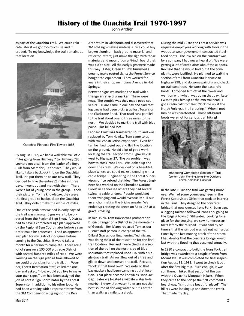
Ouachita Pinnacle Fire Tower (1966)
2 May 2011
Inspecting Completed Section of Trail (center: John Fleming, long time Outdoors
Editor, Arkansas Gazette)
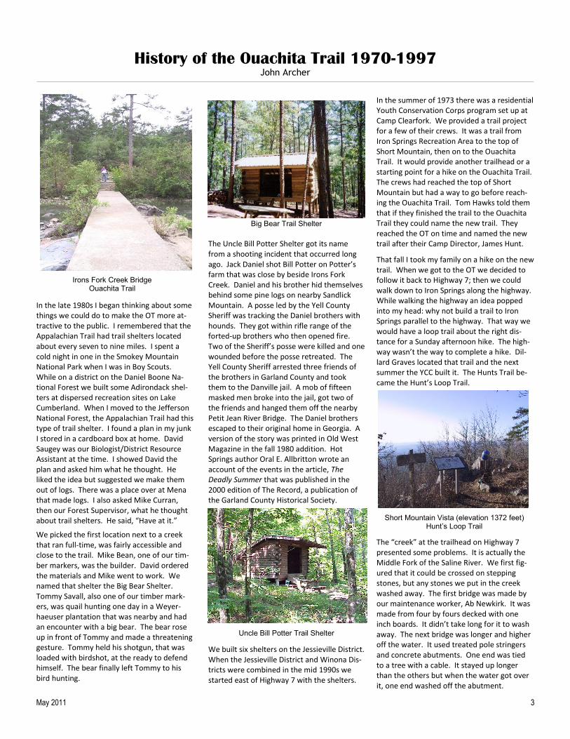
Irons Fork Creek Bridge Ouachita Trail
History of the Ouachita Trail 1970-1997
John Archer ____________________________________________________________________________________________________________________________________________________________________________________________________________________________________________________________________________________________________
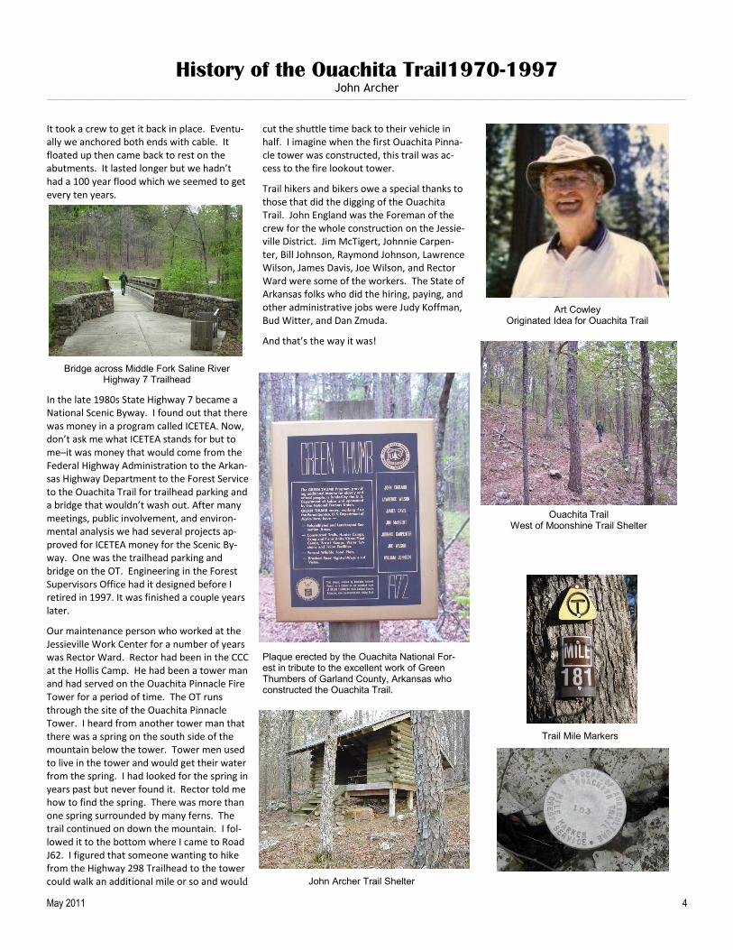
In the late 1980s I began thinking about some things we could do to make the OT more at-tractive to the public. I remembered that the Appalachian Trail had trail shelters located about every seven to nine miles. I spent a cold night in one in the Smokey Mountain National Park when I was in Boy Scouts. While on a district on the Daniel Boone Na-tional Forest we built some Adirondack shel-ters at dispersed recreation sites on Lake Cumberland. When I moved to the Jefferson National Forest, the Appalachian Trail had this type of trail shelter. I found a plan in my junk I stored in a cardboard box at home. David Saugey was our Biologist/District Resource Assistant at the time. I showed David the plan and asked him what he thought. He liked the idea but suggested we make them out of logs. There was a place over at Mena that made logs. I also asked Mike Curran, then our Forest Supervisor, what he thought about trail shelters. He said, “Have at it.”
We picked the first location next to a creek that ran full-time, was fairly accessible and close to the trail. Mike Bean, one of our tim-ber markers, was the builder. David ordered the materials and Mike went to work. We named that shelter the Big Bear Shelter. Tommy Savall, also one of our timber mark-ers, was quail hunting one day in a Weyer-haeuser plantation that was nearby and had an encounter with a big bear. The bear rose up in front of Tommy and made a threatening gesture. Tommy held his shotgun, that was loaded with birdshot, at the ready to defend himself. The bear finally left Tommy to his bird hunting.
The Uncle Bill Potter Shelter got its name from a shooting incident that occurred long ago. Jack Daniel shot Bill Potter on Potter’s farm that was close by beside Irons Fork Creek. Daniel and his brother hid themselves behind some pine logs on nearby Sandlick Mountain. A posse led by the Yell County Sheriff was tracking the Daniel brothers with hounds. They got within rifle range of the forted-up brothers who then opened fire. Two of the Sheriff’s posse were killed and one wounded before the posse retreated. The Yell County Sheriff arrested three friends of the brothers in Garland County and took them to the Danville jail. A mob of fifteen masked men broke into the jail, got two of the friends and hanged them off the nearby Petit Jean River Bridge. The Daniel brothers escaped to their original home in Georgia. A version of the story was printed in Old West Magazine in the fall 1980 addition. Hot Springs author Oral E. Allbritton wrote an account of the events in the article, The Deadly Summer that was published in the 2000 edition of The Record, a publication of the Garland County Historical Society.
We built six shelters on the Jessieville District. When the Jessieville District and Winona Dis-tricts were combined in the mid 1990s we started east of Highway 7 with the shelters.
In the summer of 1973 there was a residential Youth Conservation Corps program set up at Camp Clearfork. We provided a trail project for a few of their crews. It was a trail from Iron Springs Recreation Area to the top of Short Mountain, then on to the Ouachita Trail. It would provide another trailhead or a starting point for a hike on the Ouachita Trail. The crews had reached the top of Short Mountain but had a way to go before reach-ing the Ouachita Trail. Tom Hawks told them that if they finished the trail to the Ouachita Trail they could name the new trail. They reached the OT on time and named the new trail after their Camp Director, James Hunt.
That fall I took my family on a hike on the new trail. When we got to the OT we decided to follow it back to Highway 7; then we could walk down to Iron Springs along the highway. While walking the highway an idea popped into my head: why not build a trail to Iron Springs parallel to the highway. That way we would have a loop trail about the right dis-tance for a Sunday afternoon hike. The high-way wasn’t the way to complete a hike. Dil-lard Graves located that trail and the next summer the YCC built it. The Hunts Trail be-came the Hunt’s Loop Trail.
The “creek” at the trailhead on Highway 7 presented some problems. It is actually the Middle Fork of the Saline River. We first fig-ured that it could be crossed on stepping stones, but any stones we put in the creek washed away. The first bridge was made by our maintenance worker, Ab Newkirk. It was made from four by fours decked with one inch boards. It didn’t take long for it to wash away. The next bridge was longer and higher off the water. It used treated pole stringers and concrete abutments. One end was tied to a tree with a cable. It stayed up longer than the others but when the water got over it, one end washed off the abutment.
Big Bear Trail Shelter
Uncle Bill Potter Trail Shelter
Short Mountain Vista (elevation 1372 feet) Hunt’s Loop Trail
May 2011 3
Irons Fork Creek Bridge Ouachita Trail
History of the Ouachita Trail1970-1997 John Archer
____________________________________________________________________________________________________________________________________________________________________________________________________________________________________________________________________________________________________
It took a crew to get it back in place. Eventu-ally we anchored both ends with cable. It floated up then came back to rest on the abutments. It lasted longer but we hadn’t had a 100 year flood which we seemed to get every ten years.
In the late 1980s State Highway 7 became a National Scenic Byway. I found out that there was money in a program called ICETEA. Now, don’t ask me what ICETEA stands for but to me─it was money that would come from the Federal Highway Administration to the Arkan-sas Highway Department to the Forest Service to the Ouachita Trail for trailhead parking and a bridge that wouldn’t wash out. After many meetings, public involvement, and environ-mental analysis we had several projects ap-proved for ICETEA money for the Scenic By-way. One was the trailhead parking and bridge on the OT. Engineering in the Forest Supervisors Office had it designed before I retired in 1997. It was finished a couple years later.
Our maintenance person who worked at the Jessieville Work Center for a number of years was Rector Ward. Rector had been in the CCC at the Hollis Camp. He had been a tower man and had served on the Ouachita Pinnacle Fire Tower for a period of time. The OT runs through the site of the Ouachita Pinnacle Tower. I heard from another tower man that there was a spring on the south side of the mountain below the tower. Tower men used to live in the tower and would get their water from the spring. I had looked for the spring in years past but never found it. Rector told me how to find the spring. There was more than one spring surrounded by many ferns. The trail continued on down the mountain. I fol-lowed it to the bottom where I came to Road J62. I figured that someone wanting to hike from the Highway 298 Trailhead to the tower could walk an additional mile or so and would
cut the shuttle time back to their vehicle in half. I imagine when the first Ouachita Pinna-cle tower was constructed, this trail was ac-cess to the fire lookout tower.
Trail hikers and bikers owe a special thanks to those that did the digging of the Ouachita Trail. John England was the Foreman of the crew for the whole construction on the Jessie-ville District. Jim McTigert, Johnnie Carpen-ter, Bill Johnson, Raymond Johnson, Lawrence Wilson, James Davis, Joe Wilson, and Rector Ward were some of the workers. The State of Arkansas folks who did the hiring, paying, and other administrative jobs were Judy Koffman, Bud Witter, and Dan Zmuda.
And that’s the way it was!
Bridge across Middle Fork Saline River Highway 7 Trailhead
May 2011 4
Art Cowley Originated Idea for Ouachita Trail
Plaque erected by the Ouachita National For-est in tribute to the excellent work of Green Thumbers of Garland County, Arkansas who constructed the Ouachita Trail.
Ouachita Trail West of Moonshine Trail Shelter
John Archer Trail Shelter
Trail Mile Markers