Embed Size (px)
Citation preview
History of Maxwell Air Force Base Maxwell Air Force Base history is rich with memories of famous people and events from
DeSoto’s visit to the space age. Since 1540 when DeSoto visited the Indian town of Tawassa on
the banks of the Alabama River, the flow of leaders in history to this site has continued.
Explorers, early pioneers, and present day pioneers have returned time and again.
In February 1910 Wilbur Wright came to the Kohn Plantation, the former location of
Tawassa, in search of suitable site to establish a civilian flying school. With the assistance of
local businessmen, land was donated and a wooden hanger built to house the Wright aircraft. On
March 19, 1910, the Wright brothers opened their school on the site which later became Maxwell
AFB. The Wright’s closed the school May 27, 1910 and the field lay dormant for the next eight
years.
In 1918 local business leaders leased the field for an aviation repair depot and on
November 8, 1922, the field was officially named in honor of Second Lieutenant William C.
Maxwell, a native of Atmore, Alabama. While on a training flight in the Philippine Islands, Lt.
Maxwell’s plane developed engine trouble. When an emergency landing was attempted, he saw
children playing directly in the path of his aircraft. He deliberately swerved the plane, striking a
pole which broke his wing. Maxwell died in the crash. Maxwell Air Force Base is a tribute to
his self-sacrifice.
Construction of the first permanent buildings on Maxwell AFB began in October 1927.
The mission of the base changed in 1931 when the Air Corps Tactical School at Langley Field,
Virginia, relocated to Maxwell. The War Department established the Southeast Air Corps
Training Center July 8, 1940, with headquarters at Maxwell Field. In rapid succession, Maxwell
Field was used as an Officer Candidate School, Advanced Flying Training School, B-24
Navigation School and B-29 transition School. The SEAC was re-designated as the Army Air
Forces Eastern Flying Training Command August 23, 1943. It inactivated December 15, 1945.
After World War II, Air University and its five schools, Air Tactical School, Air
Command and Staff School, Air War College, Army Air Force School of Aviation Medicine,
and Air Special Staff School, under the command of the late General Muir S. Fairchild, emerged.
The Korean War began in June 1950, and the Air Force decided to consolidate all its educational
activities at Maxwell and nearby Gunter AFB. As a result, in 1954 the construction of the
present day academic facilities on Chennault Circle began.
In 1978 the merger of Air University and Air Training Command took place, but in July
of 1983 Air University once again returned to major command status. In 1993, during massive
restructuring of the Air Force, Air University once again joined with Air Training Command –
this time to form a new command, Air Education and Training Command, with the AU
commander also serving as the command’s director of education.
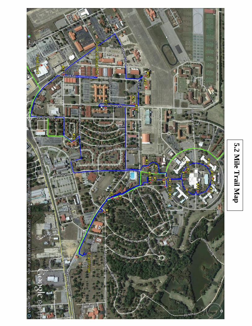
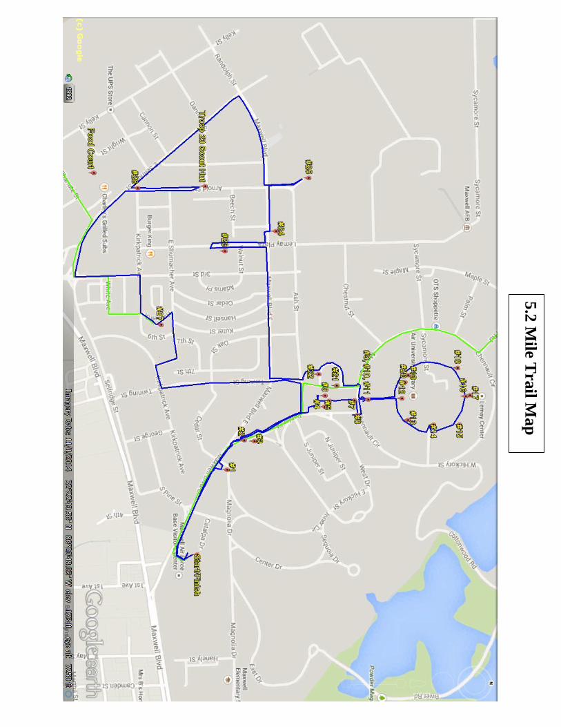
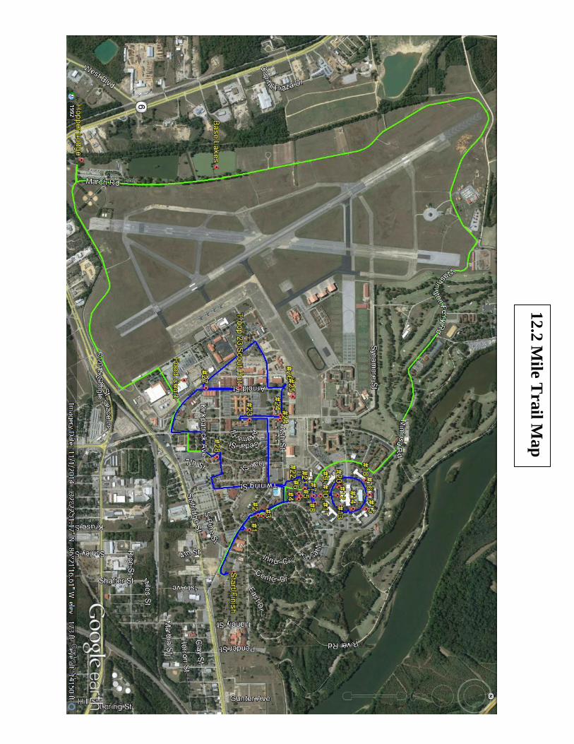
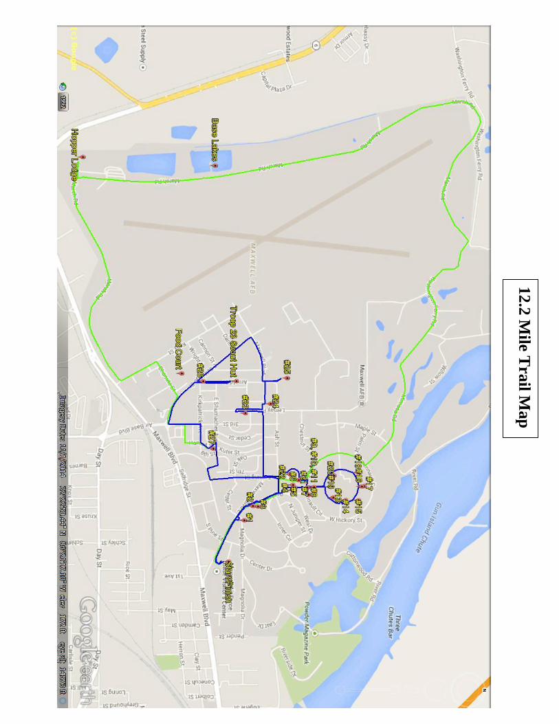
The Boy Scout Trail The Maxwell Historical Trail, located on Maxwell AFB, is a 5.2 mile long trail, with an
extended version that adds another7 miles, that highlights the rich history of the area and the Air
Force. The trail begins at the base’s Maxwell Blvd. gate, and parking for trail walkers is
available in the visitor’s center parking lot.
The Trail was conceived in 1976 by Boy Scouts of Troop 23, located on Maxwell.
Martin Emmons undertook the establishment of the Trail as his Eagle Scout project. The Trail
was opened in June of that year, leading walkers past a variety of historic sites.
By 1989 numerous additional historical points of interest on the base had been identified,
and 101 base buildings had been added to the National Register of Historic Places. Chris Tribble
of Boy Scout Troop 23 undertook the revision of the trail, adding these newly commemorated
historical sites, rerouting the trail, and establishing an abbreviated trail for less hearty hikers. He
also arranged for placement of a permanent sign to mark the trail’s start, and rewrote the trail
brochure. The revisions went into effect in January 1989.
The third revision of the trail was accomplished by Daniel Ladnier of Troop 23 as an
Eagle Scout project. Changes to street names, additional monuments and historical events taking
place since the previous revision were added, and the new trail opened in February 1997.
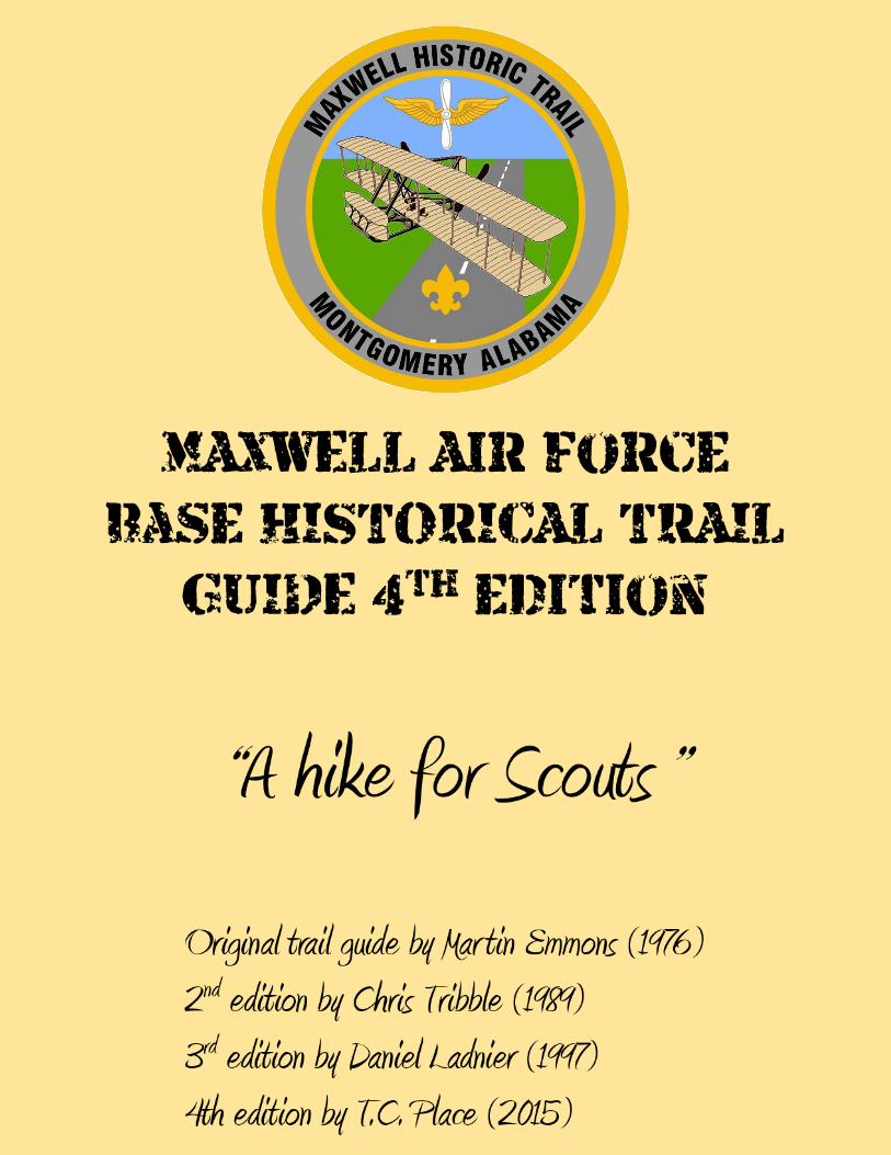
This is the fourth revision of the trail, created by Thomas C. Place (T.C. Place) of Troop
23 also as an Eagle Scout Project. Changes to the route, creation of a new patch, color pictures
and directions were added as part of the trail guide, in addition to adding a monument to the trail.
You can hike the trail for free. A Maxwell Historical Trail patch is available from the
Boy Scout Troop 23 to hikers who complete it. The cost is nominal. To purchase patches, e-
mail Troop 23 at [email protected].
Although the Trail was designed by and is administered by the Boy Scouts, it is open to
other groups also. Trail patches are available to all hikers. Since Maxwell is a U.S. military
installation, certain regulations must be followed for entry to the base, and while walking the
trail.
Participation of groups in hiking the Trail in no way obligates the U.S. Government or
the U.S. Air Force in case of accidents or injuries. For off base groups hiking the Trail, entrance
must be made at the Maxwell Blvd. gate. Vehicles will be parked at the Visitor’s Center.
SOME BASIC TIPS TO FOLLOW:
1. In order to get on base to hike the trail, all adults need a sponsor (one per group), photo ID,
and vehicle registration and insurance. For assistance finding a sponsor, please e-mail
[email protected] at least 2 weeks before your hike. Sponsors should contact the 42nd
Security Forces Squadron at 334-953-7222 several weeks before the scheduled hike to obtain
information about specific requirements to enter the base and conduct the hike.
2. Entry onto the runways or the parking ramps is prohibited. Swimming by hikers is not permitted
anywhere on the installation.
3. Hikers and their leaders must remain as a group at all times, except in case of emergency, at
which time a maximum number of adults will remain with the main group of hikers.
4. Hikers should stay on the trail and walk facing traffic in single file, staying on sidewalks
whenever possible.
5. A minimum of two adults must accompany each group with eight or fewer hikers. A minimum
of one additional adult must be present for every eight or fewer hikers after the first eight.
6. The Trail is open for hiking every day of the year, sunrise to sunset. It normally takes about two
hours to hike the 5.2 mile abbreviated trail and view the points of interest. It takes about 3-4
hours to hike the extended 12 mile trail.
7. Bring water, sunscreen, and snacks. The exchange food court is available for everyone’s use.
EMERGENCY PROCEDURES
Security forces (police), emergency medical care, the fire department are available on
Maxwell by dialing 911 from any office phone on the base. To report emergency situations over
public pay phones on the base, or by cellular phone, call: 911. This action should be taken
ONLY during EMERGENCY SITUATIONS.
The Trail Begins… From the Visitor’s Center, proceed on
Maxwell Blvd. to the start of the trail.
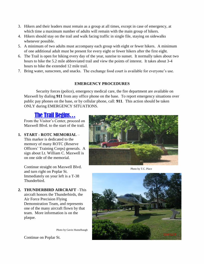
1. START - ROTC MEMORIAL –
This marker is dedicated to the
memory of many ROTC (Reserve
Officers’ Training Corps) generals. A
sign about Lt. William C. Maxwell is
on one side of the memorial.
Continue straight on Maxwell Blvd.
and turn right on Poplar St.
Immediately on your left is a T-38
Thunderbird.
2. THUNDERBIRD AIRCRAFT –This
aircraft honors the Thunderbirds, the
Air Force Precision Flying
Demonstration Team, and represents
one of the many aircraft flown by that
team. More information is on the
plaque.
Continue on Poplar St.
Photo by T.C. Place
Photo by Gavin Humelbaugh
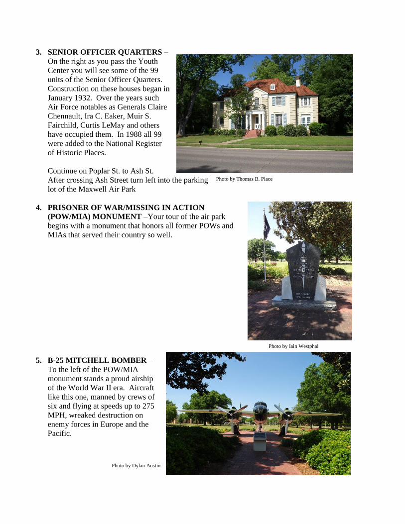
3. SENIOR OFFICER QUARTERS –
On the right as you pass the Youth
Center you will see some of the 99
units of the Senior Officer Quarters.
Construction on these houses began in
January 1932. Over the years such
Air Force notables as Generals Claire
Chennault, Ira C. Eaker, Muir S.
Fairchild, Curtis LeMay and others
have occupied them. In 1988 all 99
were added to the National Register
of Historic Places.
Continue on Poplar St. to Ash St.
After crossing Ash Street turn left into the parking
lot of the Maxwell Air Park
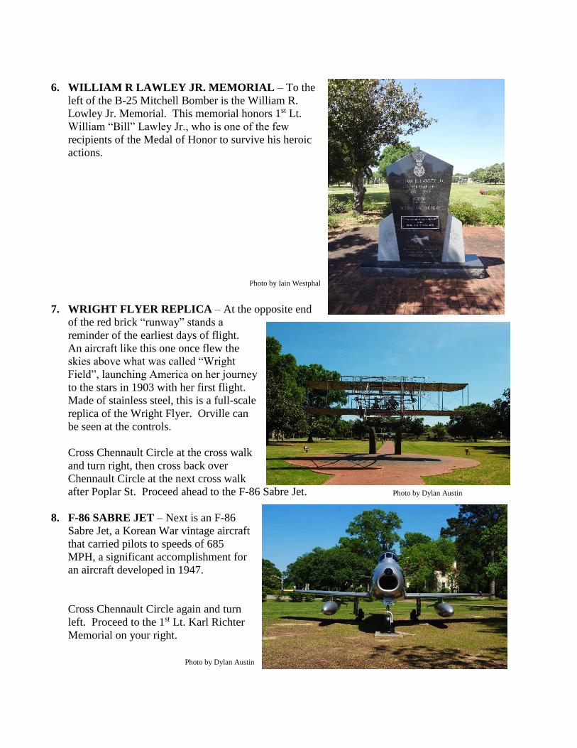
4. PRISONER OF WAR/MISSING IN ACTION
(POW/MIA) MONUMENT –Your tour of the air park
begins with a monument that honors all former POWs and
MIAs that served their country so well.
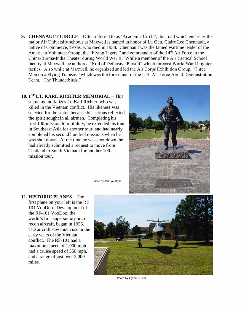
5. B-25 MITCHELL BOMBER –
To the left of the POW/MIA
monument stands a proud airship
of the World War II era. Aircraft
like this one, manned by crews of
six and flying at speeds up to 275
MPH, wreaked destruction on
enemy forces in Europe and the
Pacific.
Photo by Thomas B. Place
Photo by Iain Westphal
Photo by Dylan Austin
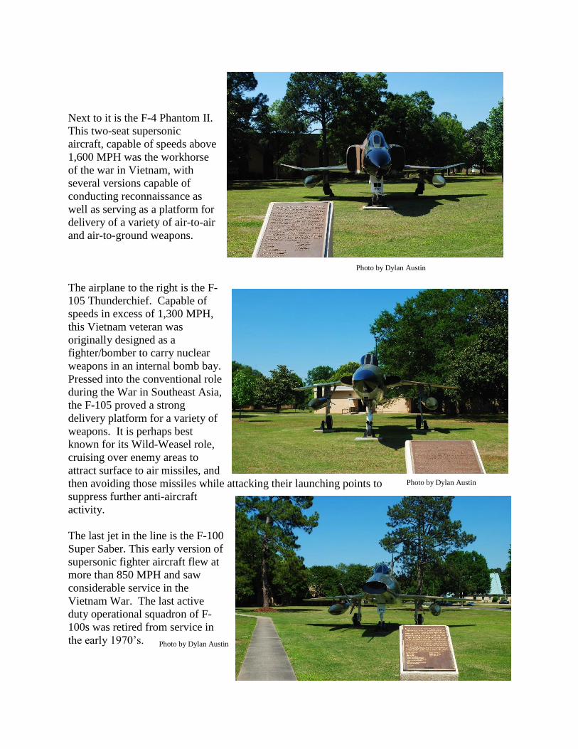
6. WILLIAM R LAWLEY JR. MEMORIAL – To the
left of the B-25 Mitchell Bomber is the William R.
Lowley Jr. Memorial. This memorial honors 1st Lt.
William “Bill” Lawley Jr., who is one of the few
recipients of the Medal of Honor to survive his heroic
actions.
7. WRIGHT FLYER REPLICA – At the opposite end
of the red brick “runway” stands a
reminder of the earliest days of flight.
An aircraft like this one once flew the
skies above what was called “Wright
Field”, launching America on her journey
to the stars in 1903 with her first flight.
Made of stainless steel, this is a full-scale
replica of the Wright Flyer. Orville can
be seen at the controls.
Cross Chennault Circle at the cross walk
and turn right, then cross back over
Chennault Circle at the next cross walk
after Poplar St. Proceed ahead to the F-86 Sabre Jet.
8. F-86 SABRE JET – Next is an F-86
Sabre Jet, a Korean War vintage aircraft
that carried pilots to speeds of 685
MPH, a significant accomplishment for
an aircraft developed in 1947.
Cross Chennault Circle again and turn
left. Proceed to the 1st Lt. Karl Richter
Memorial on your right.
Photo by Dylan Austin
Photo by Iain Westphal
Photo by Dylan Austin
9. CHENNAULT CIRCLE – Often referred to as ‘Academic Circle’, this road which encircles the
major Air University schools at Maxwell is named in honor of Lt. Gen. Claire Lee Chennault, a
native of Commerce, Texas, who died in 1958. Chennault was the famed wartime leader of the
American Volunteer Group, the “Flying Tigers,” and commander of the 14th Air Force in the
China-Burma-India Theater during World War II. While a member of the Air Tactical School
faculty at Maxwell, he authored “Roll of Defensive Pursuit” which forecast World War II fighter
tactics. Also while at Maxwell, he organized and led the Air Corps Exhibition Group, “Three
Men on a Flying Trapeze,” which was the forerunner of the U.S. Air Force Aerial Demonstration
Team, “The Thunderbirds.”
10. 1ST LT. KARL RICHTER MEMORIAL – This
statue memorializes Lt. Karl Richter, who was
killed in the Vietnam conflict. His likeness was
selected for the statue because his actions reflected
the spirit sought in all airmen. Completing his
first 100-mission tour of duty, he extended his tour
in Southeast Asia for another tour, and had nearly
completed his second hundred missions when he
was shot down. At the time he was shot down, he
had already submitted a request to move from
Thailand to South Vietnam for another 100-
mission tour.
11. HISTORIC PLANES – The
first plane on your left is the RF
101 VooDoo. Development of
the RF-101 VooDoo, the
world’s first supersonic photo-
recon aircraft, began in 1956.
The aircraft saw much use in the
early years of the Vietnam
conflict. The RF-101 had a
maximum speed of 1,000 mph
had a cruise speed of 550 mph,
and a range of just over 2,000
miles.
Photo by Iain Westphal
Photo by Dylan Austin
Next to it is the F-4 Phantom II.
This two-seat supersonic
aircraft, capable of speeds above
1,600 MPH was the workhorse
of the war in Vietnam, with
several versions capable of
conducting reconnaissance as
well as serving as a platform for
delivery of a variety of air-to-air
and air-to-ground weapons.
The airplane to the right is the F-
105 Thunderchief. Capable of
speeds in excess of 1,300 MPH,
this Vietnam veteran was
originally designed as a
fighter/bomber to carry nuclear
weapons in an internal bomb bay.
Pressed into the conventional role
during the War in Southeast Asia,
the F-105 proved a strong
delivery platform for a variety of
weapons. It is perhaps best
known for its Wild-Weasel role,
cruising over enemy areas to
attract surface to air missiles, and
then avoiding those missiles while attacking their launching points to
suppress further anti-aircraft
activity.
The last jet in the line is the F-100
Super Saber. This early version of
supersonic fighter aircraft flew at
more than 850 MPH and saw
considerable service in the
Vietnam War. The last active
duty operational squadron of F-
100s was retired from service in
the early 1970’s.
Photo by Dylan Austin
Photo by Dylan Austin
Photo by Dylan Austin
Photo by Dylan Austin
Go back to the sidewalk in front of the Richter
Memorial, then continue on the sidewalk straight
ahead towards the Fairchild Library.
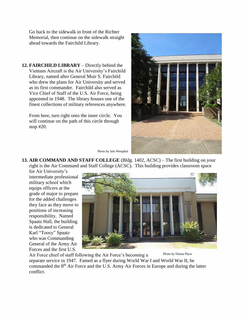
12. FAIRCHILD LIBRARY – Directly behind the
Vietnam Aircraft is the Air University’s Fairchild
Library, named after General Muir S. Fairchild
who drew the plans for Air University and served
as its first commander. Fairchild also served as
Vice Chief of Staff of the U.S. Air Force, being
appointed in 1948. The library houses one of the
finest collections of military references anywhere.
From here, turn right onto the inner circle. You
will continue on the path of this circle through
stop #20.
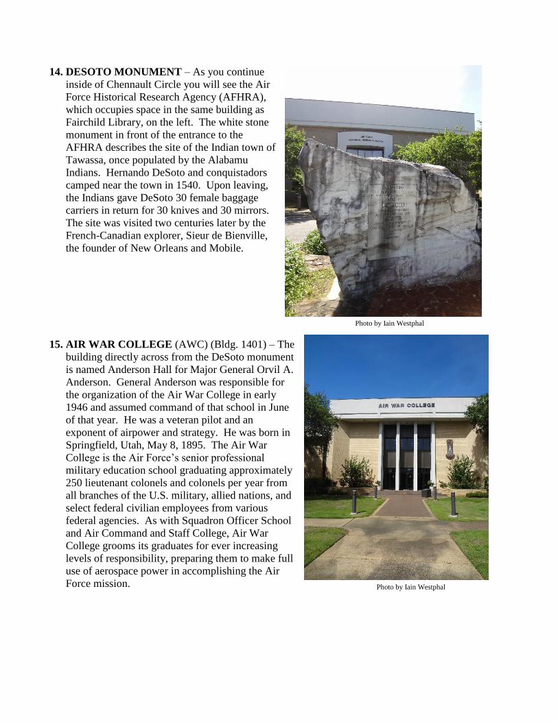
13. AIR COMMAND AND STAFF COLLEGE (Bldg. 1402, ACSC) – The first building on your
right is the Air Command and Staff College (ACSC). This building provides classroom space
for Air University’s
intermediate professional
military school which
equips officers at the
grade of major to prepare
for the added challenges
they face as they move to
positions of increasing
responsibility. Named
Spaatz Hall, the building
is dedicated to General
Karl “Tooey” Spaatz
who was Commanding
General of the Army Air
Forces and the first U.S.
Air Force chief of staff following the Air Force’s becoming a
separate service in 1947. Famed as a flyer during World War I and World War II, he
commanded the 8th Air Force and the U.S. Army Air Forces in Europe and during the latter
conflict.
Photo by Dylan Austin
Photo by Iain Westphal
Photo by Donna Place
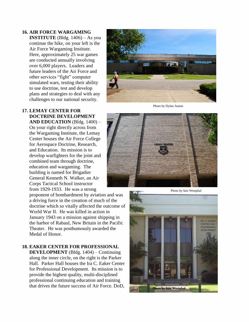
14. DESOTO MONUMENT – As you continue
inside of Chennault Circle you will see the Air
Force Historical Research Agency (AFHRA),
which occupies space in the same building as
Fairchild Library, on the left. The white stone
monument in front of the entrance to the
AFHRA describes the site of the Indian town of
Tawassa, once populated by the Alabamu
Indians. Hernando DeSoto and conquistadors
camped near the town in 1540. Upon leaving,
the Indians gave DeSoto 30 female baggage
carriers in return for 30 knives and 30 mirrors.
The site was visited two centuries later by the
French-Canadian explorer, Sieur de Bienville,
the founder of New Orleans and Mobile.
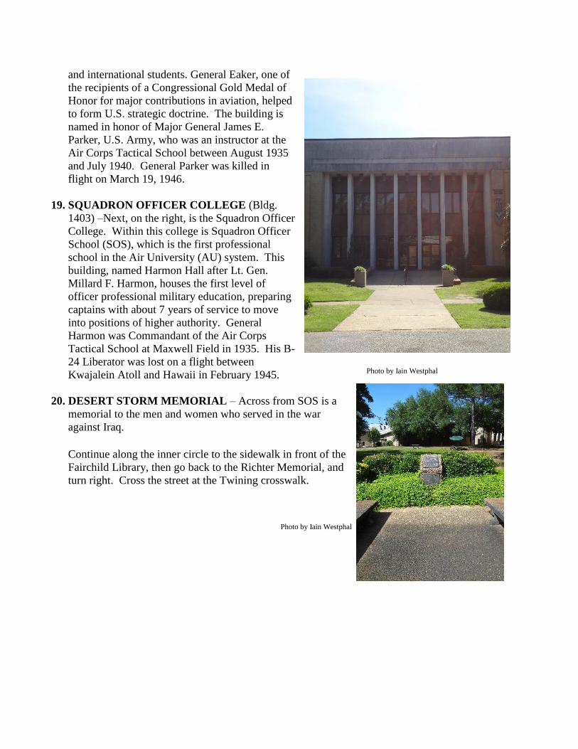
15. AIR WAR COLLEGE (AWC) (Bldg. 1401) – The
building directly across from the DeSoto monument
is named Anderson Hall for Major General Orvil A.
Anderson. General Anderson was responsible for
the organization of the Air War College in early
1946 and assumed command of that school in June
of that year. He was a veteran pilot and an
exponent of airpower and strategy. He was born in
Springfield, Utah, May 8, 1895. The Air War
College is the Air Force’s senior professional
military education school graduating approximately
250 lieutenant colonels and colonels per year from
all branches of the U.S. military, allied nations, and
select federal civilian employees from various
federal agencies. As with Squadron Officer School
and Air Command and Staff College, Air War
College grooms its graduates for ever increasing
levels of responsibility, preparing them to make full
use of aerospace power in accomplishing the Air
Force mission.
Photo by Iain Westphal
Photo by Iain Westphal
16. AIR FORCE WARGAMING
INSTITUTE (Bldg. 1406) – As you
continue the hike, on your left is the
Air Force Wargaming Institute.
Here, approximately 25 war games
are conducted annually involving
over 6,000 players. Leaders and
future leaders of the Air Force and
other services “fight” computer
simulated wars, testing their ability
to use doctrine, test and develop
plans and strategies to deal with any
challenges to our national security.
17. LEMAY CENTER FOR
DOCTRINE DEVELOPMENT
AND EDUCATION (Bldg. 1400) –
On your right directly across from
the Wargaming Institute, the Lemay
Center houses the Air Force College
for Aerospace Doctrine, Research,
and Education. Its mission is to
develop warfighters for the joint and
combined team through doctrine,
education and wargaming. The
building is named for Brigadier
General Kenneth N. Walker, an Air
Corps Tactical School instructor
from 1929-1933. He was a strong
proponent of bombardment by aviation and was
a driving force in the creation of much of the
doctrine which so vitally affected the outcome of
World War II. He was killed in action in
January 1943 on a mission against shipping in
the harbor of Rabaul, New Britain in the Pacific
Theater. He was posthumously awarded the
Medal of Honor.
18. EAKER CENTER FOR PROFESSIONAL
DEVELOPMENT (Bldg. 1404) – Continuing
along the inner circle, on the right is the Parker
Hall. Parker Hall houses the Ira C. Eaker Center
for Professional Development. Its mission is to
provide the highest quality, multi-disciplined
professional continuing education and training
that drives the future success of Air Force. DoD,
Photo by Dylan Austin
Photo by Iain Westphal
Photo by Iain Westphal
and international students. General Eaker, one of
the recipients of a Congressional Gold Medal of
Honor for major contributions in aviation, helped
to form U.S. strategic doctrine. The building is
named in honor of Major General James E.
Parker, U.S. Army, who was an instructor at the
Air Corps Tactical School between August 1935
and July 1940. General Parker was killed in
flight on March 19, 1946.
19. SQUADRON OFFICER COLLEGE (Bldg.
1403) –Next, on the right, is the Squadron Officer
College. Within this college is Squadron Officer
School (SOS), which is the first professional
school in the Air University (AU) system. This
building, named Harmon Hall after Lt. Gen.
Millard F. Harmon, houses the first level of
officer professional military education, preparing
captains with about 7 years of service to move
into positions of higher authority. General
Harmon was Commandant of the Air Corps
Tactical School at Maxwell Field in 1935. His B-
24 Liberator was lost on a flight between
Kwajalein Atoll and Hawaii in February 1945.
20. DESERT STORM MEMORIAL – Across from SOS is a
memorial to the men and women who served in the war
against Iraq.
Continue along the inner circle to the sidewalk in front of the
Fairchild Library, then go back to the Richter Memorial, and
turn right. Cross the street at the Twining crosswalk.
Photo by Iain Westphal
Photo by Iain Westphal
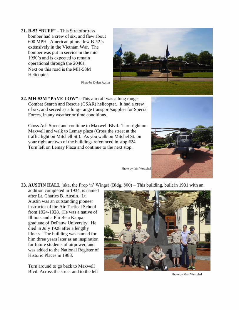
21. B-52 “BUFF” – This Stratofortress
bomber had a crew of six, and flew about
600 MPH. American pilots flew B-52’s
extensively in the Vietnam War. The
bomber was put in service in the mid
1950’s and is expected to remain
operational through the 2040s.
Next on this road is the MH-53M
Helicopter.
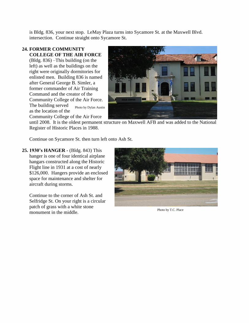
22. MH-53M “PAVE LOW”– This aircraft was a long range
Combat Search and Rescue (CSAR) helicopter. It had a crew
of six, and served as a long–range transport/supplier for Special
Forces, in any weather or time conditions.
Cross Ash Street and continue to Maxwell Blvd. Turn right on
Maxwell and walk to Lemay plaza (Cross the street at the
traffic light on Mitchell St.). As you walk on Mitchel St. on
your right are two of the buildings referenced in stop #24.
Turn left on Lemay Plaza and continue to the next stop.
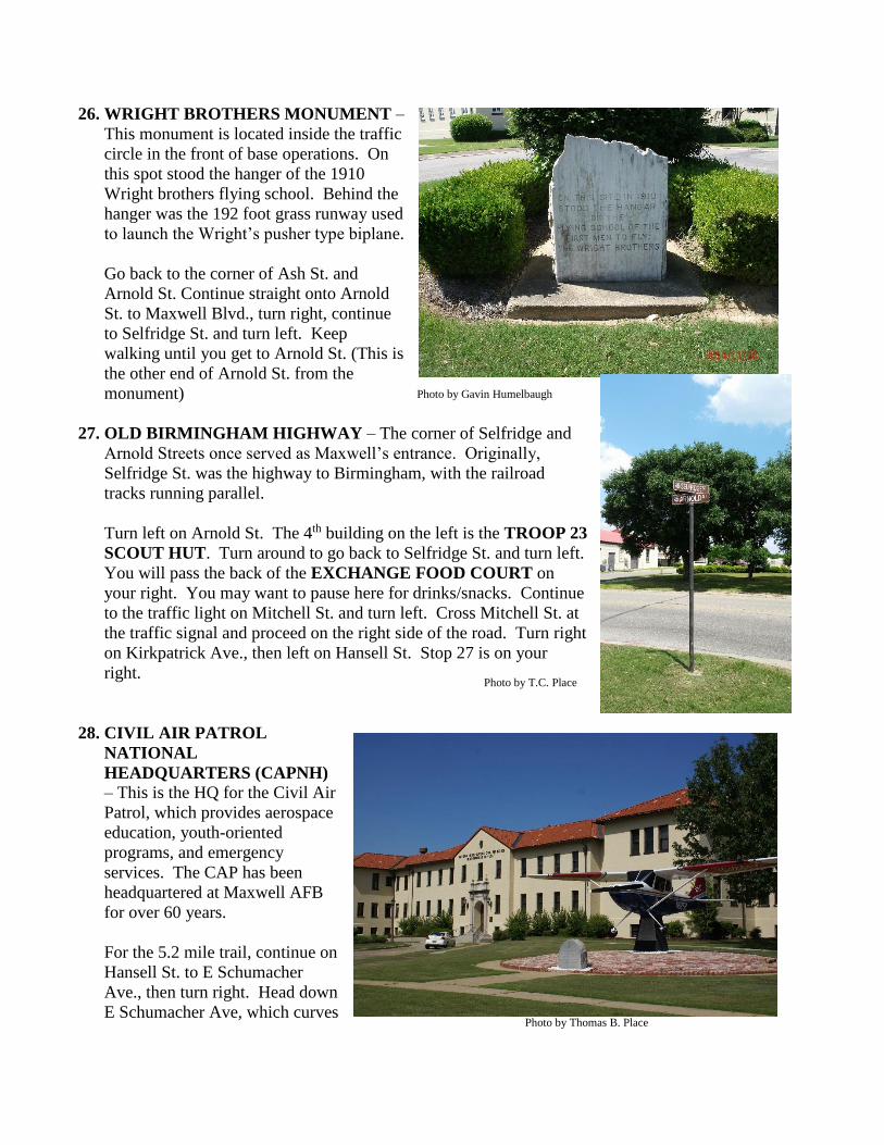
23. AUSTIN HALL (aka, the Prop ‘n’ Wings) (Bldg. 800) – This building, built in 1931 with an
addition completed in 1934, is named
after Lt. Charles B. Austin. Lt.
Austin was an outstanding pioneer
instructor of the Air Tactical School
from 1924-1928. He was a native of
Illinois and a Phi Beta Kappa
graduate of DePauw University. He
died in July 1928 after a lengthy
illness. The building was named for
him three years later as an inspiration
for future students of airpower, and
was added to the National Register of
Historic Places in 1988.
Turn around to go back to Maxwell
Blvd. Across the street and to the left
Photo by Iain Westphal
Photo by Mrs. Westphal
Photo by Dylan Austin
is Bldg. 836, your next stop. LeMay Plaza turns into Sycamore St. at the Maxwell Blvd.
intersection. Continue straight onto Sycamore St.
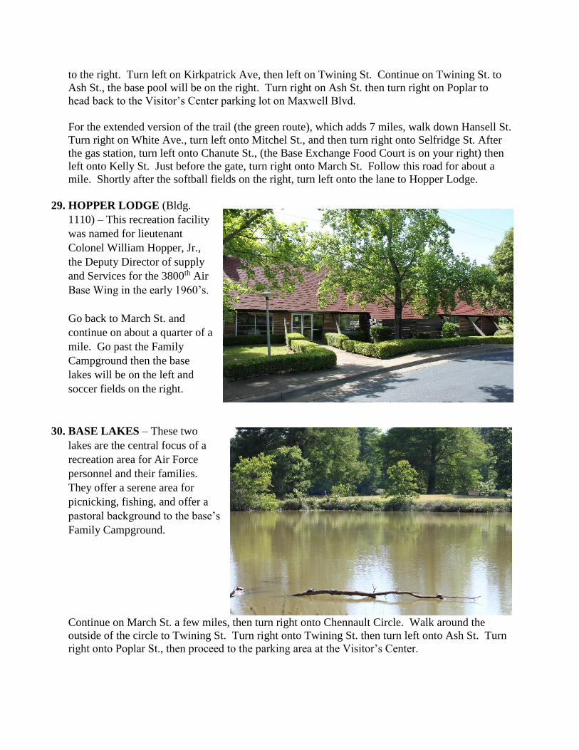
24. FORMER COMMUNITY
COLLEGE OF THE AIR FORCE (Bldg. 836) –This building (on the
left) as well as the buildings on the
right were originally dormitories for
enlisted men. Building 836 is named
after General George B. Simler, a
former commander of Air Training
Command and the creator of the
Community College of the Air Force.
The building served
as the location of the
Community College of the Air Force
until 2008. It is the oldest permanent structure on Maxwell AFB and was added to the National
Register of Historic Places in 1988.
Continue on Sycamore St. then turn left onto Ash St.
25. 1930’s HANGER - (Bldg. 843) This
hanger is one of four identical airplane
hangars constructed along the Historic
Flight line in 1931 at a cost of nearly
$126,000. Hangers provide an enclosed
space for maintenance and shelter for
aircraft during storms.
Continue to the corner of Ash St. and
Selfridge St. On your right is a circular
patch of grass with a white stone
monument in the middle.
Photo by Dylan Austin
Photo by T.C. Place
26. WRIGHT BROTHERS MONUMENT –
This monument is located inside the traffic
circle in the front of base operations. On
this spot stood the hanger of the 1910
Wright brothers flying school. Behind the
hanger was the 192 foot grass runway used
to launch the Wright’s pusher type biplane.
Go back to the corner of Ash St. and
Arnold St. Continue straight onto Arnold
St. to Maxwell Blvd., turn right, continue
to Selfridge St. and turn left. Keep
walking until you get to Arnold St. (This is
the other end of Arnold St. from the
monument)
27. OLD BIRMINGHAM HIGHWAY – The corner of Selfridge and
Arnold Streets once served as Maxwell’s entrance. Originally,
Selfridge St. was the highway to Birmingham, with the railroad
tracks running parallel.
Turn left on Arnold St. The 4th building on the left is the TROOP 23
SCOUT HUT. Turn around to go back to Selfridge St. and turn left.
You will pass the back of the EXCHANGE FOOD COURT on
your right. You may want to pause here for drinks/snacks. Continue
to the traffic light on Mitchell St. and turn left. Cross Mitchell St. at
the traffic signal and proceed on the right side of the road. Turn right
on Kirkpatrick Ave., then left on Hansell St. Stop 27 is on your
right.
28. CIVIL AIR PATROL
NATIONAL
HEADQUARTERS (CAPNH)
– This is the HQ for the Civil Air
Patrol, which provides aerospace
education, youth-oriented
programs, and emergency
services. The CAP has been
headquartered at Maxwell AFB
for over 60 years.
For the 5.2 mile trail, continue on
Hansell St. to E Schumacher
Ave., then turn right. Head down
E Schumacher Ave, which curves
Photo by Gavin Humelbaugh
Photo by T.C. Place
Photo by Thomas B. Place
to the right. Turn left on Kirkpatrick Ave, then left on Twining St. Continue on Twining St. to
Ash St., the base pool will be on the right. Turn right on Ash St. then turn right on Poplar to
head back to the Visitor’s Center parking lot on Maxwell Blvd.
For the extended version of the trail (the green route), which adds 7 miles, walk down Hansell St.
Turn right on White Ave., turn left onto Mitchel St., and then turn right onto Selfridge St. After
the gas station, turn left onto Chanute St., (the Base Exchange Food Court is on your right) then
left onto Kelly St. Just before the gate, turn right onto March St. Follow this road for about a
mile. Shortly after the softball fields on the right, turn left onto the lane to Hopper Lodge.
29. HOPPER LODGE (Bldg.
1110) – This recreation facility
was named for lieutenant
Colonel William Hopper, Jr.,
the Deputy Director of supply
and Services for the 3800th Air
Base Wing in the early 1960’s.
Go back to March St. and
continue on about a quarter of a
mile. Go past the Family
Campground then the base
lakes will be on the left and
soccer fields on the right.
30. BASE LAKES – These two
lakes are the central focus of a
recreation area for Air Force
personnel and their families.
They offer a serene area for
picnicking, fishing, and offer a
pastoral background to the base’s
Family Campground.
Continue on March St. a few miles, then turn right onto Chennault Circle. Walk around the
outside of the circle to Twining St. Turn right onto Twining St. then turn left onto Ash St. Turn
right onto Poplar St., then proceed to the parking area at the Visitor’s Center.
Geocaching This trail has three unofficial geocaches placed along it. Two are along the 5.2 mile long trail
and the third is on the 7 mile extension.
The first is a magnetic bolt attached to a smaller wheel of the Buff. Coordinates:
N 32°22'56.3376", W 86°20'46.9212"
The second is a miniature ammo can hidden next to the largest of the three bushes around the
Wright Bros. Memorial. Coordinates: N 32°22'52.3884", W 86°21'14.1984"
The third is a fake rock near the Hopper Lodge. As you approach the lodge there are two
“islands”. On the left island, about a foot away from a cement crack is the rock. Also, be careful
when opening it. Coordinates: N 32°22'2.0748", W 86°22'14.7684"
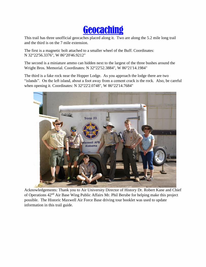
Acknowledgements: Thank you to Air University Director of History Dr. Robert Kane and Chief
of Operations 42nd Air Base Wing Public Affairs Mr. Phil Berube for helping make this project
possible. The Historic Maxwell Air Force Base driving tour booklet was used to update
information in this trail guide.
5.2
Mile T
rail M
ap
5.2
Mile T
rail M
ap
12.2
Mile T
rail M
ap
12
.2 M
ile Tra
il Map